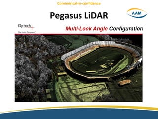
PEGASUS LIDAR
•Download as PPT, PDF•
1 like•192 views

The document discusses Pegasus LiDAR's airborne and mobile laser scanning systems. It describes a recent aerial case study for Cyclone Yasi and the Lynx M1 mobile system's dual laser scanning that offers forward and rear scanning at up to 1 million points/second under 60 km/h. The document also discusses AAM's precision navigation instruments, management of terabytes of multi-platform data through K2Vi 3D GIS, and specialized viewers for road images and point clouds.
Report
Share
Report
Share

Recommended
Ronen Shtayer,Director of ASG Operations & PMO, NXP Semiconductor
The document discusses the road ahead for securely connected cars. It summarizes that NXP is a leader in automotive semiconductors, including communications processors, RF power transistors, and automotive safety. It outlines NXP's role in enabling innovations in areas like infotainment, secure car access, vehicle networking, safety, and advanced driver assistance. The document also discusses trends like seamless connectivity and advanced driver assistance systems. It focuses on the role of vehicle-to-everything communication and security in connecting cars to infrastructure and ensuring safety.
Example high-fidelity network measures using ∆Q metrics
A selection of measures taken on broadband lines in Europe that illustrate the phenomena visible with high-fidelity metrics.
Night vision Technology in Automobiles
This presentation involves night vision technology in automobiles in various cars like mercedes, audi and bmw.
Gepgraphic-Technologies---Nasr-Khashoggi
The document outlines an agenda for a presentation on modern survey technology, including discussing GTT Profile, static LiDAR surveys using a handheld laser scanner, mobile LiDAR surveys using vehicles equipped with scanning systems, airborne mapping surveys, and 3D borehole deployment laser scanning. Specific technologies to be covered include the ModernSurvey handheld LiDAR scanner, the C-ALS 3D borehole laser scanner, the Quarryman Focus 3D system, and the Dynascan S250 mobile scanner.
Enhanced guarding
This document describes an affordable and portable security solution called Remote Sentries manufactured by RSI Video Technologies. The system combines security guard services with technology, providing intrusion detection and prevention via battery-powered cameras and sensors with a range of up to 2,000 feet. The system has been awarded "Best of Show" and can operate in temperatures from -20F to +140F, sending video alerts to a 24/7 monitoring center over the cell network. It is presented as an effective option for various applications such as warehouses, construction sites, energy facilities, and rooftops.
Boletín Cine Club Montevideo nº 12 diciembre 1950
La Unión Europea ha acordado un embargo petrolero contra Rusia en respuesta a la invasión de Ucrania. El embargo forma parte de un sexto paquete de sanciones y privará a Rusia de acceso a mercados clave. Sin embargo, Hungría, Eslovaquia y la República Checa fueron exentos temporalmente debido a su dependencia del petróleo ruso.
Buffalo Hall of Fame - Northern Territory Australia - Tourist Park
A great tourist development concepts that some friends are working on, they are seeking astute investors.
Interferometria
The document discusses MetaSensing, a company that develops and manufactures affordable, advanced, and innovative radar systems for monitoring solutions. It specifically focuses on MetaSensing's FastGBSAR radar system, which can operate in both Synthetic Aperture Radar (SAR) and Real Aperture Radar (RAR) modes. In SAR mode, the FastGBSAR is mounted on a rail to generate 2D displacement maps, while in RAR mode it is mounted on a tripod for vibration monitoring and modal analysis. The document provides details on the FastGBSAR specifications, applications, data processing software, and examples of infrastructure monitoring projects.
TU Automotive Osram Presentation Final
This document discusses infrared sensors for autonomous vehicles. It provides an overview of OSRAM, a leader in LED and laser technologies. It then discusses the sensing challenges for autonomous vehicles, including range, resolution, field of view, and computational challenges. It reviews sensor technologies like LIDAR, infrared cameras, and RADAR, and their applications in autonomous driving. It also explores concepts for low-cost LIDAR solutions using flash LIDAR and scanning LIDAR technologies.
Spynel-M
Spynel-M is an infrared panoramic detection and tracking system that acts as an infrared radar for wide area surveillance. It provides 360 degree thermal surveillance over large areas day and night through a single, lightweight sensor. The system continuously captures panoramic images and can track multiple threats automatically from long ranges of up to 1.5 km. It offers cost-effective, reliable security for critical infrastructure protection while being discreet, portable, and quickly deployed.
Lidar based PIDS Solution 20181206
The document proposes a lidar-based perimeter intrusion detection system (PIDS) with the following key points:
1. It uses lidar sensors that can scan 360 degrees and detect objects up to 300 meters away to monitor facility perimeters.
2. An integrated management platform analyzes lidar data and video surveillance to detect, track, and classify intrusions in four phases - detection, alert, intrusion, and tracking.
3. The solution is presented as more accurate, cost-effective, and weather-resistant than traditional security systems. It can identify intruders, predict intrusion paths, and automatically respond through configured workflows.
An introduction to iXBlue jti 2015
This document provides an overview of iXBlue, a company that develops fiber optic gyroscope and acoustic positioning technologies. It summarizes iXBlue's history, growth strategy focusing on civilian and military marine markets, internal organization structure divided into product divisions, worldwide presence, and key product lines within its Navigation Systems and Acoustic Systems divisions.
Mobile Laser Scanning Workshop
This document provides an overview of Mobile Laser Scanning technology using the Dynascan 3D mobile mapping system. It discusses how mobile scanning is an advancement on traditional surveying methods. The agenda includes introductions, presentations on the technology and Measurement Devices Limited, a live demo, and Q&A. Measurement Devices Limited is a leading designer and manufacturer of laser measurement technology for over 30 years. The Dynascan system is a fully integrated high-speed laser scanner, GPS, and inertial navigation system that is rugged, portable, and suitable for a wide range of land and marine applications. The document highlights the Dynascan system's capabilities and provides examples of its use in infrastructure, coastal, and construction projects.
Wolfgang Juchmann, Velodyne LiDAR
This document discusses Velodyne's VLP-16 3D lidar sensor. It is compact, affordable, and lightweight. It has 16 channels, a range of over 100 meters, and a scan rate of 300,000 points per second with dual returns. It has a vertical field of view of ±15 degrees and a 360 degree horizontal field of view. The document also shows examples of how lidar can detect solid surfaces and extract tree information from point clouds. It discusses companies that provide lidar and aerial data services and products.
Necessity of GPS-based 'Proximity Warning System' in mining industry – a tool...
The necessity of GPS-based 'Proximity Warning System' in the mining industry – a tool to prevent mine transport accidents
NIGHT VISION IN CARS
Night vision systems in cars use infrared cameras to improve the driver's vision and detection of objects at night. There are two main types: near-infrared (NIR) and far-infrared (FIR). NIR systems use an infrared light source and detect reflected light, producing clear images up to 183 meters. FIR systems are passive, detecting thermal radiation emitted by all objects. They produce black and white "heat signature" images and can detect objects up to 299 meters. Both types aim to help drivers see pedestrians, animals and other hazards better at night to improve safety.
ADAS.pptx
The document discusses advanced driver assistance systems (ADAS) and the technologies used to enable them, including lidar, radar, stereo cameras, infrared cameras, and monocular cameras. It explains how each technology works by emitting light or radio waves and measuring their reflection to determine attributes of objects. The increasing use of automotive electronics requires design processes that balance reliability, costs, and development time. ADAS can help reduce accidents and are a key technology for autonomous vehicles.
Lidar in the adverse weather: dust, fog, snow and rain
This document discusses research on LiDAR performance in adverse weather conditions such as dust, snow, rain, and fog. It outlines several papers that analyze how different weather influences LiDAR sensors, develop methods to detect and classify weather conditions using LiDAR data, and explore techniques for denoising LiDAR point clouds in adverse weather. The papers covered include work on characterizing multiple LiDAR sensors for localization and mapping applications and benchmarking LiDAR performance for automated driving tasks.
Caterpillar mining technology
Caterpillar has developed an integrated object detection and site awareness system to increase safety in mining operations. The system uses radar, cameras, and GPS to detect nearby equipment, monitor machine locations, and alert operators of potential hazards. It is designed to work across Caterpillar's equipment lines and integrate with their MineStar fleet management software to provide a comprehensive solution for increasing awareness and avoiding collisions.
OptaSense and VicRoads Monash Freeway Project 2015
VicRoads is trialling OptaSense technology along 40km of the Monash Freeway. It is being used to monitor traffic in real-time.
"Sensing Technologies for the Autonomous Vehicle," a Presentation from NXP Se...
"Sensing Technologies for the Autonomous Vehicle," a Presentation from NXP Se...Edge AI and Vision Alliance
For the full video of this presentation, please visit:
http://www.embedded-vision.com/platinum-members/nxp/embedded-vision-training/videos/pages/may-2016-embedded-vision-summit
For more information about embedded vision, please visit:
http://www.embedded-vision.com
Tom Wilson, ADAS Product Line Manager at NXP Semiconductors, presents the "Sensing Technologies for the Autonomous Vehicle" tutorial at the May 2016 Embedded Vision Summit.
Autonomous vehicles will necessarily utilize a range of sensing technologies to see and react to their surroundings. We are witnessing dramatic advances not just for embedded vision, but also in complementary technologies like radar and LiDAR. Each of these sensing technologies provides unique capabilities for giving a vehicle a complete view of its surroundings. This presentation compares vision-based sensing with complementary sensing technologies, explores key trends in sensors for autonomous vehicles, and analyses challenges and opportunities in fusing the output of multiple sensor technologies to enable robust perception and mapping for autonomous vehicles.CorporateJan2016
Senstar is a global perimeter security company with over 30 years of experience. They have installed over 40,000 km of perimeter sensors in over 80 countries. Senstar offers the broadest range of perimeter security products in the market including buried sensors, above ground sensors, fence mounted sensors, barrier sensors, security management systems, life safety/emergency call systems, cellular detection, and cyber security solutions. They serve markets such as corrections, transportation, utilities, industrial, government, and military.
Vijay Persaud, Riegl
1. UAV technology has advanced from remotely piloted vehicles in the 1980s to fully autonomous systems today.
2. UAVs are a cost-effective tool for aerial data acquisition, with lower costs than manned aircraft due to cheaper fuel, no pilot expenses, and easy mobility.
3. RIEGL has developed the RiCopter UAV integrated with the VUX-SYS laser scanning system, allowing for accurate and efficient 3D data collection over a wide field of view from UAV platforms.
Unmanned Aerial Systems for Precision Mapping
Presentation by Renee Walmsley, Remote Sensing Program Manager at Tetra Tech, for the August 16, 2017 Rocky Mountain UAS Professionals Meetup at the Esri Broomfield office.
Laser Beam Scanning LiDAR: MEMS-Driven 3D Sensing Automotive Applications fro...
MicroVision’s Director of Product Engineering, Jari Honkanen, gave a presentation at FUTURECAR 2017 detailing how MicroVision's Laser Beam Scanning technology for MEMS-based LiDAR solutions provides a unique approach that enables new 3D sensor capabilities in areas such as dynamic and variable resolution, acquisition speed, and field of view.
Haul-SNS Brochure Dec 2014_CDR 13_Split
Haul-SNS is a wireless navigation and collision avoidance system for open-pit mines that uses GPS and sensors to track the location of heavy equipment vehicles in real-time. It calculates a virtual safety zone around each vehicle and alerts operators visually and audibly if another vehicle enters that zone, reducing the risk of accidents. The system also includes proximity sensors and a central control station to monitor vehicle movements across the entire mine site.
Mini RadaScan Brochure
The Mini RadaScan is an advanced position reference sensor used in marine dynamic positioning applications. It uses radar technology to accurately measure range and bearing to intelligent microwave targets called responders, allowing calculation of vessel position and heading. The Mini RadaScan system has three main components - the Mini RadaScan sensor installed on the vessel, uniquely coded responders mounted on fixed or mobile structures, and dashboard software used by the DP operator on a bridge computer.
(Lidar) Pan Australia Topo Mapping Q1 2018
This document summarizes a LiDAR mapping campaign by Total Earth Solutions in Australia. The campaign will collect data from up to 16 locations across Australia starting in Far North Queensland and finishing in Far North Queensland. The group shoot model and large area collections will allow for cheaper, safer, better, and faster data acquisition. Standard deliverables will include orthophotos, LAS files, DSMs, DTMs, contours and reports in various formats. The data will be viewed and shared in 3D using Pointerra. Data will be collected using a modern Optech Galaxy LiDAR sensor and camera system from a safe and efficient platform. Ground control surveys will utilize RTK systems. Multiple iterations of quality control and assurance will be performed
7 habits-posters
The document provides 7 principles for being proactive and achieving goals: be proactive by taking initiative in situations and not waiting for things to happen; begin with the end in mind by envisioning your desired outcome and working backwards; put first things first by prioritizing and focusing on the most important tasks; think win-win by finding solutions where all parties achieve their goals; seek first to understand others' perspectives before trying to be understood; synergize by combining individual efforts into a collective effort that creates a greater impact than the sum of its parts; sharpen the saw by continuously improving yourself through learning and development.
More Related Content
Similar to PEGASUS LIDAR
Interferometria
The document discusses MetaSensing, a company that develops and manufactures affordable, advanced, and innovative radar systems for monitoring solutions. It specifically focuses on MetaSensing's FastGBSAR radar system, which can operate in both Synthetic Aperture Radar (SAR) and Real Aperture Radar (RAR) modes. In SAR mode, the FastGBSAR is mounted on a rail to generate 2D displacement maps, while in RAR mode it is mounted on a tripod for vibration monitoring and modal analysis. The document provides details on the FastGBSAR specifications, applications, data processing software, and examples of infrastructure monitoring projects.
TU Automotive Osram Presentation Final
This document discusses infrared sensors for autonomous vehicles. It provides an overview of OSRAM, a leader in LED and laser technologies. It then discusses the sensing challenges for autonomous vehicles, including range, resolution, field of view, and computational challenges. It reviews sensor technologies like LIDAR, infrared cameras, and RADAR, and their applications in autonomous driving. It also explores concepts for low-cost LIDAR solutions using flash LIDAR and scanning LIDAR technologies.
Spynel-M
Spynel-M is an infrared panoramic detection and tracking system that acts as an infrared radar for wide area surveillance. It provides 360 degree thermal surveillance over large areas day and night through a single, lightweight sensor. The system continuously captures panoramic images and can track multiple threats automatically from long ranges of up to 1.5 km. It offers cost-effective, reliable security for critical infrastructure protection while being discreet, portable, and quickly deployed.
Lidar based PIDS Solution 20181206
The document proposes a lidar-based perimeter intrusion detection system (PIDS) with the following key points:
1. It uses lidar sensors that can scan 360 degrees and detect objects up to 300 meters away to monitor facility perimeters.
2. An integrated management platform analyzes lidar data and video surveillance to detect, track, and classify intrusions in four phases - detection, alert, intrusion, and tracking.
3. The solution is presented as more accurate, cost-effective, and weather-resistant than traditional security systems. It can identify intruders, predict intrusion paths, and automatically respond through configured workflows.
An introduction to iXBlue jti 2015
This document provides an overview of iXBlue, a company that develops fiber optic gyroscope and acoustic positioning technologies. It summarizes iXBlue's history, growth strategy focusing on civilian and military marine markets, internal organization structure divided into product divisions, worldwide presence, and key product lines within its Navigation Systems and Acoustic Systems divisions.
Mobile Laser Scanning Workshop
This document provides an overview of Mobile Laser Scanning technology using the Dynascan 3D mobile mapping system. It discusses how mobile scanning is an advancement on traditional surveying methods. The agenda includes introductions, presentations on the technology and Measurement Devices Limited, a live demo, and Q&A. Measurement Devices Limited is a leading designer and manufacturer of laser measurement technology for over 30 years. The Dynascan system is a fully integrated high-speed laser scanner, GPS, and inertial navigation system that is rugged, portable, and suitable for a wide range of land and marine applications. The document highlights the Dynascan system's capabilities and provides examples of its use in infrastructure, coastal, and construction projects.
Wolfgang Juchmann, Velodyne LiDAR
This document discusses Velodyne's VLP-16 3D lidar sensor. It is compact, affordable, and lightweight. It has 16 channels, a range of over 100 meters, and a scan rate of 300,000 points per second with dual returns. It has a vertical field of view of ±15 degrees and a 360 degree horizontal field of view. The document also shows examples of how lidar can detect solid surfaces and extract tree information from point clouds. It discusses companies that provide lidar and aerial data services and products.
Necessity of GPS-based 'Proximity Warning System' in mining industry – a tool...
The necessity of GPS-based 'Proximity Warning System' in the mining industry – a tool to prevent mine transport accidents
NIGHT VISION IN CARS
Night vision systems in cars use infrared cameras to improve the driver's vision and detection of objects at night. There are two main types: near-infrared (NIR) and far-infrared (FIR). NIR systems use an infrared light source and detect reflected light, producing clear images up to 183 meters. FIR systems are passive, detecting thermal radiation emitted by all objects. They produce black and white "heat signature" images and can detect objects up to 299 meters. Both types aim to help drivers see pedestrians, animals and other hazards better at night to improve safety.
ADAS.pptx
The document discusses advanced driver assistance systems (ADAS) and the technologies used to enable them, including lidar, radar, stereo cameras, infrared cameras, and monocular cameras. It explains how each technology works by emitting light or radio waves and measuring their reflection to determine attributes of objects. The increasing use of automotive electronics requires design processes that balance reliability, costs, and development time. ADAS can help reduce accidents and are a key technology for autonomous vehicles.
Lidar in the adverse weather: dust, fog, snow and rain
This document discusses research on LiDAR performance in adverse weather conditions such as dust, snow, rain, and fog. It outlines several papers that analyze how different weather influences LiDAR sensors, develop methods to detect and classify weather conditions using LiDAR data, and explore techniques for denoising LiDAR point clouds in adverse weather. The papers covered include work on characterizing multiple LiDAR sensors for localization and mapping applications and benchmarking LiDAR performance for automated driving tasks.
Caterpillar mining technology
Caterpillar has developed an integrated object detection and site awareness system to increase safety in mining operations. The system uses radar, cameras, and GPS to detect nearby equipment, monitor machine locations, and alert operators of potential hazards. It is designed to work across Caterpillar's equipment lines and integrate with their MineStar fleet management software to provide a comprehensive solution for increasing awareness and avoiding collisions.
OptaSense and VicRoads Monash Freeway Project 2015
VicRoads is trialling OptaSense technology along 40km of the Monash Freeway. It is being used to monitor traffic in real-time.
"Sensing Technologies for the Autonomous Vehicle," a Presentation from NXP Se...
"Sensing Technologies for the Autonomous Vehicle," a Presentation from NXP Se...Edge AI and Vision Alliance
For the full video of this presentation, please visit:
http://www.embedded-vision.com/platinum-members/nxp/embedded-vision-training/videos/pages/may-2016-embedded-vision-summit
For more information about embedded vision, please visit:
http://www.embedded-vision.com
Tom Wilson, ADAS Product Line Manager at NXP Semiconductors, presents the "Sensing Technologies for the Autonomous Vehicle" tutorial at the May 2016 Embedded Vision Summit.
Autonomous vehicles will necessarily utilize a range of sensing technologies to see and react to their surroundings. We are witnessing dramatic advances not just for embedded vision, but also in complementary technologies like radar and LiDAR. Each of these sensing technologies provides unique capabilities for giving a vehicle a complete view of its surroundings. This presentation compares vision-based sensing with complementary sensing technologies, explores key trends in sensors for autonomous vehicles, and analyses challenges and opportunities in fusing the output of multiple sensor technologies to enable robust perception and mapping for autonomous vehicles.CorporateJan2016
Senstar is a global perimeter security company with over 30 years of experience. They have installed over 40,000 km of perimeter sensors in over 80 countries. Senstar offers the broadest range of perimeter security products in the market including buried sensors, above ground sensors, fence mounted sensors, barrier sensors, security management systems, life safety/emergency call systems, cellular detection, and cyber security solutions. They serve markets such as corrections, transportation, utilities, industrial, government, and military.
Vijay Persaud, Riegl
1. UAV technology has advanced from remotely piloted vehicles in the 1980s to fully autonomous systems today.
2. UAVs are a cost-effective tool for aerial data acquisition, with lower costs than manned aircraft due to cheaper fuel, no pilot expenses, and easy mobility.
3. RIEGL has developed the RiCopter UAV integrated with the VUX-SYS laser scanning system, allowing for accurate and efficient 3D data collection over a wide field of view from UAV platforms.
Unmanned Aerial Systems for Precision Mapping
Presentation by Renee Walmsley, Remote Sensing Program Manager at Tetra Tech, for the August 16, 2017 Rocky Mountain UAS Professionals Meetup at the Esri Broomfield office.
Laser Beam Scanning LiDAR: MEMS-Driven 3D Sensing Automotive Applications fro...
MicroVision’s Director of Product Engineering, Jari Honkanen, gave a presentation at FUTURECAR 2017 detailing how MicroVision's Laser Beam Scanning technology for MEMS-based LiDAR solutions provides a unique approach that enables new 3D sensor capabilities in areas such as dynamic and variable resolution, acquisition speed, and field of view.
Haul-SNS Brochure Dec 2014_CDR 13_Split
Haul-SNS is a wireless navigation and collision avoidance system for open-pit mines that uses GPS and sensors to track the location of heavy equipment vehicles in real-time. It calculates a virtual safety zone around each vehicle and alerts operators visually and audibly if another vehicle enters that zone, reducing the risk of accidents. The system also includes proximity sensors and a central control station to monitor vehicle movements across the entire mine site.
Mini RadaScan Brochure
The Mini RadaScan is an advanced position reference sensor used in marine dynamic positioning applications. It uses radar technology to accurately measure range and bearing to intelligent microwave targets called responders, allowing calculation of vessel position and heading. The Mini RadaScan system has three main components - the Mini RadaScan sensor installed on the vessel, uniquely coded responders mounted on fixed or mobile structures, and dashboard software used by the DP operator on a bridge computer.
Similar to PEGASUS LIDAR (20)
Necessity of GPS-based 'Proximity Warning System' in mining industry – a tool...
Necessity of GPS-based 'Proximity Warning System' in mining industry – a tool...
Lidar in the adverse weather: dust, fog, snow and rain
Lidar in the adverse weather: dust, fog, snow and rain
OptaSense and VicRoads Monash Freeway Project 2015
OptaSense and VicRoads Monash Freeway Project 2015
"Sensing Technologies for the Autonomous Vehicle," a Presentation from NXP Se...
"Sensing Technologies for the Autonomous Vehicle," a Presentation from NXP Se...
Laser Beam Scanning LiDAR: MEMS-Driven 3D Sensing Automotive Applications fro...
Laser Beam Scanning LiDAR: MEMS-Driven 3D Sensing Automotive Applications fro...
More from Brett Johnson
(Lidar) Pan Australia Topo Mapping Q1 2018
This document summarizes a LiDAR mapping campaign by Total Earth Solutions in Australia. The campaign will collect data from up to 16 locations across Australia starting in Far North Queensland and finishing in Far North Queensland. The group shoot model and large area collections will allow for cheaper, safer, better, and faster data acquisition. Standard deliverables will include orthophotos, LAS files, DSMs, DTMs, contours and reports in various formats. The data will be viewed and shared in 3D using Pointerra. Data will be collected using a modern Optech Galaxy LiDAR sensor and camera system from a safe and efficient platform. Ground control surveys will utilize RTK systems. Multiple iterations of quality control and assurance will be performed
7 habits-posters
The document provides 7 principles for being proactive and achieving goals: be proactive by taking initiative in situations and not waiting for things to happen; begin with the end in mind by envisioning your desired outcome and working backwards; put first things first by prioritizing and focusing on the most important tasks; think win-win by finding solutions where all parties achieve their goals; seek first to understand others' perspectives before trying to be understood; synergize by combining individual efforts into a collective effort that creates a greater impact than the sum of its parts; sharpen the saw by continuously improving yourself through learning and development.
Reno air race crash
A P-51 Thunder Mustang replica crashed at an air show after its engine failed on takeoff. The pilot attempted to land on the runway but touched down short and hit a taxiway, causing the plane to cartwheel. Photos show the plane cartwheeling, with the engine and cowling breaking off. Thankfully, the pilot survived, though with injuries, as crash trucks arrived quickly to the wreckage.
Reapwhatyousow
This document discusses how society has become less moral and more dangerous over recent decades by gradually removing religious teachings and values from public life. It argues that by saying "OK" to issues like banning prayer in schools, limiting religious texts, permissive parenting advice, and exposing children to sexual or violent content, society has undermined the moral rules that promoted safety, stability, and respect for others. As a result, it says we now see the negative consequences of this in increased criminal and self-destructive behaviors among youth. It encourages thinking seriously about whether restoring moral and religious principles could help address issues facing the world today.
Kg the maiden_of_maiden_ flights(manual)
Clara Adams was the only female passenger on the inaugural 1931 flight of the massive German Dornier DO-X flying boat from Rio de Janeiro to New York. In 1928, she purchased the first transatlantic air ticket ever sold to a woman for the Graf Zeppelin flight from North America to Europe. She later became the first woman to fly around the world by air in 1939, logging over 150,000 miles on inaugural flights on various airships, flying boats, and early airliners. Adams helped advance public perception of aviation as something enjoyable rather than dangerous.
Heavy lift
Ultra Marine Transport discusses an innovative way to ship very large or heavy cargo by filling the hull of a ship with water to lower itself for loading, allowing it to carry cargo that would otherwise be too large or heavy. The ship is able to fill its hull with water to sink very low in the water, then pump the water out to rise back up and travel, making it possible to transport items that could not be shipped through traditional means. The document expresses that this novel shipping method is quite effective.
Heart..attack
The document describes what to do if you experience chest pain while driving alone and suspect you are having a heart attack. It recommends coughing vigorously every 2 seconds to keep blood circulating and help regain a normal heart rhythm until help arrives or the symptoms subside. Deep breaths before each cough get oxygen into the lungs while coughing squeezes the heart. In this way, heart attack victims can potentially get to the hospital when alone. The document urges sharing this information to help save lives.
Formula1 1 vs india
This document discusses the difference between high quality and low-cost production by comparing a Ferrari made in Italy versus one made in India. It instructs the reader to press two buttons, presumably to demonstrate some difference between the two hypothetical cars.
Flowchart resolution
The flowchart provides steps for resolving a problem by first determining if the user caused the issue by messing with something, then considering whether the problem could explode or be hidden, and finally assessing whether someone else could be blamed before deciding the problem is solved or the user is screwed.
Hfem dighem general presentation
The document provides information on Fugro Airborne Surveys' DIGHEM electromagnetic system for near-surface mapping. DIGHEM can be used from both fixed-wing aircraft and helicopters for applications such as mineral and aggregate exploration, groundwater mapping, contaminant mapping, bathymetry, and infrastructure mapping. It describes the DIGHEM system, presents case studies demonstrating its use, and compares it to other airborne electromagnetic systems.
Heavy lift
Ultra Marine Transport discusses shipping very large cargo by filling the hull of a ship with water to lower itself for loading, allowing it to go down very deep. The ship fills its hull with water so it sinks itself to load extremely heavy cargo, then empties the water to travel, making it able to transport what would otherwise be unshippable.
Heart..attack
The document describes what to do if you experience chest pain while driving alone and suspect you are having a heart attack. It recommends coughing vigorously every 2 seconds to keep blood circulating and help regain a normal heart rhythm until help arrives or the symptoms subside. Deep breaths before each cough get oxygen into the lungs while coughing squeezes the heart. In this way, heart attack victims can potentially get to the hospital when alone. The document urges sharing this information to help save lives.
Ultrascan rt
The document describes the UltraScan RT real-time lidar system for unmanned aerial vehicles. It can be purchased as a payload-only bundle for $125,000 or with a Titan IV octocopter for $170,000. Key features include automated generation of .LAS files from lidar point clouds, ultra-high resolution scans, and integration capabilities for UAVs, vehicles, boats and backpacks. The system provides 600,000 dual return points per second with 40mm accuracy for high quality terrain mapping.
Wolfgram, 2004, em signatures of vhms, cu zn-workshop
This document discusses electromagnetic (EM) signatures of volcanic-hosted massive sulfide (VHMS) deposits in Western Australia. It provides examples of EM data over known VHMS deposits that show plate-like conductive responses with short to moderate time constants. However, some VHMS deposits are not strongly conductive or are screened by conductive cover. The document emphasizes using wideband EM systems, structural mapping, and allowing time for EM interpretation to best identify these deposits which can otherwise be difficult electromagnetic targets.
Sariec stoian
This document discusses the link between palynology and heavy minerals (HMs) analysis and describes some palynology and HMs projects in South Australia. It introduces a new "palymineral processing" technique that allows simultaneous palynology and HMs analysis on small samples. Several studies are summarized, including ones dating sediments and reconstructing past environments in areas like the Eucla Basin, Willochra Basin, and Flinders Island. The combination of palynology with HMs and geochemistry is shown to provide more insights into sample sources and stratigraphy.
Sariec schwarz
After emerging from the resources wilderness thanks to its world-class geology and industry-friendly government policies, South Australia is now a leader in Australian mining and hydrocarbon developments over the last decade.
In little more than a decade the State has gone from four operating mines to more than 20 and is rated Australia’s second most popular exploration destination.
With a comprehensive review of the Mining Act under way, the State’s attractiveness as a place for resources and energy investment is expected to be strengthened.
South Australia is now a leader in the exploration for next generation energy sources with companies such as Santos and BP leading the charge, while initiatives such as the Government’s Copper Strategy – designed to treble annual copper production to 1 mtpa – is set to establish the State as one of the world’s premier producers of the red metal.
In the energy space, uranium and nuclear energy is another area of keen interest, with the South Australian Government initiating a Royal Commission into Participation in the Nuclear Fuel Cycle in 2016.
The State has become synonymous with innovation, cutting-edge development and a remarkable rate of discovery. From uranium prospects, to geothermal energy and the buoyant hydrocarbons sector, South Australia is now a leader in the exploration for next generation energy sources.
With full support from the Department of State Development, the South Australian Resources and Energy Investment Conference will continue to showcase this burgeoning sector in 2017. From copper plays in the Gawler Craton, to iron ore and graphite developments on the Eyre Peninsula and the emergence of the State as a new hydrocarbon frontier, South Australia’s resources potential is at last being fully recognised.
The conference will feature the success stories and emerging players in the State from both minerals and oil and gas and will also tackle thorny industry issues such as infrastructure, corporate social responsibility and the future of the Woomera Prohibited Area.
Sariec robertson
After emerging from the resources wilderness thanks to its world-class geology and industry-friendly government policies, South Australia is now a leader in Australian mining and hydrocarbon developments over the last decade.
In little more than a decade the State has gone from four operating mines to more than 20 and is rated Australia’s second most popular exploration destination.
With a comprehensive review of the Mining Act under way, the State’s attractiveness as a place for resources and energy investment is expected to be strengthened.
South Australia is now a leader in the exploration for next generation energy sources with companies such as Santos and BP leading the charge, while initiatives such as the Government’s Copper Strategy – designed to treble annual copper production to 1 mtpa – is set to establish the State as one of the world’s premier producers of the red metal.
In the energy space, uranium and nuclear energy is another area of keen interest, with the South Australian Government initiating a Royal Commission into Participation in the Nuclear Fuel Cycle in 2016.
The State has become synonymous with innovation, cutting-edge development and a remarkable rate of discovery. From uranium prospects, to geothermal energy and the buoyant hydrocarbons sector, South Australia is now a leader in the exploration for next generation energy sources.
With full support from the Department of State Development, the South Australian Resources and Energy Investment Conference will continue to showcase this burgeoning sector in 2017. From copper plays in the Gawler Craton, to iron ore and graphite developments on the Eyre Peninsula and the emergence of the State as a new hydrocarbon frontier, South Australia’s resources potential is at last being fully recognised.
The conference will feature the success stories and emerging players in the State from both minerals and oil and gas and will also tackle thorny industry issues such as infrastructure, corporate social responsibility and the future of the Woomera Prohibited Area.
Sariec mcgeough
The Geological Survey of South Australia is changing its focus to enhance mineral prospectivity and attract more private mining investment. It aims to triple exploration expenditure to $100 million by 2007 and increase mineral production and processing to $4 billion by 2020. The Survey is leveraging government funding through partnerships with universities and research centers. It is applying new techniques like geochemistry, geophysics, and computer modeling to regional surveys to improve understanding of areas like the Central Gawler Gold Province and open up new fronts like the Mt Painter region. Current exploration expenditure is well below the target needed to sustain increased mineral production.
Sariec fabris
South Australia has significant uranium resources and potential. The Olympic Dam mine is the world's largest uranium deposit and produces 4500 tonnes of uranium oxide per year. The Beverley mine uses in situ leaching and has produced over 21,000 tonnes of uranium resources. Other deposits like Honeymoon and East Kalkaroo have over 4000 tonnes of uranium resources. The state has potential for additional discoveries in breccia complexes, sandstone roll-front deposits, vein deposits, and unconformity-related deposits.
Sareic love
After emerging from the resources wilderness thanks to its world-class geology and industry-friendly government policies, South Australia is now a leader in Australian mining and hydrocarbon developments over the last decade.
In little more than a decade the State has gone from four operating mines to more than 20 and is rated Australia’s second most popular exploration destination.
With a comprehensive review of the Mining Act under way, the State’s attractiveness as a place for resources and energy investment is expected to be strengthened.
South Australia is now a leader in the exploration for next generation energy sources with companies such as Santos and BP leading the charge, while initiatives such as the Government’s Copper Strategy – designed to treble annual copper production to 1 mtpa – is set to establish the State as one of the world’s premier producers of the red metal.
In the energy space, uranium and nuclear energy is another area of keen interest, with the South Australian Government initiating a Royal Commission into Participation in the Nuclear Fuel Cycle in 2016.
The State has become synonymous with innovation, cutting-edge development and a remarkable rate of discovery. From uranium prospects, to geothermal energy and the buoyant hydrocarbons sector, South Australia is now a leader in the exploration for next generation energy sources.
With full support from the Department of State Development, the South Australian Resources and Energy Investment Conference will continue to showcase this burgeoning sector in 2017. From copper plays in the Gawler Craton, to iron ore and graphite developments on the Eyre Peninsula and the emergence of the State as a new hydrocarbon frontier, South Australia’s resources potential is at last being fully recognised.
The conference will feature the success stories and emerging players in the State from both minerals and oil and gas and will also tackle thorny industry issues such as infrastructure, corporate social responsibility and the future of the Woomera Prohibited Area.
More from Brett Johnson (20)
Wolfgram, 2004, em signatures of vhms, cu zn-workshop
Wolfgram, 2004, em signatures of vhms, cu zn-workshop
Recently uploaded
Building Production Ready Search Pipelines with Spark and Milvus
Spark is the widely used ETL tool for processing, indexing and ingesting data to serving stack for search. Milvus is the production-ready open-source vector database. In this talk we will show how to use Spark to process unstructured data to extract vector representations, and push the vectors to Milvus vector database for search serving.
Programming Foundation Models with DSPy - Meetup Slides
Prompting language models is hard, while programming language models is easy. In this talk, I will discuss the state-of-the-art framework DSPy for programming foundation models with its powerful optimizers and runtime constraint system.
Ocean lotus Threat actors project by John Sitima 2024 (1).pptx
Ocean Lotus cyber threat actors represent a sophisticated, persistent, and politically motivated group that poses a significant risk to organizations and individuals in the Southeast Asian region. Their continuous evolution and adaptability underscore the need for robust cybersecurity measures and international cooperation to identify and mitigate the threats posed by such advanced persistent threat groups.
HCL Notes and Domino License Cost Reduction in the World of DLAU
Webinar Recording: https://www.panagenda.com/webinars/hcl-notes-and-domino-license-cost-reduction-in-the-world-of-dlau/
The introduction of DLAU and the CCB & CCX licensing model caused quite a stir in the HCL community. As a Notes and Domino customer, you may have faced challenges with unexpected user counts and license costs. You probably have questions on how this new licensing approach works and how to benefit from it. Most importantly, you likely have budget constraints and want to save money where possible. Don’t worry, we can help with all of this!
We’ll show you how to fix common misconfigurations that cause higher-than-expected user counts, and how to identify accounts which you can deactivate to save money. There are also frequent patterns that can cause unnecessary cost, like using a person document instead of a mail-in for shared mailboxes. We’ll provide examples and solutions for those as well. And naturally we’ll explain the new licensing model.
Join HCL Ambassador Marc Thomas in this webinar with a special guest appearance from Franz Walder. It will give you the tools and know-how to stay on top of what is going on with Domino licensing. You will be able lower your cost through an optimized configuration and keep it low going forward.
These topics will be covered
- Reducing license cost by finding and fixing misconfigurations and superfluous accounts
- How do CCB and CCX licenses really work?
- Understanding the DLAU tool and how to best utilize it
- Tips for common problem areas, like team mailboxes, functional/test users, etc
- Practical examples and best practices to implement right away
Generating privacy-protected synthetic data using Secludy and Milvus
During this demo, the founders of Secludy will demonstrate how their system utilizes Milvus to store and manipulate embeddings for generating privacy-protected synthetic data. Their approach not only maintains the confidentiality of the original data but also enhances the utility and scalability of LLMs under privacy constraints. Attendees, including machine learning engineers, data scientists, and data managers, will witness first-hand how Secludy's integration with Milvus empowers organizations to harness the power of LLMs securely and efficiently.
Finale of the Year: Apply for Next One!
Presentation for the event called "Finale of the Year: Apply for Next One!" organized by GDSC PJATK
Fueling AI with Great Data with Airbyte Webinar
This talk will focus on how to collect data from a variety of sources, leveraging this data for RAG and other GenAI use cases, and finally charting your course to productionalization.
Your One-Stop Shop for Python Success: Top 10 US Python Development Providers
Simplify your search for a reliable Python development partner! This list presents the top 10 trusted US providers offering comprehensive Python development services, ensuring your project's success from conception to completion.
AWS Cloud Cost Optimization Presentation.pptx
This presentation provides valuable insights into effective cost-saving techniques on AWS. Learn how to optimize your AWS resources by rightsizing, increasing elasticity, picking the right storage class, and choosing the best pricing model. Additionally, discover essential governance mechanisms to ensure continuous cost efficiency. Whether you are new to AWS or an experienced user, this presentation provides clear and practical tips to help you reduce your cloud costs and get the most out of your budget.
Operating System Used by Users in day-to-day life.pptx
Dive into the realm of operating systems (OS) with Pravash Chandra Das, a seasoned Digital Forensic Analyst, as your guide. 🚀 This comprehensive presentation illuminates the core concepts, types, and evolution of OS, essential for understanding modern computing landscapes.
Beginning with the foundational definition, Das clarifies the pivotal role of OS as system software orchestrating hardware resources, software applications, and user interactions. Through succinct descriptions, he delineates the diverse types of OS, from single-user, single-task environments like early MS-DOS iterations, to multi-user, multi-tasking systems exemplified by modern Linux distributions.
Crucial components like the kernel and shell are dissected, highlighting their indispensable functions in resource management and user interface interaction. Das elucidates how the kernel acts as the central nervous system, orchestrating process scheduling, memory allocation, and device management. Meanwhile, the shell serves as the gateway for user commands, bridging the gap between human input and machine execution. 💻
The narrative then shifts to a captivating exploration of prominent desktop OSs, Windows, macOS, and Linux. Windows, with its globally ubiquitous presence and user-friendly interface, emerges as a cornerstone in personal computing history. macOS, lauded for its sleek design and seamless integration with Apple's ecosystem, stands as a beacon of stability and creativity. Linux, an open-source marvel, offers unparalleled flexibility and security, revolutionizing the computing landscape. 🖥️
Moving to the realm of mobile devices, Das unravels the dominance of Android and iOS. Android's open-source ethos fosters a vibrant ecosystem of customization and innovation, while iOS boasts a seamless user experience and robust security infrastructure. Meanwhile, discontinued platforms like Symbian and Palm OS evoke nostalgia for their pioneering roles in the smartphone revolution.
The journey concludes with a reflection on the ever-evolving landscape of OS, underscored by the emergence of real-time operating systems (RTOS) and the persistent quest for innovation and efficiency. As technology continues to shape our world, understanding the foundations and evolution of operating systems remains paramount. Join Pravash Chandra Das on this illuminating journey through the heart of computing. 🌟
Main news related to the CCS TSI 2023 (2023/1695)
An English 🇬🇧 translation of a presentation to the speech I gave about the main changes brought by CCS TSI 2023 at the biggest Czech conference on Communications and signalling systems on Railways, which was held in Clarion Hotel Olomouc from 7th to 9th November 2023 (konferenceszt.cz). Attended by around 500 participants and 200 on-line followers.
The original Czech 🇨🇿 version of the presentation can be found here: https://www.slideshare.net/slideshow/hlavni-novinky-souvisejici-s-ccs-tsi-2023-2023-1695/269688092 .
The videorecording (in Czech) from the presentation is available here: https://youtu.be/WzjJWm4IyPk?si=SImb06tuXGb30BEH .
GraphRAG for Life Science to increase LLM accuracy
GraphRAG for life science domain, where you retriever information from biomedical knowledge graphs using LLMs to increase the accuracy and performance of generated answers
How to Interpret Trends in the Kalyan Rajdhani Mix Chart.pdf
A Mix Chart displays historical data of numbers in a graphical or tabular form. The Kalyan Rajdhani Mix Chart specifically shows the results of a sequence of numbers over different periods.
Taking AI to the Next Level in Manufacturing.pdf
Read Taking AI to the Next Level in Manufacturing to gain insights on AI adoption in the manufacturing industry, such as:
1. How quickly AI is being implemented in manufacturing.
2. Which barriers stand in the way of AI adoption.
3. How data quality and governance form the backbone of AI.
4. Organizational processes and structures that may inhibit effective AI adoption.
6. Ideas and approaches to help build your organization's AI strategy.
Nunit vs XUnit vs MSTest Differences Between These Unit Testing Frameworks.pdf
When it comes to unit testing in the .NET ecosystem, developers have a wide range of options available. Among the most popular choices are NUnit, XUnit, and MSTest. These unit testing frameworks provide essential tools and features to help ensure the quality and reliability of code. However, understanding the differences between these frameworks is crucial for selecting the most suitable one for your projects.
Letter and Document Automation for Bonterra Impact Management (fka Social Sol...
Sidekick Solutions uses Bonterra Impact Management (fka Social Solutions Apricot) and automation solutions to integrate data for business workflows.
We believe integration and automation are essential to user experience and the promise of efficient work through technology. Automation is the critical ingredient to realizing that full vision. We develop integration products and services for Bonterra Case Management software to support the deployment of automations for a variety of use cases.
This video focuses on automated letter generation for Bonterra Impact Management using Google Workspace or Microsoft 365.
Interested in deploying letter generation automations for Bonterra Impact Management? Contact us at sales@sidekicksolutionsllc.com to discuss next steps.
Columbus Data & Analytics Wednesdays - June 2024
Columbus Data & Analytics Wednesdays, June 2024 with Maria Copot 20
Recently uploaded (20)
Building Production Ready Search Pipelines with Spark and Milvus
Building Production Ready Search Pipelines with Spark and Milvus
Programming Foundation Models with DSPy - Meetup Slides
Programming Foundation Models with DSPy - Meetup Slides
Ocean lotus Threat actors project by John Sitima 2024 (1).pptx
Ocean lotus Threat actors project by John Sitima 2024 (1).pptx
HCL Notes and Domino License Cost Reduction in the World of DLAU
HCL Notes and Domino License Cost Reduction in the World of DLAU
Generating privacy-protected synthetic data using Secludy and Milvus
Generating privacy-protected synthetic data using Secludy and Milvus
Your One-Stop Shop for Python Success: Top 10 US Python Development Providers
Your One-Stop Shop for Python Success: Top 10 US Python Development Providers
Operating System Used by Users in day-to-day life.pptx
Operating System Used by Users in day-to-day life.pptx
GraphRAG for Life Science to increase LLM accuracy
GraphRAG for Life Science to increase LLM accuracy
Deep Dive: Getting Funded with Jason Jason Lemkin Founder & CEO @ SaaStr
Deep Dive: Getting Funded with Jason Jason Lemkin Founder & CEO @ SaaStr
How to Interpret Trends in the Kalyan Rajdhani Mix Chart.pdf
How to Interpret Trends in the Kalyan Rajdhani Mix Chart.pdf
Nunit vs XUnit vs MSTest Differences Between These Unit Testing Frameworks.pdf
Nunit vs XUnit vs MSTest Differences Between These Unit Testing Frameworks.pdf
Overcoming the PLG Trap: Lessons from Canva's Head of Sales & Head of EMEA Da...
Overcoming the PLG Trap: Lessons from Canva's Head of Sales & Head of EMEA Da...
Letter and Document Automation for Bonterra Impact Management (fka Social Sol...
Letter and Document Automation for Bonterra Impact Management (fka Social Sol...
PEGASUS LIDAR
- 4. Commerical-in-confidence Aerial Case Study • Case Study – Recent aerial works for Cyclone Yasi
- 6. Commerical-in-confidence Mobile Laser Scanning • Dual laser scanning system • Offers orward and rear scanning for max penetration
- 7. Commerical-in-confidence • Dense point cloud resolution • In April, the Lynx M1 system 1 million points/sec Mobile Laser Scanning <10km/h ~60km/h
- 8. Commerical-in-confidence Mobile Laser Scanning • Sensor Precision: Profilers ±7mm precision – ‘thin’ point clouds – Not ‘fuzzy’ or ‘furry’ Above. Plan view of plane fit. Look for the cloud ‘fuzz’. This is a ±4mm plane fit 25 metres from the vehicle taken of a 11m x 3m wall driving at 50 km/h near Noosa.
- 9. Commerical-in-confidence Mobile Laser Scanning • Sensor Precision:Navigation instruments – Applanix POS-LV420, the best available – AAM only runs Applanix equipment and has done so for 12 years 6mm 25mm
- 10. Commerical-in-confidence Managing the Data • AAM are leaders in multi-platform data capture – Satellite, aerial, mobile and terrestial • AAM are also experts in managing the data – Terrabytes of point cloud, imagery and vector • Integrating multi-platform datasets – Airborne and mobile and terrestrial laser scanning
- 13. Commerical-in-confidence K2Vi • K2Vi 3D GIS – For data management – For simulation – For animations • Maintain distributed datasets • Multiple scale, multi- platform
- 14. Commerical-in-confidence AAM’s RoadView • From K2Vi, launch AAM’s RoadView road-image viewer
- 15. Commerical-in-confidence AAM’s PointScribe • From K2Vi, launch AAM’s PointScribe point cloud viewer