
Recommended
More Related Content
What's hot
What's hot (20)
Viewers also liked
Viewers also liked (14)
Similar to Osgis2011 edina addy_pope
Similar to Osgis2011 edina addy_pope (20)
Recently uploaded
Recently uploaded (20)
Osgis2011 edina addy_pope
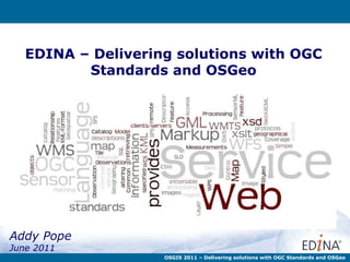
- 1. EDINA – Delivering solutions with OGC Standards and OSGeo Addy Pope June 2011 OSGIS 2011 – Delivering solutions with OGC Standards and OSGeo
- 2. Plan A Standards Open Data & Open Source Software at EDINA Who What How Why Conclusions 0 30 OGC OSGeo
- 3. What is EDINA? Open Data & Open Source Software at EDINA is a National Data Centre Based at Supported by http:// pafciu17.dev.openstreetmap.org /?module=map¢er=-3.18,55.935&zoom=17&width=400&height=400type=cycle
- 4. What do we do? Open Data & Open Source Software at EDINA http://www.flickr.com/photos/steverhode/3183290111/sizes/l/in/photostream/ Ensure continuous access to resources Preservation initiatives to ensure long term access to scholarly content Repository services for open access and other licensed material
- 5. What do we do? Open Data & Open Source Software at EDINA Authentication Multimedia Services Bibliographic Services Geo Service
- 6. Geo – Digimap Collections Open Data & Open Source Software at EDINA
- 7. Geo – Accessing the data Open Data & Open Source Software at EDINA Digimap provides access to data in several ways.............. Online mapping now with annotation........... Download the data for use on your desktop
- 9. GoGeo Open Data & Open Source Software at EDINA Images of front pages here…… Discover GIS resources Find Data Create standards compliant metadata Learn about metadata standards
- 10. ShareGeo Open Open Data & Open Source Software at EDINA Images of front pages here…… Find and Share spatial data http://sharegeo.ac.uk/ Re-use rather than recreate
- 14. Where are we going? Open Data & Open Source Software at EDINA Images of front pages here…… Location Based Service – everything goes mobile……. TouchMap Lite app that streams OS Digimap OpenStream to a mobile. Not a native app. Augmented Reality – Look at the blog for a comparison of AR browsers. HTML 5 – making use of html 5 in particular Canvas. http://mab.edina.ac.uk/geomobile-test/osopen.html http://mobilegeo.wordpress.com/
- 15. Open Data & Open Source Software at EDINA What standards do we use Just some of the standards that we publish to or use in Geo-services at EDINA Service Standards Digimap WMS Digimap for Schools WMS Openstream WMS UKB/Open Boundaries WMS GoGeo CSW for metadata harvesting and publishing OAI for metadata harvesting ISO 19139 encoded metadata ShareGeo OAI-PMH – for metadata harvesting GeoDoc Xforms (user interface for forms) Xslt (XML schema transformation) eXist (xml based database management)
- 21. Open Data & Open Source Software at EDINA WMS WFS TileCache Custom maps Standard maps Map or Data System Architecture Service Delivery
- 22. Open Data & Open Source Software at EDINA Replication Current Live Upload to Live Dev A Dev B Live A @ Kings Buildings Live B @ Appleton Tower Live Dev Backup Dev Test in live env
- 24. Things to think about….. Slide of 18 Open Data & Open Source Software at EDINA Support, documentation, development Pick the right tool for the job – open or proprietary. Hybrid systems work Solutions should provide a flexible framework that can grow and evolve Work towards standards, this will make services interoperable and should allow for flexible development Proprietary vendors should integrate their product to fit your architecture Addy Pope Email: [email_address] Twitter: @go_geo http://www.gogeo.ac.uk EDINA website: http://edina.ac.uk
- 28. Hybrid Stack Open Data & Open Source Software at EDINA We use a mix of open source and proprietary software. Why? Well, we believe it provides us with the best solution that fits our requirements. Cartographic output better handled by GoLoader and GoPublisher are great for handling Mastermap Migrating away from this but tied to it for GoPublisher.
- 29. Services we run Slide of 18 Open Data & Open Source Software at EDINA Images of front pages here……