![Who is this Guy? Brendan Sheehy [email_address] Work for Mallon Technology . I’m not a GIS expert. I’m a software developer. Working for company with lots of expertise in GIS and mapping technologies.](https://image.slidesharecdn.com/irlogipresentation-111019081656-phpapp01/75/Sustainable-and-Efficient-GIS-Open-Source-it-3-2048.jpg)
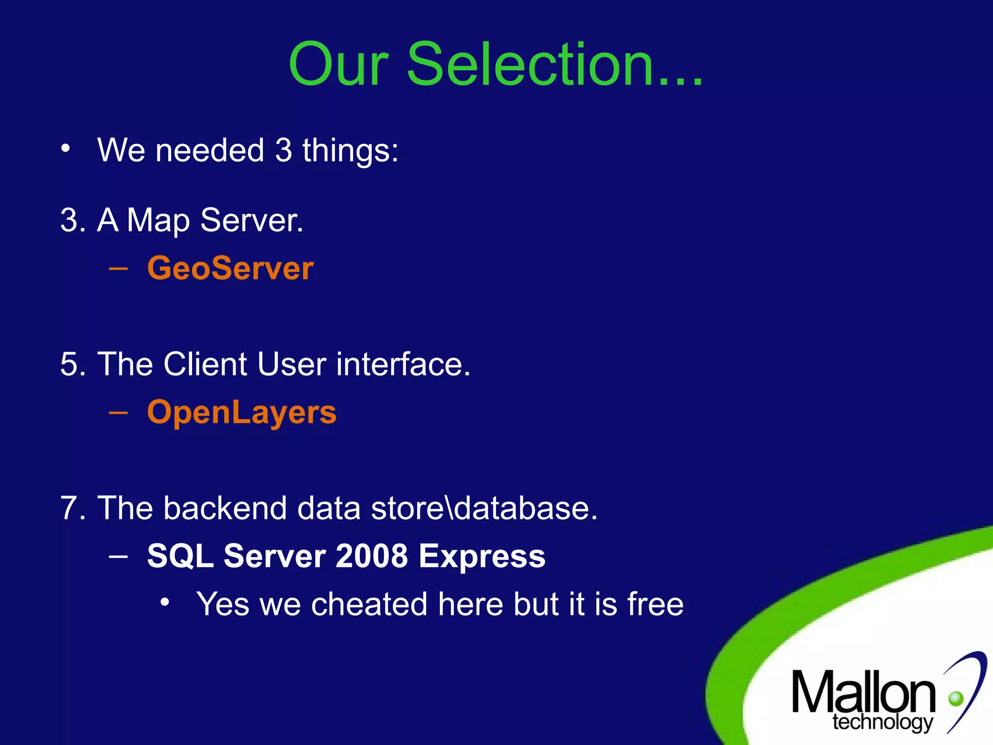
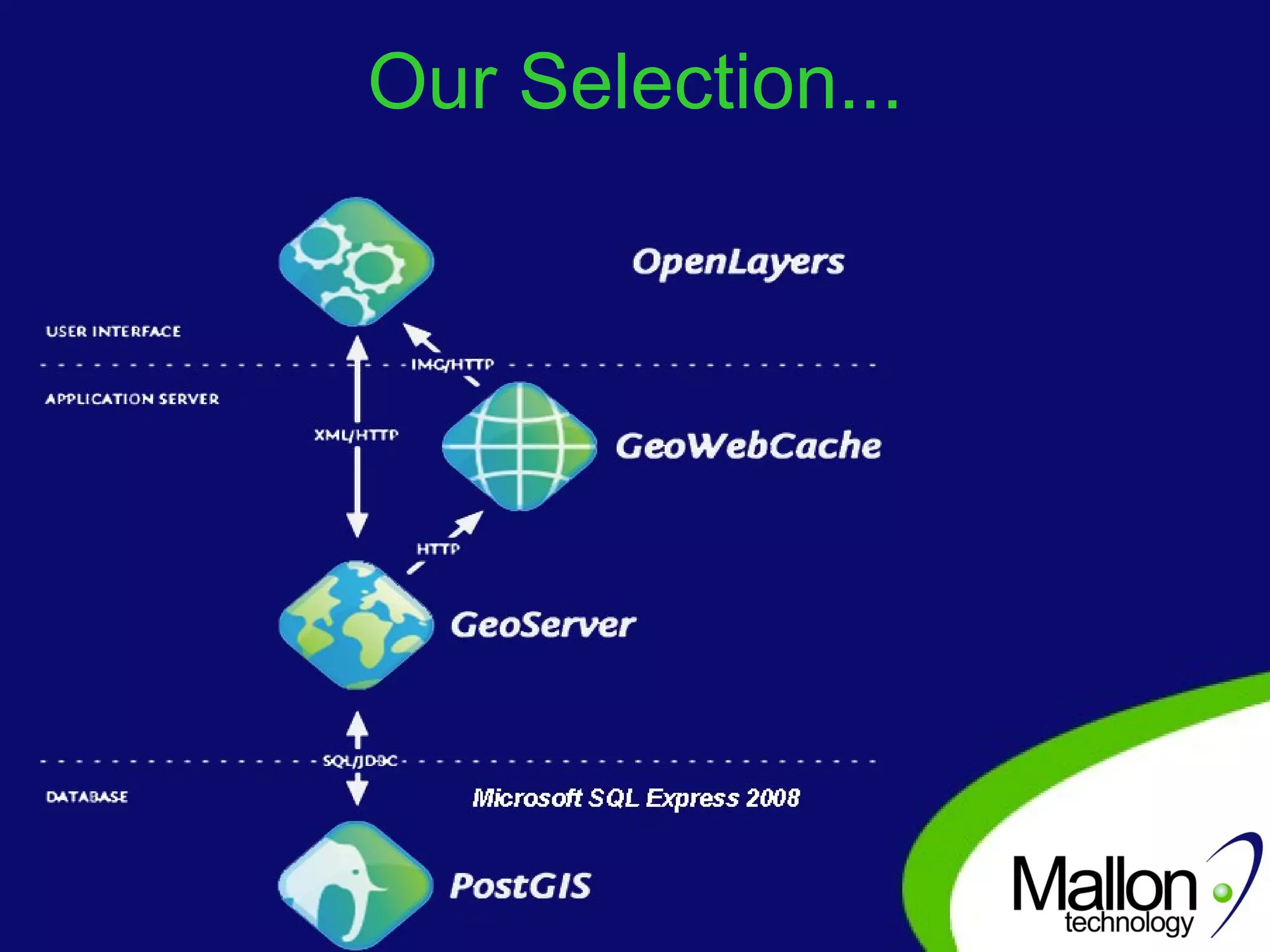
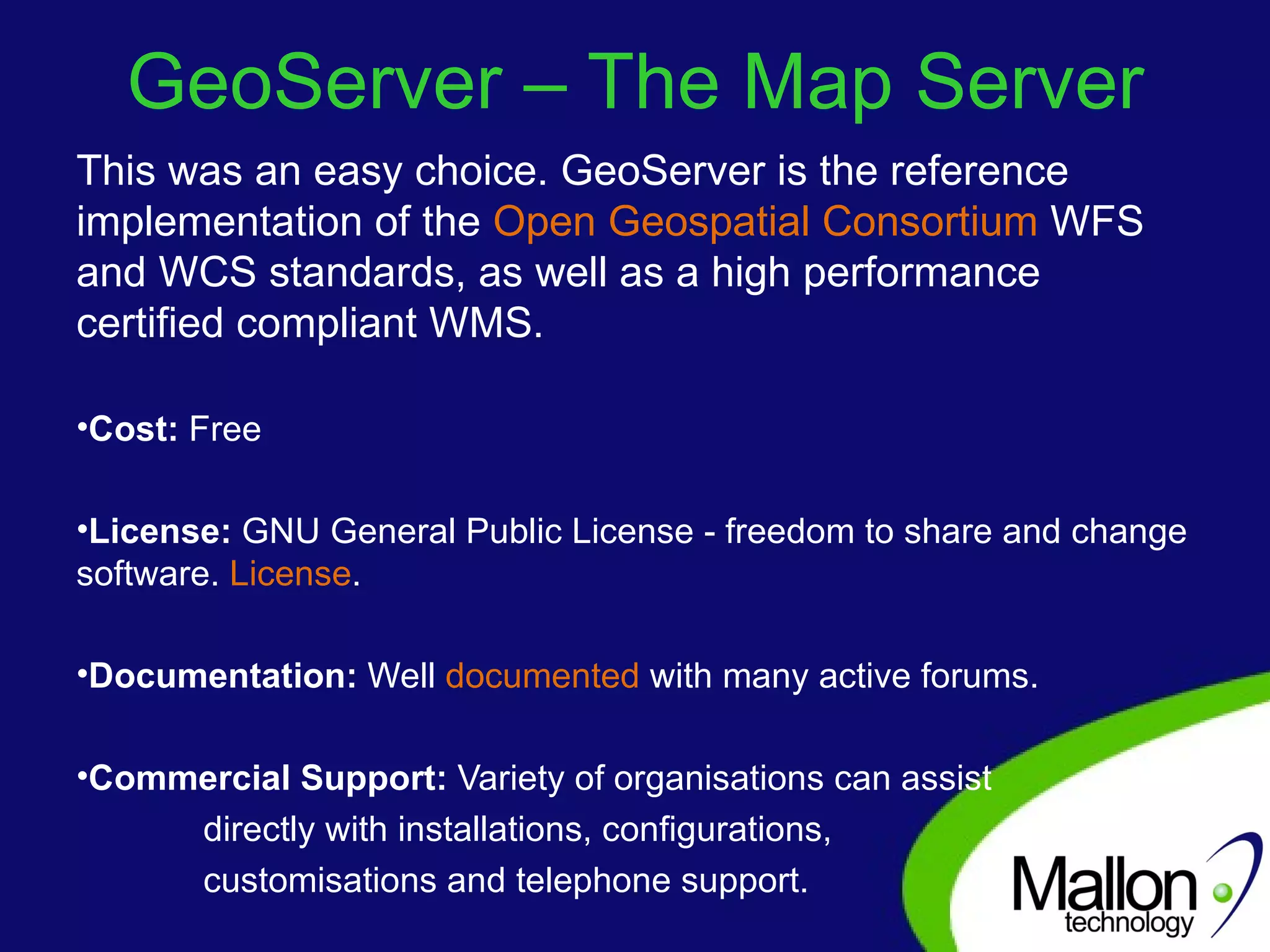
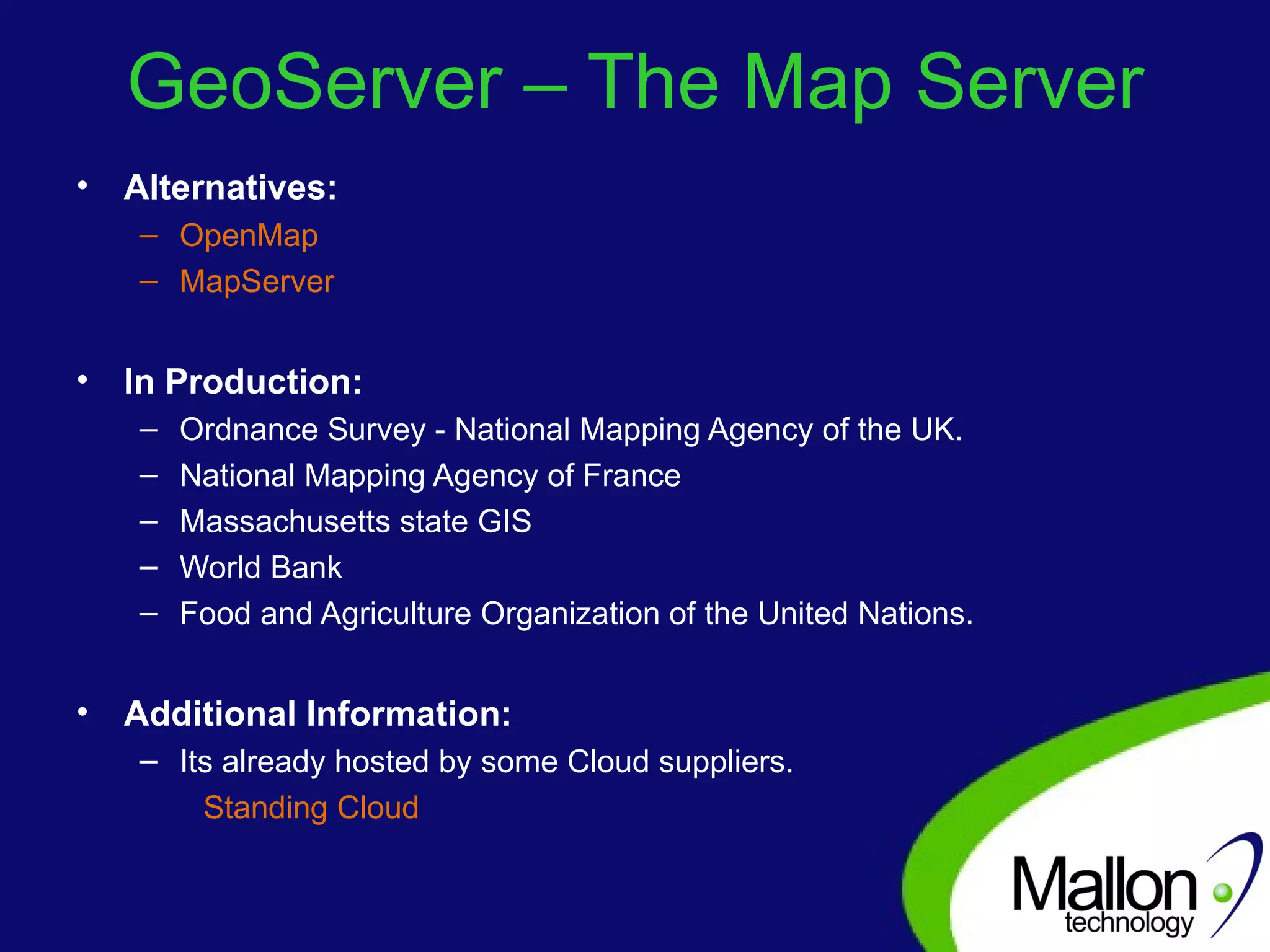
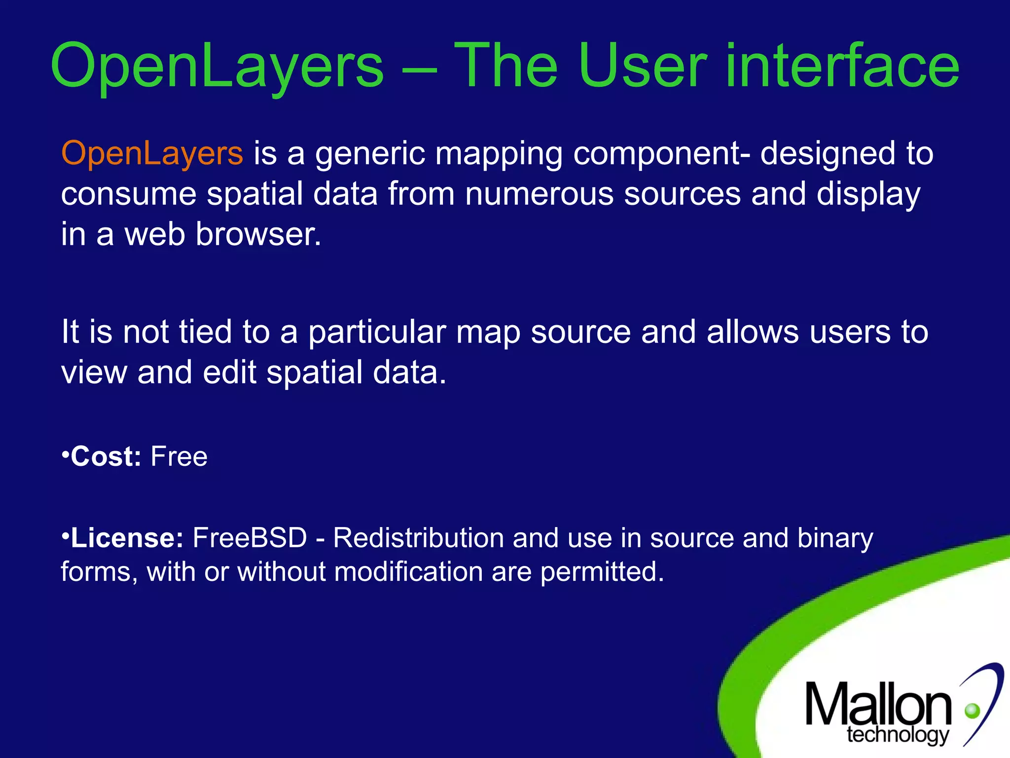
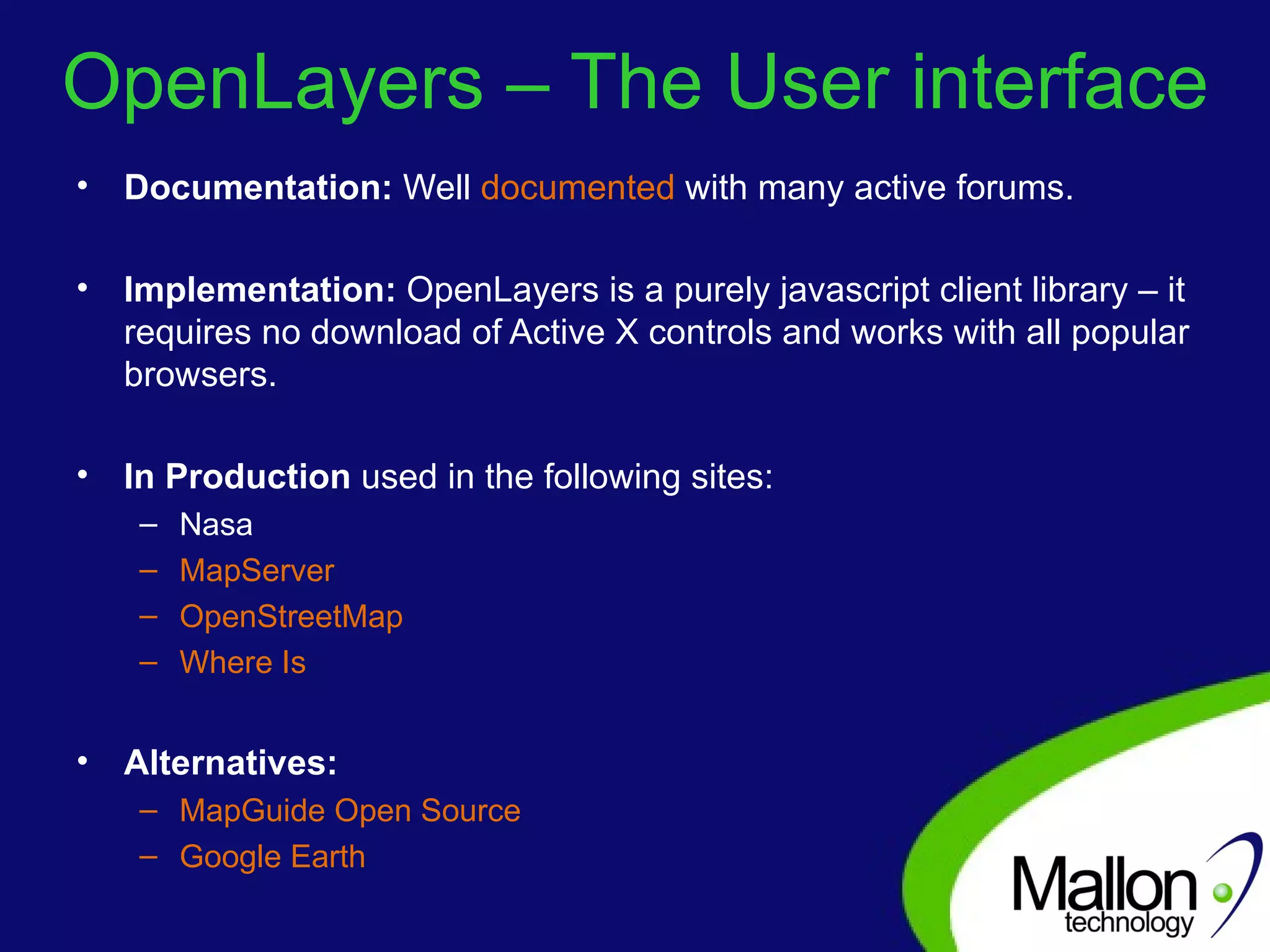


The document discusses the potential of open source technologies in Geographic Information Systems (GIS), highlighting both the advantages and challenges of implementation. It emphasizes the need for sustainable and efficient GIS systems that leverage open source solutions to reduce costs and avoid vendor lock-in. The author, Brendan Sheehy, outlines their experience in developing an online GIS solution using tools like GeoServer, OpenLayers, and SQL Server 2008 Express.


![Vibe Coding vs. Spec-Driven Development [Free Meetup]](https://cdn.slidesharecdn.com/ss_thumbnails/vibecodingvsspecdrivendevelopment-251209105622-43f455e7-thumbnail.jpg?width=640&height=640&fit=bounds)


![Coded Agents – with UiPath SDK + LangGraph [Virtual Hands-on Workshop]](https://cdn.slidesharecdn.com/ss_thumbnails/codedagentsdeck-251215155422-5497c599-thumbnail.jpg?width=640&height=640&fit=bounds)


