Download as PDF, PPTX
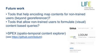
![Vocabularies for historic map contents
Content phenomena (prefix phen):
http://geographicknowledge.de/vocab/historicmapsphen [.rdf/.jpg]:
(reuse of
any
geographic/
historical
ontology,
such as: )](https://image.slidesharecdn.com/mapcontents-140616051207-phpapp02/85/Encoding-and-querying-historic-map-content-10-320.jpg)


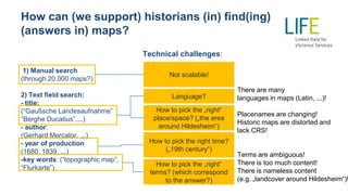
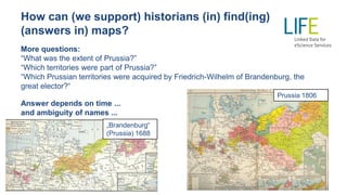
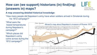
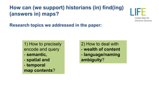
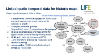
The document discusses challenges and solutions in encoding and querying historical map content to assist historians in finding specific information, such as land cover or territorial extents, from numerous maps. It highlights issues like language ambiguity, various historical names, and the limitations of manual searches, proposing linked spatio-temporal data as a solution for precise content description and query capabilities. The paper emphasizes the potential for crowdsourcing and enhanced retrieval tools to make historical data more accessible and usable for researchers.


![Polymer [ बहुलक ] Chemistry Notes PDF - Irfanullah Mehar - JJ Sir Chemistry.pdf](https://cdn.slidesharecdn.com/ss_thumbnails/polymerchemistrynotespdf-irfanullahmehar-jjsirchemistry-260210172118-3f9b37f7-thumbnail.jpg?width=640&height=640&fit=bounds)


