Nvg studiedag 2002 jw van eck
•Download as PPTX, PDF•
0 likes•430 views

Presentatie tijdens een NVG studiemiddag over GIS en Internet, gegeven op 6 juni 2002. Heb wel twee spelfouten eruit gehaald, de rest is onveranderd. Gebruik ik wellicht voor mijn presentatie op de HU op 5 november a.s.

More Related Content
Viewers also liked
Viewers also liked (17)
Similar to Nvg studiedag 2002 jw van eck
Similar to Nvg studiedag 2002 jw van eck (20)
More from Jan Willem van Eck
More from Jan Willem van Eck (20)
Nvg studiedag 2002 jw van eck
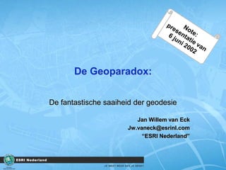
- 1. De Geoparadox: De fantastische saaiheid der geodesie Jan Willem van Eck Jw.vaneck@esrinl.com “ESRI Nederland” Note: presentatie van 6 juni 2002
- 2. GIS en Internet Mooie toepassingen…
- 3. De twee stellingen De Geodesie is het stevige fundament voor fantastische toepassingen in de GeoInformatie De saaiheid van het vakgebied wordt veroorzaakt door technisch navelstaren
- 4. Wie wil er nog in de geodesie werken?
- 5. Wie wil er nog in de logistiek werken?
- 6. Wie wil er nog in de logistiek werken? Onbekend maakt onbemind Navelstaren Niet spannend Beeld van het werkterrein verbeteren Versnippering “We zullen moeten uitstralen dat …logistiek soms saai kan zijn…maar dat het meer is en dat de rol en positie een essentiele rol speelt in ….” R. Pieters, Inkoop en Logistiek, maart/2002
- 7. Fantastisch Dagblad van het Noorden, M. van der Kooi, Infographics
- 8. Overzicht Eerst relativeren De Geoparadox Fantastisch Saai? Stellingen
- 10. Even relativeren Zoekresultaat “gis” 1042 Zoekresultaat “internet” 51557 Zoekresultaat “gis en internet” 743 Zoekresultaat “wat is gis” 54 30/4 Ilse
- 15. Flinke uitspraken “Ik ben ervan overtuigd dat de komende jaren veel toepassingen op basis van GIS zullen ontstaan. Bijeenkomsten over GIS zullen dan echter tot het verleden horen, want: GIS zal pas een succes blijken als wij het niet meer zo noemen. “ C. Guikers, NGT Geodesia 94 - 10
- 16. GIS is veel meer dan technologie “…,dat GIS niet alleen een softwarepakket is. Wanneer een organisatie een GIS wil gaan gebruiken, betekent dit veel meer dan de aanschaf van een stukje hardware of software” H. Scholten, KT 1990.XVI.4 “Internet is de democratisering van GIS” F. Lips, 2002
- 17. Paradox Een uitspraak die een (schijnbare) tegenspraak inhoudt Voorbeeld: ‘ik ben beroemd, maar niemand weet het nog’
- 18. Geo-paradox De fantastischesaaiheid der geodesie Hoe kanietssaaien tegelijkertijdfantastischzijn? Eengeweldiginteressantvakgebied, maarslechtsweinigstudenten “We brengen het zelfveeltesaai, veeltetechnisch, teweinigop de toepassingen”
- 19. Fantastisch www.Nederlandkiest.nl The District Dagblad van het Noorden TopService
- 22. Kenmerken project Opdrachtgever NOVA en NOS Online 1e gezamelijke tv en internet uitzending “innovatieve website-onderdeel samenstellen” Hoogste aantal hits ooit bij het NOB (>100.000 hits per minuut) Zeer veel positieve reacties ontvangen Politiek Journalistiek Internationaal
- 25. The District Gebaseerd op het ware verhaal van Jack Maple Jack bracht alle misdaden in kaart op een enorme plattegrond Resultaat: 1/3 minder criminaliteit Het idee werd in een computersysteem verwerkt: COMSTAT Jack schreef mee aan THE DISTRICT
- 26. The District en ESRI ESRI is ‘hofleverancier’ van de kaarten in The District Een ESRI collega was als adviseur bij The District betrokken Het gebruik van geografische informatie in The District wordt per aflevering uitgelegd op www.esrinl.com/thedistrict Elke vrijdagavond bij de NCRV
- 29. Dagblad van het Noorden Productie regionale verkiezingskaarten Aanwezig in de 1e print van de krant Unicum in Nederland (zelfs voor het ANP) Verwerking in achtergrond verhaal
- 30. Dagblad van het Noorden
- 35. AD, 17 mei
- 37. Intermezzo (1) “door de gepushte diversiviteit in terminologie over ons vakgebied, beschadigen we bewust de interessen van datzelfde vakgebied” GIS, KIS, VIS, LIS, RIS, InternetGIS, Geo-IT, Geo-ICT GIS.nl, gisinternet.nl, webgis, gisportaal.nl , geoparadox.nl “Een goede geografische bedrijfsvoering bestaat uit meer dan het bedenken van nieuwe afkortingen en domeinnamen”.
- 39. TopServices Een proef voor het online gebruiken van Topkaarten Kenmerken de datasets staat zelden dicht bij de gebruiker de toepassing staat zelden dicht bij de gebruiker Belangrijke voordelen Geen eigen beheer van andermans data Altijd toegang tot de meest recente data
- 42. Gebruiken van WebServices Profesioneele gebruiker “geo-leek” (Mobiele) Internetapplicaties
- 44. Vinden van WebServices Aanbieder en gebruikerbij elkaar brengen Topo-portaal
- 45. Intermezzo (2) “goede geo-initiatieven lijden onder de inverse relatie tussen promotie en inhoud” Open GIS ; goed en terecht initiatief Iedereen wil er bij horen, slechts weinigen dragen iets bij Naam associaties alom: GIS Open golftoernooi, Open GIS Huis. Welke organisaties zijn gecertificeerd voor Open GIS?
- 46. Saaiheid Technisch navelstaren in communicatie rond het vakgebied
- 49. Waterschap Zeeuws-Vlaanderen OBS De Stelle, Philippine
- 51. 1% van 1% regel 1% van de beroepsbevolking houdt zich bezig met GeoInformatie Als nu eens 1% van deze 1% voldoende begaan is met het vakgebied, dan hebben wij 500 ‘acties’ per jaar
- 52. Te geo-georienteerd? “geolied” “maar het proces van de verkiezingen liep zo geolied dat er geen verdere ondersteuning nodig was.” Centric Magazine, April 2002
- 53. Overzicht Eerst relativeren De Geoparadox Fantastisch Saai? Stellingen
- 54. Mijn twee open stellingen Elke geodeet is zelf verantwoordelijk voor de ondergang van zijn vakgebied Met GIS zit je goed, als je het taalgebruik van de GIS-gebruiker niet meer begrijpt.
- 55. De Geoparadox: De fantastische saaiheid der geodesie Jan Willem van Eck Jw.vaneck@esrinl.com “ESRI Nederland”
Editor's Notes
- 6 juni 2002, ALV NVG
- Maar zo kan het ook: Wereld GIS dag in Nederland