Sea Level Rise Vulnerability Assessment for Santa Barbara City Coastline
1. Average sea levels have been rising globally
since the last glacial period, approximately
15,000 years ago. However, the rate of increase
has accelerated dramatically in the last hundred
years, from around 0.25 mm per year to nearly
2 mm per year1
, and has been correlated with a
rise in average atmospheric temperatures globally2
.
The variables that cause sea level rise include:
• Thermal expansion of the ocean
• Loss of land ice
• Local tectonic processes
The coastal areas of California are some of the most
highly developed regions of the state. Coastlines are
projected to be significantly impacted as a result of
climate change in the coming decades by processes
such as sea level rise. Consequences of sea level
rise include permanent inundation, intensified storm
damage, and bluff erosion. The City of Santa Barbara
is addressing these hazards in an update of the City’s
Local Coastal Program, which guides planning and
policy within the Coastal Zone. Our study identified
the vulnerability of Santa Barbara to sea level rise
related hazards and addressed vulnerability in terms of
human populations, critical infrastructure, recreation
and public access, as well as ecological resources.
The City of Santa Barbara
Sea Level Rise Vulnerability Assessment
Prepared for the City of Santa Barbara
Project Members: Sara Denka, Alyssa Hall, Laura Nicholson http://bren.ucsb.edu/~sealevelrisesb/
Faculty Advisor: James Frew
Predictions of Sea Level Rise in Southern California1
Overview
Global Sea Level Rise
Year Sea Level Rise
2030z 1.8 – 11.8 in 0.05 – 0.30 m
2050 5.0 – 23.9 in 0.13 – 0.61 m
2100 17.4 – 65.6 in 0.44 – 1.67 m
1. Conduct a Vulnerability Assesment to determine
the impacts of sea level rise on
• Human Impacts
• Critical Infrastructure
• Recreation and Public Access
• Ecological Resources
2. Identify preliminary adaptation policies that
address the impacts of sea level rise hazards.
Project Objectives
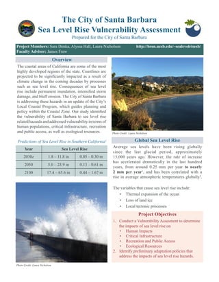
Photo Credit: Laura Nicholson
Photo Credit: Laura Nicholson
2. EXPOSURE
Permanent Inundation
Weanalyzedtheprojectionsofnine
inundation scenarios to determine
effects on human populations,
critical infrastructure, recreation
and public access, and ecology.
Storm Surge
Adding established Base Flood
Elevations for the city3
to sea level
rise values allowed us to assess
overall exposure to a 100-year
storm.
Vulnerability Assessment Components
Exposure
SENSITIVITY
ADAPTIVE CAPACITY
Inundation Storm Surge Erosion
This project is organized into three parts: exposure, sensitivity, and adaptive capacity. These three measures are
commonly used as a way to estimate the total vulnerability of an area to sea level rise.
Exposure refers to the projected spatial extent of sea level rise hazards on the land surface.
Sensitivity is a measure of the internal characteristics of exposed geographic features that may increase
the feature’s susceptibility to a sea level rise hazard.
Adaptive Capacity is the ability of the resource to maintain its function after being exposed to a hazard.
This study explored potential strategies to reduce the risk of damage caused by projected hazards.
Erosion
We modeled bluff erosion hazards
using average erosion rates for
bluffs over a time horizon of 75
years, used in city planning as the
economic lifetime of a building.
Infrastructure Populations EcologyRecreation
00 .5 10.25 Miles
Hazard Extents
Erosion (2090)
Inundation (2100)
100-year Storm Surge (2100)
00
3. Recreation and Public Access
Santa Barbara’s beaches, Harbor, and Stearns Wharf
are the most sensitive assets and the most exposed,
making them some of the most vulnerable assets
overall. Most of Santa Barbara’s recreation and public
access sites are located along the coastline near the
downtown area. The sites that are more developed are
considered to have a higher sensitivity. The resources
that have a high sensitivity also happen to be most
exposed to inundation, storm surge and erosion.
The most sensitive populations of Santa Barbara are not
exposed to permanent inundation until about 1 meter
of sea level rise. Our sensitivity evaluation for human
populations found that the coastal block groups have the
highest exposure to sea level rise hazards but have low
sensitivity based on demographic information. Some
medium and high sensitivity populations are currently
in the 100-year storm hazard zone. Bluff erosion is
projected to affect populations on the Mesa, Braemar,
and Clark Estate, which are considered to have low
sensitivity.
Permanent inundation is not a big threat to most critical
infrastructure in Santa Barbara, but a 100-year storm
surge will become increasingly hazardous.Asignificant
portion of Santa Barbara’s critical infrastructure is
located near the coast. Transportation systems such as
roads and the railroad will be affected by inundation
at 1 meter of sea level rise and are exposed to a
100-year storm surge today. Buildings are more likely
to be affected by storm surge than by permanent
inundation, which is an important consideration for
future planning efforts.
Ecological Resources
All ecological resources within the coastal area of
Santa Barbara are important habitats for federally
listed species. The species found to be affected by sea
level rise related hazards include the tidewater goby,
the California steelhead trout and the western snowy
plover. Based on this analysis, Santa Barbara’s coast
includes high and medium sensitivity ecological
resources. For ecological resources, we found that the
high sensitivity resources are also the most exposed.
Human Populations Critical Infrastructure
Above: Population Density on the Mesa. Photo Credit: Jon Blake Above: Cabrillo Boulevard flooding. Photo Credit: Laura Nicholson
Above: Santa Barbara Harbor. Photo Credit: Jon Blake Above: Mission Creek Lagoon in Santa Barbara. Photo Credit: Laura Nicholson
Sensitivity
4. First and foremost, we would like to thank our
Faculty Advisor, Dr. James Frew for his wisdom and
guidance throughout this project. We would also like
to acknowledge our Client, the City of Santa Barbara
Community Development Department, particularly
John Leadbetter and Rosie Dyste, for their motivation
to enhance the coastal resiliency of the City of Santa
Barbara. Additional thanks go to Jacob Skaggs, Dr.
Ed Keller, and Carey Batha.
Acknowledgements
The three major sea level rise adaptation strategies for any resource are: retreat, accomodate or protect.
This study identified adaptation options for each of the four research elements.
Ultimately, it will be the responsibility of the City in conjunction with its stakeholders to determine appropriate
actions, thresholds, and triggers for implementing these strategies. The City of Santa Barbara intends to include
adaptation policies to address sea level rise related hazards within the Local Coastal Program. The report will
both inform the City’s update to the Land Use Plan of their Local Coastal Program, and help the City identify
and prioritize appropriate adaptation measures.
Adaptation Capacity and Policy Options
References:
1. National Research Council. (2012). Sea-Level Rise for the Coasts of California, Oregon, and Washington: Past Present, and Future. National Academies Press.
2. Vermeer, M. & Rahmstorf, S. (2009). Global Sea Level Linked to Global Temperature. Proceedings of the National Academy of Sciences, 106(51).
3. FEMA (Federal Emergency Management Agency). (2012). Flood Insurance Study: Santa Barbara County, California, and Incorporated Areas. Flood Insurance Study
Number 06083CV001C.