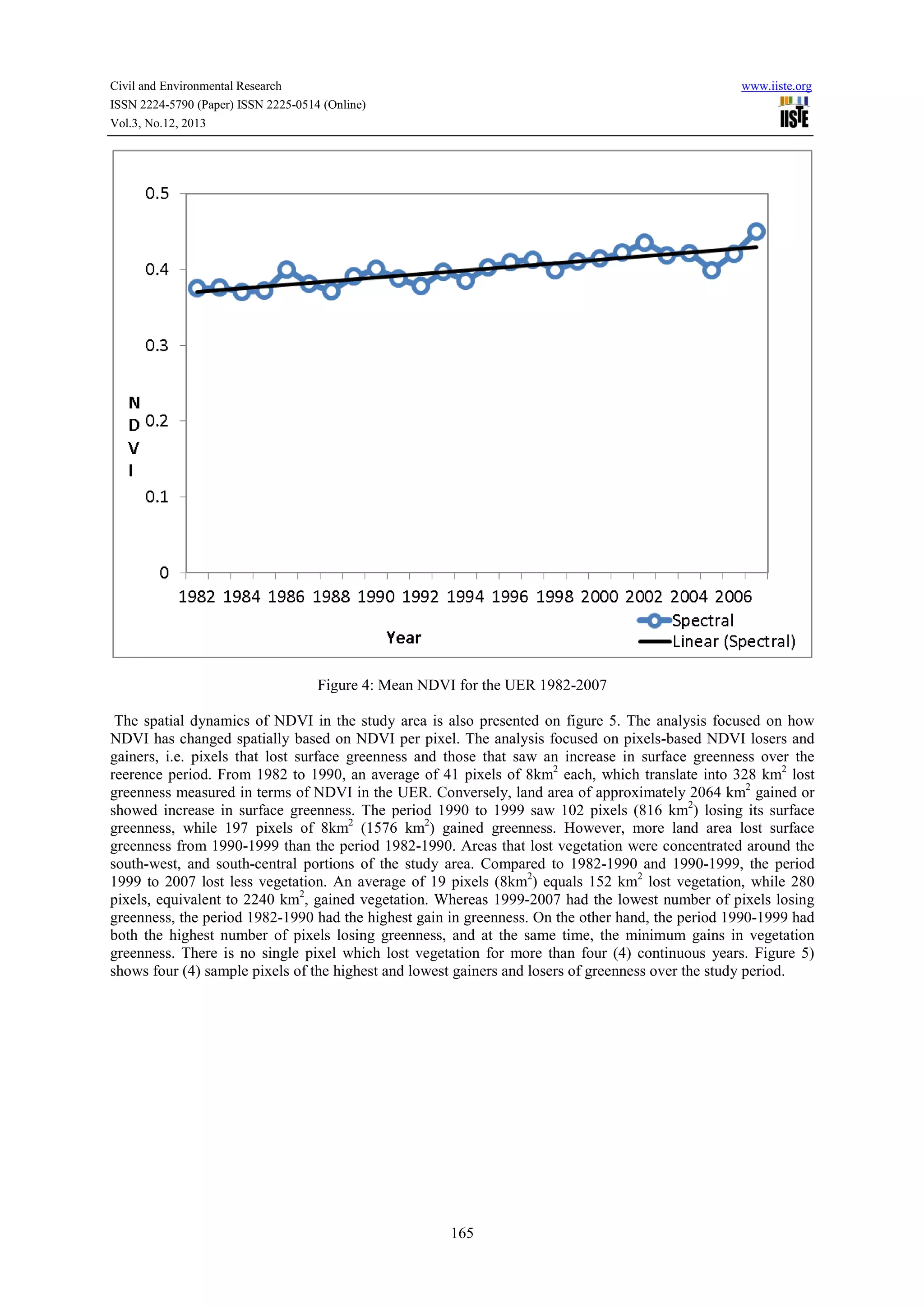
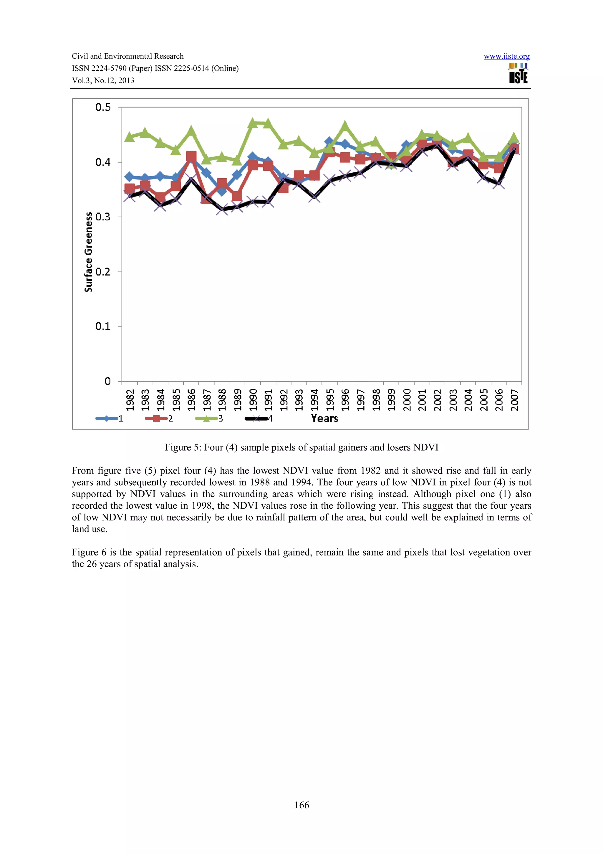
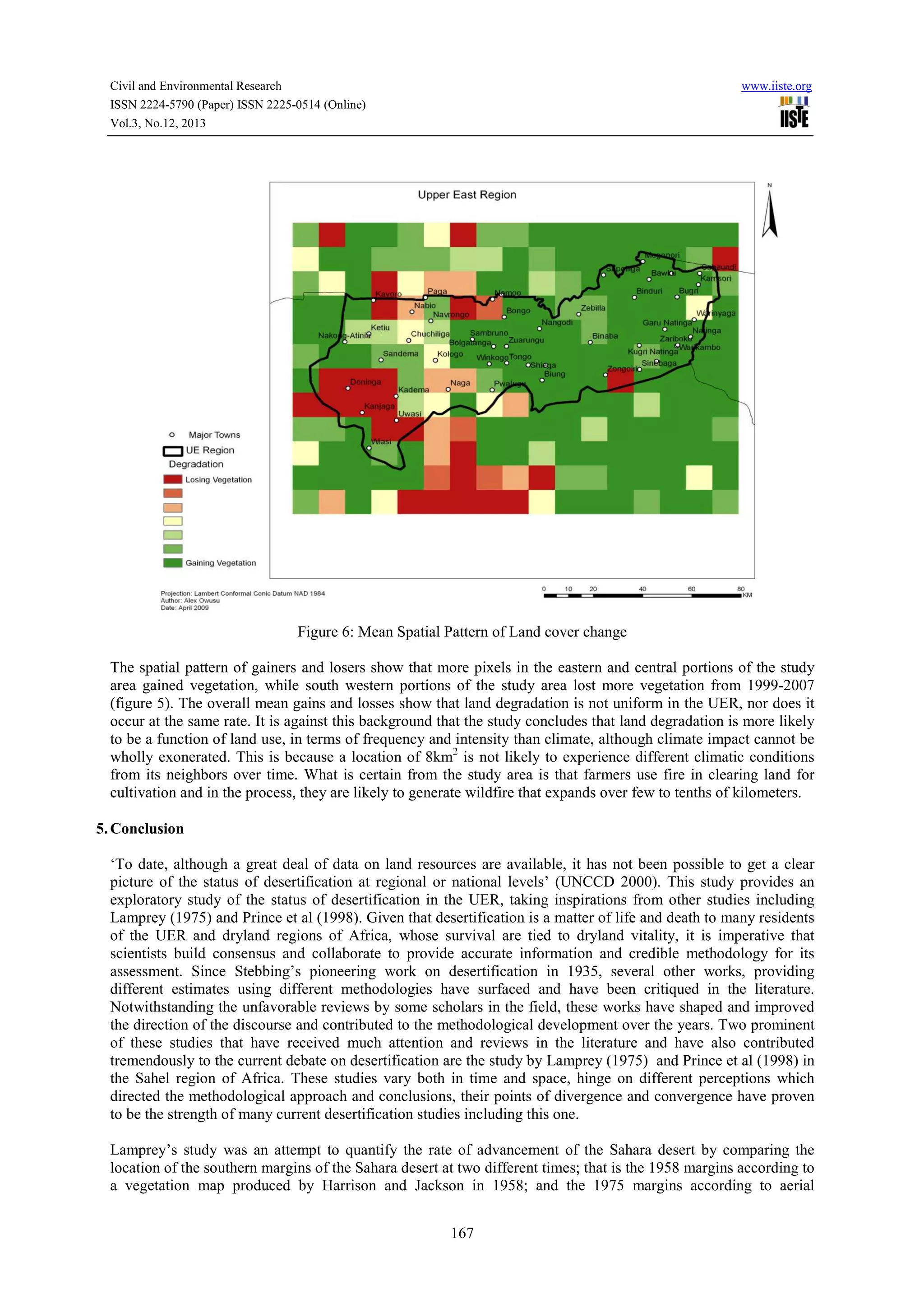
Downloaded 11 times

This document discusses approaches to measuring desertification. It reviews previous definitions of desertification and land degradation. It argues that desertification should be measured as a continuum over the long-term using indicators like Normalized Difference Vegetation Index (NDVI) that reflect changes in vegetation cover over time. Measuring desertification spatially at the pixel level and temporally over 15+ years can help account for climate variations and better identify localized degradation and causes. Efforts to combat desertification may be most effective at the local level where land use decisions are made.


