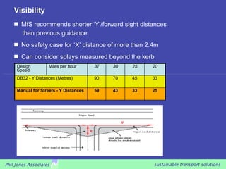
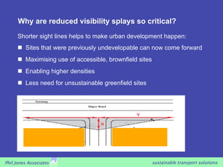
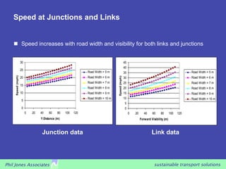
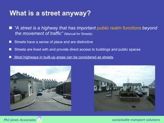
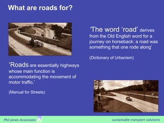
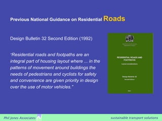
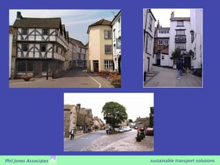
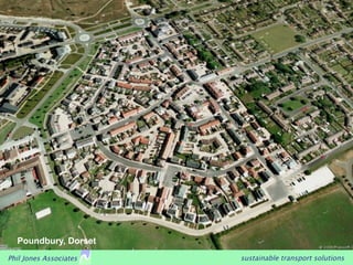
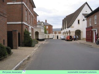
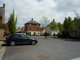
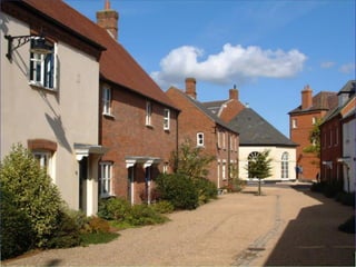
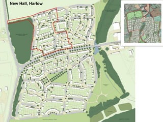
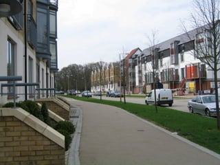
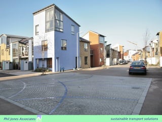
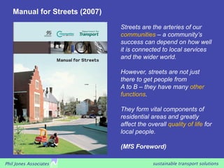
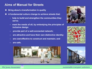
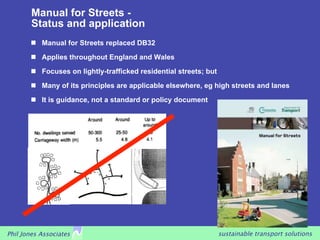
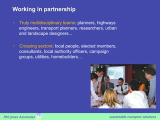
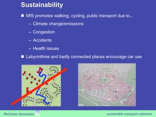
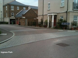
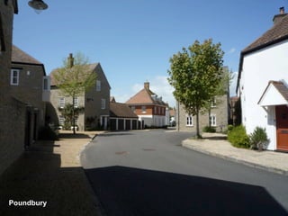
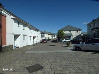
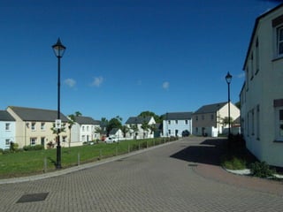
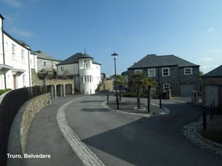
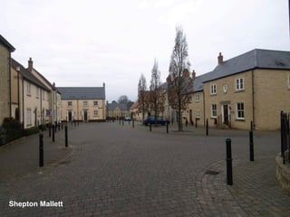
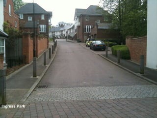
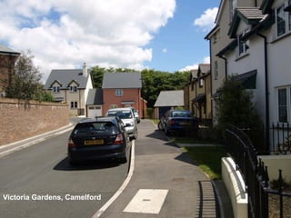
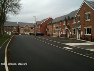
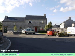
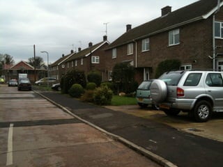
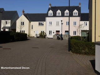
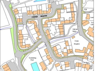
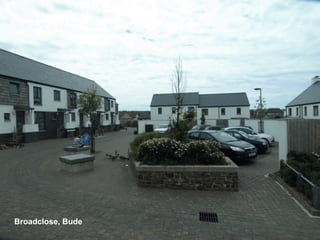
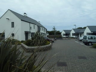
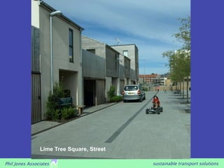
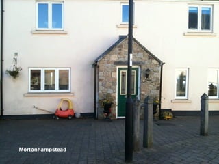
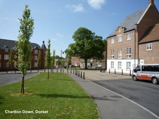
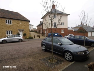
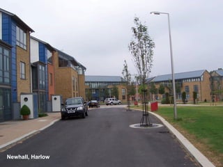
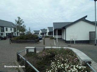
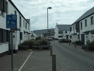
This document summarizes a presentation by Phil Jones on streets and their contribution to successful places to live. The presentation discusses streets as public spaces rather than just for traffic movement. It covers the Manual for Streets guidance which aims to create streets that strengthen communities and meet the needs of all users through inclusive design. The guidance focuses on creating well-connected street networks with their own identity that encourage walking and cycling over car use.
This document provides an overview of sustainable transport solutions and the principles of Manual for Streets (MfS). It discusses the wider application of MfS beyond residential streets, comparing it to the Design Manual for Roads and Bridges (DMRB). The document outlines the key principles of MfS, including placing an emphasis on pedestrians and balancing traffic needs. It also discusses quality audits, street typologies, shared space, and addressing concerns around liability for innovative designs.
This document discusses challenges with achieving connectivity in development planning. It notes that historical highway engineering conventions focused on segregating modes and prioritized vehicle movement, resulting in disconnected street networks. The Manual for Streets provided new guidance emphasizing placemaking and permeability. However, local standards and traffic forecasts sometimes still inhibit connectivity. Additionally, developers may prefer disconnected cul-de-sacs. Nonetheless, principles of connectivity and permeability are increasingly accepted, though barriers remain around outdated standards, land assembly challenges, and objections to change.
Phil Jones, Managing Director, Phil Jones Associates: Local Transport Note on...LandorLINKS
Local Transport Note on Shared Streets (LTN 1/11): a critical review What does the LTN do to make better streets more likely; what more could it have done?
Inchicore on Track's presentation at the ABP Oral Hearing in March 2011, in relation to the Dart Underground coming Above ground in Inchicore. Chapter 7: Community Gain & Corporate Social Responsibility
On March 2015, the City of Summit initiated a Feasibility Study on the vision of converting the abandoned Rahway Valley Railroad into a rail trail more commonly referred to as the Summit Parkline. The Study develops feasible and economical concepts for a 1.2-mile trail and linear park on the existing railroad right-of-way. The Summit Parkline is a unique opportunity for the City to create a recreational amenity that has potential to be a major local and regional attraction and character-giving symbol for the community.
Download the Official Version of this Document from the UTTIPEC Website at the Link below: http://uttipec.nic.in/StreetGuidelines-R1-Feb2011-UTTPEC-DDA.pdf
This document discusses transit oriented development (TOD). It explains that TOD brings compact, mixed-use development within walking distance of high capacity transit like rail or bus rapid transit. This allows people to access jobs, services, and opportunities with short commutes by walking, biking or public transit rather than personal vehicles. TOD is described as creating more sustainable, livable communities that promote public health and reduce environmental impacts. The document provides examples of Wendel's work on TOD projects and outlines their approach to responsible design focused on connectivity, density, mixed uses and other principles.
Getting the balance right between short term interventions and long term sust...Tristan Wiggill
A presentation by Ms Lisa Seftel (Executive Director: Transportation: City of Joburg) at the Transport Forum Month of Transport Celebrations 1 October 2015 hosted by University of Johannesburg. The theme for the event was: "Trends in Policy Development for Transport" and the topic for the presentation was: "Getting the balance right between short-term interventions and long-term sustainability."
More like this on www.transportworldafrica.co.za
Implementation and Systemic Change with UTTIPEC Street Design GuidelinesUttipec Dda
1) The document discusses the implementation of UTTIPEC Street Design Guidelines in Delhi and other Indian cities to make streets more pedestrian friendly and encourage public transit use.
2) It highlights success stories of redesigning streets in Delhi like Aurobindo Marg, IP Marg and Bhairon Marg. It also discusses pilots to reclaim street space from private parking in Vikas Marg and improve multimodal integration at metro stations in Chhatarpur.
3) It covers UTTIPEC's efforts on capacity building, third party audits, community feedback and participating in international forums to promote sustainable street design principles.
Title: Aloha Streets: Complete Streets and Complete Communities in Hawai`i
Track: Connect
Format: 90 minute panel
Abstract: Residents and visitors of Hawai'i expect paradise, but find traffic. Find out how communities at different scales in the state are expanding viable transportation options and building complete, transit-oriented cities and towns.
Presenters:
Presenter: Evan Corey Nelson\Nygaard
Co-Presenter: Mark Garrity City of Honolulu Transportation Services
Co-Presenter: Michael Moule County of Kauai
Bicycle Master Plan - Bicycle Boulevard Project - City of AustinBang the Table
This document discusses plans to develop a bicycle boulevard project along Nueces Street and Rio Grande Street in Austin. It provides an overview of the project, updates on public input received, and introduces a traffic consultant to analyze impacts. A design charrette and formation of a working group are proposed to finalize traffic calming measures and bicycle accommodations that balance the needs of all street users.
The agenda/presentation slide deck shown during the December 8, 2020 Bicycle Pedestrian Advisory Committee (BPAC) virtual workshop. The meeting video can be viewed at https://youtu.be/yW9poebzREE
The document discusses strategies for improving road safety through the "3 Es" of education, enforcement, and engineering. It examines causes of road accidents such as driver skill, attitudes, and the road environment. UK policy approaches road safety through interventions that target these three areas, including road infrastructure improvements and traffic calming measures. Road safety audits aim to evaluate the safety of road designs.
The document discusses road safety policy and interventions for improving road user safety. It covers the three main causes of accidents - road environment, skills, and attitudes. The three main interventions discussed are education, enforcement, and engineering solutions. It provides details on various road safety policies and strategies in the UK, including the vision zero approach. Road safety audits are introduced as a way to evaluate infrastructure design and its impact on safety.
This document summarizes a presentation made to the College Station City Council regarding walking development standards and safety. It outlines the benefits of providing safe walking facilities according to surveys of residents and national standards. Current city policies aim to improve mobility through a multi-modal transportation system. While the city has made progress by building 130 miles of sidewalks, over half of street miles still lack sidewalks. The home builders association proposed reducing some sidewalk requirements but city staff recommend keeping most existing standards to promote walkability and safety.
Kim DeLaney
Lynda Westin
Jennifer Willman
Transit Oriented Development (TOD) has enormous potential to help us rethink the transportation-land use connection and reinvest in communities to become more economically vibrant, sustainable and livable. New regional and statewide tools are being created to help plan for TOD by pooling our knowledge to reduce the burden on local governments. Statewide TOD
design guidelines, the Tri-Rail Station Evaluation Project, and a TOD Resource Guide for Tampa Bay are helping us do more with less. Learn about how these collaborative efforts promote an urban development paradigm shift that optimizes return on our investments.
Transit Oriented Development (TOD) results in the creation of compact, walkable and liveable communities with access to amenities built around high quality mass transit stations. However, the discourse around TODs in India is more of a densification and value capture approach, which is necessary, but yet an incomplete conversation for the Indian context. This webinar, presented by Todd Litman, Himadri Das and Lubaina Rangwala addresses the major challenges and learnings from the ‘implementation’ of a TOD.
The webinar recording can be seen here - https://www2.gotomeeting.com/register/335456930
Related Research - http://embarqindiahub.org/reports/towards-walkable-sustainable-bengaluru-accessibility-project-indiranagar-metro-station
Related webinar - http://embarqindiahub.org/webinars/parking-effective-tool-manage-travel-demand-transit-oriented-developments
Neighborhood Greenways are a network of existing low-traffic streets that are repurposed to encourage through bicycle and pedestrian trips. The goals are to keep auto traffic below 1,000 vehicles per day to create a comfortable environment for biking, add traffic calming measures to limit speeds to 20 mph, help people safely cross busy streets, and efficiently connect people to key destinations using residential streets. Common tools used for neighborhood greenways include signs, crosswalk improvements, traffic barriers, and speed bumps. The implementation process involves identifying routes, notifying residents, and holding community meetings to discuss plans and get feedback.
Title: Level of Service F for Grade A Streets
Track: Prosper
Format: 90 minute panel
Abstract: Relying solely on Level of Service criteria for street design, which evaluates vehicle congestion, leads to poor outcomes on many of our roadways. LOS F, far from a failure, creates opportunities to reallocate roadway space for more livable street designs. In this session, learn about projects in Cambridge and San Francisco that overcame opposition and generated community support in prioritizing better bicycling and walking over vehicle capacity during the peak hour of travel.
Presenters:
Presenter: Michael Sallaberry San Francisco Municipal Transportation Agency
Co-Presenter: Jeffrey Rosenblum City of Cambridge, MA
The document discusses redesigning El Camino Real in Palo Alto to make it more accommodating for pedestrians and a center of community. It outlines goals of making El Camino Real less of a barrier and more aesthetically attractive. It then discusses proposed redesigns, including reducing lanes and adding improvements for pedestrians. The proposed redesigns aim to balance needs of all modes of transportation.
ULI Seattle’s Bus Rapid Transit and Land Use Initiative Developing the Next F...Virtual ULI
This document summarizes ULI Seattle's Bus Rapid Transit and Land Use Initiative. The initiative analyzed BRT systems and station areas to develop recommendations to better integrate land use and transit. A team studied RapidRide corridors in Seattle and issued a report with detailed recommendations for 2 corridors and 3 stations. The report also established 10 principles for arterial BRT development. The initiative facilitated discussions between public and private stakeholders and established ULI Seattle as a leader on transit and land use issues regarding BRT and rail.
The document discusses how the ITE/CNU Guide for Walkable Streets can support Elgin, Illinois' plans to create more walkable and transit-oriented development. It outlines Elgin's vision for downtown and mixed-use centers, and how the guide differs from conventional traffic engineering approaches by being context-sensitive and emphasizing networks over arterials. Two challenges to implementing walkable streets in Elgin are discussed: the city's conventional network design that limits intersections, and standards requiring long blocks on arterial roads. Adopting the ITE/CNU guide's recommendations could help Elgin overcome these challenges.
This document discusses best practices in transit oriented development through six case studies: The Bridges in Calgary, Alberta; Fruitvale Village in Oakland, California; Mission Meridian Village in South Pasadena, California; and Clarendon Metro Station in Arlington, Virginia. It outlines key elements of the projects, which commonly include mixed-use and higher density development concentrated near transit stations, with densities decreasing farther out. Design guidelines aim to make the areas pedestrian-friendly while blending with surrounding neighborhoods. Common urban design themes are also outlined.
The document discusses complete street design elements and case studies. It begins with an introduction to complete streets and their physical elements. It then presents two case studies: a 4-3 road diet in an urban/suburban setting that involved reducing four lanes to three to improve safety and pedestrian access; and a corridor plan for a small town/suburban/rural setting. It discusses implementation benefits, education/advocacy, policies/plans, funding, and phasing. Context sensitivity and street components like lanes, medians, crossings, and more are examined. A history of street design and shift to auto-centric planning is provided.
Designing & Planning for Cycling, Phil Jones & Adrian LordDesign South East
Presentation on Design and Planning for cycling from the Designing and Planning for Cycling workshop at MADE on 19th May 2015. Presentation by Phil Jones and Adrian Lord, Phil Jones Associates.
This presentation highlights the importance of Roadspace Allocation within transport planning and illustrates how to develop a successful Roadspace Allocation Framework. Further to this the presentation gives an insight to understanding and meeting user requirements. It then progresses to utilise various case studies in Birmingham to further demonstrate how these frameworks can be put into practice.
This presentation on Walkability is for a upcoming seminar/charrette hosted by the Town of Collierville, Tn. There is a particular focus on block design as one of the key components of a wlakable neighborhood.
Lesson 18 for Grad Course on CSS (from UTCM Report #08-14-03 "Making Mobility Improvements a Community Asset: Transportation Improvements Using Context-Sensitive Solutions")
On May 20, 2010, Mary Raulerson of Kittelson & Associates held a workshop in Portland, OR which introduced and illustrated best practices in the field of Complete Streets using case studies she has been directly involved with around the country. During the workshop, special attention was given to the obstacles that had to be overcome and the solutions that worked. The goal of this session was to help identify and tailor practices that will further strengthen the region’s move toward creating, connecting and complimenting great places with great multimodal rights-of-way.
1) Home zones originated in the Netherlands in the 1960s-1970s as "woonerfs", which were residential streets designed to reduce car dominance and prioritize pedestrian safety.
2) The concept spread to other European countries and was introduced in the UK in the late 1990s through pilot programs and legislation allowing 20mph speed limits.
3) By the early 2000s, the UK government was providing guidance for planning and public participation in home zones, which aim to improve residents' quality of life by making streets safer for walking, cycling, and children's play.
“The ethics of transport planning” - Prof Stephen Potter talks at the HCDI se...Marco Ajovalasit
This presentation will explore the ethical issues behind what appears to be a technical design process - that of transport planning decisions. It will draw upon the transport/land use designs explored in Britain’s new towns (and Milton Keynes in particular) which help to highlight the ethical decisions involved.
This will illustrate the way that the design of towns and cities affects our travel behaviour and constrains our ability to choose to travel in a socially and environmentally responsible way. Indeed, we can get locked into unsustainable travel behaviours and feel powerless to behave otherwise. This leads to the now prevalent negative attitude towards transport policy initiatives and often outright opposition to sustainable transport developments.
Urban design professionals argue that high density settlements are the main way that sustainable transport choices can be provided, as such designs produce conditions which make for good public, and also suppress car use. However, although such an approach is possible in major conurbations and city centres, this is a difficult and contentious approach for suburban Britain. For most places ‘big city’ design solutions are not politically viable.
Perhaps we should be looking to more innovative approaches. These could blend a variety of new measures, such as the ‘smarter travel’ initiatives as well as new emerging technologies. However these require a different way of doing transport planning to the traditional ‘big infrastructure’ transport policy approaches. New physical design approaches often require the redesign of the processes and structures to implement and manage them, and this may be the key barrier to success.
TransLink presentation that looks at the challenge of building transit-oriented development in communities that are auto-oriented. Gives examples including Downtown Surrey (Whalley) and Newton. Also, look at the 5 "D" of TOD: Density, Distance, Destinations, Diversity, and Design.
This document outlines 10 principles for sustainable transportation in cities. Principle 1 emphasizes creating walkable cities by prioritizing pedestrians and improving pedestrian infrastructure and safety. Great cities focus on developing walkable streets that protect pedestrians from vehicles and provide continuous, accessible sidewalks and safe street crossings. Streetscapes should invite and draw people to walk through thoughtful design.
This document discusses tools and strategies for promoting active living through community planning and design. It outlines how land use, transportation, parks and recreation can encourage walking, biking and physical activity. Specific policies and projects are mentioned, including complete streets, traffic calming, safe routes to school and compact development. Resources for additional information on active living and community design are provided.
Building Sustainable Communities: Urban Planning in the Portland Metro Regi...South Fraser Blog
Presentation by Oregon Metro Councilor Collette in which she give a general overview of the Metro Portland region and the role of the elected Oregon Metro Council. She gives information on Metro’s role in land-use planning, the urban growth boundary, and the region’s long-term planning document: Region 2040. She focuses on the link between land-use planning and transportation plan, and how Portland is in the business of designing multi-modal transportation corridors today. She also outlines the region’s priorities for high-capacity transport or light rail, and other orders of public and active transit. There is a case study on Tigard.
Urban Design Scales and Spaces for ArchitectureMimi Alguidano
The document discusses the key elements of urban design that shape urban spaces, including buildings, public spaces, streets, transportation systems, and landscaping. It then focuses on sidewalks and streetscapes, describing the characteristics of great streets and the various elements that make up street design, such as lane width, sidewalks, curb extensions, vertical speed controls, and amenities like street trees, landscaping, lighting, and furniture. The goal is to balance the needs of all street users through designs that prioritize pedestrian experience and safety.
Smart growth is an urban planning theory that promotes compact, walkable urban areas to avoid low-density sprawl and preserve open space. The key principles of smart growth include mixing land uses, increasing transportation options, developing a range of housing and jobs, and encouraging community collaboration in development decisions. Smart growth aims to achieve unique communities with a strong sense of place while promoting public health, environmental protection, and economic competitiveness through policies like infill development, affordable housing, and transit-oriented development.
Organic Urbanism: human-oriented design for metropolisesOleksandr Galychyn
Abstract
Existing theories of sustainable development have failed to address three common structural elements of the
human-oriented transportation system: healthy neighborhoods, Transit-Oriented Developments (TODs) connected
by integrated public-soft transportation network. The newly emerged conceptual model for zero-emission and zerowaste
urban design named Green Urbanism like the previous theories has failed to develop those three structural
elements of organic city.
In this paper approaches regarding the successful integration of soft transportation to the transit network will be
discussed. Secondly, the best physical standard for TOD will be determined by comparing TODs in Japan, Denmark,
Ukraine and Turkey by socio-economic indicators of each TOD type. Finally, the concept of healthy neighborhood
will be developed based on the Lehmann’s healthy community&district definitions, concept of human oriented
transportation, and the latest eco-mobility study from Barcelona. Thus, new conceptual model for sustainable city
will be proposed.
In 3 sentences:
The document discusses the key elements to consider when designing streets for livable cities, including pedestrians, vehicles, parking, and transportation options. It emphasizes the need for a comprehensive approach that considers all users and aspects, such as transportation, safety, the environment, and the economy. The goal is to create streets that are social spaces where people can easily and safely walk, bike, access transit, and spend time, rather than only focus on traffic flow.
The document summarizes a presentation on transportation planning in Champaign-Urbana, Illinois. It discusses:
1) The region's focus on providing transportation choices through investments in biking, walking, and public transit as well as transit-supportive development.
2) A mobility implementation plan that developed scenarios to increase non-driving trips and evaluated enhanced transit corridors.
3) Recommendations to create mixed-use, walkable neighborhoods called Mobility Enhanced Developments that reduce transportation costs and emissions.
Mobility In The 21st Century ITE Conference 2010finalCynthia Hoyle
This document summarizes a presentation about creating multimodal transportation systems. It discusses the need to plan for sustainability and public health due to issues like foreign oil dependence, global warming, and obesity. It then outlines strategies like improving infrastructure for walking, biking, and transit; coordinating land use and transportation; and encouraging behavioral changes. Case studies from Champaign-Urbana, Illinois show how comprehensive planning led to investments in public transit, bike lanes, sidewalks, and other alternatives to driving. The goal is to make mobility options easy and affordable for all residents.
The document discusses guidelines for integrated pavement design in Delhi, India. It addresses the need to redesign streets to improve mobility, safety, and ecology. It outlines three goals: 1) improve mobility and accessibility for all people, 2) enhance safety and comfort, and 3) reduce environmental impact. The document then discusses defining three pavement zones, and provides guidelines for edge conditions, pavement design, tree planting, street lighting, amenities, signage, and public art to achieve the goals of mobility, safety, and ecology. Key recommendations include providing clear pedestrian zones, fences and bollards for safety, active commercial edges, minimal setbacks, and safe crosswalks.
This document discusses complete streets and their benefits. It defines complete streets as those designed and operated to be safe and accessible for all users, including pedestrians, transit riders, bicyclists, and drivers of all ages and abilities. Complete streets typically include sidewalks, safe crossings, and bike lanes. They provide benefits such as improved safety, health, accessibility, and economic development. The document advocates for complete streets policies to integrate the needs of all road users into transportation planning and design. It outlines steps communities can take to establish complete streets policies and ensure effective implementation and practice.
The document introduces the Design Manual for Urban Roads and Streets (DMURS), which provides new national street design guidance for Ireland. DMURS aims to change the conventional approach that prioritized vehicle movement over other street users. It advocates for a balanced approach that considers streets as places as well as routes for movement. DMURS seeks to create "self-explaining streets" where street design influences driver behavior to naturally reduce speeds and prioritize vulnerable street users through techniques like narrower lanes, on-street parking, and shared spaces. The challenges ahead include overcoming cultural and professional norms focused on vehicle movement and changing misconceptions about liability and legislation.
Although the street was once a multi-use space, the rise of vehicles has resulted in the street being regarded as a place for motorists with the primary purpose of moving vehicles quickly. Home zone represents an opportunity to restore the role of streets as a shared space to be used by pedestrians and cyclists as well as motorists with the privilege of pedestrians over the other road users. The most important aim of a Home Zone is to improve the quality of life in residential streets by making them
places for people not for vehicles. Research conducted on residents’ feelings about their neighbourhoods before and after implementing Home Zone show, if principles of Home Zone design are fully implemented, Home Zones can be safe, secure, pleasant, and attractive areas which not only decrease through traffic and vehicles’ speed but also improve social interactions and residents’ quality of life.
This presentation was delivered by Peter Jones from University College London on 2nd October 2015 and highlighted the importance of considering Link and Place when improving street design.
Tamed, by MADE, Beyond the Gallery, Sally RobertshawDesign South East
Presentation on MADE's project Tamed for the Beyond the Gallery event at MADE on 24/3/15. Presentation by Sally Robertshaw, Community Programmes Manager, MADE.
Beyond the Gallery, Tamed, Stuart Mugridge and Robert ColbourneDesign South East
Presentation looking at untraditional ways of displaying art from the Beyond the Gallery event at MADE on 24/3/15. Presentation by Stuart Mugridge and Robert Colbourne, Artists.
Backwards and Forwards Birmingham Public Art, Beyond Public Art, Stuart Mugri...Design South East
Presentation on public art in Birmingham from the Beyond Public Art event at MADE on 24/3/15. Presentation by Stuart Mugridge and Robert Colbourne, Artists.
Rebuilding the Brookvale Road flood wall, Tamed, Jenny HorsburghDesign South East
Presentation on MADE's designs for rebuilding the Brookvale Road flood wall in Witton for the project Tamed.
Presentation by Jenny Horsburgh, Environment Agency.
Models for Funding & Management, Functional Landscapes Seminar, Peter NealDesign South East
Presentation on Models for funding and management by Peter Neal from FLI for the RTPI West Midlands Functional Landscapes Seminar on 13th November 2014
Delivering the Urban Tree Agenda, Functional Landscapes Seminar, Martin KellyDesign South East
Martin Kelly presented a 10 point action plan for delivering an urban tree agenda. The plan calls for integrated urban planning solutions, evidence-based research on trees, education for public awareness of trees' economic, environmental and social values, and embedding tree standards into policies to ensure long-term management and funding for tree maintenance. The presentation also discussed how trees can help address issues like urban heat islands, climate change, biodiversity, and public health and wellbeing. Case studies from places like Birmingham, Sefton and Bristol showed how embedding tree standards into local plans and policies can contribute to positive environmental outcomes from new developments.
Green Infrastructure & Biodiversity, Functional Landscapes Seminar, Sue IllmanDesign South East
Presentation on Green Infrastructure and biodiversity by Sue Illman from Illman Young for the RTPI West Midlands Functional Landscapes Seminar on 13th November 2014
International Cycling Infrastructure, Best Practice Study, Phil JonesDesign South East
The document summarizes a study of international cycling infrastructure best practices. It visited 14 cities with high cycling rates to compare their approaches. The study aims to inform London's cycling plans and provide guidance to transportation authorities. Common success factors identified include strong political support for cycling, dedicated cycling infrastructure separated from traffic, and prioritization of cyclists at intersections.
Birmingham Cycle Revolution, Paul Simkins- Cycle City EventDesign South East
Presentation on Birmingham's Cycle Revolution by Graham Lennard and Paul Simkins from Birmingham City Council for the Cycle City Event on 21st October 2014
This document discusses plans for an "Urban Room" in Birmingham that would be managed by MADE, a local organization focused on design, quality, and community. The Urban Room would serve as a place for education, engagement, and investment related to the built environment and development of the city. It would feature a model of Birmingham at its core along with other displays. Funding may come from sources like the Heritage Lottery Fund and income could be generated from charges to schools, developers, and other users of meeting/display space. The proposal draws inspiration from The Building Store in London.
How can design review evolve, Les Sparks - Design Network ConferenceDesign South East
Design review has evolved from local architects' panels with narrow focuses and conflicts of interest, to CABE's model of presentations and discussions between eminent multi-disciplinary practitioners, establishing best practices and training. Currently, the Design Network regionally covers the UK in a consistent way based on CABE's 10 principles, but has patchy uptake, funding uncertainties, and poor promotion. Going forward, design review could evolve to have more open, observable reviews; in-depth strategic analyses; and hands-on design workshops.
Local leadership, Neil Deely - Design Network ConferenceDesign South East
This document discusses several ways that local leadership can help improve design quality and placemaking in their communities. It suggests nominating "Civic Champions" from the private sector and local government to engage with neighborhood forums and shape development plans. It also recommends providing training to local councillors and decision-makers on design literacy so they are better equipped to evaluate projects. Formalizing partnerships between local authorities and architecture schools is presented as a way to strengthen this skills training.
Place leadership council, Matthew Carmona - Design Network ConferenceDesign South East
The document proposes establishing a Place Leadership Council for England to promote high quality design and placemaking in the built environment. The Council would provide leadership on place-based issues through research, advocacy, and maintaining best practice resources. It would not directly conduct design reviews but could direct certain projects to undergo review. The Council would have authority through a Royal Charter and duty on government. It would be governed by representatives from relevant professions and sectors. Funding would come from a small surcharge on planning fees and project grants. The document considers different name options, ultimately suggesting Place Council for England or PlaCE.
Pro active planning, Clive Dutton - Design Network ConferenceDesign South East
This document discusses the importance of planning for the future. It argues that without a plan, cities and countries will face challenges. It uses examples from the UK and London to show how strategic planning and leadership can leverage assets to drive economic growth and development. The document suggests that fewer, larger administrative areas and clear long-term visions could make governments and cities more effective in creating positive change.
Promoting excellence to the world, Patricia Brown - Design Network ConferenceDesign South East
The architecture industry in the UK generates significant economic benefits, with exports worth £324 million annually, contributing £3.3 billion to gross value added, and £5 billion worth of construction products and materials exported each year, while employing 136,300 people across 11,700 businesses.
Civil Engineering- Alex McKeown, City Builder Academy 2014Design South East
This document discusses why people become civil engineers and the career opportunities in the field. It notes that civil engineers are drawn to the profession because they want to design and build structures, solve problems, change people's lives, and shape the future. The document outlines some of the areas civil engineers can work in, such as geotechnical, structural, and project management engineering. It also provides examples of the types of projects civil engineers are involved in, such as skyscrapers like The Shard in London, disaster recovery efforts, and infrastructure projects. Finally, the document discusses different career paths for civil engineers, including getting a university degree and working internationally or domestically in areas like drainage design.
Built on the past, designed for the future- John Hewitt, Rethinking Housebuil...Design South East
Ralph Allen Yard was a housing development project built on the site of a former quarry in Bath, England. The development was designed to be sustainable and bring community to the area, while also paying homage to the historical quarrying industry through its design elements. It aimed to rethink traditional housebuilding approaches through sustainable materials and energy usage, community spaces, and respecting the natural landscape.
Built on the past, designed for the future- John Hewitt, Rethinking Housebuil...
Manual for Streets 1
1. Manual for Streets 1
The Contribution of Streets
to Successful Places to Live
Birmingham
18 April 2011
Phil Jones, PJA
Phil Jones Associates sustainable transport solutions
2. What is a street anyway?
“A street is a highway that has important public realm functions beyond
the movement of traffic” (Manual for Streets)
Streets have a sense of place and are distinctive
Streets are lined with and provide direct access to buildings and public spaces
Most highways in built-up areas can be considered as streets.
Phil Jones Associates sustainable transport solutions
3. What are roads for?
‘The word ‘road’ derives
from the Old English word for a
journey on horseback: a road was
something that one rode along’
(Dictionary of Urbanism)
‘Roads are essentially highways
whose main function is
accommodating the movement of
motor traffic.’
(Manual for Streets)
Phil Jones Associates sustainable transport solutions
4. Previous National Guidance on Residential Roads
Design Bulletin 32 Second Edition (1992)
“Residential roads and footpaths are an
integral part of housing layout where ... in the
patterns of movement around buildings the
needs of pedestrians and cyclists for safety
and convenience are given priority in design
over the use of motor vehicles.”
Phil Jones Associates sustainable transport solutions
5. But highly standardised car-led geometric standards...
Phil Jones Associates sustainable transport solutions
7. “Some housing, such as this, meets planning and highway standards,
but fails to create a sense of place or identity. We need to set our
sights higher”
The Communities Plan - 2003
Phil Jones Associates sustainable transport solutions
8. Welcome to
The Midlands!!
Phil Jones Associates sustainable transport solutions
20. Building for Life - 4 Groups, 20 Criteria
Environment and Community
Character
Streets, Parking & Pedestrianisation
Design and Construction
Streets are fundamental to the assessment...
Phil Jones Associates sustainable transport solutions
21. Q4. Does the development have easy access to public transport?
Group 1 -
Environment & Community
The Village, St Austell
Phil Jones Associates sustainable transport solutions
22. Q9. Do the buildings and layout make it easy to find your way around?
The Village, St Austell
Group 2 - Character
Phil Jones Associates sustainable transport solutions
23. Q 10. Are the streets defined by a well-structured
building layout?
The Russells, Broadway, Worcestershire
Group 2 - Character
Phil Jones Associates sustainable transport solutions
24. Q11. Does the building layout take priority over the streets and car
parking, so that the highways do not dominate?
The Meadows, Shepton Mallet Broadclose, Bude
Group 3 - Streets, Parking & Pedestrianisation
Phil Jones Associates sustainable transport solutions
25. Q12. Is the car parking well integrated and situated so it supports
the street scene?
Broadclose, Bude, Cornwall Lime Tree Square, Street, Somerset
Group 3 - Streets, Parking & Pedestrianisation
Phil Jones Associates sustainable transport solutions
26. Q13. Are the streets pedestrian, cycle and vehicle friendly?
Victoria Gardens, Camelford, North Cornwall
Group 3 - Streets, Parking & Pedestrianisation
Phil Jones Associates sustainable transport solutions
27. Q14. Does the scheme integrate with existing streets, paths and
surrounding development?
The Russells, Broadway, Worcestershire
Group 3 - Streets, Parking & Pedestrianisation
Phil Jones Associates sustainable transport solutions
28. Q15. Are public spaces and pedestrian routes overlooked and do
they feel safe?
Gwean Pawl Urban Village, Redruth Clay Field, Elmswell, Suffolk
Group 3 - Streets, Parking & Pedestrianisation
Phil Jones Associates sustainable transport solutions
29. Manual for Streets (2007)
Streets are the arteries of our
communities – a community’s
success can depend on how well
it is connected to local services
and the wider world.
However, streets are not just
there to get people from
A to B – they have many other
functions.
They form vital components of
residential areas and greatly
affect the overall quality of life for
local people.
(MfS Foreword)
Phil Jones Associates sustainable transport solutions
30. Aims of Manual for Streets
Bring about a transformation in quality
A fundamental culture change to achieve streets that:
– help to build and strengthen the communities they
serve;
– meet the needs of all, by embodying the principles of
inclusive design
– provide part of a well-connected network;
– are attractive and have their own distinctive identity;
– are cost-effective to construct and maintain; and
– are safe.
Phil Jones Associates sustainable transport solutions
31. Manual for Streets -
Status and application
Manual for Streets replaced DB32
Applies throughout England and Wales
Focuses on lightly-trafficked residential streets; but
Many of its principles are applicable elsewhere, eg high streets and lanes
It is guidance, not a standard or policy document
Phil Jones Associates sustainable transport solutions
32. Working in partnership
• Truly multidisciplinary teams: planners, highways
engineers, transport planners, researchers, urban
and landscape designers...
• Crossing sectors: local people, elected members,
consultants, local authority officers, campaign
groups, utilities, homebuilders…
Phil Jones Associates sustainable transport solutions
33. Sustainability
MfS promotes walking, cycling, public transport due to...
– Climate change/emissions
– Congestion
– Accidents
– Health issues
Labyrinthine and badly connected places encourage car use
Phil Jones Associates sustainable transport solutions
34. Mode hierarchy
Consider modes in order:
– Pedestrians
– Cyclists
– Public Transport
– Motor vehicles
Accommodate all users on streets
Tight corner radii level crossings
Phil Jones Associates sustainable transport solutions
35. Developing a Movement Framework
Where are the key desire lines?
How can the development enhance the existing
movement framework rather than disrupt or sever it?
What points of connection and linkage
can be achieved?
Should these be for all modes?
Can concerns over ‘rat running’ be
addressed through slower speeds?
Phil Jones Associates sustainable transport solutions
36. Street Character Types
Consider
– Key dimensions (widths etc)
– Relationship to buildings and private realm
– Parking
– Materials
– Planting etc
Terminology important
– Eg avenue, mews, lane, boulevard
– Not Minor Access Road, Local Distributor Road
Phil Jones Associates sustainable transport solutions
37. Assembling Streets...
Junctions as places
Street width considerations:
– Traffic composition
– Pedestrian flow
– Parking
– Width/height ratios
– Swept paths
– Trees
Designing in three
dimensions
Phil Jones Associates sustainable transport solutions
38. Visibility
MfS recommends shorter ‘Y’/forward sight distances
than previous guidance
No safety case for ‘X’ distance of more than 2.4m
Can consider splays measured beyond the kerb
Design Miles per hour 37 30 25 20
Speed
DB32 - Y Distances (Metres) 90 70 45 33
Manual for Streets - Y Distances 59 43 33 25
Phil Jones Associates sustainable transport solutions
39. Why are reduced visibility splays so critical?
Shorter sight lines helps to make urban development happen:
Sites that were previously undevelopable can now come forward
Maximising use of accessible, brownfield sites
Enabling higher densities
Less need for unsustainable greenfield sites
Phil Jones Associates sustainable transport solutions
40. Y
X
Phil Jones Associates sustainable transport solutions
41. Speed at Junctions and Links
Speed increases with road width and visibility for both links and junctions
30 45
40
25
Road Width = 5 m 35 Road Width = 5 m
Road Width = 6 m
Speed (mph)
20 Road Width = 6 m
Speed (mph)
30
Road Width = 7 m 25 Road Width = 7 m
15
Road Width = 8 m 20 Road Width = 8 m
10 Road Width = 9 m 15 Road Width = 9 m
Road Width = 10 m 10 Road Width = 10 m
5
5
0 0
0 20 40 60 80 100 120 0 20 40 60 80 100 120
Y Distance (m) Forward Visibility (m)
Junction data Link data
Phil Jones Associates sustainable transport solutions
43. Frontage Access Research
Accident and Traffic Flow Data
examined for 20 sites
Traffic flows up to 23,000 per day
Very few recorded accidents
involving driveways
No safety justification for limiting
direct access to busier streets
Phil Jones Associates sustainable transport solutions
45. Local Standards
Local standards are important to reflect local context
Local standards need to cover placemaking and urban design
Focus on improving local distinctiveness
– Vernacular details
– Material choices
Local authorities are strongly recommended to review
standards and guidance to embrace MfS principles.
Phil Jones Associates sustainable transport solutions
46. The Lincolnshire Design Guide for
Residential Areas (1996) advocates
the qualities of traditional settlements
over those of recent developments by
juxtaposing illustrations of both.
In the following pages it then proceeds
to propose a road layout which would
clearly make it impossible ever to
produce the type of traditional
settlement that is considered so
admirable.
Sue McGlynn and Ivor Samuels, 2000.
Phil Jones Associates sustainable transport solutions
47. Suffolk Residential Design Guide
“There have been many changes since
1993 in planning policy relating to
housing and a greater emphasis on
achieving higher quality design. The
SDG is now showing its age.”
It is anticipated that Manual for Streets
will be supplemented in Suffolk...
Work is progressing...
Phil Jones Associates sustainable transport solutions
48. Worcestershire CC new standards...
Phil Jones Associates sustainable transport solutions
50. Leicestershire/East Midlands guidance
Initial review in 2007 following MfS – but mainly junction visibility
More comprehensive review said to be pending...
Phil Jones Associates sustainable transport solutions
55. Quality Audits
Quality Audits introduced in MfS1 - a ‘Balanced Audit’ reviewing key
aspects of a design against set objectives
Some authorities (eg Kent, Solihull) have taken the concept further
CIHT working towards a guidance note on Quality Audits.
Policy Review
Objective Setting
Design
Quality Auditing
Phil Jones Associates sustainable transport solutions
56. Car Parking
Parking solutions should not dominate the scheme, and
should be carefully considered to reduce the impact of
parking spaces on the character and layout of the
development.
The Taylor Review.
Phil Jones Associates sustainable transport solutions
57. Car parking - key principles
No single best solution to providing car parking.
A combination of solutions will often be
appropriate
“Rediscover the street as a beautiful car park”
On-street parking is efficient, understandable and
can increase vitality and safety
Rear courtyards need to support on-street
parking, not replace it.
Phil Jones Associates sustainable transport solutions
61. Efficiency of types of parking
Level of efficiency/ Type of parking Comments
flexibility
On-street (communal) Most efficient as
High parking spaces are
shared and the street
provides the means of
accessing the spaces.
Off-street communal Requires additional
access and circulation
space.
Off-street allocated Although more
spaces but grouped inflexible, this
arrangement allows the
potential for future
changes in allocation.
Off-street allocated Inflexible, and largely
garages but grouped precludes shared use.
Also security concerns.
Off-street within Inflexible in perpetuity
individual dwelling and more space
curtilage consuming due to need
Low for driveways.
Garages within
individual dwelling
curtilage
Phil Jones Associates sustainable transport solutions
62. Tricky Issues - Adoption
Highway Authority can refuse to adopt due to
concerns over geometry and maintenance issues –
visibility splays, radii, carriageway widths
materials, street trees and planting, sustainable
drainage...etc.
Solutions –
Development of protocols for collaborative
working with highways officers
Continuous learning from experience
Development of better standards
Phil Jones Associates sustainable transport solutions
63. Tricky Issues – Level Surface Streets
Concerns of visually-impaired/vulnerable people
over ‘shared space’ designs has extended to very
lightly-trafficked streets.
Solutions – recognition of pros and cons of level
surfaces, close dialogue with relevant groups,
appropriate traffic speeds and volumes.
Phil Jones Associates sustainable transport solutions
72. “The quality of the public realm (streets, squares and open
space) generally does not reflect the quality of the
architectural heritage of Buxton town centre.”
Buxton Design Strategy
High Peak BC will work with Derbyshire CC to see that
highway works, including the design and construction of new
roads or highway improvements...reflect the Strategy as far
as possible. This will be key to raising the quality of the
public realm in the town centre.
Phil Jones Associates sustainable transport solutions
73. Discussion Points
- Geometry
- Materials
- Parking
- Level Surface Streets
- Trees and Planting
Phil Jones Associates sustainable transport solutions