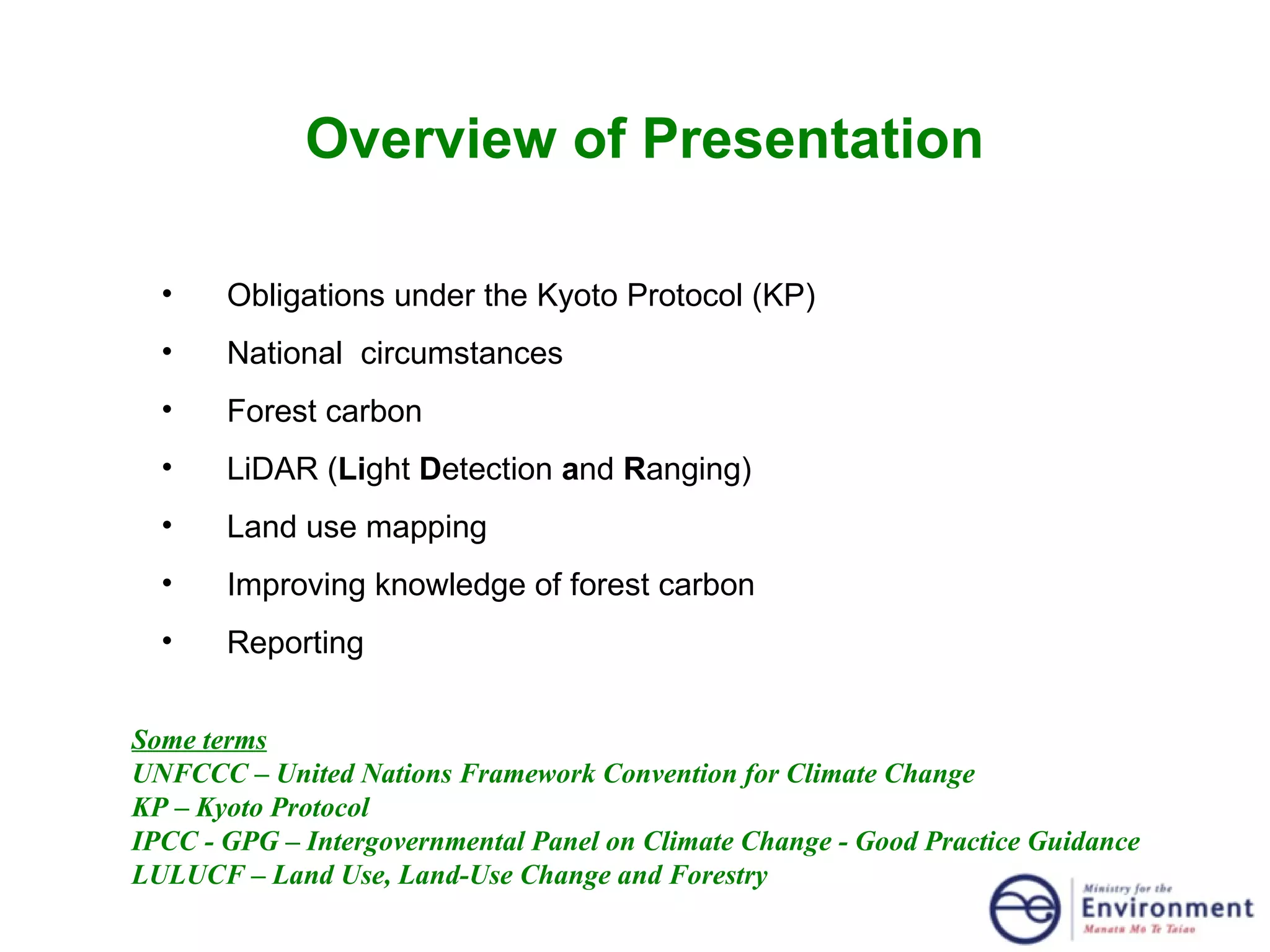
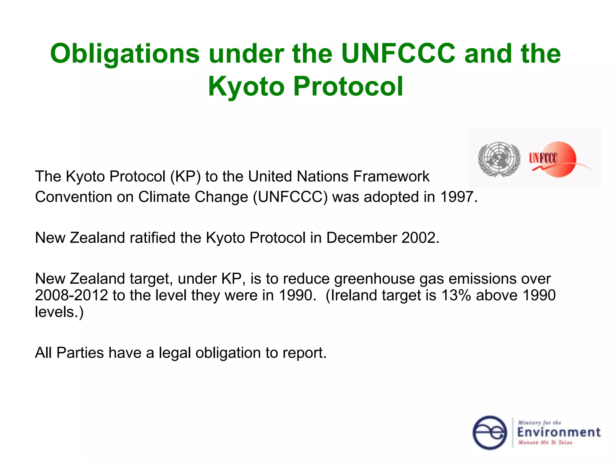
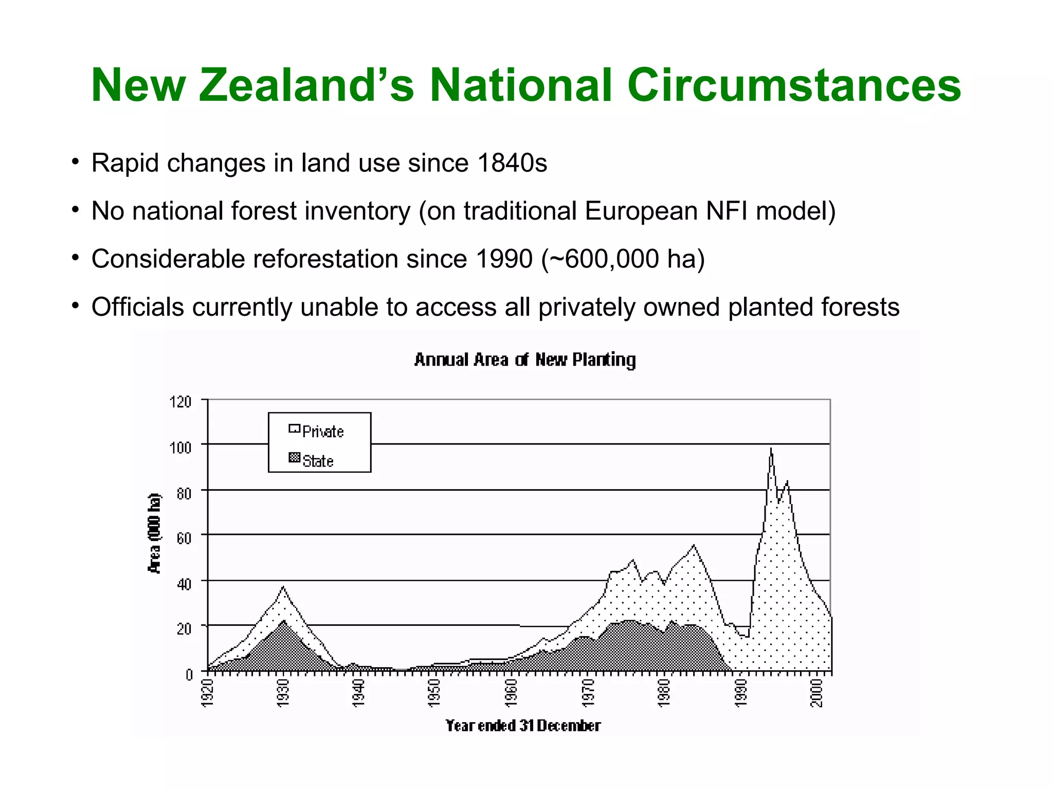
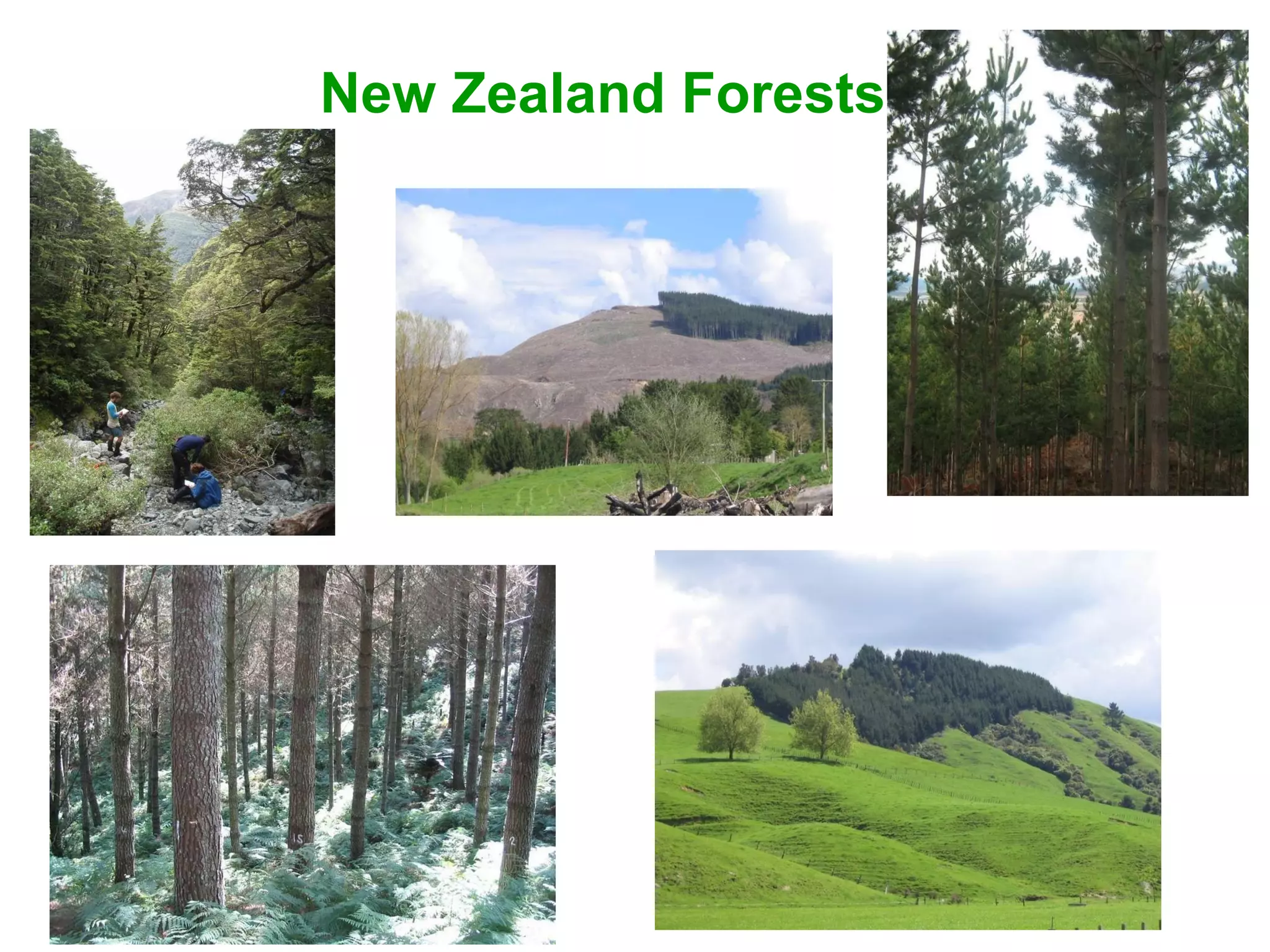
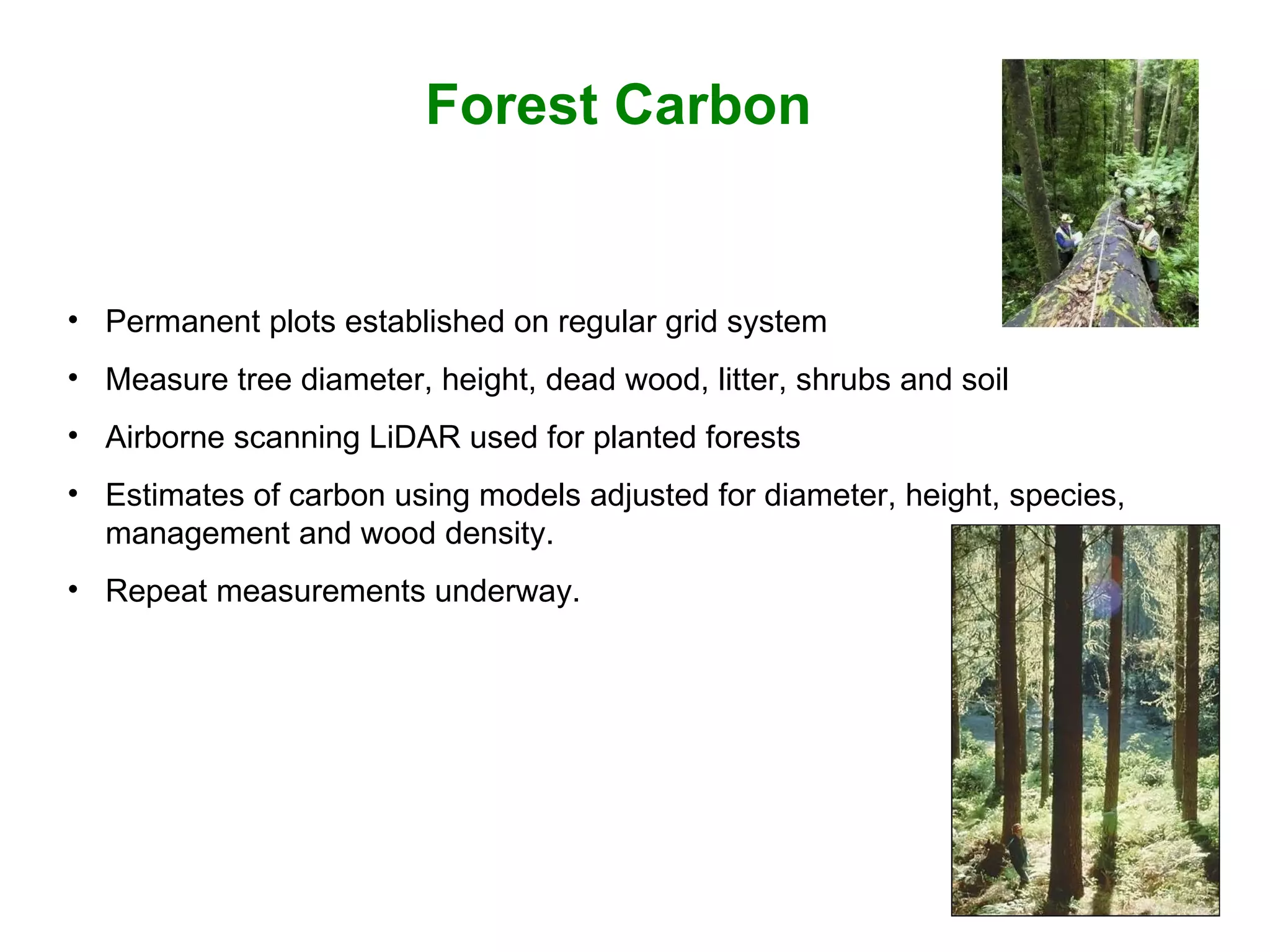
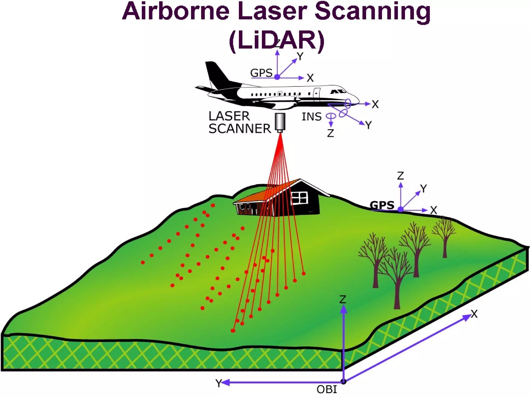
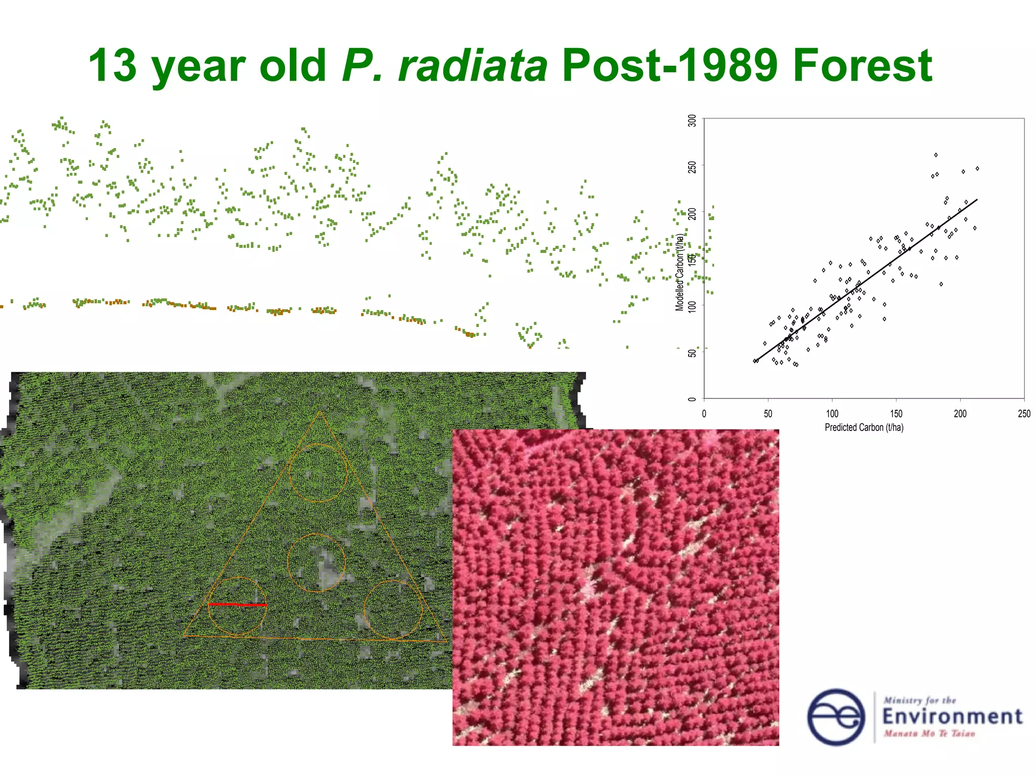
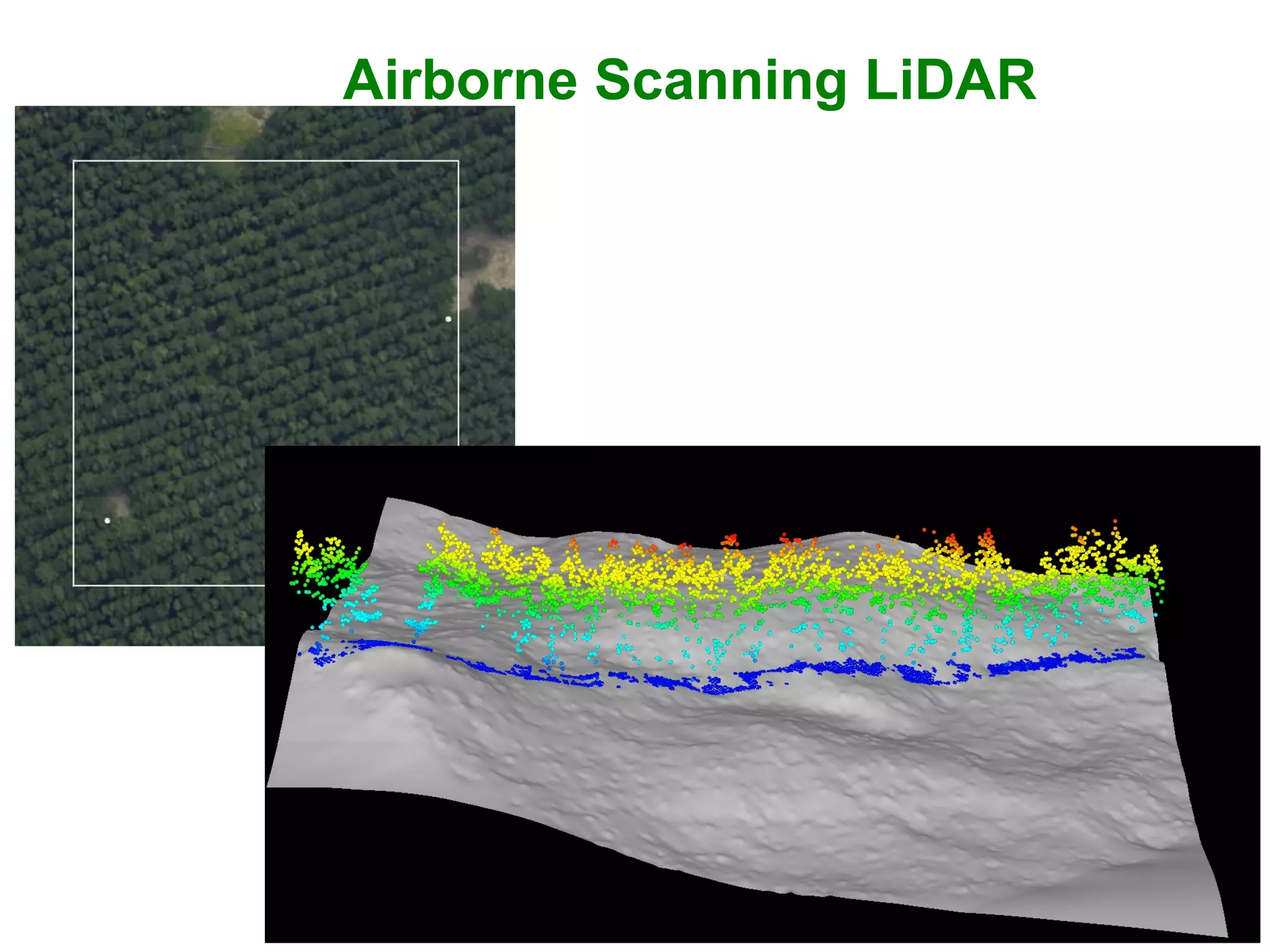
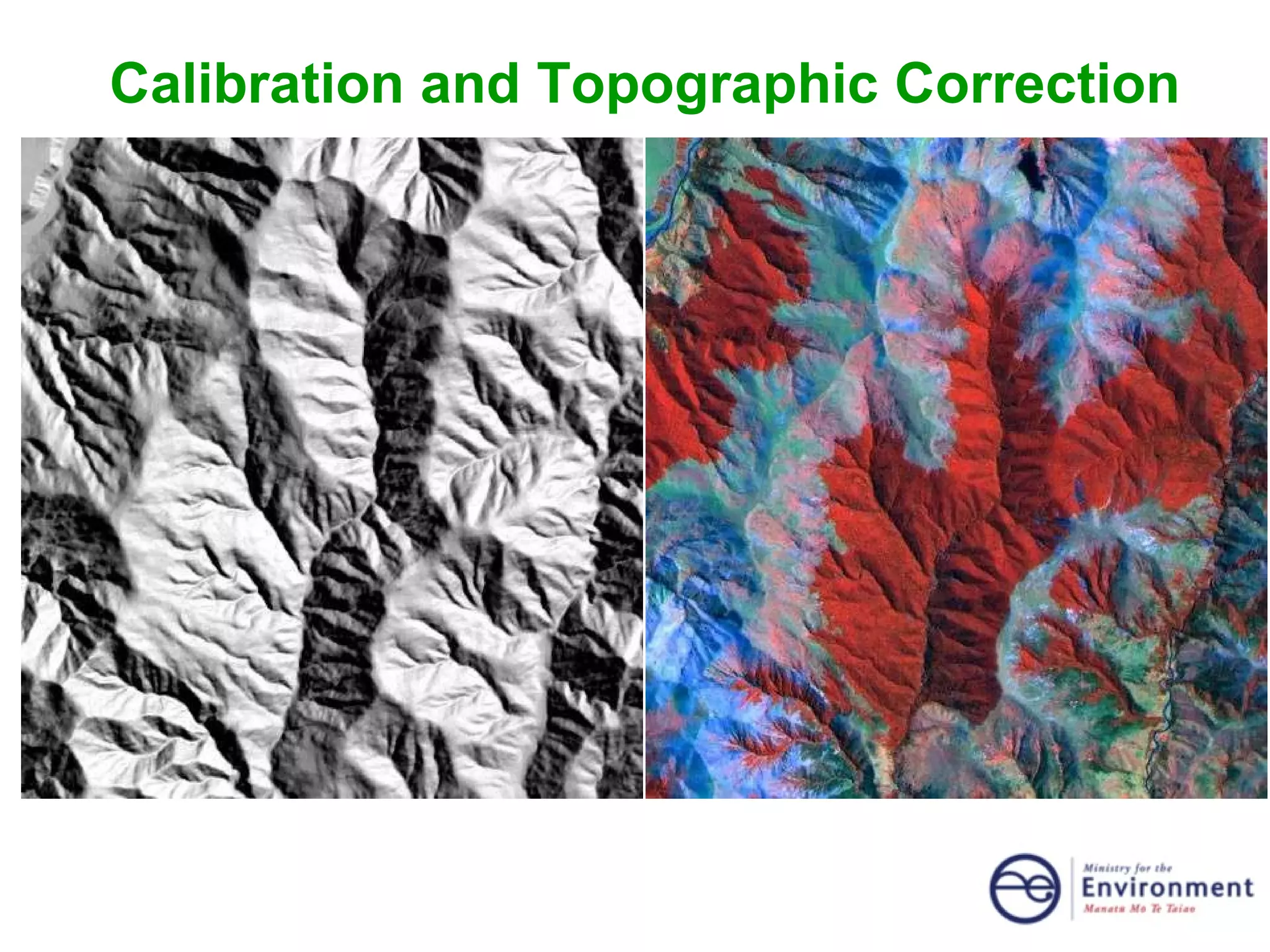
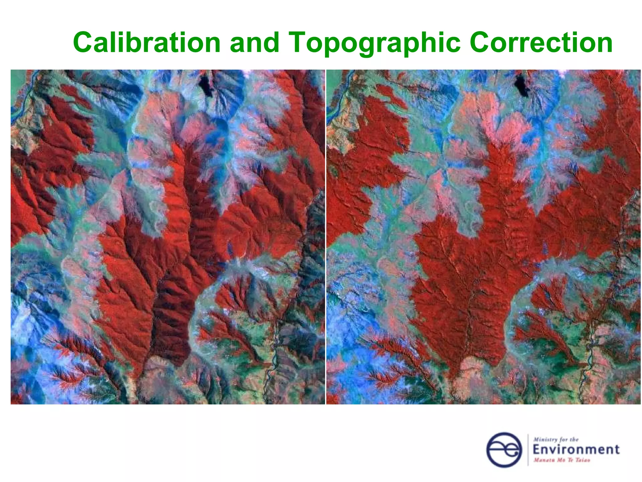
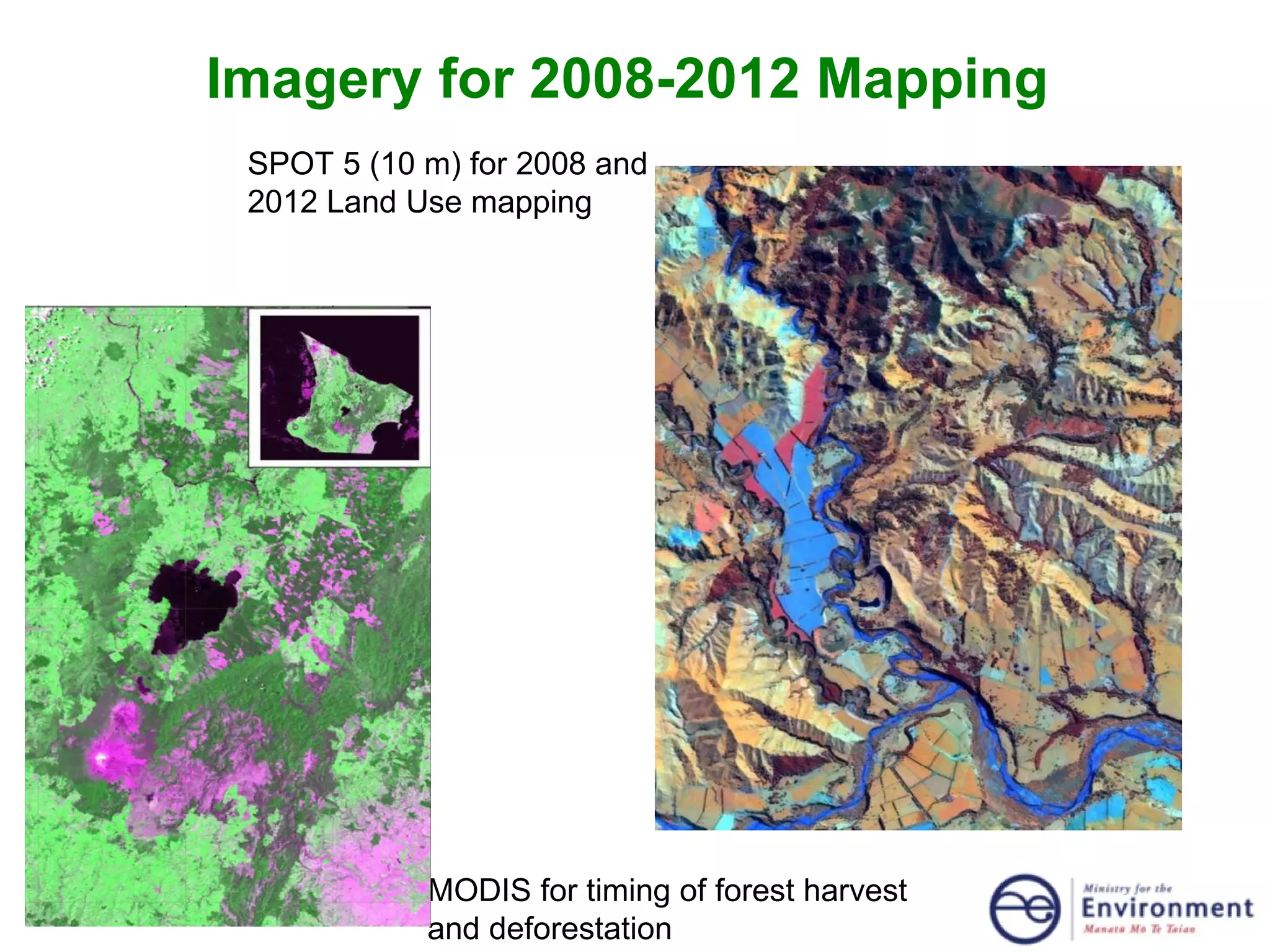
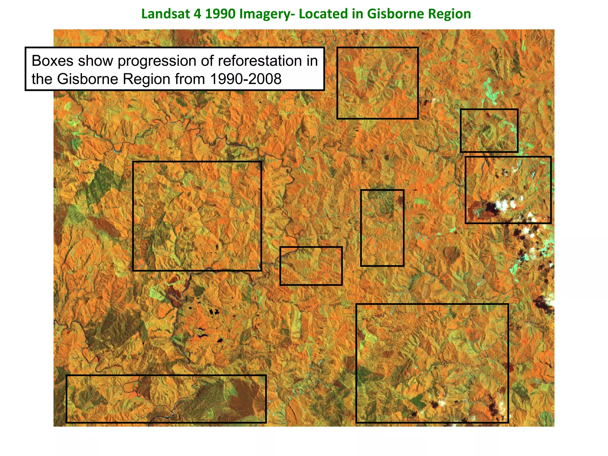
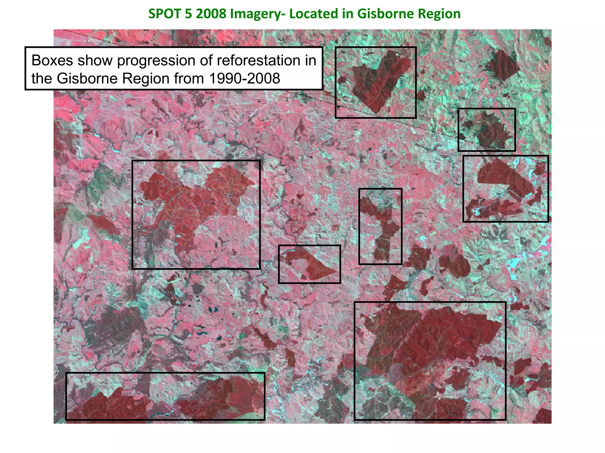
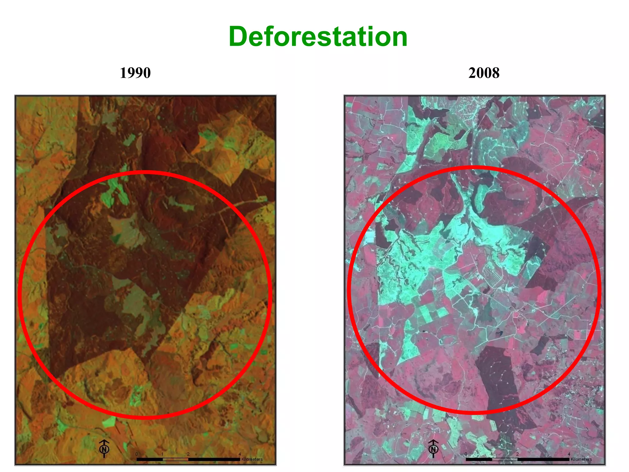
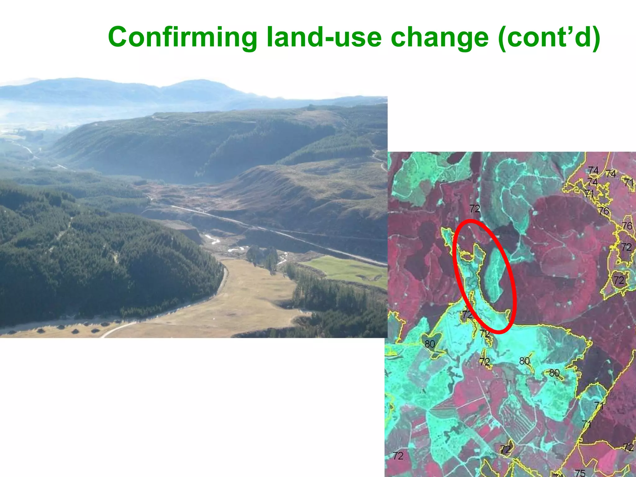
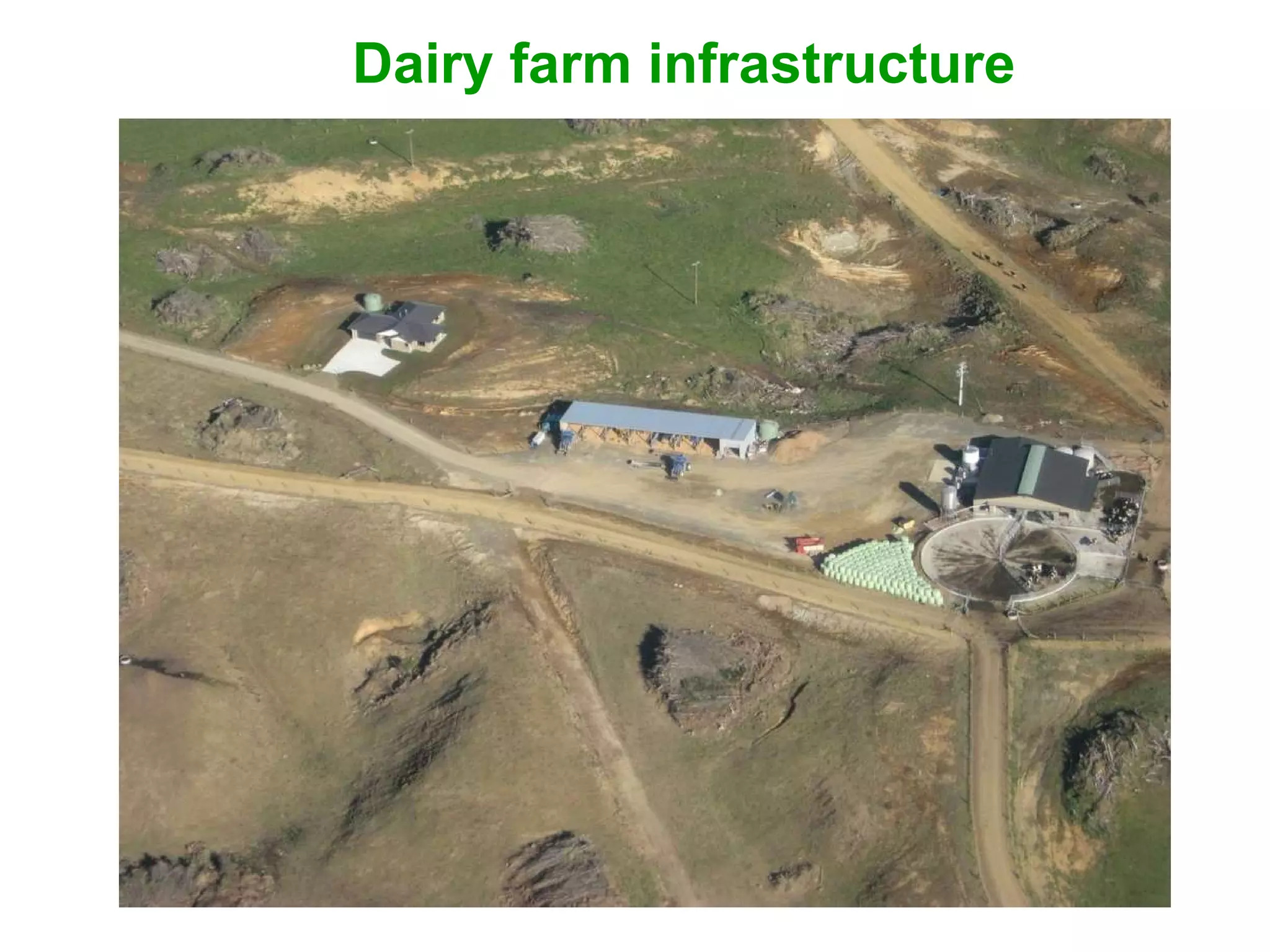
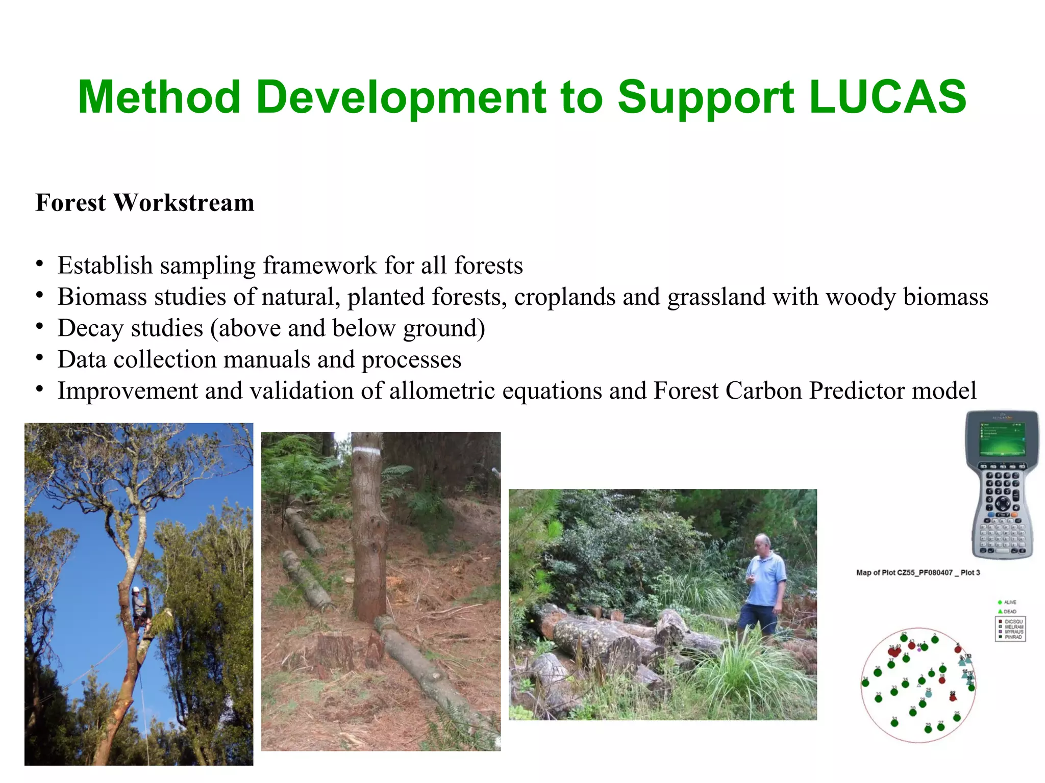
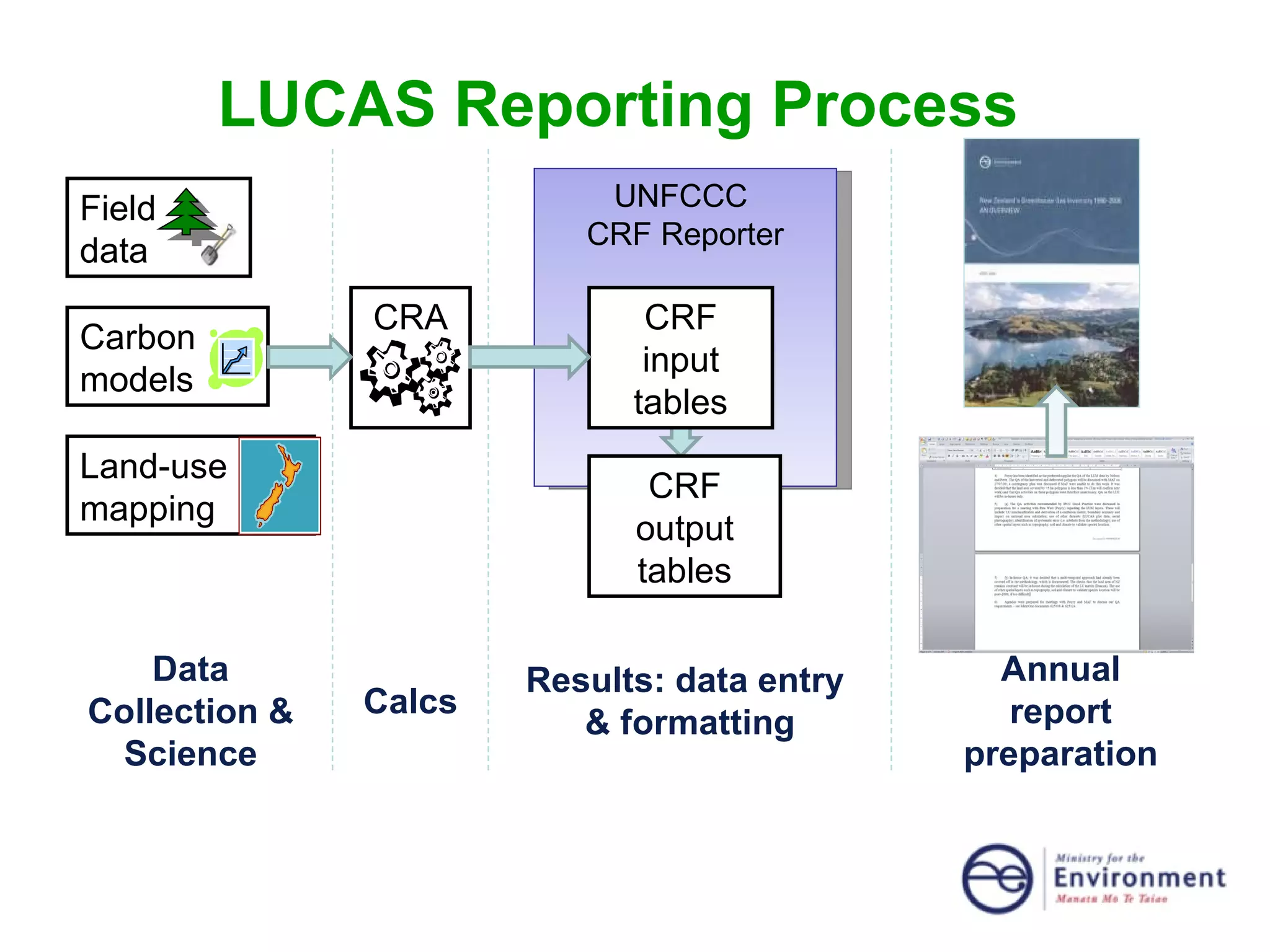
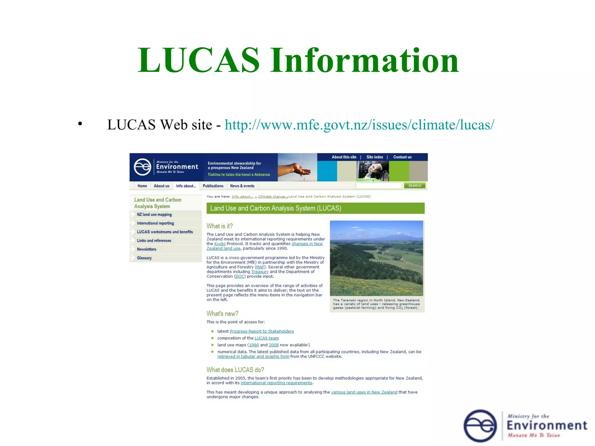
LAND USE, LAND-USE CHANGE &  FORESTRY REPORTING UNDER KYOTO Peter Stephens Ministry for the Environment New Zealand
Overview of Presentation Obligations under the Kyoto Protocol (KP) National  circumstances Forest carbon  LiDAR ( Li ght  D etection  a nd  R anging) Land use mapping  Improving knowledge of forest carbon Reporting Some terms UNFCCC – United Nations Framework Convention for Climate Change KP – Kyoto Protocol IPCC - GPG – Intergovernmental Panel on Climate Change - Good Practice Guidance LULUCF – Land Use, Land-Use Change and Forestry
Obligations under the UNFCCC and the Kyoto Protocol The Kyoto Protocol (KP) to the United Nations Framework  Convention on Climate Change (UNFCCC) was adopted in 1997. New Zealand ratified the Kyoto Protocol in December 2002. New Zealand target, under KP, is to reduce greenhouse gas emissions over 2008-2012 to the level they were in 1990.  (Ireland target is 13% above 1990 levels.)  All Parties have a legal obligation to report.
What Needs To Be Reported Under the KP Carbon stock, and stock change, for period 2008-2012 Greenhouse gas changes associated with human-induced land-use change from 1990 Five carbon pools Unbiased, transparent, complete, and uncertainties documented Reporting annually.
New Zealand’s National Circumstances Rapid changes in land use since 1840s No national forest inventory (on traditional European NFI model) Considerable reforestation since 1990 (~600,000 ha) Officials currently unable to access all privately owned planted forests
Carbon Calculations  At the national scale Carbon Stock = emission factor by pool (t C/ha) multiplied by area of land use/land-use change for each reporting year Using plots and modelling for forest and soil emission factors Land use areas and land-use changes from mapping Forest definition:  5m, 30%, 1ha, 30m  (IRL: 5m, 20%, 0.1ha, 20m)
New Zealand Forests
Forest Carbon  Permanent plots established on regular grid system Measure tree diameter, height, dead wood, litter, shrubs and soil  Airborne scanning LiDAR used for planted forests Estimates of carbon using models adjusted for diameter, height, species, management and wood density. Repeat measurements underway.
06/11/09 Canberra Feb 2007
13 year old  P. radiata  Post-1989 Forest
Airborne Scanning LiDAR
Earth Orbiting Satellites for Mapping
Showing thumbnails of 1990 Landsat 4 satellite imagery coverage, New Zealand.  Land Use Mapping IPCC Land Use Categories Natural forest Pre-1990 planted forest Post-1989 forest Cropland (2 sub-categories) Grassland (3 sub-categories) Wetlands Settlements Other land
Calibration and Topographic Correction
Imagery for 2008-2012 Mapping  SPOT 5 (10 m) for 2008 and 2012 Land Use mapping MODIS for timing of forest harvest and deforestation
Landsat 4 1990 Imagery- Located in Gisborne Region Boxes show progression of reforestation in the Gisborne Region from 1990-2008
SPOT 5 2008 Imagery- Located in Gisborne Region Boxes show progression of reforestation in the Gisborne Region from 1990-2008
Deforestation 1990 2008
Confirming land-use change
Confirming land-use change (cont’d)
Dairy farm infrastructure
Method Development to Support LUCAS Forest Workstream Establish sampling framework for all forests Biomass studies of natural, planted forests, croplands and grassland with woody biomass Decay studies (above and below ground) Data collection manuals and processes Improvement and validation of allometric equations and Forest Carbon Predictor model
LUCAS Reporting Process UNFCCC  CRF Reporter CRA CRF input tables CRF output tables Data Collection & Science Calcs Results: data entry  & formatting Annual report preparation Field  data  Carbon models  Land-use mapping
LUCAS Information LUCAS Web site -  http://www.mfe.govt.nz/issues/climate/lucas/

LAND USE, LAND-USE CHANGE & FORESTRY REPORTING UNDER KYOTO

  • 1.
    LAND USE, LAND-USECHANGE & FORESTRY REPORTING UNDER KYOTO Peter Stephens Ministry for the Environment New Zealand
  • 2.
    Overview of PresentationObligations under the Kyoto Protocol (KP) National circumstances Forest carbon LiDAR ( Li ght D etection a nd R anging) Land use mapping Improving knowledge of forest carbon Reporting Some terms UNFCCC – United Nations Framework Convention for Climate Change KP – Kyoto Protocol IPCC - GPG – Intergovernmental Panel on Climate Change - Good Practice Guidance LULUCF – Land Use, Land-Use Change and Forestry
  • 3.
    Obligations under theUNFCCC and the Kyoto Protocol The Kyoto Protocol (KP) to the United Nations Framework Convention on Climate Change (UNFCCC) was adopted in 1997. New Zealand ratified the Kyoto Protocol in December 2002. New Zealand target, under KP, is to reduce greenhouse gas emissions over 2008-2012 to the level they were in 1990. (Ireland target is 13% above 1990 levels.) All Parties have a legal obligation to report.
  • 4.
    What Needs ToBe Reported Under the KP Carbon stock, and stock change, for period 2008-2012 Greenhouse gas changes associated with human-induced land-use change from 1990 Five carbon pools Unbiased, transparent, complete, and uncertainties documented Reporting annually.
  • 5.
    New Zealand’s NationalCircumstances Rapid changes in land use since 1840s No national forest inventory (on traditional European NFI model) Considerable reforestation since 1990 (~600,000 ha) Officials currently unable to access all privately owned planted forests
  • 6.
    Carbon Calculations At the national scale Carbon Stock = emission factor by pool (t C/ha) multiplied by area of land use/land-use change for each reporting year Using plots and modelling for forest and soil emission factors Land use areas and land-use changes from mapping Forest definition: 5m, 30%, 1ha, 30m (IRL: 5m, 20%, 0.1ha, 20m)
  • 7.
  • 8.
    Forest Carbon Permanent plots established on regular grid system Measure tree diameter, height, dead wood, litter, shrubs and soil Airborne scanning LiDAR used for planted forests Estimates of carbon using models adjusted for diameter, height, species, management and wood density. Repeat measurements underway.
  • 9.
  • 10.
    13 year old P. radiata Post-1989 Forest
  • 11.
  • 12.
  • 13.
    Showing thumbnails of1990 Landsat 4 satellite imagery coverage, New Zealand. Land Use Mapping IPCC Land Use Categories Natural forest Pre-1990 planted forest Post-1989 forest Cropland (2 sub-categories) Grassland (3 sub-categories) Wetlands Settlements Other land
  • 14.
  • 15.
  • 16.
    Imagery for 2008-2012Mapping SPOT 5 (10 m) for 2008 and 2012 Land Use mapping MODIS for timing of forest harvest and deforestation
  • 17.
    Landsat 4 1990Imagery- Located in Gisborne Region Boxes show progression of reforestation in the Gisborne Region from 1990-2008
  • 18.
    SPOT 5 2008Imagery- Located in Gisborne Region Boxes show progression of reforestation in the Gisborne Region from 1990-2008
  • 19.
  • 20.
  • 21.
  • 22.
  • 23.
    Method Development toSupport LUCAS Forest Workstream Establish sampling framework for all forests Biomass studies of natural, planted forests, croplands and grassland with woody biomass Decay studies (above and below ground) Data collection manuals and processes Improvement and validation of allometric equations and Forest Carbon Predictor model
  • 24.
    LUCAS Reporting ProcessUNFCCC CRF Reporter CRA CRF input tables CRF output tables Data Collection & Science Calcs Results: data entry & formatting Annual report preparation Field data Carbon models Land-use mapping
  • 25.
    LUCAS Information LUCASWeb site - http://www.mfe.govt.nz/issues/climate/lucas/