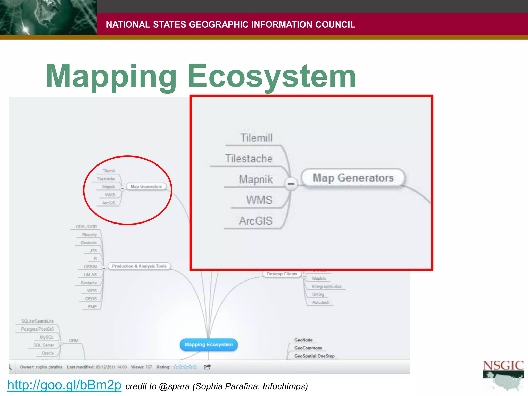
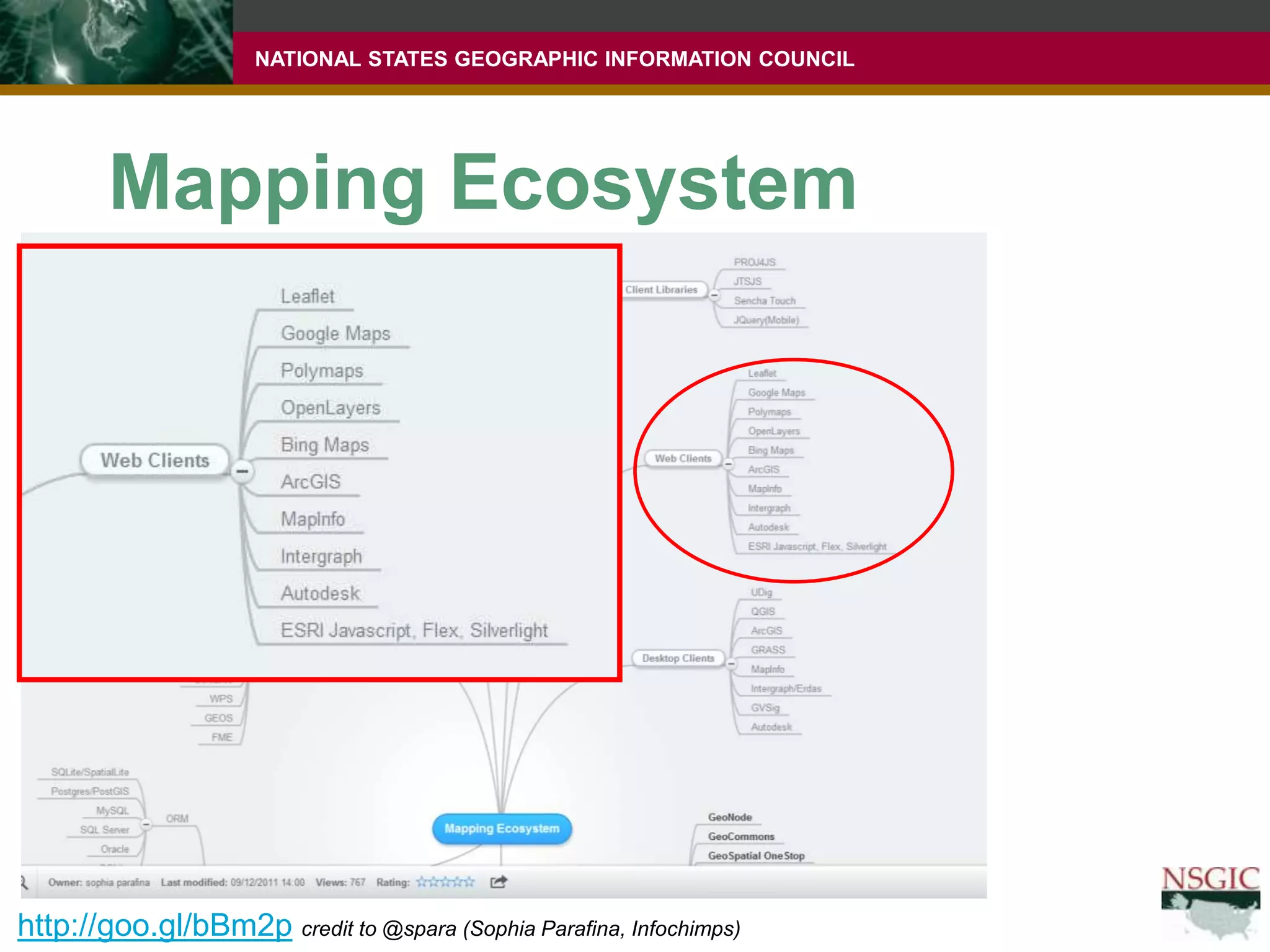
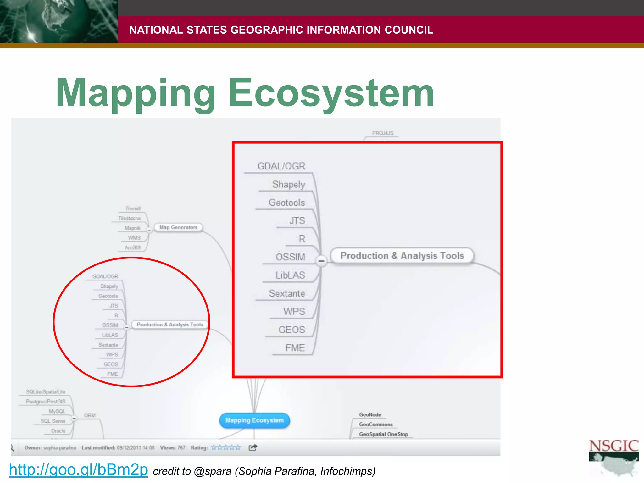
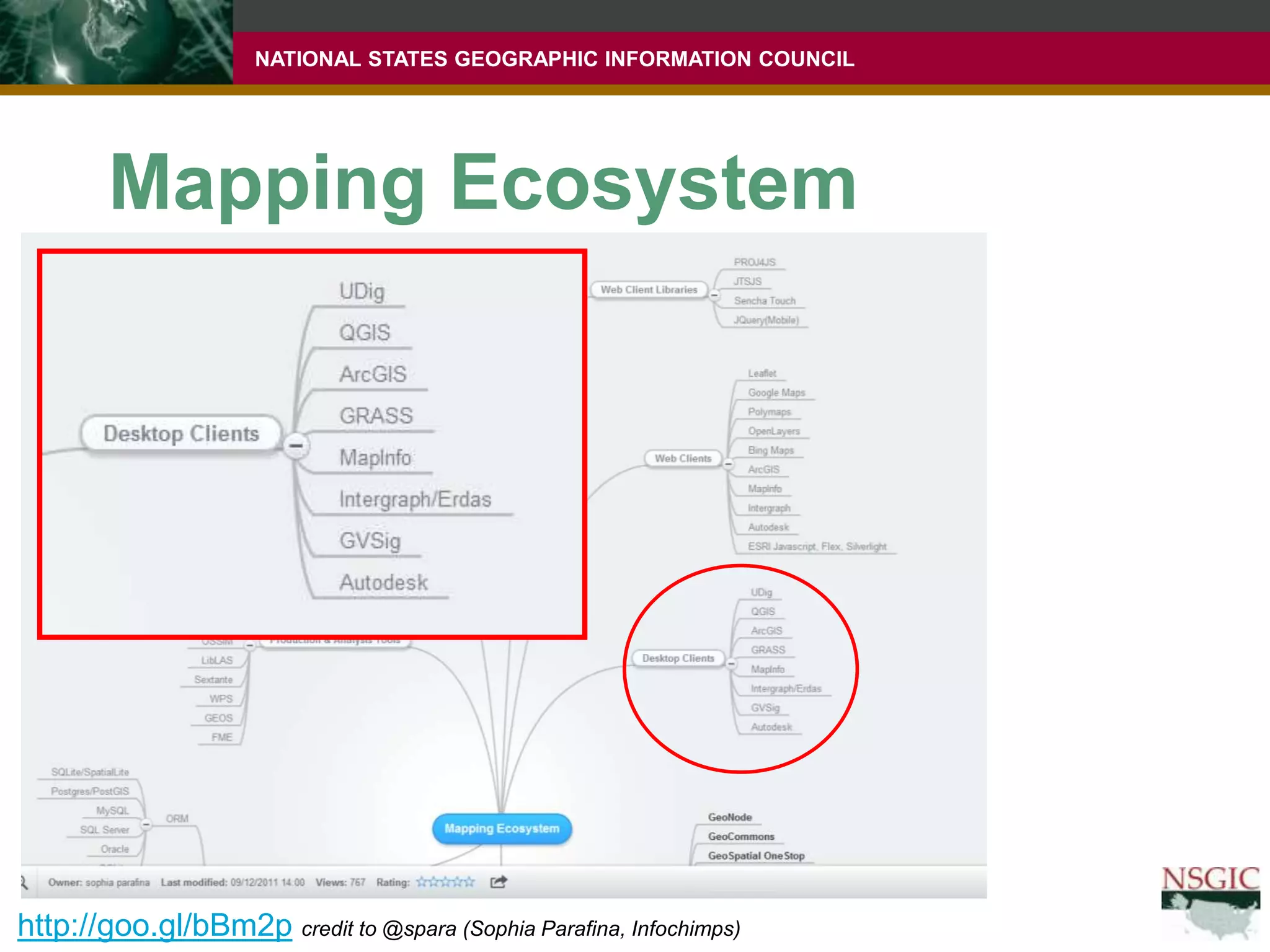
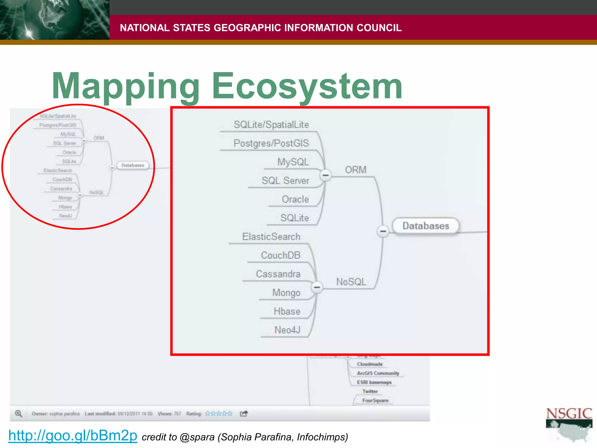
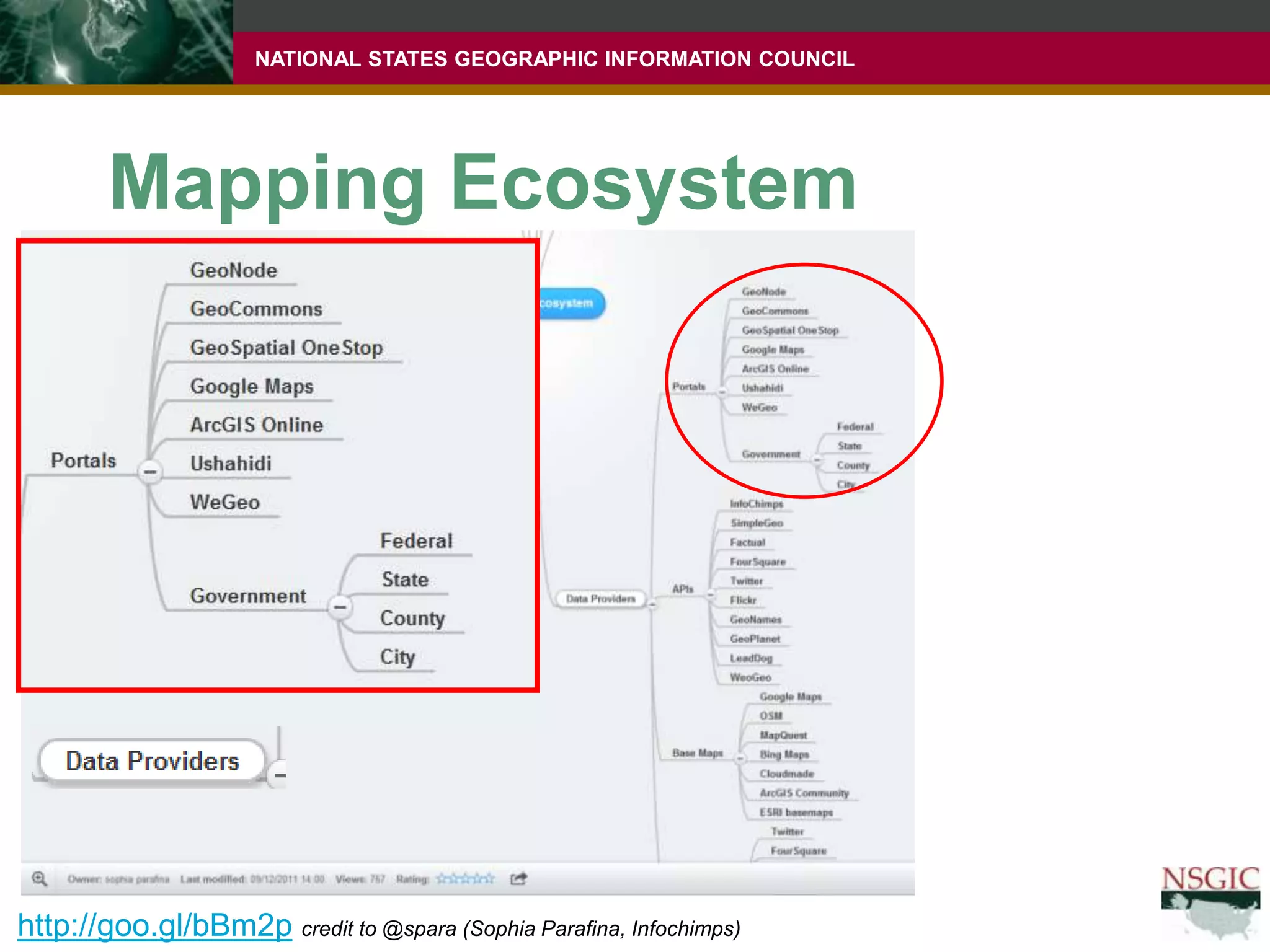
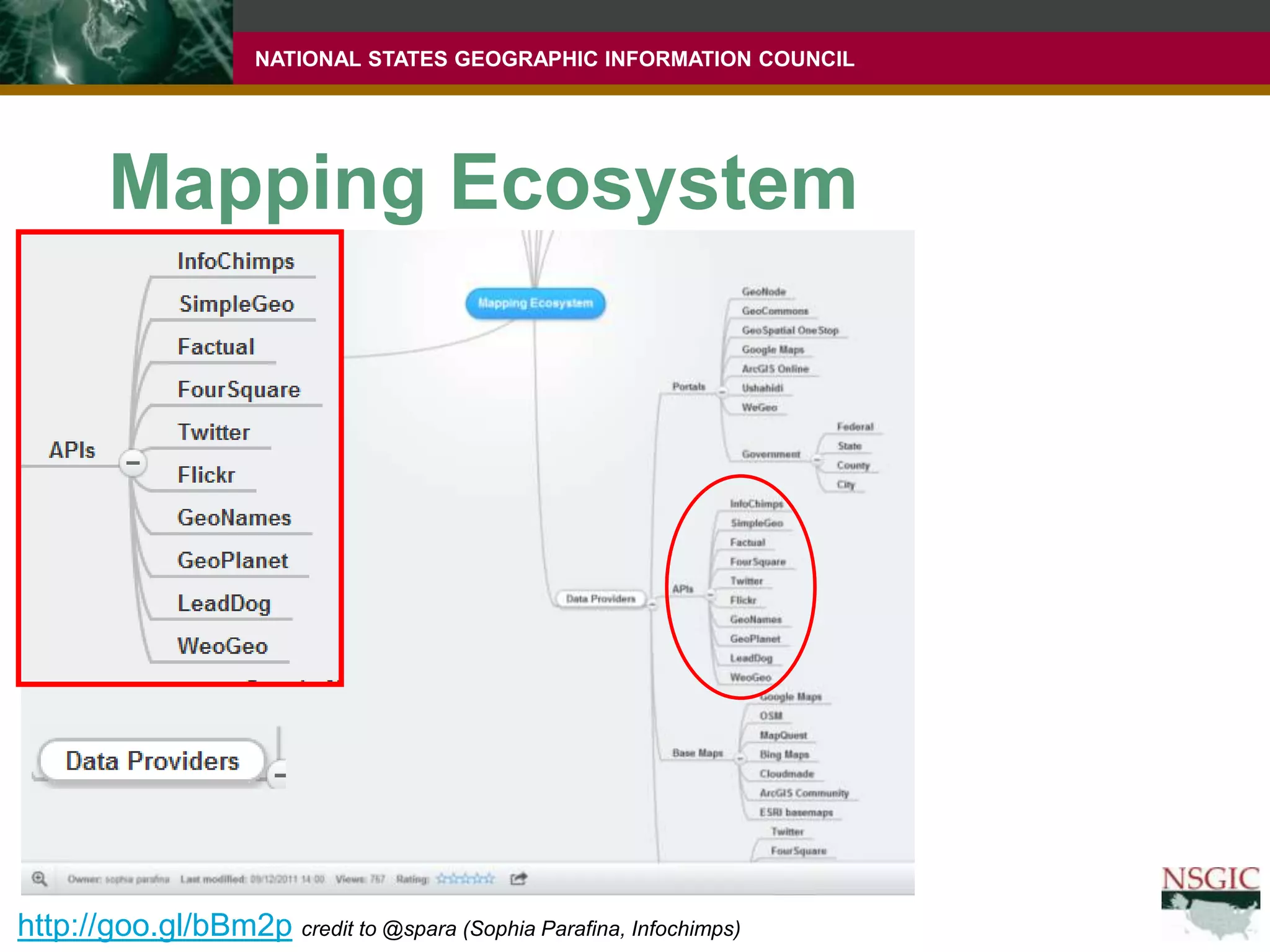
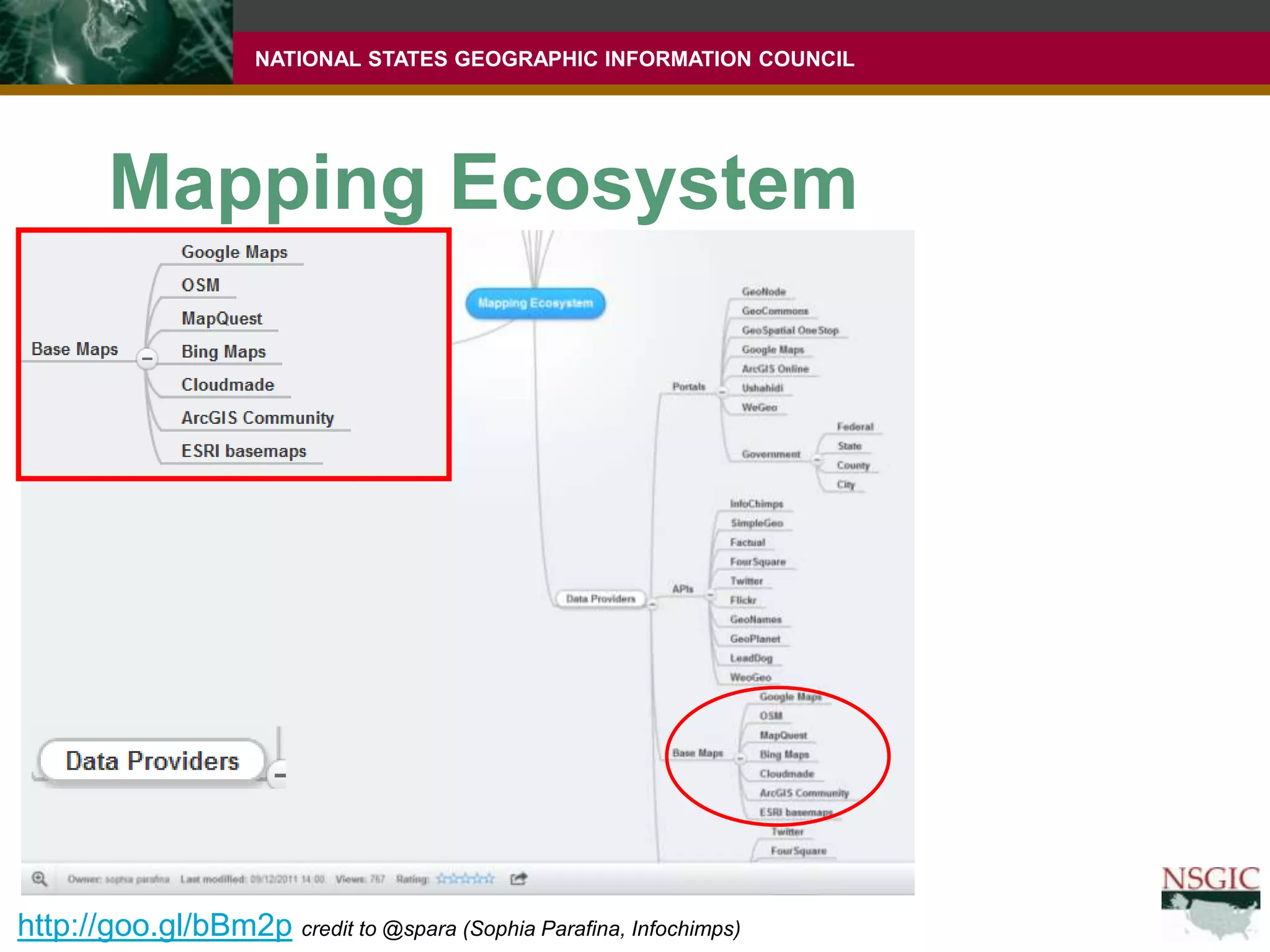
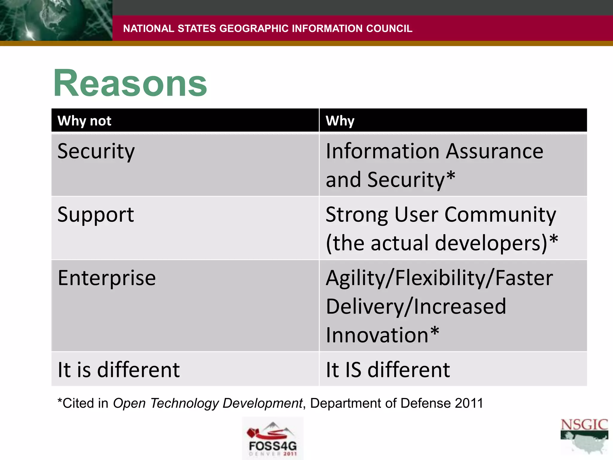
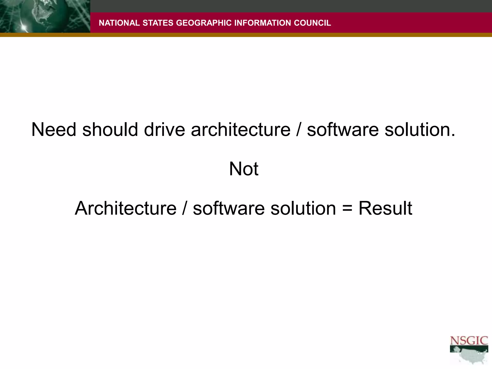
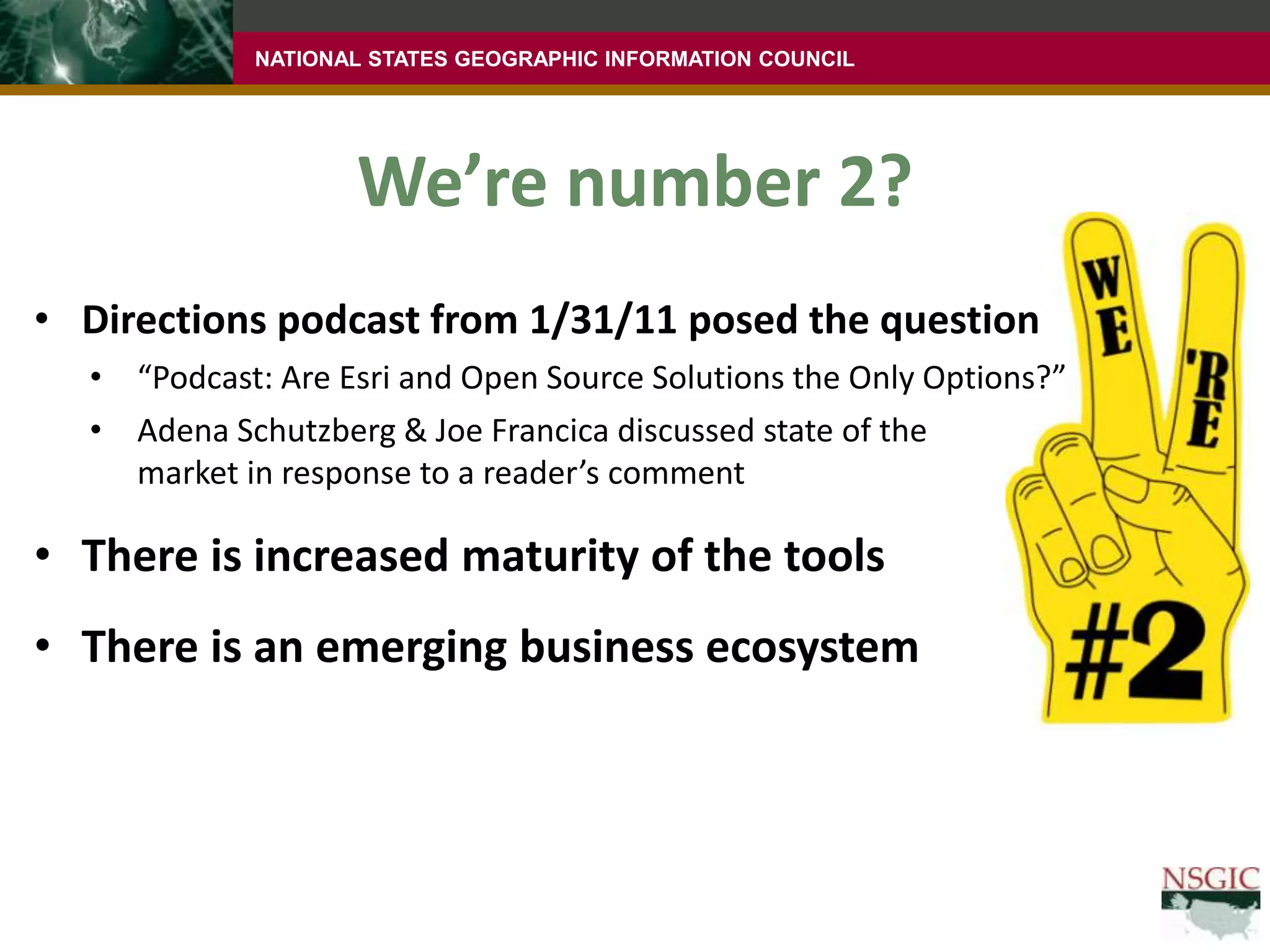
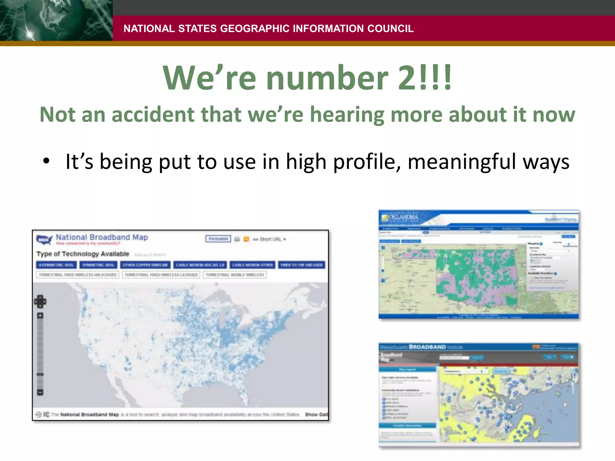
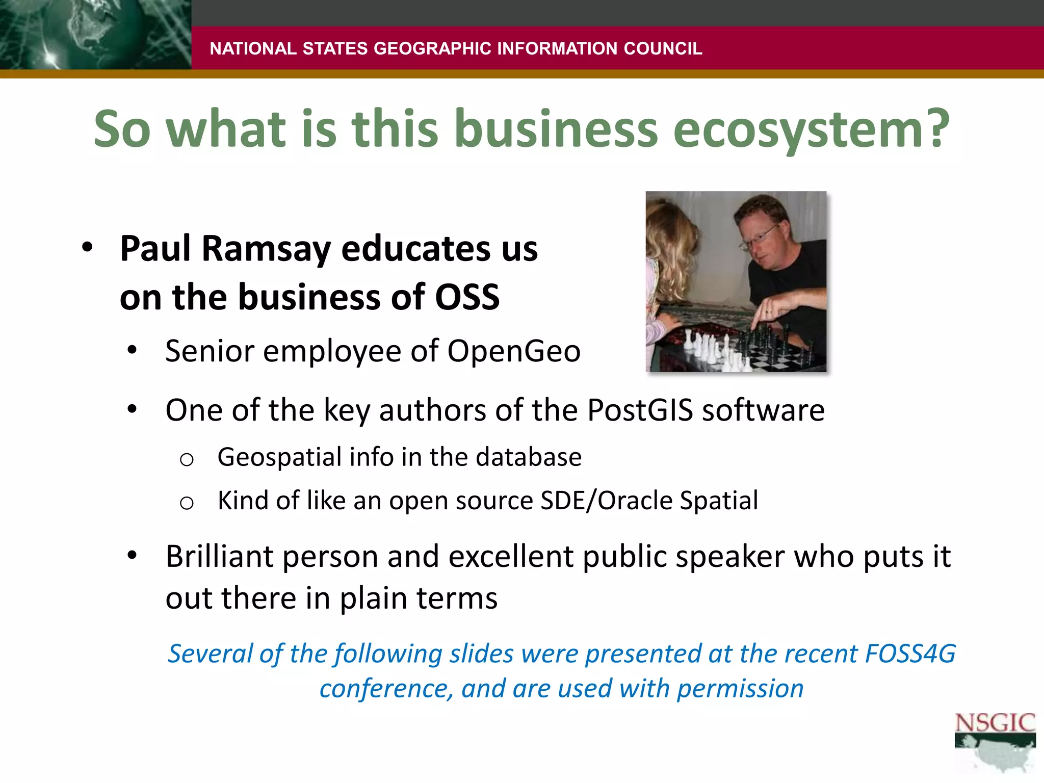
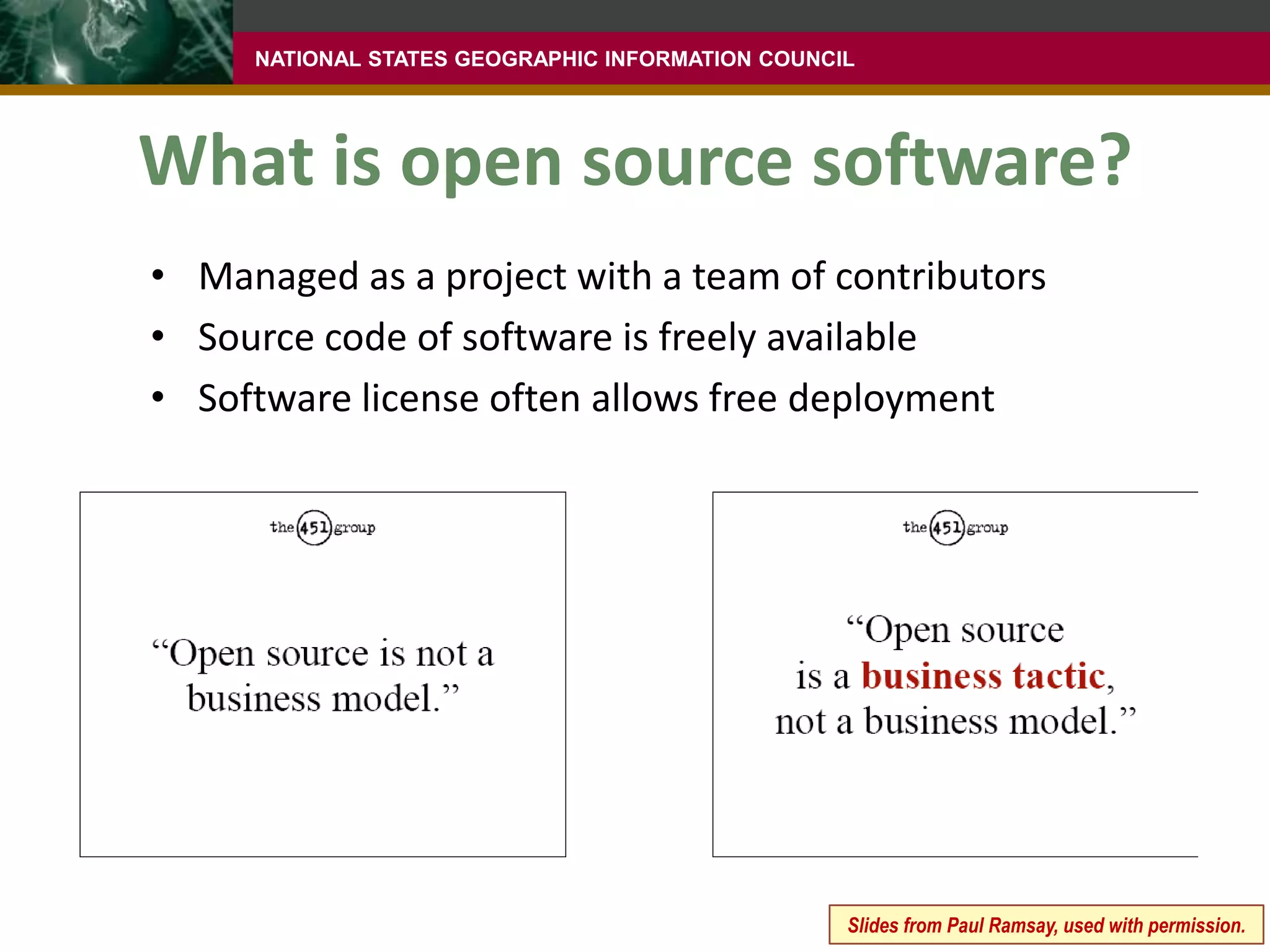
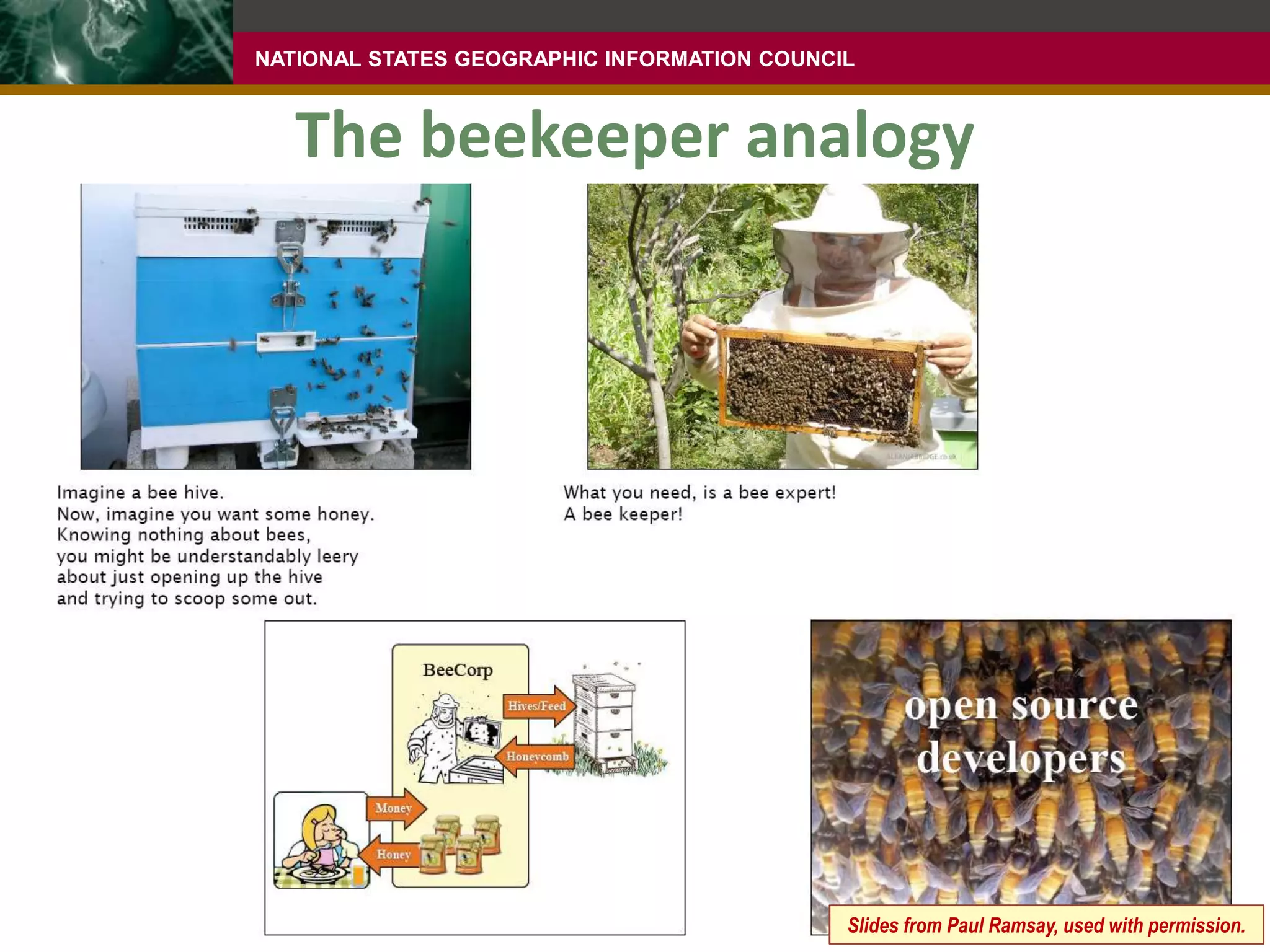
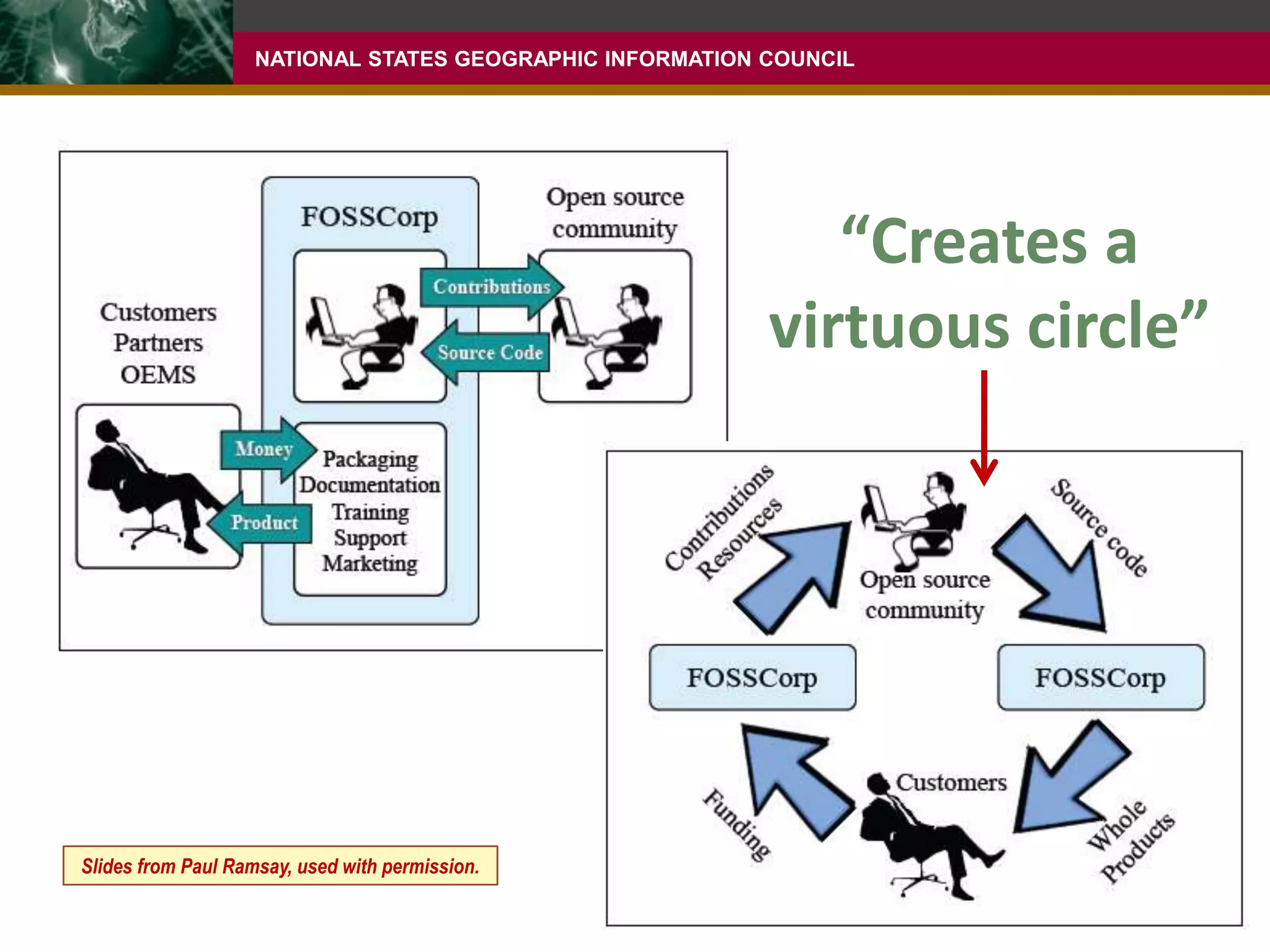
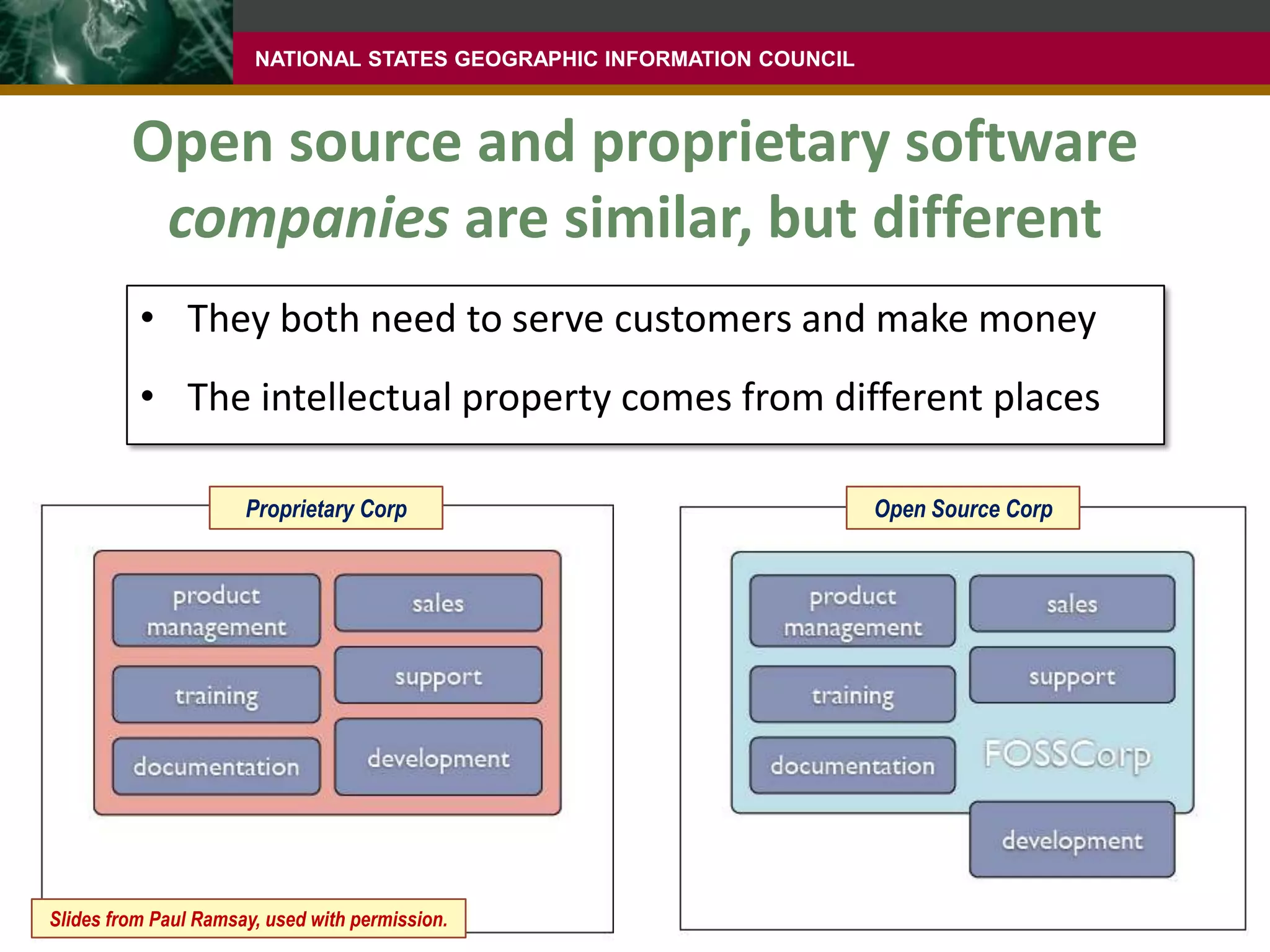
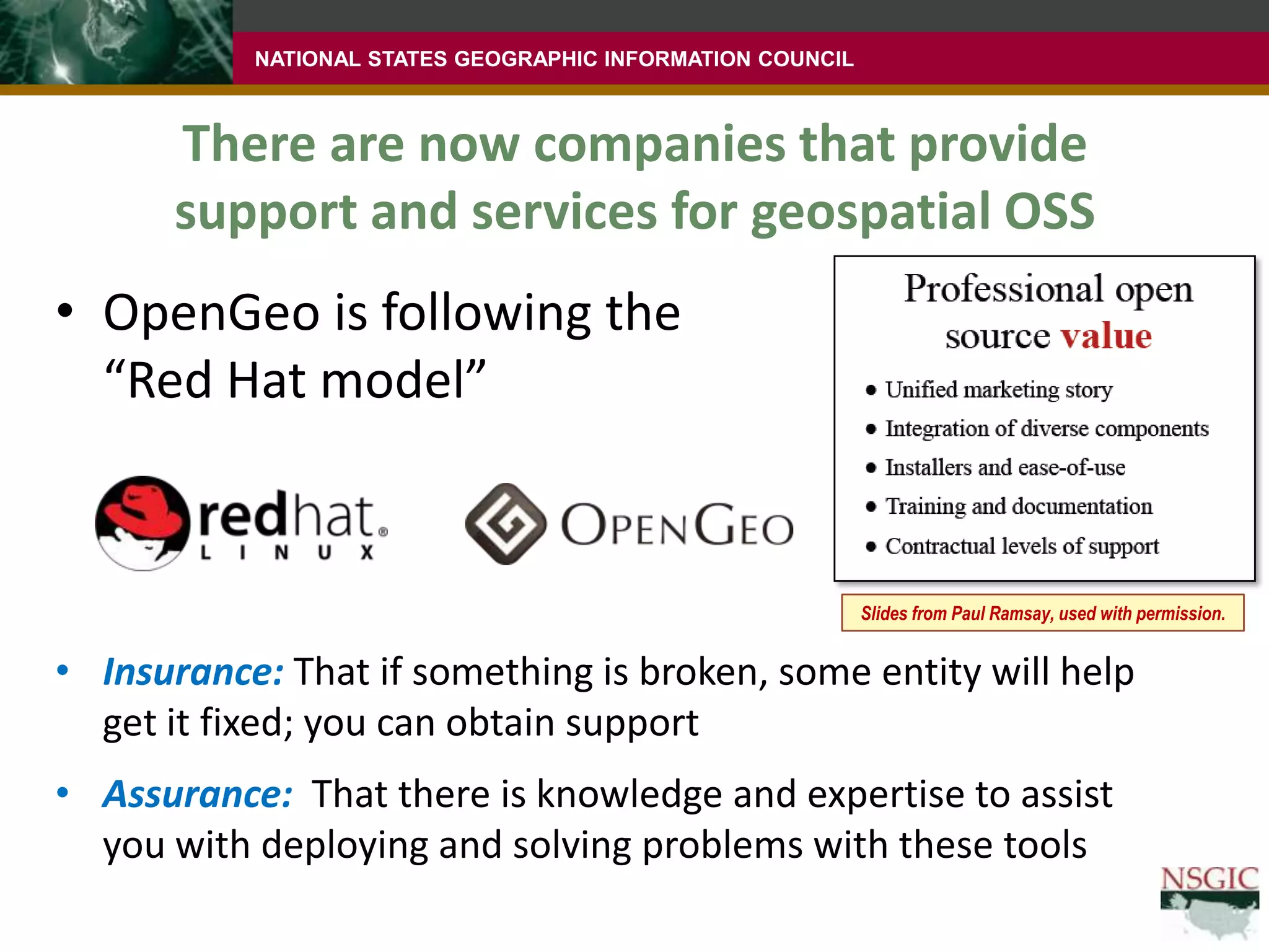
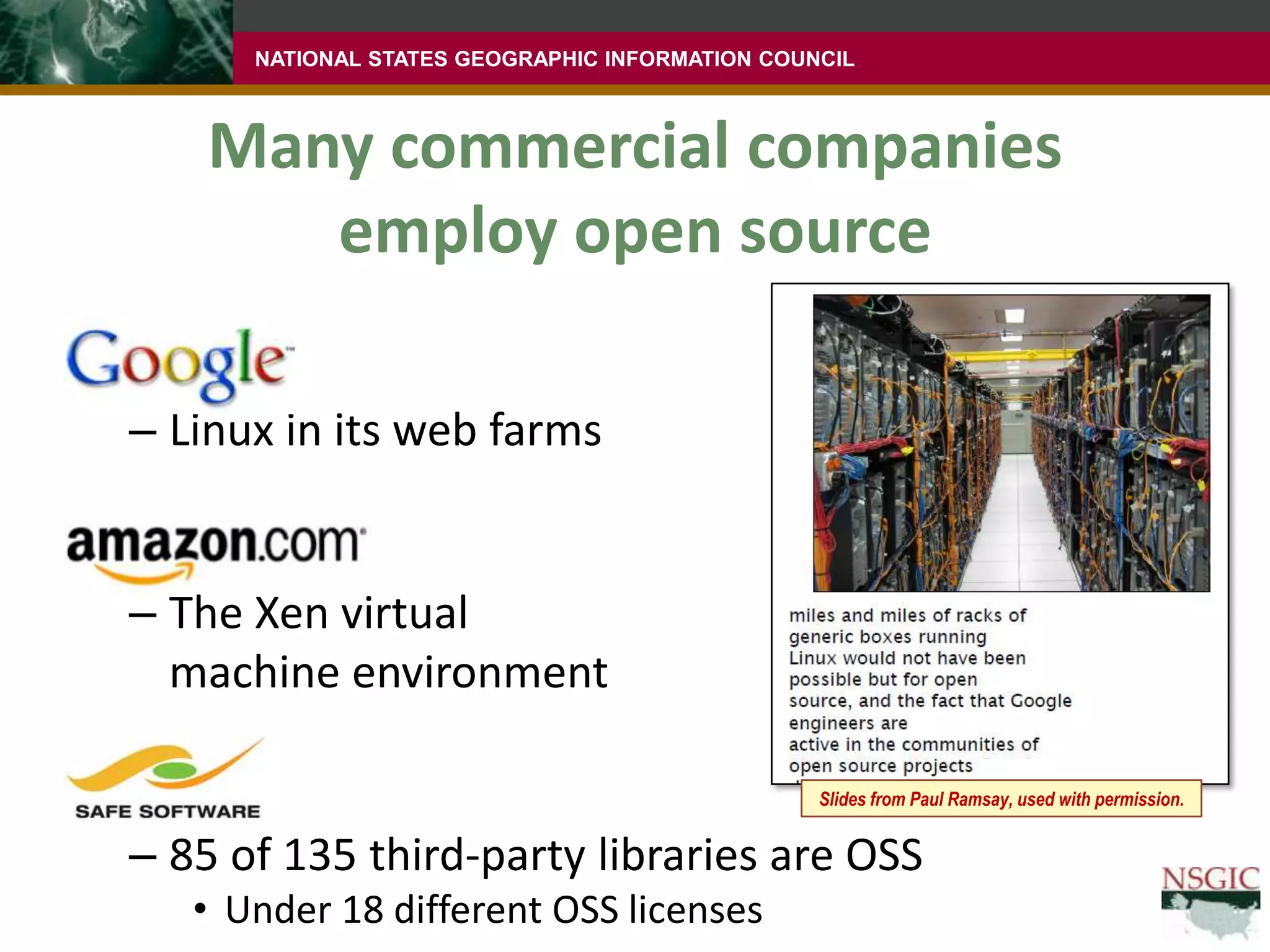
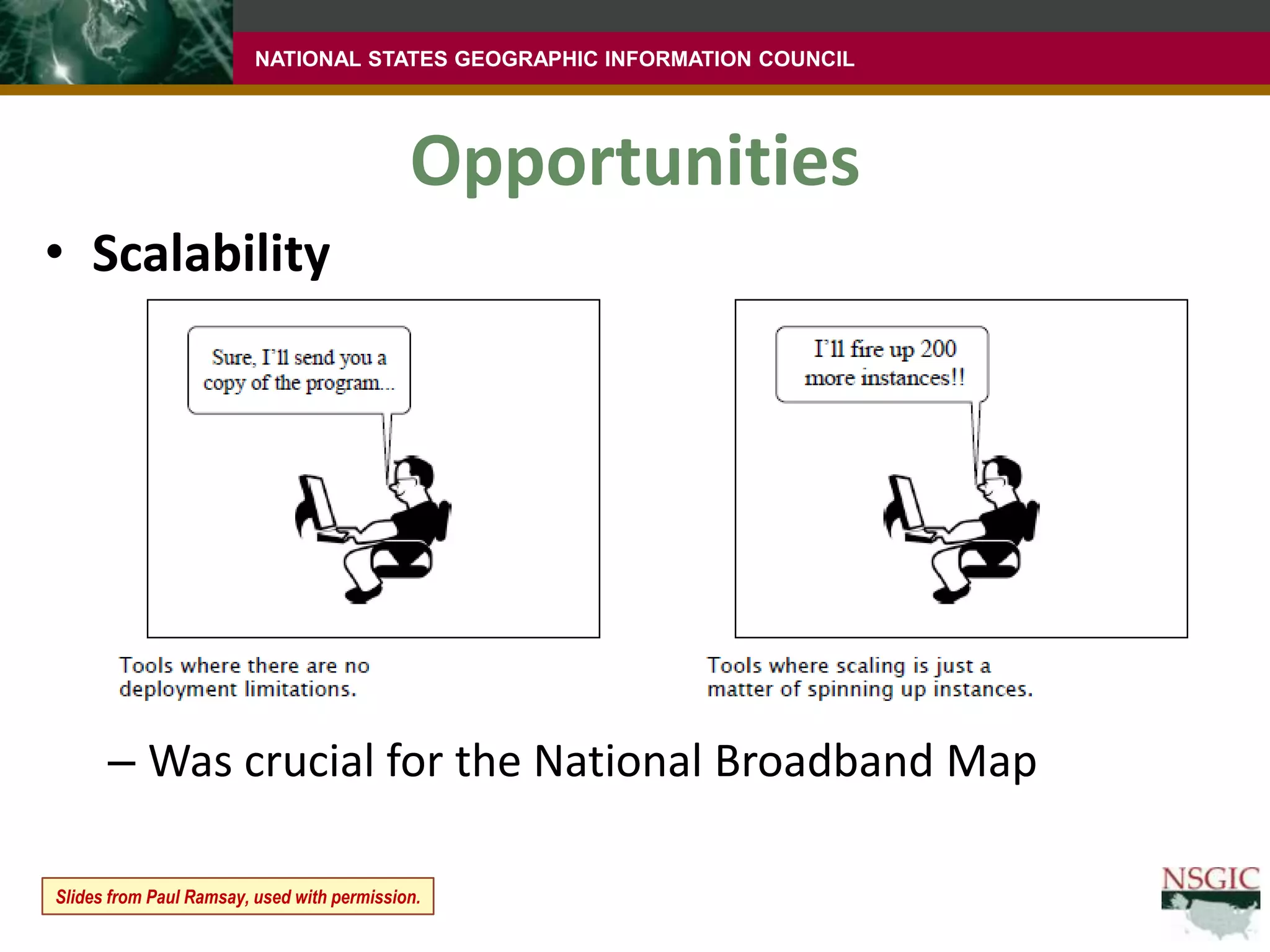
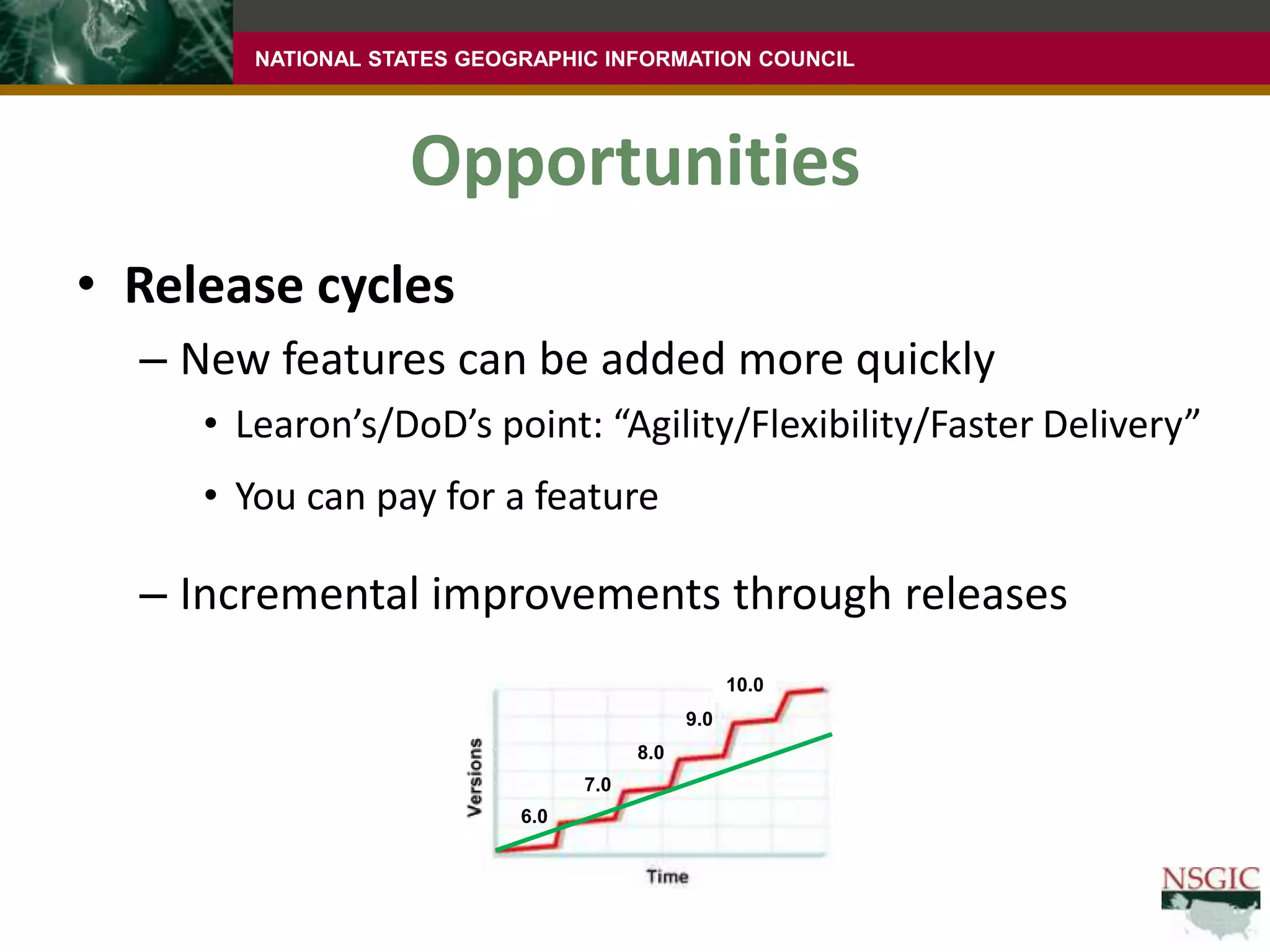
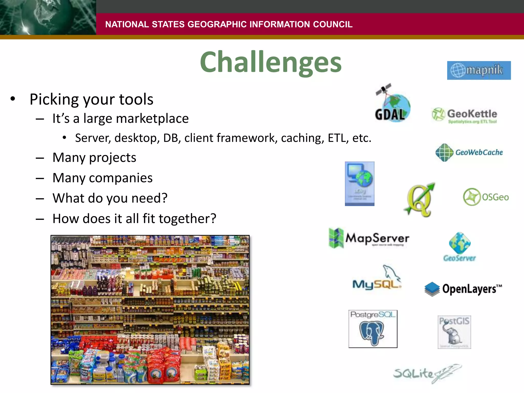
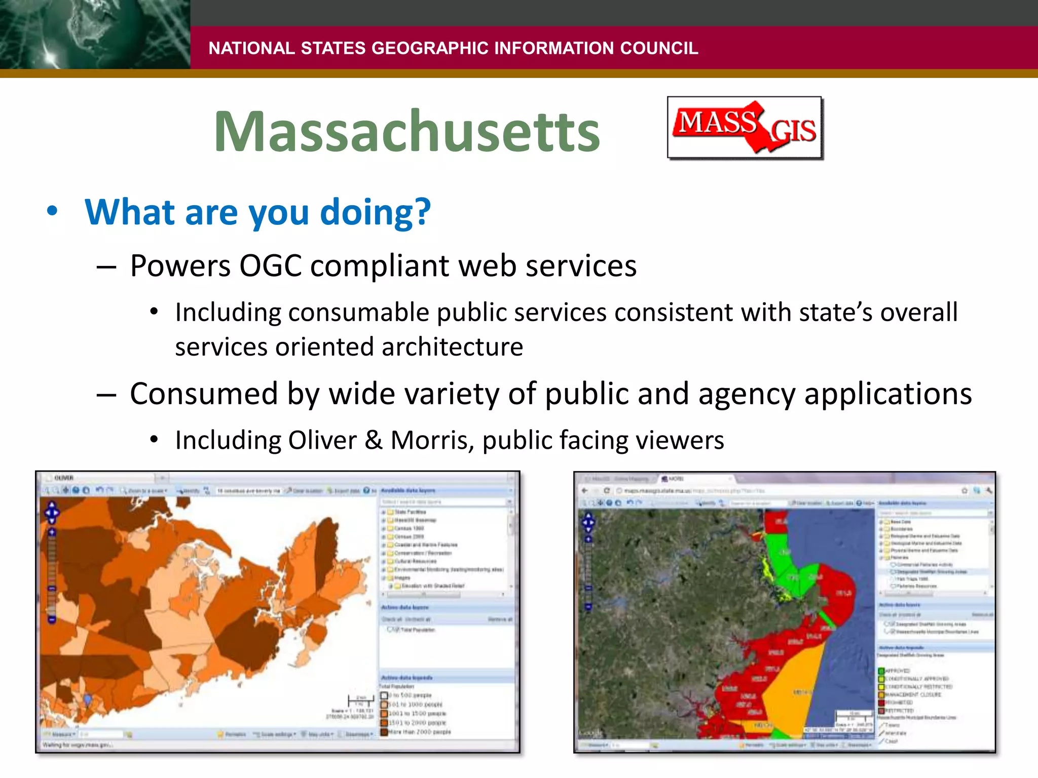
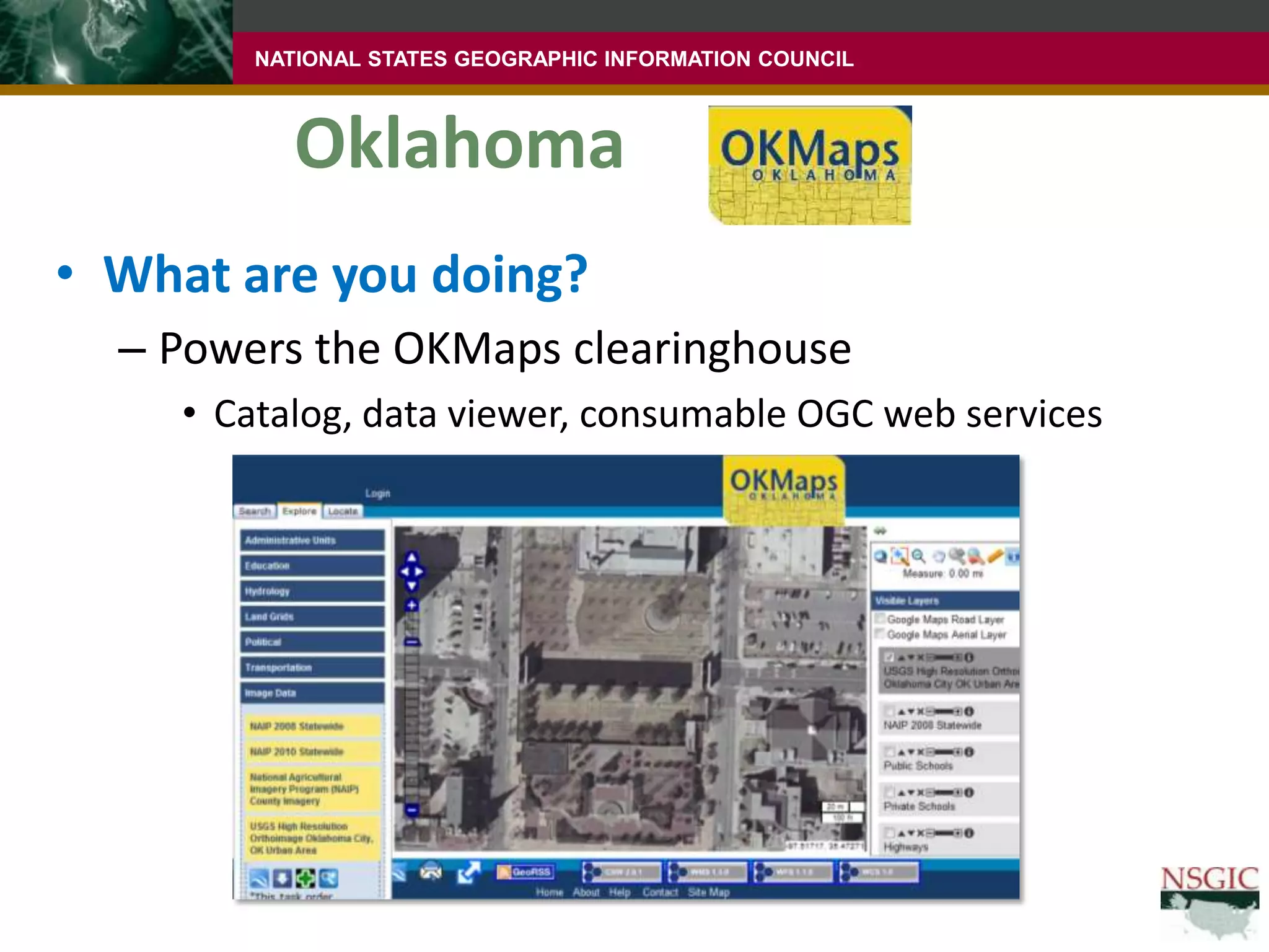
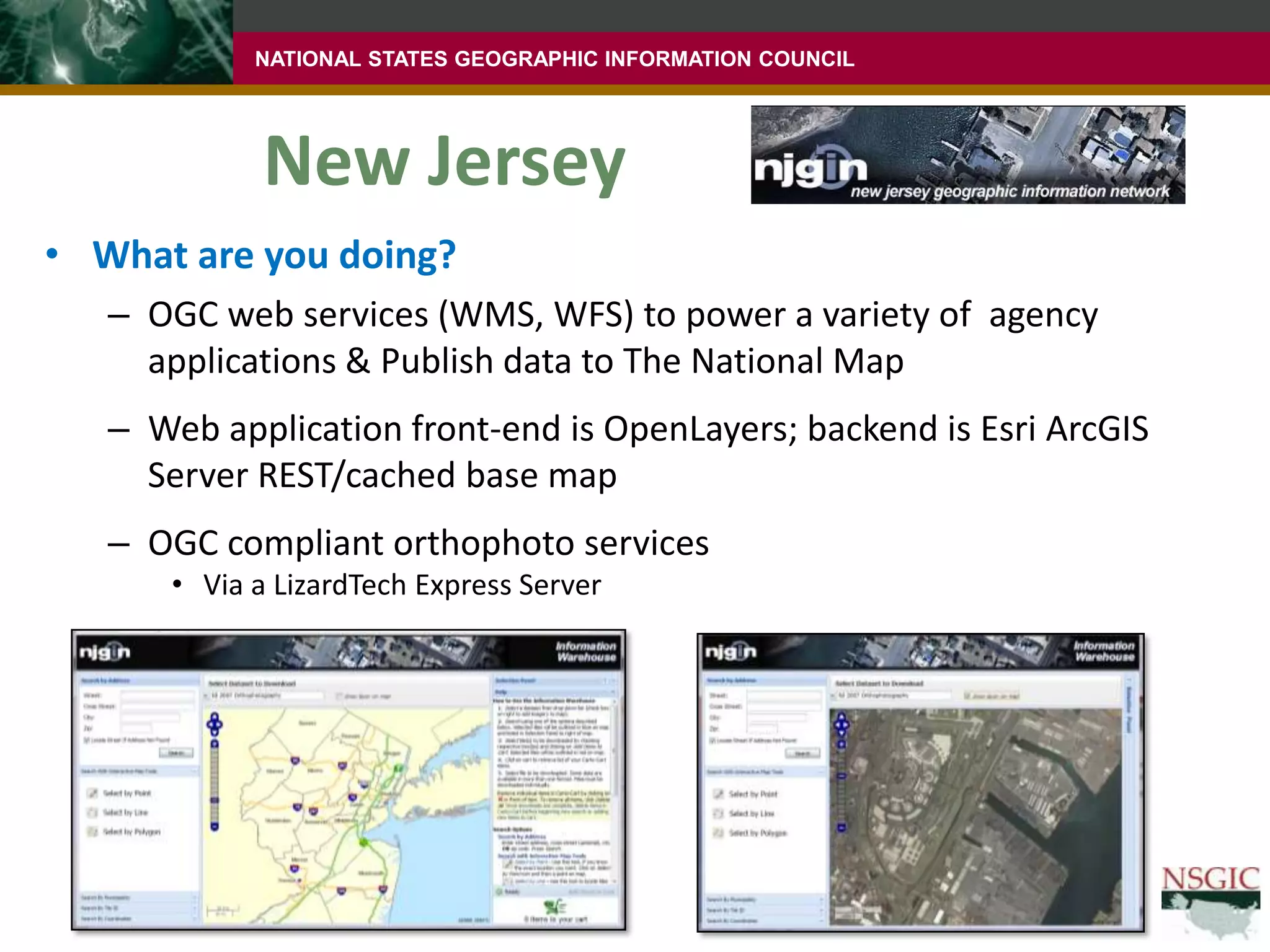
Open SourcePossibilities
Viable Option?June 15-16, 2011
Viable Option?June 15-16, 2011Yes
Mapping Ecosystemhttp://goo.gl/bBm2pcredit to @spara (Sophia Parafina, Infochimps)
Viable Option?June 15-16, 2011Yes
Reasons*Cited in Open Technology Development, Department of Defense 2011
Need should drive architecture / software solution.NotArchitecture / software solution = Result
OverviewOne question: How many of you believe you’ve heard “more” about open source for GIS recently?If yes, speculate on why
Open source business proposition
Opportunities
Challenges
What some states are doingWe’re number 2?Directions podcast from 1/31/11 posed the question“Podcast: Are Esri and Open Source Solutions the Only Options?”AdenaSchutzberg & Joe Francica discussed state of the market in response to a reader’s commentThere is increased maturity of the tools
There is an emerging business ecosystemWe’re number 2!!!Not an accident that we’re hearing more about it nowIt’s being put to use in high profile, meaningful waysSo what is this business ecosystem?Paul Ramsay educates us on the business of OSSSenior employee of OpenGeoOne of the key authors of the PostGIS softwareGeospatial info in the database
Kind of like an open source SDE/Oracle SpatialBrilliant person and excellent public speaker who puts it out there in plain termsSeveral of the following slides were presented at the recent FOSS4G conference, and are used with permission
What is open source software?Managed as a project with a team of contributorsSource code of software is freely availableSoftware license often allows free deploymentSlides from Paul Ramsay, used with permission.
The beekeeper analogySlides from Paul Ramsay, used with permission.
“Creates a virtuous circle”Slides from Paul Ramsay, used with permission.
Open source and proprietary software companies are similar, but differentOpen Source CorpProprietary CorpThey both need to serve customers and make moneyThe intellectual property comes from different placesSlides from Paul Ramsay, used with permission.
There are now companies that provide support and services for geospatial OSSOpenGeo is following the “Red Hat model”Insurance: That if something is broken, some entity will help get it fixed; you can obtain supportAssurance: That there is knowledge and expertise to assist you with deploying and solving problems with these toolsSlides from Paul Ramsay, used with permission.
Many commercial companies employ open sourceGoogleLinux in its web farmsAmazonThe Xen virtual machine environment85 of 135 third-party libraries are OSSUnder 18 different OSS licensesSlides from Paul Ramsay, used with permission.
OpportunitiesScalabilityWas crucial for the National Broadband MapSlides from Paul Ramsay, used with permission.
OpportunitiesRelease cyclesNew features can be added more quicklyLearon’s/DoD’s point: “Agility/Flexibility/Faster Delivery”You can pay for a featureIncremental improvements through releases10.09.08.0Versions7.06.0
ChallengesMeaningful quote at the conference:“Free is the least important word in FOSS4G”(FOSS4G = Free and Open Source Software for Geospatial)Free does not mean that there are no costsYou can/should pay for supportThere are costs in training staffEtc.
ChallengesPicking your toolsIt’s a large marketplaceServer, desktop, DB, client framework, caching, ETL, etc.Many projectsMany companiesWhat do you need?How does it all fit together?
So what’s going on with FOSS4G in the NSGIC community?Massachusetts, Oklahoma and New JerseyAny others?Three questionsWhat are you doing?Why did you do it?Any advice to offer?PS: None of these states has abandoned Esri
MassachusettsWhat are you doing?Powers OGC compliant web servicesIncluding consumable public services consistent with state’s overall services oriented architectureConsumed by wide variety of public and agency applicationsIncluding Oliver & Morris, public facing viewers
MassachusettsWhy did you do it?Adopted OGC API over 10 years agoIn 2001, ArcIMS was not up to task of affordably publishing 100+ OGC compliant map servicesHave viewed OSS as a supplement, not a replacement for Esri technology
MassachusettsAny advice to offer?Support exists, but finding it and becoming familiar with the new model takes some timeEnsure you have access to adequate technical support via consultants and/or staff for configuration and deployment
OklahomaWhat are you doing?Powers the OKMaps clearinghouseCatalog, data viewer, consumable OGC web services
OklahomaWhy did you do it?Reduce licensing costsOriginal project was grant funded, no budget for maintenanceAbility to “clone this clearinghouse” and provide to counties so they can help feed the state systemNot yet, however
OklahomaAny advice to offer?“Although one may avoid licensing costs, there are still significant costs”Need for staff expertiseGood professional partnerOSS is under constant development, important to stay current on releases
New JerseyWhat are you doing?OGC web services (WMS, WFS) to power a variety of  agency applications & Publish data to The National MapWeb application front-end is OpenLayers; backend is EsriArcGIS Server REST/cached base mapOGC compliant orthophoto servicesVia a LizardTech Express Server
New JerseyWhy did you do it?Fill in some gaps in the Esri product offeringsRobust OGC supportJavaScript development before release of REST APISupplement existing Esri infrastructureComfortable  with a heterogeneous environment

NSGIC 2011 Presentation on geo open source

  • 1.
  • 2.
  • 3.
  • 4.
    Mapping Ecosystemhttp://goo.gl/bBm2pcredit to@spara (Sophia Parafina, Infochimps)
  • 5.
    Mapping Ecosystemhttp://goo.gl/bBm2pcredit to@spara (Sophia Parafina, Infochimps)
  • 6.
    Mapping Ecosystemhttp://goo.gl/bBm2pcredit to@spara (Sophia Parafina, Infochimps)
  • 7.
    Mapping Ecosystemhttp://goo.gl/bBm2pcredit to@spara (Sophia Parafina, Infochimps)
  • 8.
    Mapping Ecosystemhttp://goo.gl/bBm2pcredit to@spara (Sophia Parafina, Infochimps)
  • 9.
    Mapping Ecosystemhttp://goo.gl/bBm2pcredit to@spara (Sophia Parafina, Infochimps)
  • 10.
    Mapping Ecosystemhttp://goo.gl/bBm2pcredit to@spara (Sophia Parafina, Infochimps)
  • 11.
    Mapping Ecosystemhttp://goo.gl/bBm2pcredit to@spara (Sophia Parafina, Infochimps)
  • 12.
    Mapping Ecosystemhttp://goo.gl/bBm2pcredit to@spara (Sophia Parafina, Infochimps)
  • 13.
    Mapping Ecosystemhttp://goo.gl/bBm2pcredit to@spara (Sophia Parafina, Infochimps)
  • 14.
  • 15.
  • 16.
    Reasons*Cited in OpenTechnology Development, Department of Defense 2011
  • 17.
    Need should drivearchitecture / software solution.NotArchitecture / software solution = Result
  • 18.
    OverviewOne question: Howmany of you believe you’ve heard “more” about open source for GIS recently?If yes, speculate on why
  • 19.
  • 20.
  • 21.
  • 22.
    What some statesare doingWe’re number 2?Directions podcast from 1/31/11 posed the question“Podcast: Are Esri and Open Source Solutions the Only Options?”AdenaSchutzberg & Joe Francica discussed state of the market in response to a reader’s commentThere is increased maturity of the tools
  • 23.
    There is anemerging business ecosystemWe’re number 2!!!Not an accident that we’re hearing more about it nowIt’s being put to use in high profile, meaningful waysSo what is this business ecosystem?Paul Ramsay educates us on the business of OSSSenior employee of OpenGeoOne of the key authors of the PostGIS softwareGeospatial info in the database
  • 24.
    Kind of likean open source SDE/Oracle SpatialBrilliant person and excellent public speaker who puts it out there in plain termsSeveral of the following slides were presented at the recent FOSS4G conference, and are used with permission
  • 25.
    What is opensource software?Managed as a project with a team of contributorsSource code of software is freely availableSoftware license often allows free deploymentSlides from Paul Ramsay, used with permission.
  • 26.
    The beekeeper analogySlidesfrom Paul Ramsay, used with permission.
  • 27.
    “Creates a virtuouscircle”Slides from Paul Ramsay, used with permission.
  • 28.
    Open source andproprietary software companies are similar, but differentOpen Source CorpProprietary CorpThey both need to serve customers and make moneyThe intellectual property comes from different placesSlides from Paul Ramsay, used with permission.
  • 29.
    There are nowcompanies that provide support and services for geospatial OSSOpenGeo is following the “Red Hat model”Insurance: That if something is broken, some entity will help get it fixed; you can obtain supportAssurance: That there is knowledge and expertise to assist you with deploying and solving problems with these toolsSlides from Paul Ramsay, used with permission.
  • 30.
    Many commercial companiesemploy open sourceGoogleLinux in its web farmsAmazonThe Xen virtual machine environment85 of 135 third-party libraries are OSSUnder 18 different OSS licensesSlides from Paul Ramsay, used with permission.
  • 31.
    OpportunitiesScalabilityWas crucial forthe National Broadband MapSlides from Paul Ramsay, used with permission.
  • 32.
    OpportunitiesRelease cyclesNew featurescan be added more quicklyLearon’s/DoD’s point: “Agility/Flexibility/Faster Delivery”You can pay for a featureIncremental improvements through releases10.09.08.0Versions7.06.0
  • 33.
    ChallengesMeaningful quote atthe conference:“Free is the least important word in FOSS4G”(FOSS4G = Free and Open Source Software for Geospatial)Free does not mean that there are no costsYou can/should pay for supportThere are costs in training staffEtc.
  • 34.
    ChallengesPicking your toolsIt’sa large marketplaceServer, desktop, DB, client framework, caching, ETL, etc.Many projectsMany companiesWhat do you need?How does it all fit together?
  • 35.
    So what’s goingon with FOSS4G in the NSGIC community?Massachusetts, Oklahoma and New JerseyAny others?Three questionsWhat are you doing?Why did you do it?Any advice to offer?PS: None of these states has abandoned Esri
  • 36.
    MassachusettsWhat are youdoing?Powers OGC compliant web servicesIncluding consumable public services consistent with state’s overall services oriented architectureConsumed by wide variety of public and agency applicationsIncluding Oliver & Morris, public facing viewers
  • 37.
    MassachusettsWhy did youdo it?Adopted OGC API over 10 years agoIn 2001, ArcIMS was not up to task of affordably publishing 100+ OGC compliant map servicesHave viewed OSS as a supplement, not a replacement for Esri technology
  • 38.
    MassachusettsAny advice tooffer?Support exists, but finding it and becoming familiar with the new model takes some timeEnsure you have access to adequate technical support via consultants and/or staff for configuration and deployment
  • 39.
    OklahomaWhat are youdoing?Powers the OKMaps clearinghouseCatalog, data viewer, consumable OGC web services
  • 40.
    OklahomaWhy did youdo it?Reduce licensing costsOriginal project was grant funded, no budget for maintenanceAbility to “clone this clearinghouse” and provide to counties so they can help feed the state systemNot yet, however
  • 41.
    OklahomaAny advice tooffer?“Although one may avoid licensing costs, there are still significant costs”Need for staff expertiseGood professional partnerOSS is under constant development, important to stay current on releases
  • 42.
    New JerseyWhat areyou doing?OGC web services (WMS, WFS) to power a variety of agency applications & Publish data to The National MapWeb application front-end is OpenLayers; backend is EsriArcGIS Server REST/cached base mapOGC compliant orthophoto servicesVia a LizardTech Express Server
  • 43.
    New JerseyWhy didyou do it?Fill in some gaps in the Esri product offeringsRobust OGC supportJavaScript development before release of REST APISupplement existing Esri infrastructureComfortable with a heterogeneous environment
  • 44.
    New JerseyAny adviceto offer?When you venture into OSS, understand the release cycle and modelDaily builds are available and sometimes have something you wantBut can be less stable
  • 45.
    ConclusionIt’s continuing tomatureQuality of toolsBusiness ecosystemIt’s adding valueTo both government and businessWe’re likely to be seeing more of it, not less
  • 46.