
Recommended
Recommended
More Related Content
Similar to Indus and Vedic.pdf
Similar to Indus and Vedic.pdf (20)
More from MilanAgrawal3
Recently uploaded
Recently uploaded (20)
Indus and Vedic.pdf
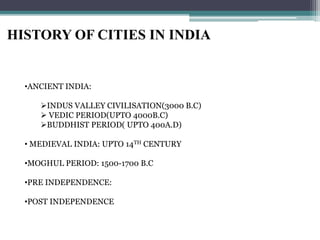
- 1. HISTORY OF CITIES IN INDIA •ANCIENT INDIA: INDUS VALLEY CIVILISATION(3000 B.C) VEDIC PERIOD(UPTO 4000B.C) BUDDHIST PERIOD( UPTO 400A.D) • MEDIEVAL INDIA: UPTO 14TH CENTURY •MOGHUL PERIOD: 1500-1700 B.C •PRE INDEPENDENCE: •POST INDEPENDENCE
- 2. INDUS VALLEY
- 3. Trade route through the civilisation
- 4. Geography and evolution Located in the Indus River Valley on the Indian subcontinent The river arose in the high mountains of the Himalayas and flowed south through semiarid plains to the Arabian Sea, a part of the Indian Ocean. When it flooded each summer, the river deposited a layer of fertile silt that made for easy tilling of the soil Weather is influenced by yearly monsoons. The Kyber Pass thru the Hindu Kush mountains allow people to cross into the Indus River Valley That soil attracted farmers, who built villages and, in time, cities. The studies reveal that the Indus Valley civilization was home to around 100 villages and several walled cities. Two large cities, Harappa and Mohenjo-daro, dominated the region. The Indus often flooded deeply, so farmers built their settlements on high ground and surrounded them with barriers of stone or earth. They planted wheat and barley when the floodwaters receded. At some point they also began growing cotton
- 5. The social and economic life of the people of Indus Valley Civilization (Harappan Civilization) was systematic and organised. The Indus valley population consisted of Australoid, Mediterranean, Mongoloid and Alpine races. The cosmopolitan character of the population proves that the Indus valley was the meeting place of the people of various races. The people had good understanding of an urban civilization. The population of Mohenjo-Daro was about 35000. The center of government was the citadel. The Harappan’s had a strong and well-organized central government People who lived in the towns and cities were mostly merchants and craftsmen People who lived in areas outside the cities were farmers and herders The Harappans invented the first system of weights and measures for trade They traded as far away as ancient Sumer where they imported textiles and food in exchange for copper, lumber, precious stones, cotton, and luxury goods Society and people
- 6. Society and people The studies reveal that the Indus Valley civilization was home to around 100 villages and several walled cities. Two large cities, Harappa and Mohenjo-daro, dominated the region. Harappa and Mohenjo-daro reflected the organization and complexity that is a key sign of a civilization. Each consisted of two sections—an elevated citadel, or fortress, and a lower residential area. Both were surrounded by walls. In the citadel, members of the ruling class likely conducted their political business and carried out religious rituals. In the residential city below, the people lived in brick houses linked by an orderly arrangement of streets. The finer homes had wells for water and bathrooms that drained into the city’s main sewer system. More people involved in trade and craftsmanship than other civilizations Little evidence to suggest what their class system was like Women had no legal rights and were considered the property of their husbands As the Arayan influence spread, a caste system developed
- 8. Major cities •Mohenjo-daro (hill of dead) now in Pakistan •Kalibangan in Rajasthan •Lothal, Sukortada and Dhoulavira in Gujrat •Rakhigadhi in Haryana
- 9. Characteristic features While in 2500b.c the Egyptians were building pyramids, the Indus was laying sun dried bricks in India’s first cities. The most interesting feature of this civilisation was its town planning and sewerage& water supply systems. The civilisation has greatly developed as that of ancient Mesopotamia. The cities at Mohenjo-Daro and Harrapa were built systematically, divided into 12 blocks, each 365m X 244m. Walls were laid in English bonds The streets were 9m wide The streets and buildings were marked by under-ground drainage lines with inspection chambers at regular intervals.
- 13. Grid-iron layout for streets Houses were of varying sies and of one or two storeys, built stictly on utility basis. A series of rooms were arranged around an open to sky courtyard and contained a staircase to the upper storey. The openings were small and there were no openings to the main streets and subsidiary walkways. The city had an effective drainage and water supply system. Houses had well designed toilets and bathing facilities. Acommon well was provided to the group of houses. The drainage lines were running under the walkways and finally connected to the main sewers. There were manholes located at different places for cleaning and inspection The indus valley culture collapsed due to the natural catastrophe. After centuries later, it was occupied by the aryan invaders in 1500-1000b.c
- 15. VEDIC PERIOD The aryans were originally from central europe. They came riding horses and chariots to the North west India and these war like invaders capture the unarmed people of Indus valley. They attacked the fertile land of Gangatic plains and captured the nose-less and dark Dasyus(Dravidians). This marked the beginning of Aryan culture in India. The aryan village was made of timber and thatch huts which were arranged in a group of three or four around an open courtyard. It was protected by a timber fence consisting of rectangular wooden posts at regular intervals and connected with three horiontal bamboo bars At the enterance, it was projected out where a gateway was provided which consisted of two upright wooden posts. These gateways was later converted into ornamental gateways called Torans.
- 17. VEDIC PERIOD Even in vedic period, the town planning was done on scientific grounds. The principles of town planning are mentioned in some sacred books. In viswa karmaprakash it is stated that first layout the towns and then the houses. Mansara silpashastra deals with many aspects of town planning such as study of soil, climate, topography and layout of various types such as Dandaka, Swastika, Padmaka, Nandyavarta, Prastara, Chaturmukh, Karmuka. The main or king streets ( Raja Marg) were alligned East-West to get the roads purified with sun rays, while the short roads were alligned North-South. The roads running around the village are called Mangal Vithi, were served for priests. These books also refer to the qualification and moral qualities of the town planner (Sthapati)
- 23. A traditional nagara(city) is one where the sacred and the secular mingle. Temples ( mentioned in Yajurveda hymns)- the link between the cosmic and the human Cultural centres; festive and ritual activities Educational: pathshala Social life: public meetings and social gatherings Mathas: monastic centre of education and pilgrim rest house.
- 24. Ancient texts Sthapatya Veda: (parts of artherva veda) ; layout of a city Smriti shastra: street layouts (micro & macro) Vaastu shastra: treatises on architectural planning; construction and design; matters relating to site selection, site planning and orientation, quality of soil, water resources, planning of trees and groves. Arthashastra: Enviornmental management Manasara Shilpa Shastra: Grama vidhana & nagara vidhana Mayamata Viswakarma Vaastu purush Mandala
- 25. Silpashastra refers to four distinct categories of habitation settlements: Janabhavanas: houses for common mass Rajbhavanas: palaces and gorgeous mansions Devabhavans: religious shrines The public buildings such as public rest house, public gardens, reservoirs, wells, etc Manasara, mayamata and vishvakarma prakara laid emphasis on planning and architecture of janabhavanas There were 4 kinds of Varnas & 4 kinds of Ashramas ( classification of society) Brahamana: Intellectual class Kshatriya: Administrative class Vaisya: Business class Sudra: Working class Sannyasa: Renounced order Vanaprastha: Intermediate stage between grihasta and sannyasa Grihasta: ideal married person, who contributes to society Bhramacharya: does academic learning under a bonafide guru
- 26. Nagara vidhana Grid-iron pattern: main streets Primary, secondary and tertiary street layout Street design with green plant borders Pedestrian foothpath between street and green belt Junction of main axis: Bhramhastana Mixed use on main streets, i.e residences above commercial People of similar professions, age groups, heaalth can be housed in the same quarters Crematoria were placed outside the layout Mandala
- 27. Early Mauryan : 274 bc -237 bc
- 28. Emperor Chandragupta Maurya was one of the powerful rulers of this time. Kautilya or Chanakya were chief ministers who wrote Arthashastra. Patliputra city (modern patna), the capital of Magadh, was laid on grid iron pattern consisting of 16 sectors. Most of the houses had gardens with wells and ponds. Waste water was carried through underground drainage which finally opened in river Ganga. The city was surrounded by a moat on all sides. (16 km long and 3.5 km wide) Protected by ramparts stretching more than 40 km and had 64 gates and 570 towers. Main gates were oriented at cardinal points. Wide enough for elephants to pass through. Gates were two storeys high and contained guard rooms.
- 29. BULANDI BAGH SITE Mauryan remains of a wooden palissade at Bulandi Bagh site
- 32. Wooden origin was noted in most of the construction of this period. Teak wood were carefully trimmed into the required shape. Vaulted roofs were supplemented by a series of curved wooden ribs or groins which were closely spaced. The erly phase of timber construction is seen to be carried over in later rock cut architecture of Buddhist period. A filling of lime plaster was added and painted in white.
- 33. Depiction of balconied and windowed streets of the Mauryan towns, that were much more lively than the rather bleak windowless streets of Mohenjodaro
- 36. Budhism on the other hand marks its beginning in 563 bc, by Shiddhartha, also known as Gautam, son of chief of Sakya dynasty. The religion teaches non-violence, oneness, humanity, deliverance from sorrow and all trouble, through enlightment. Nirvana can be attained by a path of self purification, with no regard to caste, creed. Three objects worthy of veneration in Buddhiam are: Sarika: physical remains like hair, nail, bones Prabhogika: like begging bowl, robes, vessels Uddesika: symbols like tri ratna, stupa, chakra Eightfold path enunciated by Budhha are Right Belief, Right Aspiration, Right Speech, Right Action, Right means of Livelihood, Right effort, Right awareness, Right meditation. ASHOKAAND BEGINNING OF BUDDHISM
- 37. ASHOKAAND BEGINNING OF BUDDHISM Emperor Ashoka was the grandson of Chadragupta Maurya who took the empire forward. He strengthened the city of pataliputra and provided many civic amenities like rest houses, wells, hospitals for travellers. His conquest of Kalinga was a turning point in his life. He turned to Buddhism in 261 bc. For propagating budhhism, he built 84000 stupas, stone edicts written in pali language. At his time, the change from wooden to rock as material happened, thus resulting in construction of various massive rock cut structures and religious structures during his era. Memorial pillars or lats were also important feature of this period. As many as 30 pillars were constructed.
- 38. CHARACTERISTIC FEATURES • STUPAS OR TOPES • STAMBHA OR LAT • CHAITYA • VIIHARA • MONASTRY
- 39. Budhhism rejected any form of image worship therefore no temples, statues were built The represented Budhha by means of symbols like stupa, Bodhi tree as enlightment, wheel of law as the first sermon, corporeal wheel of budhha and his footprints. Other scultural works include jatak tales, serpents, yaksha and yakshika Female figures were also used on the bracket capital, railing pillars