Downloaded 103 times


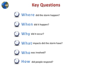

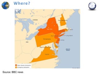
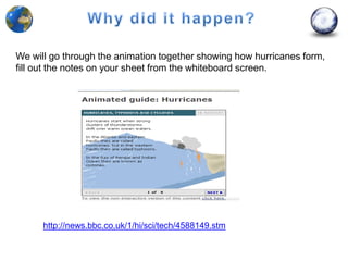


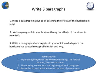

The document outlines an educational activity for students to analyze the causes and effects of Hurricane Sandy. Students will work in groups to examine photographs, gather facts from video clips, and read newspaper articles to understand the storm's impact in Haiti and New York. They will then write and refine paragraphs discussing the hurricane's effects and present the final work incorporating visual aids.


