Ews by forecast fdrs of thailand and upper asean and forest fire control in thailand vt
•
1 like•522 views

Forest Fire IT and Control in Thailand and Upper ASEAN

Recommended
Recommended
More Related Content
Similar to Ews by forecast fdrs of thailand and upper asean and forest fire control in thailand vt
Similar to Ews by forecast fdrs of thailand and upper asean and forest fire control in thailand vt (20)
More from Veerachai Tanpipat
More from Veerachai Tanpipat (7)
Recently uploaded
Recently uploaded (20)
Ews by forecast fdrs of thailand and upper asean and forest fire control in thailand vt
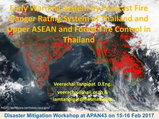
- 1. Early Warning System by Forecast Fire Danger Rating System of Thailand and Upper ASEAN and Forest Fire Control in Thailand Veerachai Tanpipat, D.Eng. veerachai@haii.or.th & iamtanpipat@hotmail.com Disaster Mitigation Workshop at APAN43 on 15-16 Feb 2017 https://worldview.earthdata.nasa.gov/
- 2. Contents • What is Early Warning System for Forest Fire? • What is Fire Danger Rating System (FDRS) • Global Fire Early Warning System • ASEAN FDRS System • Forecast Thailand and Upper ASEAN FDRS • 6 things that Forest Fire Information System needs to include • Forest Fire Decision Supporting and Management System (FFDSMS) • Conclusions and Challenges Disaster Mitigation Workshop at APAN43 on 15-16 Feb 2017
- 3. Source: Global Fire EWS--http://www.fire.uni-freiburg.de/gwfews/index.html & de Groot et al., 2010 Early Warning System for Forest Fire or Wildland Fire (EWS-Fire) is a system that will allow forest fire managers and related people to mitigate fire-related problems, to know fire fuel conditions, to reduce fire suppression costs and to enhance more efficient fire control. Forest and land management agencies, as well as land owners and communities, require early warning of extreme fire danger conditions that lead to uncontrolled wildfires.
- 4. Fire danger rating (FDR) is a mature science and has long been used as a tool to indicate the potential of fire start, spread and impact. Fire danger rating is the systematic assessment of fire risk and potential impact, and it is the cornerstone of contemporary fire control and management program. Source: Global Fire EWS--http://www.fire.uni-freiburg.de/gwfews/index.html & de Groot et al., 2010 Wagner, V., 1987
- 5. Fire Danger Rating System (FDRS): –Use weather data at noon as inputs (Van Wager, 1987, Lee et al. 2002, Amiro et al., 2004, de Groot et al., 2006, Taylor and Alexander, 2006 and FAO, 2006) 1. Temperature 2. Humidity 3. Wind Speed 4. Amount of 24 Hours Precipitation CFFDRS software can be downloaded at http://www.lakestatesfiresci.net/SciLibrary/FireDanger.htm and http://rpackages.ianhowson.com/cran/cffdrs/man/fwi.html
- 6. Fire Danger Rating information is used for many operational reasons: 1. to determine suppression resource levels (fire fighters, equipment, helicopters, fixed wing air tankers), mobilization, and strategic prepositioning; 2. to define safe and acceptable prescribed burn prescription criteria; 3. to establish fire management budgets based on long-term fire danger statistics; and 4. to justify increased funding during times of wildfire disaster. Source: Global Fire EWS--http://www.fire.uni-freiburg.de/gwfews/index.html & de Groot et al., 2010
- 7. FDRS History –Began in U.S. in 1919; Canada in 1925; Russia in 1949 –In Canada began with field data collection of how trees were responded to fire • Have a system in used in 1960 • in 1987 Van Wagner developed into a better easy to use system Source: Wildfire Hazards, Risks, and Disasters, Ch. 11 Wildland Fire Danger Rating and Early Warning Systems, William J. de Groot, B. Michael Wotton, Michael D. Flannigan 2015
- 8. 1. new longer term predictions of fire danger based on advanced numerical weather models 2. common global fire danger metrics to support international fire management cooperation, including resource-sharing during times of fire disaster 3. a fire danger rating system for the many countries that do not have a national system in place Source: Global Fire EWS--http://www.fire.uni-freiburg.de/gwfews/index.html & de Groot et al., 2010
- 9. 1. Long-term early warning products (or seasonal forecasts) provide an indication of anticipated global trends in fire danger over the course of the upcoming fire season. 2. Medium-term early warning products (1-2 weeks) provide information for large-scale tactical decision-making that requires 'spool-up' time to implement fire management action plans such as arranging the transfer of helicopters, fixed-wing air tankers, or fire fighters and equipment across international borders. Source: Global Fire EWS--http://www.fire.uni-freiburg.de/gwfews/index.html & de Groot et al., 2010
- 10. 3. Short-term of 1-5 days provides information for strategic decision-making, such as pre- positioning suppression resources in the most critical areas to most effectively control new fires and contain on-going fires. Fire danger is calculated with Global Forecast System data from the U.S. National Centers for Environmental Prediction (NCEP) or The European Centre for Medium-Range Weather Forecasts (ECMWF). Source: Global Fire EWS--http://www.fire.uni-freiburg.de/gwfews/index.html & de Groot et al., 2010
- 11. Source: http://www.fire.uni-freiburg.de/gwfews/index.html Forecast fire danger provides early warning of future trends in fire potential, allowing fire managers to plan/implement fire control strategies in advance.
- 12. ASEAN FDRS History –El Nino 1997-8 caused severe smoke and haze problem in Indonesia and neighboring countries –ASEAN signed agreement in 2002 –2002-2005 System Development through Canadian Forest Service support –2006 started running the system at Malaysian Meteorological Department
- 13. ASEAN System by Malaysian Meteorological Department Source: http://haze.asean.org/#
- 14. Source: http://haze.asean.org/# ASEAN System by Malaysian Meteorological Department
- 15. Source: http://www.met.gov.my/web/metmalaysia/climate/fdrs/southeastasia ASEAN System by Malaysian Meteorological Department
- 19. http://www2.dnp.go.th/gis/FDRS/FDRS.html Source: http://www2.dnp.go.th/gis/FDRS/FDRS.php Manomaiphiboon, K., Tanpipat, V., Nhuchaiya, P., Jaroonrattanapak, N., 2015
- 20. Combining forecasted fire danger maps with historical fire hotspots will indicate critical areas where serious fire problem will occur if current fire activity persists.
- 21. Using FWI with fire hotspots on Google Earth 2 October 2016
- 22. สกลนคร
- 23. 6 Basic steps you have to do: 1. Prevention 2. Monitoring 3. Prediction (Forecasting, Modeling) 4. Warning 5. Response 6. Recovery, Assessment, Mitigation What we need to cover in order to deal with Natural Disasters, especially forest fires?
- 24. 1. Prevention A. Rising Awareness through a) Public Relation and Propaganda b) Training c) Fire break activities with locals B. Community Based Fire Management (CBFiM) C. Etc. What we need to cover in order to deal with Natural Disasters, especially forest fires?
- 25. Prevention
- 26. Prevention
- 27. 2. Monitoring A. Watch-out tower, different vehicles (car, SUV, motorcycle, and bicycle), helicopters, fixed wings, EOS, UAV (unmanned aircraft vehicle), CCTV with both visible and thermal infrared camera B. Public Network C. Etc. What we need to cover in order to deal with Natural Disasters, especially forest fires?
- 32. Thermal and Visible Camera Source: http://www.insightrobotics.com Source: http://hopewish.en.made-in- china.com/product/AqkmbTocYwUf/China-Fire- Alarm-System-Thermal-Imaging-Camera.html
- 33. Unmanned Aircraft Vehicle Source: https://www.icarus.upc.edu/ en/research/unmanned-aerial-systems-uas
- 35. EARTHDATA Fire Information for Resource Management System Source: https://firms.modaps.eosdis.nasa.gov/
- 37. Flow Chart of Thailand Fire Danger Rating System and Fire Hotspot
- 38. Daily report to the main forest fire control task forces by using rapid and daily fire hotspot alert emails, www FDRS, and a smart phone applications (e.g. LINE) by Department of National Park, Wildlife and Plant Conservation (DNP) ว/ว/ว วววว LAT LONG P OINT _ X P OINT _ Y วววววววว วววว ววววว ววววววว ววววววววววว วววววววววววววววววว 21/2/2016 14.15 15.955 101.539 771788 1765614 Aqua แหลมทอง ภักดีชุมพล ชัยภูมิ ไทรทอง สถานีควบคุมไฟป่าไทรทอง 21/2/2016 14.15 15.963 101.547 772634 1766510 Aqua ห ้วยแย ้ หนองบัวระเหว ชัยภูมิ ไทรทอง สถานีควบคุมไฟป่าไทรทอง 21/2/2016 14.15 18.188 98.429 439616 2011079 Aqua บ่อหลวง ฮอด เชียงใหม่ แม่โถ 21/2/2016 14.15 18.192 98.437 440463 2011519 Aqua บ่อหลวง ฮอด เชียงใหม่ แม่โถ 21/2/2016 14.15 14.922 98.942 493762 1649700 Aqua ชะแล ทองผาภูมิ กาญจนบุรี ลาคลองงู 21/2/2016 14.15 18.371 97.717 364456 2031711 Aqua เสาหิน แม่สะเรียง แม่ฮ่องสอน สาละวิน สา 21/2/2016 14.15 15.260 99.328 535220 1687110 Aqua คอกควาย บ ้านไร่ อุทัยธานี ห ้วยขาแข ้ง สถานีควบคุมไฟป่าห ้วยคต 21/2/2016 14.15 15.268 99.331 535540 1687995 Aqua คอกควาย บ ้านไร่ อุทัยธานี ห ้วยขาแข ้ง สถานีควบคุมไฟป่าห ้วยคต วววววว Hotspots ววววววววววววววววววววววววววววววว21 วววววววววว2559 Where? Which forest fire control responsibility! A Daily Report by DNP Source: http://portal.dnp.go.th/
- 39. Chiangrai Hotspot & Early Burning Application Sirimongkonlertkun, N. and Yanawongsa, E., 2016
- 40. Monitoring Transport of Biomass Burning Aerosols Himawari-8 Geostationary Monitoring http://www.highfirerisk.com.au/imr/Thai_H8_01.htm http://www.data.jma.go.jp/mscweb/data/himawari/ sat_img.php?area=se1 http://realearth.ssec.wisc.edu/ Rick McRae, Risk Analyst, Emergency Management, Risk and Spatial Services, ACT Emergency Services Agency, Australia
- 41. 3. Prediction (Forecasting and Modeling) A. Smoke and haze monitoring and forested system (7 SEAS and ECMWF-CAMS, Himawari-8) B. Early Warning System for fire (EWR-Fire) based on Fire Danger Rating System (FDRS) such as GFEWS, EFFIS, UATFFDRS, INFFDRS C. Etc. What we need to cover in order to deal with Natural Disasters, especially forest fires?
- 42. Smoke and Haze Monitoring By 7 SEAS Source: http://www.nrlmry.navy.mil/aerosol_web/7seas/7seas.html
- 43. Forecasted Smoke and Haze By 7 SEAS Aerosol Optical Depth 24-30 April 2016 Source: http://www.nrlmry.navy.mil/aerosol_web/7seas/7seas.html
- 44. Forecasted Smoke and Haze By 7 SEAS Source: http://www.nrlmry.navy.mil/aerosol_web/7seas/ 18-22 April 2016 25-29 April 2016
- 45. Fire Radiative Power – Aerosol Optical Depth by Copernicus Atmosphere Monitoring Service (CAMS) and Copernicus Climate Change Service (C3S), implemented by ECMWF. Source: http://macc.copernicus- atmosphere.eu/d/services/gac/nrt/fire_radiati ve_power!SE%20Asia!Fire%20Radiative%20Po wer!macc!od!enfo!fire_radiative_power!2017 020700!/ Source: http://www.gmes- atmosphere.eu/d/services/gac/nrt/nrt_o pticaldepth!03!Total!SE%20Asia!macc!od !enfo!nrt_opticaldepth!2016121400!!/
- 46. Source: http://www2.dnp.go.th/gis/FDRS/FDRS.php/ Forecast Fire Danger Rating for Upper ASEAN and Thailand
- 47. 4. Warning FIRMS active fire or fire hotspot alert emails: A. Review historical fire related by EOS directly in WorldView for overall situation B. Forecast Fire Danger Rating System (FDRS) C. Risk maps D. Daily fire fuel survey E. Weather condition F. Fire Radiative Power G. Etc. What we need to cover in order to deal with Natural Disasters, especially forest fires?
- 48. Smoke and haze caused by fires in Maechaem area during 16 – 24 April 2016 16 April 19 April 22 April 17 April 18 April 20 April 21 April 23 April 24 April Source: https://worldview.earthdata.nasa.gov
- 50. Source: http://www.cefa.dri.edu/CFS/fwi.php and : http://www.fire.uni- freiburg.de/gwfews/forecast_ews.html New calibrated Thresholds being used by Global Fire EWS for upper ASEAN (Bill De Groot & Alan Cantin, Natural Resources Canada, Canadian Forest Service) with Global FWI Monthly Forecast for 9 Months for Planning Prescribe Burning and Others
- 51. Source: http://forest.jrc.ec.europa.eu/effis/applications/global-viewer/ Global Wildfire Information System by The European Forest Fire Information System (EFFIS)
- 52. –Weather (wind, precipitation, etc.) • Windyty (http://www.windyty.com)
- 53. Source: http://www.gmes- atmosphere.eu/d/services/gac/n rt/fire_radiative_power/ Fire Radiative Power Mark Parrington, ECMWF, 2017
- 54. 5. Response A. Forest fire suppression units B. Related agencies and collaborated local communities C. Etc. What we need to cover in order to deal with Natural Disasters, especially forest fires?
- 56. 6. Recovery, Assessment and Mitigation A. Burn Severity Index (BSI) B. Burn Area C. Emissions D. Reforestation E. Public Relation F. Etc. What we need to cover in order to deal with Natural Disasters, especially forest fires?
- 57. Burned Areas Detection using Burn Severity Index (BSI) Ken Brewer and Carl Albury, 2015
- 59. Fire Decision Support System (FDSS) RS ICTGPS GIS FDSS Socioeconomics, social dimension maps, statistics, weather, models, topographic maps EOS imageries, weather, climate, monitoring, detection, condition, Communication technologies, related information & knowledge (research, publication, Location identifying technologies, accuracy, GNSS
- 61. Conclusions and Challenges ➢Need to combine and integrate Lower and Upper ASEAN FDRS together in order to complete the SEA regional picture ➢Need to put fire early warning (Forecast FDRS) information into a forest fire planning process and daily forest fire control activities ➢Need to develop better accuracy high resolution medium range weather forecast inputs (DA and Ensemble) for FDRS ➢Need to have reliable and scientific proved Fire Decision Support System (FDSS) e.g. CWFIS Disaster Mitigation Workshop at APAN43 on 15-16 Feb 2017
- 62. Conclusions and Challenges ➢Need a full cooperation and supports from ASEAN forest fire agencies, people and related ➢Need to accept, in Asia, the main cause of fires is “Human,” all advance information or system will mean nothing if we do not solve the real cause, so NEED to make people realize and concern how worse the smoke can do to them and their families!!!!! Moreover, need to provide other without fire alternatives for them to earn a living! ➢Need to find easier and simpler communication schema to deliver scientific information. Disaster Mitigation Workshop at APAN43 on 15-16 Feb 2017
- 63. Acknowledgements Dr. Jeff Schmaltz (NASA/GSFC-LANCE-Rapid Response), Dr. Diane Davies (NASA-LANCE Operation Manager), Prof. Dr. Johann Goldammer (GFMC, U. of Freiburg), Dr. Robert Field (Columbia University, NASA GSFC), Dr. Bill De Groot (NRCAN-Canadian Forest Service), Mr. Rick McRae (ACT Emergency Services Agency), Ms. Minnie Wong (WorldView, NASA-EarthData), Ms. Anja Hoffmann (GOLD-GOFC Coordinator), Dr. Jeff Reid and Dr. Edward Hyer (Naval Research Laboratory), Dr. Mark Parrington (ECMWF) Dr. Kaseamsan Manomaipiboon (JGSEE), Dir. Siri Akkakara, Dir. Manus Panmon, Dir. Suraphol Leerawaropat (DNP), Mr. Prayoonyong Nuchaiya and Mr. Narin Jaroonrattanapak (DNP) Disaster Mitigation Workshop at APAN43 on 15-16 Feb 2017