The document outlines a roadmap and strategies for rolling out a big data initiative. It discusses developing an initial investment plan, creating focus groups to identify use cases, scoping pilot programs, and defining a strategy to get approvals. The roadmap then involves production rollout, with pilots, analysis of results, and planning for recommendations before full production rollout. Governance models and understanding potential impacts on the business are also addressed.
BigInsights BigData Study 2013 - Exec SummaryBigInsights
The document summarizes the findings of a 2013 survey on big data conducted across Asia-Pacific. The key findings include:
- The majority of respondents do not understand the benefits big data could provide or have the skills and resources to pursue big data initiatives.
- However, most business leaders believe big data could help understand customers and business trends better and improve decision making.
- Respondents see potential in mining data from websites, social media, data warehouses for big data solutions.
- Adoption of Hadoop and NoSQL technologies is expected to increase over the next two years.
This document discusses big data and characteristics of big data businesses. It notes that the amount of data created daily is growing exponentially and data has become a new economic input for businesses. Big data refers to large, complex data that is analyzed in real-time to unlock intelligence. The document outlines the history and components of big data including distributed storage, computation and tools like Hadoop. It presents a taxonomy of big data companies and discusses competitive barriers for these businesses like data network effects and economies of scale. Finally, it notes that successful big data teams require data science and scalable architecture skills.
This document summarizes a presentation comparing various GIS mobile applications. It outlines the evolution of mobile GIS from early PDAs to current smartphones. It then discusses several open source and proprietary GIS mobile products, the platforms they support, and their key features. The document performs feature and performance tests on some Windows Mobile products. It concludes with observations on opportunities for open source mobile GIS given new devices, platforms, and use cases.
The document presents GeoShield, an open source solution for managing authentication and authorization for OGC services including WMS, WFS, and SOS. It describes GeoShield's protection strategies, web interface, and a new GeoServer plugin that allows configuring access rules for different users and groups. The plugin is demonstrated as a way to centrally control and secure access to various spatial data and sensor observation services.
This document discusses the PostgreSQL ecosystem and provides an overview of various tools and extensions. It begins with introductions of the speaker and Taiwan PostgreSQL User Group. The agenda then covers topics like load balancers (PgBouncer, Pgpool-II), replication (Postgres BDR), REST APIs (PostgREST), schema models (PostGIS, PipelineDB, Apache AGE), scalability (Greenplum DB, Postgres-XC/XC2/XL), foreign data wrappers, and other tools like Apache MADlib. The speaker hopes to promote wider adoption of PostgreSQL in Taiwan and collaboration with local system integrators.
gvSIG Mobile as a client of SDI,OSGIS 2009.Nottinghamadelrey
gvSIG Mobile is a mobile GIS client developed under the gvSIG project as a framework for mobile devices. It allows users to view and edit geospatial data in the field. The presentation described the history and capabilities of gvSIG Mobile, including its use of Java and support for vector data, raster data, and OGC web services. Future plans for gvSIG Mobile include support for additional format types and direct connections to spatial databases and sensor networks.
1) The document summarizes the author's experience at JavaOne 2009, noting over 15,000 attendees from 43 countries and 389 sessions over 4 days.
2) Key announcements included new versions of JavaFX, GlassFish, NetBeans, and the Java EE 6 roadmap. Java FX 1.2 added support for desktop, TV, and phones.
3) The JavaOne keynotes highlighted projects like modularity in JDK 7 and the Java language roadmap, and promoted tools like Kenai for collaboration and Hudson for continuous integration.
State of GeoServer provides an update on our community and reviews the new and noteworthy features for the Project. The community keeps an aggressive six month release cycle with GeoServer 2.8 and 2.9 being released this year.
Each releases bring together exciting new features. This year a lot of work has been done on the user interface, clustering, security and compatibility with the latest Java platform. We will also take a look at community research into vector tiles, multi-resolution raster support and more.
Attend this talk for a cheerful update on what is happening with this popular OSGeo project. Whether you are an expert user, a developer, or simply curious what these projects can do for you, this talk is for you.
The document discusses the geoSDI framework, an open source framework for developing rich web GIS applications using Java. It describes geoSDI's goals of enabling work with heterogeneous geospatial data through OGC standards. The framework includes Geo-Platform Services and GUI modules along with various widgets that extend functionality like map features, layer management, data uploading, and more. The framework aims to provide a flexible solution for geospatial portals using Java and JavaScript.
Raster data in GeoServer and GeoTools: Achievements, issues and future devel...GeoSolutions
The purpose of this presentation is, on a side, to dissect the developments performed during last year as far as raster data support in GeoTools and GeoServer is concerned, while on the other side to introduce and discuss the future development directions.
Advancements and improvements for the management of raster mosaic and pyramids will be introduced and analyzed, as well as the latest developments for the exploitation of GDAL raster sources.
Extensive details will be provided on the latest updates for the management of multidimensional raster data used in the Remote Sensing and MetOc fields.
The presentation will also introduce and provide updates on the JAITools and ImageIO-Ext projects. JAITools provides a number of new raster data analysis operators, including powerful and fast raster algebra support. ImageIO-Ext bridges the gap across the Java world and native raster data access libraries providing high performance access to GDAL, Kakadu and other libraries.
The presentation will wrap up providing an overview of unresolved issues and challenges that still need to be addressed, suggesting tips and workarounds allowing to leverage the full potential of the systems.
gvSIG is a free and open source desktop GIS application. It was originally developed in Spain to provide a free software alternative for GIS tasks. gvSIG can perform common GIS functions like accessing spatial data formats, performing geospatial analysis, and outputting maps. The software is developed by a global community of users and contributors and continues to expand its capabilities.
The document discusses new features and functionalities in the upcoming version 1.0 of the gvSIG Mobile GIS application for mobile devices. Key updates include a new UI framework, multithreading for performance, improved editing tools, support for additional data formats and sensors, and easier extensibility through a plug-in architecture. The release is nearing completion but still faces some issues around speed, usability, and full integration that must be addressed before a beta launch.
GeoServer an introduction for beginnersGeoSolutions
This presentation will provide an introduction to the GeoServer project and its abilities to publish data with a mix of well-known OGC protocols and other popular protocols and data formats.
Martin Dobias of Lutra Consulting explaining some of the performance enhancements coming in the next releases of QGIS including multi-threaded processing.
QGIS UK User Group - QGIS Performance Enhancements (Lutra)QGIS UK
Martin Dobias of Lutra Consulting explaining some of the performance enhancements coming in the next releases of QGIS including multi-core, multi-threaded processing.
Raster Data In GeoServer And GeoTools: Achievements, Issues And Future Develo...GeoSolutions
The purpose of this presentation is to discuss the developments during last years in raster data support in GeoTools and GeoServer, and also to introduce and discuss future development directions.
PoPostgreSQL Web Projects: From Start to FinishStart To Finishelliando dias
This document summarizes PostgreSQL, an open source relational database. It highlights that PostgreSQL is an 11 year old project that is SQL compliant, highly concurrent, fast, robust and secure. It also discusses PostgreSQL's features, principles, sponsors, users in the UK and internationally, and use cases like web applications. Finally, it outlines how to get started with PostgreSQL for web projects and how projects can scale up from basic to advanced features.
IV. Jornadas Sig Libre: The State of OSGeo and the Global SDIArnulf Christl
The current State of OSGeo: Overview of the established OSGeo software products, incubating projects, local chapter and conference activities and some politics. And as always: What is different about software in general.
GeoDjango is a framework that allows for the use of geographic information in Django projects. It provides Django model fields to store geospatial data like points, lines and polygons. It also includes tools to import data from formats like Shapefiles into Django models and query and manipulate spatial data using the Django ORM. GeoDjango leverages spatial databases like PostGIS to handle geographic queries and functions. It aims to make building geographic web applications with Django simple and intuitive.
This document provides an overview of GeoServer, an open source geospatial data server. It discusses GeoServer's capabilities including supporting OGC standards like WMS, WFS, WCS. It outlines GeoSolutions, the company that develops GeoServer, and provides summaries of new features in recent GeoServer releases like 2.2, 2.3, and upcoming 2.4, such as virtual services, improved projections, and WCS 2.0 support.
OGC Update for State of Geospatial Tech at T-RexGeorge Percivall
An update on OGC activities in three time horizons: Now, Next and After Next. Finishing with how to keep updated on OGC activities.
Now
Recently approved OGC standards
Implementation of approved standards
Next
Standards Program
Innovation Program
After Next
Tech Forecast
How to keep in touch
Geospatial Temporal Open Standards for Big Data from Space (BiDS2014)George Percivall
Presentation to ESA Big Data From Space (BiDS2014), November 2014.
Big data from space requires processing large amounts of data in a distributed environment. For efficient, quality and cost-effective deployment, these environments must be based on open standards. The Open Geospatial Consortium (OGC) open standards for geospatial-temporal information have been tuned through implementations to meet the needs of big data.
Open Source GIS Stack: Data hub for flexibility, performance and effectivenesseHealth Africa
This document discusses the use of open source GIS stacks by organizations in Nigeria and Quebec. It describes how eHealth Africa uses FOSS4G tools like QGIS, MapServer, PostgreSQL and OpenLayers to manage and share public health data in Nigeria. Similarly, Quebec Public Safety uses FOSS4G including MapServer, OpenLayers and PostGIS to provide open, flexible and cost-effective GIS services for disaster management. Both organizations chose FOSS4G for benefits like standard compliance, community support, lower costs and greater flexibility compared to proprietary software. The document also outlines opportunities for partnership between the two organizations.
GeoNetwork, The Open Source Solution for the interoperable management of ge...GeoSolutions
GeoNetwork is an open source software solution for managing geospatial metadata. It allows users to search metadata from multiple catalogues, edit metadata online using templates, and view maps through an integrated web map viewer. GeoNetwork implements common geospatial standards and can be used to build spatial data infrastructures and geospatial portals. It has features for metadata harvesting, distributed searching, and supporting INSPIRE metadata requirements.
gvSIG Mobile at the 2nd gvSIG users meeting in Trieste (Italy)adelrey
gvSIG Mobile is an open source Java mobile GIS client that allows users to view and edit geospatial data on mobile devices. The presentation provides an overview of the gvSIG Mobile prototypes, including its navigation, data viewing, querying, and editing capabilities. Future plans are outlined to add support for more formats, spatial databases, and synchronization. In conclusion, gvSIG Mobile is positioned as a useful tool for mobile GIS tasks and spatial data infrastructure applications in fields such as urban planning and emergency response.
El documento describe cómo montar una red social propia utilizando BuddyPress, un plugin para WordPress. Explica que BuddyPress añade funcionalidades de red social como perfiles de usuario, amigos, grupos, blogs y foros. También menciona algunos plugins adicionales y proporciona instrucciones sobre cómo instalar y configurar BuddyPress para crear una red social personalizada.
This document describes the gvSIG project, an open-source desktop and mobile GIS client. It has support for common GIS file formats and protocols. The document also describes Prodevelop, a Spanish company involved in the gvSIG project and open source GIS. Finally, it discusses plans to integrate sensor observation services (SOS) from the OGC into future versions of gvSIG desktop and mobile to allow accessing real-time sensor data.
More Related Content
Similar to gvSIG Goes Mobile. gvSIG porting for mobile devices.
1) The document summarizes the author's experience at JavaOne 2009, noting over 15,000 attendees from 43 countries and 389 sessions over 4 days.
2) Key announcements included new versions of JavaFX, GlassFish, NetBeans, and the Java EE 6 roadmap. Java FX 1.2 added support for desktop, TV, and phones.
3) The JavaOne keynotes highlighted projects like modularity in JDK 7 and the Java language roadmap, and promoted tools like Kenai for collaboration and Hudson for continuous integration.
State of GeoServer provides an update on our community and reviews the new and noteworthy features for the Project. The community keeps an aggressive six month release cycle with GeoServer 2.8 and 2.9 being released this year.
Each releases bring together exciting new features. This year a lot of work has been done on the user interface, clustering, security and compatibility with the latest Java platform. We will also take a look at community research into vector tiles, multi-resolution raster support and more.
Attend this talk for a cheerful update on what is happening with this popular OSGeo project. Whether you are an expert user, a developer, or simply curious what these projects can do for you, this talk is for you.
The document discusses the geoSDI framework, an open source framework for developing rich web GIS applications using Java. It describes geoSDI's goals of enabling work with heterogeneous geospatial data through OGC standards. The framework includes Geo-Platform Services and GUI modules along with various widgets that extend functionality like map features, layer management, data uploading, and more. The framework aims to provide a flexible solution for geospatial portals using Java and JavaScript.
Raster data in GeoServer and GeoTools: Achievements, issues and future devel...GeoSolutions
The purpose of this presentation is, on a side, to dissect the developments performed during last year as far as raster data support in GeoTools and GeoServer is concerned, while on the other side to introduce and discuss the future development directions.
Advancements and improvements for the management of raster mosaic and pyramids will be introduced and analyzed, as well as the latest developments for the exploitation of GDAL raster sources.
Extensive details will be provided on the latest updates for the management of multidimensional raster data used in the Remote Sensing and MetOc fields.
The presentation will also introduce and provide updates on the JAITools and ImageIO-Ext projects. JAITools provides a number of new raster data analysis operators, including powerful and fast raster algebra support. ImageIO-Ext bridges the gap across the Java world and native raster data access libraries providing high performance access to GDAL, Kakadu and other libraries.
The presentation will wrap up providing an overview of unresolved issues and challenges that still need to be addressed, suggesting tips and workarounds allowing to leverage the full potential of the systems.
gvSIG is a free and open source desktop GIS application. It was originally developed in Spain to provide a free software alternative for GIS tasks. gvSIG can perform common GIS functions like accessing spatial data formats, performing geospatial analysis, and outputting maps. The software is developed by a global community of users and contributors and continues to expand its capabilities.
The document discusses new features and functionalities in the upcoming version 1.0 of the gvSIG Mobile GIS application for mobile devices. Key updates include a new UI framework, multithreading for performance, improved editing tools, support for additional data formats and sensors, and easier extensibility through a plug-in architecture. The release is nearing completion but still faces some issues around speed, usability, and full integration that must be addressed before a beta launch.
GeoServer an introduction for beginnersGeoSolutions
This presentation will provide an introduction to the GeoServer project and its abilities to publish data with a mix of well-known OGC protocols and other popular protocols and data formats.
Martin Dobias of Lutra Consulting explaining some of the performance enhancements coming in the next releases of QGIS including multi-threaded processing.
QGIS UK User Group - QGIS Performance Enhancements (Lutra)QGIS UK
Martin Dobias of Lutra Consulting explaining some of the performance enhancements coming in the next releases of QGIS including multi-core, multi-threaded processing.
Raster Data In GeoServer And GeoTools: Achievements, Issues And Future Develo...GeoSolutions
The purpose of this presentation is to discuss the developments during last years in raster data support in GeoTools and GeoServer, and also to introduce and discuss future development directions.
PoPostgreSQL Web Projects: From Start to FinishStart To Finishelliando dias
This document summarizes PostgreSQL, an open source relational database. It highlights that PostgreSQL is an 11 year old project that is SQL compliant, highly concurrent, fast, robust and secure. It also discusses PostgreSQL's features, principles, sponsors, users in the UK and internationally, and use cases like web applications. Finally, it outlines how to get started with PostgreSQL for web projects and how projects can scale up from basic to advanced features.
IV. Jornadas Sig Libre: The State of OSGeo and the Global SDIArnulf Christl
The current State of OSGeo: Overview of the established OSGeo software products, incubating projects, local chapter and conference activities and some politics. And as always: What is different about software in general.
GeoDjango is a framework that allows for the use of geographic information in Django projects. It provides Django model fields to store geospatial data like points, lines and polygons. It also includes tools to import data from formats like Shapefiles into Django models and query and manipulate spatial data using the Django ORM. GeoDjango leverages spatial databases like PostGIS to handle geographic queries and functions. It aims to make building geographic web applications with Django simple and intuitive.
This document provides an overview of GeoServer, an open source geospatial data server. It discusses GeoServer's capabilities including supporting OGC standards like WMS, WFS, WCS. It outlines GeoSolutions, the company that develops GeoServer, and provides summaries of new features in recent GeoServer releases like 2.2, 2.3, and upcoming 2.4, such as virtual services, improved projections, and WCS 2.0 support.
OGC Update for State of Geospatial Tech at T-RexGeorge Percivall
An update on OGC activities in three time horizons: Now, Next and After Next. Finishing with how to keep updated on OGC activities.
Now
Recently approved OGC standards
Implementation of approved standards
Next
Standards Program
Innovation Program
After Next
Tech Forecast
How to keep in touch
Geospatial Temporal Open Standards for Big Data from Space (BiDS2014)George Percivall
Presentation to ESA Big Data From Space (BiDS2014), November 2014.
Big data from space requires processing large amounts of data in a distributed environment. For efficient, quality and cost-effective deployment, these environments must be based on open standards. The Open Geospatial Consortium (OGC) open standards for geospatial-temporal information have been tuned through implementations to meet the needs of big data.
Open Source GIS Stack: Data hub for flexibility, performance and effectivenesseHealth Africa
This document discusses the use of open source GIS stacks by organizations in Nigeria and Quebec. It describes how eHealth Africa uses FOSS4G tools like QGIS, MapServer, PostgreSQL and OpenLayers to manage and share public health data in Nigeria. Similarly, Quebec Public Safety uses FOSS4G including MapServer, OpenLayers and PostGIS to provide open, flexible and cost-effective GIS services for disaster management. Both organizations chose FOSS4G for benefits like standard compliance, community support, lower costs and greater flexibility compared to proprietary software. The document also outlines opportunities for partnership between the two organizations.
GeoNetwork, The Open Source Solution for the interoperable management of ge...GeoSolutions
GeoNetwork is an open source software solution for managing geospatial metadata. It allows users to search metadata from multiple catalogues, edit metadata online using templates, and view maps through an integrated web map viewer. GeoNetwork implements common geospatial standards and can be used to build spatial data infrastructures and geospatial portals. It has features for metadata harvesting, distributed searching, and supporting INSPIRE metadata requirements.
gvSIG Mobile at the 2nd gvSIG users meeting in Trieste (Italy)adelrey
gvSIG Mobile is an open source Java mobile GIS client that allows users to view and edit geospatial data on mobile devices. The presentation provides an overview of the gvSIG Mobile prototypes, including its navigation, data viewing, querying, and editing capabilities. Future plans are outlined to add support for more formats, spatial databases, and synchronization. In conclusion, gvSIG Mobile is positioned as a useful tool for mobile GIS tasks and spatial data infrastructure applications in fields such as urban planning and emergency response.
Similar to gvSIG Goes Mobile. gvSIG porting for mobile devices. (20)
El documento describe cómo montar una red social propia utilizando BuddyPress, un plugin para WordPress. Explica que BuddyPress añade funcionalidades de red social como perfiles de usuario, amigos, grupos, blogs y foros. También menciona algunos plugins adicionales y proporciona instrucciones sobre cómo instalar y configurar BuddyPress para crear una red social personalizada.
This document describes the gvSIG project, an open-source desktop and mobile GIS client. It has support for common GIS file formats and protocols. The document also describes Prodevelop, a Spanish company involved in the gvSIG project and open source GIS. Finally, it discusses plans to integrate sensor observation services (SOS) from the OGC into future versions of gvSIG desktop and mobile to allow accessing real-time sensor data.
This document summarizes OSM, a free and open source mobile map viewer application for phones. It can display maps and points of interest from OpenStreetMap using the phone's GPS. The application is developed by a Spanish GIS company called Prodevelop, which has 16 years of experience in open source GIS software like gvSIG. Future plans for OSM include additional features like offline address search and integration with social apps.
Este documento presenta gvSIG Mobile, un software SIG para dispositivos móviles. Describe las herramientas y funcionalidades del software como navegación, capas, edición, formularios personalizados y búsqueda por atributos. También describe un juego de localización de pistas usando gvSIG Mobile para encontrar respuestas escondidas y adivinar un país misterioso.
Threats to mobile devices are more prevalent and increasing in scope and complexity. Users of mobile devices desire to take full advantage of the features
available on those devices, but many of the features provide convenience and capability but sacrifice security. This best practices guide outlines steps the users can take to better protect personal devices and information.
Maruthi Prithivirajan, Head of ASEAN & IN Solution Architecture, Neo4j
Get an inside look at the latest Neo4j innovations that enable relationship-driven intelligence at scale. Learn more about the newest cloud integrations and product enhancements that make Neo4j an essential choice for developers building apps with interconnected data and generative AI.
Cosa hanno in comune un mattoncino Lego e la backdoor XZ?Speck&Tech
ABSTRACT: A prima vista, un mattoncino Lego e la backdoor XZ potrebbero avere in comune il fatto di essere entrambi blocchi di costruzione, o dipendenze di progetti creativi e software. La realtà è che un mattoncino Lego e il caso della backdoor XZ hanno molto di più di tutto ciò in comune.
Partecipate alla presentazione per immergervi in una storia di interoperabilità, standard e formati aperti, per poi discutere del ruolo importante che i contributori hanno in una comunità open source sostenibile.
BIO: Sostenitrice del software libero e dei formati standard e aperti. È stata un membro attivo dei progetti Fedora e openSUSE e ha co-fondato l'Associazione LibreItalia dove è stata coinvolta in diversi eventi, migrazioni e formazione relativi a LibreOffice. In precedenza ha lavorato a migrazioni e corsi di formazione su LibreOffice per diverse amministrazioni pubbliche e privati. Da gennaio 2020 lavora in SUSE come Software Release Engineer per Uyuni e SUSE Manager e quando non segue la sua passione per i computer e per Geeko coltiva la sua curiosità per l'astronomia (da cui deriva il suo nickname deneb_alpha).
Programming Foundation Models with DSPy - Meetup SlidesZilliz
Prompting language models is hard, while programming language models is easy. In this talk, I will discuss the state-of-the-art framework DSPy for programming foundation models with its powerful optimizers and runtime constraint system.
Best 20 SEO Techniques To Improve Website Visibility In SERPPixlogix Infotech
Boost your website's visibility with proven SEO techniques! Our latest blog dives into essential strategies to enhance your online presence, increase traffic, and rank higher on search engines. From keyword optimization to quality content creation, learn how to make your site stand out in the crowded digital landscape. Discover actionable tips and expert insights to elevate your SEO game.
GraphSummit Singapore | The Art of the Possible with Graph - Q2 2024Neo4j
Neha Bajwa, Vice President of Product Marketing, Neo4j
Join us as we explore breakthrough innovations enabled by interconnected data and AI. Discover firsthand how organizations use relationships in data to uncover contextual insights and solve our most pressing challenges – from optimizing supply chains, detecting fraud, and improving customer experiences to accelerating drug discoveries.
Removing Uninteresting Bytes in Software FuzzingAftab Hussain
Imagine a world where software fuzzing, the process of mutating bytes in test seeds to uncover hidden and erroneous program behaviors, becomes faster and more effective. A lot depends on the initial seeds, which can significantly dictate the trajectory of a fuzzing campaign, particularly in terms of how long it takes to uncover interesting behaviour in your code. We introduce DIAR, a technique designed to speedup fuzzing campaigns by pinpointing and eliminating those uninteresting bytes in the seeds. Picture this: instead of wasting valuable resources on meaningless mutations in large, bloated seeds, DIAR removes the unnecessary bytes, streamlining the entire process.
In this work, we equipped AFL, a popular fuzzer, with DIAR and examined two critical Linux libraries -- Libxml's xmllint, a tool for parsing xml documents, and Binutil's readelf, an essential debugging and security analysis command-line tool used to display detailed information about ELF (Executable and Linkable Format). Our preliminary results show that AFL+DIAR does not only discover new paths more quickly but also achieves higher coverage overall. This work thus showcases how starting with lean and optimized seeds can lead to faster, more comprehensive fuzzing campaigns -- and DIAR helps you find such seeds.
- These are slides of the talk given at IEEE International Conference on Software Testing Verification and Validation Workshop, ICSTW 2022.
Dr. Sean Tan, Head of Data Science, Changi Airport Group
Discover how Changi Airport Group (CAG) leverages graph technologies and generative AI to revolutionize their search capabilities. This session delves into the unique search needs of CAG’s diverse passengers and customers, showcasing how graph data structures enhance the accuracy and relevance of AI-generated search results, mitigating the risk of “hallucinations” and improving the overall customer journey.
Communications Mining Series - Zero to Hero - Session 1DianaGray10
This session provides introduction to UiPath Communication Mining, importance and platform overview. You will acquire a good understand of the phases in Communication Mining as we go over the platform with you. Topics covered:
• Communication Mining Overview
• Why is it important?
• How can it help today’s business and the benefits
• Phases in Communication Mining
• Demo on Platform overview
• Q/A
AI 101: An Introduction to the Basics and Impact of Artificial IntelligenceIndexBug
Imagine a world where machines not only perform tasks but also learn, adapt, and make decisions. This is the promise of Artificial Intelligence (AI), a technology that's not just enhancing our lives but revolutionizing entire industries.
Climate Impact of Software Testing at Nordic Testing DaysKari Kakkonen
My slides at Nordic Testing Days 6.6.2024
Climate impact / sustainability of software testing discussed on the talk. ICT and testing must carry their part of global responsibility to help with the climat warming. We can minimize the carbon footprint but we can also have a carbon handprint, a positive impact on the climate. Quality characteristics can be added with sustainability, and then measured continuously. Test environments can be used less, and in smaller scale and on demand. Test techniques can be used in optimizing or minimizing number of tests. Test automation can be used to speed up testing.
Pushing the limits of ePRTC: 100ns holdover for 100 daysAdtran
At WSTS 2024, Alon Stern explored the topic of parametric holdover and explained how recent research findings can be implemented in real-world PNT networks to achieve 100 nanoseconds of accuracy for up to 100 days.
In his public lecture, Christian Timmerer provides insights into the fascinating history of video streaming, starting from its humble beginnings before YouTube to the groundbreaking technologies that now dominate platforms like Netflix and ORF ON. Timmerer also presents provocative contributions of his own that have significantly influenced the industry. He concludes by looking at future challenges and invites the audience to join in a discussion.
How to Get CNIC Information System with Paksim Ga.pptxdanishmna97
Pakdata Cf is a groundbreaking system designed to streamline and facilitate access to CNIC information. This innovative platform leverages advanced technology to provide users with efficient and secure access to their CNIC details.
Unlock the Future of Search with MongoDB Atlas_ Vector Search Unleashed.pdfMalak Abu Hammad
Discover how MongoDB Atlas and vector search technology can revolutionize your application's search capabilities. This comprehensive presentation covers:
* What is Vector Search?
* Importance and benefits of vector search
* Practical use cases across various industries
* Step-by-step implementation guide
* Live demos with code snippets
* Enhancing LLM capabilities with vector search
* Best practices and optimization strategies
Perfect for developers, AI enthusiasts, and tech leaders. Learn how to leverage MongoDB Atlas to deliver highly relevant, context-aware search results, transforming your data retrieval process. Stay ahead in tech innovation and maximize the potential of your applications.
#MongoDB #VectorSearch #AI #SemanticSearch #TechInnovation #DataScience #LLM #MachineLearning #SearchTechnology
HCL Notes and Domino License Cost Reduction in the World of DLAUpanagenda
Webinar Recording: https://www.panagenda.com/webinars/hcl-notes-and-domino-license-cost-reduction-in-the-world-of-dlau/
The introduction of DLAU and the CCB & CCX licensing model caused quite a stir in the HCL community. As a Notes and Domino customer, you may have faced challenges with unexpected user counts and license costs. You probably have questions on how this new licensing approach works and how to benefit from it. Most importantly, you likely have budget constraints and want to save money where possible. Don’t worry, we can help with all of this!
We’ll show you how to fix common misconfigurations that cause higher-than-expected user counts, and how to identify accounts which you can deactivate to save money. There are also frequent patterns that can cause unnecessary cost, like using a person document instead of a mail-in for shared mailboxes. We’ll provide examples and solutions for those as well. And naturally we’ll explain the new licensing model.
Join HCL Ambassador Marc Thomas in this webinar with a special guest appearance from Franz Walder. It will give you the tools and know-how to stay on top of what is going on with Domino licensing. You will be able lower your cost through an optimized configuration and keep it low going forward.
These topics will be covered
- Reducing license cost by finding and fixing misconfigurations and superfluous accounts
- How do CCB and CCX licenses really work?
- Understanding the DLAU tool and how to best utilize it
- Tips for common problem areas, like team mailboxes, functional/test users, etc
- Practical examples and best practices to implement right away
HCL Notes and Domino License Cost Reduction in the World of DLAU
gvSIG Goes Mobile. gvSIG porting for mobile devices.
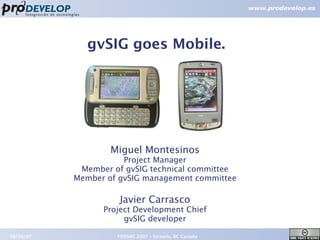
1. gvSIG goes Mobile.
Miguel Montesinos
Project Manager
Member of gvSIG technical committee
Member of gvSIG management committee
Javier Carrasco
Project Development Chief
gvSIG developer
09/26/07 FOSS4G 2007 – Victoria, BC Canada 1
3. Introduction
Introduction. Prodevelop
● Spanish company, Valencia
●
15 years of GIS experience
● 40 people
● Member of gvSIG dev. team
●
High focus on FOSS4G
www.prodevelop.es
09/26/07 FOSS4G 2007 – Victoria, BC Canada 3
5. Introduction
Introduction. gvSIG context
● Available in 10+ languages
● Around 1.500 users subscribed to lists
09/26/07 FOSS4G 2007 – Victoria, BC Canada 5
6. Introduction
Introduction. gvSIG @ FOSS4G2007
● DEMO. gvSIG.
● DEMO THEATER. Wednesday 12:40
● SEXTANTE: a gvSIG-based platform for
geographical analysis
● Victor Olaya. Univ.Extremadura.
● OAK BAY 2. Wednesday 11:30 – 12:00.
● gvSIG: towards 4D GIS
● Salva Bayarri. Iver.
● SAANICH. Thursday 10:30 - 11:00
09/26/07 FOSS4G 2007 – Victoria, BC Canada 6
7. Introduction
Introduction. gvSIG Mobile
● A prototype developed by:
● Prodevelop.
● Robotics Institute @ Univ. of Valencia
●
A proposal for a full-featured
mobile GIS project.
● Vision:
● To gain mobile devices as delivery
platforms of gvSIG.
09/26/07 FOSS4G 2007 – Victoria, BC Canada 7
9. Description
Scope. General Details
● Running Platforms
● Windows Mobile 5.0
● Windows Mobile 6.0
● Developed in Java ME
09/26/07 FOSS4G 2007 – Victoria, BC Canada 9
12. Description
Scope. Functionalities
● Tools
● Identify (Query by Point)
● Measures (coordinates/distance/area)
● Features Selection
●
GPS Support
● Internal/Bluetooth Support
● Display Coordinates
● Display Position
● Automatic Recenter based on GPS
● Waypoint Creation
● Satellite Constellation
● Tracklog Saving
09/26/07 FOSS4G 2007 – Victoria, BC Canada 12
13. Description
Scope. Functionalities
● Data Integration
● gvSIG extension for exporting data to the PDA
● Selection of Layers
● Selection of Attributes
● Clip/Select by bounding box
● Exporting of gvSIG Mobile Project
● Integration with OpenMobileIS Project:
● Geosynchronization based on files
● Bidirectional synchronization
● Direct Push to the PDA through ActiveSync
09/26/07 FOSS4G 2007 – Victoria, BC Canada 13
14. Description
Architecture
● Based on gvSIG internal architecture
● Platform
● Java ME
● CDC 1.1: Connected Device Configuration (JSR 218)
● PP 1.1: Personal Profile (JSR 216)
● AWT + some J2SE classes
● Some JNI wrappers for access to DLL's
09/26/07 FOSS4G 2007 – Victoria, BC Canada 14
15. Description
Architecture. Challenges
● JVMs
●
Java ME vs. J2SE
● GUI
● Performance
●
Open Source JVM. PhoneME project.
● Lack of Experiences
09/26/07 FOSS4G 2007 – Victoria, BC Canada 15
16. Description
Used Libraries
● They are the base of this & almost all projects
● Giants we lean on
Java
● gvSIG/FMap
● GeoTools
● Gpsylon
● RxTxComm
C/C++
● Shapelib C
● ECW SDK
09/26/07 FOSS4G 2007 – Victoria, BC Canada 16
17. Demo
Demo I
gvSIG Mobile
09/26/07 FOSS4G 2007 – Victoria, BC Canada 17
18. Demo
Demo II
How do I send data to the PDA?
1. Select & Export data from gvSIG
Easy
Things
09/26/07 FOSS4G 2007 – Victoria, BC Canada 18
19. Demo
Demo III
How do I see the data in the PDA?
2. Just Open the project in gvSIG Mobile
Easy
Things
09/26/07 FOSS4G 2007 – Victoria, BC Canada 19
20. Future Steps
Future Steps
● gvSIG Mobile will feature:
● Extra Vectorial support:
● GML
● DWG
● DGN
● ...
● Extra Raster Support
● GeoTIFF
● ¿MrSID?
● ...
09/26/07 FOSS4G 2007 – Victoria, BC Canada 20
22. Future Steps
Future Steps
● gvSIG Mobile will feature:
● Customization
● Geosynchronization
● Against gvSIG Sources
● Versioned WFS-T
● Geodatabase support:
● PostGIS
● Oracle Locator
● MySQL
● Database support built-in ¿H2, db4objects, ...?
● Much more
09/26/07 FOSS4G 2007 – Victoria, BC Canada 22
23. Conclusions
Conclusions
● GIS in mobile devices is a real needing
● FOSS4G in mobility is behind the market
● Java ME for mobile GIS is possible
● gvSIG to be available to a new & broad
range of devices
09/26/07 FOSS4G 2007 – Victoria, BC Canada 23
26. gvSIG goes Mobile
Thank you very much for your attention
Miguel Montesinos Javier Carrasco
mmontesinos@prodevelop.es jcarrasco@prodevelop.es
09/26/07 FOSS4G 2007 – Victoria, BC Canada 26