Greening of the Arctic: An IPY initiative
1-Rationale and overview of the GOA initiative.
2-North American Arctic Transect.
3-Yamal Russia Transect.
4-Circumpolar analysis of 28-year trends of sea-ice concentration, land-surface temperatures and greening patterns
The North America and Eurasia Arctic transects: Edie Barbour
Walker, D.A., Kuss, H.P., Kopecky, M., Frost, G.V., Kade, A., Vonlanthen, C., Raynolds, M.K., and Epstein, H., 2011, The North America and Eurasia Artctic transects: Using phytosociology and remote sensing to detect vegetation pattern and change: Proceedings Euiropean Vegetation Survey, 20th Workshop, Rome, 6-9 April 2011,
This is a "PHP 201" presentation that was given at the December 2010 Burlington, Vermont PHP Users group meeting. Going beyond the basics, this presentation covered working with arrays, functions, and objects.
Discussion of the science, collection and availability of lidar, specifically topobathymetric lidar. Use of NOAA/USGS Interagency Elevation Inventory leveraged
Guidelines for Modelling Groundwater Surface Water Interaction in eWater SourceeWater
One of the key challenges in modelling GW-SW interactions is the significant time-scale
differences between surface water and groundwater processes. Because groundwater
movement can be orders of magnitude slower than surface water movement, the
responses of groundwater systems to hydrological and management drivers such as
climate variability, land use change, and groundwater extraction can be very damped and
lagged. Hence, a key requirement in modelling GW-SW interactions in river system
models is to account for these time lags.
The modelling of GW-SW interactions in river system models is still very much in its
infancy, not just in Australia, but also throughout the world. As such, there is no consensus
on implementation of this functionality in river system models, and hence the little
discussion in the literature so far on what constitutes Best Practice Modelling in this
domain.
Dr. Jay Famiglietti - 21st Century Water Security and Implications for Animal...John Blue
21st Century Water Security and Implications for Animal Agriculture - Dr. Jay Famiglietti, Associate Professor at University of California, Irvine and Senior Water Scientist at the NASA Jet Propulsion Laboratory, from the 2015 NIAA Annual Conference titled 'Water and the Future of Animal Agriculture', March 23 - March 26, 2015, Indianapolis, IN, USA.
More presentations at http://www.trufflemedia.com/agmedia/conference/2015_niaa_water_future_animal_ag
Developments and directions in 3D mapping of mineral systems using geophysicsRichard Lane
(See Geoscience Australia website - https://www.ga.gov.au/products/servlet/controller?event=GEOCAT_DETAILS&catno=70386 ). “Developments and directions in 3D mapping of mineral systems using geophysics” by Richard Lane (Geoscience Australia, richard.lane@ga.gov.au). Presented at “Science at the Surveys” (Melbourne, Victoria, Australia, 22 March 2010). The primary author would like to acknowledge the assistance of many people who have provided material and thoughts for this presentation, with special mention of Richard Chopping, Marina Costelloe, David Hutchinson, Nick Williams, and Lesley Wyborn. This presentation material will be included in a lecture that will be given in various South Pacific locations during 2011 as part of the Society of Exploration Geophysicists “Honorary Lecture Program” sponsored by Shell (http://www.seg.org/).
Presentation given during the kick-off of the TU Delft Climate Institute on March 1st 2012. Sea level rise is one of the reserach topics of the new institute. Dr Bert Vermeersen explained why.
Surface and soil moisture monitoring, estimations, variations, and retrievalsJenkins Macedo
This presentation explored five leading articles in the remotely sensed and in situ surface and soil moisture monitoring, estimations, variations, and retrievals for global environmental change. The presentation gives insight to the purpose of each study, subjects of investigations, methods used to collect and analyze data sets, results and implications, and conclusions. This project is in fulfillment of the course on remote sensing for global environmental change and precedes our preview on water resources monitoring. This project was conducted by Christina Geller, 5th year accelerated graduate student in Geographic Information Systems for Development, and Environment and Jenkins Macedo, 2nd year graduate students in Environmental Science and Policy at the Department of International Development, Community, and Environment (IDCE) at Clark University. All academic materials used in this study were appropriately referenced (see bibliography for details).
Similar to WE1.L10 - GRACE Applications to Regional Hydrology and Water Resources (20)
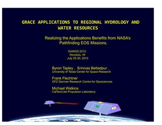
WE1.L10 - GRACE Applications to Regional Hydrology and Water Resources
1.
GRACE
APPLICATIONS
TO
REGIONAL
HYDROLOGY
AND
WATER
RESOURCES
Realizing the Applications Benefits from NASA’s
Pathfinding EOS Missions,
IGARSS 2010
Honolulu, HI
July 25-30, 2010
Byron Tapley , Srinivas Bettadpur ,
University of Texas Center for Space Research
Frank Flechtner
GFZ German Research Centre for Geosciences
Michael Watkins
CalTech/Jet Propulsion Laboratory
1-08-2008
3. Secular/Episodic Gravity Changes
Difference of two 2-year means (2003-2004 and 2005-2006)
(degree/order 30 or ~700 km resolution)
GIA over Canada;
Lake Victoria basin Sumatra-Andaman
Greenland & Alaska
mass loss
Earthquake
ice mass losses
microgal
1-08-2008
5. Resent Results: The Global Water Cycle
Global Gravity Measurements
are Used to Determine Mean
Global Mass Distribution and the
Temporal Variations. which
measures change in water mass
of land and oceans
GRACE measures the change
in all forms of the water stored
on land after precipitation has
been stored as snow, filtrated
into the ground, evaporated or
left a basin as stream flow
Storage Change = Inflow (Precipitation) – Outflow (Evaporation + Streamflow)
9. Variability in Ice-Mass Change
104 Gt/yr
246 Gt/yr
.
137Gt/yr
2004 2005 2006 2007 2008 2009
286 Gt/yr
From Watkins et al, 2009
(from Velicogna et al, 2009)
10. Groundwater Monitoring
Estimates match groundwater well measurements
Illinois
Illinois
280,000 sq km
Swenson, 2007
Method is applied in regions where groundwater is not well monitored, but
depletion is likely: Africa, Middle East, etc.
11. GRACE DETECTS UNSUSTAINABLE GROUNDWATER LOSS
Water Storage Anomaly
Drawdown by 31 km3
(= 1 Lake Mead)
in 66 months
Famiglietti et al., 2009
Observed trends in Sacramento and
San Joaquin River basins
in California. Sierra Nevada October,
2003 – March, 2009
Loss of 109 km3
(3 Lake Meads)
over 72 months
Rodell et al., 2009
Pattern of groundwater depletion in NW
India
12.
13.
14.
15. GRACE Follow-On Status: 2007-10
• NASA accepted GRACE-II as a Decadal Survey mission, but the
launch date (~>2020) would create a significant gap in this critical
climate dataset.
• Science Community has expressed concern about the loss in
measurement continuity.
• GRACE Follow-On studies were split into two parts
– Focus on quick gap-filling for GRACE continuity, building on the
GRACE heritage and to be launched ~2015.
– Longer term more for improved measurement precision to be >~2020.
• NASA included the GRACE Climate Continuity mission, Grace
FO, in the President’s FY 2011 Budget Initiative
– Planned as a possible NASA/ DLR Implementation for launch in
2016
7/28/10 15