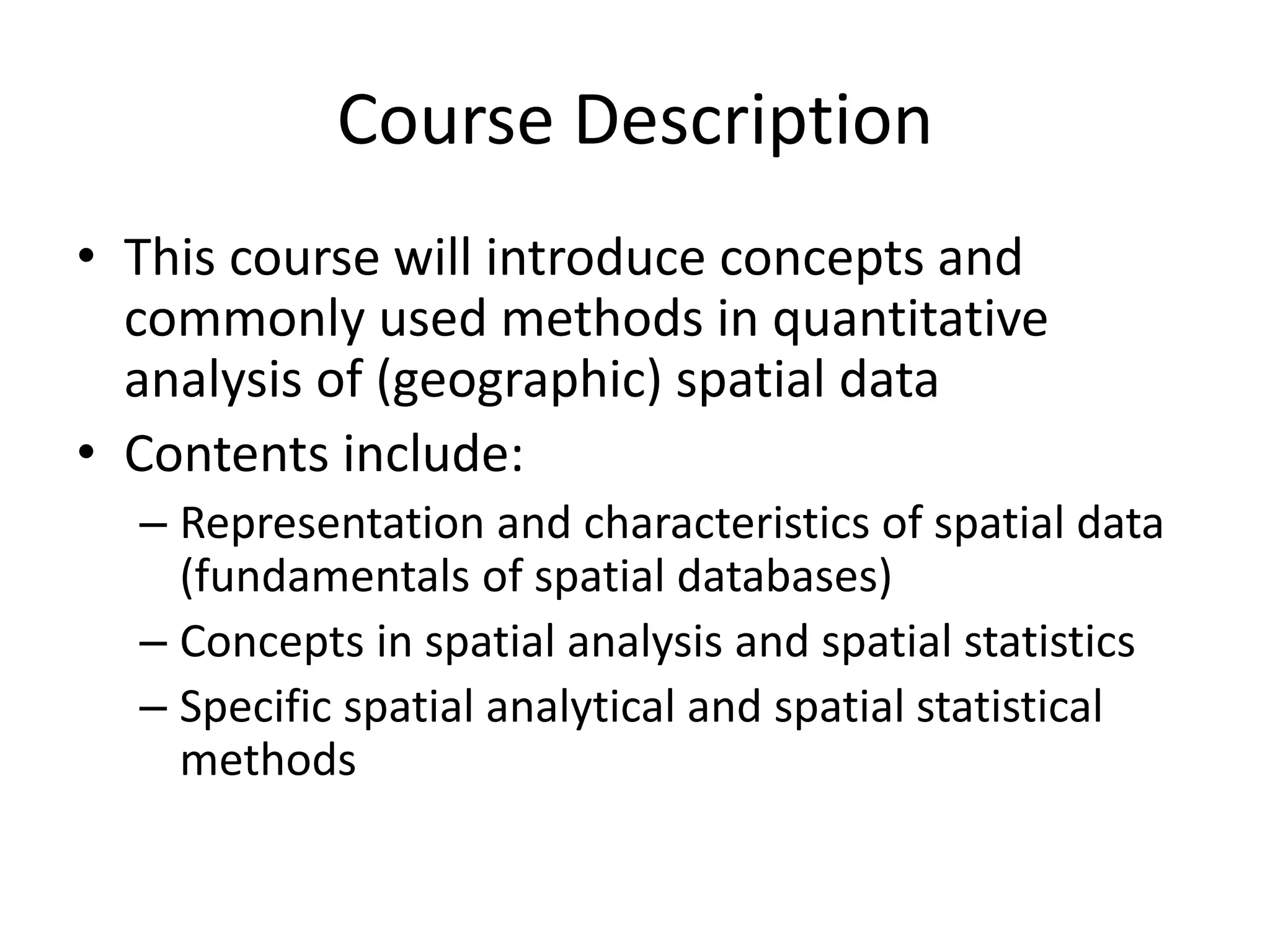
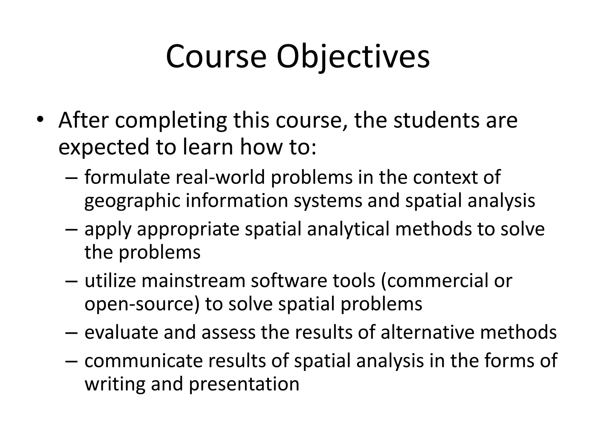
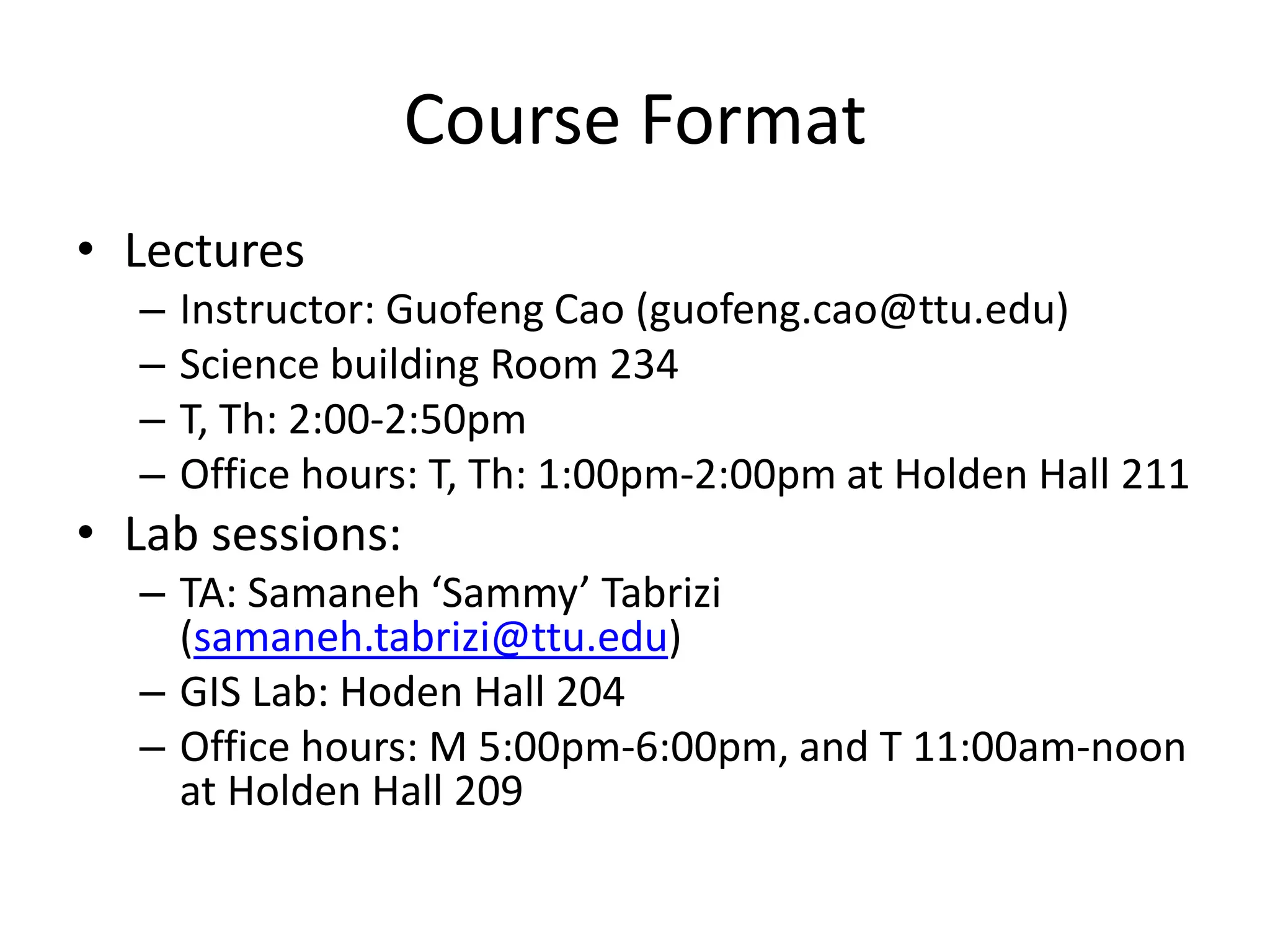
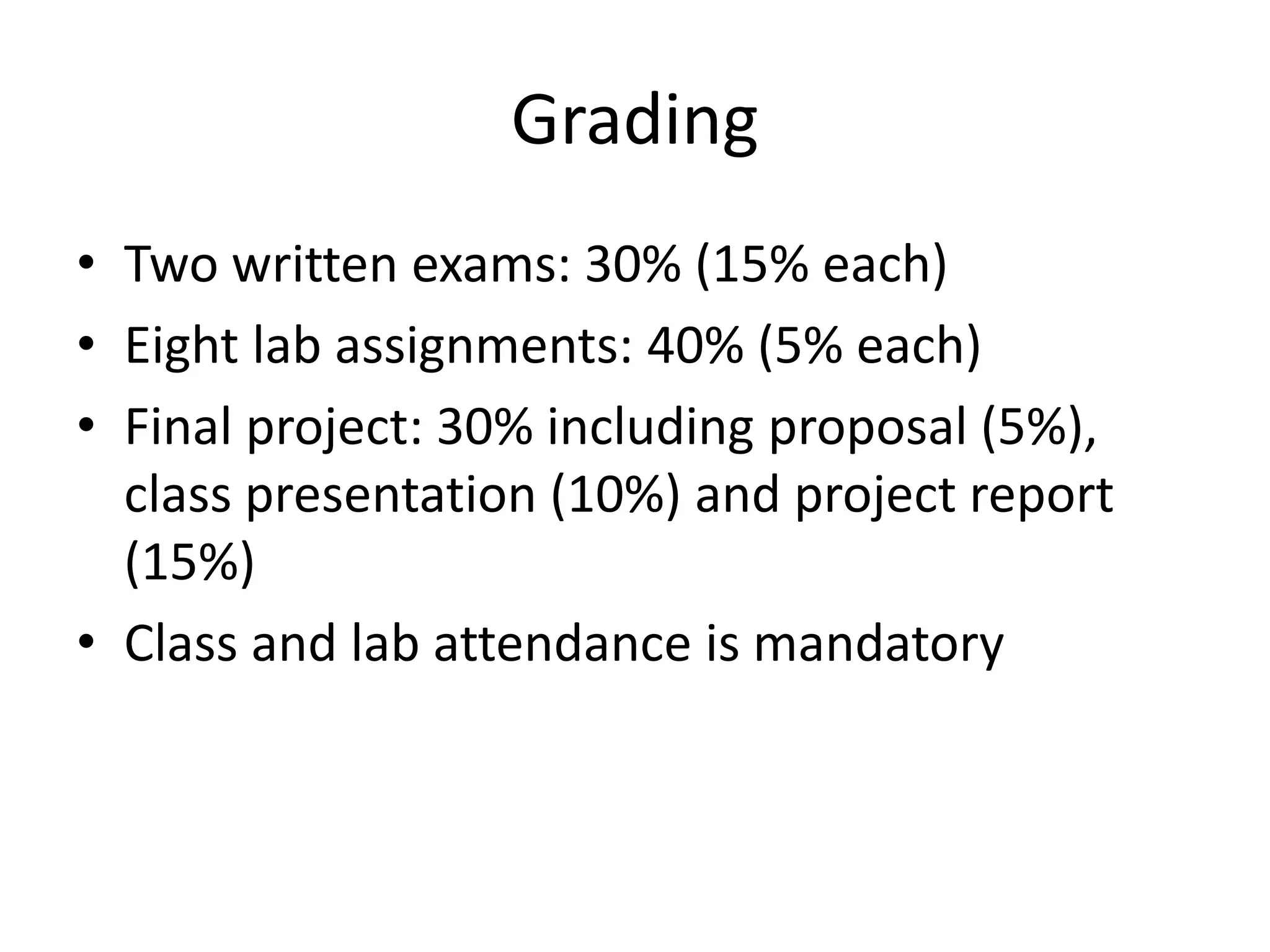
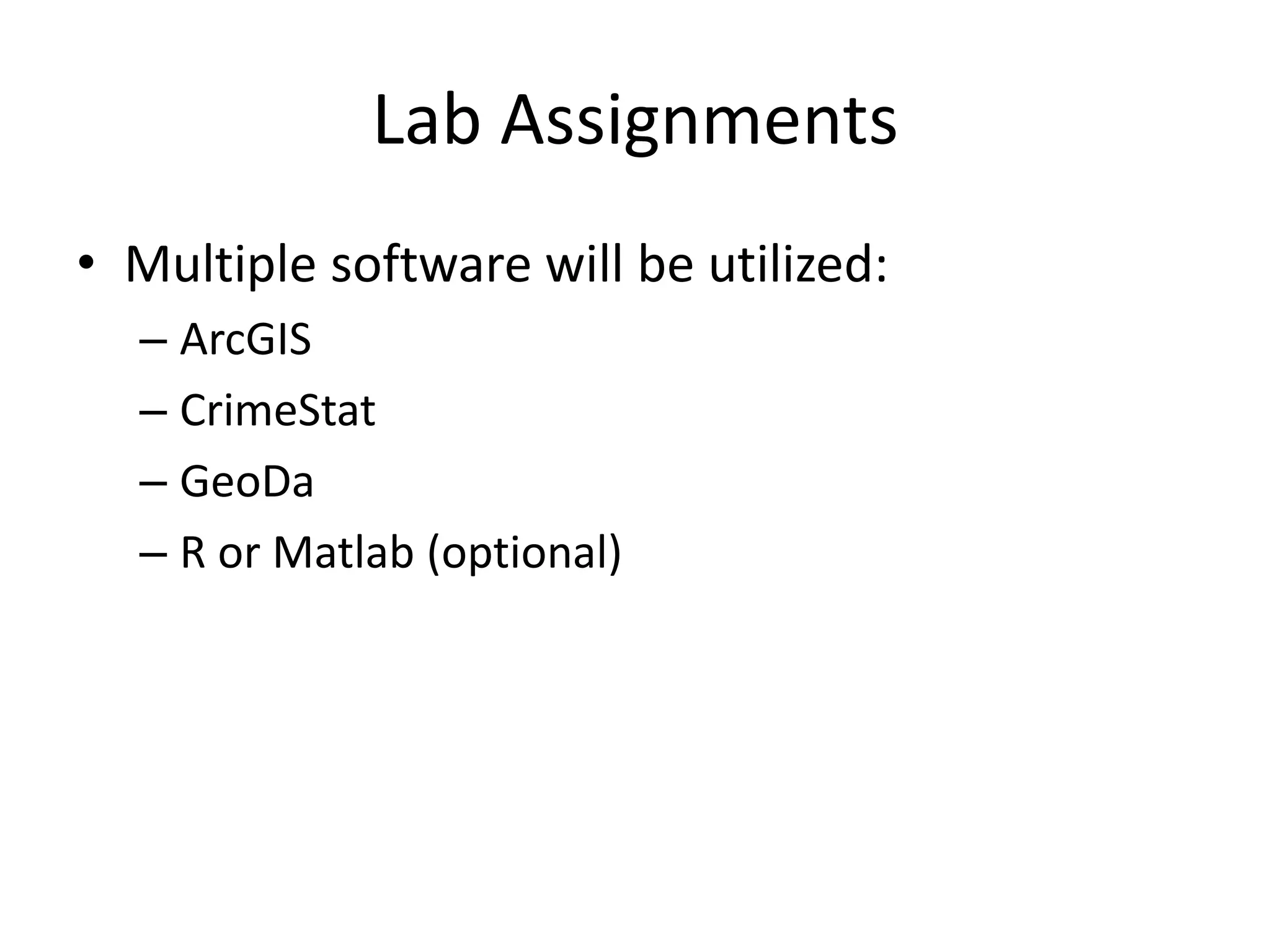
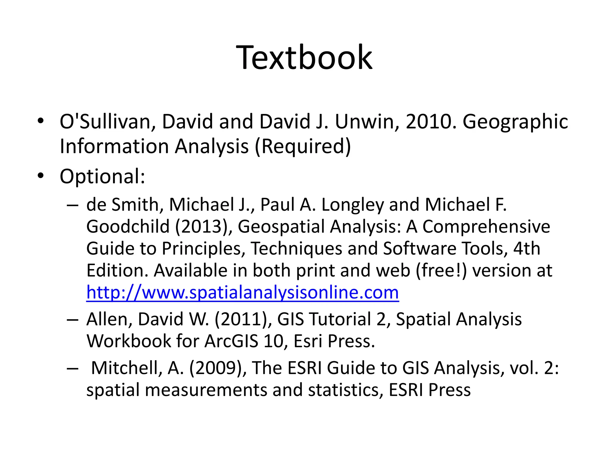
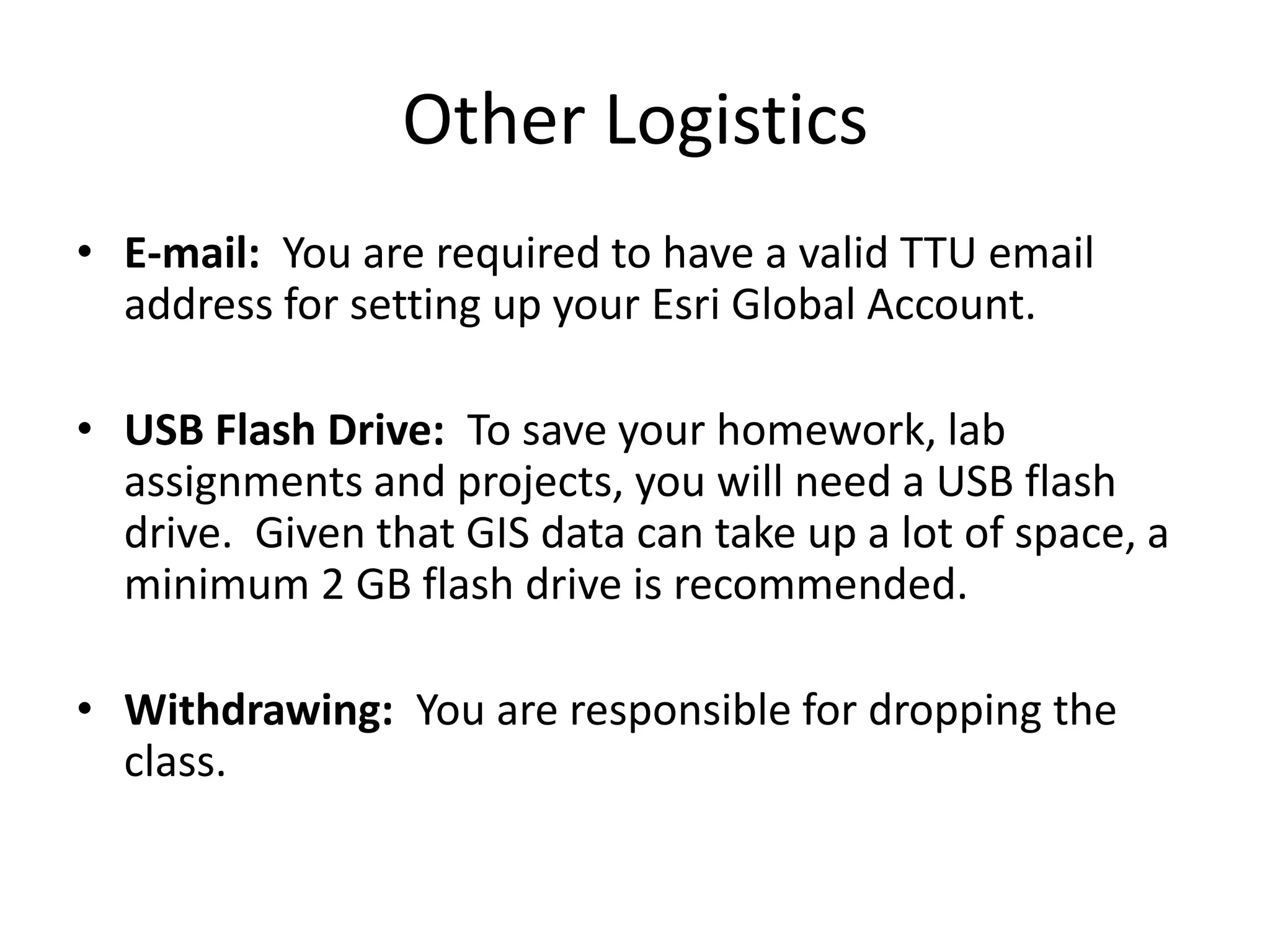
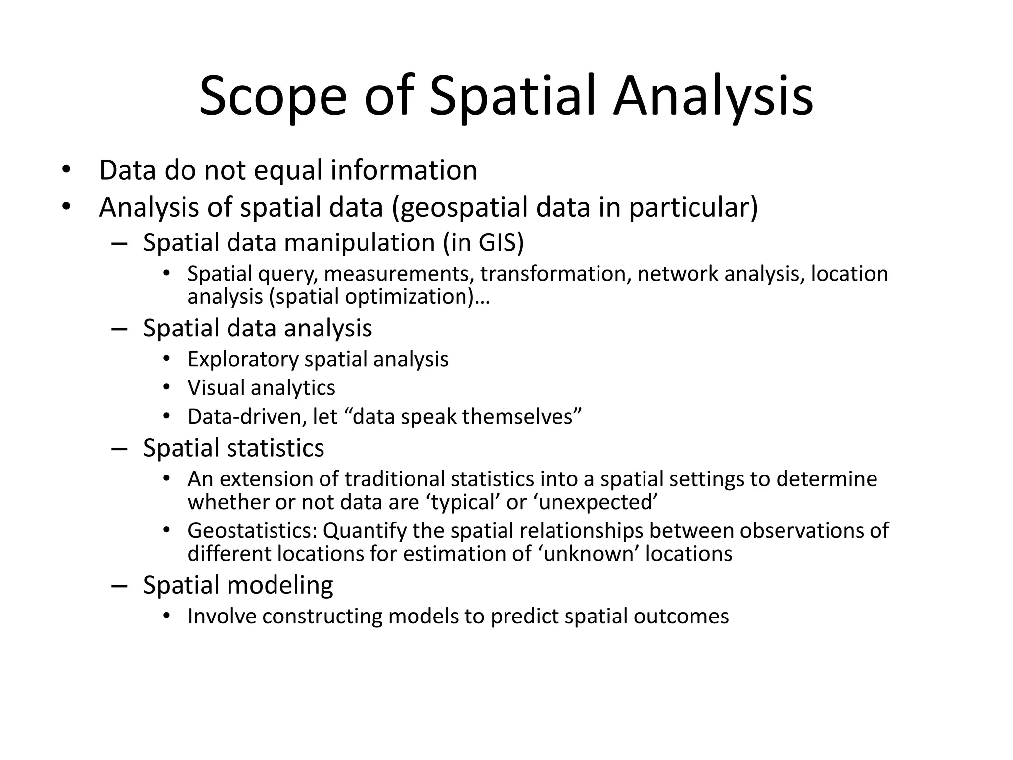
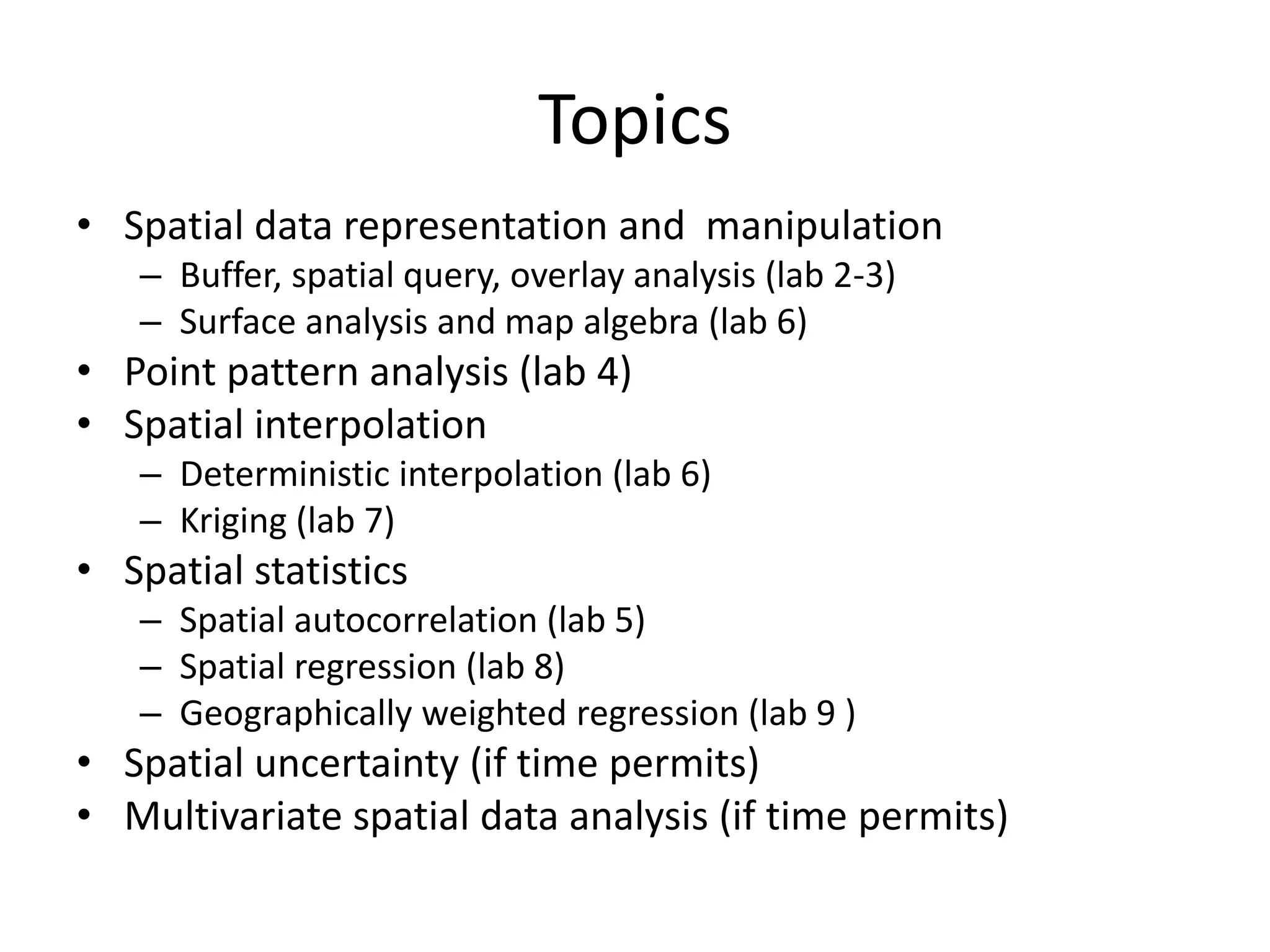
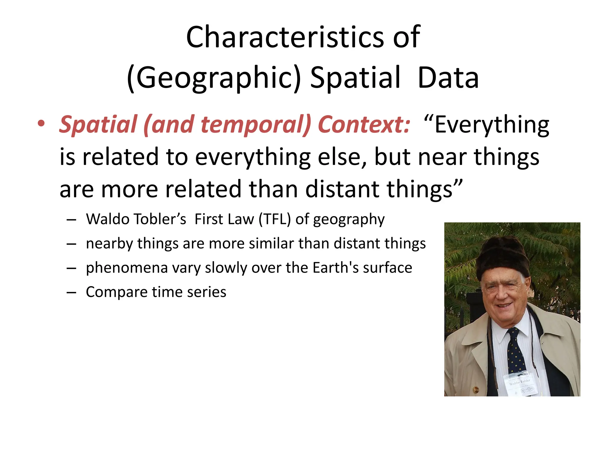
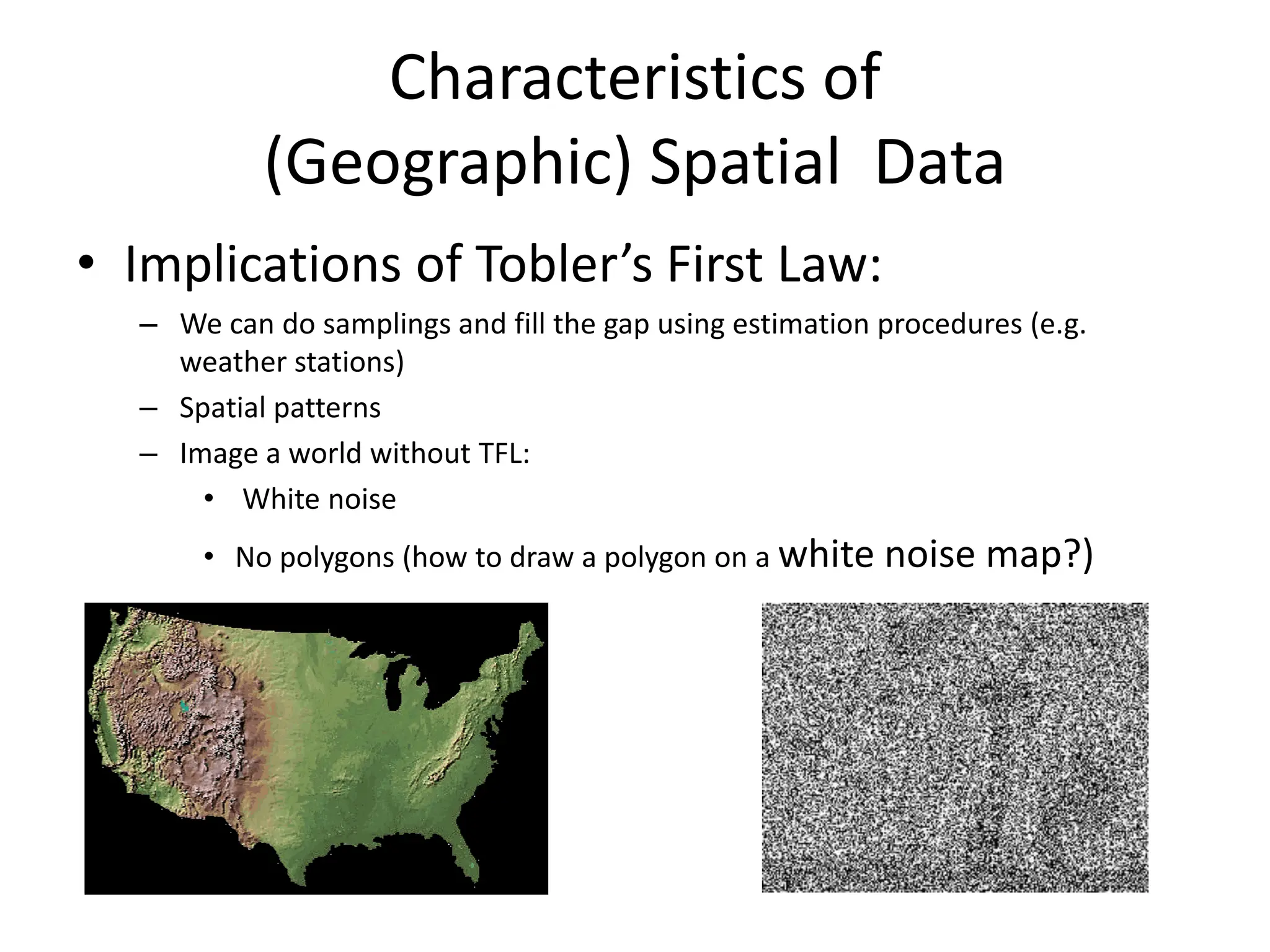
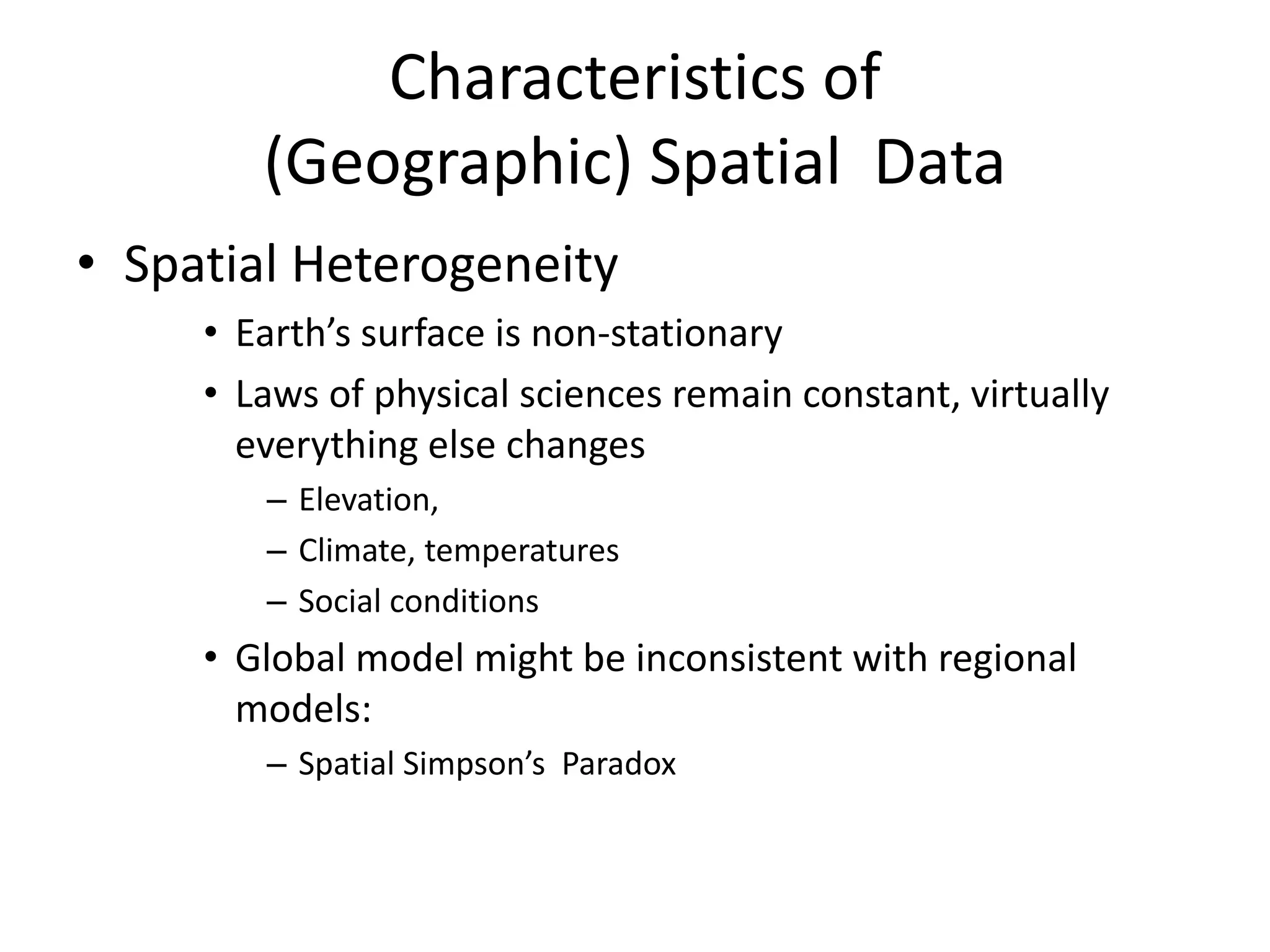
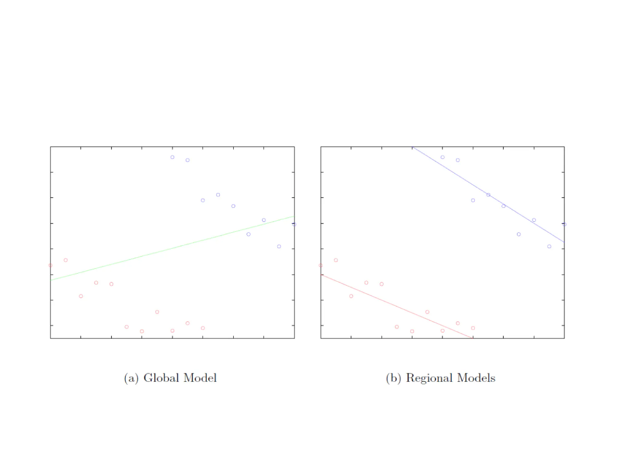
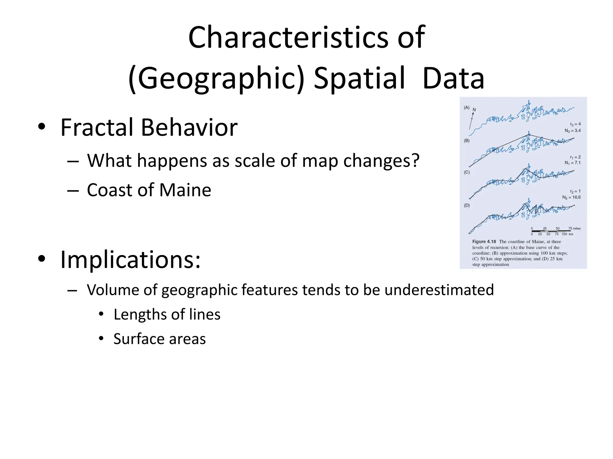
(9818099198) Call Girls In Noida Sector 14 (NOIDA ESCORTS)
gis mathematicalgis mathematical modelling
1. Spatial Analysis and Modeling
(GIST 4302/5302)
Guofeng Cao
Department of Geosciences
Texas Tech University
2. Geographic Information Science and Technology (GIST)
3 Core Courses and 2 Electives
GIST 5300. Geographic Information Systems (3)
GIST 5302.Spatial Analysis and Modeling (3)
GIST 5304. Advanced Geographic Information Systems (3)
GIST 5308. Cartographic Design (3)
GIST 5310. GPS Field Mapping (3)
GIST 5312. Internet Mapping (3)
GEOG 5301. Remote Sensing of the Environment (3)
GEOL 5341. Digital Imagery in the Geosciences (3)
GEOL 5342. Spatial Data Analysis and Modeling in Geosciences (3)
NRM 5404. Aerial Terrain Analysis (4)
TTU Graduate Certificate
3. Geographic Information Science and Technology (GIST)
2 Core Courses and 4 Approved Electives
GIST 3300. Geographic Information Systems (3) (Required for Geography
Major)
GIST 4302. Spatial Analysis and Modeling (3)
GIST 4304. Advanced Geographic Information Systems (3)
GIST 4308. Cartographic Design (3)
GIST 4310. GPS Field Mapping (3)
GIST 4312. Internet Mapping (3)
GEOG 3301. Remote Sensing of the Environment (3)
GEOL 4341. Digital Imagery in the Geosciences (3)
GEOL 4342. Spatial Data Analysis and Modeling in Geosciences (3)
NRM 4404. Aerial Terrain Analysis (4)
Undergraduate Minor in GIST
4. Course Description
• This course will introduce concepts and
commonly used methods in quantitative
analysis of (geographic) spatial data
• Contents include:
– Representation and characteristics of spatial data
(fundamentals of spatial databases)
– Concepts in spatial analysis and spatial statistics
– Specific spatial analytical and spatial statistical
methods
5. Course Objectives
• After completing this course, the students are
expected to learn how to:
– formulate real-world problems in the context of
geographic information systems and spatial analysis
– apply appropriate spatial analytical methods to solve
the problems
– utilize mainstream software tools (commercial or
open-source) to solve spatial problems
– evaluate and assess the results of alternative methods
– communicate results of spatial analysis in the forms of
writing and presentation
6. Course Format
• Lectures
– Instructor: Guofeng Cao (guofeng.cao@ttu.edu)
– Science building Room 234
– T, Th: 2:00-2:50pm
– Office hours: T, Th: 1:00pm-2:00pm at Holden Hall 211
• Lab sessions:
– TA: Samaneh ‘Sammy’ Tabrizi
(samaneh.tabrizi@ttu.edu)
– GIS Lab: Hoden Hall 204
– Office hours: M 5:00pm-6:00pm, and T 11:00am-noon
at Holden Hall 209
7. Grading
• Two written exams: 30% (15% each)
• Eight lab assignments: 40% (5% each)
• Final project: 30% including proposal (5%),
class presentation (10%) and project report
(15%)
• Class and lab attendance is mandatory
8. Lab Assignments
• Multiple software will be utilized:
– ArcGIS
– CrimeStat
– GeoDa
– R or Matlab (optional)
9. Final Project
• The project could be used as a setting for your
thesis and dissertation topics, other course
topics or research interests
• Start to think of the project ideas early and
communicate with the instructor and TA for
comments
10. Textbook
• O'Sullivan, David and David J. Unwin, 2010. Geographic
Information Analysis (Required)
• Optional:
– de Smith, Michael J., Paul A. Longley and Michael F.
Goodchild (2013), Geospatial Analysis: A Comprehensive
Guide to Principles, Techniques and Software Tools, 4th
Edition. Available in both print and web (free!) version at
http://www.spatialanalysisonline.com
– Allen, David W. (2011), GIS Tutorial 2, Spatial Analysis
Workbook for ArcGIS 10, Esri Press.
– Mitchell, A. (2009), The ESRI Guide to GIS Analysis, vol. 2:
spatial measurements and statistics, ESRI Press
11. Other Logistics
• E-mail: You are required to have a valid TTU email
address for setting up your Esri Global Account.
• USB Flash Drive: To save your homework, lab
assignments and projects, you will need a USB flash
drive. Given that GIS data can take up a lot of space, a
minimum 2 GB flash drive is recommended.
• Withdrawing: You are responsible for dropping the
class.
12. Survey
• Name, major, year
• GIS experiences (courses taken, projects
participated, etc.)
• What do you expect to learn from this class?
• Programming experiences (programming
languages, databases, and etc). There would
be file if you don’t have
14. Scope of Spatial Analysis
• Data do not equal information
• Analysis of spatial data (geospatial data in particular)
– Spatial data manipulation (in GIS)
• Spatial query, measurements, transformation, network analysis, location
analysis (spatial optimization)…
– Spatial data analysis
• Exploratory spatial analysis
• Visual analytics
• Data-driven, let “data speak themselves”
– Spatial statistics
• An extension of traditional statistics into a spatial settings to determine
whether or not data are ‘typical’ or ‘unexpected’
• Geostatistics: Quantify the spatial relationships between observations of
different locations for estimation of ‘unknown’ locations
– Spatial modeling
• Involve constructing models to predict spatial outcomes
16. Characteristics of
(Geographic) Spatial Data
• Spatial (and temporal) Context: “Everything
is related to everything else, but near things
are more related than distant things”
– Waldo Tobler’s First Law (TFL) of geography
– nearby things are more similar than distant things
– phenomena vary slowly over the Earth's surface
– Compare time series
17. Characteristics of
(Geographic) Spatial Data
• Implications of Tobler’s First Law:
– We can do samplings and fill the gap using estimation procedures (e.g.
weather stations)
– Spatial patterns
– Image a world without TFL:
• White noise
• No polygons (how to draw a polygon on a white noise map?)
18. Characteristics of
(Geographic) Spatial Data
• Spatial Heterogeneity
• Earth’s surface is non-stationary
• Laws of physical sciences remain constant, virtually
everything else changes
– Elevation,
– Climate, temperatures
– Social conditions
• Global model might be inconsistent with regional
models:
– Spatial Simpson’s Paradox
19.
20. Characteristics of
(Geographic) Spatial Data
• Fractal Behavior
– What happens as scale of map changes?
– Coast of Maine
• Implications:
– Volume of geographic features tends to be underestimated
• Lengths of lines
• Surface areas
21. Lab of this week
• Review of map projection:
– Mercator puzzle: http://gmaps-
samples.googlecode.com/svn/trunk/poly/puzzledr
ag.html