Download to read offline


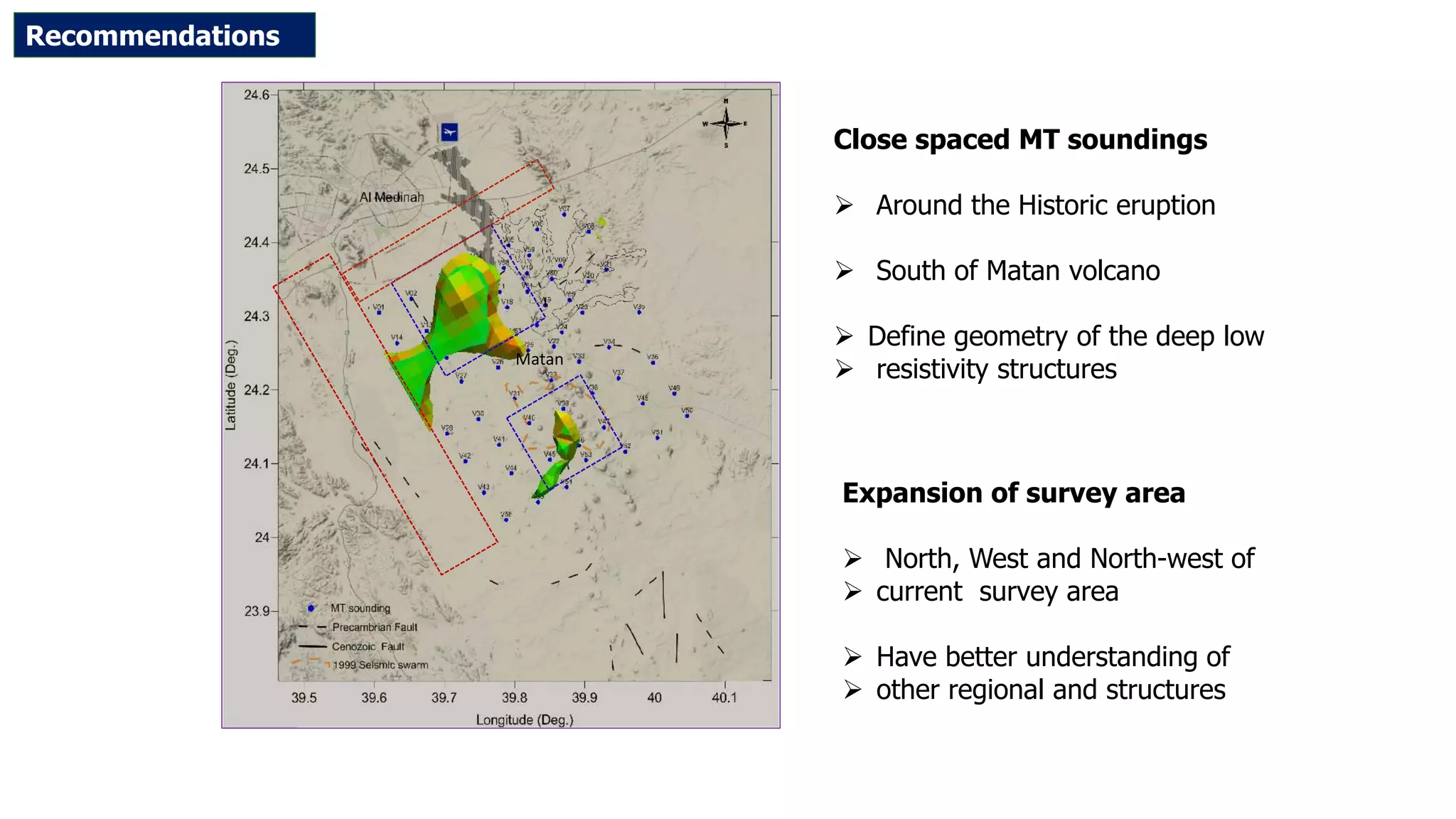


This document summarizes magnetotelluric (MT) data collection and analysis to explore geothermal potential in the Rahat volcanic field in Saudi Arabia. 65 MT sites were surveyed across a 1050 km2 area with 5 km spacing. Data was analyzed using 2D and 3D inversion models. Results identified two resistivity peaks in the northwest and southern ends, possibly indicating geothermal reservoirs. The study recommends additional close-spaced MT soundings and expanding the survey area to better define deep resistivity structures.


