This document summarizes a study that evaluated the behavior of the Gelabar Earth Dam in Iran during construction and first watering using numerical modeling and comparison with data from instruments installed on the dam. The study used the Plaxis software to model pore water pressure, stresses, and other parameters in two dimensions. Results from the numerical model were compared to measurements from piezometers, soil pressure instruments, and subsidence monitors to calibrate the model parameters. The study found generally good agreement between the model and instrument data, indicating the dam was behaving safely and as expected during initial filling.
Emperical and Numerical Solution Of Seepage Problems Underneath Hydraulic S...RafidAlboresha
Hydraulic structures are structures submerged or partially submerged in water, they’re used to retain or divert natural water flow. Any hydraulic structure that retains water is faced with seep-age problems as the water seeks the path with the least resistance through or under the hydraulic structure. If the water carries materials as it flows or exerts high pressure on the floor of the structure, it will cause failures such as piping and cracks and there are many ways to prevent that, including cutoffs. In this paper, seepage is analyzed for different cases by using the empirical method (Khosla’s theory) and the numerical method by using computer software (SEEP/W). The results had some slight differences between the two methods as a result of not taking into account the effect of soil characteristics of the empirical method. However, the water pressure heads underneath the impervious floor that calculated by the numerical method were greater.
Spe 163367-ms-p Modelling of regional aquifer.....Burgan Field Minagish Reser...Stephen Crittenden
Bergan Field Kuwait. The Minagish Reservoir comprising oolite shoals, is aquifer pressure connected to other fields in the region which interact with each other.
Dr. Malek Smadi, Ph.D. thesis lateral deformation and associated settlement r...Dr. Malek Smadi
Settlement of structures on soft clay deposits results from flow and consolidation of soil. In the latter case, water squeezes out from under the structure, whereas in the former case soil squeezes out. Settlement resulting from flow of soil depends on the factor of safety against undrained instability.
In construction situations where the factor of safety is small, an accurate prediction of settlement reSUlting from flow of soil is required. Field measurements of horizontal deformation of soft clays during and after construction of embankments and storage facilities have been collected from throughout the world, covering 180 case histories, to relate lateral deformation to the factor of safety and to develop a practical procedure for computing settlements resulting from flow of soil.
The rapid drawdown effects directly on the stability of upstream slope of earth
dams, where the seepage direction will be in the reverse direction due to emergency
emptiness, which causes flow from downstream to upstream through the dam body,
such flow may be not considered in design. In this research two cases of rapid
drawdown are adopted, in the first case, the reservoir is empty from service canal
(outlet flow) where the discharge of this canal is 200 m3/sec. In the second case, the
reservoir is empty by spillway canal with discharge capacity equal to 2750 m3/sec.
The results show that the discharge from spillway takes a few hours which threaten
the dam stability compering with allowable factor of safety while discharge from
outlet flow service takes a few days and the threaten was nominal, both of them under
rapid drawdown condition .
International Journal of Engineering Research and Applications (IJERA) aims to cover the latest outstanding developments in the field of all Engineering Technologies & science.
International Journal of Engineering Research and Applications (IJERA) is a team of researchers not publication services or private publications running the journals for monetary benefits, we are association of scientists and academia who focus only on supporting authors who want to publish their work. The articles published in our journal can be accessed online, all the articles will be archived for real time access.
Our journal system primarily aims to bring out the research talent and the works done by sciaentists, academia, engineers, practitioners, scholars, post graduate students of engineering and science. This journal aims to cover the scientific research in a broader sense and not publishing a niche area of research facilitating researchers from various verticals to publish their papers. It is also aimed to provide a platform for the researchers to publish in a shorter of time, enabling them to continue further All articles published are freely available to scientific researchers in the Government agencies,educators and the general public. We are taking serious efforts to promote our journal across the globe in various ways, we are sure that our journal will act as a scientific platform for all researchers to publish their works online.
Overbank Flow Condition in a River SectionIDES Editor
When the flows in natural or man made channel
sections exceed the main channel depth, the adjoining
floodplains become inundated and carry part of the river
discharge. Due to different hydraulic conditions prevailing in
the river and floodplain of a compound channel, the mean
velocity in the main channel and in the floodplain are different.
This leads to the transfer of momentum between the main
channel water and that of the floodplain making the flow
structure more complex. Results of some experiments
concerning the overbank flow distribution in a compound
channel are presented. Flow sharing in river channels is
strongly dependant on the interaction between flow in the
main channel and that in the floodplain. The influence of the
geometry on velocity and flow distribution and different
functional relationships are obtained. Dimensionless
parameters are used to form equations representing the over
bank flow sharing in the subsections. The equations agree
well with experimental discharge data and other published
data. Using the proposed method, the error between the
measured and calculated discharge distribution for the a
compound sections is found to be the minimum when compared
with that using other investigators.
International Journal of Engineering Research and Applications (IJERA) is an open access online peer reviewed international journal that publishes research and review articles in the fields of Computer Science, Neural Networks, Electrical Engineering, Software Engineering, Information Technology, Mechanical Engineering, Chemical Engineering, Plastic Engineering, Food Technology, Textile Engineering, Nano Technology & science, Power Electronics, Electronics & Communication Engineering, Computational mathematics, Image processing, Civil Engineering, Structural Engineering, Environmental Engineering, VLSI Testing & Low Power VLSI Design etc.
Evaluation of Modelling of Flow in Fracturesidescitation
Heat-transport is important for geothermal exploration. The presence of
fractures can have a pronounced effect on groundwater and heat transfer.The inclusion of
fractures into geothermal reservoir models on different scales is often still a difficult task. A
comparison of approaches for flow in fractures has been carried out. A very simple
approach is to simulate fractures with thin but highly conductive layers, for instance by
applying the Cubic-Law. A more sophisticated approach, typically in FEM codes, is the
application of lower dimensional (1D/2D) high permeable discrete elements with specific
flow properties, following e.g. Hagen-Poiseuille or Manning-Strickler. However, such an
approach typically fails while studying only partly saturated fractures. For studying the
applicability of simplified fracture modellingapproaches a comparison with a CFD
(Computational Fluid Dynamics) solution was performed. Furthermore a DEM (Discrete
Element Method)approach has been illuminated. The various methodologies are studied by
varying roughnesses,this way studying the versatility of the approach. The sensitivity of
flow in fractures to various numerical parameters can be studied this way. A detailed
analysis of temperature and flow using Péclet and Reynolds numbers helps to quantify the
contributions of the different transfer processes.
Review on Design Optimization of Liquid Carrier Tanker for Reduction of Slosh...IOSR Journals
Abstract: This Paper Reviews Briefly The Current Research On Sloshing And Its Effect In Liquid Carrier
Tanker. The Aim Of This Paper To Study The Basics Of Sloshing And Its Prevention (Mainly In Liquid Carrier
Tanker) The Liquid Sloshing Is Free Surface Fluctuation Of Liquid When Its Container Is Excited By External
Vibrations Such As Earthquakes. The Liquid Sloshing May Cause Various Engineering Problem, For Example
Instability Of Ships In Aero Engineering And Ocean Engineering, Failures On Structural Systems Of The
Liquid Container. The Tanker Used For The Transportation Of Liquid Over The Road-Ways Is An Integral
Part Of The Carrier/Vehicle. The Tanker Is Expected To Withstand The Unbalanced Forces On Account Of
Transit Over Uneven And Irregular Surfaces/Contours Of The Road As Also Due To Sudden Acceleration Or
Deceleration (Due To Application Of Brakes).
Keywords-Sloshing, Impact, Baffle, Simulation
Application of Buckley-Leverett Equation in Modeling the Radius of Invasion i...IJERD Editor
A thorough review of existing literature indicates that the Buckley-Leverett equation only analyzes
waterflood practices directly without any adjustments on real reservoir scenarios. By doing so, quite a number
of errors are introduced into these analyses. Also, for most waterflood scenarios, a radial investigation is more
appropriate than a simplified linear system. This study investigates the adoption of the Buckley-Leverett
equation to estimate the radius invasion of the displacing fluid during waterflooding. The model is also adopted
for a Microbial flood and a comparative analysis is conducted for both waterflooding and microbial flooding.
Results shown from the analysis doesn’t only records a success in determining the radial distance of the leading
edge of water during the flooding process, but also gives a clearer understanding of the applicability of
microbes to enhance oil production through in-situ production of bio-products like bio surfactans, biogenic
gases, bio acids etc.
Experimental conceptualisation of the Flow Net system construction inside the...Dr.Costas Sachpazis
ABSTRACT
By means of a drainage and seepage tank, an experimental flow net system inside the body of a homogeneous earth embankment dam model, formed from Leighton Buzzard Silica sand, was developed and studied in this experimental research paper.
Water flow through dams is one of the basic problems for geotechnical engineers. Seepage analysis in an important factor to be considered in the proper design of many civil engineering structures. Seepage can occur in both through the structure itself as the case of earth dams and under foundations of an engineering structure. Successful seepage analysis is achieved on the proper and accurate construction of a flow net.
Amongst the various existing methods of seepage analysis, the “Finite Element Method” and the method of “Experimental Flow Nets” are the most widely used ones.
Construction of a flow net is mainly used for solving water flow problems through porous media where the geometry makes sometimes analytical solutions impractical. This method is usually used in soil mechanics, geotechnical or civil engineering as an initial check for problems of water flow under hydraulic structures like embankments or dams. As such, a grid obtained by drawing a series of equipotential lines and stream or flow lines is called a flow net. In this procedure the Laplace equation principles must be satisfied.
Hence, the construction of a flow net is an important tool in analysing two-dimensional irrotational flow problems and provides an approximate solution to the flow problem by following simple rules, as initially set out by Forchheimer, 1900, and later refined by Casagrande,1937. It can also be very useful tool even for problems with complex geometries, as proven in this experimental research paper.
The objectives of this experimental research paper are:
• To determine the position and shape of the flow line representing the uppermost free water surface inside the body of a dam by using a drainage and seepage tank,
• To conceptualise the flow lines system and to demonstrate that each flow line starts perpendicular to the upstream slope of the dam and that that slope is a boundary equipotential line,
• To construct an experimental flow net and subsequently to verify and analyse it by the FEA method,
• To calculate the rate of seepage through the dam body, and
• To summarise the calculations and experimental findings in a concise and readable format.
In order to achieve these objectives, an experimental flow net system inside the body of a homogeneous earth embankment dam model was formulated by using a drainage and seepage tank.
From the constructed flow net in the present experimental research paper, an attempt has been made to analyze, determine and present the following parameters:
The pressure drop from one side of the embankment to the other,
The seepage flow rate in each flow “channel”,
The total seepage flow rate, and
The pore pressure ratio, ru, for the embankment.
THE APPLICATION OF MATHEMATICAL MODELS IN MANAGEMENT OF AQUIFERAnonymouslVQ83F8mC
Before feeling water -shortage crisis human has understood the importance of water From the
religious texts. Considering recent conditions of the world the water will replace most recent
boundaries, at future. Imamzadeh Jaafar plain is located 5 kilometers northeast of Gachsaran, south
of Kohgilooye and Boerahmad province. The plain has 61km 2 area extents and contains two,
alluvial and carbonate aquifers. These aquifers supply the water needs, agricultural, industrial and
domestic. Highly exploitation and transportation of groundwater resources, especially by National Oil
Company, caused highly drawdown in alluvial aquifer, 1.85m in a 5 years period from 1361 to
1365 as reported by Mahab Ghods Consulting Engineers. There are two artificial recharge
projects, 1 flood spreading system and 1 recharge ponds system, in the plain. To present the future
water resources management program the hydrogeological behaviors of the alluvial aquifer and the
effects of artificial recharge must be evaluated. edrock, hydrodynamic coefficients, topography, water
resources and were collected, field surveys were performed and required maps were prepared. Using
conceptual model and MODFLOW PMWIN code the mathematical model of the plain was
calibrated against water year 1380 -81 and then verified against water year 1384 - 85. The verified
model was used to predict future conditions of aquifer. The results implied the rapid response of
aquifer to precipitation due to high aquifer ransmissivity, positive water budget at year 1385
comparing year 65, change of direction of groundwater flow from plain outlet to the center of
plain in response to highly exploitation at the center of plain, water level in the wells located
downward the flood spreading system will raise as 1 to 6m and water level in t he wells located
downward the recharge pond system will lower as 1 to 4m.
THE APPLICATION OF MATHEMATICAL MODELS IN MANAGEMENT OF AQUIFERamsjournal
Before feeling water -shortage crisis human has understood the importance of water From the
religious texts. Considering recent conditions of the world the water will replace most recent
boundaries, at future. Imamzadeh Jaafar plain is located 5 kilometers northeast of Gachsaran, south
of Kohgilooye and Boerahmad province. The plain has 61km 2 area extents and contains two,
alluvial and carbonate aquifers. These aquifers supply the water needs, agricultural, industrial and
domestic. Highly exploitation and transportation of groundwater resources, especially by National Oil
Company, caused highly drawdown in alluvial aquifer, 1.85m in a 5 years period from 1361 to
1365 as reported by Mahab Ghods Consulting Engineers. There are two artificial recharge
projects, 1 flood spreading system and 1 recharge ponds system, in the plain. To present the future
water resources management program the hydrogeological behaviors of the alluvial aquifer and the
effects of artificial recharge must be evaluated. edrock, hydrodynamic coefficients, topography, water
resources and were collected, field surveys were performed and required maps were prepared. Using
conceptual model and MODFLOW PMWIN code the mathematical model of the plain was
calibrated against water year 1380 -81 and then verified against water year 1384 - 85. The verified
model was used to predict future conditions of aquifer. The results implied the rapid response of
aquifer to precipitation due to high aquifer ransmissivity, positive water budget at year 1385
comparing year 65, change of direction of groundwater flow from plain outlet to the center of
plain in response to highly exploitation at the center of plain, water level in the wells located
downward the flood spreading system will raise as 1 to 6m and water level in t he wells located
downward the recharge pond system will lower as 1 to 4m.
THE APPLICATION OF MATHEMATICAL MODELS IN MANAGEMENT OF AQUIFERpijans
Before feeling water -shortage crisis human has understood the importance of water From the
religious texts. Considering recent conditions of the world the water will replace most recent
boundaries, at future. Imamzadeh Jaafar plain is located 5 kilometers northeast of Gachsaran, south
of Kohgilooye and Boerahmad province. The plain has 61km 2 area extents and contains two,
alluvial and carbonate aquifers. These aquifers supply the water needs, agricultural, industrial and
domestic. Highly exploitation and transportation of groundwater resources, especially by National Oil
Company, caused highly drawdown in alluvial aquifer, 1.85m in a 5 years period from 1361 to
1365 as reported by Mahab Ghods Consulting Engineers. There are two artificial recharge
projects, 1 flood spreading system and 1 recharge ponds system, in the plain. To present the future
water resources management program the hydrogeological behaviors of the alluvial aquifer and the effects of artificial recharge must be evaluated. edrock, hydrodynamic coefficients, topography, water resources and were collected, field surveys were performed and required maps were prepared. Using
conceptual model and MODFLOW PMWIN code the mathematical model of the plain was calibrated against water year 1380 -81 and then verified against water year 1384 - 85. The verified model was used to predict future conditions of aquifer. The results implied the rapid response of
aquifer to precipitation due to high aquifer ransmissivity, positive water budget at year 1385 comparing year 65, change of direction of groundwater flow from plain outlet to the center of
plain in response to highly exploitation at the center of plain, water level in the wells located downward the flood spreading system will raise as 1 to 6m and water level in t he wells located
downward the recharge pond system will lower as 1 to 4m.
THE APPLICATION OF MATHEMATICAL MODELS IN MANAGEMENT OF AQUIFERpijans
Before feeling water -shortage crisis human has understood the importance of water From the
religious texts. Considering recent conditions of the world the water will replace most recent
boundaries, at future. Imamzadeh Jaafar plain is located 5 kilometers northeast of Gachsaran, south
of Kohgilooye and Boerahmad province. The plain has 61km 2 area extents and contains two,
alluvial and carbonate aquifers. These aquifers supply the water needs, agricultural, industrial and
domestic. Highly exploitation and transportation of groundwater resources, especially by National Oil
Company, caused highly drawdown in alluvial aquifer, 1.85m in a 5 years period from 1361 to
1365 as reported by Mahab Ghods Consulting Engineers. There are two artificial recharge
projects, 1 flood spreading system and 1 recharge ponds system, in the plain. To present the future
water resources management program the hydrogeological behaviors of the alluvial aquifer and the
effects of artificial recharge must be evaluated. edrock, hydrodynamic coefficients, topography, water
resources and were collected, field surveys were performed and required maps were prepared. Using
conceptual model and MODFLOW PMWIN code the mathematical model of the plain was
calibrated against water year 1380 -81 and then verified against water year 1384 - 85. The verified
model was used to predict future conditions of aquifer. The results implied the rapid response of
aquifer to precipitation due to high aquifer ransmissivity, positive water budget at year 1385
comparing year 65, change of direction of groundwater flow from plain outlet to the center of
plain in response to highly exploitation at the center of plain, water level in the wells located
downward the flood spreading system will raise as 1 to 6m and water level in t he wells located
downward the recharge pond system will lower as 1 to 4m.
THE APPLICATION OF MATHEMATICAL MODELS IN MANAGEMENT OF AQUIFERpijans
Groundwater models are often developed to obtain predictions of societal importance. Such
predictions might be the response of an aquifer to future groundwater pumping, or the
groundwater transport of contaminants from a source location. Because the groundwater flow
system characteristics represented in such models are always unknown to some degree, model
predictions are uncertain. To reduce this prediction uncertainty, it is necessary to improve the
model so that it more accurately represents the flow system
THE APPLICATION OF MATHEMATICAL MODELS IN MANAGEMENT OF AQUIFERamsjournal1
Before feeling water -shortage crisis human has understood the importance of water From the
religious texts. Considering recent conditions of the world the water will replace most recent
boundaries, at future. Imamzadeh Jaafar plain is located 5 kilometers northeast of Gachsaran, south
of Kohgilooye and Boerahmad province. The plain has 61km 2 area extents and contains two,
alluvial and carbonate aquifers. These aquifers supply the water needs, agricultural, industrial and
domestic. Highly exploitation and transportation of groundwater resources, especially by National Oil
Company, caused highly drawdown in alluvial aquifer, 1.85m in a 5 years period from 1361 to
1365 as reported by Mahab Ghods Consulting Engineers. There are two artificial recharge
projects, 1 flood spreading system and 1 recharge ponds system, in the plain. To present the future
water resources management program the hydrogeological behaviors of the alluvial aquifer and the
effects of artificial recharge must be evaluated. edrock, hydrodynamic coefficients, topography, water
resources and were collected, field surveys were performed and required maps were prepared. Using
conceptual model and MODFLOW PMWIN code the mathematical model of the plain was
calibrated against water year 1380 -81 and then verified against water year 1384 - 85. The verified
model was used to predict future conditions of aquifer. The results implied the rapid response of
aquifer to precipitation due to high aquifer ransmissivity, positive water budget at year 1385
comparing year 65, change of direction of groundwater flow from plain outlet to the center of
plain in response to highly exploitation at the center of plain, water level in the wells located
downward the flood spreading system will raise as 1 to 6m and water level in t he wells located
downward the recharge pond system will lower as 1 to 4m.
International Journal of Engineering Research and Applications (IJERA) is an open access online peer reviewed international journal that publishes research and review articles in the fields of Computer Science, Neural Networks, Electrical Engineering, Software Engineering, Information Technology, Mechanical Engineering, Chemical Engineering, Plastic Engineering, Food Technology, Textile Engineering, Nano Technology & science, Power Electronics, Electronics & Communication Engineering, Computational mathematics, Image processing, Civil Engineering, Structural Engineering, Environmental Engineering, VLSI Testing & Low Power VLSI Design etc.
IRJET- Parameters Affecting the Clogging of Recharge Wells in Different Soil ...
Gelabar duc
1. European Online Journal of Natural and Social Sciences 2014; www.european-science.com
Vol.3, No.4 Special Issue on Architecture, Urbanism, and Civil Engineering
ISSN 1805-3602
657
Evaluation of Gelabar Earth Dam Behavior during Construction and First
Watering by the Method of Limited Components and Comparison with Real
Amount Resulted by Precise Instruments Data
Reza Mollaei1
*, Mohammad Mollaei2
, Mohammad Hossein Noori Gheidari1
, Hamid Ali Elahi1
1
Department of Civil Engineering, Zanjan Branch, Islamic Azad University, Zanjan, Iran
2
Department of Civil Engineering, Qazvin Branch, Islamic Azad University, Zanjan, Iran
*E-mail: mollaei.reza585@gmail.com
Abstract
The increase in pore water pressure in earth-rock fill dams with clay core during construction
and first watering can cause the start and progress in hydraulic fracture. Construction costs being
high and also the damage caused by dams’ fracture make the necessity of taking care and behavior
survey of earth dams, more obvious than anything. According to this, in this research while
modeling Gelabar earth dam, pore water pressure, pore water pressure ratio, the amount of total
stress and effective stress, arching and lateral soil pressure ratio is measured and has been compared
with the amount measured by precise instruments which has the construction capability of Plaxis
v8.5 for numerical modeling from two –dimensioned software, has been used. Behavior models
used in this analysis, Moher- Coulomb and it is xis v8 hardening. Considering the data of precise
instruments installed on Dam’s body and implementing return analysis, real parameters of
construction materials was obtained. Evaluation of numerical modeling results and precise
instruments can find out an appropriate Dam behavior and consequently, the correct modeling
procedure. Also, studies have been indicator of suitable stability and safe position for Gelabar Dam.
Keywords: Gelabar Dam, Precise instruments, Numerical Analysis, Pore water pressure,
Total stress, Effective stress, Arching
Introduction
Earth dam development has caused that most dams in the world to be of earth – rock fill type. In the
past, for the lack of knowledge from these dams’ behavior, the height of earth dams were limited,
but today, by the development of soil mechanics science and the existence of advanced soft wares
for the modeling and analysis of earth dams, the height of theses dams has been increased. Among
high earth dams in the world, Roguni Dam with the height of 335 meters 1 can be mentioned which
is located in Russia (Saeedi Nia , Akbari, and Salemi, 2012). Considering high cost of construction
of Dams and extensive damages caused by their unsafety, dams’ sustainability control is of great
importance. In order to evaluate Dam’s behavior, Return analysis method can be utilized. In this
method, Dam performance has been measured through the assessment of results obtained from
precise instruments used on Dam’s body, is evaluated. For Dam’s behavior logy, the results obtained
by precise instruments are compared with preliminary suppositions related to Dam design. Earth
Dams having various parts include: core, crust, filter, drainage, Rock-fill cover (Rip Rap). In these
types of dams sealing is done by core. Dam core can be constructed by construction materials with
low penetration like: Clay and Concrete that because of appropriate flexibility of Clay and it is being
economic, in most Earth dams clay has been used for the core construction. In these dams because
the lack of penetration in construction materials of the core, the increase in dam reservoir balance in
preliminary watering period causes the rise in pore water pressure on the core. By The increase in
pure water pressures the effective stress between sand particles decreases that this issue causes soil
shear and the increase of the risk of Dam hydraulic rupture. Therefore, created pore water pressure
2. Special Issue on Architecture, Urbanism, and Civil Engineering
Openly accessible at http://www.european-science.com 658
control during preliminary watering period, plays a significant role in dam’s stability. Also, the
control of existing stress on dam’s body and comparing it with the amounts considered in
preliminary dam design is of great importance in conservation of dam’s stability. Maleki and
Alavifar (2005), have evaluated behavior of Masjed Soleiman ‘s Dam along with numerical analysis
through FLAC 4.0 software. Parameters; pore water pressure ratio ,have expressed and determined
arching and the amount of changes in total stress and transformations due to first watering of Dam’s
reservoir , can threaten Dam’s stability. Mirghassemi and Mokrami Ghartavol (2013) by using
piezometers’ results and applied stress testers in clay core of Gelabar Dam, have evaluated Dam’s
status during construction and return analysis have been implemented by ABAQUS software, finally
they have expressed that the amounts of pore water pressure in core during construction of Dam,
total stress changes and effective stress have been at acceptable range. Niroumand et al (2000) have
evaluated and expressed the function of Karkhe Dam, which is considered one of the largest earth
dams in Iran, by using the results of precise instruments and return analysis have been implemented
through CA2 software that regarding measured vertical pressure, there is a great conformity among
the results obtained from precise instruments and the software. Aflaki (2009) evaluated Shirin
Darreh earth dam and expressed that regarding Dam subsidence and total stress ,there is a relatively
great conformity among the result of software, stress testers and subsidence testers. Nik-khah in the
year 2007[8], evaluated the precise instrument installed on Molla Sadra earth Dam’s body and
considering the rate Arching ratio which was between 0.45 to 0.58, he expressed that Molla Sadra
Dam is at suitable condition. Cherzanovski et al (2002) have evaluated the parameters of earth
dam’s construction materials, at Diamond Lake and valley, based on geodesy measurement and
provided a method of using limited element analysis, for modeling the impact of dam construction
materials saturation in order to determine and change sites during reservoir watering.
In the present research return numerical analysis have been implemented and main
parameters of construction materials have been specified and then they studied the pore water
pressure, pore water pressure ratio, the amount of total stress and effective stress, Arching, soil
lateral pressure ratio (Malaei, 2014).
Materials and methods
General features of Gelabar Dam
Gelabar Earth- Rock fill dam is locate at Zanjan, 50 kms south –west Ejroud Sub-province
and 3kms to Gelabar village and on Sajass River, which is at the moment the largest dam in the
province. The maximum height of the Dam; from bed rock 82 meters (from level 1628 to 1710) and
the dam crest height is, 247 meters. Utilizing this Dam, has made 8 acres of rain fed lands of
Ejeroud sub-province have become watered land and in addition, it supplies the water for industries
such as petrochemicals. This dam has been constructed with the objective of Sajs roud flood control,
agricultural, industrial and services water supply , increase of agricultural products , lateral
industries and creating jobs. Utilizing this Dam, 46 million cube meters of water supply for
agricultural lands and sub-province’s industries have been regulated by this dam. Gelabar Dam , has
been instrumented in 8 sections and the applied types of precise instruments on dam’s body are as
follows:
47 Electronic Piezometers of vibrating web( EP), 34 vertical pipe piezometers, and
observation wells on rest points(P).
69 Soil pressure measuring tools, including Quintuplet clusters (PC). Inequality testers and
the plate levels of subsidence testers are in 8 transverse sections of the Dam, 5-5 section is the
middle section and the most highest and full of instruments, in Gelabar Dam. The mentioned section
3. Reza Mollaei, Mohammad Mollaei, Mohammad Hossein Noori Gheidari, Hamid Ali Elahi
Openly accessible at http://www.european-science.com 659
is analyzed as the maximum and most critical section (figure 1),and also( figure 2 ) shows the
General plan of Gelabar Dam.
Figure 1. Section 5-5 Gelabar Dam Figure 2. General Plan of Gelabar Dam
Modeling steps for Gelabar Dam and the implementation of return analysis
The main objective of applying return analysis, is to achieve to more precise features of
containing construction materials of the Dam and the closeness of model behavior to the real dam
behavior. Comparing the results of precise instruments and numerical model can achieve the
parameters which makes the model behavior close to the reality. In Gelabar Dam before return
analysis ,the accuracy of the precise instruments’ results has been evaluated and considering the
evaluations implemented ,Dam’s existing condition was determined that installed piezometers at
level 1690,because of the low embankment on them and also piezometers at level 1655 because soil
unsaturation until day 280 of Dam construction , and the piezometers installed at level 1629 located
at lower hand of the core ,do not show correct function.
PLAXIS V8.5 software is used for modeling analysis. This software has been written based
on the limited components relationships that are able to analyze stress- transformation and stability
of geotechnical structures in plain strain status and also calculation of water flow in these types of
structures (Brinkgreve and Vermeer, 2001).
Two below models are used in Gelabar dam analysis:
А - Moher- Coulomb Model
This model is used in many researches because of simplicity and no need for numerous
parameters. The concept of plasticity is mainly related to irreversible strains. For this reason a
subordinate of stress-strain surrender is introduced as a level in main stress environment so that
plastic points can be evaluated. It is obvious that some points in surrender level have a complete
flexible behavior. Based on this model, strain and the rate of strain are comprised of two parts of
elastic and plastic. In other words,
= = ( - ) (1)
According to plasticity theory (Hill,1950), plastic strains are in the proportion of derivation
of surrender function towards stresses. In other words, plastic strains can be considered as vectors
vertical to surrender level. Based on this , the relationship between the rate of effective stress and the
rate of effective strain can be obtained.
́ = ́
́
(2)
4. Special Issue on Architecture, Urbanism, and Civil Engineering
Openly accessible at http://www.european-science.com 660
In this equation d = ́
́
. Moher- Coulomb surrender standard has been according to
main stresses and comprises of a hexahedron cone in major stress environment can be shown as
general equation;
, , ́ , , ́ , , ́ , , ́ , , sin ∅ cos ∅ 0 (3)
In which k,j and i respectively are 2,3 and 1. Two parameters of ∅ and C in this model are
adherence and soil fraction degree. Also, six potential function of plastic can be defined and the
general equation below:
, , ́ , , ́ , , ́ , , ́ , , sin 0 (4)
Ψ parameter has been the dilatation angle which with its aid volume strain of saturated soils,
can be modeled.
В - Hardening model
In hardening behavioral model, the surrender level in major stress environment has not been
limited and because of the existence of plastic strains, the below level is developed. In this model
there are two hardening shear and compressive stresses which are respectively applied for modeling
the strains of non –flexible plastics of comprehensive deviated stress and pressured stress. Also, this
model has an application for the simulation of soft and hard soils. When the soil is under deviated
stress, the soil hardness has been decreased and plastic strains are developed. This kind of behavior
is capable of modeling through hyperbolic model (Duncan and Chang,1970). Hardening model
because of utilizing plasticity theory and entering dilatation parameters and also soil hardness to
stress and strain is more appropriate alternative. One of features of this model is dependence of soil
hardness to stress which in consolidation conditions is expressible as below:
⁄ (5)
For the soft soils supposed that m=1 is close to reality. In this case
=
∗⁄ (6)
∗
= 1⁄ (7)
In these equations is reference stress and ∗
is modified compaction index. In a
similar type, flexibility ratio of unloading and reloading can be related to modified inflation ratio
Ƙ∗
, in other words
=3 1 2 Ƙ∗
⁄ (8)
Ƙ∗
Ƙ 1⁄ (9)
In which is Poisson ratio of unloading and reloading. In this model the impact of soil
movement or secondary subsidence that mainly occurs in long –term, is not considered.
Hardening soil model is an advanced model for soil behavior simulation. for Mouher –
Coulomb model the limited stress status is described through fraction angle Φ and adherence c and
dilatation angle Ψ ,while that in hardening model ,the soil hardness is described more accurately by
using three different inputs , three axis loading E50 ,hardness of three axis unloading Eur and
hardness of audio meter loading , the main difference in Mouher- Coulomb model and hardening
soil is that hardening soil model is subordinate to stress, and has considered hardness. This means
all hard nesses increase with pressure. Therefore, each three hard nesses affiliated to reference stress
are considered 100 kpa. Summary of modeling procedures are this way that after implementation of
Plaxis Program and applying required preliminary adjustments, model geometry is drawn precisely
and by using standard fixities selection, defined constraints and after this stage, construction
material features of each cluster, considering tables 1 and 2 in preliminary analysis and table 3 in
return analysis are defined. More to that, meshing operation has been done and after definition of
5. Reza Mollaei, Mohammad Mollaei, Mohammad Hossein Noori Gheidari, Hamid Ali Elahi
Openly accessible at http://www.european-science.com 661
preliminary water level , we enter measurement stage that in model related to Gelabar Dam, include
sixteen different construction stages that are respectively are evaluated.
First measurement stage is related to conditions Dam site during excavation and the second
measurement stage is of status where embankments around dam has been constructed and the first
layer of dam body is also constructed. The Dam body embankment stages of third to seventh stage
are evaluated layer by layer. Seventh stage up to next is related to the period of first dam reservoir
watering. Gelabar Dam watering has started on Aug, 2006 and the reservoir water level has reached
a relatively fixed level [4]. Different kinds of calculations are listed in Calculation type section that
considering the type of required calculation, one of them is selected. Plastic type is for the status
that there is no need to consider the time in calculations and this type of calculations is used in most
Geotechnical issues. Consolidation type is for condition where it is required that Consolidation in
Model to be considered. In this type the loading measurement is done in stages. Selecting this type
of calculation, software through stage loading evaluates the consolidation phenomenon in model.
Ph/ic reduction is for the calculation of dam’s reliability ratio for stability. In this method soil
parameters (tan f and c) are regularly decreased so that the soil is raptured. In present model for first
and second phase , calculation type is plastic and for other phases except last phase consolidation
calculation type is supposed. In only last phase that deals with the determining relaibility level
against stability. Type of calculation is Ph/ic reduction.
After the completion of calculation operation, at the top of the page, output option is
appeared. To see the output of each phase, first we select it and then we click on out put option. In
output page using existing options in menu at the top of the page, all information regarding stress,
obeisance, pore water pressure, water flow line, and dam body subsidence can be obtained. Next , as
a sample is mentioned , related to pore water pressure is created in cross section of Gelabar dam
(Malaei, 2014).
After preliminary analysis, main and first input parameters should be changed logically to
software like elasticity and penetration module considering Dam’s real behavior, so that the real
behavior is also created in model. Pore pressure is of important issues in soil mechanics engineering.
Changes in pore pressure ratio in earth dams at construction time, depends on factors such as:
overhead pressure, the speed of embankment, drainage speed, penetration, saturation degree and soil
density. The increase in pore pressure has caused soil shear resistance and it threatens dam stability.
Therefore, by controlling embankment speed, pore pressure speed can be controlled. Through
increase of elasticity module, the soil becomes harder and its density is increased, this matter causes
the soil mass become less dense and smaller values of is transferred to existing liquid phase and it
causes the amounts of extra pore water pressure on soil. Also by decrease in penetration, the
amounts of water created in pore pressure, will be more. Another effective parameter in modeling is
the percentage of soil density (Niroomand, 1996). The more the percentage of soil density is, the
more the created pore pressure will be. Since, the embankment density in Dams such as Gelabar
Dam with high density percentage and close to 90% is applied and this amount increases by
continuing embankment till the complete saturation. In numerical model, the dense soil has been
supposed saturated form the beginning. It is worth –mentioning that the penetration of dam
foundation at contact place with core has been improved by cement slurry injection (Consolidation
Injection). Therefore, in numerical model also in order to reset parameters, foundation penetration
has been decreased.
The features of construction materials comprising Gelabar Dam that includes five main
sections: Clay Core, Filter, Crust (Sand), Crust (Land-fill) and foundation, include: table (1) related
to the amounts of main and first parameters based on Mouher- Coulomb and table (2)related to the
6. Special Issue on Architecture, Urbanism, and Civil Engineering
Openly accessible at http://www.european-science.com 662
amounts of main and first parameters is regarding hardening behavior and resulted parameters of
return analysis and reset is expressed in table 3
Table 1. Geotechnical Parameters of applied construction materials in Gelebar Dam , Mouher
Coulomb modele
eo k (m/sec) n F C (Kpa) E (Mpa) gd (t/m2) Construction material
features
0.54 1E-9 0.3 27 10 25 1.7 Clay Core
0.18 1E-5 0.3 35 0 28 2.0 Filter
0.18 1E-5 0.3 42 0 40 2.0 Crust (sand)
0.11 1E-5 0.3 46 0 54 22 Crust(rock- fill)
0.25 1E-7 0.24 36 100 150 23 Foundation
Table 2. Geotechnical Parameters of applied construction materials in Gelebar Dam,
hardening model
Table 3. Geotechnical parameters of Gelabar Dam(the amounts used in return analysis).
e o k (m/sec) n F C (Kpa) E (Mpa) gd (t/m2) Construction material features
0.54 5.7E-10 0.3 27 15 17.8 1.7 Clay Core
0.18 1E-5 0.3 35 0 28 2.0 Filter
0.18 1E-5 0.3 42 0 40 2.0 Crust (sand)
0.11 1E-5 0.3 46 0 54 22 Crust(rock- fill)
0.25 1.58E-8 0.24 36 100 150 23 Foundation
Evaluation of pore water pressure
A set of piezometers cross- section 5-5 include: four piezometers at level 1629, 5
piezometers at level 1639, four piezometers at level 1655 and two piezometers at level 1690 that
precise instruments readings from the first day of installation till the day 2020 is registered and in
access. It is worth- mentioning that Gelabar dam’s lake watering from the day 428 of construction
has been started.
Figure 3. Gelabar dam Embankment level and watering
1630
1640
1650
1660
1670
1680
1690
1700
1710
1720
0 500 1000 1500 2000 2500
water level
Fill elevation Day of reading
اheight
(m)
Eref50 (MPA) Erefoed (MPA) Erefur (MPA) Construction material features
27.50 32.07 85.95 Clay Core
30.80 35.92 96.26 Filter
165.00 192.45 515.70 Foundation
44.00 48.96 137.52 Crust (sand)
50.40 66.52 185.65 Crust(rock- fill)
7. Reza Mollaei, Mohammad Mollaei, Mohammad Hossein Noori Gheidari, Hamid Ali Elahi
Openly accessible at http://www.european-science.com 663
Figure 4. Changes in pore water pressure, level 1629.
Figure 5. Piezometer function, level 1629, lower hand the core .
Figure 6 . Piezometer level 1639, upper hand filter
0
100
200
300
400
500
600
-18-13-8-32712
Day 154
Day 345
Day 811
Day 1009
Day 2020
distance from core
centre
pressure
KN/
0
50
100
150
200
250
300
350
400
450
500
0 500 1000 1500 2000 2500
Mohr coulomb
Measured
Hardening
Back – Mohr
Back ‐ Hardening
Reading Day
0
100
200
300
400
500
600
0 500 1000 1500 2000 2500
Mohr coulomb
Measured
Hardening
Back – Mohr
Back ‐ Hardening
Reading Day
8. Special Issue on Architecture, Urbanism, and Civil Engineering
Openly accessible at http://www.european-science.com 664
Figure 7. Piezometer, level 1655, upper hand the core
The results of software results along with the results obtained from precise instruments in
order to evaluate the correctness of dam‘s function during construction and first watering, in figure
3-7, have been compared and the figure 3 has showed the embankment procedure and Dam’s
watering during construction and its first watering .
Studies show that the pore water pressure during construction increases by the increase in
embankment level and by starting dam watering and reaching the water level to the piezometers and
water level getting higher at upper and of the Dam, piezometers show more pore water pressure, of
course the Piezometer installed upper hand of the core affects more from upper hand water level and
when we move down from upper hand to the lower hand, the rate of impacting becomes less and the
time of impacting becomes more, its reason is also the low penetration of construction material of
the core , of course after watering and through the passage of time the pore water pressure Figure
,comes out ascending status and it follows a descending procedure for some time, that the reason for
this is the consolidation phenomenon. Results obtained from modeling based on the preliminary
construction materials’ features show that, precise instruments show more pore water pressure but in
return analysis done, through the decrease of foundation penetration because of consolidation
injection operation at the place of connection of dam’s body to the foundation by cement slurry and
the change in effective parameters, the curve of changes in model has had more proportionate
function with precise instruments. Also reviews show , installed piezometers at level 1690 lower
hand and upper hand of the core for the low embankment(maximum 20 m), show ineligible amounts
for pore water pressure which these data are not attributable.
Evaluation of changes in general and effective changes
Set of tools in 5-5 cross- section
Cross –section 5-5, level 1639, has five Total Pressure Cells (TPC) and at level 1655 has 3
TPCs has been installed that each TPC includes five tester in different directions and a piezometer.
‐50
0
50
100
150
200
250
300
350
0 500 1000 1500 2000 2500
Measured
Hardening
Mohr coulomb
Back – Mohr
Back ‐ Hardening
Reading Day
9. Reza Mollaei, Mohammad Mollaei, Mohammad Hossein Noori Gheidari, Hamid Ali Elahi
Openly accessible at http://www.european-science.com 665
Figure 8. Effective stress, level 1639, core upper head, P.W Axis 90
Figure 9. Total stress, level 1639, lower hand the core, FLAT
Figure 10. Total stress, level 1639, upper hand filter to DS to - 45
Figure 11. Total stress, level 1655, upper hand the core , V to axis- 90
0
20
40
60
80
100
120
140
0
100
200
300
400
500
600
700
800
0 1 000 2 000 3 000
sig'‐yy
water level
press
ure
KN/
Reading Day
0
200
400
600
800
1000
1200
1400
0 500 1000 1500 2000 2500
Mohr coulomb
Measured
Hardening
Back – Mohr
Back ‐ Hardening
Reading Day
pressure
KN/
0
200
400
600
800
1000
1200
0 500 1000 1500 2000
Mohr coulomb
Measured
Hardening
Back – Mohr
Back ‐ Hardening
Reading Day
pressu
re
KN/
0
100
200
300
400
500
600
700
800
0 500 1000 1500 2000
Measured
Hardening
Mohr coulomb
Back ‐ Hardening
Back – Mohr
Reading Day
pressu
re
KN/
10. Special Issue on Architecture, Urbanism, and Civil Engineering
Openly accessible at http://www.european-science.com 666
Figure 12. The stress of total level 1655, upper hand the core, to RS -45
The review of stress testers shows that total stresses obtained from return modeling in x,y,z
directions have relatively great conformity with the results of precise instruments and in final
reading days because of consolidation phenomenon, total changes procedure of total stress, has had
the descending process to the small amount and also as observed in Figure (6),by the increase in
embankment level ,effective stress increases, but by the start of watering the lake and the increase in
dam reservoir water level, the effective stress decreases and at the final days ,because of
consolidation phenomenon descends.
Review of the installed stress testers by 45 degree, shows that the measured amounts is less
than the amounts of return analysis that is likely the reason for this difference in method and
installation stages of precise instruments.
For installation of pressure – tester cells at a specified level, they excavate a hole at the
considered area and locate pressure –tester in the hole and then fill out the excavated hole with the
same construction materials and smash it again, but considering that the soil to fill the hole
excavated, is going to be dense by lighter rollers, always the existing soil in the hole is less dense
than the soil surrounding the hole and by the increase in Embankment level, soil construction
materials existing inside the hole rely on the surrounding and as a result , local Archingoccurs and
following that the registered stress through precise instruments , makes error. Also, the error
existence at placement angle precisely or change of angle during soil density by the rollers or later
stages dam embankments causes error in angled precise instruments.
As it can be observed , in return analysis ,the Figure procedure relies on hardening behavior
has better conformity with precise instruments than Mouher- Coulomb behavior. The reason for this
is that hardening model because of considering more parameters of the soil, models construction
material behavior better than others. In this model surrender level is larger because of plastic
obeisance (despite Mouher- Coulomb behavior). On the other hand, in hardening model soil
dilatation has been seen during the cut. This issue is more important for the lower layers that
gradually through embankment procedure development consolidate. In other words, elasto –plastic
model, models soil behavior in ordinary flexible stresses, thus in hardening model the soil behavior
is considered elasto – plastic from the beginning.
Results show that major changes in dam’s body has occurred during construction operation,
this problem reveals the necessity of behavior assessment during construction.
Set of Cross- section instruments 3-3 and 7-7
3-3 Section has three TPC cells installed at level 1655 and also section 7-7 has three TPC.
cells installed at level 1657 meters, locating features of the above –mentioned instruments include:
lower hand set of instruments that are at the distance , 9 meters from the core center (PC3 -1- 5 and
0
100
200
300
400
500
600
700
0 500 1000 1500 2000
Measured
Hardening
Mohr coulomb
Back ‐ Hardening
Back – Mohr
Reading Day
pressure
KN/
11. Reza Mollaei, Mohammad Mollaei, Mohammad Hossein Noori Gheidari, Hamid Ali Elahi
Openly accessible at http://www.european-science.com 667
PC3-1-1), set of instruments installed at the center of the core (PC3-2-5 and PC3-2-1) and set of
instruments installed at 9 meters distance from the core center (PC3-3-5 and PC3-3-1). It is worth-
mentioning that for views of installed tension gauges , three numbers are used that the first number
from the left side is indicator of installation section , the second number from the left side , lateral
location of precise instruments( the lateral distance of precise instrument installation from the core
center) and the third from the left side is indicator of of installation status of tension gauge that
RS=1to -45 , V to axis- 90 , FLAT= 3, P.W Axis 90, DS to – 45 ,
Figure 13. Total tension, section 3-3, level 1655, lower hand the core
Figure 14. Total tension , section 3-3 , level 1655, upper hand the core
12. Special Issue on Architecture, Urbanism, and Civil Engineering
Openly accessible at http://www.european-science.com 668
Figure 15. Total tension section7-7,level 1657, core center
Figure 16. Total tension,section7-7, level 1657, upper hand the core
Review of above figures show that in proportion with the increase in embankment level, the
amount of total tension starts to increase, but after completion embankment operation through the
passage of time and applying consolidation phenomenon, ascending process of total tension Figure
is decreased and finally also slightly descends. With a little attention, we find out that if we make
comparison among five tension gauges at one point , this conclusion is reached that maximum
amounts of tension directions are respectively as follow: FLAT, RS to -45, DS to- 45, PW Axis-90
and V.to Axis -90.
Reviewing the related figures of section 3-3 ,we found out that the rate of total tension at a
specified level ,considering the distance of precise instrument’s distance from the lake varies, as
13. Reza Mollaei, Mohammad Mollaei, Mohammad Hossein Noori Gheidari, Hamid Ali Elahi
Openly accessible at http://www.european-science.com 669
with the comparison of three points upper hand the dam (+9 meters), the core center and lower hand
of the dam (-9 meters),we found out that the maximum total tension is related to the tension gauge
installed at upper hand of the dam that by moving towards the core , the amount of total tension is
decreasing but passing the center of the core and nearing the lower hand of the dam ,the amount of
total tension is increased but still it is less than the total tension amount at the upper hand of the
dam.
Evaluation of pore water pressure ratio
The created pore water pressure inside the core has a significant role in Dam’s stability. In
order to make the obtained results more comparable, precise instruments and software in Gelabar
Dam and other Dams are used in order to calculate pore water pressure as the proportion of RU. To
evaluate pore water pressures inside the core, determining the pore pressure is of especial
importance. The pore pressure of a point of the core is equal to the proportion of calculated pore
pressure inside the core on total measured vertical pressure at that point (equation 8). Low pore
water pressure is indicator of high dam reliability ratio against hydraulic rapture.
Gelabar dam has 8 cross –sections that have piezometers installed at different levels.
Following that, the Figures related to different sections, is provided.
Figure 17. The changes in pore water pressure , section 1-1 at level 1690
h
u
Ru
14. Special Issue on Architecture, Urbanism, and Civil Engineering
Openly accessible at http://www.european-science.com 670
Figure 18. The pore water pressure ratio , section 3-3 at level 1655 and 1690
Figure 19. Changes in pore water pressure ratio related to section 5-5 at levels 1630,
1639,1655,1690
Evaluations showed that maximum rate of pore water pressure at different levels are as
follow:
Level 1630 meters at section 5 ,0.41- level of 1639 meters at section 5 ,0.45- level
1655meters at sections 3 and 5 ,0.28- level 1657 at section 7 ,0.23- level 1670 at section 6 , 0.57-
level 1673 at section 2 and 8 ,0.28 – level 1690 meters at sections 1,3,5 and 7 ,0.17 –level 1695
meters at sections 4,6 and 8 ,0.18.
Considering above data, maximum pore water pressure ratio at Dam’s body considering the
evaluation of eight transverse sections of Gelabar Dam is related to section 6-6 that its amount is
0.57. For small dams in order to preserve safety, the number of pore water pressure ratio 0.62 can be
15. Reza Mollaei, Mohammad Mollaei, Mohammad Hossein Noori Gheidari, Hamid Ali Elahi
Openly accessible at http://www.european-science.com 671
considered as the maximum limit and for large dams, this ratio can be increased up to 0.7.
Considering the domain of pore water pressure ratio for Earth dams, Gelabar Dam is in suitable
condition of Hydraulic rapture.
Evaluation of the rate Arching at Gelabar Dam’s body
One of the very important issues and capable to review in dams, is Arching. This
phenomenon occurs because of the compressibility of the construction materials of the crust and
core. Considering that core construction materials are mainly clay and they are due to subsidence,
but the core construction materials of granules and have instant subsidence through the time that the
core subsidence increases, the core because of high transformation relies on the crust.
To the phenomenon of hanging the core of the crust that causes the decrease in vertical
pressure in the core, is called Arching. Maximum Arching generally occurs close to filter, and it is
decreased in the middle of the core. If Arching phenomenon it will cause the decrease in tension in
the core and there will be the possibility of hydraulic rupture during watering.
To provide a low amount of Arching, Arching ratio is defined that includes: the proportion of
vertical pressure at a point of the core on product of core construction materials gravity by
embankment height at upper hand of the considered point inside the core (equation 10).
(10)
It is worth- mentioning that the smaller this ratio is, occurred, the more arching inside the
core will be.
Transverse section 5-5
In section 5-5 of a set of considered precise instruments have installed at levels 1639 and
1655. Figures related to the evaluation of Arching ratio during construction and watering Gelabar
Dam are included as following :
Figure 20. Arching ratio , level1639, upper head the core.
h
RatioArching v
16. Special Issue on Architecture, Urbanism, and Civil Engineering
Openly accessible at http://www.european-science.com 672
Figure 21. Arching ratio , level 1655, upper head the core
Evaluations show that return analysis software model has the great conformity with precise
instruments data that these ratios are in an acceptable domain. Also it is observed return analysis
model based on hardening behavior, has the great conformity with the results of precise instruments
and it is worth –mentioning that at the start of embankment ,the amount of Arching ratios has had a
lot of fluctuations but with continuation of embankment and the increase in the over –head height
,the amount of this ratio has tended to a stable number.
Transverse section 7-7
In section 7-7, set of considered precise instruments installed at level 1657.
Figure 22. Arching ratio- level 1657- upper hand the core
17. Reza Mollaei, Mohammad Mollaei, Mohammad Hossein Noori Gheidari, Hamid Ali Elahi
Openly accessible at http://www.european-science.com 673
The features of each set of precise instruments include: five tension gauges and a piezometer
that have registered readings from the installation day one to 2020. Figures related to the evaluation
of Arching ratio during construction and watering Gelabar Dam has followed below.
Evaluating section 7-7 , it is observed that Arching ratios related level 1657 , is located at
intervals from 0.61 to 0.9. Also it is observed that at the start of construction the rate of Arching
ratio has had fluctuations, but with continuing embankment and the passage of time, the amount of
these ratios have tended towards a stable amount. Comparing ratios obtained with Arching ratios of
world ‘s largest dams like: OSWATWAN with 130 meters height in Norway that its Arching ratio
is 0.9 to 0.32 and Wattandaquant Dam with 125 meters height that its Arching ration is 0,35 to 0.63
(Niroomand, 1996) and considering that the more the Arching ratio is ,the less the created Arching
will be, we reach this conclusion that Gelabar Dam will have no problem regarding hydraulic
rupture and Arching phenomenon is less at the core. Observations indicate that maximum Arching
related to upper hand of the dam close to filter.
Studying the possibility of hydraulic rupture at Dam’s body
To estimate the risk of hydraulic crack, through the method of comparison of tensions with
hydrostatic pressure of water is applied. In this method, a comparison between main tensions,
maximum and minimum total tensions, total horizontal and vertical tensions in upper hand of the
core with water hydrostatic pressure has been implemented.
Figure 23. Comparison of main tensions with hydrostatic pressure of water at level 1639.
Reviews show that in different levels of Dam’s body during construction and watering, the
amount of tensions has been more than the amount of the amount of hydrostatic pressure. Therefore,
the risk of hydraulic crack in Gelbar Dam is not probable.
Evaluation of soil lateral pressure ratio in Dam Body
The proportion of vertical tension that is recognized as soil lateral pressure ratio at inertia
and from the equation 11, it is determinable, which has always taken geo-techniques Engineers’
attention.
K0 = h / v (11)
One of the equation evaluation methods provided by researchers in order to determine it, is
the use of precise instruments’ Data that the real amount of this ratio for the embankments which is
gradually created and become dense, is obtained. This ratio is reckonable through having the
amounts of horizontal and vertical tensions.
0
200
400
600
800
1000
1200
0 500 1000 1500 2000
sig‐1
sig‐3
Active PP
Reading Day
pressure
KN/
18. Special Issue on Architecture, Urbanism, and Civil Engineering
Openly accessible at http://www.european-science.com 674
Figure 24. Soil lateral pressure ratio at level 1657
The evaluations show that at the start of embankment, confining tensions are so little, for this
reason, the amount of K0 is variable but with the increase the level of embankment and the increase
in vertical pressure, the amount of K0 tends towards around K0 = 0.4.
Conclusion
In this research, the limited components of reservoir Dam Gelabar located at Zanjan
province, re provided as case study. Accomplished analysis is related construction time and the first
watering. Also, by using the information obtained from precise instruments, for Gelabar Dam ;
return analysis done with the aid of software Plaxis V8 and geotechnical parameters of Dam’s
construction materials which are corrected with the aid of return analysis, have been used for
remodeling Dam’s behavior. Next step, by determining hole water pressure , pore water pressure
ratio ; the amount of changes in total tension and effective tension , the rate of Arching and soil
lateral pressure at transverse sections of Gelabar Dam , at different levels were evaluated and the
possibility of hydraulic rupture and the stability of Gelabar Dam were analyzed.
The evaluations showed that the obtained results from the hardening model has better
conformity with the results precise instruments which are indicator of real soil behavior
rather than Mouher –Coulomb model. This issue can be because of using more complete
parameters in hardening model.
Results are indicative that extra pore pressure resulted by reading installed piezometers , in
practice has been created inside the core because of relatively large width of clay core , low
penetration of granules construction materials and the appropriate density of construction
materials, but the project implementation time causes the decay of pore pressure that has
created inside the core. Also the maximum hole water pressure ratio in Dam’s body
considering the evaluation of eight transverse sections of Gelabar Dam are related to section
6-6 that its amount is 0.57. considering the domain of pore water pressure ratio for earth
dams , Gelabar Dam is in suitable condition regarding hydraulic rupture.
Installed piezometers upper hand the clay core, because of river water penetration at upper
hand, show larger amounts of hole water pressure than the core center. A large part of this
pressure is due to head water at upper hand, so that the piezometer which is located at upper
0
0,1
0,2
0,3
0,4
0,5
0,6
0,7
0 500 1000 1500 2000
level 1657
Readingg Day
19. Reza Mollaei, Mohammad Mollaei, Mohammad Hossein Noori Gheidari, Hamid Ali Elahi
Openly accessible at http://www.european-science.com 675
hand filter , level 1639 meters shows the pressure almost equal to the water height at upper
hand .
Evaluations showed that the amount of total tension has maximum rate at upper hand part
that by moving towards the center of the core ,the amount of total tension is decreased while
by keeping out of the core center and moving towards lower hand , the amount of total
tension increases but still it is less than the total tension at upper hand.
In Tension gauges installed in 45 degree position , because of hole excavation and placement
of the tension gauge in angled position and low amount of soil density inside the hole ,
Arching phenomenon occurs and as a result precise instruments show less tension than the
real tension, also the change in installation degree can be an effective factor in changing the
amount of registered tension.
Evaluation of tension gauges show that total tensions obtained from return analysis in
directions x,y,z, have relatively great conformity the results obtained from precise
instruments and also on final days of reading because of consolidation phenomenon , the
changing procedure in total tension has had a little downturn.
Main changes of total tension in Dam’s body have occurred during construction operation,
this issue, completely reveals the necessity of behavior survey during construction.
Evaluations showed that at the start of embankment , the limited tensions are so small, for
this reason the amount of K0 is variable but with the increase of embankment level and the
increase in vertical pressure ,the amount of K0 tends towards a stable amount around
K0=0.4.
Evaluations showed that at different levels of Dam’s body, during construction and watering,
the amount of maximum and minimum main tensions have been more than the amounts of
water hydrostatic pressure, therefore the risk of hydraulic breakage of Gelabar dam is not
probable.
By the evaluation of different section of Gelabar Dam, it was observed that Arching ratios
are between 0.52 to 0.9 which in comparison with Arching ratios of world’s largest dams
like: OSWATWAN with 130 meters height in Norway that its Arching ratio is 0.9 to 0.32
and Wattandaquant Dam with 125 meters height that its Arching ration is 0,35 to 0.63 [10],
we reach this conclusion that Gelabar Dam will have no problem regarding hydraulic rupture
and Arching phenomenon is less at the core and Arching phenomenon in the core is low
when Arching related to upper hand has occurred near the filter.
By return analysis and achieving a model that has had closer behavior to the reality , the
points expect those of Precise instrument’s placements ,can be evaluated and the result is that
Gelabar Dam’s reliability ratio regarding hydraulic rupture is in suitable condition .
Present research shows that results obtained from preliminary analysis modeling and data
from precise instruments have differences but in secondary modeling (Return Analysis )
through changes in effective parameters, model behavior have become close with and has
better conformity to precise instrument behavior. In Return analysis model elasticity module
and core penetration has been decreased and the core adherence has been increased and also
because of cement slurry injection to the foundation, penetration of the foundation is
decreased.
20. Special Issue on Architecture, Urbanism, and Civil Engineering
Openly accessible at http://www.european-science.com 676
References
Aflaki, E. (2009). Comparing Numerical Analysis Predictions and Experimental Data for
Shirindarreh Embankment Earth Dam”, Asian Journal of Applied Sciences, 50-62.
Brinkgreve, R.B.J. & Vermeer, P.A. (2001). Plaxis 2D, general information- reference & scientific
manual, Balkema Publisher. Netherlands
Duncan, J.M., & Chang, C.Y. (1970). Nonlinear analysis of stress and strain. ASCE Journal of Soil
Mechanics and Foundation Div. 96:1629-1653.
Hill, R.(1950). The mathematical theory of plasticity. Oxford University Press. London,UK.
Mahab Ghodss Consulting Engineers (2010). Technical Report ,Gelabar Reservior Dam.
Malaei, R. (2014). Return analysis of Earth –rock fill Dam during construction and first watering
and comparing it with the results of precise instruments (Case study ;Gelabar Dam)” , Msc.
Thesis in Civil Engineering, Islamic Azad university, Zanjan branch.
Maleki, M. & Alavifer, A. (2005). Safety Evaluation of Masjed-E-Soleyman, During Construction
and First Stage Impounding. 73rd Annual Meeting of ICOLD, Tehran, Iran.
Mokrami Ghartavol, M, & Mir Ghassemi, A. (2013). Evaluation of pore water pressure of Clay core
of Gelabar Dam during construction by using return analysis , Series of papers , Seventh
National Congress on Civil Engineering ,Zahedan.
Nikkhah, M., Attaie, S., Tavakoli, H. & Hasan, Y. (2007). Evaluation of Instrumentation Records of
the Dam Body and Foundation if Embankment Mollasadra Dam during Construction
and First Stage Impounding, ICOLD 75th Annual Meeting, Saint Petersburg, Russia.
Niroomand, H, Mir Ghassemi & Pak Nedjad, M. (2011). Behavior survey of Karkhe Dam during
Construction using the results of precise instruments, Series of papers, Fourth Conference on
Dam Construction, Tehran.
Niroomand, H. (1996). Behavior Survey of Kharkhe Dam during construction using the results of
precise instruments , Msc. Thesis in Civil Engineering , Tehran University.
Saeedinia, A., Akbari, H., Salemi, I. (2012). Earth Dam’s precise instruments , Sepa Sad
Engineering Co. publication.
Szostak-Chrzanowski, A., M. Massiera, A. Chrzanowski, F. Le-Hoan & C. Whitaker (2002).
Verification of Material Parameter of Earthen Dams at Diamond Valley Lake Using
Geodetic Measurements. FIG XXII International Congress Washington, DC. USA
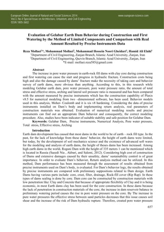
![Special Issue on Architecture, Urbanism, and Civil Engineering
Openly accessible at http://www.european-science.com 658
control during preliminary watering period, plays a significant role in dam’s stability. Also, the
control of existing stress on dam’s body and comparing it with the amounts considered in
preliminary dam design is of great importance in conservation of dam’s stability. Maleki and
Alavifar (2005), have evaluated behavior of Masjed Soleiman ‘s Dam along with numerical analysis
through FLAC 4.0 software. Parameters; pore water pressure ratio ,have expressed and determined
arching and the amount of changes in total stress and transformations due to first watering of Dam’s
reservoir , can threaten Dam’s stability. Mirghassemi and Mokrami Ghartavol (2013) by using
piezometers’ results and applied stress testers in clay core of Gelabar Dam, have evaluated Dam’s
status during construction and return analysis have been implemented by ABAQUS software, finally
they have expressed that the amounts of pore water pressure in core during construction of Dam,
total stress changes and effective stress have been at acceptable range. Niroumand et al (2000) have
evaluated and expressed the function of Karkhe Dam, which is considered one of the largest earth
dams in Iran, by using the results of precise instruments and return analysis have been implemented
through CA2 software that regarding measured vertical pressure, there is a great conformity among
the results obtained from precise instruments and the software. Aflaki (2009) evaluated Shirin
Darreh earth dam and expressed that regarding Dam subsidence and total stress ,there is a relatively
great conformity among the result of software, stress testers and subsidence testers. Nik-khah in the
year 2007[8], evaluated the precise instrument installed on Molla Sadra earth Dam’s body and
considering the rate Arching ratio which was between 0.45 to 0.58, he expressed that Molla Sadra
Dam is at suitable condition. Cherzanovski et al (2002) have evaluated the parameters of earth
dam’s construction materials, at Diamond Lake and valley, based on geodesy measurement and
provided a method of using limited element analysis, for modeling the impact of dam construction
materials saturation in order to determine and change sites during reservoir watering.
In the present research return numerical analysis have been implemented and main
parameters of construction materials have been specified and then they studied the pore water
pressure, pore water pressure ratio, the amount of total stress and effective stress, Arching, soil
lateral pressure ratio (Malaei, 2014).
Materials and methods
General features of Gelabar Dam
Gelabar Earth- Rock fill dam is locate at Zanjan, 50 kms south –west Ejroud Sub-province
and 3kms to Gelabar village and on Sajass River, which is at the moment the largest dam in the
province. The maximum height of the Dam; from bed rock 82 meters (from level 1628 to 1710) and
the dam crest height is, 247 meters. Utilizing this Dam, has made 8 acres of rain fed lands of
Ejeroud sub-province have become watered land and in addition, it supplies the water for industries
such as petrochemicals. This dam has been constructed with the objective of Sajs roud flood control,
agricultural, industrial and services water supply , increase of agricultural products , lateral
industries and creating jobs. Utilizing this Dam, 46 million cube meters of water supply for
agricultural lands and sub-province’s industries have been regulated by this dam. Gelabar Dam , has
been instrumented in 8 sections and the applied types of precise instruments on dam’s body are as
follows:
47 Electronic Piezometers of vibrating web( EP), 34 vertical pipe piezometers, and
observation wells on rest points(P).
69 Soil pressure measuring tools, including Quintuplet clusters (PC). Inequality testers and
the plate levels of subsidence testers are in 8 transverse sections of the Dam, 5-5 section is the
middle section and the most highest and full of instruments, in Gelabar Dam. The mentioned section](data:image/gif;base64,R0lGODlhAQABAIAAAAAAAP///yH5BAEAAAAALAAAAAABAAEAAAIBRAA7)