1. 1/7/14 1:09 PM
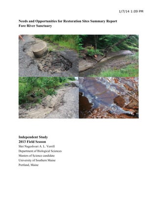
Needs and Opportunities for Restoration Sites Summary Report
Fore River Sanctuary
Independent Study
2013 Field Season
Shri Nageshvari A. L. Verrill
Department of Biological Sciences
Masters of Science candidate
University of Southern Maine
Portland, Maine
2. 2
Table of Contents
Cover Page 1
Table of Contents 2
Introduction 3
Site Report Summary 4-6
Appendice A (Railroad) 7-11
Appendice B (Utilities) 12-13
Appendice C (Scanned Data Forms) separate pdf
Appendice D (Spreadsheet) separate pdf
Photos of Sites Submitted to CBEP on flashdrive
3. 3
Introduction
In the 2013field season, a modified version of the protocol utilized by Northern
Ecological Associates (NEA 2005) was applied to assess restoration needs and opportunities at
sites within the Fore River Sanctuary, Portland Maine. Two data forms were used 1) Site
Identification and Degradation Scoring (NEA 2005), and 2) Invasive Species Evaluation Form
(Verrill 2013). Thirty-four total sites were assessed, documented and sorted into descriptive
categories, with their respective degradation source and indication scores cataloged in an Excel
spreadsheet (See appendix). Forms, photos and Google Earth “kmz.” files were compiled, and
sites were sorted into four major classes, which are based on the primary stakeholders or
assumed steward for the sites (See table 1.1).
1 Railroad
2 Utilities
A Water and Sewer
B Power/Electricity
3 Local Stewardship Organizations
A Casco Bay Estuary Partnership
i Footbridge
ii Canal boat basin
iii Railroad
iv Water/Sewage Utility
4. 4
Table
1.1
Classe
s 1-4 and subclasses 2A&B, and 3A&B were created to direct restoration practitioner attention to
the appropriate stakeholder. Recognizing the feasibility for collaboration in stewardship
activities for each site in advance of applying for funding will contribute to the creation of a
realistic timeline for restoration and stewardship programs to take place.
B Portland Trails
4 Private
5. Appendice
B
(Utilities)
1) Railroad
Fig. 1 Flags and red outlines depict sites identified as needing restoration to mitigate degradation originating
from the railroad bed.
• The majority of degraded wetland is a result of poorly maintained, destabilizing railroad bed erosion causing
wetland loss, filling the salt marsh and creating disturbed habitat for invasive vegetation. On August 12,
2013 sites A-H were identified as degraded and documented. Degradation indicators attributed to the
railroad bed bisecting the salt marsh were greater than the other sites combined. Tidal restriction and
wetland fill due to bank destabilization and erosion are the major sources. Large monotypic stands of
invasive brackish species are a secondary effect of disturbance caused by sand and gravel fill reducing tidal
flooding onto the marsh surface, as well as nutrient runoff from the nearby road (See appendices for
photos).
• The land cleared for the Power, Sewage, and Water utility companies contributed additional and significant
wetland and water quality degradation, including but not limited to tidal restriction, severe erosion, water
pollution, and debris in the streambeds.
6. 6
3A) Local Stewardship Organization: Casco Bay Estuary Partnership (CBEP)
Fig. 2 Many tidal restrictions were observed, on site. Nine were assessed, documented, and marked with the
blue-wave icons above. The primary effects of tidal restrictions are wetland degradation, invasive brackish
vegetation, shoreline erosion and bank destabilization.
• The two local stewardship organizations, Casco Bay Estuary Partnership and Portland Trails are reasonably
situated to address a number of the degradation issues created by the railroad and utility company activities.
Efforts made by Portland Trails to control Phragmites stands are evident in several highly stressed stands.
While there are many tidal restrictions within the assessed area, nine were documented. Building
footbridges over the existing trail to allow tidal flux into boat basin will significantly reduce invasive
vegetation and increase marsh health. Sites adjacent to privately owned land are not significant enough to
7. 7
warrant immediate action. Educating citizen scientists and introducing locals to stewardship practices
would likely have a greater effect.
Reference
NEA
(2005)
Report
prepared
for
Casco
Bay
Estuary
Program
on
the
Presumpscot
River
Restoration
Needs
and
Opportunities.
9. 9
Fig. 5 Eroding railroad bed, debris in polluted stream, and the invasive Loosestrife at Site C.
10. 10
Fig.
6
Repeated
filling
with
gravel
and
the
creosote
soaked
railroad
ties
are
not
addressing
the
erosion
problem
and
runoff
is
polluting
the
water
at
Site
D.
Fig. 7 Evidence of frequent erosion and bank destabilization at a major tidal restriction beneath the railbed:
A sinkhole recently filled with sand and gravel will soon be washed into the salt marsh below at Site E.
11. 11
Fig. 8 A discarded creosote soaked railroad tie at Site F.
Fig. 9 These two perched culverts create an obvious tidal restriction that prevents tidal flooding from
reaching the high marsh at Site G.
12. 12
Fig. 10 A pile of sand and gravel fill in the marsh at the bottom of a steep storm-water runoff channel along
side of the embankment at Site H.
Railroad summary
Gravel and sand filling the marsh, bank destabilization, erosion, and tidal restriction are the major
degradation issues along the railroad bank. Removing fill and debris from the wetlands, and stabilizing the
bank with stone rip-rap are recommended reparations.
13.
2A) Water and Sewer Utility
Fig. 11 Buried water and sewer lines along the area outlined above in red lead to a bridge over a
tidal creek; Altered hydrology is significantly eroding and destabilizing the bank at Site e.
2B) Power Utility
Fig. 12 Herbicide use below the power lines and adjacent to water contributes to a rainbow sheen
and white crust on the water at Site O.
14. 14
Fig. 13 More evidence of herbicide-use below power lines and within 25 feet of open water at
Site T.