The document summarizes Fort Collins, Colorado's experience over 10 years in implementing multimodal transportation standards. It discusses both successes ("hits") and challenges ("misses") experienced. On the positive side, multimodal standards led to increased transit ridership and bike culture, and changed community expectations. Challenges included difficulties maintaining new infrastructure, inconsistent enforcement, and integrating new development with existing areas. The document advocates updating standards to better accommodate infill and retrofitting existing areas with multimodal facilities.
City of San Antonio Sustainable Neighborhood Planning Tool (PLACE3S)BikeTexas
This document describes a project to implement the INDEX GIS-based planning software in San Antonio to measure sustainability indicators across the city. The objectives are to reduce energy/water use, vehicle travel, emissions, and carbon footprint. INDEX can calculate 89 indicators in categories like land use, housing, travel, and environment. It was implemented in target neighborhoods and validated by comparing indicators between neighborhoods. Results were organized by the city's 10 major districts and neighborhood associations to support planning efforts.
This document presents a plan for development in Maitland, Florida focused around improving connectivity to a new SunRail station. It proposes mixed-use and high-density residential developments within walking distance of the station, emphasizing pedestrian access and public spaces. Conceptual plans and statistics are provided for multiple development sites, showing numbers of residential units and parking spaces. The goal is to create an active, walkable transit-oriented community around the SunRail station.
Reconstruction of the Congress Parkway Bridge Over the South Branch of the Ch...Daniel X. O'Neil
The document summarizes plans to rehabilitate the Congress Parkway bridges over the South Branch of the Chicago River. The project will rehabilitate the bascule bridges over two construction seasons, closing one bridge each season to traffic. It outlines the traffic control plan with reduced lanes, alternate routes, and coordination efforts with local agencies. Safety issues like narrow lanes and high speeds require improvements to lighting, crash protection, and clear lane markings.
This advice note from the Department of Transport provides recommendations on the location, use, and layout of kerbs and edgings along rural roads. It addresses when kerbs should be used versus hard strips or edge lining, guidelines for dropped kerbs, and types of upstand kerbs appropriate for different contexts like urban versus rural locations. The recommendations aim to delineate the road edge while considering traffic safety, drainage, and accessibility for various users.
Snow Removal and Lighting Follow Up: Dec. 13, 2016Fairfax County
The document summarizes a pilot program to clear snow from and provide lighting for sidewalks and trails near two Metrorail stations in Fairfax County, Virginia. It describes several trail locations considered in Tysons and elsewhere in the county, and estimates annual costs of $259,000 for snow removal and $80,000 for lighting across five trail locations. The trails discussed include Vesper Trail, Scotts Run Trail, Ashgrove Trail Extension, and sidewalks near the Franconia-Springfield and Dunn Loring-Merrifield Metro stations. Comparisons are made to the level of service provided on the nearby W&OD trail.
This document appears to be a planning and design portfolio belonging to Christine Hefti and Vanessa VC. Hefti. It includes 10 projects they have worked on between 2013-present. The projects include designs for parks, trails, plazas and other public spaces in locations across the Midwest United States and France. Each project includes brief descriptions and illustrations of the proposed designs. The portfolio also includes sketches of site furnishings and examples of the designers' hand-drawing and watercolor skills.
The Americans with Disabilities Act 1990 (ADA), is a landmark civil rights law that prohibits discrimination based on disability. Title II of the ADA requires state and local governments to make their programs and services accessible to persons with disabilities. This requirement extends not only to physical access at government facilities, programs and events — but also to pedestrian facilities in public rights-of-way. To comply with the ADA, every state and local government is required to prepare a self-evaluation report to identify program access issues. From this, a transition plan is required, with a schedule identifying corrective measures to achieve a barrier-free environment. In 2008, Bellevue undertook an ADA sidewalk and curb ramp self-evaluation update to assess its program responsibilities for existing pedestrian facilities in the public rights-of-way. The City employed innovative technologies to document barriers and prioritize improvements where most needed. Implementation of this technology development and compliance effort involved a coordinated staffing and funding commitment from the City of Bellevue, Federal Highway Administration and King County, with technical support from Starodub Inc., an engineering services firm. The technical precision offered by Bellevue’s approach is identified as a best practice in ADA Compliance at Transportation Agencies: A Review of Practices (NCHRP 20-07 Task 249), a Texas Transportation Institute study. The report notes that “[e]fforts such as those at the City of Bellevue, Washington, that rely on the collection of large datasets at extremely fine spatial and temporal disaggregation levels have the potential to significantly automate the identification of non-compliant locations in the field.”
The document describes the divided peri-urban area of Viana in Luanda, Angola. It is physically divided by a highway and railway, and socially divided between informal and formal areas. The project aims to bridge this divide by facilitating accessibility and civic spaces. Viana is developing into a diverse place with urban qualities where the zones meet at the train station. However, the zones remain separated with a lack of connection between the two sides.
This document outlines a proposed update to the Tehachapi General Plan. It discusses maintaining Tehachapi's character as a small mountain town while managing development interest and community concerns. The document evaluates different planning approaches and develops a vision of 6 planning areas to guide growth. It proposes applying this community-generated vision through a regulatory system including a physically-based general plan with 8 elements to clearly convey the vision and tailor development to Tehachapi.
Charlotte is a growing city that relies on its Department of Transportation (CDOT) to serve over 683,000 residents daily. CDOT plays a key role in creating a livable community through its focus on transit-oriented development around centers, corridors, and neighborhoods. The presentation highlights CDOT's rapid transit improvements like the successful LYNX Blue Line and plans for the North Corridor Commuter Rail and Blue Line Extension. It also discusses policies, zoning, and development tracking to encourage housing and mixed-use development near transit that has generated substantial investment and tax revenue. Lessons learned emphasize the importance of coordination between different stakeholders to successfully implement transit-oriented development.
This document discusses three types of freeway removals: replacement, removal, and prevention. Replacement involves fundamentally changing the design and classification of a freeway. Removal involves completely taking down a freeway structure to evaporate traffic and untangle intersections. Prevention refers to stopping freeway plans that are still just on paper to avoid needing changes later due to traffic or safety issues. The document provides examples of projects in each removal category and was prepared by an urban designer to discuss cost savings from freeway teardowns.
The document outlines President Obama's vision for a national high-speed rail network in the United States. It describes the benefits of high-speed rail, such as traveling between cities quickly without the hassles of air travel like airport security or flight delays. President Obama envisions a system that would allow people to walk to public transportation stations and travel at speeds over 100 miles per hour between towns. He quotes Daniel Burnham who said "make no little plans" and believes this philosophy should apply to rebuilding America's infrastructure through ambitious projects like a high-speed rail network.
The document lists the names of several neighborhoods, developments, and parks located near or along waterfront areas in various cities across the United States, including Clarksville, Travis Heights in Austin, Austin Development, Chicago Waterfront, Charleston Waterfront, Baltimore Waterfront, a development plan for the San River North area, and Austin Waterfront, as well as Central Park in New York.
Brian Canin, President of Canin Associates, discusses ongoing research into a model for Transit Ready Design based in Central Florida including Restoration, a major development project that is expected to include a project funded streetcar line.
Danny Pleasant, Key Business Executive/Director in the City of Charlotte's Department of Transportation discusses phasing and the development of Charlotte's successful light rail system which is continuing to expand.
New Urbanism emerged in the late 20th century as a response to the negative impacts of modernist urban planning from the mid-1900s. The document provides a timeline of influential urban planning projects throughout history starting from ancient Greek and Roman cities to company towns in the 19th century industrial era and early 20th century garden cities. It then outlines the "perfect storm" of factors in the mid-1900s including racism, highway expansion, and modernist ideals that led to the decline of existing urban areas and rise of automobile-dependent suburbs, setting the stage for New Urbanism.
Kevin Nichols, Senior Planner, City of Arvada, CO discusses planning in anticipation of FasTracks light rail expansion with several stops of differing urban character within the City of Arvada.
The document describes the Florida Public Officials Design Institute, which provides training to elected officials from local communities on sustainable development and design. The Institute aims to help communities address issues like climate change, reduce sprawl, and improve quality of life. Officials participate in a design process for a site in their own community, working with experts. The program has led to implemented recommendations and design standards that encourage sustainability.
This document summarizes presentations from a conference on form-based codes. It discusses form-based codes from Blue Springs, Missouri and West Evanston, Illinois that divide areas into transect zones and include building typologies. It also summarizes Dallas' transition from a conventional zoning code to a new form-based code with districts, building types, permitted uses, and streetscape standards designed to enable transit-oriented development. The new Dallas code acts as a set of optional base zoning districts rather than mandated location-specific changes.
As communities turn from sprawl and work to retrofit existing districts and corridors, misfits between street and land use types often compromise livability, sustainability, and economic development. We’ll look at how some cities have responded by designing streets that go beyond the conventional arterial-collector-local street classification system and have implemented innovative streets with flexible spaces and uses - often overlapping the single-use functions of typical street "zoning." Presentation delivered at CNU 17, Denver, CO on June 12, 2009.
The document discusses urban planning efforts in Abu Dhabi, UAE that aim to implement principles of the New Urbanism. An international team of experts was assembled to create comprehensive plans for Abu Dhabi and its regions through 2030. The plans focus on creating walkable, mixed-use communities integrated with nature and reflective of Arab culture, while allowing for sustainable and measured growth.
A well-written form-based code can ensure that the community vision is actually what gets built. This session includes an awards presentation and in-depth analysis of the 2009 Driehaus Form-Based Code Award winners. Discover the exemplary features of each winner, and hear about the lessons learned from the winning communities.
Carol Wyant, Executive Director, Form-Based Codes Institute
Mary E. Madden, Principal, Ferrell Madden Lewis, LLC
Peter Park, Manager, Community Planning and Development, City of Denver
Daniel Parolek, AIA,, Principal , Opticos Design, Inc.
Sam Poole, Shareholder, Berger Singerman Attorneys
The document discusses Vancouver's efforts to become a more sustainable, livable, and vibrant city through policies like EcoDensity that promote density done well. It outlines how Vancouver is focusing on walkability, cycling infrastructure, transit, design quality, and amenities to support density. The goal of being carbon neutral by 2030 and the "greenest city in the world by 2020" is mentioned. Successful projects that achieved sustainable density through approaches like laneway housing are highlighted.
The document summarizes HUD's funding and initiatives under the American Recovery and Reinvestment Act of 2009. It allocates $13.61 billion across 9 programs to promote energy efficiency, unlock credit markets, and mitigate foreclosures. It outlines HUD's implementation approach of quick spending combined with longer-term program targeting. It also describes HUD's partnerships with other agencies and new FY2010 initiatives including an Energy Innovation Fund and Sustainable Communities Initiative.
Public housing in the United States has changed significantly over time. Originally conceived as temporary housing for low-income families, today's public housing consists of both traditional housing projects and housing vouchers used to rent private units. While public housing still provides homes for many low-income families, it now focuses more on self-sufficiency and mixed-income communities rather than large isolated housing projects of the past.
The document discusses a panel on opportunities for innovation in affordable housing between the Congress for the New Urbanism (CNU) and the Department of Housing and Urban Development (HUD). The panel features presentations from Elinor Bacon, President of E.R. Bacon Development, Michael Freedberg of HUD, and Sunia Zaterman, Executive Director of CLPHA. It is moderated by Ray Gindroz and includes responses from experts in urban design. The panel explores how the past collaboration between HUD and CNU through the HOPE VI program advanced sustainable neighborhood design and how those lessons can be applied today. It also discusses the goal of forming an initiative team to develop an ongoing collaboration between CNU and
Dubai World is a large company present in over 100 cities globally with 50,000 employees. The document discusses Limitless, a subsidiary of Dubai World, and its portfolio and core competencies in real estate development. Specifically, it details Limitless' work in master planning mixed-use sustainable communities and waterfront developments across a 5 square mile area, including residential and commercial buildings.
The document discusses Scotland's history with urban planning from King David I in the 12th century who established law and order and promoted trade, to the modern Scottish Sustainable Communities Initiative. It notes planning's reputation as a technical world obscured from laymen and challenges with building consensus to tackle big problems. The conclusion reflects on Scotland's urban tradition providing inspiration for meeting new environmental and economic challenges through innovative solutions like the Scottish Sustainable Communities Initiative, but cautions the line between vision and hallucination is fine.
The document discusses the gentrification of neighborhoods in northwest Brooklyn, New York along the L train subway line. It describes the history and evolution of neighborhoods like Williamsburg and Bushwick from largely industrial areas to hipster enclaves. Key factors driving gentrification included the development of the L train in the early 20th century, an influx of artists and students in the 1990s, and rising rents in Manhattan pushing hipsters across the East River. The document also analyzes the housing, retail, and demographic preferences of hipster residents to develop strategies for providing "Housing for Hipsters" through new construction and building conversions that can appeal to their tastes.
This document discusses using citizen participation and technology to facilitate community planning. It proposes a three-step public process:
1) Analytical phase to understand community values through interactive tools
2) Generative phase to develop a vision for how the community can address shared values
3) Deliberative phase to discuss policies to implement the vision through public feedback technology
The goal is to integrate public input and information to create a comprehensive plan that reflects community wants and enables informed decision making.
This document discusses how understanding demographic and economic forces is important for comprehensive planning. It provides an overview of key demographic trends like changing household structures, a growing minority population, and an aging population. It also discusses the importance of evaluating the local economy by understanding key industries and how they may change. The document emphasizes that transportation must be considered as it influences the locations of jobs, housing, and economic activity. It concludes by providing four lessons for comprehensive planning: understand opportunities for change in the community; consider the regional economic context; use data to support land use policies; and plan for diverse demographics, industries, and transportation needs.
2 Making The Invisible Visible - Abigail Thorne-Lyman
F Is Fantastic Jackson
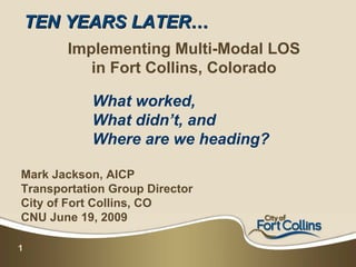
1. TEN YEARS LATER…
Implementing Multi-Modal LOS
in Fort Collins, Colorado
What worked,
What didn’t, and
Where are we heading?
Mark Jackson, AICP
Transportation Group Director
City of Fort Collins, CO
CNU June 19, 2009
1
2. The City of Fort Collins
• Mid-size community of 137,000 in Northern CO
• Home to Colorado State University
• Diverse, progressive community
2
3. The City of Fort Collins
• Developed and implemented Multi-Modal LOS
Standards in 1999
• Created a “Complete Streets” culture within the
organization (before it was cool)
• Changed expectations for City Staff and Developers
alike
• Many positives realized, but some missteps and
lessons learned
• Hits, Misses & Future Direction
3
4. What Makes Great Streets?
• Serve PEOPLE
• All Modes - Autos, Bikes, Peds, Transit,
RVs, Trucks, Trains, etc.
• Functional - Mobility & Utilities
• Attractive & Inviting Streetscapes
• Active Land Uses – Day & Night
4
5. Multimodal Standards: •ROW
•Travel Lanes
Based on City Plan &
Master Street Plan •Medians
•Parking
Design Standards Vary by
Facility Type & Location •Bike Lanes
•Parkway
Transportation Impact
Study includes all modes •Sidewalk
•Utilities
Street include auto,
pedestrian, bicycle and
transit elements
5
6. Tools for an effective
Multi-modal Transportation System
Complete Streets: Many tools in the toolbox:
St reet •Corridor & District Plans
Syst em •Land Use Code
7 Signals
10 Landscaped Medians •Master Street Plan
8 Safet y
4 Drainage
5 Buses IRRIGATION
•Street Standards & Design Manuals
1 Str eet Vehicles
IRRIGATION
•LOS Manual & TIS Guidelines
STORM
SEWER
2 Bike Lanes SEWER
•Outreach & Education
BUS
WATER
DRIVEWAY
9 Parkways IRRIGATION
3 Sidewalks ELECTRIC DUCTS
IRRIGATION
CABLE
ELECTRIC
PHONE
6 Ut ilit ies
CABLE
•Adequate Public Facilities
GAS
WATER
STORM SEWER
•City Plan Comprehensive Plan
SEWER
6
7. Multimodal LOS Standards:
Automobile
Goes beyond traditional volume/capacity based LOS
•Access
•Connectivity
•Continuity
Differentiates between Activity Centers, Commercial
Corridors, Mixed Use Districts
7
9. Multimodal LOS Standards:
Destination Areas:
Pedestrian •Recreation Sites
•Residential Areas
LOS Criteria:
•Institutional Sites
•Directness
•Office Buildings
•Continuity
•Commercial Sites
•Street Crossings
•Industrial Sites
•Visual Interest & Amenities
Location Areas:
•Security
•Pedestrian District
•Activity Center/Corridor
•Transit Corridor
•School Walk Area
9
•Other
10. Multimodal LOS Standards:
Bicycle
Based on Connectivity to Bike facilities in connecting
corridors
Bike Corridors may contain 1 of 3 types of facilities:
On-street lanes
Off-street paths
On-street routes
10
11. Multimodal LOS Standards:
Transit
Based on Route
characteristics & Land Use
characteristics
Standards developed during
Transit Development Plan
Standards evaluate service Service Level Standards:
planned by 2015
Hours of service
Mixed Use Centers & Frequency of service
Commercial Corridors Travel time factor
or Peak load factor
11 Remainder of service area
13. Development Review Real Life Lessons:
Hits:
New development provides good connectivity and continuity
Proactive approach reduces City’s capital infrastructure burdens
Education of & buy-in from developers, engineers & planners
(eventually)
Better interconnectivity between modes, higher modal splits
Misses:
Easy when economy and development demand is strong
Difficult to implement in infill areas
Qualitative criteria often confusing and inconsistent
Transit service assumptions not being realized
Next Steps:
Update APF Policy and Process
13
Review & Update LOS standards for Infill Development
14. Results: Real Life Lessons
Hits: Culture Change in the Community!
•Transit Ridership up 15% in 2008; still rising
•Three new transit routes added
•Mason Corridor BRT becoming a reality
•Gold Level Bicycle Community
•Bike Culture Acceptance
•Community Expectations
14
15. Hits: Rise of the Bike Culture in FC
• Robust system of off
street trails and on
street paths
• Functional and efficient
• Built in Bike Population
(CSU Students)
• Hired Bicycle
Coordinator in 2006
• Programs and Public
Private Collaboration
• Popularity has exploded
in last two years!
15
16. Hits: Rise of the Bike Culture in FC
• 2008 Gold Level Bicycle
Community Award
• Private Sector Jumping
on the Bandwagon!
16
17. Hits: Community Expectations
• At first, neighbors,
developers and buyers
fought “new” standards
• Now, it is seen as an
asset and amenity
• Ped/Bike accessibility,
connectivity
• A different feel than
“Anywhere USA”
17
18. Misses: On the Ground Realities
Several Challenges & Lessons Learned over the Years:
• Maintenance challenges
• Enforcement issues
• Dealing with other Local Agencies
• Making the fit with existing development
18
19. Misses: On the Ground Realities
Maintenance Challenges
• Sometimes theory doesn’t
quite translate into function
– Setback standards vs.
utility space needs
– Inset parking vs. drainage
and snow removal
– Who maintains the ped
connection?
– Colored, Raised
Crosswalks
19
20. Misses: Enforcement Issues
Good intentions, but:
– Early attempts
confusing, frustrating
– Eventually became
self-policing
– People still want to
park in front
20
21. Misses: Dealing with Other
Local Agencies
Counter-Intuitive and Self-
Defeating:
• School Districts!
– New School Locations
– Incomplete
connections
– Located on major
arterials
– No options but SOV
21
22. Misses: Making it Fit
with Existing Development
• Some New Urbanist
development on urban
fringe
• Great internal
connectivity and design
meets old or County
standard facilities
• How to link old
& new?
22
23. Moving Forward: Trends & Changes
• Infill Development
– review & revise standards
– retrofit multi-modal needs to old infrastructure
– Capitalize on development opportunities
– Transit Oriented Development a reality
• Evolving from rigid standards to solution oriented
approach
• Integrate sustainability into design
• Changing revenue structure threatens progress
23
24. Many Thanks To:
• Kathleen Bracke, AICP: Transportation Planning Director
• Ted Shepard, AICP: Chief Planner
• Sheri Langenberger, PE: Engineering Dev. Review
• Marc Virata,PE: Engineering Dev. Review
• Many developers, designers, professionals, and leaders
who have helped us make this real
24
25. City of Fort Collins – Resource List:
•Multimodal Level of Service Standards:
http://www.co.larimer.co.us/engineering/GMARdStds/ApdxH%2010-01-02.pdf
• Larimer County Urban Area Street Standards:
http://www.co.larimer.co.us/engineering/GMARdStds/UrbanSt.htm
• Fort Collins Pedestrian Level of Service Manual:
http://fcgov.com/transportationplanning/pdf/levelofservice.pdf
Contact: Mark Jackson, AICP, Transportation Group Director
phone: (970) 416-2029 or via e-mail: mjackson@fcgov.com
25