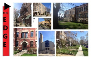
SlideShare a Scribd company logo
1 of 32
Download to read offline
1
THE
E
D
G
E
Bryan
T
o
w
n
l
e
y
2
3
Contents
Introduction and Background.....................................................................4
Assets and Liabilities....................................................................................5
Figure Ground...............................................................................................6
Land Use........................................................................................................7
	 Residential.......................................................................................................................8
	Commercial.....................................................................................................................9
	Industrial........................................................................................................................10
	 Unspecified Use..........................................................................................................11
	 Vacant Land.................................................................................................................12
Building Condition.....................................................................................13
GraySpace...................................................................................................14
Lynch Map...................................................................................................15
	 Paths................................................................................................................................16
	Edges...............................................................................................................................17
	Districts...........................................................................................................................18
	Nodes..............................................................................................................................19
	Landmarks.....................................................................................................................20
Transit..........................................................................................................21
Walkability..................................................................................................22
SWOT Analysis............................................................................................23
Interventions..............................................................................................24
	 Abstract.........................................................................................................................25
	 Strategic Infill Development..................................................................................26
	 Capitalizing on Transit Accessibility....................................................................28
	 Erasing Gray Space....................................................................................................30
	 Enhancing Connections..........................................................................................31
The Edge, located five miles from Downtown Cleveland,
is the southern portion of the city’s Edgewater
neighborhood. For the purposes of this project, The Edge
is bordered by W 117th St and Lakewood to the west,
the single track rail line to the north and east, and the
Greater Cleveland RTA’s Red Line Rapid to the south and
east. The neighborhood began with settlements on large
farms and estates owned by Eliza and Simeon Jennings.
As Germans and other European immigrants began
moving into the area, the neighborhood was included
as part of the Village of West Cleveland in 1871, and was
subsequently annexed by Cleveland in 1894.
The name“The Edge”stems from several factors:
the neighborhood’s being included in the overall
“Edgewater”neighborhood, being located on the edge
of Cleveland and Lakewood, and the neighborhood’s
reputation as having a grittier, punkier, or“edgier”feel
than its counterpart to the north.
4
Introduction and Background
Assets
-Located in between two RTA Rapid stations
-Diverse, walkable“Downtown”area along Detroit Avenue
-Wide range of housing types/styles
-Located ¾ mile from Edgewater Park and Lake Erie
-Acts as a“gateway”between Cleveland and Lakewood
Liabilities
-W 117th commercial corridor is pockmarked with suburban-style
development and parking lots
-Many industrial structures are in disrepair or are not utilized to their full
potential
-Large tracts of gray space, including parking lots and industrial sites
-Poor connection with adjacent neighborhoods due to bordering railroad
tracks
-Derelict structures within residential and commercial areas harm the urban
fabric and perception of the neighborhood
5
Assets and Liabilities
The figure-ground map shows four distinct subareas within the neighborhood. The first of these subareas is made
up of a concentration of small structures, detached homes, in the center of the neighborhood. Due to their close
proximity to one another, it could be inferred that these are located on small lots and were built before WWII. The
differential spacing between these homes shows that some have driveways while others do not, suggesting that
this part of the neighborhood development on the cusp of mass automobile ownership. The larger structures in
this subarea represent multifamily apartment complexes, demonstrating the variety of housing types on most of
the neighborhood’s residential streets.
The second subarea is represented by the slightly larger structures that abut Detroit Ave. These structures’tight,
and sometimes touching, proximity and frontage with zero setbacks suggests a dense, urban commercial corridor.
The gaps in this corridor’s fabric, with larger structures interspersed along its length, represent development that
has occurred more recently.
The third subarea is located in the southwestern portion of the neighborhood and is comprised of mostly larger
structures, with greater space in between. Some of these structures do not conform to the regular grid of streets,
and are arranged in a somewhat haphazard manner. The structures also have smaller outbuildings located on-site.
These items, combined with the structures’proximity to a busy, active rail line suggest industrial use. The large
spaces in between each building represent parking for their many employees and/or ample turn-around and
loading space for trucks.
The fourth subarea is located in the eastern portion of the neighborhood and is made up of buildings of
various sizes, located relatively far from the street. The subarea is also comprised of large swaths of land devoid
of structures. In addition, the regular street grid disappears in this portion of the neighborhood. All of this
suggests that development in this subarea has occurred at a much later date than the majority of the rest of the
neighborhood. The relatively sparse portion north of Detroit Ave in this subarea could possibly be a remnant of a
railroad corridor that at one time had more tracks.
6
Figure Ground
Detroit
Franklin
W117th
The land use map shows the overall layout
of The Edge neighborhood. Residential
use dominates the core of the area,
while commercial uses line the two main
thoroughfares- W 117th St and Detroit Ave.
Industrial use controls the majority of the
southern portion of the neighborhood, as
railroad rights of way frame The Edge to the
north, south, and east. The individual land
uses are analyzed in greater detail in the
following pages.
7
Land Use
The majority of land in The Edge neighborhood is used for residential purposes of varying densities, however is
concentrated in its western and northern portions. Of these, low density is the most common, followed by high
density and medium density. All three are fairly evenly spread throughout the neighborhood, except for clusters of
high density residential in the center of the neighborhood and north of Detroit Ave. While some parcels are excep-
tions, most exclusively residential areas are located in the core of the neighborhood, away from major thorough-
fares. The low and medium density parcels are relatively uniform in size, while the high density parcels tend to be
larger, suggesting larger structures. Several streets within the neighborhood’s core residential area have somewhat
fragmented edges, possibly due to converted industrial or commercial use, or demolition and vacancy.
8
Residential
While fragmented, the dispersal of commercial parcels in The Edge form two corridors along W 117th St and De-
troit Ave. Labeled“C2”on the adjacent map, few offices are located in the neighborhood, while primary commer-
cial parcels, labeled“C1,”are more common. The fragmented nature of the two commercial corridors represents
several factors at work: interspersed exclusively residential structures, encroaching parking lots, and demolition
and vacancy. The lack of commercial parcels along the eastern portion of the Detroit Ave corridor follows the gen-
eral lack of structures of any use there.
9
Commercial
The majority of the southern portion of The Edge is comprised of industrial parcels. The placement of industrial
parcels corresponds to their proximity to the busy railroad tracks that form the neighborhood’s southern border.
These parcels are much larger than those of other uses, suggesting larger structures. However, there are several
smaller industrial parcels that are of the same size as most residential parcels in the neighborhood. This could
demonstrate how industrial uses have encroached into primarily residential areas, possibly needing more parking
or adequate space for truck loading or storage.
10
Industrial
Large swaths of The Edge, primarily in the eastern half of the neighborhood, are labeled as“unspecified”on land
use maps. Several explanations could be possible for the lack of information corresponding to these parcels. First,
“unspecified”may be a catch-all category for uncommon land uses, such as institutional (with the Eliza Jennings
health facility), public transportation (with the two rapid stations), or educational (with the multiple schools in the
neighborhood). On the other hand, the lack of information could simply stem from a lack of bookkeeping by the
City of Cleveland and Cuyahoga County, suggesting a need for updates.
11
Unspecified Use
Vacant parcels are few and far between in The Edge, possibly demonstrating that the neighborhood has avoided a
fate that many other Cleveland neighborhoods have had to contend with. The two patterns that are visible when
looking at the vacant parcel map show a clusters of vacancy along W 117th St and along the railroad tracks to the
south. The vacancies along W 117th St are most definitely a contributing factor to that corridor’s being an overall
liability for the neighborhood. The vacancies along the railroad track simply reinforce the notion of The Edge’s
southern border being an impermeable barrier. Both clusters hurt not only adjacent properties, but also The Edge’s
connections to surrounding neighborhoods.
12
Vacant Land
The structures in The Edge neighborhood were analyzed in terms of their physical exterior from A (best) to D
(worst). The majority of structures in the neighborhood are graded as B, followed by C and A. D-graded structures,
those that are physically falling apart and/or have broken/boarded up windows, are few in number, suggesting an
area with relatively solid bones. The majority of A-graded structures are located on residential parcels, specifically
in clusters along W 114th and W 110th Streets. B-graded structures are found throughout the neighborhood and
do not follow a uniform pattern in terms of land use. Clusters of C-graded structures are located on commercial
and industrial parcels, with several in residential areas. The few D-graded structures are found on industrial parcels.
Being among the largest structures in the neighborhood, the relatively poor condition of those that are industrial
creates a huge aesthetic issue, especially for the southern portion of the neighborhood. Similarly, the cluster of
C-graded structures along Detroit Ave in the“Downtown Edgewater”area creates an aesthetic drag on the neigh-
borhood’s“Main Street.”All of this seems to point to relatively good upkeep of residential structures, fair to poor
upkeep of commercial structures, and very poor upkeep of industrial structures.
When observing residential building condition by overlaying the land use and building condition maps, one
can attempt to find a correlation between condition and residential density. However, it appears that A-graded
through D-graded structures are somewhat randomly dispersed regardless of density. One might theorize that
low density (single family) parcels would be of the best condition due their likely being owner-occupied, and thus
occupied by those who have a larger stake in the community. However, that does not seem to be the case in The
Edge, as low density structures are just as likely to be graded highly as are medium and high density structures.
13
Building Condition
Detroit
Franklin
W117th
The Edge neighborhood is plagued with huge amounts of gray space. Much of this gray space is comprised of
parking lots surrounding industrial structures in the southwestern portion of the neighborhood, as well as parking
that serves the suburban design-dominated W 117th commercial corridor. The neighborhood’s gray space also
includes large gravel or dirt lots that serve as underutilized storage space for industry. In addition, the neighbor-
hood’s amount of gray space is augmented by the park and ride lots at the W 117th-Madison and West Blvd-Cudell
Rapid stations. While the central portion of the neighborhood is not as affected by gray space, the edges of the
neighborhood, and thus connections with other neighborhoods, are harmed. The gray space along these edges
acts as a barrier which impedes access to and from an already poorly-connected neighborhood.
14
Gray Space
Detroit
Franklin
W117th
15
Lynch Map
The Edge neighborhood contains two primary paths: Detroit Ave and W 117th St. Both of these roadways act as
multimodal corridors that stretch for miles across the city. Each street carries a public transportation route (the
26 bus along Detroit Ave and the 78 along W 117th St), as well as high volumes of vehicular traffic. Detroit Ave in
particular sees high volumes of bicycle traffic (it is arguably the busiest bicycle corridor on Cleveland’s west side)
as well as decent pedestrian activity in the“downtown”portion and closer to the West Blvd-Cudell Rapid station.
RTA’s Red Line Rapid and Madison Ave represent the two secondary paths within the neighborhood. The Red Line,
as the busiest public transportation route in Ohio, sees much daily traffic, especially at rush hour. Madison Ave acts
as an alternative east-west corridor through the neighborhood, and sees decent vehicular and bicycle counts.
The neighborhood is comprised of one tertiary path: Franklin Blvd/W 110th St. This street combination acts as
an important connector between Lakewood, the northern portion of Cleveland’s Edgewater neighborhood, and
Edgewater Park via Baltic Rd.
16
Paths
Detroit
Franklin
W117th
RTA Red Line
Madison
W110th
It is fitting that“The Edge”neighborhood is surrounded by very well-defined edges. Three of the neighborhoods
borders, W 117th St, the single track rail line to the north, and RTA’s Red Line to the south, represent primary edges.
The two rail lines, and especially the red line with its raised nature, are strong barriers that explicitly divide neigh-
borhoods. W 117th, a wide street with structures set far back from the roadway, acts as an edge that disrupts the
urban fabric, in addition to being a municipal boundary. A secondary edge within the neighborhood is the break
between the older portion to the west and the newer portion to the east. While not a physical barrier, this edge
represents the end of the traditional street grid and a complete change in development patterns. A tertiary edge,
comprised of W 115th St and Franklin Blvd, acts as a divide between the residential subarea to the north and the
industrial subarea to the south. A change in use warrants demarcation as an edge in this case because the change
is abrupt-there is no gradual transition of use.
17
Edges
Detroit
Franklin
W117th
The neighborhood contains four districts: Downtown Edgewater, Edgewater Industrial, Health Campus, and W
117th Commercial. While located within the same neighborhood, each district has its own distinct feel, typical use,
and style. Downtown Edgewater is the historic core of the neighborhood and encompasses the commercial corri-
dor along Detroit Ave, and the surrounding apartment buildings. This district is characterized by large structures
built in the early 1900s with zero setbacks, housing various shops, restaurants, bars, and housing.
The Edgewater Industrial district is comprised of the exclusively industrial southern portion of the neighborhood.
This district is typified by large, turn of the 20th century industrial and warehouse structures in various (mostly
poor) states of repair. Also taking up much of the district are swaths of storage and/or vacant space.
The Health Campus district is in the eastern portion of the neighborhood and is made up of relatively new struc-
tures with health-focused uses, including the Eliza Jennings and Applewood facilities. These facilities are located
on sprawling sites set back far from Detroit Ave, and are surrounded by a tree-covered, almost park-like lawn.
The W 117th Commercial district is named for the street it runs along, and is made up of mostly small, detached
commercial structures designed in a suburban manner. A few remnants including several row houses and apart-
ment buildings remain to suggest the district’s former character, however little else is left. The W 117th corridor,
with its disheveled character, represents a liability to the neighborhood.
18
Districts
Detroit
Franklin
W117th
The Edge neighborhood contains four major nodes: the Detroit Ave-W 117th St, Detroit Ave-W 110th St, Madi-
son Ave-W 117th St, and Detroit Ave-Berea Rd intersections. All four nodes represent important points of activity
or connection in the neighborhood. The Detroit/W 117th node acts as the gateway to The Edge neighborhood,
Cleveland as a whole, and Lakewood. This node is also a busy transfer point between RTA’s 26 and 78 bus lines. The
neighborhood also sees a high volume of pedestrian activity, due to a high population density and a proliferation
of nearby stores and services. The Detroit/W 110th node is located in the center of the neighborhood and, as stat-
ed in the“Paths”section above, is an important connector route between Lakewood and the northern portion of
the Edgewater neighborhood. Just outside The Edge neighborhood, Baltic Children’s Park is accessed via W 110th
St. The Madison/W 117th node is another gateway point between the cities of Lakewood and Cleveland, as well as
the Edgewater/Jefferson/Cudell neighborhoods. The intersection is a convergence of all modes of transportation,
as it is directly adjacent to RTA’s W 117th-Madison Rapid station. The Detroit/Berea node is another busy intersec-
tion surrounded by relatively dense housing and the West Blvd-Cudell Rapid station.
19
Nodes
Detroit
Franklin
W117th
Madison
Berea
The W 117th-Madison and West Blvd-Cudell Rapid stations, along with the Eastman apartment building and the St.
Rose Church represent the four landmarks in The Edge neighborhood. The two rapid stations act as highly visible
meeting points which are centers of activity for the surrounding areas. The Eastman building, located on Detroit
Ave, is a large, historic residential structure that is arguably the most well-maintained of the neighborhood’s stock
of historic structures. The St. Rose Church, also on Detroit Ave, is a tall structure that has a commanding street
presence. It is laid out with a small front plaza, and its ancillary Hope Academy makes it a focal point for the neigh-
borhood.
20
Landmarks
Detroit
Franklin
W117th
St. Rose Church Eastman Building
West Blvd-Cudell Station
W 117th-Madison Station
One of the neighborhood’s greatest strengths is its transit accessibility. In addition to containing two RTA Red Line
rapid stations, W 117th-Madison and West Blvd-Cudell, The Edge boasts direct connections to four bus routes. The
25 bus, traveling along Madison Ave and ending at the W 117th-Madison rapid station, provides connections to
the southern portion of Lakewood, Rocky River, and Westlake’s Crocker Park. The 26 bus provides service along
Detroit Ave, connecting with Downtown Lakewood, Rocky River, and Fairview Park to the west, and Cleveland’s
Cudell, Detroit Shoreway, Ohio City, and Downtown neighborhoods to the east. The 78 bus, traveling primarily
along W 117th St, connects Lakewood’s Gold Coast to the north and Cleveland’s southwestern neighborhoods to
the south. The 81 bus, ending at the West Blvd-Cudell rapid station, takes a circuitous route to Downtown Cleve-
land via the Jefferson, Stockyards, Clark Fulton, Tremont, and Ohio City neighborhoods.
A large section of Cleveland’s west side can be reached within a half hour by public transportation from The Edge.
The majority of Rocky River and all of Lakewood can be accessed to the west of The Edge within a half hour, along
with large swaths of Cleveland’s Jefferson and Puritas neighborhoods to the south. The majority of Downtown
Cleveland is accessible, along with Ohio City, Tremont, and a small portion of University Circle via RTA’s Red Line.
21
Transit
Red Line
78
26
25
81
University Circle
Lakewood
Rocky River
Clark-Fulton
Ohio City
Downtown
Puritas
Overall, The Edge is a relatively walkable neighborhood due to its residential density and its mostly intact street
grid. From the rough center of the neighborhood and W 110th St and Detroit Ave, the majority of the neighbor-
hood can be reached by a 10 minute walk. This 10 minute radius also allows a pedestrian to access Clifton Blvd
to the north and portions of Lakewood to the west. Of note, however, is the inability to reach either rapid station
within 10 minutes from the neighborhood’s center. The 20 minute pedestrian timeshed extends to encompass
both rapid stations, larger portions of Lakewood, Lake Erie’s shore to the north, and portions of Cleveland’s Cudell
neighborhood to the east and south. A 30 min walk gives access to Edgewater Park to the northeast, portions of
the Detroit Shoreway neighborhood to the east, and the large shopping plaza at the interchange of Interstate 90
and W 117th St.
The overall pedestrian timeshed has a somewhat oblong shape extending along the east-west axis, suggesting
that pedestrian access is more limited north to south. This is most likely due to the general east-west nature of
Cleveland’s main thoroughfares, as well as The Edge’s strong, impermeable southern boundary along with the
dissolution of the street grid to the south.
22
Walkability
Edgewater Park
Lakewood
Gold Coast
Target
Detroit Shoreway
W 117th-Madison Sta.
West Blvd-Cudell Sta.
Strengths
The Edge’s strengths as a neighborhood are drawn from its intrinsic qualities as well as its proximity to what sur-
rounds it. Possibly its largest strength is containing two rapid stations along with stops for four bus lines within its
boundaries, offering some of the best transit access in northeast Ohio. The neighborhood also boasts a historic,
walkable commercial corridor along Detroit Ave which remains vital with restaurants, bars, music venues, and
quirky shops. The Edge’s residential stock is in good repair compared to many other Cleveland neighborhoods, and
includes a wide variety of types and styles from“Cleveland Doubles”and average apartments to high-end condos
and townhomes. The health facilities and industrial business (that are still operable) within the neighborhood offer
possible career avenues for its residents.
When looking slightly outside The Edge’s boundaries, one can also observe that several of its strengths are drawn
from its location. The neighborhood is very close to Lake Erie shoreline, with the major draw of Edgewater Park
roughly one mile away. Its ability to maintain a viable commercial street may be a function of its adjacency to the
relatively well to do northern portion of Edgewater, as well as the City of Lakewood. The Edge is also close to the
major job center that is Downtown Cleveland, being a 10-12 minute rapid ride or drive away.
Weaknesses
The Edge’s primary weakness lies in its lack of connectivity to surrounding neighborhoods. In some ways, because
of its two rapid stops, the neighborhood is more connected to more distant neighborhoods than those that it
is directly proximate to. However, the rapid tracks that connect those two stations act as impermeable barriers.
Compounding the connectivity issue are large portions of industrial land that are either vacant or underutilized.
These not only hurt movement between and within the neighborhood, but damage The Edge’s aesthetic qualities,
especially in its southern half. These gray spaces are also unfortunately located near the two rapid stations, under-
mining their viability.
The W 117th St corridor, the neighborhood’s western boundary, is also one of its weaknesses. While there are a few
bright spots along this stretch, it is of a largely cratered suburban design. It could also be considered a barrier for
the neighborhood, both physically (as a wide expanse with fast-moving traffic) and mentally (as an ugly gray space
that cuts through charming neighborhoods).
While the two health facilities in The Edge’s eastern portion could be considered overall neighborhood strengths,
their design makes them weaknesses. Low buildings set far back from the street on expansive lawns create a dis-
ruptive void in the urban fabric that exists directly to the west and east.
Opportunities
Based on The Edge’s weaknesses, there are several opportunities for neighborhood betterment. Connections to
surrounding neighborhoods, if enhanced, could improve access to recreational opportunities, potential jobs for
residents, daily services, and the two rapid stations. The vacant and/or underutilized industrial sections could be
developed higher density mixed use and residential structures, better leveraging the two rapid stations. These
developments could also serve to make the southern portion of the neighborhood more aesthetically attractive
and inviting for pedestrians.
Both major thoroughfares within the neighborhood- W 117th St and Detroit Ave- have the potential to become
great multimodal corridors. Detroit Ave is further along in the process, as its relatively dense“Downtown Edgewa-
ter”portion is highly walkable. In addition, Detroit Ave has large volumes of cycling traffic, representing an import-
ant connection between Lakewood and Downtown Cleveland. However, room for improvement exists, especially
east of W 107th St and around the West Blvd-Cudell rapid station. Further development should be encouraged
eastward along the corridor to better extend the urban fabric across what is now a gap. W 117th St, on the other
23
SWOT Analysis
hand, is weak in its current state, but thus has much future opportunity. It has the benefit of serving as a direct
connection between Lakewood’s high density Gold Coast neighborhood and the W 117th-Madison rapid station.
Current suburban developments patterns along the corridor could be replaced with ones that better fit the more
urban nature of the surrounding neighborhoods. In addition, the excessively wide road could stand for a road diet,
allowing for improved pedestrian and bicycle facilities. These would all help to bridge the gap that W 117th St
currently creates.
Opportunities also exist for the eastern half of the neighborhood where two health facilities currently exist. The
Edge, currently lacking in green space, could utilize the empty land surrounding the facilities as park space, with
potential to create new connections between Madison Ave, Detroit Ave, and the West Blvd-Cudell rapid station.
This park space could also be part of a larger network that connects to Edgewater Park to the northeast.
Threats
Threats to The Edge stem from three main factors: a continuation of new development being suburban in design,
further degradation of industrial sites, and a declining quality of residential stock in the neighborhood. One of the
reasons for W 117th St’s being a largely suburban corridor is that most of its development is newer than the neigh-
borhood overall. Even the newest developments, including the GFS market north of the W 117th/Detroit inter-
section, are highly suburban with large setbacks, low-rise buildings, and oversize parking lots that dominate the
parcel. The Eliza Jennings and Applewood health facilities are also relatively new buildings, and thus have more
suburban character as well.
As the number of manufacturing jobs declines across the country, The Edge’s industrial southern portion runs the
risk of increased vacancies. Already plagued with closed industrial facilities, further closures could hurt the viability
of those that remain, as well as harm the aesthetic quality of the neighborhood through neglect and lack of up-
keep. Similarly, the neighborhood’s housing stock runs the risk of becoming abandoned and derelict, a fate that
many Cleveland neighborhoods have succumbed to. Already, some single homes and apartment complexes in
the neighborhood have fallen into disrepair, with some complete vacancies. Since residential parcels take up the
majority of the land area in the neighborhood, a further spread of housing abandonments would definitely hurt
the sustainability of The Edge.
24
Interventions
Through analysis of existing conditions of The Edge neighborhood, sev-
eral overarching themes were manifested:
-The Detroit Ave corridor is an overall asset, while the W 117th corridor is a
liability.
-The neighborhood has some of the best transit access in northeast Ohio,
however fails to capitalize on transit-oriented development due to large
swaths of vacant land near stations.
-Gray space consumes much of the neighborhood, especially around its
edges.
-The Edge lacks connectivity to other neighborhoods because of strong, im-
permeable barriers.
Considering these themes, corresponding interventions are proposed:
-Use infill development, with proper density and urban character, to repair
the urban fabric of the W 117th St corridor, while further taking advantage
of the Detroit Ave corridor.
-Develop underutilized areas, including park-n-ride lots, surrounding the W
117th-Madison and West Blvd-Cudell rapid stations to leverage great transit
access.
-Create opportunities for open/park space use on the neighborhood’s many
gray spaces.
-Extend the street grid eastward and enhance pedestrian/bicycle connec-
tions to surrounding neighborhoods, especially around the West Blvd-Cu-
dell rapid station.
25
Abstract
W 117th St has the potential to become a great urban street, being the border of Cleveland and the relatively
urban Lakewood. However, in its current state it stands as a pock-marked street with an overall suburban design
(large setbacks and parking lots), vacant buildings, and lack of structures at key intersections. To remedy this, infill
development should be targeted to these“blank spaces”along the corridor.
W 117th St’s intersection with Detroit Ave marks the gateway to both The Edge and the City of Lakewood. Corre-
spondingly, the intersection should be treated as a focal point of the neighborhood, with buildings directly front-
ing both streets to the north and south of Detroit. These structures should be of mixed use and relate in height
(3-5 stories) and style to the existing mixed use buildings on Detroit. In addition, the recently constructed GFS
store to the north of the intersection (with highly suburban design) will be retrofitted with a multi-story structure
with zero setbacks along W 117th St. South of Detroit Ave to Franklin Blvd, any parking lots that front W 117th St
will be redeveloped into lower density mixed use. This will ensure continuity of W 117th as a commercial corridor,
with opportunities to augment the neighborhood’s population density.
Infill development should also be targeted along Detroit Ave, the stronger of the neighborhood’s two commercial
corridors. While the corridor already embodies a dense, walkable, mixed use“downtown”in the western portion of
The Edge, its eastern reaches peter out into vacant, semi-industrial and institutional space. Medium and low densi-
ty residential infill development will be focused to the north side of Detroit Ave between W 110th St and the West
Blvd-Cudell rapid station. Due to the sloping nature of the parcels to the north of Detroit, the opportunity exists
for the construction of unique townhomes with possible views of Lake Erie. Fronting Detroit Ave, the townhomes
will be 1-2 stories while, due to the slope, will be 2-3 stories in the rear. These structures should have a small set-
back from the street, in keeping with the majority of other residential structures in the neighborhood.
Slightly east along Detroit, the recently-redeveloped“Chicle”residences should be expanded to the north of
Detroit in the diamond-shaped parcel surrounded on three sides by railroad tracks. Like the current townhomes
that exist on the Chicle site, the new residential structures will be 3-6 stories with a“postindustrial”design. These
will serve to connect the urban fabric of The Edge to the neighboring Cudell neighborhood, while also boosting
population density in close proximity to the West Blvd-Cudell rapid station.
26
Strategic Infill Development
AwningsBalconies
Bike Lanes
27
Currently some of the lowest density areas of The Edge surround two of its greatest assets-the W 117th-Madison
and West Blvd-Cudell rapid stations. In order to fully capitalize on the two stations, medium to high density mixed
use development should be focused on the“blank”spaces that surround the transit stops-whether they come in
the form of parking lots, vacant industrial structures, underutilized industrial storage space, or park-n-ride lots.
The W 117th-Madison station is an important transit node for both the neighborhood and the City of Lakewood,
however overall nearby development patterns have a very suburban character. In addition, the rapid station is
bordered to the west and east by industry (or vacant industrial buildings). Because of this, connectivity to the rapid
station suffers as the surrounding area is not welcoming to pedestrians.
To remedy this, mixed use development will be focused on the parcel comprising of the station’s current park-n-
ride lot, with its parking spaces transferred to a parking garage. A half block north on W 117th, another mixed use
structure should be constructed. Further east on Madison Ave between W 116th and W 112th Streets, the large-
ly vacant industrial parcels will be developed with medium and high density residential structures. All of these
proposed buildings shall incorporate design elements from remaining industrial sites, as well as the existing mixed
use building on the northeast corner of W 117th and Madison. The density of the proposed structures will taper
down the closer they get to existing low density housing. In this manner, higher density can be achieved while not
overwhelming existing structures.
Appropriate public space will also be of importance in redevelopment. The now-gravel parking lot for the existing
mixed use structure mentioned above shall be incorporated as a piazza, connecting to the new mixed use struc-
ture that will be located directly to the north. This piazza could have the potential to function as a small outdoor
music venue, possibly in keeping with the neighborhood’s punk roots. In addition, the alleyway-like W 115th St
shall be converted into a pedestrian-only street (running to the block’s midway point north of Madison Ave) nes-
tled in between two of the new high density residential structures mentioned above. While the proposed piazza
will be focused on serving both residents and patrons of the new mixed use structures, the W 115th pedestrian
street will largely serve as a“hang-out”space for residents and visitors.
The West Blvd-Cudell rapid station site currently serves as an odd juxtaposition to the relatively high density mixed
use structures directly to the south of Detroit Ave. In addition, the station is largely severed from surrounding
neighborhoods on almost all sides by railroad tracks and the overly-wide Detroit Ave (interventions pertaining to
connection enhancements are described in detail below). Much like the W 117th-Madison station, medium to high
density mixed use development should be focused on the existing park-n-ride lot, as those parking spaces will
be transferred to parking garages. In this way, the north side of the Detroit will better mirror the existing develop-
ment to the south.
Within the new development, structures of the highest density should be located at the busy intersections of
Berea Rd/Detroit Ave and West Blvd/Detroit Ave. Structures of slightly lower density will the space in between the
two intersections. Public space will also be incorporated into the redeveloped site, in the form of a plaza directly
north of the intersection of Detroit and W 101st St, along with a pedestrian promenade connecting West Blvd’s in-
tersection with Detroit Ave to the rapid station itself. These two spaces will serve to maintain and enhance pedes-
trian connectivity to the rapid station, while replacing a currently a somewhat desolate and uninviting landscape.
28
Capitalizing on Transit Accessibility
Detroit
Franklin
W117th
West Blvd-Cudell Sta.
W 117th-Madison Sta.
29
While much of The Edge neighborhood is built-up, a vast proliferation of gray space still exists. Ranging from small
parking lots to large, abandoned gravel and dirt industrial lots, gray space is spread throughout the neighbor-
hood. While much gray space will be erased from the two intervention plans detailed above, additional spaces
could serve the community in other ways.
As the neighborhood is defined for this project, no formal green or park space is currently located within The
Edge’s boundaries. In order to erase the neighborhood’s proliferation of gray space, three green spaces will be pro-
posed: a small park in the center of the neighborhood, a larger park south of the Eliza Jennings health facility, and
a greenway paralleling RTA’s red line from Madison Ave to the West Blvd-Cudell rapid station.
The small“central”park should be located on what is now a parking lot just south of Detroit Ave, between W 112th
and W 110th Streets. The park shall have access from all three streets with the main entrance located on W 112th
St, and will have two main elements: a playground and a community garden. The larger park south of the health
facility will incorporate several elements of the open space that is now reserved for exclusive use by the facility.
The park will be accessed via an extended Franklin Blvd and W 106th St and will directly connect to the proposed
greenway. This park will have space for a main open field, two pavilions for event use, and a short jogging/walking
trail. A water feature could also be added if additional space would become available. The greenway will include a
narrow, landscaped strip of land that houses a multi-use trail. The greenway will have connections with Madison
Ave, the extended Franklin Blvd, Detroit Ave, the West Blvd-Cudell station, and possibly Edgewater Park to the
northeast (enhanced connections are explained in more detail in the following section).
30
Erasing Gray Space
Detroit
Franklin
W117th
As discussed in the neighborhood analysis section, The Edge has very well-defined, impermeable boundaries. The
railroad tracks to the north, south, and east of the neighborhood, along with the suburban void of W 117th St to
the west, hem in the wedge-shaped neighborhood. Compounding the lack of access because of these barriers, the
eastern portion of the neighborhood is basically cut-off from everything surrounding it.
To remedy this lack of connectivity within the neighborhood and to other neighborhoods, three main treatments
are proposed: the extension of the street grid into the eastern portion of the neighborhood, connecting bicycle fa-
cilities that exist outside the neighborhood, and creating pedestrian connections to surrounding neighborhoods.
Currently, the city street grid is interrupted between W 107th St and the West Blvd-Cudell rapid station. Franklin
Blvd should be extended from W 107th to Detroit Ave near the Chicle residential development. This will allow for
quicker access, especially for pedestrians, to the nearby rapid station and proposed mixed use developments. W
106th St will also be extended south from its current terminus at Baltic Rd to connect with Detroit Ave and Franklin
Blvd near the Eliza Jennings facility and proposed park.
Enhancements of bicycle facilities will come in three forms: a multi-use trail, bike lanes, and sharrows. The multi-
use trail will follow the proposed greenway (mentioned above) between Madison Ave and the extended Franklin
Blvd, then will continue from the intersection of Franklin and Detroit to the West Blvd-Cudell rapid station. The
potential exists for an extension of this greenway northeast to Edgewater Park, paralleling the railroad tracks.
Bike lanes will be placed on Detroit Ave, Franklin Blvd (and W 110th St), Madison Ave, and W 117th St. The Detroit
Ave bike lanes will connect to bike lanes that currently exist to the east in the Detroit Shoreway neighborhood,
and will correspond to a road diet of the overly-wide Detroit Ave around the West Blvd-Cudell rapid station. The
Franklin Blvd/W 110th St bike lanes will be an extension of the street’s bike lanes in Lakewood to the west, and
the Madison Ave bike lanes will similarly be an extension of the soon-to-be-completed bike lanes on that street in
Lakewood. The addition of bike lanes to W 117th St will correspond with a slight road diet of the street, reducing
the width of current travel lanes. This will create a strong, north-south multimodal corridor in an area that largely
lacks north-south connections.
Sharrows, the lowest rung of bicycle facilities, will be placed on two slightly less important stretches of roadway:
W 110th St north of Detroit Ave and the extended Franklin Blvd from W 110th to the proposed greenway. The
W 110th St sharrows will act as a connection to the northern portion of the Edgewater neighborhood, while the
Franklin Blvd sharrows will simply connect proposed bike lanes to the proposed greenway.
Enhancing pedestrian connectivity is of the utmost importance, especially around the walled-off West Blvd-Cudell
rapid station. Three main pedestrian bridges and walkways will be constructed in the vicinity of this rapid station: a
bridge to the northeast of the station connecting to existing high density residential, a bridge to the north to con-
nect to a portion of Edgewater’s low density residential area, and a walkway/bridge westward connecting to the
proposed medium to high density residential development along Detroit Ave. Additionally, a pedestrian walkway
will be proposed extending south from the current terminus of W 107th St to the intersection of Berea Rd/Madison
Ave in Cleveland’s Cudell neighborhood to the south. Finally, an east-west pedestrian walkway will be constructed
midblock between W 117th St and W 107th St, in order to break up the large block size between Franklin Blvd and
Detroit Ave.
31
Enhancing Connections
Detroit
Franklin
W117th
Sources:
Maps:
-Google Maps. https://www.google.com/maps/
-Cuyahoga County Geographical Information Systems. http://gis.cuyahogacounty.us/
-US Census Bureau. https://www.census.gov/geo/maps-data/data/tiger.html
-Greater Cleveland Regional Transit Authority. http://www.riderta.com/
-Walk Score. https://www.walkscore.com/
Pictures:
-http://www.audiopromobiledj.com/wp-content/uploads/2013/04/1IMG_5663edit-20130330-232605.jpg
-http://slog.thestranger.com/files/2007/10/12th_and_pine.jpg
-http://sitelife.construction.com/ver1.0/Content/images/store/5/6/958db167-23db-4566-b6ae-0ff363450463.Full.
jpg
-http://www.metalocus.es/content/en/system/files/file-images/seccion_2-High_Line-Nueva_York-12_0.jpeg
-http://i.ytimg.com/vi/fkx6RreXwT4/maxresdefault.jpg
-https://c2.staticflickr.com/8/7178/7007244040_69073c5db3_b.jpg
-http://upload.wikimedia.org/wikipedia/commons/4/4a/A_quadrant_bench_on_Saint_Werburgh_Street_-_geo-
graph.org.uk_-_781494.jpg
-http://www.kannfinch.com/wp-content/uploads/2011/06/BaulkhamHills_1.jpg
-http://peninsulatransportation.org/wp-content/uploads/2012/11/Coupa-Bike-Corral.jpg
-http://www.chiclebuilding.com/images/cth-render.jpg
-http://toulouseletrek.com/wp-content/uploads/2011/06/distillery-district-distillery-lane01-web1.jpg
-http://forums.steves-digicams.com/attachments/people-photos/159524d1280105905-toronto-distillery-dis-
trict-sunday-stroll-dsc04151_a_sd.jpg
-http://thegreenwayguy.com/wp-content/uploads/2012/08/DSC010792.jpg
-http://cdn.snappages.com/vq4usn/assets/1963561_2646702_1423676697.jpg
-http://eoa-architects.com/wp-content/gallery/fourth-and-monroe-mixed-use-development/fourth-and-monroe-
mixed-use-development-01.jpg
-http://www.outdoordesign.com.au/uploads/articles/green-net--2-story.jpg
-http://www.davidhess.net/img/furniture/hudson.jpg
-http://images.listonce.com.au/listings/27-eastbourne-street-prahran-vic-3181/987/00122987_img_06_1600x.
jpg?6
-http://smspoke.org/wp-content/uploads/2013/01/IMG_0488.jpg
-http://yvonnebambrick.com/wp-content/uploads/2011/03/Kensington-Bike-Rack-May_10-YB.jpg
-http://www.nextstopstl.org/nextstop/wp-content/uploads/2012/07/MetroLink-Downtown-STL.jpg
-http://fr.academic.ru/pictures/frwiki/77/Midtown_Greenway-Minneapolis-2007.jpg
-http://imagesus.homeaway.ca/mda01/51d1ee21-8013-4e37-bddd-18e2c98b852a.1.6
-http://www.arlnow.com/wp-content/uploads/2010/02/pentagon-row-concert.jpg
-http://www.bizion.com/data/cheditor4/1407/1315d5fb735097eae7ced7cf5a1311e9_jO9fWrszU.jpg
-http://i.imgur.com/vdY1kds.jpg
-http://leeannapham.com/wp-content/uploads/2015/04/XWBXFV.jpg
-http://sdotblog.seattle.gov/wp-content/uploads/2009/09/sharrow12NE2.jpg
-http://static.panoramio.com/photos/original/30827360.jpg
-https://s-media-cache-ak0.pinimg.com/736x/c8/73/b1/c873b17c49bc1268a209b0303f5bf320.jpg

More Related Content

Viewers also liked

Presentation on the Neighborhood Development Center
Presentation on the Neighborhood Development CenterPresentation on the Neighborhood Development Center
Presentation on the Neighborhood Development Centergreaterohio
 
Manor Park Neighborhood Urban Park
Manor Park Neighborhood Urban ParkManor Park Neighborhood Urban Park
Manor Park Neighborhood Urban ParkJose Carlos Ayala
 
Neighborhood design and obesity
Neighborhood design and obesityNeighborhood design and obesity
Neighborhood design and obesityjarmanjo
 
Land Policy, Municipal Finance, and Urban Housing Problems in China - Zhi Liu
Land Policy, Municipal Finance, and Urban Housing Problems in China - Zhi LiuLand Policy, Municipal Finance, and Urban Housing Problems in China - Zhi Liu
Land Policy, Municipal Finance, and Urban Housing Problems in China - Zhi LiuAfricaChinaUrbanInitiative
 
Should neighborhood effect be stable in urban geosimulation model? A case stu...
Should neighborhood effect be stable in urban geosimulation model? A case stu...Should neighborhood effect be stable in urban geosimulation model? A case stu...
Should neighborhood effect be stable in urban geosimulation model? A case stu...Beniamino Murgante
 
Downtown OKC, Inc. Retailers' Workshop 4-13-2015
Downtown OKC, Inc. Retailers' Workshop 4-13-2015Downtown OKC, Inc. Retailers' Workshop 4-13-2015
Downtown OKC, Inc. Retailers' Workshop 4-13-2015Shane Hampton
 
Sustainable Neighborhood Design
Sustainable Neighborhood DesignSustainable Neighborhood Design
Sustainable Neighborhood DesignOsama Hidayat
 
Architectural Design 3 2011- Project 2
Architectural Design 3 2011- Project 2Architectural Design 3 2011- Project 2
Architectural Design 3 2011- Project 2Galala University
 
Housing problem
Housing problemHousing problem
Housing problemaziz khan
 
Urban Planning theories and models
Urban Planning theories and modelsUrban Planning theories and models
Urban Planning theories and modelsGeofrey Yator
 
Abierto 2013
Abierto 2013Abierto 2013
Abierto 2013aarias409
 
The Top Skills That Can Get You Hired in 2017
The Top Skills That Can Get You Hired in 2017The Top Skills That Can Get You Hired in 2017
The Top Skills That Can Get You Hired in 2017LinkedIn
 

Viewers also liked (13)

Presentation on the Neighborhood Development Center
Presentation on the Neighborhood Development CenterPresentation on the Neighborhood Development Center
Presentation on the Neighborhood Development Center
 
Manor Park Neighborhood Urban Park
Manor Park Neighborhood Urban ParkManor Park Neighborhood Urban Park
Manor Park Neighborhood Urban Park
 
Neighborhood design and obesity
Neighborhood design and obesityNeighborhood design and obesity
Neighborhood design and obesity
 
Land Policy, Municipal Finance, and Urban Housing Problems in China - Zhi Liu
Land Policy, Municipal Finance, and Urban Housing Problems in China - Zhi LiuLand Policy, Municipal Finance, and Urban Housing Problems in China - Zhi Liu
Land Policy, Municipal Finance, and Urban Housing Problems in China - Zhi Liu
 
Should neighborhood effect be stable in urban geosimulation model? A case stu...
Should neighborhood effect be stable in urban geosimulation model? A case stu...Should neighborhood effect be stable in urban geosimulation model? A case stu...
Should neighborhood effect be stable in urban geosimulation model? A case stu...
 
Downtown OKC, Inc. Retailers' Workshop 4-13-2015
Downtown OKC, Inc. Retailers' Workshop 4-13-2015Downtown OKC, Inc. Retailers' Workshop 4-13-2015
Downtown OKC, Inc. Retailers' Workshop 4-13-2015
 
Sustainable Neighborhood Design
Sustainable Neighborhood DesignSustainable Neighborhood Design
Sustainable Neighborhood Design
 
Architectural Design 3 2011- Project 2
Architectural Design 3 2011- Project 2Architectural Design 3 2011- Project 2
Architectural Design 3 2011- Project 2
 
New Urbanism Intro CNU
New Urbanism Intro CNUNew Urbanism Intro CNU
New Urbanism Intro CNU
 
Housing problem
Housing problemHousing problem
Housing problem
 
Urban Planning theories and models
Urban Planning theories and modelsUrban Planning theories and models
Urban Planning theories and models
 
Abierto 2013
Abierto 2013Abierto 2013
Abierto 2013
 
The Top Skills That Can Get You Hired in 2017
The Top Skills That Can Get You Hired in 2017The Top Skills That Can Get You Hired in 2017
The Top Skills That Can Get You Hired in 2017
 

Similar to Edge Neighborhood's Untapped Potential

2007_tree_canopy_analysis_final_version_rfs
2007_tree_canopy_analysis_final_version_rfs2007_tree_canopy_analysis_final_version_rfs
2007_tree_canopy_analysis_final_version_rfsChelsea Coullette
 
Matthew Hill - SeniorProject(InProgress)
Matthew Hill - SeniorProject(InProgress)Matthew Hill - SeniorProject(InProgress)
Matthew Hill - SeniorProject(InProgress)Matthew Hill
 
Matthew Hill - SeniorProject(InProgress)
Matthew Hill - SeniorProject(InProgress)Matthew Hill - SeniorProject(InProgress)
Matthew Hill - SeniorProject(InProgress)Matthew Hill
 
Palant Portfolio
Palant PortfolioPalant Portfolio
Palant PortfolioJake Palant
 
L3 land use in urban areas website
L3 land use in urban areas websiteL3 land use in urban areas website
L3 land use in urban areas websitemrabski
 
AP human Geography Unit 7 PBL project
AP human Geography Unit 7 PBL projectAP human Geography Unit 7 PBL project
AP human Geography Unit 7 PBL projectAdam Bjelland
 
Models of Urban Growth
Models of Urban GrowthModels of Urban Growth
Models of Urban GrowthKhandace Davis
 
MLK Boulevard Plan
MLK Boulevard PlanMLK Boulevard Plan
MLK Boulevard PlanJames May
 
Beacon Falls Town Plan Msparzo
Beacon Falls Town Plan MsparzoBeacon Falls Town Plan Msparzo
Beacon Falls Town Plan Msparzomcs05010
 
Seediscussions,stats,andauthorprofilesforthispublicati.docx
Seediscussions,stats,andauthorprofilesforthispublicati.docxSeediscussions,stats,andauthorprofilesforthispublicati.docx
Seediscussions,stats,andauthorprofilesforthispublicati.docxjeffreye3
 
ZON2006-00040 Princeton-Smith
ZON2006-00040 Princeton-SmithZON2006-00040 Princeton-Smith
ZON2006-00040 Princeton-SmithSeann Smith, AICP
 
Settlement Characteristics
Settlement CharacteristicsSettlement Characteristics
Settlement Characteristicswhiskeyhj
 

Similar to Edge Neighborhood's Untapped Potential (20)

URBDP505-Final-Print
URBDP505-Final-PrintURBDP505-Final-Print
URBDP505-Final-Print
 
2007_tree_canopy_analysis_final_version_rfs
2007_tree_canopy_analysis_final_version_rfs2007_tree_canopy_analysis_final_version_rfs
2007_tree_canopy_analysis_final_version_rfs
 
Matthew Hill - SeniorProject(InProgress)
Matthew Hill - SeniorProject(InProgress)Matthew Hill - SeniorProject(InProgress)
Matthew Hill - SeniorProject(InProgress)
 
Matthew Hill - SeniorProject(InProgress)
Matthew Hill - SeniorProject(InProgress)Matthew Hill - SeniorProject(InProgress)
Matthew Hill - SeniorProject(InProgress)
 
Palant Portfolio
Palant PortfolioPalant Portfolio
Palant Portfolio
 
L3 land use in urban areas website
L3 land use in urban areas websiteL3 land use in urban areas website
L3 land use in urban areas website
 
AP human Geography Unit 7 PBL project
AP human Geography Unit 7 PBL projectAP human Geography Unit 7 PBL project
AP human Geography Unit 7 PBL project
 
Models of Urban Growth
Models of Urban GrowthModels of Urban Growth
Models of Urban Growth
 
Midtown Plaza
Midtown PlazaMidtown Plaza
Midtown Plaza
 
Urban Design Study
Urban Design StudyUrban Design Study
Urban Design Study
 
MLK Boulevard Plan
MLK Boulevard PlanMLK Boulevard Plan
MLK Boulevard Plan
 
New York City
New York City New York City
New York City
 
Beacon Falls Town Plan Msparzo
Beacon Falls Town Plan MsparzoBeacon Falls Town Plan Msparzo
Beacon Falls Town Plan Msparzo
 
T3 w8b
T3 w8bT3 w8b
T3 w8b
 
Seediscussions,stats,andauthorprofilesforthispublicati.docx
Seediscussions,stats,andauthorprofilesforthispublicati.docxSeediscussions,stats,andauthorprofilesforthispublicati.docx
Seediscussions,stats,andauthorprofilesforthispublicati.docx
 
ZON2006-00040 Princeton-Smith
ZON2006-00040 Princeton-SmithZON2006-00040 Princeton-Smith
ZON2006-00040 Princeton-Smith
 
Vridian writing sample
Vridian writing sampleVridian writing sample
Vridian writing sample
 
Settlement Characteristics
Settlement CharacteristicsSettlement Characteristics
Settlement Characteristics
 
Capstone
CapstoneCapstone
Capstone
 
Portfolio
PortfolioPortfolio
Portfolio
 

More from Bryan Townley

Bryan Townley Portfolio
Bryan Townley PortfolioBryan Townley Portfolio
Bryan Townley PortfolioBryan Townley
 
Cuyahoga County Income Elevation
Cuyahoga County Income ElevationCuyahoga County Income Elevation
Cuyahoga County Income ElevationBryan Townley
 
Rails to Trails - Past, Present, and Future
Rails to Trails - Past, Present, and FutureRails to Trails - Past, Present, and Future
Rails to Trails - Past, Present, and FutureBryan Townley
 
Push for Alternative Transportation at Ohio State
Push for Alternative Transportation at Ohio State Push for Alternative Transportation at Ohio State
Push for Alternative Transportation at Ohio State Bryan Townley
 
Using ArcGIS to Propose an On-Street Bicycle Network
Using ArcGIS to Propose an On-Street Bicycle NetworkUsing ArcGIS to Propose an On-Street Bicycle Network
Using ArcGIS to Propose an On-Street Bicycle NetworkBryan Townley
 
Reynoldsburg Infrastructure Enhancement Plan
Reynoldsburg Infrastructure Enhancement PlanReynoldsburg Infrastructure Enhancement Plan
Reynoldsburg Infrastructure Enhancement PlanBryan Townley
 

More from Bryan Townley (6)

Bryan Townley Portfolio
Bryan Townley PortfolioBryan Townley Portfolio
Bryan Townley Portfolio
 
Cuyahoga County Income Elevation
Cuyahoga County Income ElevationCuyahoga County Income Elevation
Cuyahoga County Income Elevation
 
Rails to Trails - Past, Present, and Future
Rails to Trails - Past, Present, and FutureRails to Trails - Past, Present, and Future
Rails to Trails - Past, Present, and Future
 
Push for Alternative Transportation at Ohio State
Push for Alternative Transportation at Ohio State Push for Alternative Transportation at Ohio State
Push for Alternative Transportation at Ohio State
 
Using ArcGIS to Propose an On-Street Bicycle Network
Using ArcGIS to Propose an On-Street Bicycle NetworkUsing ArcGIS to Propose an On-Street Bicycle Network
Using ArcGIS to Propose an On-Street Bicycle Network
 
Reynoldsburg Infrastructure Enhancement Plan
Reynoldsburg Infrastructure Enhancement PlanReynoldsburg Infrastructure Enhancement Plan
Reynoldsburg Infrastructure Enhancement Plan
 

Edge Neighborhood's Untapped Potential

  • 2. 2
  • 3. 3 Contents Introduction and Background.....................................................................4 Assets and Liabilities....................................................................................5 Figure Ground...............................................................................................6 Land Use........................................................................................................7 Residential.......................................................................................................................8 Commercial.....................................................................................................................9 Industrial........................................................................................................................10 Unspecified Use..........................................................................................................11 Vacant Land.................................................................................................................12 Building Condition.....................................................................................13 GraySpace...................................................................................................14 Lynch Map...................................................................................................15 Paths................................................................................................................................16 Edges...............................................................................................................................17 Districts...........................................................................................................................18 Nodes..............................................................................................................................19 Landmarks.....................................................................................................................20 Transit..........................................................................................................21 Walkability..................................................................................................22 SWOT Analysis............................................................................................23 Interventions..............................................................................................24 Abstract.........................................................................................................................25 Strategic Infill Development..................................................................................26 Capitalizing on Transit Accessibility....................................................................28 Erasing Gray Space....................................................................................................30 Enhancing Connections..........................................................................................31
  • 4. The Edge, located five miles from Downtown Cleveland, is the southern portion of the city’s Edgewater neighborhood. For the purposes of this project, The Edge is bordered by W 117th St and Lakewood to the west, the single track rail line to the north and east, and the Greater Cleveland RTA’s Red Line Rapid to the south and east. The neighborhood began with settlements on large farms and estates owned by Eliza and Simeon Jennings. As Germans and other European immigrants began moving into the area, the neighborhood was included as part of the Village of West Cleveland in 1871, and was subsequently annexed by Cleveland in 1894. The name“The Edge”stems from several factors: the neighborhood’s being included in the overall “Edgewater”neighborhood, being located on the edge of Cleveland and Lakewood, and the neighborhood’s reputation as having a grittier, punkier, or“edgier”feel than its counterpart to the north. 4 Introduction and Background
  • 5. Assets -Located in between two RTA Rapid stations -Diverse, walkable“Downtown”area along Detroit Avenue -Wide range of housing types/styles -Located ¾ mile from Edgewater Park and Lake Erie -Acts as a“gateway”between Cleveland and Lakewood Liabilities -W 117th commercial corridor is pockmarked with suburban-style development and parking lots -Many industrial structures are in disrepair or are not utilized to their full potential -Large tracts of gray space, including parking lots and industrial sites -Poor connection with adjacent neighborhoods due to bordering railroad tracks -Derelict structures within residential and commercial areas harm the urban fabric and perception of the neighborhood 5 Assets and Liabilities
  • 6. The figure-ground map shows four distinct subareas within the neighborhood. The first of these subareas is made up of a concentration of small structures, detached homes, in the center of the neighborhood. Due to their close proximity to one another, it could be inferred that these are located on small lots and were built before WWII. The differential spacing between these homes shows that some have driveways while others do not, suggesting that this part of the neighborhood development on the cusp of mass automobile ownership. The larger structures in this subarea represent multifamily apartment complexes, demonstrating the variety of housing types on most of the neighborhood’s residential streets. The second subarea is represented by the slightly larger structures that abut Detroit Ave. These structures’tight, and sometimes touching, proximity and frontage with zero setbacks suggests a dense, urban commercial corridor. The gaps in this corridor’s fabric, with larger structures interspersed along its length, represent development that has occurred more recently. The third subarea is located in the southwestern portion of the neighborhood and is comprised of mostly larger structures, with greater space in between. Some of these structures do not conform to the regular grid of streets, and are arranged in a somewhat haphazard manner. The structures also have smaller outbuildings located on-site. These items, combined with the structures’proximity to a busy, active rail line suggest industrial use. The large spaces in between each building represent parking for their many employees and/or ample turn-around and loading space for trucks. The fourth subarea is located in the eastern portion of the neighborhood and is made up of buildings of various sizes, located relatively far from the street. The subarea is also comprised of large swaths of land devoid of structures. In addition, the regular street grid disappears in this portion of the neighborhood. All of this suggests that development in this subarea has occurred at a much later date than the majority of the rest of the neighborhood. The relatively sparse portion north of Detroit Ave in this subarea could possibly be a remnant of a railroad corridor that at one time had more tracks. 6 Figure Ground Detroit Franklin W117th
  • 7. The land use map shows the overall layout of The Edge neighborhood. Residential use dominates the core of the area, while commercial uses line the two main thoroughfares- W 117th St and Detroit Ave. Industrial use controls the majority of the southern portion of the neighborhood, as railroad rights of way frame The Edge to the north, south, and east. The individual land uses are analyzed in greater detail in the following pages. 7 Land Use
  • 8. The majority of land in The Edge neighborhood is used for residential purposes of varying densities, however is concentrated in its western and northern portions. Of these, low density is the most common, followed by high density and medium density. All three are fairly evenly spread throughout the neighborhood, except for clusters of high density residential in the center of the neighborhood and north of Detroit Ave. While some parcels are excep- tions, most exclusively residential areas are located in the core of the neighborhood, away from major thorough- fares. The low and medium density parcels are relatively uniform in size, while the high density parcels tend to be larger, suggesting larger structures. Several streets within the neighborhood’s core residential area have somewhat fragmented edges, possibly due to converted industrial or commercial use, or demolition and vacancy. 8 Residential
  • 9. While fragmented, the dispersal of commercial parcels in The Edge form two corridors along W 117th St and De- troit Ave. Labeled“C2”on the adjacent map, few offices are located in the neighborhood, while primary commer- cial parcels, labeled“C1,”are more common. The fragmented nature of the two commercial corridors represents several factors at work: interspersed exclusively residential structures, encroaching parking lots, and demolition and vacancy. The lack of commercial parcels along the eastern portion of the Detroit Ave corridor follows the gen- eral lack of structures of any use there. 9 Commercial
  • 10. The majority of the southern portion of The Edge is comprised of industrial parcels. The placement of industrial parcels corresponds to their proximity to the busy railroad tracks that form the neighborhood’s southern border. These parcels are much larger than those of other uses, suggesting larger structures. However, there are several smaller industrial parcels that are of the same size as most residential parcels in the neighborhood. This could demonstrate how industrial uses have encroached into primarily residential areas, possibly needing more parking or adequate space for truck loading or storage. 10 Industrial
  • 11. Large swaths of The Edge, primarily in the eastern half of the neighborhood, are labeled as“unspecified”on land use maps. Several explanations could be possible for the lack of information corresponding to these parcels. First, “unspecified”may be a catch-all category for uncommon land uses, such as institutional (with the Eliza Jennings health facility), public transportation (with the two rapid stations), or educational (with the multiple schools in the neighborhood). On the other hand, the lack of information could simply stem from a lack of bookkeeping by the City of Cleveland and Cuyahoga County, suggesting a need for updates. 11 Unspecified Use
  • 12. Vacant parcels are few and far between in The Edge, possibly demonstrating that the neighborhood has avoided a fate that many other Cleveland neighborhoods have had to contend with. The two patterns that are visible when looking at the vacant parcel map show a clusters of vacancy along W 117th St and along the railroad tracks to the south. The vacancies along W 117th St are most definitely a contributing factor to that corridor’s being an overall liability for the neighborhood. The vacancies along the railroad track simply reinforce the notion of The Edge’s southern border being an impermeable barrier. Both clusters hurt not only adjacent properties, but also The Edge’s connections to surrounding neighborhoods. 12 Vacant Land
  • 13. The structures in The Edge neighborhood were analyzed in terms of their physical exterior from A (best) to D (worst). The majority of structures in the neighborhood are graded as B, followed by C and A. D-graded structures, those that are physically falling apart and/or have broken/boarded up windows, are few in number, suggesting an area with relatively solid bones. The majority of A-graded structures are located on residential parcels, specifically in clusters along W 114th and W 110th Streets. B-graded structures are found throughout the neighborhood and do not follow a uniform pattern in terms of land use. Clusters of C-graded structures are located on commercial and industrial parcels, with several in residential areas. The few D-graded structures are found on industrial parcels. Being among the largest structures in the neighborhood, the relatively poor condition of those that are industrial creates a huge aesthetic issue, especially for the southern portion of the neighborhood. Similarly, the cluster of C-graded structures along Detroit Ave in the“Downtown Edgewater”area creates an aesthetic drag on the neigh- borhood’s“Main Street.”All of this seems to point to relatively good upkeep of residential structures, fair to poor upkeep of commercial structures, and very poor upkeep of industrial structures. When observing residential building condition by overlaying the land use and building condition maps, one can attempt to find a correlation between condition and residential density. However, it appears that A-graded through D-graded structures are somewhat randomly dispersed regardless of density. One might theorize that low density (single family) parcels would be of the best condition due their likely being owner-occupied, and thus occupied by those who have a larger stake in the community. However, that does not seem to be the case in The Edge, as low density structures are just as likely to be graded highly as are medium and high density structures. 13 Building Condition Detroit Franklin W117th
  • 14. The Edge neighborhood is plagued with huge amounts of gray space. Much of this gray space is comprised of parking lots surrounding industrial structures in the southwestern portion of the neighborhood, as well as parking that serves the suburban design-dominated W 117th commercial corridor. The neighborhood’s gray space also includes large gravel or dirt lots that serve as underutilized storage space for industry. In addition, the neighbor- hood’s amount of gray space is augmented by the park and ride lots at the W 117th-Madison and West Blvd-Cudell Rapid stations. While the central portion of the neighborhood is not as affected by gray space, the edges of the neighborhood, and thus connections with other neighborhoods, are harmed. The gray space along these edges acts as a barrier which impedes access to and from an already poorly-connected neighborhood. 14 Gray Space Detroit Franklin W117th
  • 16. The Edge neighborhood contains two primary paths: Detroit Ave and W 117th St. Both of these roadways act as multimodal corridors that stretch for miles across the city. Each street carries a public transportation route (the 26 bus along Detroit Ave and the 78 along W 117th St), as well as high volumes of vehicular traffic. Detroit Ave in particular sees high volumes of bicycle traffic (it is arguably the busiest bicycle corridor on Cleveland’s west side) as well as decent pedestrian activity in the“downtown”portion and closer to the West Blvd-Cudell Rapid station. RTA’s Red Line Rapid and Madison Ave represent the two secondary paths within the neighborhood. The Red Line, as the busiest public transportation route in Ohio, sees much daily traffic, especially at rush hour. Madison Ave acts as an alternative east-west corridor through the neighborhood, and sees decent vehicular and bicycle counts. The neighborhood is comprised of one tertiary path: Franklin Blvd/W 110th St. This street combination acts as an important connector between Lakewood, the northern portion of Cleveland’s Edgewater neighborhood, and Edgewater Park via Baltic Rd. 16 Paths Detroit Franklin W117th RTA Red Line Madison W110th
  • 17. It is fitting that“The Edge”neighborhood is surrounded by very well-defined edges. Three of the neighborhoods borders, W 117th St, the single track rail line to the north, and RTA’s Red Line to the south, represent primary edges. The two rail lines, and especially the red line with its raised nature, are strong barriers that explicitly divide neigh- borhoods. W 117th, a wide street with structures set far back from the roadway, acts as an edge that disrupts the urban fabric, in addition to being a municipal boundary. A secondary edge within the neighborhood is the break between the older portion to the west and the newer portion to the east. While not a physical barrier, this edge represents the end of the traditional street grid and a complete change in development patterns. A tertiary edge, comprised of W 115th St and Franklin Blvd, acts as a divide between the residential subarea to the north and the industrial subarea to the south. A change in use warrants demarcation as an edge in this case because the change is abrupt-there is no gradual transition of use. 17 Edges Detroit Franklin W117th
  • 18. The neighborhood contains four districts: Downtown Edgewater, Edgewater Industrial, Health Campus, and W 117th Commercial. While located within the same neighborhood, each district has its own distinct feel, typical use, and style. Downtown Edgewater is the historic core of the neighborhood and encompasses the commercial corri- dor along Detroit Ave, and the surrounding apartment buildings. This district is characterized by large structures built in the early 1900s with zero setbacks, housing various shops, restaurants, bars, and housing. The Edgewater Industrial district is comprised of the exclusively industrial southern portion of the neighborhood. This district is typified by large, turn of the 20th century industrial and warehouse structures in various (mostly poor) states of repair. Also taking up much of the district are swaths of storage and/or vacant space. The Health Campus district is in the eastern portion of the neighborhood and is made up of relatively new struc- tures with health-focused uses, including the Eliza Jennings and Applewood facilities. These facilities are located on sprawling sites set back far from Detroit Ave, and are surrounded by a tree-covered, almost park-like lawn. The W 117th Commercial district is named for the street it runs along, and is made up of mostly small, detached commercial structures designed in a suburban manner. A few remnants including several row houses and apart- ment buildings remain to suggest the district’s former character, however little else is left. The W 117th corridor, with its disheveled character, represents a liability to the neighborhood. 18 Districts Detroit Franklin W117th
  • 19. The Edge neighborhood contains four major nodes: the Detroit Ave-W 117th St, Detroit Ave-W 110th St, Madi- son Ave-W 117th St, and Detroit Ave-Berea Rd intersections. All four nodes represent important points of activity or connection in the neighborhood. The Detroit/W 117th node acts as the gateway to The Edge neighborhood, Cleveland as a whole, and Lakewood. This node is also a busy transfer point between RTA’s 26 and 78 bus lines. The neighborhood also sees a high volume of pedestrian activity, due to a high population density and a proliferation of nearby stores and services. The Detroit/W 110th node is located in the center of the neighborhood and, as stat- ed in the“Paths”section above, is an important connector route between Lakewood and the northern portion of the Edgewater neighborhood. Just outside The Edge neighborhood, Baltic Children’s Park is accessed via W 110th St. The Madison/W 117th node is another gateway point between the cities of Lakewood and Cleveland, as well as the Edgewater/Jefferson/Cudell neighborhoods. The intersection is a convergence of all modes of transportation, as it is directly adjacent to RTA’s W 117th-Madison Rapid station. The Detroit/Berea node is another busy intersec- tion surrounded by relatively dense housing and the West Blvd-Cudell Rapid station. 19 Nodes Detroit Franklin W117th Madison Berea
  • 20. The W 117th-Madison and West Blvd-Cudell Rapid stations, along with the Eastman apartment building and the St. Rose Church represent the four landmarks in The Edge neighborhood. The two rapid stations act as highly visible meeting points which are centers of activity for the surrounding areas. The Eastman building, located on Detroit Ave, is a large, historic residential structure that is arguably the most well-maintained of the neighborhood’s stock of historic structures. The St. Rose Church, also on Detroit Ave, is a tall structure that has a commanding street presence. It is laid out with a small front plaza, and its ancillary Hope Academy makes it a focal point for the neigh- borhood. 20 Landmarks Detroit Franklin W117th St. Rose Church Eastman Building West Blvd-Cudell Station W 117th-Madison Station
  • 21. One of the neighborhood’s greatest strengths is its transit accessibility. In addition to containing two RTA Red Line rapid stations, W 117th-Madison and West Blvd-Cudell, The Edge boasts direct connections to four bus routes. The 25 bus, traveling along Madison Ave and ending at the W 117th-Madison rapid station, provides connections to the southern portion of Lakewood, Rocky River, and Westlake’s Crocker Park. The 26 bus provides service along Detroit Ave, connecting with Downtown Lakewood, Rocky River, and Fairview Park to the west, and Cleveland’s Cudell, Detroit Shoreway, Ohio City, and Downtown neighborhoods to the east. The 78 bus, traveling primarily along W 117th St, connects Lakewood’s Gold Coast to the north and Cleveland’s southwestern neighborhoods to the south. The 81 bus, ending at the West Blvd-Cudell rapid station, takes a circuitous route to Downtown Cleve- land via the Jefferson, Stockyards, Clark Fulton, Tremont, and Ohio City neighborhoods. A large section of Cleveland’s west side can be reached within a half hour by public transportation from The Edge. The majority of Rocky River and all of Lakewood can be accessed to the west of The Edge within a half hour, along with large swaths of Cleveland’s Jefferson and Puritas neighborhoods to the south. The majority of Downtown Cleveland is accessible, along with Ohio City, Tremont, and a small portion of University Circle via RTA’s Red Line. 21 Transit Red Line 78 26 25 81 University Circle Lakewood Rocky River Clark-Fulton Ohio City Downtown Puritas
  • 22. Overall, The Edge is a relatively walkable neighborhood due to its residential density and its mostly intact street grid. From the rough center of the neighborhood and W 110th St and Detroit Ave, the majority of the neighbor- hood can be reached by a 10 minute walk. This 10 minute radius also allows a pedestrian to access Clifton Blvd to the north and portions of Lakewood to the west. Of note, however, is the inability to reach either rapid station within 10 minutes from the neighborhood’s center. The 20 minute pedestrian timeshed extends to encompass both rapid stations, larger portions of Lakewood, Lake Erie’s shore to the north, and portions of Cleveland’s Cudell neighborhood to the east and south. A 30 min walk gives access to Edgewater Park to the northeast, portions of the Detroit Shoreway neighborhood to the east, and the large shopping plaza at the interchange of Interstate 90 and W 117th St. The overall pedestrian timeshed has a somewhat oblong shape extending along the east-west axis, suggesting that pedestrian access is more limited north to south. This is most likely due to the general east-west nature of Cleveland’s main thoroughfares, as well as The Edge’s strong, impermeable southern boundary along with the dissolution of the street grid to the south. 22 Walkability Edgewater Park Lakewood Gold Coast Target Detroit Shoreway W 117th-Madison Sta. West Blvd-Cudell Sta.
  • 23. Strengths The Edge’s strengths as a neighborhood are drawn from its intrinsic qualities as well as its proximity to what sur- rounds it. Possibly its largest strength is containing two rapid stations along with stops for four bus lines within its boundaries, offering some of the best transit access in northeast Ohio. The neighborhood also boasts a historic, walkable commercial corridor along Detroit Ave which remains vital with restaurants, bars, music venues, and quirky shops. The Edge’s residential stock is in good repair compared to many other Cleveland neighborhoods, and includes a wide variety of types and styles from“Cleveland Doubles”and average apartments to high-end condos and townhomes. The health facilities and industrial business (that are still operable) within the neighborhood offer possible career avenues for its residents. When looking slightly outside The Edge’s boundaries, one can also observe that several of its strengths are drawn from its location. The neighborhood is very close to Lake Erie shoreline, with the major draw of Edgewater Park roughly one mile away. Its ability to maintain a viable commercial street may be a function of its adjacency to the relatively well to do northern portion of Edgewater, as well as the City of Lakewood. The Edge is also close to the major job center that is Downtown Cleveland, being a 10-12 minute rapid ride or drive away. Weaknesses The Edge’s primary weakness lies in its lack of connectivity to surrounding neighborhoods. In some ways, because of its two rapid stops, the neighborhood is more connected to more distant neighborhoods than those that it is directly proximate to. However, the rapid tracks that connect those two stations act as impermeable barriers. Compounding the connectivity issue are large portions of industrial land that are either vacant or underutilized. These not only hurt movement between and within the neighborhood, but damage The Edge’s aesthetic qualities, especially in its southern half. These gray spaces are also unfortunately located near the two rapid stations, under- mining their viability. The W 117th St corridor, the neighborhood’s western boundary, is also one of its weaknesses. While there are a few bright spots along this stretch, it is of a largely cratered suburban design. It could also be considered a barrier for the neighborhood, both physically (as a wide expanse with fast-moving traffic) and mentally (as an ugly gray space that cuts through charming neighborhoods). While the two health facilities in The Edge’s eastern portion could be considered overall neighborhood strengths, their design makes them weaknesses. Low buildings set far back from the street on expansive lawns create a dis- ruptive void in the urban fabric that exists directly to the west and east. Opportunities Based on The Edge’s weaknesses, there are several opportunities for neighborhood betterment. Connections to surrounding neighborhoods, if enhanced, could improve access to recreational opportunities, potential jobs for residents, daily services, and the two rapid stations. The vacant and/or underutilized industrial sections could be developed higher density mixed use and residential structures, better leveraging the two rapid stations. These developments could also serve to make the southern portion of the neighborhood more aesthetically attractive and inviting for pedestrians. Both major thoroughfares within the neighborhood- W 117th St and Detroit Ave- have the potential to become great multimodal corridors. Detroit Ave is further along in the process, as its relatively dense“Downtown Edgewa- ter”portion is highly walkable. In addition, Detroit Ave has large volumes of cycling traffic, representing an import- ant connection between Lakewood and Downtown Cleveland. However, room for improvement exists, especially east of W 107th St and around the West Blvd-Cudell rapid station. Further development should be encouraged eastward along the corridor to better extend the urban fabric across what is now a gap. W 117th St, on the other 23 SWOT Analysis hand, is weak in its current state, but thus has much future opportunity. It has the benefit of serving as a direct connection between Lakewood’s high density Gold Coast neighborhood and the W 117th-Madison rapid station. Current suburban developments patterns along the corridor could be replaced with ones that better fit the more urban nature of the surrounding neighborhoods. In addition, the excessively wide road could stand for a road diet, allowing for improved pedestrian and bicycle facilities. These would all help to bridge the gap that W 117th St currently creates. Opportunities also exist for the eastern half of the neighborhood where two health facilities currently exist. The Edge, currently lacking in green space, could utilize the empty land surrounding the facilities as park space, with potential to create new connections between Madison Ave, Detroit Ave, and the West Blvd-Cudell rapid station. This park space could also be part of a larger network that connects to Edgewater Park to the northeast. Threats Threats to The Edge stem from three main factors: a continuation of new development being suburban in design, further degradation of industrial sites, and a declining quality of residential stock in the neighborhood. One of the reasons for W 117th St’s being a largely suburban corridor is that most of its development is newer than the neigh- borhood overall. Even the newest developments, including the GFS market north of the W 117th/Detroit inter- section, are highly suburban with large setbacks, low-rise buildings, and oversize parking lots that dominate the parcel. The Eliza Jennings and Applewood health facilities are also relatively new buildings, and thus have more suburban character as well. As the number of manufacturing jobs declines across the country, The Edge’s industrial southern portion runs the risk of increased vacancies. Already plagued with closed industrial facilities, further closures could hurt the viability of those that remain, as well as harm the aesthetic quality of the neighborhood through neglect and lack of up- keep. Similarly, the neighborhood’s housing stock runs the risk of becoming abandoned and derelict, a fate that many Cleveland neighborhoods have succumbed to. Already, some single homes and apartment complexes in the neighborhood have fallen into disrepair, with some complete vacancies. Since residential parcels take up the majority of the land area in the neighborhood, a further spread of housing abandonments would definitely hurt the sustainability of The Edge.
  • 25. Through analysis of existing conditions of The Edge neighborhood, sev- eral overarching themes were manifested: -The Detroit Ave corridor is an overall asset, while the W 117th corridor is a liability. -The neighborhood has some of the best transit access in northeast Ohio, however fails to capitalize on transit-oriented development due to large swaths of vacant land near stations. -Gray space consumes much of the neighborhood, especially around its edges. -The Edge lacks connectivity to other neighborhoods because of strong, im- permeable barriers. Considering these themes, corresponding interventions are proposed: -Use infill development, with proper density and urban character, to repair the urban fabric of the W 117th St corridor, while further taking advantage of the Detroit Ave corridor. -Develop underutilized areas, including park-n-ride lots, surrounding the W 117th-Madison and West Blvd-Cudell rapid stations to leverage great transit access. -Create opportunities for open/park space use on the neighborhood’s many gray spaces. -Extend the street grid eastward and enhance pedestrian/bicycle connec- tions to surrounding neighborhoods, especially around the West Blvd-Cu- dell rapid station. 25 Abstract
  • 26. W 117th St has the potential to become a great urban street, being the border of Cleveland and the relatively urban Lakewood. However, in its current state it stands as a pock-marked street with an overall suburban design (large setbacks and parking lots), vacant buildings, and lack of structures at key intersections. To remedy this, infill development should be targeted to these“blank spaces”along the corridor. W 117th St’s intersection with Detroit Ave marks the gateway to both The Edge and the City of Lakewood. Corre- spondingly, the intersection should be treated as a focal point of the neighborhood, with buildings directly front- ing both streets to the north and south of Detroit. These structures should be of mixed use and relate in height (3-5 stories) and style to the existing mixed use buildings on Detroit. In addition, the recently constructed GFS store to the north of the intersection (with highly suburban design) will be retrofitted with a multi-story structure with zero setbacks along W 117th St. South of Detroit Ave to Franklin Blvd, any parking lots that front W 117th St will be redeveloped into lower density mixed use. This will ensure continuity of W 117th as a commercial corridor, with opportunities to augment the neighborhood’s population density. Infill development should also be targeted along Detroit Ave, the stronger of the neighborhood’s two commercial corridors. While the corridor already embodies a dense, walkable, mixed use“downtown”in the western portion of The Edge, its eastern reaches peter out into vacant, semi-industrial and institutional space. Medium and low densi- ty residential infill development will be focused to the north side of Detroit Ave between W 110th St and the West Blvd-Cudell rapid station. Due to the sloping nature of the parcels to the north of Detroit, the opportunity exists for the construction of unique townhomes with possible views of Lake Erie. Fronting Detroit Ave, the townhomes will be 1-2 stories while, due to the slope, will be 2-3 stories in the rear. These structures should have a small set- back from the street, in keeping with the majority of other residential structures in the neighborhood. Slightly east along Detroit, the recently-redeveloped“Chicle”residences should be expanded to the north of Detroit in the diamond-shaped parcel surrounded on three sides by railroad tracks. Like the current townhomes that exist on the Chicle site, the new residential structures will be 3-6 stories with a“postindustrial”design. These will serve to connect the urban fabric of The Edge to the neighboring Cudell neighborhood, while also boosting population density in close proximity to the West Blvd-Cudell rapid station. 26 Strategic Infill Development AwningsBalconies Bike Lanes
  • 27. 27
  • 28. Currently some of the lowest density areas of The Edge surround two of its greatest assets-the W 117th-Madison and West Blvd-Cudell rapid stations. In order to fully capitalize on the two stations, medium to high density mixed use development should be focused on the“blank”spaces that surround the transit stops-whether they come in the form of parking lots, vacant industrial structures, underutilized industrial storage space, or park-n-ride lots. The W 117th-Madison station is an important transit node for both the neighborhood and the City of Lakewood, however overall nearby development patterns have a very suburban character. In addition, the rapid station is bordered to the west and east by industry (or vacant industrial buildings). Because of this, connectivity to the rapid station suffers as the surrounding area is not welcoming to pedestrians. To remedy this, mixed use development will be focused on the parcel comprising of the station’s current park-n- ride lot, with its parking spaces transferred to a parking garage. A half block north on W 117th, another mixed use structure should be constructed. Further east on Madison Ave between W 116th and W 112th Streets, the large- ly vacant industrial parcels will be developed with medium and high density residential structures. All of these proposed buildings shall incorporate design elements from remaining industrial sites, as well as the existing mixed use building on the northeast corner of W 117th and Madison. The density of the proposed structures will taper down the closer they get to existing low density housing. In this manner, higher density can be achieved while not overwhelming existing structures. Appropriate public space will also be of importance in redevelopment. The now-gravel parking lot for the existing mixed use structure mentioned above shall be incorporated as a piazza, connecting to the new mixed use struc- ture that will be located directly to the north. This piazza could have the potential to function as a small outdoor music venue, possibly in keeping with the neighborhood’s punk roots. In addition, the alleyway-like W 115th St shall be converted into a pedestrian-only street (running to the block’s midway point north of Madison Ave) nes- tled in between two of the new high density residential structures mentioned above. While the proposed piazza will be focused on serving both residents and patrons of the new mixed use structures, the W 115th pedestrian street will largely serve as a“hang-out”space for residents and visitors. The West Blvd-Cudell rapid station site currently serves as an odd juxtaposition to the relatively high density mixed use structures directly to the south of Detroit Ave. In addition, the station is largely severed from surrounding neighborhoods on almost all sides by railroad tracks and the overly-wide Detroit Ave (interventions pertaining to connection enhancements are described in detail below). Much like the W 117th-Madison station, medium to high density mixed use development should be focused on the existing park-n-ride lot, as those parking spaces will be transferred to parking garages. In this way, the north side of the Detroit will better mirror the existing develop- ment to the south. Within the new development, structures of the highest density should be located at the busy intersections of Berea Rd/Detroit Ave and West Blvd/Detroit Ave. Structures of slightly lower density will the space in between the two intersections. Public space will also be incorporated into the redeveloped site, in the form of a plaza directly north of the intersection of Detroit and W 101st St, along with a pedestrian promenade connecting West Blvd’s in- tersection with Detroit Ave to the rapid station itself. These two spaces will serve to maintain and enhance pedes- trian connectivity to the rapid station, while replacing a currently a somewhat desolate and uninviting landscape. 28 Capitalizing on Transit Accessibility Detroit Franklin W117th West Blvd-Cudell Sta. W 117th-Madison Sta.
  • 29. 29
  • 30. While much of The Edge neighborhood is built-up, a vast proliferation of gray space still exists. Ranging from small parking lots to large, abandoned gravel and dirt industrial lots, gray space is spread throughout the neighbor- hood. While much gray space will be erased from the two intervention plans detailed above, additional spaces could serve the community in other ways. As the neighborhood is defined for this project, no formal green or park space is currently located within The Edge’s boundaries. In order to erase the neighborhood’s proliferation of gray space, three green spaces will be pro- posed: a small park in the center of the neighborhood, a larger park south of the Eliza Jennings health facility, and a greenway paralleling RTA’s red line from Madison Ave to the West Blvd-Cudell rapid station. The small“central”park should be located on what is now a parking lot just south of Detroit Ave, between W 112th and W 110th Streets. The park shall have access from all three streets with the main entrance located on W 112th St, and will have two main elements: a playground and a community garden. The larger park south of the health facility will incorporate several elements of the open space that is now reserved for exclusive use by the facility. The park will be accessed via an extended Franklin Blvd and W 106th St and will directly connect to the proposed greenway. This park will have space for a main open field, two pavilions for event use, and a short jogging/walking trail. A water feature could also be added if additional space would become available. The greenway will include a narrow, landscaped strip of land that houses a multi-use trail. The greenway will have connections with Madison Ave, the extended Franklin Blvd, Detroit Ave, the West Blvd-Cudell station, and possibly Edgewater Park to the northeast (enhanced connections are explained in more detail in the following section). 30 Erasing Gray Space Detroit Franklin W117th
  • 31. As discussed in the neighborhood analysis section, The Edge has very well-defined, impermeable boundaries. The railroad tracks to the north, south, and east of the neighborhood, along with the suburban void of W 117th St to the west, hem in the wedge-shaped neighborhood. Compounding the lack of access because of these barriers, the eastern portion of the neighborhood is basically cut-off from everything surrounding it. To remedy this lack of connectivity within the neighborhood and to other neighborhoods, three main treatments are proposed: the extension of the street grid into the eastern portion of the neighborhood, connecting bicycle fa- cilities that exist outside the neighborhood, and creating pedestrian connections to surrounding neighborhoods. Currently, the city street grid is interrupted between W 107th St and the West Blvd-Cudell rapid station. Franklin Blvd should be extended from W 107th to Detroit Ave near the Chicle residential development. This will allow for quicker access, especially for pedestrians, to the nearby rapid station and proposed mixed use developments. W 106th St will also be extended south from its current terminus at Baltic Rd to connect with Detroit Ave and Franklin Blvd near the Eliza Jennings facility and proposed park. Enhancements of bicycle facilities will come in three forms: a multi-use trail, bike lanes, and sharrows. The multi- use trail will follow the proposed greenway (mentioned above) between Madison Ave and the extended Franklin Blvd, then will continue from the intersection of Franklin and Detroit to the West Blvd-Cudell rapid station. The potential exists for an extension of this greenway northeast to Edgewater Park, paralleling the railroad tracks. Bike lanes will be placed on Detroit Ave, Franklin Blvd (and W 110th St), Madison Ave, and W 117th St. The Detroit Ave bike lanes will connect to bike lanes that currently exist to the east in the Detroit Shoreway neighborhood, and will correspond to a road diet of the overly-wide Detroit Ave around the West Blvd-Cudell rapid station. The Franklin Blvd/W 110th St bike lanes will be an extension of the street’s bike lanes in Lakewood to the west, and the Madison Ave bike lanes will similarly be an extension of the soon-to-be-completed bike lanes on that street in Lakewood. The addition of bike lanes to W 117th St will correspond with a slight road diet of the street, reducing the width of current travel lanes. This will create a strong, north-south multimodal corridor in an area that largely lacks north-south connections. Sharrows, the lowest rung of bicycle facilities, will be placed on two slightly less important stretches of roadway: W 110th St north of Detroit Ave and the extended Franklin Blvd from W 110th to the proposed greenway. The W 110th St sharrows will act as a connection to the northern portion of the Edgewater neighborhood, while the Franklin Blvd sharrows will simply connect proposed bike lanes to the proposed greenway. Enhancing pedestrian connectivity is of the utmost importance, especially around the walled-off West Blvd-Cudell rapid station. Three main pedestrian bridges and walkways will be constructed in the vicinity of this rapid station: a bridge to the northeast of the station connecting to existing high density residential, a bridge to the north to con- nect to a portion of Edgewater’s low density residential area, and a walkway/bridge westward connecting to the proposed medium to high density residential development along Detroit Ave. Additionally, a pedestrian walkway will be proposed extending south from the current terminus of W 107th St to the intersection of Berea Rd/Madison Ave in Cleveland’s Cudell neighborhood to the south. Finally, an east-west pedestrian walkway will be constructed midblock between W 117th St and W 107th St, in order to break up the large block size between Franklin Blvd and Detroit Ave. 31 Enhancing Connections Detroit Franklin W117th
  • 32. Sources: Maps: -Google Maps. https://www.google.com/maps/ -Cuyahoga County Geographical Information Systems. http://gis.cuyahogacounty.us/ -US Census Bureau. https://www.census.gov/geo/maps-data/data/tiger.html -Greater Cleveland Regional Transit Authority. http://www.riderta.com/ -Walk Score. https://www.walkscore.com/ Pictures: -http://www.audiopromobiledj.com/wp-content/uploads/2013/04/1IMG_5663edit-20130330-232605.jpg -http://slog.thestranger.com/files/2007/10/12th_and_pine.jpg -http://sitelife.construction.com/ver1.0/Content/images/store/5/6/958db167-23db-4566-b6ae-0ff363450463.Full. jpg -http://www.metalocus.es/content/en/system/files/file-images/seccion_2-High_Line-Nueva_York-12_0.jpeg -http://i.ytimg.com/vi/fkx6RreXwT4/maxresdefault.jpg -https://c2.staticflickr.com/8/7178/7007244040_69073c5db3_b.jpg -http://upload.wikimedia.org/wikipedia/commons/4/4a/A_quadrant_bench_on_Saint_Werburgh_Street_-_geo- graph.org.uk_-_781494.jpg -http://www.kannfinch.com/wp-content/uploads/2011/06/BaulkhamHills_1.jpg -http://peninsulatransportation.org/wp-content/uploads/2012/11/Coupa-Bike-Corral.jpg -http://www.chiclebuilding.com/images/cth-render.jpg -http://toulouseletrek.com/wp-content/uploads/2011/06/distillery-district-distillery-lane01-web1.jpg -http://forums.steves-digicams.com/attachments/people-photos/159524d1280105905-toronto-distillery-dis- trict-sunday-stroll-dsc04151_a_sd.jpg -http://thegreenwayguy.com/wp-content/uploads/2012/08/DSC010792.jpg -http://cdn.snappages.com/vq4usn/assets/1963561_2646702_1423676697.jpg -http://eoa-architects.com/wp-content/gallery/fourth-and-monroe-mixed-use-development/fourth-and-monroe- mixed-use-development-01.jpg -http://www.outdoordesign.com.au/uploads/articles/green-net--2-story.jpg -http://www.davidhess.net/img/furniture/hudson.jpg -http://images.listonce.com.au/listings/27-eastbourne-street-prahran-vic-3181/987/00122987_img_06_1600x. jpg?6 -http://smspoke.org/wp-content/uploads/2013/01/IMG_0488.jpg -http://yvonnebambrick.com/wp-content/uploads/2011/03/Kensington-Bike-Rack-May_10-YB.jpg -http://www.nextstopstl.org/nextstop/wp-content/uploads/2012/07/MetroLink-Downtown-STL.jpg -http://fr.academic.ru/pictures/frwiki/77/Midtown_Greenway-Minneapolis-2007.jpg -http://imagesus.homeaway.ca/mda01/51d1ee21-8013-4e37-bddd-18e2c98b852a.1.6 -http://www.arlnow.com/wp-content/uploads/2010/02/pentagon-row-concert.jpg -http://www.bizion.com/data/cheditor4/1407/1315d5fb735097eae7ced7cf5a1311e9_jO9fWrszU.jpg -http://i.imgur.com/vdY1kds.jpg -http://leeannapham.com/wp-content/uploads/2015/04/XWBXFV.jpg -http://sdotblog.seattle.gov/wp-content/uploads/2009/09/sharrow12NE2.jpg -http://static.panoramio.com/photos/original/30827360.jpg -https://s-media-cache-ak0.pinimg.com/736x/c8/73/b1/c873b17c49bc1268a209b0303f5bf320.jpg