SlideShare a Scribd company logo
1 of 23
Download to read offline
Location Map Subject Site
SU M M A RY
AG E N DA IT E M 10 PR I N C E T O N -SM I T HJ U L Y 1 8 , 2 0 0 6
Case Number
ZON2006-00040
Applicant
James W. Kersey
Property Location
The southeast corner of West
Smith Street and Edgewater
Drive
(±1.74 acres, District 3).
Parcel ID(s)
14-22-29-1474-07-100,
-110, and –140
Requested Action
Planned Development Ap-
proval for 105 multi-family
residential units, 35,237 s.f.
of office, 22,247 s.f. of
ground floor commercial/
retail, and an associated
parking garage.
Recommendation
Approval of the rezoning, sub-
ject to the conditions in this
report.
Project Planner
Seann Smith
Agenda Item Summary
MUNICIPAL PLANNING BOARD
Updated: July 14, 2006
Project Description
The applicant proposes to rezone to PD
and redevelop the subject property into a
7-story mixed use project consisting of
22,247 sf of commercial, 35,237 sf of
office uses, 105 residential units, and a
parking structure with 369 parking spaces,
all on the portion of the subject property
zoned AC-1/T/SP/AR and AC-1/T, with
access and buffer area on the portion of
the property currently zoned R-2A/T.
Background
1925 - Property is platted
1946 - Existing CVS Pharmacy building
built
1950 - Existing Single-Family Resi-
dence and two 4-Plex Multi-Family
Residential buildings built
1988 - Existing Suntrust Bank Building
Built
2002-2006 - Current Owner Pur-
chased Subject Property
Public Comment
Courtesy notices were mailed to property
owners within 400 ft. of the subject prop-
erty on July 5, 2006. As of July 10, 2006,
staff has not received any comments from
the public concerning this request.
ZON2006-00040—Princeton-SmithPage 2
EXISTING CONDITIONS SURVEY
Subject
Site
EdgewaterDr
W Princeton St
W Smith St
Vassar St
PrincetonCt
W Smith St
W Princeton St
AnnArborAv
Subject
Site
EdgewaterDr
W Princeton St
W Smith St
Vassar St PrincetonCt
W Smith St
W Princeton St
AnnArborAv
AC-1/T
R-2/T
AC-1/T/SP/AR
ZON2006-00040—Princeton-SmithPage 3
EXISTING CONDITIONS SURVEY
P R O J E C T C O N T E X T
PHOTOS OF SUBJECT PROPERTY
Looking Northeast Down Edgewater Drive.
Looking East at 20-inch Live Oak Proposed to be Removed,
but Staff Recommends to Retain
Looking Southeast Down Edgewater Drive.
Looking East at Northwestern Corner of Edgewater Façade Looking East at Southwestern Corner of Edgewater Façade
Page 4 ZON2006-00040—Princeton-SmithPage 4 ZON2006-00040—Princeton-Smith
Looking East at Pocket-Park Under 20-inch Live Oak.
PHOTOS OF SURROUNDING PROPERTY
Looking Southwest, Down Edgewater Drive, on
the Southwestern Corner of the Subject Parcel
Looking South at the Adjacent Single-Family Residential to
the East of the Subject Parcel
Looking Northwest, Down Edgewater Drive, at the Façade
Across Edgewater Drive from the Subject Parcel
Looking South at Façade of Church to the South of the Subject
Parcel, Across Princeton Street
Looking North of the Subject Parcel, at the Southwestern Corner
Façade on West Smith Street and Edgewater Drive (the Wellesley)
Page 5 ZON2006-00040—Princeton-SmithPage 5 ZON2006-00040—Princeton-Smith
Looking South at the rest of the Church Property to the
South of the Subject Parcel, Across Princeton Street
Subject Area: District 4
City of Orlando
Economic Development Department
July 2006
Zoning District
AC-1/T/SP/AR, AC-1/T, R-2A/T
(±1.74 ac.)
E X I S T I N G
Z O N I N G
Z O N 2 0 0 6 - 0 0 0 4 0
North
ZONING MAPS
Subject Area: District 3
Zoning Line
City of Orlando
Economic Development Department
July 2006
Zoning District
PD/T/AR, PD/ T (±1.74 ac)
P R O P O S E D
Z O N I N G
Z O N 2 0 0 6 - 0 0 0 4 0
North
Subject Area: District 3
Zoning Line
Page 6 ZON2006-00040—Princeton-SmithPage 6 ZON2006-00040—Princeton-Smith
Page 7 ZON2006-00040—Princeton-SmithPage 7 ZON2006-00040—Princeton-Smith
PROJECT CONTEXTSITE PLAN AND RENDERED PERSPECTIVE
This site plan shows the ground floor retail, an exclusive 47-space garage for the retail, service corridor through the middle of
the building and exfiltration trench under College Lane.
North
Will Need to
Recess Doors
Will Need to
Redesign Curb
Original View from the intersection of Edgewater Drive and Princeton Street
Page 8 ZON2006-00040—Princeton-SmithPage 8 ZON2006-00040—Princeton-Smith
RENDERED ELEVATIONS
These revised rendered elevations are the resulting changes that the applicant made in re-
sponse to initial Urban Design staff comments. Those initial staff comments were based
on the original rendered perspective drawing (please refer to page 7) and the original ele-
vations (please refer to pages 10).
Revised View from Edgewater Drive
Revised View from West Smith Street
Page 9
PROJECT CONTEXT
ZON2006-00040—Princeton-SmithPage 9
BUILDING ELEVATIONS - SOUTH & EAST
Shown below are the original elevations that the applicant is still in the process of changing to respond to staff comments.
ZON2006-00040—Princeton-Smith
Page 10 ZON2006-00040—Princeton-SmithPage 10 ZON2006-00040—Princeton-Smith
PROJECT CONTEXTBUILDING ELEVATIONS - NORTH & WEST
Shown below are the original elevations that the applicant is still in the process of changing to respond to staff comments.
The latest version of the elevations shown below are rendered on page 8.
Page 11 ZON2006-00040—Princeton-SmithPage 11 ZON2006-00040—Princeton-Smith
PROJECT CONTEXTBUILDING SECTIONS
These sections slices of the structure show how the various levels fit together from different vantage points.
Page 12 ZON2006-00040—Princeton-SmithPage 12 ZON2006-00040—Princeton-Smith
PROJECT CONTEXTFLOOR PLAN
The Fourth Floor Plan Below Shows the Proposed Location of the Common Area Pool for the Residents of the Development
(as well as reference letters/numbers to orient oneself to the sections and elevations on pages 9, 10, and 11).
ZON2006-00040—Princeton-SmithPage 13
F I N D I N G S
Subject to the conditions contained
herein, the proposal is consistent with
the requirements for approval of
Planned Development applications
contained in Section 65.360 of the Land
Development Code (LDC):
1. The proposed development is
consistent with the City’s Growth
Management Plan and specifically
implements the following goals, ob-
jectives and policies of the Urban
Design Element: Goal 1, Objective
1.4 and Policy 1.4.1 related to com-
munity design.
2. The proposed development is con-
sistent with the City’s Growth Man-
agement Plan and specifically imple-
ments the following goals, objectives
and policies of the Future Land Use
Element: Goal 1, Objective 1.3, Pol-
icy 1.3.2, Goal 2, Objective 2.1 and
Policy 2.2.1 related to residential
transition.
3. The proposed development is con-
sistent with the purpose and intent of
the AC-1/T/SP/AR, AC-1/T, and R-
2A/T zoning districts, including appli-
cable performance and design re-
quirements of the Land Development
Code.
4. The proposed development will be
constructed in accordance with
Chapter 59 of the LDC, the Concur-
rency Management Ordinance,
which ensures that adequate public
facilities are available to serve the
development.
PROJECT OVERVIEW & ANALYSIS
O ve r vi e w
The subject site is located on the east side of Edgewater Drive, between West
Smith Street and Princeton Street, and comprises +/- 1.74 acres. The subject site
is developed with existing commercial uses on +/-1.18 acres, two 4-plex multifam-
ily units on +/-0.28 acres, and two single-family homes on +/-0.28 acres (see sur-
vey on Page 3). The subject site is in the heart of the College Park Neighborhood,
in the heart of the Activity Center. Most of College Park, including the subject prop-
erty, was platted prior to 1945, and is thus within the Traditional City (/T) overlay
district.
Development on the subject site is generally consistent with that found along this
segment of Edgewater Drive. This pattern of development features commercial
uses (mostly retail and restaurant) along both sides of Edgewater Drive with resi-
dential scale professional offices and small-scale multifamily often providing a tran-
sition between the commercial uses and the residential neighborhoods on either
side of the corridor. The commercial development on the subject site currently con-
sists of a Blockbuster Video, a CVS Pharmacy, a Suntrust Bank, the College Park
Cleaners, and a vacant drive-thru. Behind the main building (to the east) is surface
parking, two single-family structures fronting on West Smith Street, and two 4-plex
multifamily structures fronting on Princeton Street.
The surrounding neighborhood land uses lend itself to the redevelopment of this
underutilized site. The block to the west of the subject site (across Edgewater
Drive) is lined with one-story specialty retail shops and restaurants. Edgewater
Drive is four-lanes wide in this area with on-street parking provided on both sides of
the street. The block to the north of the subject site is under construction. This
site, the “Wellesley”, will become a mixed-use development similar in massing and
function to this development, though this project will likely have different architec-
ture and a smaller scale (1.74 acres versus the Wellesley’s 2.52 acres). The block
to the south of the subject site is the College Park United Methodist Church com-
plex.
The parcels to the east are all developed with single-family homes in a neighbor-
hood that is seeing a lot of redevelopment, either as part of a larger development
like this, or renovations/rebuilds. The quality of that redevelopment is of real con-
cern to the neighborhood, as demonstrated in a neighborhood meeting on July 28,
2006 on this project. The meeting began with an announcement that there was a
committee meeting to explore the establishment of a non-regulatory national his-
toric district. After a presentation of the project, neighborhood concerns were fo-
cused on parking and traffic issues. While the City’s Traffic Engineering Depart-
ment is still reviewing the details of the study, the applicant’s consultant deter-
mined that the impact of the proposed development would be
negligible when compared to the uses that existed currently on the
site.
An a l ys i s
As stated above, one of the primary concerns in the neighborhood
was with regard to how the proposed development would impact
the parking situation in the neighborhood. The applicant contends
that the proposed development will help the parking situation in
the area by providing more parking than what is required to serve
the latent parking demand of Edgewater Drive. According to the
applicant’s calculations, the proposed uses would require 312
parking spaces (staff estimates only 308 are required) and the
Use Min. Req. # of
Units
Required
Parking
Total
Parking
Provided
Parking
retail/office 2.5/1000sf 57,484 143.71
1-Bedroom 1.5/unit 80 120
2-Bedroom 1.75/unit 24 42
3-Bedroom 2/unit 1 2
total: 308 369
Exhibit 1
ZON2006-00040—Princeton-SmithPage 14
PROJECT ANALYSIS (CONT.)
proposed parking provides 369 parking spaces. The 4th level of the parking area, which is the 3rd floor of the building, is pro-
posed to be dedicated to the residential units (123 spaces). The 3rd level of parking, which is the 2nd floor of the building, is
intended to have half dedicated for residential and the other half for office and general use (150 spaces total), approximately
87 spaces available to the public). The intent is to have the office parking spaces (approximately 87 spaces) to only be re-
served during normal business hours and will be for public use during nights and weekends. Therefore, the intent is that the
office users would not exclusively reserve their parking spaces. The ground level and intermediate level (the second level of
parking), are intended for public use (96 spaces), and the ground level is intended for the use of the retail users and general
public. However, staff believes it would be best to condition the PD to only require the public parking is to be free only for the
first hour, to avoid problems with potential future tenants.
After a review of those calculations (please see Exhibit 1), and a review of the code, staff has concluded that the parking pro-
vided, as conditioned in this report, is greater than that required under the Code, and is a superior design consistent with a
Planned Development that will serve the latent parking demands needed along Edgewater Drive.
College Lane will be a two-way access drive and not a private street built to City standards. Therefore, the replat of the prop-
erty will be a minor plat.
Impervious Surface Ratio (ISR)
Initially the applicant applied for a Master Plan approval. How-
ever, once staff determined that the project would violate the ISR
requirements (please see Exhibit 2), the applicant elected to con-
vert the application into a Planned Development request.
Therefore the issue of ISR in this case is a significant one. Be-
cause it triggers the need for a rezoning to PD, staff needs to de-
termine the amount of increased impervious surface proposed.
To do that, staff needs to know what the exact amount of impervi-
ous surface that currently exists. Once calculated, the amount of
total proposed impervious surface needs to be specified in the PD
ordinance. Provision and review of ISR information is a condition
of approval of the proposed Planned Development.
Purpose and Intent
To better understand why staff believes that taking the project
through the Planned Development process, the following excerpt
of Sec. 58.361, “Purpose of the District,” is provided as context:
“The standards and procedures of this district are
intended to promote flexibility of design and permit
planned diversification and integration of uses and structures, while at the same time retaining in the City
Council the absolute authority to establish such limitations and regulations as it deems necessary to
protect the public health, safety and general welfare.”
While the applicant is proposing a dense and intense project, the only purpose of using the Planned Development process is
to give the proposed development the flexibility to exceed the maximum Impervious Surface Ratio (ISR), which is a reasonable
request, so long as the existing ordinance sized trees are maintained and protected on the property for future enjoyment.
Proposed bufferyards should be maintained in perpetuity so as to not increase the ISR beyond the amount proposed, unless
the applicant obtains an approved amendment to the PD ordinance.
Density and Intensity Bonus
The applicant is requesting a density bonus and an intensity bonus to allow a total amount of development that exceeds the
maximum amount of development prescribed in the AC-1/T zoning district without a density or intensity bonus. As proposed,
the applicant is asking for an additional 47 units and an additional 12,966 square feet of commercial (office/retail) uses than
what would be allowed by right in the existing zoning district. Density and Intensity bonuses are allowed for mixed use projects
ISR Allowed AC-1/t R-2A/t Total
Acres (gross) 1.46 0.28 1.74
Max ISR 85% 55% 80.2%
Max Acres Impervious 1.241 0.154 1.395
Total Max %: 80.2%
ISR Existing AC-1/t R-2A/t Total
Acres (gross) pending pending pending
Acres (impervious) pending pending pending
% Impervious Existing pending pending pending
ISR Proposed AC-1/t R-2A/t Total PD
Acres (gross) 1.46 0.28 1.74
Acres (impervious) 1.46 0.11 1.57
% Impervious Proposed 100% 39% 90%
Exhibit 2
under Future Land Use Policy 2.1.3 and Sections 58.1000 – 58.1104 of the Land Development Code when a proposed devel-
opment incorporates at least two uses (for example, commercial and residential) and the building is designed to promote an
active, pedestrian-friendly street environment.
Density/Intensity bonuses are not entitlements (see Section 58.1101 of the LDC) and are thus not allowed ‘by right.’ The
subject parcel (at the center of the Edgewater Drive activity center), creates an appropriate location for the density and inten-
sity proposed by the project, provided that the project incorporates the staff urban design comments. Since density/intensity
bonuses are specific to a project design and location, such an intensity on parcels further from the middle of the Activity Cen-
ter may not be appropriate in the future.
The proposed density and intensity bonuses only ap-
ply to the 1.46-acre Activity Center portion of the
1.74-acre site. The maximum density (please refer
to Exhibit 3) normally allowed in the AC-1/t zoning
district is 40 dwelling units per acre (1.46 acres x 40
dwelling units per acre = 58 dwelling units). The
maximum density allowed with a density bonus is 80
dwelling units per acre (1.46 acres x 80 dwelling
units per acre = 117 dwelling units). The applicant is
proposing 105 dwelling units, which equates to a
density of 72 dwelling units per acre (105 dwelling units / 1.46 acres = 72 dwelling units per acre).
The maximum non-residential intensity normally allowed in the AC-1/t zoning district is 0.7 Floor Area Ratio (FAR). FAR is cal-
culated as gross floor area divided by building site area. Based on 1.46 acres, the maximum intensity allowed on the subject
site is 44,518 square feet (1.46 acres x 43,560 square feet per acre = 63,598 square feet x 0.7 FAR = 44,518 square feet).
The maximum intensity allowed with an intensity bonus is 1.0 FAR (63,598 square feet x 1.0 FAR = 63,598). The applicant is
proposing 57,484 square feet, which equates to an intensity of 0.9 FAR.
However, as stated by Section 58.1101 of the Code, “A bonus shall not be considered an entitlement.” Bonuses are granted
by the City once the applicant demonstrates the project meets the purposes and intent of the Bonus program. Section
58.1001 (titled Purpose of Bonuses) of the Code describes that intent by stating, in part:
“The bonuses set forth below are intended to provide incentives to help achieve superior design, and a greater
mixture of land uses and intensity than might otherwise occur in office districts, mixed use corridors, activity cen-
ters and other districts in the absence of such bonuses. These incentives are also intended to encourage housing
opportunities in situations where such opportunities might not otherwise be provided by the private market.”
While any project can be improved upon, the Planning Official has determined that the proposed density and intensity bonuses
may comply with the purposes and intent of this section of the code, conditioned upon staff review confirmation that the
planned development ordinance and final site plans comply with the purposes and intent of the code.
Conservation Element of the Growth Management Plan
Notwithstanding the density and intensity bonus regulations, the City recently adopted Policies 1.7.8, 1.7.9 and 1.7.10 in the
Conservation Element of the Growth Management Plan (adopted December 12, 2005, effective February 28, 2006). Policy
1.7.8 requires 20% open space within any residential development of five acres or more. In this case, the subject site is less
than five acres, so Policy 1.7.8 does not apply. Policy 1.7.9 requires that the City adopt zoning regulations to implement the
Wekiva policies by January 1, 2007. Policy 1.7.10 prohibits density and intensity bonuses in the Wekiva Study Area.
The Wekiva Study Area covers portions of 15 local governments in Orange, Seminole and Lake Counties. A very small portion
of the Study Area affects the City of Orlando. Approximately 5,584 acres of property within Orlando’s jurisdiction (7% of the
City) is within the Study Area, including the Rosemont, Princeton/Silver Star, Mercy Drive, and College Park (north of Lake Ivan-
hoe) neighborhoods. The subject property is located within the Wekiva Study Area.
Policies 1.7.8, 1.7.9, and 1.7.10 were adopted to address the requirements of the Wekiva Parkway and Protection Act, Part III
ZON2006-00040—Princeton-SmithPage 15
PROJECT ANALYSIS (CONT.)
Max. AC-1/T Max. w/
Bonus
Proposed
Density
(Dwellings per Acre)
58 du
(40 du/ac)
116 du
(80 du/ac)
105 du
(72 du/ac)
Intensity
(Floor Area Ratio)
0.7 FAR
44,518 sf
1.0 FAR
63,598 sf
0.9 FAR
57,484 sf
Exhibit 3
ZON2006-00040—Princeton-SmithPage 16
PROJECT ANALYSIS (CONT.)
of Chapter 369, Florida Statutes, which was signed into law by Governor Bush on June 29, 2004. This law requires that local
governments within the Wekiva Study Area adopt land use strategies that optimize open space and promote patterns of devel-
opment that protect the most effective recharge areas, karst features, and sensitive natural habitats. These specifically pro-
tected areas were mapped as Resource Protection Areas on the City’s Future Land Use Map. The subject property is not
within a Resource Protection Area. While Policy 1.7.10 was intended to limit the density and intensity of development as a
way to “optimize open space,” the strict application of this policy may actually increase development pressures in Resource
Protection Areas.
Portions of Edgewater Drive and Colonial Drive are located within the Wekiva Study Area. These corridors are substantially
developed and allow high intensities of development. Redevelopment within these corridors would allow the City and region to
accommodate the projected population while relieving development pressures on the rural and environmentally sensitive por-
tions of the Wekiva Study Area. In addition, density and intensity bonuses within these corridors could be accommodated
without increasing the amount of building coverage.
The footprint for the proposed project would most likely be the same size with or without the proposed density and intensity
bonuses due to the functional requirements of structured parking and the ability to merely increase unit size without increas-
ing density. Further, the property is already developed and has relatively little pervious area.
Upon further review of Policy 1.7.10, the Planning Official has determined that the proposed density and intensity bonuses
may be approved, subject to the adoption of exceptions to the bonus policy as part of the Wekiva Overlay Zoning District regu-
lations, and subject to standard bonus review and approval criteria.
City staff anticipates that the proposed Wekiva Overlay Zoning District regulations will exempt development along Edgewater
Drive and Colonial Drive from Policy 1.7.10 as a way to achieve the purpose and intent of the Wekiva Parkway and Protection
Act by encouraging the redevelopment of urbanized areas and the use of existing facilities and services while relieving the
pressure to develop Resource Protection areas within the Wekiva Study Area. City staff anticipates that the proposed regula-
tions will be considered by the Municipal Planning Board in August and scheduled for adoption by City Council in October
2006. Approval of the proposed Planned Development should be contingent upon adoption of the proposed Wekiva Overlay
Zoning District and a determination by staff that the subject project complies with that newly adopted set of subarea regula-
tions.
School Capacity
As development in the area has progressed, school capacity is be-
coming an increasingly vital component of staff’s analysis of pro-
posals. In this case, all three affected schools are over capacity
(please refer to Exhibit 4). While it may have a significant impact on
school capacity, the amount of development proposed is less than
the maximum already allowed under current zoning standards.
Therefore, the applicant for this project will not be required to exe-
cute a Capacity Enhancement Agreement. However, any approval of this proposal should be conditioned upon the under-
standing that any amendment to this Planned Development zoning ordinance shall be subject to the “Interlocal Agreement
Regarding School” capacity approved by the Orange County Board of County Commissioners on March 21, 2006, by the Or-
lando City Council on June 19, 2006, and may require the execution of a Capacity Enhancement Agreement between the de-
veloper and the Orange County School Board prior to final approval of this amendment by City Council.
Existing Tree Canopy, Plaza/Pocket-Park, & Other Urban Design Issues
Large trees, such as those existing on the subject site, provide a unique feature that create a context to the site. The appli-
cant proposes to save a 48-inch oak in the southeast portion of the site and establish a commons area for the development,
but to eliminate the 20-inch oak in the public Right-Of-Way at the southeast corner of West Smith Street and Edgewater Drive
(please refer to page 4). However, staff contends the applicant needs to design in a manner that preserves both of these ordi-
nance size trees by also retaining the 20-inch oak in a redesigned plaza acceptable to the City.
In order to preserve the oaks the applicant will need to establish, through a certified arborist, what extra precautions will be
Affected Schools Program
Capacity
Enrollement
Princeton ES 252 496
Lee MS 738 1,017
Edgewater HS 2,674 2,763
Exhibit 4
ZON2006-00040—Princeton-SmithPage 17
PROJECT ANALYSIS (CONT.)
taken to ensure the trees are not damaged. At minimum, construction activities shall be barricaded from the dripline of the
existing oaks. As part of the review the applicant needs to provide details of the retaining wall along the eastern edge of
the proposed College Lane. This area will be developed in a manner that is consistent with the bufferyard B requirements
in the LDC. Again, once approved, the impervious surfaces of the project site shall not be increased in the future without
amending the PD ordinance. Any loss of the aforementioned ordinance sized trees shall require a revised site plan, which
would trigger the need of a Planning Official Determination with appropriate mitigation for the loss of the tree.
Planned Development
Planned Developments are based on an ordinance that acts as a contract between the developer and the City that de-
scribes the proposed development. As with any typical contract, if it is not implemented within a set time period, there is a
‘reverter clause’ that is included to remove the development entitlements should the project not be executed, or other issue
not covered by the ordinance. In this case the reverter clause will read, “Except as modified herein the proposed
development shall be constructed in accordance with the existing standards of the AC-1/T and R-2A/T zoning districts
requirements on the respectively zoned property as specified in the Land Development Code. Any future modification of
the proposed PD zoning ordinance must comply with the existing underlying zoning designations, and/or a Future Land Use
amendment will be required. Further, if the proposed PD ordinance is not implemented within 5 years, the zoning will
default back to the existing zoning designation and the PD ordinance is rescinded.”
Reasonable minor modifications might be anticipated in the future. The City and applicant need some flexibility to react to
small issues that crop up. The minor modification section of the ordinance will allow “Minor modifications and design
changes including but not limited to fences, accessory structures, signs, landscaping, interior alterations, and minor
changes to the new building, that are required beyond those previously reviewed by the Municipal Planning Board (MPB),
may be approved by the Planning Official or his designee without further review by the MPB. Major changes shall require
review by the MPB. A major change would include, but is not be limited to, the relocation of the proposed bufferyard and
changes to the elevations that do not comply with the conditions under the Urban Design section”. This will ensure that the
development of the property, as well as elevations, street sections, landscaping, and the hardscaping plan, is generally con-
sistent with the attached development plan, and the conditions herein.
A Final Site Plan review is required to be submitted to the City Planning Division (in accordance with Sections 65.346 to
65.350 of the Land Development Code) prior to building permit application due to the changes that are needed to comply
with the conditions in this report. The Project Manager, Zoning Official, and Planning Official will review the plans for confor-
mance with the requirements of this Planned Development. Any change required to ensure conformance with the condi-
tions of approval shall be incorporated into the plans prior to building permit application. The final site plan will also include
a waste management plan.
Urban Design
Urban Design Staff reviewed the project according to Chapter 62 of the LDC. Section
62.300 describes the general requirements for the Appearance Review Overlay; Sec-
tion 62.309 describes the Edgewater Special Plan overlay district; and Section 62.600
describes the Traditional City requirements. The proposed project meets these require-
ments; as conditioned by staff (the City architect) however, there are a number of items
that should be addressed in a revised design, submitted to Urban Design prior to sub-
mitting construction documents, in order to meet the architectural intent of these de-
sign standards. In working with the applicant, staff has provided the applicant a number
of sketches (please refer to Exhibit 5) in an effort to explain what changes to the exterior
are needed to get the design to conform to the requirements. Further, elements of the
streetscape need to be refined according to the conditions. The applicant needs to
provide staff with streetscape sections and plans. This overall design package review
and approval by the Appearance Review Officer are a condition of approval in order to
integrate the variety of architectural styles designed by the applicant and conditions
created by staff for the articulation of the massing of the elements of the building.
Exhibit 5
P L A N N I N G
For questions regarding Current Planning review, please contact Seann Smith at (407) 246-3282 or email:
seann.smith@cityoforlando.net.
1. Parking. The office parking spaces (approximately 87 spaces) shall be reserved for office use during normal busi-
ness hours and shall be available for public use during nights and weekends. The ground level and intermediate
level (2nd level of parking) shall be available for public use (96 spaces), and the ground level shall be utilized for the
exclusive use of the retail users. Employees of the retail use shall park on upper levels. All parking shall be free
for the first hour to visitors of the retail establishments and surrounding parking demands of Edgewater Drive.
2. Wekiva Overlay Zoning District. Approval of the proposed Planned Development is contingent upon adoption of the
proposed Wekiva Overlay Zoning District and a determination by staff that the subject project complies with that
newly adopted subarea regulation.
3. Impervious Surface Ratio. The applicant shall provide final calculations of the amount of existing and proposed im-
pervious surface, as described in the analysis of this report. Once approved, the proposed impervious surfaces of
the project site shall not be increased in the future without amending the PD ordinance.
4. General Code Compliance. The proposed project shall be developed in consistency with the conditions in this re-
port, and all codes and ordinances of the City of Orlando, the State of Florida, and all other applicable regulatory
agencies.
5. Density and Intensity Bonus. Staff shall verify that the final planned development ordinance complies with Future
Land Use Policy 2.1.3 and Sections 58.1000 – 58.1104 of the Land Development Code.
6. School Capacity. Any amendment to this Planned Development zoning ordinance and/or Master Plan shall be sub-
ject to the Interlocal Agreement Regarding School Capacity approved by the Orange County Board of County Com-
missioners on March 21, 2006 and by the Orlando City Council on June 19, 2006, and may require the execution of
a Capacity Enhancement Agreement between the developer and the Orange County School Board prior to final ap-
proval of that amendment by City Council.
7. Existing Tree Canopy. The applicant shall work with staff to save the 20-inch oak at the southeast corner of Edge-
water Drive and West Smith Street, and the 48-oak in the southeast portion of the site. If the applicant fails to prop-
erly protect these trees, the applicant shall apply for a Determination letter the Planning Official to determine if the
proposed mitigation is acceptable to the City.
8. Pedestrian Zones. The applicant shall design (with City public works approval) and pay for the construction of nec-
essary any redevelopment of the seating area at the southeast corner of Edgewater Drive and West Smith Street.
Any design shall incorporate the preservation of the 20-inch oak. Further, the applicant will provide a common area
park in the area around the 48-inch oak at the southeast portion of the development in the proposed buffer, for use
by the users of the development. The proposed street-trees in this area shall create a streetscape with tree-wells
aligned with the existing tree nearer to the curb, instead of lining the eastern property line as currently proposed.
9. Bufferyard. The applicant shall make modifications to the proposed buffer area on the eastern side of the subject
parcel. The applicant shall provide details of the retaining wall along the eastern edge of the proposed College
Lane. This area shall be developed in a manner that is consistent with the bufferyard B requirements in the LDC.
10. General Conditions. A. Development of the property, as well as elevations, street sections, landscaping, and hard-
scaping plans shall be generally consistent with the attached development plan and the conditions herein; and B.
Due to the changes needed to address conditions in this report, a Final Site Plan review is required to be submitted
to the City Planning Division in accordance with Sections 65.346 to 65.350 of the Land Development Code prior to
building permit application, or in the case of substantial change in the building design. The Project Manager, Zoning
Official, and Planning Official shall review the plans for conformance with the requirements of this master plan ap-
proval. Any change required to ensure conformance with the conditions of approval shall be incorporated into the
plans prior to building permit application. The final site plan shall include a waste management plan.
11. Default Zoning District Standards. Except as modified herein the proposed development shall be constructed in ac-
cordance with the existing standards of the AC-1/T and R-2A/T zoning districts requirements on the respectively
zoned property as specified in the Land Development Code. Any future modification of the proposed PD zoning
ordinance must comply with the existing underlying zoning designations, and/or a Future Land Use amendment will
be required. Further, if the proposed PD ordinance is not implemented within 5 years, the zoning will default back
to the existing zoning designation and the PD ordinance is rescinded.
12. Minor Modifications. Minor modifications and design changes including but not limited to fences, accessory struc-
tures, signs, landscaping, interior alterations, and minor changes to the new building, that are required beyond
CONDITIONS OF APPROVAL
ZON2006-00040—Princeton-SmithPage 18
ZON2006-00040—Princeton-SmithPage 19
CONDITIONS OF APPROVAL, CONT’D
those previously reviewed by the Municipal Planning Board (MPB), may be approved by the Planning Official or his
designee without further review by the MPB. Major changes shall require review by the MPB. A major change
would include, but is not be limited to, the relocation of the proposed bufferyard and changes to the elevations that
do not comply with the conditions under the Urban Design section.
E N G I N E E R I N G A N D Z O N I N G
The Office of Permitting Services recommends approval of the proposed Planned Development, subject to the following
conditions and requirements. For questions regarding Engineering or Zoning, contact Shenitonnia Bryant at (407)246-
3239 or:
Shenitonnia.Bryant@cityoforlando.net
1. This property is required to be replatted in accordance with Section 65.401 of the City's Land Development Code
prior to the issuance of building permits. Contact the Land Development Section of the City Planning Bureau at
(407) 246-2175 to make an appointment for a pre-application conference.
2. Final Plat: At the time of final plat submittal, the following is required:
A. Mylar plat (executed by the owner and signed and sealed by the surveyor).
B. Certificate of Title or Title Opinion (A title insurance policy is not acceptable.) Refer to Florida Statutes 177.041
for additional information.
C. Six sets of approvable construction plans.
D. Joinder and Consent to Plat - If there is a mortgage on the property, a joinder and consent to plat document is
required from each mortgage holder. The document is recorded with the plat. Refer to Florida Statute 177.081
for additional information.
E. The plat must be reviewed by Orange County prior to recording. Begin this process by taking a copy of the
executed plat to Room 1700 (Orange County Property Appraiser's Office, Attn. Judy Miley), 200 S. Orange
Avenue, Sun Trust Bank Center. A copy of the completed Statement of Lien from Orange County is required
by this office. The original Statement of Lien must be delivered to the Orange County Records Department lo-
cated at 400 E. South Street (corner of South St. and Rosalind Ave.) prior to recording the plat.
3. All new construction, change in use, additions, or redevelopments are required to submit a Concurrency Manage-
ment application as a part of the building plan review process.
4. As per Section 61.225 of the Land Development Code and the Edgewater Drive Special Plan, a 13-foot wide con-
crete sidewalk is required along all dedicated rights-of-way, unless other site specific specifications are given.
(From Planning-In this case a 5-foot furniture zone and an 8-foot pedestrian zone is provided. The arcade along
Edgewater shall contain a City sidewalk easement of 8 feet clear to provide the required pedestrian area accord-
ing to the plan.) Any existing sidewalk damaged or broken is to be repaired.
5. The City Council Adopted the Engineering Standards Manual (ESM), Third Edition on January 27, 2003. All plans
must conform to the ESM and all construction must be accomplished in accordance to the ESM.
6. All sanitary sewer construction is to be in accordance with the Engineering Standards Manual. One lateral for
each lot is required. Section 9.03.02 (J) of the ESM provides that a double wye is not acceptable.
7. Construction activities including clearing, grading and excavating activities shall obtain an Environmental Protec-
tion Agency (EPA) National Pollution Discharge Elimination System (NPDES) permit, except: Operations that re-
sult in the disturbance of one acre total land area which are not part of a larger common plan of development or
sale.
8. This project may require a Florida Department of Environmental Protection (FDEP) permit for the sanitary sewer
system. The Office of Permitting Services processes the permit for projects with reserved sewer capacity. At the
time of FDEP permit submittal to the Office of Permitting Services, the following is required: 1. Permit Application -
signed/sealed by the owner. This Office will complete page 10 of 11 when the construction plans are approved.
2. Construction Plans - six sets, signed/sealed by the engineer. The plans are to include the on-site and off-site
sewer design together with the City's details. If a lift station is part of the sewer design, the engineer is to submit
the shop drawings for the lift station (private or public).
9. The construction plans are reviewed by the City of Orlando's Waste Water Bureau and returned to the Office of
Permitting Services when approved. This Office will contact the engineer to pick up the application and two sets
of the approved plans or the transport to FDEP. The remaining sets will be retained by the Office for distribution.
Reminder: PLEASE ALLOW 3-4 WEEKS FOR THIS PROCESS
10. See Chapter 64 Orlando Land Development Code for sign requirements and regulations. Separate permit applica-
tions are required for signs.
11. The owner/developer is required to design and construct an on-site storm water system in accordance with the
Engineering Standards Manual and the approved Master Drainage Plan. Approval from St. Johns Water Manage-
ment District is required. The system is to be privately owned and maintained.
12. Please submit stormwater drainage calculations and geotechnical report for review.
13. A stormwater pollution prevention plan is required and will need to include an erosion control plan.
14. All exterior awnings need to meet the design criteria of Section 61.204 of the Land Development Code.
15. All proposed generators and transformers must be located in the interior portion of the new structure(s) on the
subject site. If proposed mechanical equipment is to be located on the roof of the structure, it must be properly
screened from view.
16. The Proposed development is located in the Edgewater Drive Special Plan overlay district of the City of Orlando,
future development of the site will require appearance review by Urban Design prior to permit plan submittal.
17. Development plans will need to show and label the "property lines" on the elevation plans, foundation plans, and
the "building section's plans".
18. In accordance with City Code Section 28.6 (f) 1-3, the Office of Permitting Services is authorized to make a deter-
mination of approval/disapproval of refuse container sites. Approval/disapproval of the use of commercial hand
pick-up of refuse from any non-residential entity shall be determined solely by the Refuse Collection Bureau Staff.
19. At the time of development, the owner/developer is required to apply an on-site inspection fee that is a percentage
of the cost of the on-site improvements, excluding the building, in accordance with City Land Development Code,
Section 65.604.
20. The owner/developer should contact the Wastewater Bureau for review and approval of available sanitary sewer
capacity to serve the proposed development. Future construction of the sanitary sewer connections shall be in
accordance with the Engineering Standard Manual Third Edition.
21. Two copies of the soils report are required for this site in accordance with Section 65.418 (f) of the City Land De-
velopment Code.
22. The Orlando City Council approved a resolution at the January 27, 1997 City Council Meeting. Section 61.226 of
the City's Land Development Code provides for a Street Tree Trust Fund. The developer is required to contribute
funds to the Trust Fund prior to issuance of the building permit. The City is responsible for installation of the trees.
The cost is $350 for each 12'-14' height of canopy tree. The developer may install the street trees in lieu of contri-
bution to the Trust Fund in accordance with Section 61.226.
23. All Landscaping shall be in accordance with Chapter 60, with a minimum shade coverage of 15 tree points per
acre, per Section 60.240, figure 5.
24. All landscaped areas shall be irrigated in accordance with Section 60.232 (e) Orlando Land Development Code.
25. Storm water control measures to minimize the impact of the erosion/sedimentation shall be incorporated in the
plan of the development for all projects in the City of Orlando and a detailed description of these measures are to
be included with the final engineering submittal. This is in accordance with Section 6 of the Orlando Urban Storm
Water Management Manual.
26. The proposed name of the new street shall be submitted to the Engineering Bureau for review for duplication of
established street names, same sounding name, type of spelling, etc., in accordance with the City Land Develop-
ment Code, Section 61.221.
27. At the time of development, the owner/developer is required to pay an on-site inspection fee at a rate of up to 3%
of the on-site improvements, excluding the building, in accordance with City Land Development Code, Section
65.604.
28. The owner/developer is required to design and construct an on-site storm water system in accordance with the
Orlando Urban Storm Water Management Manual and the approved Master Drainage Plan. Approval from St.
John Water Management District is required. The system is to be privately owned and maintained.
29. Construction activities including: clearing, grading, and excavating activities shall obtain an Environmental Protec-
tion Agency (EPA) National Pollution Discharge Elimination System (NPDES) permit, except for, “Operations that
result in the disturbance of less than five acres total land area which are not part of a larger common plan of de-
velopment or sale.”
30. Please be advised that the development of this project/property is subject to the terms and provisions of Concur-
rency Management Chapter 59 of the City Code and the Committed Trip Allocation Policy.
ZON2006-00040—Princeton-SmithPage 20
CONDITIONS OF APPROVAL, CONT’D
ZON2006-00040—Princeton-Smith
T R A N S P O R T A T I O N E N G I N E E R I N G
Transportation Engineering has no objections to the proposed Planned Development
approval provided that the Owner/Developer shall comply with the following Transpor-
tation Engineering conditions and requirements. For questions regarding Transporta-
tion Engineering issues contact Adam Walosik at (407) 246-3322 or email:
adam.walosik@cityoforlando.net
1. City Services/Sidewalk Easement Dedication : The Owner/Developer shall
dedicate additional City Services/Sidewalk Easements to the City of Orlando
for any portion of the public sidewalk constructed outside the City R-O-W.
2. Service Area Access: The eastern service driveways radii approaches onto
Smith Street, and Princeton Street shall be enlarged to minimum 40’ to ac-
commodate turning radii of the service/delivery vehicles. The western radii of
the driveways onto Smith Street and Princeton Street shall be geometrically
designed to reflect the One-Way movement.
3. Building Entrances: Pedestrian entrances and doors that lead directly from
the sidewalk, right-of-way, or the proposed arcades shall be recessed so the doors do not swing open into the
sidewalk area.
4. Pedestrian Walkway Treatments: stamped or colored concrete, etc. is required where walkways are pro-
posed to cross driveways.
5. Bus Stop: Eliminate one parking space adjacent to the southernmost landscape island on Edgewater Drive
and install a bus stop with a bench. Install a bench at the bus stop on the opposite site of Edgewater Drive.
6. Intersection crossings: The project shall install Enhanced Visibility Crosswalks for approaches at the Smith
Street/Edgewater Drive and Princeton Street/Edgewater Drive intersections. The City prefers crosswalks that
utilize imprinted or stamped pavement or concrete in a contrasting color, or retro-reflective thermoplastic mark-
ing (skid-resistant) in a contrasting color instead of the proposed bricked crosswalks.
7. Bicycle Parking Plan: A total of four-bicycle hitch racks shall be installed along Edgewater Drive in the fur-
nishing zone of the streetscape. See the attached graphic (Exhibit 3) showing a bike bollard rack. Three bike
lockers shall be installed in the parking garage in a high-surveillance area.
8. General Transportation Conditions:
a. Encourage employees and residents to use public transportation by displaying Lynx transit information
and encourage tenants to participate in Lynx’s ridesharing program.
b. The owner/developer and future tenants site shall participate in downtown transportation management
associations, current and future, for the downtown area. The owner/developer and tenants of the project
shall pay 50% of the cost of transit passes for any employees working at the site who desire them.
c. Shower facilities shall be made available to all employees of the retail and office uses.
d. The Owner/Developer and Management Company shall designate a person responsible for coordinating
transit, rideshare, and bicycle forms of commuting. The person shall annually provide a letter document-
ing the availability of programs, summarizing the level of transit pass subsidy, and conveying all other
relevant information on alternative forms of transit. A copy of the letter must be sent to the City’s Director
of Transportation.
9. Staging Area and Construction Traffic: A Maintenance Of Traffic (MOT) during construction plan, includ-
ing location of staging areas, shall be coordinated with Transportation Engineering, Attn: Scot Walker at
(407) 246-2372.
10. Driver's and Pedestrian's Clear Sight Distance - The Driver's and Pedestrian's Clear Sight Distance shall
not be blocked by signs, buildings, building columns, landscaping, etc. at street intersections and driveways.
No structure, fence, wall, etc. shall obstruct vision between three feet and eight feet in height above street
level. The street corner / driveway visibility area shall be shown & noted on construction plans and any future
site plans.
Page 21
Exhibit 3
ZON2006-00040—Princeton-SmithPage 22
CONDITIONS OF APPROVAL, CONT’D
U R B A N D E S I G N
Urban Design Staff reviewed the project according to Chapter 62 of the LDC. Section 62.300 describes the general
requirements for the Appearance Review Overlay; Section 62.309 describes the Edgewater Special Plan overlay dis-
trict; and Section 62.600 describes the Traditional City requirements. The appearance review requirements include
logic of design, exterior space utilization, attractiveness, material selection, compatibility with surrounding properties,
multi-modal circulation, accepted architectural principals and protection of property values along with Land Develop-
ment Code & Growth Management Plan compliance. The majority of the proposed project meets these require-
ments, however, the following items shall be addressed in a revised design, submitted to Urban Design, prior to sub-
mitting construction documents in order to meet the architectural intent of these design standards. For questions re-
garding Urban Design issues contact Holly Stenger at (407) 246-2861 or email:
holly.stenger@cityoforlando.net
1. Building Façade: The style of the building needs more integration among the different styles proposed. The de-
sire to have a more “collegiate” style to refer to the atmosphere of College Park is being composed of several
unrelated materials, forms, and styles in the details of the project. Certain architectural details are not logically
placed on the façade and shall be revised such as:
a. Quoining details shall be placed at corners of the architecture, not along mid-wall lengths of the façade.
There are instances of the project where this detail has been utilized appropriately, and other examples
where it is not an appropriate detail considering its location on the façade.
b. The location of columns and pilasters on the façade of the project shall be reconsidered such that the pilas-
ters at the top of the building and throughout the body align with the base of the building. These details shall
appear structurally accurate. The amount of columns located along the arcades shall be minimized in order
to allow visibility for the retail and pedestrian activity, a basic CPTED principal.
c. Reinforcing the corners of the building along Edgewater Drive is appropriate; however, the transition to those
corners shall have further refinement. For example, the mid-section of the south tower shall be capped with
a spandrel of brick materials to terminate the brick columns or a treatment that ties the brick columns to-
gether. The north tower shall have a detail to the brick columns (such as a heavier base) to allow a more
proportionate scale to the triumphal arch, which is nearly 3.5 stories in the air supported by these smaller
columns.
d. The transition of form of the 4-story base and the 3-story upper floors along the Edgewater façade shall
translate into the elevation treatments around the corner, such that the forms are integrated when viewed
from the corner of Edgewater/Princeton and Edgewater/Smith and transform the 1-3-2 floor level rhythm on
Edgewater and the 1-2-4 floor level rhythm along these other streets (as described by sketches with the City
Architects). The applicant shall continue to work with the City Architect to resolve this issues prior to build-
ing permit submittal.
e. The north garage opening of the speed ramp along the east façade is off-centered from architectural pilas-
ters and columns of the building itself. The applicant shall modify the design to revise the lower 3-story de-
tailing such that the pilasters and columns create a logic from top to bottom, particularly along this area of
the speed ramp opening (especially the southern column near this entrance, which shall be moved a few
feet to the south, per sketches provided to applicant). The elevation does not appear to match the plan and
structural grid in this area.
f. Eliminate the unneeded columns on all colonnades, and space them appropriately according to the structural
modules and/or patterns of the upper architecture.
g. Because of the complexity of the architectural design, the design shall be modeled in three dimensions, vir-
tually or physically, to see the impacts of each of the elements on other architectural elements.
2. Height and Massing – The building is redeveloping a full block with public streets on 3 of the 4 sides. Per the
zoning designation, the maximum permitted building height for AC-1/T is 75-feet. However, the existing build-
ing context is mainly one-story commercial buildings along Edgewater Drive. The proposed building is continu-
ing the one-story colonnade; emphasizing the architectural elements around the 3rd
or 4th
story, and stepping
the building mass above, back with a total height of 75-feet. The proportions of the building related to height
and massing shall remain. Any changes shall be reviewed and approved by the City Architect.
3. Accessory Structures – Mechanical equipment, utility hardware, refuse and waste removal areas, and exterior
storage and work areas shall be screened from public view or located so as not to be visible from the public
ZON2006-00040—Princeton-SmithPage 23
CONDITIONS OF APPROVAL, CONT’D
ways. The plans shall identify where all above-mentioned equipment will be located and propose how it will be
screened. Special attention shall be paid to the Service Drive area if it is intended to also provide pedestrian ac-
cess from the public parking to the ground floor retail, office lobby, and/or residential lobby.
4. Windows- The use of windows as an architectural element is important to façade design. Window size, shape,
and materials shall relate to surrounding buildings and to pedestrian activity on the street. To be consistent with
the area, the storefront window on the ground level shall be installed between 8” to 24” above the sidewalk (for
instance over knee wall or curb, as shown in elevations), with a variety of storefront conditions. The glass shall be
clear, not tinted or reflective. A minimum of 60% transparency for the ground floor storefronts facing Edgewater
Drive is required. Each floor level below the roofline shall have a minimum of 35% transparency. Openings in
parking garages shall have details to appear as fenestration, and shall count toward transparency.
5. Awnings and Canopies – The proposed arcades shelter pedestrians from sun and rain, and reduce heat gain at
the storefront glass. Additional use of awnings to create a transition of scale from the street to the building entries
shall be provided along Princeton.
6. Lighting – Lighting shall be used to accent product displays (storefront displays shall be lit at night). Exterior fix-
tures shall be of decorative nature and coordinate with the style of the building. To keep light-rays and glare from
encroaching adjacent properties, illumination shall be installed with house-side (full cut-off) shields and reflectors
to confine the light-rays to the premises. All public streets adjacent to the development shall have street lighting.
Streetlight fixtures shall be located within the “furniture zone”. A signed and sealed photometric plan, showing all
exterior lights associated with the project, shall be submitted and approved by the Appearance Review Officer.
7. Signs –All signage shall be reviewed under separate permit and in accordance with LDC Section 62.309. A sign
master plan shall be submitted and reviewed separately prior to building permits.
8. Parking – Parking facilities shall be located and designed so as to avoid dominating the view from the public right
of way. All facades of the parking structure shall be designed as to integrate into the overall building design.
9. Landscaping - The proposed landscaping shall be consistent with the existing conditions of the area. Sable
palms shall be provided at street intersections along Edgewater Drive, to be same size as existing at time of
planting, unless a change is approved by Urban Design. The landscape plans shall conform to LDC Chapter 60,
particularly the sections regarding tree removal permits (Sec.60.211), minimum shade coverage–15 tree points
per acre (Sec.60.241), minimum planting areas (Sec.60.255), parking garages (Sec.60.257), bufferyards
(Sec.60.260), etc. The locations for the planting areas and tree wells shall not interfere with consistent pedestrian
circulation clearances.
10. Streetscape- Elements of the streetscape shall be redesigned: the sidewalks shall maintain a 5-foot clear zone
at all times; the sidewalk along Princeton (between the service exit and College Lane) shall be 7 feet wide, with a
5-foot park-strip with canopy trees and 2’-4” landscape area along the garage; canopy trees shall be installed
throughout all frontages in tree-wells at least 6 feet by 9 feet, except for the area between College and the service
entrance on Smith, which shall be designed in accordance with code and approved by Appearance Review,
allowing for the proposed 7-foot 4-inch sidewalk with a 4-foot park-strip just in this particular area; tree-wells shall
remain 25 feet from all street corners; trees shall have at-grade tree-wells; those tree-wells shall be located
adjacent to the edge of the curb; and the proposed curb at the southeast corner of Edgewater Drive and West
Smith Street shall be redesigned to provide more room to relocate the proposed street-trees out of the sidewalk
clear zone. The applicant shall provide streetscape sections and plans for approval by the Appearance Review
Officer prior obtaining a building permit.
SU M M A RY AN D RE C O M M EN DAT I O N
Based on the above analysis, staff recommends approval of the request to rezone the subject property from
AC-1/T/SP/AR to PD/T/SP/AR, AC-1/T to PD/T, and R-2A/T to PD/T, to permit development of the
Princeton-Smith mixed-use project, subject to the conditions contained in the staff report.

More Related Content

What's hot

Planning Staff Report Elizabeth Ann Seton 2010 Oct 14
Planning Staff Report Elizabeth Ann Seton 2010 Oct 14Planning Staff Report Elizabeth Ann Seton 2010 Oct 14
Planning Staff Report Elizabeth Ann Seton 2010 Oct 14Adam Cohen
 
AH City Council Meeting 12.14.15 - Item #10 - 6116 Broadway & 213 Henderson
AH City Council Meeting 12.14.15 - Item #10  - 6116 Broadway & 213 HendersonAH City Council Meeting 12.14.15 - Item #10  - 6116 Broadway & 213 Henderson
AH City Council Meeting 12.14.15 - Item #10 - 6116 Broadway & 213 HendersonMarian Vargas Mendoza
 
Land West Bursledon Promotion Doc - Savills Planning & Regeneration
Land West Bursledon Promotion Doc - Savills Planning & RegenerationLand West Bursledon Promotion Doc - Savills Planning & Regeneration
Land West Bursledon Promotion Doc - Savills Planning & RegenerationCRAIG BRITS
 
Two Fulton Market District Projects Approved!
Two Fulton Market District Projects Approved!Two Fulton Market District Projects Approved!
Two Fulton Market District Projects Approved!West Central Association
 
Public Hearing Development Applications 2009 12 14
Public Hearing Development Applications 2009 12 14Public Hearing Development Applications 2009 12 14
Public Hearing Development Applications 2009 12 14jgabateman
 
Landfill Terminology
Landfill TerminologyLandfill Terminology
Landfill TerminologyAx318960
 
Emmp community presentations_anc oct 15 presentation final rev1
Emmp community presentations_anc oct 15 presentation final rev1Emmp community presentations_anc oct 15 presentation final rev1
Emmp community presentations_anc oct 15 presentation final rev1RamaChilamkurthy
 
Massey, Annex and Page Ave. Buildings Demolition and Site Restoration Sept 2020
Massey, Annex and Page Ave. Buildings Demolition and Site Restoration Sept 2020Massey, Annex and Page Ave. Buildings Demolition and Site Restoration Sept 2020
Massey, Annex and Page Ave. Buildings Demolition and Site Restoration Sept 2020Fairfax County
 
Emmp community meeting 04 07-31-2019
Emmp community meeting 04 07-31-2019Emmp community meeting 04 07-31-2019
Emmp community meeting 04 07-31-2019RamaChilamkurthy
 
Recommendations for Green Roof Planning, Jackson Square Redevelopment Initiative
Recommendations for Green Roof Planning, Jackson Square Redevelopment InitiativeRecommendations for Green Roof Planning, Jackson Square Redevelopment Initiative
Recommendations for Green Roof Planning, Jackson Square Redevelopment InitiativeFlanna489y
 
Eastern market metro park project community meeting 07-22-2020
Eastern market metro park project community meeting  07-22-2020Eastern market metro park project community meeting  07-22-2020
Eastern market metro park project community meeting 07-22-2020RamaChilamkurthy
 
What You Need to Know about DC’s New Zoning Regulations for Downtown
What You Need to Know about DC’s New Zoning Regulations for Downtown What You Need to Know about DC’s New Zoning Regulations for Downtown
What You Need to Know about DC’s New Zoning Regulations for Downtown Rachael Hesling
 
Foxhall w street community meeting-flyer
Foxhall w street  community meeting-flyerFoxhall w street  community meeting-flyer
Foxhall w street community meeting-flyerRamaChilamkurthy
 
Hearst community meeting 04.05.2018
Hearst community meeting   04.05.2018Hearst community meeting   04.05.2018
Hearst community meeting 04.05.2018RamaChilamkurthy
 
Hearst community meeting 10.02.18 pn_3-30pm
Hearst community meeting   10.02.18 pn_3-30pmHearst community meeting   10.02.18 pn_3-30pm
Hearst community meeting 10.02.18 pn_3-30pmRamaChilamkurthy
 

What's hot (20)

Planning Staff Report Elizabeth Ann Seton 2010 Oct 14
Planning Staff Report Elizabeth Ann Seton 2010 Oct 14Planning Staff Report Elizabeth Ann Seton 2010 Oct 14
Planning Staff Report Elizabeth Ann Seton 2010 Oct 14
 
AH City Council Meeting 12.14.15 - Item #10 - 6116 Broadway & 213 Henderson
AH City Council Meeting 12.14.15 - Item #10  - 6116 Broadway & 213 HendersonAH City Council Meeting 12.14.15 - Item #10  - 6116 Broadway & 213 Henderson
AH City Council Meeting 12.14.15 - Item #10 - 6116 Broadway & 213 Henderson
 
Land West Bursledon Promotion Doc - Savills Planning & Regeneration
Land West Bursledon Promotion Doc - Savills Planning & RegenerationLand West Bursledon Promotion Doc - Savills Planning & Regeneration
Land West Bursledon Promotion Doc - Savills Planning & Regeneration
 
Shaggy Dog
Shaggy DogShaggy Dog
Shaggy Dog
 
Two Fulton Market District Projects Approved!
Two Fulton Market District Projects Approved!Two Fulton Market District Projects Approved!
Two Fulton Market District Projects Approved!
 
Public Hearing Development Applications 2009 12 14
Public Hearing Development Applications 2009 12 14Public Hearing Development Applications 2009 12 14
Public Hearing Development Applications 2009 12 14
 
Item #7 PPT Broadway Ellwood Replat
Item #7   PPT Broadway Ellwood ReplatItem #7   PPT Broadway Ellwood Replat
Item #7 PPT Broadway Ellwood Replat
 
Landfill Terminology
Landfill TerminologyLandfill Terminology
Landfill Terminology
 
Emmp community presentations_anc oct 15 presentation final rev1
Emmp community presentations_anc oct 15 presentation final rev1Emmp community presentations_anc oct 15 presentation final rev1
Emmp community presentations_anc oct 15 presentation final rev1
 
Complete Proposal
Complete ProposalComplete Proposal
Complete Proposal
 
Massey, Annex and Page Ave. Buildings Demolition and Site Restoration Sept 2020
Massey, Annex and Page Ave. Buildings Demolition and Site Restoration Sept 2020Massey, Annex and Page Ave. Buildings Demolition and Site Restoration Sept 2020
Massey, Annex and Page Ave. Buildings Demolition and Site Restoration Sept 2020
 
City Hall Site Selection
City Hall Site SelectionCity Hall Site Selection
City Hall Site Selection
 
Emmp community meeting 04 07-31-2019
Emmp community meeting 04 07-31-2019Emmp community meeting 04 07-31-2019
Emmp community meeting 04 07-31-2019
 
Recommendations for Green Roof Planning, Jackson Square Redevelopment Initiative
Recommendations for Green Roof Planning, Jackson Square Redevelopment InitiativeRecommendations for Green Roof Planning, Jackson Square Redevelopment Initiative
Recommendations for Green Roof Planning, Jackson Square Redevelopment Initiative
 
Eastern market metro park project community meeting 07-22-2020
Eastern market metro park project community meeting  07-22-2020Eastern market metro park project community meeting  07-22-2020
Eastern market metro park project community meeting 07-22-2020
 
What You Need to Know about DC’s New Zoning Regulations for Downtown
What You Need to Know about DC’s New Zoning Regulations for Downtown What You Need to Know about DC’s New Zoning Regulations for Downtown
What You Need to Know about DC’s New Zoning Regulations for Downtown
 
Foxhall w street community meeting-flyer
Foxhall w street  community meeting-flyerFoxhall w street  community meeting-flyer
Foxhall w street community meeting-flyer
 
Hearst community meeting 04.05.2018
Hearst community meeting   04.05.2018Hearst community meeting   04.05.2018
Hearst community meeting 04.05.2018
 
Binder1(1)
Binder1(1)Binder1(1)
Binder1(1)
 
Hearst community meeting 10.02.18 pn_3-30pm
Hearst community meeting   10.02.18 pn_3-30pmHearst community meeting   10.02.18 pn_3-30pm
Hearst community meeting 10.02.18 pn_3-30pm
 

Viewers also liked

Viewers also liked (7)

75 лет московской битве. 2
75 лет московской битве. 275 лет московской битве. 2
75 лет московской битве. 2
 
Virtual
VirtualVirtual
Virtual
 
Dharmendra Updated CV
Dharmendra Updated CVDharmendra Updated CV
Dharmendra Updated CV
 
ACE16_Template
ACE16_TemplateACE16_Template
ACE16_Template
 
Blog
BlogBlog
Blog
 
[학부모교육] 학부모가 학부모에게 전하는 글
[학부모교육] 학부모가 학부모에게 전하는 글[학부모교육] 학부모가 학부모에게 전하는 글
[학부모교육] 학부모가 학부모에게 전하는 글
 
James O’Keefe
James O’KeefeJames O’Keefe
James O’Keefe
 

Similar to ZON2006-00040 Princeton-Smith

BURLINGTON SITE PLAN REPORT
BURLINGTON SITE PLAN REPORTBURLINGTON SITE PLAN REPORT
BURLINGTON SITE PLAN REPORTYuri Langlois
 
2_North Reserve Scott Street Master Plan Executive Summary
2_North Reserve Scott Street Master Plan Executive Summary2_North Reserve Scott Street Master Plan Executive Summary
2_North Reserve Scott Street Master Plan Executive SummaryJeremy Keene
 
120618_MurrayCSO_NEWS
120618_MurrayCSO_NEWS120618_MurrayCSO_NEWS
120618_MurrayCSO_NEWSErica Jacobs
 
15P-031 - CC Staff Report (2)
15P-031 - CC Staff Report (2)15P-031 - CC Staff Report (2)
15P-031 - CC Staff Report (2)GalvestonPlanning
 
SUTTMAN BUILDING REDEVELOPMENTDowntown Miamisburg, Ohio.docx
SUTTMAN BUILDING REDEVELOPMENTDowntown Miamisburg, Ohio.docxSUTTMAN BUILDING REDEVELOPMENTDowntown Miamisburg, Ohio.docx
SUTTMAN BUILDING REDEVELOPMENTDowntown Miamisburg, Ohio.docxmabelf3
 
Manor Park Neighborhood Urban Park
Manor Park Neighborhood Urban ParkManor Park Neighborhood Urban Park
Manor Park Neighborhood Urban ParkJose Carlos Ayala
 
Eastgate Neighborhood Plan Amendment - Developer Presentation
Eastgate Neighborhood Plan Amendment - Developer PresentationEastgate Neighborhood Plan Amendment - Developer Presentation
Eastgate Neighborhood Plan Amendment - Developer PresentationCity of College Station
 
South Main Revitalization Plan
South Main Revitalization PlanSouth Main Revitalization Plan
South Main Revitalization PlanMax Herzog
 
Town planning report northroad 20121210 a
Town planning report northroad 20121210 aTown planning report northroad 20121210 a
Town planning report northroad 20121210 aAnne Kim
 
Item # 7 - NOI 4821 Broadway
Item # 7 - NOI 4821 BroadwayItem # 7 - NOI 4821 Broadway
Item # 7 - NOI 4821 Broadwayahcitycouncil
 
South Ironbound Resiliency Action Plan (Newark)
South Ironbound Resiliency Action Plan (Newark)South Ironbound Resiliency Action Plan (Newark)
South Ironbound Resiliency Action Plan (Newark)APA-NJ
 
Titusville FL Talking Points January 2017
Titusville FL Talking Points   January 2017Titusville FL Talking Points   January 2017
Titusville FL Talking Points January 2017Edyie McCall
 
City council presentation 05.14.12 revised
City council presentation 05.14.12 revisedCity council presentation 05.14.12 revised
City council presentation 05.14.12 revisedcityofevanston
 
City Council June 7, 2011 Planning Presentation
City Council June 7, 2011 Planning PresentationCity Council June 7, 2011 Planning Presentation
City Council June 7, 2011 Planning PresentationCity of San Angelo Texas
 
9 10ebcctbrownfieldsseminarfinal 100914104154 Phpapp01
9 10ebcctbrownfieldsseminarfinal 100914104154 Phpapp019 10ebcctbrownfieldsseminarfinal 100914104154 Phpapp01
9 10ebcctbrownfieldsseminarfinal 100914104154 Phpapp01sherylyn_garner08
 
9-10ebcctbrownfieldsseminarfinal-100914104154-phpapp01
9-10ebcctbrownfieldsseminarfinal-100914104154-phpapp019-10ebcctbrownfieldsseminarfinal-100914104154-phpapp01
9-10ebcctbrownfieldsseminarfinal-100914104154-phpapp01Sherylyn Garner
 

Similar to ZON2006-00040 Princeton-Smith (20)

BURLINGTON SITE PLAN REPORT
BURLINGTON SITE PLAN REPORTBURLINGTON SITE PLAN REPORT
BURLINGTON SITE PLAN REPORT
 
Property Acquistion Report_FINAL
Property Acquistion Report_FINALProperty Acquistion Report_FINAL
Property Acquistion Report_FINAL
 
the-haven-south-mdp
the-haven-south-mdpthe-haven-south-mdp
the-haven-south-mdp
 
Final EIR
Final EIRFinal EIR
Final EIR
 
2_North Reserve Scott Street Master Plan Executive Summary
2_North Reserve Scott Street Master Plan Executive Summary2_North Reserve Scott Street Master Plan Executive Summary
2_North Reserve Scott Street Master Plan Executive Summary
 
120618_MurrayCSO_NEWS
120618_MurrayCSO_NEWS120618_MurrayCSO_NEWS
120618_MurrayCSO_NEWS
 
15P-031 - CC Staff Report (2)
15P-031 - CC Staff Report (2)15P-031 - CC Staff Report (2)
15P-031 - CC Staff Report (2)
 
SUTTMAN BUILDING REDEVELOPMENTDowntown Miamisburg, Ohio.docx
SUTTMAN BUILDING REDEVELOPMENTDowntown Miamisburg, Ohio.docxSUTTMAN BUILDING REDEVELOPMENTDowntown Miamisburg, Ohio.docx
SUTTMAN BUILDING REDEVELOPMENTDowntown Miamisburg, Ohio.docx
 
Manor Park Neighborhood Urban Park
Manor Park Neighborhood Urban ParkManor Park Neighborhood Urban Park
Manor Park Neighborhood Urban Park
 
Eastgate Neighborhood Plan Amendment - Developer Presentation
Eastgate Neighborhood Plan Amendment - Developer PresentationEastgate Neighborhood Plan Amendment - Developer Presentation
Eastgate Neighborhood Plan Amendment - Developer Presentation
 
South Main Revitalization Plan
South Main Revitalization PlanSouth Main Revitalization Plan
South Main Revitalization Plan
 
Town planning report northroad 20121210 a
Town planning report northroad 20121210 aTown planning report northroad 20121210 a
Town planning report northroad 20121210 a
 
City Council December 20, 2011 Planning
City Council December 20, 2011 PlanningCity Council December 20, 2011 Planning
City Council December 20, 2011 Planning
 
Item # 7 - NOI 4821 Broadway
Item # 7 - NOI 4821 BroadwayItem # 7 - NOI 4821 Broadway
Item # 7 - NOI 4821 Broadway
 
South Ironbound Resiliency Action Plan (Newark)
South Ironbound Resiliency Action Plan (Newark)South Ironbound Resiliency Action Plan (Newark)
South Ironbound Resiliency Action Plan (Newark)
 
Titusville FL Talking Points January 2017
Titusville FL Talking Points   January 2017Titusville FL Talking Points   January 2017
Titusville FL Talking Points January 2017
 
City council presentation 05.14.12 revised
City council presentation 05.14.12 revisedCity council presentation 05.14.12 revised
City council presentation 05.14.12 revised
 
City Council June 7, 2011 Planning Presentation
City Council June 7, 2011 Planning PresentationCity Council June 7, 2011 Planning Presentation
City Council June 7, 2011 Planning Presentation
 
9 10ebcctbrownfieldsseminarfinal 100914104154 Phpapp01
9 10ebcctbrownfieldsseminarfinal 100914104154 Phpapp019 10ebcctbrownfieldsseminarfinal 100914104154 Phpapp01
9 10ebcctbrownfieldsseminarfinal 100914104154 Phpapp01
 
9-10ebcctbrownfieldsseminarfinal-100914104154-phpapp01
9-10ebcctbrownfieldsseminarfinal-100914104154-phpapp019-10ebcctbrownfieldsseminarfinal-100914104154-phpapp01
9-10ebcctbrownfieldsseminarfinal-100914104154-phpapp01
 

More from Seann Smith, AICP

PA-06-07-52 The Loop Staff Report to BCC - Plan Amendment
PA-06-07-52 The Loop Staff Report to BCC - Plan AmendmentPA-06-07-52 The Loop Staff Report to BCC - Plan Amendment
PA-06-07-52 The Loop Staff Report to BCC - Plan AmendmentSeann Smith, AICP
 
Carbon Tax V Trade - When Forests Burn
Carbon Tax V Trade - When Forests BurnCarbon Tax V Trade - When Forests Burn
Carbon Tax V Trade - When Forests BurnSeann Smith, AICP
 
Preliminary Plat Staff Report (S-6-05 NSB SE Interchange)
Preliminary Plat Staff Report (S-6-05 NSB SE Interchange)Preliminary Plat Staff Report (S-6-05 NSB SE Interchange)
Preliminary Plat Staff Report (S-6-05 NSB SE Interchange)Seann Smith, AICP
 
SP-6-05 Flagler Avenue Retail-Residential Project
SP-6-05 Flagler Avenue Retail-Residential ProjectSP-6-05 Flagler Avenue Retail-Residential Project
SP-6-05 Flagler Avenue Retail-Residential ProjectSeann Smith, AICP
 

More from Seann Smith, AICP (7)

Babcock work-samplev5
Babcock work-samplev5Babcock work-samplev5
Babcock work-samplev5
 
PA-06-07-52 The Loop Staff Report to BCC - Plan Amendment
PA-06-07-52 The Loop Staff Report to BCC - Plan AmendmentPA-06-07-52 The Loop Staff Report to BCC - Plan Amendment
PA-06-07-52 The Loop Staff Report to BCC - Plan Amendment
 
Carbon Tax V Trade - When Forests Burn
Carbon Tax V Trade - When Forests BurnCarbon Tax V Trade - When Forests Burn
Carbon Tax V Trade - When Forests Burn
 
Preliminary Plat Staff Report (S-6-05 NSB SE Interchange)
Preliminary Plat Staff Report (S-6-05 NSB SE Interchange)Preliminary Plat Staff Report (S-6-05 NSB SE Interchange)
Preliminary Plat Staff Report (S-6-05 NSB SE Interchange)
 
SP-6-05 Flagler Avenue Retail-Residential Project
SP-6-05 Flagler Avenue Retail-Residential ProjectSP-6-05 Flagler Avenue Retail-Residential Project
SP-6-05 Flagler Avenue Retail-Residential Project
 
Renderings
RenderingsRenderings
Renderings
 
Babcock Work Sample.v3
Babcock Work Sample.v3Babcock Work Sample.v3
Babcock Work Sample.v3
 

ZON2006-00040 Princeton-Smith

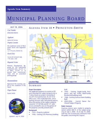
  • 1. Location Map Subject Site SU M M A RY AG E N DA IT E M 10 PR I N C E T O N -SM I T HJ U L Y 1 8 , 2 0 0 6 Case Number ZON2006-00040 Applicant James W. Kersey Property Location The southeast corner of West Smith Street and Edgewater Drive (±1.74 acres, District 3). Parcel ID(s) 14-22-29-1474-07-100, -110, and –140 Requested Action Planned Development Ap- proval for 105 multi-family residential units, 35,237 s.f. of office, 22,247 s.f. of ground floor commercial/ retail, and an associated parking garage. Recommendation Approval of the rezoning, sub- ject to the conditions in this report. Project Planner Seann Smith Agenda Item Summary MUNICIPAL PLANNING BOARD Updated: July 14, 2006 Project Description The applicant proposes to rezone to PD and redevelop the subject property into a 7-story mixed use project consisting of 22,247 sf of commercial, 35,237 sf of office uses, 105 residential units, and a parking structure with 369 parking spaces, all on the portion of the subject property zoned AC-1/T/SP/AR and AC-1/T, with access and buffer area on the portion of the property currently zoned R-2A/T. Background 1925 - Property is platted 1946 - Existing CVS Pharmacy building built 1950 - Existing Single-Family Resi- dence and two 4-Plex Multi-Family Residential buildings built 1988 - Existing Suntrust Bank Building Built 2002-2006 - Current Owner Pur- chased Subject Property Public Comment Courtesy notices were mailed to property owners within 400 ft. of the subject prop- erty on July 5, 2006. As of July 10, 2006, staff has not received any comments from the public concerning this request.
  • 2. ZON2006-00040—Princeton-SmithPage 2 EXISTING CONDITIONS SURVEY Subject Site EdgewaterDr W Princeton St W Smith St Vassar St PrincetonCt W Smith St W Princeton St AnnArborAv Subject Site EdgewaterDr W Princeton St W Smith St Vassar St PrincetonCt W Smith St W Princeton St AnnArborAv AC-1/T R-2/T AC-1/T/SP/AR
  • 4. P R O J E C T C O N T E X T PHOTOS OF SUBJECT PROPERTY Looking Northeast Down Edgewater Drive. Looking East at 20-inch Live Oak Proposed to be Removed, but Staff Recommends to Retain Looking Southeast Down Edgewater Drive. Looking East at Northwestern Corner of Edgewater Façade Looking East at Southwestern Corner of Edgewater Façade Page 4 ZON2006-00040—Princeton-SmithPage 4 ZON2006-00040—Princeton-Smith Looking East at Pocket-Park Under 20-inch Live Oak.
  • 5. PHOTOS OF SURROUNDING PROPERTY Looking Southwest, Down Edgewater Drive, on the Southwestern Corner of the Subject Parcel Looking South at the Adjacent Single-Family Residential to the East of the Subject Parcel Looking Northwest, Down Edgewater Drive, at the Façade Across Edgewater Drive from the Subject Parcel Looking South at Façade of Church to the South of the Subject Parcel, Across Princeton Street Looking North of the Subject Parcel, at the Southwestern Corner Façade on West Smith Street and Edgewater Drive (the Wellesley) Page 5 ZON2006-00040—Princeton-SmithPage 5 ZON2006-00040—Princeton-Smith Looking South at the rest of the Church Property to the South of the Subject Parcel, Across Princeton Street
  • 6. Subject Area: District 4 City of Orlando Economic Development Department July 2006 Zoning District AC-1/T/SP/AR, AC-1/T, R-2A/T (±1.74 ac.) E X I S T I N G Z O N I N G Z O N 2 0 0 6 - 0 0 0 4 0 North ZONING MAPS Subject Area: District 3 Zoning Line City of Orlando Economic Development Department July 2006 Zoning District PD/T/AR, PD/ T (±1.74 ac) P R O P O S E D Z O N I N G Z O N 2 0 0 6 - 0 0 0 4 0 North Subject Area: District 3 Zoning Line Page 6 ZON2006-00040—Princeton-SmithPage 6 ZON2006-00040—Princeton-Smith
  • 7. Page 7 ZON2006-00040—Princeton-SmithPage 7 ZON2006-00040—Princeton-Smith PROJECT CONTEXTSITE PLAN AND RENDERED PERSPECTIVE This site plan shows the ground floor retail, an exclusive 47-space garage for the retail, service corridor through the middle of the building and exfiltration trench under College Lane. North Will Need to Recess Doors Will Need to Redesign Curb Original View from the intersection of Edgewater Drive and Princeton Street
  • 8. Page 8 ZON2006-00040—Princeton-SmithPage 8 ZON2006-00040—Princeton-Smith RENDERED ELEVATIONS These revised rendered elevations are the resulting changes that the applicant made in re- sponse to initial Urban Design staff comments. Those initial staff comments were based on the original rendered perspective drawing (please refer to page 7) and the original ele- vations (please refer to pages 10). Revised View from Edgewater Drive Revised View from West Smith Street
  • 9. Page 9 PROJECT CONTEXT ZON2006-00040—Princeton-SmithPage 9 BUILDING ELEVATIONS - SOUTH & EAST Shown below are the original elevations that the applicant is still in the process of changing to respond to staff comments. ZON2006-00040—Princeton-Smith
  • 10. Page 10 ZON2006-00040—Princeton-SmithPage 10 ZON2006-00040—Princeton-Smith PROJECT CONTEXTBUILDING ELEVATIONS - NORTH & WEST Shown below are the original elevations that the applicant is still in the process of changing to respond to staff comments. The latest version of the elevations shown below are rendered on page 8.
  • 11. Page 11 ZON2006-00040—Princeton-SmithPage 11 ZON2006-00040—Princeton-Smith PROJECT CONTEXTBUILDING SECTIONS These sections slices of the structure show how the various levels fit together from different vantage points.
  • 12. Page 12 ZON2006-00040—Princeton-SmithPage 12 ZON2006-00040—Princeton-Smith PROJECT CONTEXTFLOOR PLAN The Fourth Floor Plan Below Shows the Proposed Location of the Common Area Pool for the Residents of the Development (as well as reference letters/numbers to orient oneself to the sections and elevations on pages 9, 10, and 11).
  • 13. ZON2006-00040—Princeton-SmithPage 13 F I N D I N G S Subject to the conditions contained herein, the proposal is consistent with the requirements for approval of Planned Development applications contained in Section 65.360 of the Land Development Code (LDC): 1. The proposed development is consistent with the City’s Growth Management Plan and specifically implements the following goals, ob- jectives and policies of the Urban Design Element: Goal 1, Objective 1.4 and Policy 1.4.1 related to com- munity design. 2. The proposed development is con- sistent with the City’s Growth Man- agement Plan and specifically imple- ments the following goals, objectives and policies of the Future Land Use Element: Goal 1, Objective 1.3, Pol- icy 1.3.2, Goal 2, Objective 2.1 and Policy 2.2.1 related to residential transition. 3. The proposed development is con- sistent with the purpose and intent of the AC-1/T/SP/AR, AC-1/T, and R- 2A/T zoning districts, including appli- cable performance and design re- quirements of the Land Development Code. 4. The proposed development will be constructed in accordance with Chapter 59 of the LDC, the Concur- rency Management Ordinance, which ensures that adequate public facilities are available to serve the development. PROJECT OVERVIEW & ANALYSIS O ve r vi e w The subject site is located on the east side of Edgewater Drive, between West Smith Street and Princeton Street, and comprises +/- 1.74 acres. The subject site is developed with existing commercial uses on +/-1.18 acres, two 4-plex multifam- ily units on +/-0.28 acres, and two single-family homes on +/-0.28 acres (see sur- vey on Page 3). The subject site is in the heart of the College Park Neighborhood, in the heart of the Activity Center. Most of College Park, including the subject prop- erty, was platted prior to 1945, and is thus within the Traditional City (/T) overlay district. Development on the subject site is generally consistent with that found along this segment of Edgewater Drive. This pattern of development features commercial uses (mostly retail and restaurant) along both sides of Edgewater Drive with resi- dential scale professional offices and small-scale multifamily often providing a tran- sition between the commercial uses and the residential neighborhoods on either side of the corridor. The commercial development on the subject site currently con- sists of a Blockbuster Video, a CVS Pharmacy, a Suntrust Bank, the College Park Cleaners, and a vacant drive-thru. Behind the main building (to the east) is surface parking, two single-family structures fronting on West Smith Street, and two 4-plex multifamily structures fronting on Princeton Street. The surrounding neighborhood land uses lend itself to the redevelopment of this underutilized site. The block to the west of the subject site (across Edgewater Drive) is lined with one-story specialty retail shops and restaurants. Edgewater Drive is four-lanes wide in this area with on-street parking provided on both sides of the street. The block to the north of the subject site is under construction. This site, the “Wellesley”, will become a mixed-use development similar in massing and function to this development, though this project will likely have different architec- ture and a smaller scale (1.74 acres versus the Wellesley’s 2.52 acres). The block to the south of the subject site is the College Park United Methodist Church com- plex. The parcels to the east are all developed with single-family homes in a neighbor- hood that is seeing a lot of redevelopment, either as part of a larger development like this, or renovations/rebuilds. The quality of that redevelopment is of real con- cern to the neighborhood, as demonstrated in a neighborhood meeting on July 28, 2006 on this project. The meeting began with an announcement that there was a committee meeting to explore the establishment of a non-regulatory national his- toric district. After a presentation of the project, neighborhood concerns were fo- cused on parking and traffic issues. While the City’s Traffic Engineering Depart- ment is still reviewing the details of the study, the applicant’s consultant deter- mined that the impact of the proposed development would be negligible when compared to the uses that existed currently on the site. An a l ys i s As stated above, one of the primary concerns in the neighborhood was with regard to how the proposed development would impact the parking situation in the neighborhood. The applicant contends that the proposed development will help the parking situation in the area by providing more parking than what is required to serve the latent parking demand of Edgewater Drive. According to the applicant’s calculations, the proposed uses would require 312 parking spaces (staff estimates only 308 are required) and the Use Min. Req. # of Units Required Parking Total Parking Provided Parking retail/office 2.5/1000sf 57,484 143.71 1-Bedroom 1.5/unit 80 120 2-Bedroom 1.75/unit 24 42 3-Bedroom 2/unit 1 2 total: 308 369 Exhibit 1
  • 14. ZON2006-00040—Princeton-SmithPage 14 PROJECT ANALYSIS (CONT.) proposed parking provides 369 parking spaces. The 4th level of the parking area, which is the 3rd floor of the building, is pro- posed to be dedicated to the residential units (123 spaces). The 3rd level of parking, which is the 2nd floor of the building, is intended to have half dedicated for residential and the other half for office and general use (150 spaces total), approximately 87 spaces available to the public). The intent is to have the office parking spaces (approximately 87 spaces) to only be re- served during normal business hours and will be for public use during nights and weekends. Therefore, the intent is that the office users would not exclusively reserve their parking spaces. The ground level and intermediate level (the second level of parking), are intended for public use (96 spaces), and the ground level is intended for the use of the retail users and general public. However, staff believes it would be best to condition the PD to only require the public parking is to be free only for the first hour, to avoid problems with potential future tenants. After a review of those calculations (please see Exhibit 1), and a review of the code, staff has concluded that the parking pro- vided, as conditioned in this report, is greater than that required under the Code, and is a superior design consistent with a Planned Development that will serve the latent parking demands needed along Edgewater Drive. College Lane will be a two-way access drive and not a private street built to City standards. Therefore, the replat of the prop- erty will be a minor plat. Impervious Surface Ratio (ISR) Initially the applicant applied for a Master Plan approval. How- ever, once staff determined that the project would violate the ISR requirements (please see Exhibit 2), the applicant elected to con- vert the application into a Planned Development request. Therefore the issue of ISR in this case is a significant one. Be- cause it triggers the need for a rezoning to PD, staff needs to de- termine the amount of increased impervious surface proposed. To do that, staff needs to know what the exact amount of impervi- ous surface that currently exists. Once calculated, the amount of total proposed impervious surface needs to be specified in the PD ordinance. Provision and review of ISR information is a condition of approval of the proposed Planned Development. Purpose and Intent To better understand why staff believes that taking the project through the Planned Development process, the following excerpt of Sec. 58.361, “Purpose of the District,” is provided as context: “The standards and procedures of this district are intended to promote flexibility of design and permit planned diversification and integration of uses and structures, while at the same time retaining in the City Council the absolute authority to establish such limitations and regulations as it deems necessary to protect the public health, safety and general welfare.” While the applicant is proposing a dense and intense project, the only purpose of using the Planned Development process is to give the proposed development the flexibility to exceed the maximum Impervious Surface Ratio (ISR), which is a reasonable request, so long as the existing ordinance sized trees are maintained and protected on the property for future enjoyment. Proposed bufferyards should be maintained in perpetuity so as to not increase the ISR beyond the amount proposed, unless the applicant obtains an approved amendment to the PD ordinance. Density and Intensity Bonus The applicant is requesting a density bonus and an intensity bonus to allow a total amount of development that exceeds the maximum amount of development prescribed in the AC-1/T zoning district without a density or intensity bonus. As proposed, the applicant is asking for an additional 47 units and an additional 12,966 square feet of commercial (office/retail) uses than what would be allowed by right in the existing zoning district. Density and Intensity bonuses are allowed for mixed use projects ISR Allowed AC-1/t R-2A/t Total Acres (gross) 1.46 0.28 1.74 Max ISR 85% 55% 80.2% Max Acres Impervious 1.241 0.154 1.395 Total Max %: 80.2% ISR Existing AC-1/t R-2A/t Total Acres (gross) pending pending pending Acres (impervious) pending pending pending % Impervious Existing pending pending pending ISR Proposed AC-1/t R-2A/t Total PD Acres (gross) 1.46 0.28 1.74 Acres (impervious) 1.46 0.11 1.57 % Impervious Proposed 100% 39% 90% Exhibit 2
  • 15. under Future Land Use Policy 2.1.3 and Sections 58.1000 – 58.1104 of the Land Development Code when a proposed devel- opment incorporates at least two uses (for example, commercial and residential) and the building is designed to promote an active, pedestrian-friendly street environment. Density/Intensity bonuses are not entitlements (see Section 58.1101 of the LDC) and are thus not allowed ‘by right.’ The subject parcel (at the center of the Edgewater Drive activity center), creates an appropriate location for the density and inten- sity proposed by the project, provided that the project incorporates the staff urban design comments. Since density/intensity bonuses are specific to a project design and location, such an intensity on parcels further from the middle of the Activity Cen- ter may not be appropriate in the future. The proposed density and intensity bonuses only ap- ply to the 1.46-acre Activity Center portion of the 1.74-acre site. The maximum density (please refer to Exhibit 3) normally allowed in the AC-1/t zoning district is 40 dwelling units per acre (1.46 acres x 40 dwelling units per acre = 58 dwelling units). The maximum density allowed with a density bonus is 80 dwelling units per acre (1.46 acres x 80 dwelling units per acre = 117 dwelling units). The applicant is proposing 105 dwelling units, which equates to a density of 72 dwelling units per acre (105 dwelling units / 1.46 acres = 72 dwelling units per acre). The maximum non-residential intensity normally allowed in the AC-1/t zoning district is 0.7 Floor Area Ratio (FAR). FAR is cal- culated as gross floor area divided by building site area. Based on 1.46 acres, the maximum intensity allowed on the subject site is 44,518 square feet (1.46 acres x 43,560 square feet per acre = 63,598 square feet x 0.7 FAR = 44,518 square feet). The maximum intensity allowed with an intensity bonus is 1.0 FAR (63,598 square feet x 1.0 FAR = 63,598). The applicant is proposing 57,484 square feet, which equates to an intensity of 0.9 FAR. However, as stated by Section 58.1101 of the Code, “A bonus shall not be considered an entitlement.” Bonuses are granted by the City once the applicant demonstrates the project meets the purposes and intent of the Bonus program. Section 58.1001 (titled Purpose of Bonuses) of the Code describes that intent by stating, in part: “The bonuses set forth below are intended to provide incentives to help achieve superior design, and a greater mixture of land uses and intensity than might otherwise occur in office districts, mixed use corridors, activity cen- ters and other districts in the absence of such bonuses. These incentives are also intended to encourage housing opportunities in situations where such opportunities might not otherwise be provided by the private market.” While any project can be improved upon, the Planning Official has determined that the proposed density and intensity bonuses may comply with the purposes and intent of this section of the code, conditioned upon staff review confirmation that the planned development ordinance and final site plans comply with the purposes and intent of the code. Conservation Element of the Growth Management Plan Notwithstanding the density and intensity bonus regulations, the City recently adopted Policies 1.7.8, 1.7.9 and 1.7.10 in the Conservation Element of the Growth Management Plan (adopted December 12, 2005, effective February 28, 2006). Policy 1.7.8 requires 20% open space within any residential development of five acres or more. In this case, the subject site is less than five acres, so Policy 1.7.8 does not apply. Policy 1.7.9 requires that the City adopt zoning regulations to implement the Wekiva policies by January 1, 2007. Policy 1.7.10 prohibits density and intensity bonuses in the Wekiva Study Area. The Wekiva Study Area covers portions of 15 local governments in Orange, Seminole and Lake Counties. A very small portion of the Study Area affects the City of Orlando. Approximately 5,584 acres of property within Orlando’s jurisdiction (7% of the City) is within the Study Area, including the Rosemont, Princeton/Silver Star, Mercy Drive, and College Park (north of Lake Ivan- hoe) neighborhoods. The subject property is located within the Wekiva Study Area. Policies 1.7.8, 1.7.9, and 1.7.10 were adopted to address the requirements of the Wekiva Parkway and Protection Act, Part III ZON2006-00040—Princeton-SmithPage 15 PROJECT ANALYSIS (CONT.) Max. AC-1/T Max. w/ Bonus Proposed Density (Dwellings per Acre) 58 du (40 du/ac) 116 du (80 du/ac) 105 du (72 du/ac) Intensity (Floor Area Ratio) 0.7 FAR 44,518 sf 1.0 FAR 63,598 sf 0.9 FAR 57,484 sf Exhibit 3
  • 16. ZON2006-00040—Princeton-SmithPage 16 PROJECT ANALYSIS (CONT.) of Chapter 369, Florida Statutes, which was signed into law by Governor Bush on June 29, 2004. This law requires that local governments within the Wekiva Study Area adopt land use strategies that optimize open space and promote patterns of devel- opment that protect the most effective recharge areas, karst features, and sensitive natural habitats. These specifically pro- tected areas were mapped as Resource Protection Areas on the City’s Future Land Use Map. The subject property is not within a Resource Protection Area. While Policy 1.7.10 was intended to limit the density and intensity of development as a way to “optimize open space,” the strict application of this policy may actually increase development pressures in Resource Protection Areas. Portions of Edgewater Drive and Colonial Drive are located within the Wekiva Study Area. These corridors are substantially developed and allow high intensities of development. Redevelopment within these corridors would allow the City and region to accommodate the projected population while relieving development pressures on the rural and environmentally sensitive por- tions of the Wekiva Study Area. In addition, density and intensity bonuses within these corridors could be accommodated without increasing the amount of building coverage. The footprint for the proposed project would most likely be the same size with or without the proposed density and intensity bonuses due to the functional requirements of structured parking and the ability to merely increase unit size without increas- ing density. Further, the property is already developed and has relatively little pervious area. Upon further review of Policy 1.7.10, the Planning Official has determined that the proposed density and intensity bonuses may be approved, subject to the adoption of exceptions to the bonus policy as part of the Wekiva Overlay Zoning District regu- lations, and subject to standard bonus review and approval criteria. City staff anticipates that the proposed Wekiva Overlay Zoning District regulations will exempt development along Edgewater Drive and Colonial Drive from Policy 1.7.10 as a way to achieve the purpose and intent of the Wekiva Parkway and Protection Act by encouraging the redevelopment of urbanized areas and the use of existing facilities and services while relieving the pressure to develop Resource Protection areas within the Wekiva Study Area. City staff anticipates that the proposed regula- tions will be considered by the Municipal Planning Board in August and scheduled for adoption by City Council in October 2006. Approval of the proposed Planned Development should be contingent upon adoption of the proposed Wekiva Overlay Zoning District and a determination by staff that the subject project complies with that newly adopted set of subarea regula- tions. School Capacity As development in the area has progressed, school capacity is be- coming an increasingly vital component of staff’s analysis of pro- posals. In this case, all three affected schools are over capacity (please refer to Exhibit 4). While it may have a significant impact on school capacity, the amount of development proposed is less than the maximum already allowed under current zoning standards. Therefore, the applicant for this project will not be required to exe- cute a Capacity Enhancement Agreement. However, any approval of this proposal should be conditioned upon the under- standing that any amendment to this Planned Development zoning ordinance shall be subject to the “Interlocal Agreement Regarding School” capacity approved by the Orange County Board of County Commissioners on March 21, 2006, by the Or- lando City Council on June 19, 2006, and may require the execution of a Capacity Enhancement Agreement between the de- veloper and the Orange County School Board prior to final approval of this amendment by City Council. Existing Tree Canopy, Plaza/Pocket-Park, & Other Urban Design Issues Large trees, such as those existing on the subject site, provide a unique feature that create a context to the site. The appli- cant proposes to save a 48-inch oak in the southeast portion of the site and establish a commons area for the development, but to eliminate the 20-inch oak in the public Right-Of-Way at the southeast corner of West Smith Street and Edgewater Drive (please refer to page 4). However, staff contends the applicant needs to design in a manner that preserves both of these ordi- nance size trees by also retaining the 20-inch oak in a redesigned plaza acceptable to the City. In order to preserve the oaks the applicant will need to establish, through a certified arborist, what extra precautions will be Affected Schools Program Capacity Enrollement Princeton ES 252 496 Lee MS 738 1,017 Edgewater HS 2,674 2,763 Exhibit 4
  • 17. ZON2006-00040—Princeton-SmithPage 17 PROJECT ANALYSIS (CONT.) taken to ensure the trees are not damaged. At minimum, construction activities shall be barricaded from the dripline of the existing oaks. As part of the review the applicant needs to provide details of the retaining wall along the eastern edge of the proposed College Lane. This area will be developed in a manner that is consistent with the bufferyard B requirements in the LDC. Again, once approved, the impervious surfaces of the project site shall not be increased in the future without amending the PD ordinance. Any loss of the aforementioned ordinance sized trees shall require a revised site plan, which would trigger the need of a Planning Official Determination with appropriate mitigation for the loss of the tree. Planned Development Planned Developments are based on an ordinance that acts as a contract between the developer and the City that de- scribes the proposed development. As with any typical contract, if it is not implemented within a set time period, there is a ‘reverter clause’ that is included to remove the development entitlements should the project not be executed, or other issue not covered by the ordinance. In this case the reverter clause will read, “Except as modified herein the proposed development shall be constructed in accordance with the existing standards of the AC-1/T and R-2A/T zoning districts requirements on the respectively zoned property as specified in the Land Development Code. Any future modification of the proposed PD zoning ordinance must comply with the existing underlying zoning designations, and/or a Future Land Use amendment will be required. Further, if the proposed PD ordinance is not implemented within 5 years, the zoning will default back to the existing zoning designation and the PD ordinance is rescinded.” Reasonable minor modifications might be anticipated in the future. The City and applicant need some flexibility to react to small issues that crop up. The minor modification section of the ordinance will allow “Minor modifications and design changes including but not limited to fences, accessory structures, signs, landscaping, interior alterations, and minor changes to the new building, that are required beyond those previously reviewed by the Municipal Planning Board (MPB), may be approved by the Planning Official or his designee without further review by the MPB. Major changes shall require review by the MPB. A major change would include, but is not be limited to, the relocation of the proposed bufferyard and changes to the elevations that do not comply with the conditions under the Urban Design section”. This will ensure that the development of the property, as well as elevations, street sections, landscaping, and the hardscaping plan, is generally con- sistent with the attached development plan, and the conditions herein. A Final Site Plan review is required to be submitted to the City Planning Division (in accordance with Sections 65.346 to 65.350 of the Land Development Code) prior to building permit application due to the changes that are needed to comply with the conditions in this report. The Project Manager, Zoning Official, and Planning Official will review the plans for confor- mance with the requirements of this Planned Development. Any change required to ensure conformance with the condi- tions of approval shall be incorporated into the plans prior to building permit application. The final site plan will also include a waste management plan. Urban Design Urban Design Staff reviewed the project according to Chapter 62 of the LDC. Section 62.300 describes the general requirements for the Appearance Review Overlay; Sec- tion 62.309 describes the Edgewater Special Plan overlay district; and Section 62.600 describes the Traditional City requirements. The proposed project meets these require- ments; as conditioned by staff (the City architect) however, there are a number of items that should be addressed in a revised design, submitted to Urban Design prior to sub- mitting construction documents, in order to meet the architectural intent of these de- sign standards. In working with the applicant, staff has provided the applicant a number of sketches (please refer to Exhibit 5) in an effort to explain what changes to the exterior are needed to get the design to conform to the requirements. Further, elements of the streetscape need to be refined according to the conditions. The applicant needs to provide staff with streetscape sections and plans. This overall design package review and approval by the Appearance Review Officer are a condition of approval in order to integrate the variety of architectural styles designed by the applicant and conditions created by staff for the articulation of the massing of the elements of the building. Exhibit 5
  • 18. P L A N N I N G For questions regarding Current Planning review, please contact Seann Smith at (407) 246-3282 or email: seann.smith@cityoforlando.net. 1. Parking. The office parking spaces (approximately 87 spaces) shall be reserved for office use during normal busi- ness hours and shall be available for public use during nights and weekends. The ground level and intermediate level (2nd level of parking) shall be available for public use (96 spaces), and the ground level shall be utilized for the exclusive use of the retail users. Employees of the retail use shall park on upper levels. All parking shall be free for the first hour to visitors of the retail establishments and surrounding parking demands of Edgewater Drive. 2. Wekiva Overlay Zoning District. Approval of the proposed Planned Development is contingent upon adoption of the proposed Wekiva Overlay Zoning District and a determination by staff that the subject project complies with that newly adopted subarea regulation. 3. Impervious Surface Ratio. The applicant shall provide final calculations of the amount of existing and proposed im- pervious surface, as described in the analysis of this report. Once approved, the proposed impervious surfaces of the project site shall not be increased in the future without amending the PD ordinance. 4. General Code Compliance. The proposed project shall be developed in consistency with the conditions in this re- port, and all codes and ordinances of the City of Orlando, the State of Florida, and all other applicable regulatory agencies. 5. Density and Intensity Bonus. Staff shall verify that the final planned development ordinance complies with Future Land Use Policy 2.1.3 and Sections 58.1000 – 58.1104 of the Land Development Code. 6. School Capacity. Any amendment to this Planned Development zoning ordinance and/or Master Plan shall be sub- ject to the Interlocal Agreement Regarding School Capacity approved by the Orange County Board of County Com- missioners on March 21, 2006 and by the Orlando City Council on June 19, 2006, and may require the execution of a Capacity Enhancement Agreement between the developer and the Orange County School Board prior to final ap- proval of that amendment by City Council. 7. Existing Tree Canopy. The applicant shall work with staff to save the 20-inch oak at the southeast corner of Edge- water Drive and West Smith Street, and the 48-oak in the southeast portion of the site. If the applicant fails to prop- erly protect these trees, the applicant shall apply for a Determination letter the Planning Official to determine if the proposed mitigation is acceptable to the City. 8. Pedestrian Zones. The applicant shall design (with City public works approval) and pay for the construction of nec- essary any redevelopment of the seating area at the southeast corner of Edgewater Drive and West Smith Street. Any design shall incorporate the preservation of the 20-inch oak. Further, the applicant will provide a common area park in the area around the 48-inch oak at the southeast portion of the development in the proposed buffer, for use by the users of the development. The proposed street-trees in this area shall create a streetscape with tree-wells aligned with the existing tree nearer to the curb, instead of lining the eastern property line as currently proposed. 9. Bufferyard. The applicant shall make modifications to the proposed buffer area on the eastern side of the subject parcel. The applicant shall provide details of the retaining wall along the eastern edge of the proposed College Lane. This area shall be developed in a manner that is consistent with the bufferyard B requirements in the LDC. 10. General Conditions. A. Development of the property, as well as elevations, street sections, landscaping, and hard- scaping plans shall be generally consistent with the attached development plan and the conditions herein; and B. Due to the changes needed to address conditions in this report, a Final Site Plan review is required to be submitted to the City Planning Division in accordance with Sections 65.346 to 65.350 of the Land Development Code prior to building permit application, or in the case of substantial change in the building design. The Project Manager, Zoning Official, and Planning Official shall review the plans for conformance with the requirements of this master plan ap- proval. Any change required to ensure conformance with the conditions of approval shall be incorporated into the plans prior to building permit application. The final site plan shall include a waste management plan. 11. Default Zoning District Standards. Except as modified herein the proposed development shall be constructed in ac- cordance with the existing standards of the AC-1/T and R-2A/T zoning districts requirements on the respectively zoned property as specified in the Land Development Code. Any future modification of the proposed PD zoning ordinance must comply with the existing underlying zoning designations, and/or a Future Land Use amendment will be required. Further, if the proposed PD ordinance is not implemented within 5 years, the zoning will default back to the existing zoning designation and the PD ordinance is rescinded. 12. Minor Modifications. Minor modifications and design changes including but not limited to fences, accessory struc- tures, signs, landscaping, interior alterations, and minor changes to the new building, that are required beyond CONDITIONS OF APPROVAL ZON2006-00040—Princeton-SmithPage 18
  • 19. ZON2006-00040—Princeton-SmithPage 19 CONDITIONS OF APPROVAL, CONT’D those previously reviewed by the Municipal Planning Board (MPB), may be approved by the Planning Official or his designee without further review by the MPB. Major changes shall require review by the MPB. A major change would include, but is not be limited to, the relocation of the proposed bufferyard and changes to the elevations that do not comply with the conditions under the Urban Design section. E N G I N E E R I N G A N D Z O N I N G The Office of Permitting Services recommends approval of the proposed Planned Development, subject to the following conditions and requirements. For questions regarding Engineering or Zoning, contact Shenitonnia Bryant at (407)246- 3239 or: Shenitonnia.Bryant@cityoforlando.net 1. This property is required to be replatted in accordance with Section 65.401 of the City's Land Development Code prior to the issuance of building permits. Contact the Land Development Section of the City Planning Bureau at (407) 246-2175 to make an appointment for a pre-application conference. 2. Final Plat: At the time of final plat submittal, the following is required: A. Mylar plat (executed by the owner and signed and sealed by the surveyor). B. Certificate of Title or Title Opinion (A title insurance policy is not acceptable.) Refer to Florida Statutes 177.041 for additional information. C. Six sets of approvable construction plans. D. Joinder and Consent to Plat - If there is a mortgage on the property, a joinder and consent to plat document is required from each mortgage holder. The document is recorded with the plat. Refer to Florida Statute 177.081 for additional information. E. The plat must be reviewed by Orange County prior to recording. Begin this process by taking a copy of the executed plat to Room 1700 (Orange County Property Appraiser's Office, Attn. Judy Miley), 200 S. Orange Avenue, Sun Trust Bank Center. A copy of the completed Statement of Lien from Orange County is required by this office. The original Statement of Lien must be delivered to the Orange County Records Department lo- cated at 400 E. South Street (corner of South St. and Rosalind Ave.) prior to recording the plat. 3. All new construction, change in use, additions, or redevelopments are required to submit a Concurrency Manage- ment application as a part of the building plan review process. 4. As per Section 61.225 of the Land Development Code and the Edgewater Drive Special Plan, a 13-foot wide con- crete sidewalk is required along all dedicated rights-of-way, unless other site specific specifications are given. (From Planning-In this case a 5-foot furniture zone and an 8-foot pedestrian zone is provided. The arcade along Edgewater shall contain a City sidewalk easement of 8 feet clear to provide the required pedestrian area accord- ing to the plan.) Any existing sidewalk damaged or broken is to be repaired. 5. The City Council Adopted the Engineering Standards Manual (ESM), Third Edition on January 27, 2003. All plans must conform to the ESM and all construction must be accomplished in accordance to the ESM. 6. All sanitary sewer construction is to be in accordance with the Engineering Standards Manual. One lateral for each lot is required. Section 9.03.02 (J) of the ESM provides that a double wye is not acceptable. 7. Construction activities including clearing, grading and excavating activities shall obtain an Environmental Protec- tion Agency (EPA) National Pollution Discharge Elimination System (NPDES) permit, except: Operations that re- sult in the disturbance of one acre total land area which are not part of a larger common plan of development or sale. 8. This project may require a Florida Department of Environmental Protection (FDEP) permit for the sanitary sewer system. The Office of Permitting Services processes the permit for projects with reserved sewer capacity. At the time of FDEP permit submittal to the Office of Permitting Services, the following is required: 1. Permit Application - signed/sealed by the owner. This Office will complete page 10 of 11 when the construction plans are approved. 2. Construction Plans - six sets, signed/sealed by the engineer. The plans are to include the on-site and off-site sewer design together with the City's details. If a lift station is part of the sewer design, the engineer is to submit the shop drawings for the lift station (private or public). 9. The construction plans are reviewed by the City of Orlando's Waste Water Bureau and returned to the Office of Permitting Services when approved. This Office will contact the engineer to pick up the application and two sets of the approved plans or the transport to FDEP. The remaining sets will be retained by the Office for distribution. Reminder: PLEASE ALLOW 3-4 WEEKS FOR THIS PROCESS 10. See Chapter 64 Orlando Land Development Code for sign requirements and regulations. Separate permit applica- tions are required for signs.
  • 20. 11. The owner/developer is required to design and construct an on-site storm water system in accordance with the Engineering Standards Manual and the approved Master Drainage Plan. Approval from St. Johns Water Manage- ment District is required. The system is to be privately owned and maintained. 12. Please submit stormwater drainage calculations and geotechnical report for review. 13. A stormwater pollution prevention plan is required and will need to include an erosion control plan. 14. All exterior awnings need to meet the design criteria of Section 61.204 of the Land Development Code. 15. All proposed generators and transformers must be located in the interior portion of the new structure(s) on the subject site. If proposed mechanical equipment is to be located on the roof of the structure, it must be properly screened from view. 16. The Proposed development is located in the Edgewater Drive Special Plan overlay district of the City of Orlando, future development of the site will require appearance review by Urban Design prior to permit plan submittal. 17. Development plans will need to show and label the "property lines" on the elevation plans, foundation plans, and the "building section's plans". 18. In accordance with City Code Section 28.6 (f) 1-3, the Office of Permitting Services is authorized to make a deter- mination of approval/disapproval of refuse container sites. Approval/disapproval of the use of commercial hand pick-up of refuse from any non-residential entity shall be determined solely by the Refuse Collection Bureau Staff. 19. At the time of development, the owner/developer is required to apply an on-site inspection fee that is a percentage of the cost of the on-site improvements, excluding the building, in accordance with City Land Development Code, Section 65.604. 20. The owner/developer should contact the Wastewater Bureau for review and approval of available sanitary sewer capacity to serve the proposed development. Future construction of the sanitary sewer connections shall be in accordance with the Engineering Standard Manual Third Edition. 21. Two copies of the soils report are required for this site in accordance with Section 65.418 (f) of the City Land De- velopment Code. 22. The Orlando City Council approved a resolution at the January 27, 1997 City Council Meeting. Section 61.226 of the City's Land Development Code provides for a Street Tree Trust Fund. The developer is required to contribute funds to the Trust Fund prior to issuance of the building permit. The City is responsible for installation of the trees. The cost is $350 for each 12'-14' height of canopy tree. The developer may install the street trees in lieu of contri- bution to the Trust Fund in accordance with Section 61.226. 23. All Landscaping shall be in accordance with Chapter 60, with a minimum shade coverage of 15 tree points per acre, per Section 60.240, figure 5. 24. All landscaped areas shall be irrigated in accordance with Section 60.232 (e) Orlando Land Development Code. 25. Storm water control measures to minimize the impact of the erosion/sedimentation shall be incorporated in the plan of the development for all projects in the City of Orlando and a detailed description of these measures are to be included with the final engineering submittal. This is in accordance with Section 6 of the Orlando Urban Storm Water Management Manual. 26. The proposed name of the new street shall be submitted to the Engineering Bureau for review for duplication of established street names, same sounding name, type of spelling, etc., in accordance with the City Land Develop- ment Code, Section 61.221. 27. At the time of development, the owner/developer is required to pay an on-site inspection fee at a rate of up to 3% of the on-site improvements, excluding the building, in accordance with City Land Development Code, Section 65.604. 28. The owner/developer is required to design and construct an on-site storm water system in accordance with the Orlando Urban Storm Water Management Manual and the approved Master Drainage Plan. Approval from St. John Water Management District is required. The system is to be privately owned and maintained. 29. Construction activities including: clearing, grading, and excavating activities shall obtain an Environmental Protec- tion Agency (EPA) National Pollution Discharge Elimination System (NPDES) permit, except for, “Operations that result in the disturbance of less than five acres total land area which are not part of a larger common plan of de- velopment or sale.” 30. Please be advised that the development of this project/property is subject to the terms and provisions of Concur- rency Management Chapter 59 of the City Code and the Committed Trip Allocation Policy. ZON2006-00040—Princeton-SmithPage 20 CONDITIONS OF APPROVAL, CONT’D
  • 21. CONDITIONS OF APPROVAL, CONT’D ZON2006-00040—Princeton-Smith T R A N S P O R T A T I O N E N G I N E E R I N G Transportation Engineering has no objections to the proposed Planned Development approval provided that the Owner/Developer shall comply with the following Transpor- tation Engineering conditions and requirements. For questions regarding Transporta- tion Engineering issues contact Adam Walosik at (407) 246-3322 or email: adam.walosik@cityoforlando.net 1. City Services/Sidewalk Easement Dedication : The Owner/Developer shall dedicate additional City Services/Sidewalk Easements to the City of Orlando for any portion of the public sidewalk constructed outside the City R-O-W. 2. Service Area Access: The eastern service driveways radii approaches onto Smith Street, and Princeton Street shall be enlarged to minimum 40’ to ac- commodate turning radii of the service/delivery vehicles. The western radii of the driveways onto Smith Street and Princeton Street shall be geometrically designed to reflect the One-Way movement. 3. Building Entrances: Pedestrian entrances and doors that lead directly from the sidewalk, right-of-way, or the proposed arcades shall be recessed so the doors do not swing open into the sidewalk area. 4. Pedestrian Walkway Treatments: stamped or colored concrete, etc. is required where walkways are pro- posed to cross driveways. 5. Bus Stop: Eliminate one parking space adjacent to the southernmost landscape island on Edgewater Drive and install a bus stop with a bench. Install a bench at the bus stop on the opposite site of Edgewater Drive. 6. Intersection crossings: The project shall install Enhanced Visibility Crosswalks for approaches at the Smith Street/Edgewater Drive and Princeton Street/Edgewater Drive intersections. The City prefers crosswalks that utilize imprinted or stamped pavement or concrete in a contrasting color, or retro-reflective thermoplastic mark- ing (skid-resistant) in a contrasting color instead of the proposed bricked crosswalks. 7. Bicycle Parking Plan: A total of four-bicycle hitch racks shall be installed along Edgewater Drive in the fur- nishing zone of the streetscape. See the attached graphic (Exhibit 3) showing a bike bollard rack. Three bike lockers shall be installed in the parking garage in a high-surveillance area. 8. General Transportation Conditions: a. Encourage employees and residents to use public transportation by displaying Lynx transit information and encourage tenants to participate in Lynx’s ridesharing program. b. The owner/developer and future tenants site shall participate in downtown transportation management associations, current and future, for the downtown area. The owner/developer and tenants of the project shall pay 50% of the cost of transit passes for any employees working at the site who desire them. c. Shower facilities shall be made available to all employees of the retail and office uses. d. The Owner/Developer and Management Company shall designate a person responsible for coordinating transit, rideshare, and bicycle forms of commuting. The person shall annually provide a letter document- ing the availability of programs, summarizing the level of transit pass subsidy, and conveying all other relevant information on alternative forms of transit. A copy of the letter must be sent to the City’s Director of Transportation. 9. Staging Area and Construction Traffic: A Maintenance Of Traffic (MOT) during construction plan, includ- ing location of staging areas, shall be coordinated with Transportation Engineering, Attn: Scot Walker at (407) 246-2372. 10. Driver's and Pedestrian's Clear Sight Distance - The Driver's and Pedestrian's Clear Sight Distance shall not be blocked by signs, buildings, building columns, landscaping, etc. at street intersections and driveways. No structure, fence, wall, etc. shall obstruct vision between three feet and eight feet in height above street level. The street corner / driveway visibility area shall be shown & noted on construction plans and any future site plans. Page 21 Exhibit 3
  • 22. ZON2006-00040—Princeton-SmithPage 22 CONDITIONS OF APPROVAL, CONT’D U R B A N D E S I G N Urban Design Staff reviewed the project according to Chapter 62 of the LDC. Section 62.300 describes the general requirements for the Appearance Review Overlay; Section 62.309 describes the Edgewater Special Plan overlay dis- trict; and Section 62.600 describes the Traditional City requirements. The appearance review requirements include logic of design, exterior space utilization, attractiveness, material selection, compatibility with surrounding properties, multi-modal circulation, accepted architectural principals and protection of property values along with Land Develop- ment Code & Growth Management Plan compliance. The majority of the proposed project meets these require- ments, however, the following items shall be addressed in a revised design, submitted to Urban Design, prior to sub- mitting construction documents in order to meet the architectural intent of these design standards. For questions re- garding Urban Design issues contact Holly Stenger at (407) 246-2861 or email: holly.stenger@cityoforlando.net 1. Building Façade: The style of the building needs more integration among the different styles proposed. The de- sire to have a more “collegiate” style to refer to the atmosphere of College Park is being composed of several unrelated materials, forms, and styles in the details of the project. Certain architectural details are not logically placed on the façade and shall be revised such as: a. Quoining details shall be placed at corners of the architecture, not along mid-wall lengths of the façade. There are instances of the project where this detail has been utilized appropriately, and other examples where it is not an appropriate detail considering its location on the façade. b. The location of columns and pilasters on the façade of the project shall be reconsidered such that the pilas- ters at the top of the building and throughout the body align with the base of the building. These details shall appear structurally accurate. The amount of columns located along the arcades shall be minimized in order to allow visibility for the retail and pedestrian activity, a basic CPTED principal. c. Reinforcing the corners of the building along Edgewater Drive is appropriate; however, the transition to those corners shall have further refinement. For example, the mid-section of the south tower shall be capped with a spandrel of brick materials to terminate the brick columns or a treatment that ties the brick columns to- gether. The north tower shall have a detail to the brick columns (such as a heavier base) to allow a more proportionate scale to the triumphal arch, which is nearly 3.5 stories in the air supported by these smaller columns. d. The transition of form of the 4-story base and the 3-story upper floors along the Edgewater façade shall translate into the elevation treatments around the corner, such that the forms are integrated when viewed from the corner of Edgewater/Princeton and Edgewater/Smith and transform the 1-3-2 floor level rhythm on Edgewater and the 1-2-4 floor level rhythm along these other streets (as described by sketches with the City Architects). The applicant shall continue to work with the City Architect to resolve this issues prior to build- ing permit submittal. e. The north garage opening of the speed ramp along the east façade is off-centered from architectural pilas- ters and columns of the building itself. The applicant shall modify the design to revise the lower 3-story de- tailing such that the pilasters and columns create a logic from top to bottom, particularly along this area of the speed ramp opening (especially the southern column near this entrance, which shall be moved a few feet to the south, per sketches provided to applicant). The elevation does not appear to match the plan and structural grid in this area. f. Eliminate the unneeded columns on all colonnades, and space them appropriately according to the structural modules and/or patterns of the upper architecture. g. Because of the complexity of the architectural design, the design shall be modeled in three dimensions, vir- tually or physically, to see the impacts of each of the elements on other architectural elements. 2. Height and Massing – The building is redeveloping a full block with public streets on 3 of the 4 sides. Per the zoning designation, the maximum permitted building height for AC-1/T is 75-feet. However, the existing build- ing context is mainly one-story commercial buildings along Edgewater Drive. The proposed building is continu- ing the one-story colonnade; emphasizing the architectural elements around the 3rd or 4th story, and stepping the building mass above, back with a total height of 75-feet. The proportions of the building related to height and massing shall remain. Any changes shall be reviewed and approved by the City Architect. 3. Accessory Structures – Mechanical equipment, utility hardware, refuse and waste removal areas, and exterior storage and work areas shall be screened from public view or located so as not to be visible from the public
  • 23. ZON2006-00040—Princeton-SmithPage 23 CONDITIONS OF APPROVAL, CONT’D ways. The plans shall identify where all above-mentioned equipment will be located and propose how it will be screened. Special attention shall be paid to the Service Drive area if it is intended to also provide pedestrian ac- cess from the public parking to the ground floor retail, office lobby, and/or residential lobby. 4. Windows- The use of windows as an architectural element is important to façade design. Window size, shape, and materials shall relate to surrounding buildings and to pedestrian activity on the street. To be consistent with the area, the storefront window on the ground level shall be installed between 8” to 24” above the sidewalk (for instance over knee wall or curb, as shown in elevations), with a variety of storefront conditions. The glass shall be clear, not tinted or reflective. A minimum of 60% transparency for the ground floor storefronts facing Edgewater Drive is required. Each floor level below the roofline shall have a minimum of 35% transparency. Openings in parking garages shall have details to appear as fenestration, and shall count toward transparency. 5. Awnings and Canopies – The proposed arcades shelter pedestrians from sun and rain, and reduce heat gain at the storefront glass. Additional use of awnings to create a transition of scale from the street to the building entries shall be provided along Princeton. 6. Lighting – Lighting shall be used to accent product displays (storefront displays shall be lit at night). Exterior fix- tures shall be of decorative nature and coordinate with the style of the building. To keep light-rays and glare from encroaching adjacent properties, illumination shall be installed with house-side (full cut-off) shields and reflectors to confine the light-rays to the premises. All public streets adjacent to the development shall have street lighting. Streetlight fixtures shall be located within the “furniture zone”. A signed and sealed photometric plan, showing all exterior lights associated with the project, shall be submitted and approved by the Appearance Review Officer. 7. Signs –All signage shall be reviewed under separate permit and in accordance with LDC Section 62.309. A sign master plan shall be submitted and reviewed separately prior to building permits. 8. Parking – Parking facilities shall be located and designed so as to avoid dominating the view from the public right of way. All facades of the parking structure shall be designed as to integrate into the overall building design. 9. Landscaping - The proposed landscaping shall be consistent with the existing conditions of the area. Sable palms shall be provided at street intersections along Edgewater Drive, to be same size as existing at time of planting, unless a change is approved by Urban Design. The landscape plans shall conform to LDC Chapter 60, particularly the sections regarding tree removal permits (Sec.60.211), minimum shade coverage–15 tree points per acre (Sec.60.241), minimum planting areas (Sec.60.255), parking garages (Sec.60.257), bufferyards (Sec.60.260), etc. The locations for the planting areas and tree wells shall not interfere with consistent pedestrian circulation clearances. 10. Streetscape- Elements of the streetscape shall be redesigned: the sidewalks shall maintain a 5-foot clear zone at all times; the sidewalk along Princeton (between the service exit and College Lane) shall be 7 feet wide, with a 5-foot park-strip with canopy trees and 2’-4” landscape area along the garage; canopy trees shall be installed throughout all frontages in tree-wells at least 6 feet by 9 feet, except for the area between College and the service entrance on Smith, which shall be designed in accordance with code and approved by Appearance Review, allowing for the proposed 7-foot 4-inch sidewalk with a 4-foot park-strip just in this particular area; tree-wells shall remain 25 feet from all street corners; trees shall have at-grade tree-wells; those tree-wells shall be located adjacent to the edge of the curb; and the proposed curb at the southeast corner of Edgewater Drive and West Smith Street shall be redesigned to provide more room to relocate the proposed street-trees out of the sidewalk clear zone. The applicant shall provide streetscape sections and plans for approval by the Appearance Review Officer prior obtaining a building permit. SU M M A RY AN D RE C O M M EN DAT I O N Based on the above analysis, staff recommends approval of the request to rezone the subject property from AC-1/T/SP/AR to PD/T/SP/AR, AC-1/T to PD/T, and R-2A/T to PD/T, to permit development of the Princeton-Smith mixed-use project, subject to the conditions contained in the staff report.