

Recommended
Recommended
More Related Content
Similar to Drought analysis portugal
Similar to Drought analysis portugal (20)
Recently uploaded
Recently uploaded (20)
Drought analysis portugal
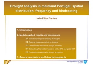
- 1. João Filipe Fragoso dos Santos 2012.03.081 Drought analysis in mainland Portugal: spatial distribution, frequency and hindcasting João Filipe Santos 1. Introduction 2. Models applied, results and conclusions 2.1 Spatial and temporal variability of droughts 2.2 Regional frequency analysis of droughts 2.3 Dimensionality reduction in drought modeling 2.4 Spring drought prediction based on winter NAO and global SST 2.5 Precipitation thresholds for drought recognition 3. General conclusions and future developments
- 2. João Filipe Fragoso dos Santos 2012.03.082 üDrought is one of the most complex and least understood of all natural hazards, affecting more people than any other one. The marked natural climate variability in the Mediterranean region makes drought events appear as a recurrent phenomenon causing important damages in the economy, the environment and the society. ü However, until recently, few attempts have been made to fully characterize drought and even to test its potential predictability for Portugal. This thesis is the first one to embrace the drought throughout mainland Portugal in different and complementary aspects. 1. Introduction. General framework
- 3. João Filipe Fragoso dos Santos 2012.03.083 ü Study supported by 94-years (from October 1910 to September 2004) of monthly precipitation records in 144 rain gauges regularly distributed throughout the country. üMonthly precipitation samples with a few gaps were filled by applying linear regression… common reconstruction technique of hydrologic time series. (mean annual precipitation … more than 2800 mm, in the north-western region, to less than 400 mm, in the southern region, following a complex spatial pattern, in close connection with the relief, far beyond the most determinant factor of the precipitation pattern). 1. Introduction. Study area and data
- 4. João Filipe Fragoso dos Santos 2012.03.084 ü Another data... North Atlantic Oscillation (NAO) and sea surface temperature (SST) were considered as potential external predictors since it is proved that they affect Europe’s climate (several authors). ü NAO index... defined as the diference between the normalized sea level pressure over Gibraltar and Southwest Iceland (http://www.cru.uea.ac.uk/ftpdata/nao.dat) ü SST data... NCDC Extended Reconstructed SST v3b dataset. Three SST fields: Mediterranean Ocean – SST1 (37oE-7oW; 31oN-47oN); Brazil in the south-western part of Atlantic Ocean – SST2 (35oW-25oW; 15oS- 10oS); and the North Atlantic – SST3 (45oW- 25oW; 38oN-42oN). 1. Introduction. Study area and data
- 5. João Filipe Fragoso dos Santos 2012.03.085 üIn the research… it was important the choice of the indicator used to assess drought: the standardized precipitation index (SPI) designed to quantify the precipitation deficit at multiple time 1. Introduction. Drought Index Non-exceedance probability SPI Drought category 0.05 >1.65 Extremely wet 0.10 >1.28 Severely wet 0.20 >0.84 Moderately wet 0.60 >-0.84 and <0.84 Normal 0.20 <-0.84 Moderate Drought 0.10 <-1.28 Severe Drought 0.05 <-1.65 Extreme Drought Drought Classification scales, according to the impact of droughts on the different components of the hydrological cycle. üThree modifications in the SPI calculation were adopted: (i) the use of the Pearson Type III distribution (instead of the Gamma); (ii) the consideration of the L-moment method for the calculation of the Pearson Type III parameters; (iii) the adoption of a different classification for drought intensity (instead of the original one). Standardized Precipitation index (SPI)
- 6. João Filipe Fragoso dos Santos 2012.03.086 üSPI, advantages… (a) great flexibility, as it can be applied at different time scales; (b) less complexity, comparatively to other indexes, as it requires simple and well set calculations; (c) adaptability to hydro-climatologic variables besides precipitation; and (d) suitability to spatial representation, allowing comparison between areas within the same region. üSPI, timescales … at 1 month is mainly a meteorological drought index … between 3 and 6 months it can be considered an agricultural drought index … and between 6 and 12 months it is considered a hydrological drought index, becoming useful for monitoring the surface water resources. 1. Introduction. Drought Index
- 7. João Filipe Fragoso dos Santos 2012.03.087 ü Objectives (addressed in the different chapters and published in journals with very high IF) • Characterization of the temporal and spatial variability of droughts regarding the regions identified by the spatial classification… Also the identification of cycles of dry and wet events in those temporal patterns. • Assessment of regional frequency analysis based on the Hosking and Wallis methodology aiming at identifying the regional probability distribution functions in order to produce drought hazard maps. • Identification of the minimum number of rain gauges that need to be considered in a given drought monitoring network in order to improve the monitoring and, consequently, the predictability of drought-related events. • Hindcasting* the drought phenomena (*a way of testing or validating a model, by running it for a past time period and comparing results with observations). • Establishment of precipitation surfaces that provide thresholds for expeditious drought recognition on a monthly basis and across different time scales. 1. Introduction. Objectives
- 8. João Filipe Fragoso dos Santos 2012.03.088 2. Models applied, results and conclusions 2.1 Spatial and temporal variability of droughts in Portugal* ü … Characterization of the temporal and spatial variability of droughts … Also identification of cycles of dry and wet events in the temporal patterns. üSPI time scales… at 1 (SPI1), 6 (SPI6), and 12 (SPI12); at 6 months of the dry season (April to September, SPI6Apr-Sep); and at 12 months of the hydrologic year (October to September, SPI12Oct-Sep). *Santos J.F., Pulido-Calvo I., Portela M.M., 2010. “Spatial and Temporal Variability of Droughts in Portugal”. Journal of Water Resources Research, 46, W03503. ISSN 0043–1397 (IF: 2.597)
- 9. João Filipe Fragoso dos Santos 2012.03.089 üPrincipal components analysis (PCA) (… SPI data…) identification of patterns and expressing of the data in such a way as to highlight their similarities and differences. üNon-hierarchical cluster analysis (KMC) (… SPI data…) grouping of rain gauges so that similar SPI variations are assigned to the same group, while different variations are grouped separately. üSpectral analysis (… SPI data…) recognition of cyclical patterns by decomposing complex time series into a few underlying functions of particular wavelengths. 2.1. Spatial and temporal variability of droughts. Models
- 10. João Filipe Fragoso dos Santos 2012.03.0810 üThe three main patterns (F1, F2 and F3) explain more than 70% of the total variance. üThe first component (F1) explains between 30 and 37% of total variance. PCA – Principal Components Analysis: variance explained by each component ü The second component (F2) explains 30% of total variance for the lower time scale (1 and 6 months) being less important than the third one (F3) for highest time scale (12 months). 2.1. Spatial and temporal variability of droughts. Results – PCA
- 11. João Filipe Fragoso dos Santos 2012.03.0811 … representation of the spatial extent of the first three components (F1, F2 and F3) by mapping the values of the factorial matrix (correlations between each component and the original field of SPI series) 2.1. Spatial and temporal variability of droughts. Results – PCA ü For all the SPI time scales, the first component (F1) highlights an area located in the south of Portugal
- 12. João Filipe Fragoso dos Santos 2012.03.0812 ü… F2 is mainly representative of the north-western region. üF1 and F2 do not overlap, being clearly spatially disjunctive. ü… the third component F3 highlights a central region which confines with the regions identified by F1 and F2. 2.1. Spatial and temporal variability of droughts. Results – PCA
- 13. João Filipe Fragoso dos Santos 2012.03.0813 (…similar results for SPI1, SPI6, SPI12 and SPI12Oct-Sep)SPI6Apr-Sep KMC - K-means clustering: classification groups … spatial distribution of the clusters for 2, 3 and 4 classification groups 2.1. Spatial and temporal variability of droughts. Results – KMC
- 14. João Filipe Fragoso dos Santos 2012.03.0814 … From the cluster analysis, three different well-defined regions, a number similar to the one shown by the PCA method, were adopted … suggesting that both methods can be used to identify spatial areas of SPI with different temporal patterns 2.1. Spatial and temporal variability of droughts. Results – KMC
- 15. João Filipe Fragoso dos Santos 2012.03.0815 Southern Portugal (SPI6Apr-Sep) PCA – F1 Cluster 3 RPearson= 0.964 North-western Portugal (SPI6Apr-Sep) PCA - F2 Cluster 1 RPearson= 0.938 Temporal patterns: … the results from PCA and KMC showed once more to be similar 2.1. Spatial and temporal variability of droughts. Results
- 16. João Filipe Fragoso dos Santos 2012.03.0816 üTemporal evolution of the area affected by moderate, severe and extreme drought in the regions (highlighted in the figure) with correlations according to the PCA greater than 0.7 2.1. Spatial and temporal variability of droughts. Results Areal evolution of droughts: … according to PCA and for SPI6Apr-Sep …
- 17. João Filipe Fragoso dos Santos 2012.03.0817 üSouthern region (F1) is more affected by drought events than the north-western part (F2). In fact, the number of events affecting more than 50% of the area was 17 in south and 12 in the north. üThe most widespread extreme droughts occurred in the southern region with 69% and 73% of area affected in 1944 and 1954, respectively, and in the northern region with 43% in 1954 and 1989. 2.1. Spatial and temporal variability of droughts. Results
- 18. João Filipe Fragoso dos Santos 2012.03.0818 üThe fast Fourier transform technique, or FFT, was used to analyze the cyclical behavior of the SPI patterns (based on PCA and cluster analysis). Spectral Analysis 2.1. Spatial and temporal variability of droughts. Results Southern region One clear peak in the periodogram plot, representing a period of 3.6 years. Northern region Two clear peaks in the periodogram plot, representing, one, a period of 2.4 years and, the other, a period of 13.4 years. F1 CL3 F2 CL1
- 19. João Filipe Fragoso dos Santos 2012.03.0819 ü… The characterization achieved can provide a basis for drought risk assessment, by highlighting regions more prone to droughts, where additional storage capacity is required for drought protection. üFor all times scales, the PCA and the KMC analysis resulted in an equivalent areal zoning, with three regions with different behaviors: the north, the center and the south of Portugal üThe similarity of the results achieved by PCA and the KMC analysis were an indicative that both methods can be used for drought classification purposes, regarding spatial and temporal pattern analysis nevertheless… the components produced by PCAs provide a more clear and simple method to recognize distinct temporal patterns 2.1. Spatial and temporal variability of droughts. Conclusions
- 20. João Filipe Fragoso dos Santos 2012.03.0820 2. Models applied, results and conclusions 2.2 Regional Frequency Analysis of Droughts: Portuguese Case* üDrought hazard maps were produced by statistical tools with the aim of drought risk analysis. ü Long series of drought characteristics and suitable statistical models are required to address any statistical characterization. ü … study based on the three well defined sub regions with different drought patterns previously identified. *Santos J.F., Portela M.M., Pulido-Calvo I., 2011. “Regional Frequency Analysis of Droughts in Portugal”. Journal of Water Resources Management, Springer. ISSN 0920-4741. DOI10.1007/s11269-011-9869-z (IF: 2.054) Cluster 1: North Cluster 2: Center Cluster 3: South
- 21. João Filipe Fragoso dos Santos 2012.03.0821 ü … the concept of drought comprehends a beginning, an ending, a drought intensity and a drought magnitude. Threshold adopted: -0.84 2.2. Regional frequency analysis of droughts. Models ü … for each one of the 144 rain gages and for the different times scales of SPI, the time series of the drought magnitude were established and analyzed following two approaches: üAMS (annual maximum series) … series built upon the severest event in each year: one drought per year, the one with the highest magnitude, given that such drought event is larger than a given threshold. üPDS (partial duration series) … series built upon several events per year: the first, second, third, etc. largest drought events, provided those events are mutually independents and larger than a given threshold.
- 22. João Filipe Fragoso dos Santos 2012.03.0822 ü The regional frequency analysis was applied separately in each one of the three regions (… number of rain gages in each of 56, 53 and 35, cluster 1, 2 and 3, respectively). ü …according to Hosking and Wallis methodology, two steps were applied: (1) screening of the data to identify the rain gauges discordant within a group of sites in order to test the assumption of regional homogeneity; (2) once the homogeneity of a given region is confirmed, identification (L-moments diagrams and Z-statistic) of the regional probability distribution functions. 2.2. Regional frequency analysis of droughts. Models
- 23. João Filipe Fragoso dos Santos 2012.03.0823 ü…discordancy measure (Si) resulted in the selection of 131 and 133 rain gauges for the AMS and PDS approaches, respectively. ü…heterogeneity measure (H1)… AMS led to better results in all clusters, comparatively, to the PDS approach. (1) screening of the data and testing for regional homogeneity 2.2. Regional frequency analysis of droughts. Results . (2) identification of the regional probability distribution function
- 24. João Filipe Fragoso dos Santos 2012.03.0824 • PEIII: Pearson III • GP: generalized Pareto • GEV: generalized extreme value • GL: generalized logistic; • LN: lognormal-3. Legend: 0.1 0.2 0.3 0.4 0.5 0.1 0.2 0.3 0.4 0.5 0.6 L-Skewness (t3) L-Kurtosis(t4) 0.1 0.2 0.3 0.4 0.5 0.1 0.2 0.3 0.4 0.5 0.6 L-Skewness (t3) L-Kurtosis(t4) 0.1 0.2 0.3 0.4 0.5 0.1 0.2 0.3 0.4 0.5 0.6 L-Skewness (t3) L-Kurtosis(t4) 0.1 0.2 0.3 0.4 0.5 0.1 0.2 0.3 0.4 0.5 0.6 L-Skewness (t3) L-Kurtosis(t4) 0.1 0.2 0.3 0.4 0.5 0.1 0.2 0.3 0.4 0.5 0.6 L-Skewness (t3) L-Kurtosis(t4) 0.1 0.2 0.3 0.4 0.5 0.1 0.2 0.3 0.4 0.5 0.6 L-Skewness (t3) L-Kurtosis(t4) CL1 PDS Legend: AMS CL1 CL2 CL2 CL3 CL3 2.2. Regional frequency analysis of droughts. Results Identification of the regional probability distribution function (L-moments diagrams):
- 25. João Filipe Fragoso dos Santos 2012.03.0825 ü For the AMS approach, the better choices were the PEIII and the GP distributions, depending on the time scales. ü For the PDS approach a wider distribution of the average points was obtained. There was a close match between the SPI1 and the GP distribution while the PEIII distribution provides the better model for the remaining. However, when the Z-statistics > 1.64, the kappa distribution was adopted. ü To compare between the drought magnitudes provided by the AMS and PDS by the chosen regional distribution models, an error measure, RMSE, was applied to the differences between observed and estimated magnitudes. ü The results achieved suggested the better performance of the AMS model. 2.2. Regional frequency analysis of droughts. Results
- 26. João Filipe Fragoso dos Santos 2012.03.0826 üAMS .. maps of drought magnitude for the return periods of 50 and 100 years 50 years 2.2. Regional frequency analysis of droughts. Results SPI1 SPI3 100 years 50 years 100 years
- 27. João Filipe Fragoso dos Santos 2012.03.0827 üAMS .. maps of drought magnitude for the return periods of 50 and 100 years 50 years 2.2. Regional frequency analysis of droughts. Results SPI6 SPI12 100 years 50 years 100 years
- 28. João Filipe Fragoso dos Santos 2012.03.0828 ü Several authors state the PDS approach as being more efficient than the AMS which was not confirmed by the results obtained. ü However, those results also reflect the threshold adopted (-0.84). Some authors found that the quantile estimates may vary significantly when small changes are made in the threshold. ü When drought evaluation studies are envisaged the values of the threshold are fixed which compromise the discussion about the PDS approach. ü So it was not clear the advantage of using the PDS approach when modeling the spatial distribution of drought magnitude. 2.2. Regional frequency analysis of droughts. Conclusions
- 29. João Filipe Fragoso dos Santos 2012.03.0829 2. Models applied, results and conclusions 2.3 Dimensionality reduction in drought modeling* *Santos J.F., Portela M.M., Pulido-Calvo I., 2012. “Dimensionality reduction in drought modeling”. Hydrological Processes. DOI:10.1002/hyp.9300 (IF: 2.488) ü The monitoring of hydro-climatological events characterized by high spatial and temporal variability, such as droughts, requires the selection of the optimal number of gauge stations able to describe the phenomenon within an area. üIdentification of the minimum number of rain gauges in each one of the three regions previously identified in order to improve the monitoring and, consequently, the predictability of drought-related phenomena.
- 30. João Filipe Fragoso dos Santos 2012.03.0830 2.3 Dimensionality reduction in drought modeling. Models Three different reduction techniques were applied: (i) a method that relies on extracting knowledge contained within artificial neural networks (ANNs) by incorporating sensitivity analyses (ANN-SA); (ii) the mutual information (MI) criterion, which is a measure of the strength of dependence between two variables; (iii) a K-means clustering technique (Kmeans-ED) that, using the Euclidean distance measure, selects the most important rain gauges from each of the clusters. THE PERFORMANCE OF THE DIMENSIONALITY REDUCTION TECHNIQUES WAS TESTED BY COMPARING THE TEMPORAL AND SPATIAL DROUGHT PATTERNS PROVIDED BY THE SPI INDEX
- 31. João Filipe Fragoso dos Santos 2012.03.0831 2.3 Dimensionality reduction in drought modeling. Models Assessing the performance of the dimensionality reduction techniques Cluster 1: North Cluster 2: Center Cluster 3: South ü… two essential requisites: the set of selected rain gauges in each region by any of the reduction techniques should be able to reproduce the temporal and spatial patterns of the droughts in that region. (Four accuracy measures were used to evaluate each reduction technique: RMSE, R, E1, E2 and PI).
- 32. João Filipe Fragoso dos Santos 2012.03.0832 2.3 Dimensionality reduction in drought modeling. Results ü … the ANN-SA resulted in the maximum reduction in the number of stations and the Kmeans-ED method in the minimum one… ü … for each reduction technique were compared patterns of the droughts produced by the original and by the reduced sets of rain gauges. ü …in general terms, all the reduction techniques identified a set of rain gauges able to reproduce the original drought temporal patterns. Performance of the dimensionality reduction techniques: temporal pattern
- 33. João Filipe Fragoso dos Santos 2012.03.0833 2.3 Dimensionality reduction in drought modeling. Results Performance of the dimensionality reduction techniques: spatial pattern üMaps (… based on the IDW spatial interpolation technique that outperformed the kigging technique … ) of the dimensionless error obtained by comparing the maps of drought events using the original and the reduced sets of rain gauges. SPI1 SPI3
- 34. João Filipe Fragoso dos Santos 2012.03.0834 ü The error increases as the SPI timescale increases… ü The performance of the dimensionality reduction methods showed to be dependent of the SPI time scale and region. 2.3 Dimensionality reduction in drought modeling. Results … drought temporal patterns… …. the accurate measures obtained with the best methods in southern were worse then those obtained for the northern and central regions. Nevertheless … from a statistical point of view all the results were fairly good… Performance of the dimensionality reduction techniques: spatial pattern SPI6 SPI12
- 35. João Filipe Fragoso dos Santos 2012.03.0835 *Santos J.F., Portela M.M., Pulido-Calvo I., 2012. “Spring drought prediction based on winter NAO and global SST in Portugal”. Hydrological Processes. DOI: 10.1002/hyp.9641 (IF: 2.488) üObjective… hindcast drought phenomena (a way of testing and validating a model by running it for a past time period and comparing results with observations). ü Based… (1) consideration of the impact of large-scale predictors (SST – sea surface temperature; Royal Netherlands Meteorological Institute database) and of atmospheric circulation patterns (NAO – North Atlantic Oscillation; CRU, University of East Anglia database) on the spatio-temporal variability of drought; (2) assessment of the capability of the models to hindcast based on a new concept of probability maps for droughts. 2. Models applied, results and conclusions 2.4 Spring drought prediction based on winter NAO and global SST in Portugal*
- 36. João Filipe Fragoso dos Santos 2012.03.0836 üANNs with several predictors to hindcast droughts in the North (CL1), Center (CL2) and South (CL3)… 2.4 Spring drought prediction based on winter NAO and global SST. Models The drought data to be hindcast was the SPI6 for the spring months: SPI6April, SPI6May and SPI6June, respectively. (Why? Because the 6-month time scale is a useful monitoring tool for agricultural drought assessment) ANNs Internal predictor: normalized cumulative precipitation until March External predictor: normalized winter SST and the winter NAO index I N P U T S SPI6April SPI6May SPI6June ü Individual ANN calibration and validation (error measures were applied to identify the best model) for each of the rain gauge dataset (144 ANN models) ANN Modeling approach: Model applied: O U T P U T S
- 37. João Filipe Fragoso dos Santos 2012.03.0837 2.4 Spring drought prediction based on winter NAO and global SST. Models The residuals should be a random variable that is approximately normally distributed with a null mean. ü Were obtained maps of spatial linear correlation between SPI6April, SPI6May and SPI6June and SST1, SST2, SST3 and NAO… providing the basis to select the input variables among the considered ones. üUncertainty of the predictions were assessed by probability maps based on the distribution of the residuals of the best ANN model (in each rain gauge and SPI6 spring month). Modeling approach:
- 38. João Filipe Fragoso dos Santos 2012.03.0838 SPI6April-NAO SPI6April-SST1 SPI6April-SST2 SPI6April-SST3 SPI6April–NAOand SPI6April–SST3 SPI6April–SST1and SPI6April–SST2 Selection of the external predictors, SST and NAO, based on the linear correlation between SPI6 and each predictor … period from October 1910 to September 2004. 2.4 Spring drought prediction based on winter NAO and global SST. Results üSimilar patterns for SPI6April, SPI6May or SPI6June üCorrelations between SST2 and any of the SPI6 always very weak and not statistically significant SST2 was excluded as external predictor. üResults indicating that stable indices such as the NAO, SST1 and SST3 can be adopted as external predictors for the hindcasting of spring SPI6.
- 39. João Filipe Fragoso dos Santos 2012.03.0839 Selection internal predictors, precipitation üPrecipitation is the most important variable for drought monitoring and prediction, and the only one used to calculate SPI6 its reliability as a internal predictor was also assessed. ü … at each rain gauge correlation between normalized cumulative precipitations (from November to March, P(NDJFM), from December to March, P(DJFM), and from January to March, P(JFM), and the SPI6April, SPI6May and SPI6June, respectively). difference terms, is reflected in E2. The measure E1 (here called the modified coefficient of efficiency) reduces the effect of the squared terms. A value of zero for E2 indicates that the observed mean is as good predictor as the hindcast SPI6, whereas negative values indicate that the observed mean is a better predictor than the hindcast pattern (Legates and McCabe, 1999). For a good match, the values of R2 and of Ej should be close to one. Lastly, the PI used to evaluate the performance of the models is given by (Kitanidis and Bras, 1980): PI ¼ 1 XN i¼1 SPI6m À S^PI6m À Á2 XN i¼1 SPI6m À SPI6m-Lð Þ2 (3) where SPI6m-L is the observed SPI value at the time step m-L and L is the lag time. In our calculations, L one reflects a perfect fit between observed and h temporal patterns, and a value of zero is equiv saying that the model is no better than a ‘naïve’ Uncertainty of neural models To address the likelihood of the predictions g each of the best ANNs models, for each of the rain and spring SPI6 hindcast month, probability ma generated based on the distribution of the residual best ANN model. The residuals are defined as th ANN hindcast estimates minus the SPI6 indices from the observations. At each rain gauge and f time series, the residuals should be a random varia is approximately normally distributed (i.e. the sk coefficient is not significantly different from zero null mean (Demyanov et al., 1998). To che hypothesis of normality of the residuals, the Snedecor and Cochran (Snedecor and Cochran Figure 4. Correlation plot between spring SPI6 months and the normalized cumulative precipitation from November to March – Prec(NDJ Stronger correlations between P(NDJFM) and SPI6April ; followed by P(DJFM) and SPI6May and by P(JFM) and SPI6June 2.4 Spring drought prediction based on winter NAO and global SST. Results
- 40. João Filipe Fragoso dos Santos 2012.03.0840 ü … in each rain gauge, based on the accuracy measures (RMSE, r, E1, E2 and PI) applied to the observed and hindcasted droughts given by the different ANNs models. ü Results quite good for SPI6April and less good as the lag time increased (April May June); but even for SPI6June the values of the error measures were still statistically good (RMSE<0.55; r>0.78; E1>0.37; E2>0.60; PI>0.77). ü The average of the mean of the residuals for the ANNs in each region nearly zero consistent with the normality assumption (based on the Snedecor and Cochran test for normality). ü Based on the best ANN in each rain gauge maps comparing the hindcast and the observed droughts in the spring months of 2002 and 2004 when severe drought events were registered. Selection of the best ANNs models 2.4 Spring drought prediction based on winter NAO and global SST. Results
- 41. João Filipe Fragoso dos Santos 2012.03.0841 Historical droughts versus hincasted droughts in two years 2002 2004 ü The ANNs underestimate the spatial extent of the drought areas. ü The performance of the ANNs is better in April 2002. ü Especially for 2004, the hindcast capabilities of the ANNs progressively decreases as the lag time increases. April May June April May June April May June April May June Historical Hindcasted 2.4 Spring drought prediction based on winter NAO and global SST. Results
- 42. João Filipe Fragoso dos Santos 2012.03.0842 such as the NAO, SST1 and SST3 can be potential external predictors for the hindcasting of SPI6 for April, May and June. In line with where the highest correlation coefficients normalized cumulative precipitation from Nove March (NDJFM), from December to March and from January to March (JFM) for SPI6April, SPI6 Figure 7. Probability maps for different drought thresholds, Tr, based on the predicted values of SPI6 for the spring months of: a) April, S üProbability maps for the spring months of 2002 and 2004 … probability of having a drought of intensity equal to or worse than a given threshold -0.84 (moderate), -1.28 (severe) and -1.65 (extreme). Historical droughts April May June ay, SPI6May; and c) June, SPI6June of 2004 (see Table I for Hydrol. Process. (2012) 2002 Probability maps April May June April May June April May June -1.28 -1.65 Despite the decreasing predictive capacity as the lag time increases, the regions that experienced drought are always highlighted. -0.84 2.4 Spring drought prediction based on winter NAO and global SST. Results
- 43. João Filipe Fragoso dos Santos 2012.03.0843 precipitation (NDJFM), followed by SPI6May (DJFM) and by SPI6June (JFM). while the measures E1, E2 and PI are the closes (0.81, 0.95 and 0.98, respectively). üProbability maps for the spring months of 2002 and 2004 … probability of having a drought of intensity equal to or worse than a given threshold -0.84 (moderate), -1.28 (severe) and -1.65 (extreme). Historical droughts ay, SPI6May; and c) June, SPI6June of 2004 (see Table I for Hydrol. Process. (2012) 2004 April May June April May June April May June -1.28 -1.65 April May June Despite the decreasing predictive capacity as the lag time increases, the regions that experienced drought are always highlighted. Probability maps -0.84 2.4 Spring drought prediction based on winter NAO and global SST. Results
- 44. João Filipe Fragoso dos Santos 2012.03.0844 üDrought forecasting was achieved with a probabilistic approach based on climatological indicators (SPI), teleconnection patterns (NAO) and SST. ü The concept of drought probability maps was developed. ü Such maps can act as a fundamental support tool in drought forecasting and, consequently, in the integrated planning and management of water resources. ü Any decision making approach under water stress scenarios would benefit from the predictions several months in advance obtained by the type of models developed. 2.4 Spring drought prediction based on winter NAO and global SST. Conclusions
- 45. João Filipe Fragoso dos Santos 2012.03.0845 *Santos J.F., Portela M.M., Naghettini M., Matos J.P. e A.T. Silva, 2013. “Precipitation thresholds for drought recognition: a complementary use of the Standardized Precipitation Index, SPI”. River Basin Management 2013, Wessex Institute, UK. üPrecipitation is the most widely used operational variable in many water resources issues due to the close correlation between its temporal and spatial variability and the water resources excess or shortage (…. floods and drought episodes). ü An additional calculation was developed that gives the SPI values that represent drought thresholds back to the precipitation field, thus facilitating an adequate interpretation of the meaning of such index and quite easily identifying the drought episodes. 2. Models applied, results and conclusions 2.5 Precipitation thresholds for drought recognition*
- 46. João Filipe Fragoso dos Santos 2012.03.0846 ü… by inversion of the SPI maps with the spatial distribution of the precipitation in 1, 3, 6 and 12 months for different droughts thresholds: if in a certain location the precipitation registered in any of the considered time intervals falls below the value given by the map, then a drought is occurring (… severe or extreme according to the threshold to which the map relates). 2.5 Precipitation thresholds for drought recognition. Models Figure 7.5 Inversion of SPI3=-1.28. Precipitation in 3 consecu drought threshold. September to November October to December Novem May to July June to August July t Chapter 7 – Precipitation thresholds for dr January to March February to April May to July June to August !!Rain!Gauges! Surfaces of monthly and cumulative precipitation thresholds for drought recognition SPI3=-1.28 (severe drought)
- 47. João Filipe Fragoso dos Santos 2012.03.0847 2.5 Precipitation thresholds for drought recognition. ResultsChapter 7 – Precipitation thresholds for drought recognition: A complementary use of the standardized precipitation index, SPI August to October January to March February to April March to May April to June September to November October to December November to January December to February May to July June to August July to September !!Rain!Gauges! ü… equivalent results for the other time scales … üFrom severe droughts to extreme droughts the precipitation thresholds decrease. Surfaces of the precipitation in the successive periods of 3 consecutive months (beginning in the successive months of the civil year) for recognition of severe droughts (SPI3=-1.28)
- 48. João Filipe Fragoso dos Santos 2012.03.0848 2.5 Precipitation thresholds for drought recognition. Results ü… very useful, practical and perceptive tool to monitor the progressive development of drought events. Surfaces of the precipitation in the successive periods of 6 consecutive months (beginning in the successive months of the civil year) for recognition of extreme droughts (SPI3=-1.68) January to June February to July March to August April to September September to February October to March November to April December to May !!!!!!!!Rain!Gauges! May to October June to November July to December August to January
- 49. João Filipe Fragoso dos Santos 2012.03.0849 Main achievements (for mainland Portugal) 1. Three coherent regions with different drought behavior were identified based on principal components analysis, PCA, and non- hierarchical cluster analysis, KMC: the North, the Centre and the South. 3. General conclusions and future developments
- 50. João Filipe Fragoso dos Santos 2012.03.0850 Main achievements (for mainland Portugal): 1. Three coherent regions with different drought behavior were identified based on principal components analysis, PCA, and non- hierarchical cluster analysis, KMC: the North, the Centre and the South. 2. By applying spectral analysis, the periodic signals in the SPI time series were recognized, revealing more frequent cycles of the SPI in the South than in the North. 3. General conclusions and future developments
- 51. João Filipe Fragoso dos Santos 2012.03.0851 Main achievements (for mainland Portugal): 3. The comparative assessment between annual maximum duration series, AMS, and partial duration series, PDS, based on Hosking and Wallis methodology was also addressed. Especially for the PDS, the estimates proved to be deeply dependent on the threshold and less reliable than those of the AMS approach. Maps of drought magnitudes were obtained. 50 years 100 years 0.1 0.2 0.3 0.4 0.5 0.1 0.2 0.3 0.4 0.5 0.6 L-Skewness (t3) L-Kurtosis(t4)3. General conclusions and future developments
- 52. João Filipe Fragoso dos Santos 2012.03.0852 Main achievements (for mainland Portugal): 3. The comparative assessment between annual maximum duration series, AMS, and partial duration series, PDS, based on Hosking and Wallis methodology was also addressed. Especially for the PDS, the estimates proved to be deeply dependent on the threshold and less reliable than those of the AMS approach. Maps of drought magnitudes were obtained. 4. By applying three reduction techniques (artificial neural networks combined with sensitivity analyses, ANN-SA, mutual information criterion, MI, and K-means clustering technique, Kmeans-ED), it was shown that is possible to reduce the network of rain gauges allocated to the drought monitoring thus resulting in a more sustainable and equally efficient monitoring system with less cost. 3. General conclusions and future developments
- 53. João Filipe Fragoso dos Santos 2012.03.0853 SST1 presents positive correlation in the northern region (cluster 1), the highest values being around 0.5. The correlations between SST2 and any of the SPI6 time series (SPI6April, SPI6May and SPI6June) were always very weak and not statistically significant. Accordingly, the external predictor SST2 was excluded from further analysis. For the SST3, significant negative correlations were obtained mainly in the coastal southern region, but with acceptable values for the entire southern region. The results indicate that significant and stable indices such as the NAO, SST1 and SST3 can be potential external predictors for the hindcasting of SPI6 for April, May and June. In line with where the highest correlation coefficients were obtained, NAO was considered a potential predictor for the northern, central and southern region; while SST1 was only considered for the north and SST3 for the south. Based on these assumptions, multiple ANN multilayer perceptron hindcast models have been developed. Since the precipitation is the most important trigger for drought monitoring and prediction, and is the only variable used to calculate SPI6, its reliability as a predictor was also assessed. The predictive variables related to the precipitation at each rain gauge were the normalized cumulative precipitation from November to March (NDJFM), from December to March (DJFM) and from January to March (JFM) for SPI6April, SPI6May and J. F. SANTOS, M. M. PORTELA AND I. PULIDO-CALVO Main achievements (for mainland Portugal): 5. It was shown that it is possible to have a seasonal hindcasting structure to hindcast droughts based on a new concept of probability maps and using oceanic variables (sea surface temperature, SST) and atmospheric circulation patterns (North Atlantic Oscillation, NAO). 3. General conclusions and future developments
- 54. João Filipe Fragoso dos Santos 2012.03.0854 Chapter 7 – Precipitation thresholds for drought recognition: A complementary use of the standardized precipitation index, SPI Figure 7.5 Inversion of SPI3=-1.28. Precipitation in 3 consecutive months corresponding to the severe August to October January to March February to April March to May April to June September to November October to December November to January December to February May to July June to August July to September !!Rain!Gauges! Main achievements (for mainland Portugal): 5. It was shown that it is possible to have a seasonal hindcasting structure to hindcast droughts based on a new concept of probability maps and using oceanic variables (sea surface temperature, SST) and atmospheric circulation patterns (North Atlantic Oscillation; NAO). 6. With more a practical objective, a new application of the SPI was proposed for expeditious drought recognition based on surfaces of monthly and cumulative precipitation thresholds. 3. General conclusions and future developments
- 55. João Filipe Fragoso dos Santos 2012.03.0855 Some future developments ü The periodicity of the SPI of more than 13 years in northern region and around 4 years in the southern region, remains a challenging task that should include the study of the interaction with other regional phenomenon’s such as the temperature or the soil moisture variation. ü Bivariate frequency analysis methods need to be developed to improve the coupled analysis of drought duration and magnitude aiming at estimating probabilities for fixed drought duration with different magnitudes or for fixed drought magnitude with different durations. 3. General conclusions and future developments
- 56. João Filipe Fragoso dos Santos 2012.03.0856 Some future developments ü Further research focused on the optimal location of the rain gauges for drought monitoring purposes should be developed. üA better understanding of the historical relations and patterns among climatic or oceanographic variables and atmospheric circulation modes is needed. ü The analysis of the behavior of the droughts in connection to the climate change phenomenon should be addressed. 3. General conclusions and future developments
- 57. João Filipe Fragoso dos Santos 2012.03.0857 Drought analysis in mainland Portugal: spatial distribution, frequency and hindcasting João Filipe Santos (Supervisor: Doctor Maria Manuela Portela, IST, UTL, Portugal Co-Supervisor: Doctor Inmaculada Pulido-Calvo, EU, Spain)