This document summarizes a presentation on drone applications in concrete paving given by Olsson. It discusses Olsson's UAV program and experience providing drone services for infrastructure projects like concrete paving, surveying, asset inspections, and environmental monitoring. Specific applications highlighted include stockpile inventories, pavement surveys, construction documentation, and upcoming capabilities like onboard LiDAR. The presentation outlines Olsson's safety practices and the regulatory compliance of its drone operations.
UAV Bridge Inspection Trials - Minnesota Department of TransportationsenseFly
A joint presentation by Minnesota Department of Transportation (MnDOT) bridge inspection engineer, Jennifer Zink, and Barritt Lovelace of Collins Engineers. It describes MnDOT's ongoing study of UAV (drone) technology for bridge inspections, the second phase of which is using senseFly's albris inspection drone (previously called eXom). Explore albris at: https://www.sensefly.com/drones/albris.html Read MnDOT's current project summary: http://mntransportationresearch.org/2015/09/28/using-drones-to-inspect-bridges/ (full study PDF at http://www.dot.state.mn.us/research/TS/2015/201540.pdf)
Disaster response involves rapid integration of diverse data sources in order to derive spatial information critical to an effective disaster response. This presentation will look at a range of use cases where FME has been used in both disaster response scenarios and practical applications. Safe participated in a recent OGC Testbed that involved a flood disaster response scenario for the San Francisco Bay area. A number of national mapping and environment agencies use FME for managing their flood data, weather data and disaster response resources. Typical disaster response workflows and formats will also be reviewed, including how FME works with DEMs, imagery, time series data and live web feeds to integrate real time with base map data and provide the results planners need to respond effectively. FME's strong support for open standards related to emergency response will also be discussed.
Doug Zeissner and Bryan Tuschhoff, of Michael Baker International, present "UAVs: Understanding Unmanned Aerial Systems (UAS) and Potential Applications" to ASCE OC on December 10, 2015.
UAS Applications for Civil EngineeringUAS Colorado
Presentation provided by Mary Wohnrade, Brendan Thompson and Don Schoen of Wohnrade Civil Engineers at the October 26, 2016 Rocky Mountain UAS Professionals Meetup group.
The Skyway, officially the Metro Manila Skyway System or Metro Manila Skyway, is an elevated highway serving as the main expressway in southern Metro Manila, Philippines, following much of the existing South Luzon Expressway's alignment by going above it. It stretches from Gil Puyat Avenue in the north to Alabang–Zapote Road in the south and crosses through the highly urbanized areas of Makati, Pasay, Taguig, Parañaque, and Muntinlupa, relieving SLEx and other major thoroughfares from heavy traffic.
Splunk at Gatwick Airport: From Road to Runway, how we use Business Analytics...Splunk
Progressing passengers from “road to runway” is no simple task. With multiple processes and checks along the way, bottlenecks can easily occur as peak time numbers surge. Yet Gatwick Airport has tackled these passenger pinch-points by using IoT sensors and data monitoring software to make the passage to flight significantly more efficient.
Aircraft Safety on Airfield Pavements Considering Standing Water, Slush, and ...Waheed Uddin
Safety and security of aircraft during takeoff and landing operations are reviewed by examining the impact of pavement surface irregularities, ponding, standing water and slush, and pavement longitudinal roughness.
Similar to Drone Applications in Concrete Paving (20)
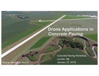
India Orthopedic Devices Market: Unlocking Growth Secrets, Trends and Develop...Kumar Satyam
According to TechSci Research report, “India Orthopedic Devices Market -Industry Size, Share, Trends, Competition Forecast & Opportunities, 2030”, the India Orthopedic Devices Market stood at USD 1,280.54 Million in 2024 and is anticipated to grow with a CAGR of 7.84% in the forecast period, 2026-2030F. The India Orthopedic Devices Market is being driven by several factors. The most prominent ones include an increase in the elderly population, who are more prone to orthopedic conditions such as osteoporosis and arthritis. Moreover, the rise in sports injuries and road accidents are also contributing to the demand for orthopedic devices. Advances in technology and the introduction of innovative implants and prosthetics have further propelled the market growth. Additionally, government initiatives aimed at improving healthcare infrastructure and the increasing prevalence of lifestyle diseases have led to an upward trend in orthopedic surgeries, thereby fueling the market demand for these devices.
Taurus Zodiac Sign_ Personality Traits and Sign Dates.pptxmy Pandit
Explore the world of the Taurus zodiac sign. Learn about their stability, determination, and appreciation for beauty. Discover how Taureans' grounded nature and hardworking mindset define their unique personality.
[Note: This is a partial preview. To download this presentation, visit:
https://www.oeconsulting.com.sg/training-presentations]
Sustainability has become an increasingly critical topic as the world recognizes the need to protect our planet and its resources for future generations. Sustainability means meeting our current needs without compromising the ability of future generations to meet theirs. It involves long-term planning and consideration of the consequences of our actions. The goal is to create strategies that ensure the long-term viability of People, Planet, and Profit.
Leading companies such as Nike, Toyota, and Siemens are prioritizing sustainable innovation in their business models, setting an example for others to follow. In this Sustainability training presentation, you will learn key concepts, principles, and practices of sustainability applicable across industries. This training aims to create awareness and educate employees, senior executives, consultants, and other key stakeholders, including investors, policymakers, and supply chain partners, on the importance and implementation of sustainability.
LEARNING OBJECTIVES
1. Develop a comprehensive understanding of the fundamental principles and concepts that form the foundation of sustainability within corporate environments.
2. Explore the sustainability implementation model, focusing on effective measures and reporting strategies to track and communicate sustainability efforts.
3. Identify and define best practices and critical success factors essential for achieving sustainability goals within organizations.
CONTENTS
1. Introduction and Key Concepts of Sustainability
2. Principles and Practices of Sustainability
3. Measures and Reporting in Sustainability
4. Sustainability Implementation & Best Practices
To download the complete presentation, visit: https://www.oeconsulting.com.sg/training-presentations
Unveiling the Secrets How Does Generative AI Work.pdfSam H
At its core, generative artificial intelligence relies on the concept of generative models, which serve as engines that churn out entirely new data resembling their training data. It is like a sculptor who has studied so many forms found in nature and then uses this knowledge to create sculptures from his imagination that have never been seen before anywhere else. If taken to cyberspace, gans work almost the same way.
Skye Residences | Extended Stay Residences Near Toronto Airportmarketingjdass
Experience unparalleled EXTENDED STAY and comfort at Skye Residences located just minutes from Toronto Airport. Discover sophisticated accommodations tailored for discerning travelers.
Website Link :
https://skyeresidences.com/
https://skyeresidences.com/about-us/
https://skyeresidences.com/gallery/
https://skyeresidences.com/rooms/
https://skyeresidences.com/near-by-attractions/
https://skyeresidences.com/commute/
https://skyeresidences.com/contact/
https://skyeresidences.com/queen-suite-with-sofa-bed/
https://skyeresidences.com/queen-suite-with-sofa-bed-and-balcony/
https://skyeresidences.com/queen-suite-with-sofa-bed-accessible/
https://skyeresidences.com/2-bedroom-deluxe-queen-suite-with-sofa-bed/
https://skyeresidences.com/2-bedroom-deluxe-king-queen-suite-with-sofa-bed/
https://skyeresidences.com/2-bedroom-deluxe-queen-suite-with-sofa-bed-accessible/
#Skye Residences Etobicoke, #Skye Residences Near Toronto Airport, #Skye Residences Toronto, #Skye Hotel Toronto, #Skye Hotel Near Toronto Airport, #Hotel Near Toronto Airport, #Near Toronto Airport Accommodation, #Suites Near Toronto Airport, #Etobicoke Suites Near Airport, #Hotel Near Toronto Pearson International Airport, #Toronto Airport Suite Rentals, #Pearson Airport Hotel Suites
Accpac to QuickBooks Conversion Navigating the Transition with Online Account...PaulBryant58
This article provides a comprehensive guide on how to
effectively manage the convert Accpac to QuickBooks , with a particular focus on utilizing online accounting services to streamline the process.
What is the TDS Return Filing Due Date for FY 2024-25.pdfseoforlegalpillers
It is crucial for the taxpayers to understand about the TDS Return Filing Due Date, so that they can fulfill your TDS obligations efficiently. Taxpayers can avoid penalties by sticking to the deadlines and by accurate filing of TDS. Timely filing of TDS will make sure about the availability of tax credits. You can also seek the professional guidance of experts like Legal Pillers for timely filing of the TDS Return.
Cracking the Workplace Discipline Code Main.pptxWorkforce Group
Cultivating and maintaining discipline within teams is a critical differentiator for successful organisations.
Forward-thinking leaders and business managers understand the impact that discipline has on organisational success. A disciplined workforce operates with clarity, focus, and a shared understanding of expectations, ultimately driving better results, optimising productivity, and facilitating seamless collaboration.
Although discipline is not a one-size-fits-all approach, it can help create a work environment that encourages personal growth and accountability rather than solely relying on punitive measures.
In this deck, you will learn the significance of workplace discipline for organisational success. You’ll also learn
• Four (4) workplace discipline methods you should consider
• The best and most practical approach to implementing workplace discipline.
• Three (3) key tips to maintain a disciplined workplace.
3. Agenda
• Olsson’s UAV Program
• Concrete Paving Construction Applications
• Construction Project Examples
• Additional Drone Services
• Future Services
4. Olsson’s UAV Program
• Safety and Reputation
• Early Adopter
• Diverse Client and Project List
• Streamlined Field Procedures & Post
Processing
• 4-Years of Professional UAV Services
• Premiere Access / Connections
§ Airport Managers, Air Traffic Control, Law Enforcement
§ KC Downtown, KC International, OMA & LNK Entire Class-C
§ City of Lincoln, JOCO & Mesa CO Sheriffs, KU, JCCC
5. Clients/Travel/Challenges
• DOTs/HWY: First job NDOR: Brewster, NE Streambank erosion
§ 100 foot sand slope
• Rail: UPRR,BNSF NE, TX, WA, OR, CA,
§ 125 mile long corridor map – CO
§ 5 mile track video of Oregon from 1 mile across Columbia River in Washington
• Wind/Solar: Invenergy, Nextera: NE, OK, NM, CO, MI, TN
§ 800 turbines. 45mph wind. 105 degrees OK dust-bowl. 12 hrs continuous ops. 4 days.
• Energy: Lincoln Electric H-pole inspection. 98 poles in 2 days
• Google: monthly construction progress (confidential location)
§ Very active site. 5 cranes, tall conc stacks, electrical interference, tight security protocals
• TESLA: auto loading facility: Freemont CA factory
6. Olsson UAV Program Strengths
• Early Adopter - 2014
§ Large portfolio, wide variety experience & clients
§ Field & Office workflows perfected
§ Rapid Response to a Large territory
• Talented Pilots:
§ Environmental Scientist: GIS expert, Cutting edge research & applications
§ Licensed Pilot: Connections FAA, Towers, Airports, Law Enforcement
§ Licensed Surveyor: Understanding of ground control, accuracies/error analysis
• Safety Record and Reputation
§ Spotless Record of Safe operations at sensitive sites
§ airports, hospitals, urban, spinning turbines, industrial sites
44. Drone Application for Environmental Services
• Siting and Design
§ Wetlands Assessment and Design
§ Document environmental compliance: erosion fencing, silt runoff, etc.
45. Additional UAV Services
• Aerial Scouting: Micrositing
• Construction Damage Documentation before/after. Acres damaged
• Traffic Study Surveys: continuous video traffic problems
• Post Project Marketing Photography
• FAA Surveys (Instrument Approach,1-A, and 2-C, Certifications)
• Measure height of structures: Transmission line route
46. FAA Part 107.39 Operation Over Human Beings
No person may operate a small UAV directly over a human being unless that person is:
(a) Participating in the operation; (Think: Construction Site)
-or-
(b) Located under a covered structure or inside a stationary vehicle that can provide
reasonable protection from a falling small unmanned aircraft.
47. FAA Part 107.37 Operation Near manned aircraft
(a) Must give way to all manned aircraft. May not pass over, under, or ahead unless well clear.
48. FAA Part 107.41 & .43 Operation in vicinity of airports
(a) Class B, C, D, E-surface: requires prior authorization from Air Traffic Control
(b) No person may operate a UAV in a manner that interferes with manned aircraft operations.
49. Coming Soon: UAV LIDAR
• 200 pts per square meter, 1 cm accuracy
• 5 laser pulse returns - Penetrate vegetation to bare earth
• Specializes in Long corridor mapping
• Low light capability
• Game-changer
50. Lincoln Airport – Runway 36
200’ x 12,900’
• 200 pts per square meter at 1 cm accuracy
• Altitude: 250’
• Swath width: 200’
• Speed 11mph = 1,000 feet per minute
• Map a 12,000’ runway in 12 minutes
FAA Compliance:
• 15 minute Clearance from
control tower
51. I-80 through Omaha
10 lanes - 200’ wide
• 200 pts per square meter at 1 cm accuracy
• Swath width: 200’
• 1,000 fpm = 5 miles on one 25 minute flight
Safety & FAA Compliance:
• Temp lane closures
• Fly at 2am - FAA night waiver
• LIDAR is active sensor. No light required
200feet