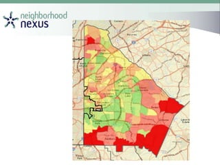
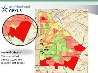
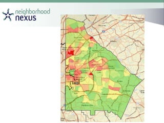
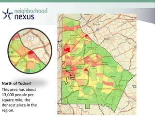
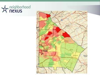
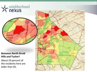
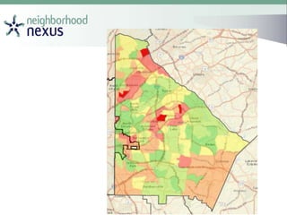
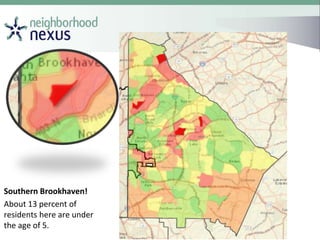
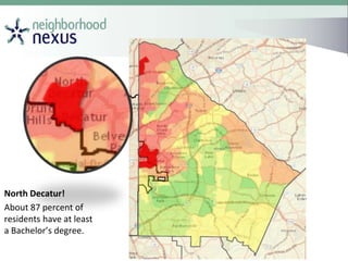
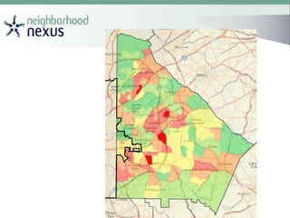
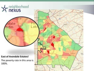
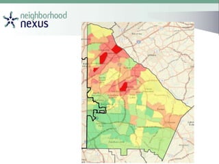
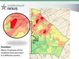
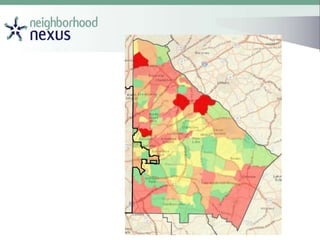
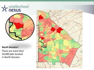
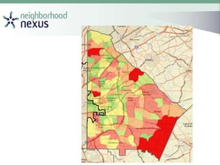
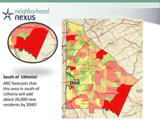
Data-Driven Decision Making:
“Change What You Know. Know What To Change”
Think You Know DeKalb County?
How Well Do You Know the
DeKalb County?
Which area added the most
population between 2000 &
2010?
South of Lithonia!
This area added
almost 10,000 new
residents last decade.
Which area has the highest
population density (most
people per square mile)?
North of Tucker!
This area has about
13,000 people per
square mile, the
densest place in the
region.
Which area has the heaviest
concentrations of those
65+?
Between North Druid
Hills and Tucker!
About 24 percent of
the residents here are
older than 65.
Which area has the heaviest
concentrations of those
under 5?
Southern Brookhaven!
About 13 percent of
residents here are under
the age of 5.
Which area has the highest
concentrations of those
with at least a Bachelor’s
degree?
North Decatur!
About 87 percent of
residents have at least
a Bachelor’s degree.
Which area has the highest
per capita income?
Druid Hills!
The per capita income
in this area is around
$79,000.
Which area has the highest
poverty rate?
East of Avondale Estates!
The poverty rate in this area is
100%.
Which area has the highest
percentage of Foreign
Born?
Chamblee!
About 71 percent of the
residents here were born
in a different country.
Which neighborhood has
the highest percentage of
those without health
insurance?
Chamblee!
About 75 percent of the
residents here do not
have health insurance.
Which area has the most
jobs?
North Decatur!
There are more than
24,000 jobs located
in North Decatur.
Which area is forecast to
add the most people?
South of Lithonia!
ARC forecasts that
this area in south of
Lithonia will add
about 26,000 new
residents by 2040!

Dekalb weavetricks

Editor's Notes

  • #8 SLIDE BUILDS BEFORE BUILD Again, here are the top ten areas, and it is very hard to see because they are all small tracts inside the city of Atlanta. In addition to knowing what areas are growing the most, planners also like to know which areas have the greatest population densities, because these areas will be more urban, and our land use guidelines need to reflect that not all areas in the region are equal, and our policies reflect that. AFTER BUILD This area in Midtown has around 19,000 residents per square mile, which is the densest area in the region. And our land use policies – as reflected in our Unified Growth Policy Map – outline the types of development that are appropriate here – things like high-rise condos, mixed-use development, infill, etc. And while these are perfect for areas like midtown, we know that these policies are not appropriate for other areas of the region, like that tract out in northern Gwinnett.
  • #9 SLIDE BUILDS BEFORE BUILD Again, here are the top ten areas, and it is very hard to see because they are all small tracts inside the city of Atlanta. In addition to knowing what areas are growing the most, planners also like to know which areas have the greatest population densities, because these areas will be more urban, and our land use guidelines need to reflect that not all areas in the region are equal, and our policies reflect that. AFTER BUILD This area in Midtown has around 19,000 residents per square mile, which is the densest area in the region. And our land use policies – as reflected in our Unified Growth Policy Map – outline the types of development that are appropriate here – things like high-rise condos, mixed-use development, infill, etc. And while these are perfect for areas like midtown, we know that these policies are not appropriate for other areas of the region, like that tract out in northern Gwinnett.