The document is a teacher packet for a field trip to Dead Horse Bay in Gateway National Recreation Area. It provides information about the goals and objectives of the program, introduction and background on the National Park Service and Gateway National Recreation Area, details about the trip such as arrival time and directions, things for teachers and students to remember like appropriate clothing, safety rules and collection policies, and items to bring. It also outlines chaperone responsibilities to ensure a successful trip. The packet is designed to prepare teachers and students for their visit to explore and learn about the unique Dead Horse Bay ecosystem.
Final days of our popular traveling exhibits, Dinosaurs Unearthed and Math Midway. IMAX film Sea Monsers will be closing, and introducing Sea Rex: Journey to a Prehistoric World, coming in May. Check out the other fun and exciting events in April and May at MNS.
Final days of our popular traveling exhibits, Dinosaurs Unearthed and Math Midway. IMAX film Sea Monsers will be closing, and introducing Sea Rex: Journey to a Prehistoric World, coming in May. Check out the other fun and exciting events in April and May at MNS.
Choosing the Right Camp for Your Young Marine BiologistCamp Navigator
Does your child love the ocean and all the
mysteries that lie within? Does a stroll on
the beach take hours because you pause
to explore every tide pool, every shell, and
every suspicious shadow in the waves?
National Aquarium Teacher Orientation - Pre Visit Slide Show. A brief look at the National Aquarium in Baltimore to help teachers preprae their classes for a field trip.
Similar to Dead horse bay teacher packet 2007 (20)
1. Gateway US Department of the Interior
National Park Service
Gateway National Recreation Area
Jamaica Bay Unit
New York
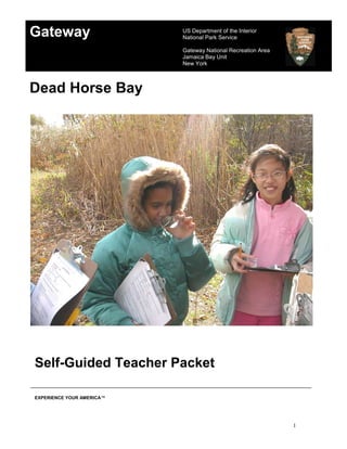
Dead Horse Bay
Self-Guided Teacher Packet
EXPERIENCE YOUR AMERICA™
1
2. Dead Horse Bay Program
Theme: Dead Horse Bay is a springboard for discovery. Wetlands,
shorelines, and trails present a unique opportunity to relate classroom science to
the natural world.
Goal: To familiarize participants with the living and non-living aspects of
the Dead Horse Bay ecosystem, through discovery and outdoor exploration.
Objectives:
Grade K-1 The students will discover the plants and animals in the upland and
shoreline habitats.
Grade 2-3 Students will explore the relationships between plant and animal
communities of the upland and shoreline habitats.
Grade 4-6 Students will investigate both the organisms and the non-living
elements to understand what makes Dead Horse Bay a unique ecosystem.
2
3. INTRODUCTION
Dear Teacher:
Gateway National Recreation Area and the staff of the Jamaica Bay Unit are
pleased to welcome you and your class to Dead Horse Bay. The information in
this guide is designed to acquaint you with Dead Horse Bay prior to your visit so
that you and your students can make the most of your experience.
Dead Horse Bay is a place fro the wondrous exploration of a unique stretch of
upland trails, beach, and salt marsh. The mission of the National Park Service is
to preserve and protect the natural and cultural resources within the park.
Education plays a vital role in the accomplishment of this objective. Our hands-on
approach to environmental education is interdisciplinary. We strongly encourage
you to include all subjects into your pre-visit and post-visit lessons. It is extremely
important that you and your students relate the field trip experience to the
classroom and home/school environment.
The guided group consists of outdoor activities based on observation and
exploration of Dead Horse Bay. Special activities designed to meet your specific
goals can be included in the program. Requests of this kind can be made well in
advance of your class visit.
Our primary goal is to activate children’s natural sense of wonder and to educate
them about their environment. Most importantly, for the students to understand
that all citizens must act as stewards of these resources and play an active role
in their preservation and protection. With your help, we can achieve this goal and
instill a feeling of kinship with the natural environment.
Gateway National Recreation Area
Jamaica Bay Unit
3
4. What is the National
Park Service?
The National Park Service is a bureau of the U.S. Department of the Interior.
The“Organic Act” of 1916 established the National Park Service”...to
conserve the scenery and the natural objects and the wildlife therein and to
provide for the enjoyment of the same in such manner and by such means
as will leave them unimpaired
for the enjoyment of future generations...”. The mission of
the National Park Service to protect and maintain these
cultural and natural resources for the use and enjoyment
of all people today and in the future.
Today, there are some 391 sites in the National Park System.
These sites include national parks, historic sites, recreation
areas, preserves, seashores, scenic rivers, lakeshores and
scenic trails. The System is divided into 7 regions. Gateway National
Recreation Area is part of the Northeast Region,
which consists of some 100 units and related areas. Other
parks in this region include Statue of Liberty/Ellis Island
National Monument, Acadia National Park, Edison National
Historic Site, Cape Cod National Seashore and Gettysburg
National Military Park. For further information on parks
in this region, contact your nearest national park,
or visit us on the Web at www.nps.gov.
Active participation in your parks is
encouraged. The Volunteers in
Parks (VIP) program offers those
interested the opportunity to
give their time and abilities
to support programs and
resource volunteering,
contact any
Gateway unit.
4
5. TRIP INFORMATION
When you and your class arrive at Floyd Bennett Field the park ranger will greet
the class at the Ranger Station parking lot. The park ranger and the class will
continue walking to the trailhead of Dead Horse Bay where the program will
begin. You should plan to arrive at 10am and expect the program to be two hours
in length.
If you have any questions about the information in this packet or the event of
inclement weather on the morning of your trip please feel free to contact us at
(718) 338-4306, Monday-Friday, 8:30-5:00.
Travel Directions
Refer to the map of Gateway National Recreation Area.
From Manhattan, Brooklyn and Queens: Take the Belt Parkway to exit 11S,
Flatbush Avenue South. Proceed south on Flatbush Avenue approximately one
mile to the traffic light before the bridge. Turn left at the light into Floyd Bennett
Field. Make the second left onto Ranger Road. Follow along until reaching the
Ecology Village sign on the left, make left down the drive-way to the Ecology
Village parking lot.
From the Rockaways: Take Beach Channel Drive to the Marine Park Bridge.
Cross the bridge and make a right at the first traffic light onto Floyd Bennett Field.
Follow the above directions.
Bus Permit for the Belt Parkway
A bus permit is required by all buses to travel the Belt Parkway. The issuance of
a permit is subject to restrictions due to construction schedules. If you intend to
use the Belt Parkway to reach Gateway NRA ask the administration of your
school for the proper transportation permit.
5
6. Things to Remember
Preparation
1. The success of your visit depends on how well you and your class are
prepared.
2. To enable the ranger to make the trip more personal for each student,
have them wear name tags.
3. Discipline and control of the group are the responsibility of the teacher.
The class must stay together as a group.
4. Please have one chaperone per every 8-10 children.
5. Please discuss the rules with your class before the trip.
Dress
1. The trail is usually windier and colder because it is near the shore, so
please dress accordingly
2. We suggest layered clothing: hats and gloves in cool weather, hat and sun
protection in warm weather.
3. Casual clothes should be worn: long pants, long sleeve shirts and closed
sturdy walking shoes, boots or sneakers. No sandals.
Safety Rules
1. Review the tick information bulletin included in this packet with your
students. Pant legs should be tucked into socks to keep ticks out.
Periodically check for ticks that may be clinging to clothing or skin. Check
yourselves again for ticks before boarding the bus. Remind the students
not to walk into any grassy or bushy areas because they more likely to
come into contact with ticks.
2. Poison Ivy grows throughout Gateway. During the growing season the
shiny leaves are in groups of three. Many people are allergic to the oils of
this plant. Wash hands with soap and water after contact with poison ivy.
3. Please do not eat any plants or berries you find along the trail. Plants may
look attractive and edible but they could make you sick.
4. The program is held outdoors, so please have the students' dress
accordingly.
5. Pieces of wood containing nails and beach debris such as broken glass
and metal objects are often being washed ashore. Please have the
students avoid contact with these materials.
6. Students at all times must keep their shoes on.
6
7. Collection
1. The collection of plants and animals (dead or alive) is prohibited in federal
lands. Please leave only footprints and take only memories.
Things to Bring
1. First Aid Kit
2. Insect Repellant
3. Bring along items to explore the trails of Dead Horse Bay such as:
binoculars, hand lens, field guides, small notebooks, and camera.
Lunch
1. There is no place to purchase food. Students should bring their own food
and beverages.
2. Lunches must be left on the bus during the program.
3. The picnic gazebo at Ecology Village is available for the groups to use
after the field trip.
4. Bathrooms are available at Ecology Village for after the field trip, please
inform the students of this information because the program begins on
arrival.
7
8. Gateway National Recreation Area
Chaperon Responsibilities
Thank you for volunteering to chaperon a Gateway National Recreation Area
education program. You are an important partner and your cooperation and
participation will insure a successful trip.
A selected number of students should be assigned to each chaperon in
advance of the trip. These students will look to you for leadership and to set
boundaries.
All visitors to the park are required to comply with park regulations. Your
help may be needed to enforce these regulations with students. Feeding of
wildlife is not allowed. Enjoy animals from a distance. Do not pick vegetation in
the park. Stay on the trails. There are no foods or beverages permitted on the
trails. Smoking is prohibited.
Be aware of safety. Do not allow students to wander from the program area or
engage in dangerous behavior. Look out for poison ivy and ticks.
Be an active participant. Please stay with your group. Set an example by
joining activities. Students pick up your reactions. If you are having fun, they will
too.
Guide the learning activities. Keep students’ attention focused on the ranger.
Encourage the students to answer questions and listen respectfully when others
are speaking. Manage behavior problems as they arise.
The National Park Service and Gateway National Recreation Area are committed
to providing a stimulating educational experience. Your visits ensure today’s
students will be equipped with knowledge that will help them make responsible
decisions about our natural resources in tomorrow’s world.
Please accept our sincere appreciation for your time and effort to make the trip a
memorable one.
8
9. HISTORY
Strange as the name may sound, Dead Horse Bay is an area rich in cultural and
natural history. Dead Horse Bay is located at the southern end of Flatbush
Avenue, north of the Gil Hodges/Marine Park Bridge, northeast of the Rockaway
Inlet. The earliest known inhabitants of the Jamaica Bay area were the Canarsie
Indians. The Native Americans fished and harvested abundant shellfish found in
these waters. During the seventeenth century Dutch settlers moved into the area,
and it was during this time that tidal mills appeared on the bay. These mills
utilized the power derived from the changing tides to grind wheat into flour. One
cannot help but notice the one remaining millstone along the trail that bears its
name.
From the middle of the nineteenth century to the early twentieth, the former
Barren Island, now Floyd Bennett Field, was the site of numerous factories which
manufactures fertilizers from the remains of dead animals. Later, fish oil
produced from the menhaden caught in the bay was used in tanning leather,
mixing paint, and making rope for ships. When the menhaden became scarce
Barren Island became a landfill for the disposal of New York City's garbage.
In 1928, the shallows around Barren Island were filled in to create Floyd Bennett
Field, New York City's first municipal airport, making the island part of the
Brooklyn mainland. The deteriorating pilings and pieces of wooden dock at the
shore of Dead Horse Bay are what remains of old ferry slips. Ferries were the
means of transportation to and from the Rockaways prior to the construction of
the Gil Hodges/marine Park Bridge.
As industry, landfill, and development altered the land the ecosystem changed.
Filling in the shallows cut some of the flow of water between Jamaica Bay and
Dead Horse Bay. This and similar changes that have occurred in and around the
bay have contributed to the slowing down of the natural flushing of the bay. Acres
of salt marsh that remove certain contaminants and provide nurseries for marine
life have been drained and filled. Landfill leachate and road run-off contributes to
the pollution of the bay, as well as other factors. Although the water quality has
improved over the years, efforts must continue to ensure the protection of the
bay. There is still much work to be done.
9
10. NATURAL RESOURCE INFORMATION
BEACH
DEFINITION The shore of an ocean or bay, seashore.
GENERAL DESCRIPTION
As you approach the beach from the Millstone trail, notice the salty scent of the
air. Looking south, you will see the Rockaway peninsula and to the west the
remains of the former docks that would have been destroyed long ago if this
beach was not protected by the Rockaway peninsula, a barrier beach. These
beaches protect the land that lies behind them, receiving the brunt of storm wind
and waves, thereby forming a barrier to the mainland, in this case, Brooklyn’s
south shore.
Sand, small pebbles and broken shells make up the beach substrate at Dead
Horse Bay. A line of beach wrack usually lies on the upper beach marking the
last high tide. Beach wrack may contain seaweed, pieces of wood, the remains of
marine animals and other floatable material.
PLANTS AND ANIMALS
As you step off the trail and onto the beach, look at the gradual change in
vegetation. The closer you get to the beach the fewer the plants you will
encounter. The plants and animals of the shore are all adapted to their life in the
harsh, salty marine environment. The upper beach is submerged only during high
tides and is inhabited by microscopic plants and animals (plankton) living in the
water and between the sand grains. The area above the upper beach is where
American beach grass, little blue stem, and Virginia creeper grow. These plants
have root systems called rhizomes that enable them to anchor securely in loose
sand and to absorb fresh water.
The lower beach is always under water. It supports a variety of marine life, such
as tiny amphipods, clams, crabs and snails. At Dead Horse Bay, it is possible to
find periwinkles on pilings, mud snails, horse crabs and spider crabs, all of which
are common to Jamaica Bay and the Rockaway Inlet.
Animals are usually secretive, we may never see them, even though they are
present somewhere nearby. Insects and birds are somewhat conspicuous. They
are some of the easiest animals to observe.
Several species of birds live at the beach year-round, such as the herring gull
and ring-billed gull. It is very likely that you will see them during your trip. There
10
11. are many other species that only frequent this area for a brief time, as they pass
through during migration.
Two summer residents that may be seen feeding on small fish from late April to
September at Dead Horse Bay are the least tern and common tern. In New York
State, the least tern and the common tern are threatened due to loss of habitat.
Some pairs nest at the beach at Breezy Point at the eastern tip of the
Rockaways. This nesting area is protected through the efforts of the National
Park Service and volunteers.
HUMAN IMPACT
Floatable materials, such as, bottles, plastics, and wood often litter the beach.
These items are carried sometimes many miles from their place of origin. This
litter may be due to people, industry, and nautical accidents. Plastic bags,
balloons, loose fishing line, pieces of fishing net and six-pack loops are
hazardous to marine life. Fish, turtles, birds, and seals can sometimes be
trapped and drown due to free floating netting, fishing line, and six-pack loops.
Plastic and rubber objects that can be swallowed and become lodged in the
airway of sea turtles, birds and seals can cause them to suffocate. If these
objects become lodged in the stomach the animal will starve.
Problems have arisen due to the massive quantities of waste that is produced
and must be disposed of daily. Communities throughout the United States are
implementing recycling/reuse programs. We can help by recycling and
discouraging litter at home, at school and in our community. By addressing the
solid waste problem in this manner our beaches will hopefully become cleaner in
the future and result in a cleaner environment for all.
DUNES
DEFINITION A mound or hill formed by the deposition of sand from
waves, currents, and wind.
DESCRIPTION
The dunes lie above the beach, beyond the Phragmites dominated upland. The
dunes at Dead Horse Bay are small and not as dramatic compared to those of
ocean beaches along the Atlantic coast. You may barely notice them, but these
small dunes undergo accretion and erosion in the same manner as other dunes
and the plants and animals of this habitat are typical of dune communities
elsewhere on the east coast.
11
12. ECOLOGICAL IMPORTANCE
Dunes build slowly over time as sand is deposited. They become moderately
stabilized by grasses and other plants. The plant roots anchor the sand in place,
aiding the building process. The first dunes to form are called primary dunes.
Once established, secondary or back dunes can form. Dunes are very fragile.
Even a narrow path over a dune can cause rapid erosion. A break in the dune
line exposes the plants to salt spray and storm flood tides.
Dunes and barrier beaches are constantly changing due to the natural process of
accretion and erosion of these sand formations. Without dunes beaches rapidly
erode. At the western edge of Dead Horse Bay, there is an eroding sand
bank/dune edge. The sand is being moved by wind and water action from the
inlet, exposing the old landfill underneath the bank. Think of the effects a
hurricane could have on the coastal areas of Brooklyn, Queens, and Long Island
without the protection of barrier beaches.
PLANTS AND ANIMALS
As you walk up from the beach toward the primary and secondary dunes, notice
the gradual increase in plant variety. Hardy plants, such as beach grass and
poison ivy, anchor themselves in the shifting sand by deep, spreading roots
called rhizomes. These pioneer plants can tolerate the salt spray, harsh sun, low
moisture and poor soil quality of a primary dune. These plants hold the sand and
enrich the soil as they die and decay. Over time, the soil will support other plants
such as, sea rocket, seaside goldenrod, and the fragrant beach rose.
Eventually, plant succession will progress to the point where pioneer shrubs,
such as, bayberry, and trees, such as, wild black cherry are able to grow.
Provided succession continues, a forest community will someday be reached.
The process is evident in the upland trails where vast stands of phragmites, the
giant reed grass are dwarfed by a few large trees.
Ants, spiders, and various insects commonly live in the dune. These and other
animals either feed on the plants or on other animals. Meadow voles, white
footed mice, cottontail rabbits, common yellowthroats and song sparrows eat
plants, seeds, and insects. The northern harrier (marsh hawk), a bird of prey,
eats voles, mice, rabbits, and birds.
HUMAN IMPACT
Dunes are threatened naturally by wind, waves, and fierce storms. The dunes at
Dead Horse Bay are no exception. Visitors pose a threat to dune communities by
walking and climbing on them. Dune building is extremely slow and the pioneer
12
13. plants must be protected. Please, “keep off the dunes” to avoid trampling the
important plants and grasses. On some beaches, wooden snow fencing is
erected as a physical barrier which also helps to hold the sand in place. Kindly
respect the fragility of this area by walking on the trails and open beach areas. It
is up to all of us to be stewards of the environment and protect our natural
resources.
SALT MARSH
DEFINITION The land and water behind the barrier, at the edge of the bay
subject to the rise and fall of the tides.
DESCRIPTION
A small salt marsh lies on the northeastern edge of Dead Horse Bay, adjacent to
the marina. The marsh is best observed at low tide. When the salt marsh cord
grasses are exposed, the marsh emits a rich briny odor.
ECOLOGICAL IMPORTANCE
Of all the world’s ecosystems, the salt marsh is the most productive.
Phytoplankton (minute, free floating, aquatic plants) grow in abundance and are
the basis of the marine food web. Scientists estimate that phytoplankton is
responsible for the production of 80% of the earth’s atmospheric oxygen.
Salt marshes are spawning sites for countless species of marine animals. Salt
marshes play a critical role in controlling beach erosion and modifying the effects
of coastal storms. The plants of a salt marsh have the natural ability to absorb
certain pollutants from the water. We are now beginning to realize the massive
loss of resources that accompanies the destruction of a salt marsh, once
common along our coasts. Fortunately, there are still a few salt marshes
remaining in the Rockaway inlet and Jamaica Bay, of varying sizes. The small
salt marsh at the western end of the Dead Horse Bay is an excellent example of
a salt marsh habitat in miniature.
PLANTS
The most important species of this habitat are salt marsh cord grass, Spartina
alterniflora, which grows in clumps at mid tide level and salt meadow cord grass,
Spartina patens, growing at higher ground. These grasses have the ability to
remove excess salt from their tissues. Look along the leaves for tiny salt crystals
that have formed where the plant oozed a drop of salt laden water. The grass
provides cover for young fish and shellfish so they mature into adulthood. At the
13
14. root/soil interface, mussels attach in order to remain anchored so they can feed
and grow.
ANIMALS
Crabs, mussels, and horseshoe crabs can be seen along the edge of the salt
marsh and at the base of the salt marsh cord grass stems. Empty shells and crab
molts are often there too.
Wading birds like the great egret, snowy egret, great blue heron, and black
crowned heron hunt for fish in the tide pools from spring to autumn.
Oystercatchers and glossy ibis search for tiny mussels and other protein rich
foods in the marsh. During the winter, brant geese and several species of ducks
feed and rest here.
HUMAN IMPACT
Over the past three hundred years, extensive marshlands have been drained and
filled throughout the United States. During the 1930’s it was proposed that all
marshland of Jamaica Bay should be filled. Fortunately, that proposal was not
carried out. Today, these marshes are protected by law.
Erosion from excessive wave action (and possibly siltation) is the biggest threat
to the marsh now. Marshes are of vital importance to breeding marine organisms
and their developing young. Marshes are an integral part of natural flood control
and the earth’s water cycle. In order to retain the benefits, marshes must be
protected from future development and maintained as the natural, functional
systems.
14
15. ACTIVITIES
Pre-Visit Suggestions (Teacher led)
The presentation of pre and post activities will reinforce important concepts. The
material in this packet is generalized and should be modified to meet the needs
of your students.
Topics of Discussion
1. Why is Gateway an appropriate name for this national park? Locate the
areas of Gateway national Recreation Area on a map.
2. Locate Dead horse Bay on the map. Is this an open area or protected
bay? What do we call the land mass that lies to the south of Dead Horse
Bay. How, if at all, does it benefit the coastline?
3. How do you think Dead Horse Bay got its name?
4. Discuss new vocabulary found in the glossary.
5. Discuss safety precautions for the trip.
Activities
1. Look at a tide chart for the New York City area. What will be the tide at the
time of your visit?
2. Ask the class to describe a marine organism. Draw pictures of them in
their natural habitat. Use a field guide or other book for information.
On-Site Activities
1. On the morning of the trip, observe and record the weather conditions at
the school. Observe and record the conditions at Dead Horse Bay on the
worksheet provided in the teacher packet. If possible, duplicate this sheet
and have each student write their own individual observations at the site.
2. Pause on the trail, and ask the students to close their eyes and to remain
silent for a few minutes. Afterwards ask the students what they heard and
what they didn’t hear. What else did their senses tell them? How did they
feel about this activity? Repeat this activity on the beach.
3. Ask the students to look for signs of animals along the trail and on the
beach. Encourage the class to ask questions about what they see and
hear.
4. Students can collect and classify shellfish (Mollusks), using field guides
and the shell identification handout provided.
5. Students will collect and organize data regarding the diversity and
abundance of the biotic community at Dead Horse Bay. An investigation
sheet goes along with the activity.
6. Students will collect data on the abiotic factors of the Dead Horse Bay
marine ecosystem. An investigation sheet goes along with the activity.
15
16. 7. Using a plankton net, the ranger will collect a sample of water from the
bay (not at the water’s edge). Students will identify their findings with
discovery scopes and field guides provided. An investigation sheet is
included with the activity.
8. Discuss the needs of plants and animals. What are adaptations? Name
some adaptations. What makes living in or near the ocean so difficult for
plants and animals?
9. Hand out a few small empty containers. Collect some sand from different
sections of the beach (upper beach, tide line, lower beach). Examine
these samples carefully with a hand lens. Note any differences and
similarities. Return the sand samples to the beach when the exercise is
over.
10. Assume the role of an archeologist and look for clues to the history of this
area. Discuss what is found and whether the objects are old or not. How
did these objects get there?
11. Have the class sit and draw, or write a list of words that describe what
they see around them.
Post Visit Activity
1. Review the format of the worksheet that was completed during the field
trip. Have the class make a similar data sheet to record their findings
around the school building. For homework, have the students complete
their sheet and compare and contrast both sets of data the following day
in class.
2. As a group, compile a list of products and foods from the sea. Where can
such products be purchased? How can we find out more about this?
3. Have the students write a one page essay on their field trip experience
and to include what they thought was the most interesting aspect of the
trip.
Projects and Research
1. Research one aspect of the marine environment. Students present oral
reports to the class, followed by a discussion of the findings.
2. Create a collage, mural or photographic journal of the field trip.
3. Construct food web charts using photographs from magazines.
4. Dead Horse Bay is partially landfill; research this topic. Why are garbage
landfills becoming scarce? Where does our garbage go and what will be
done in the future?
16
17. Glossary
The following are defined within the context of environmental science.
aquatic Pertains to living in or near water.
adaptation Anything that is changed or changes so as to become
suitable to a new or special use or situation.
barrier beach a single elongated sand ridge rising above the high tide line
level and extending parallel with the coast, but separated by
a lagoon.
bay An inlet in the shore of a sea or lake, a small body of water
set off from the main body.
bird A warm-blooded egg feathered laying animal with the
forelimbs modified to form wings.
camouflage Concealment by appearing to be a part of the natural
surroundings.
community Organisms living together under relatively similar conditions;
the region in which they live.
competition The rivalry between two or more organisms for a limited
resource.
deciduous Trees that lodes their leaves on a seasonal basis.
decomposer An organism that feeds on dead organisms or nonliving
organic matter.
dependent Unable to exist or function satisfactorily without the use or
aid of another.
ecology The study of the interrelationships of organisms and their
environment.
ecosystem An ecological community together with its physical
environment, considered a unit.
energy The ability to do work or produce motion.
17
18. environment The total of circumstances surrounding an organism or a
group of organisms, including the physical, social, and
cultural conditions affecting the nature of the organism.
erosion Natural processes by which soil and rock are transported.
flower A plants reproductive structure.
food chain The path along which food energy is transferred between
two or more species.
food web A complex of interacting food chains.
habitat The place where an organism lives in which it finds all its
requirements.
herbivore A plant eating organism.
insect An invertebrate having an adult stage characterized by three
pair of legs, a segmented body, and usually two pair of eyes.
interdependence Organisms depend on and need each other.
invertebrate An animal that does not possess a spinal column.
life cycles A progression through a series of differing stages of
development.
mammal A warm-blooded vertebrate with hair, and in the female milk-
producing glands; most give birth to live young.
millstone A stone used in a mill for grinding grain.
National Park
Service A bureau of the U.S. Department of the Interior, created in
1916. Established to preserve and protect and manage the
natural, cultural, historical, and recreational areas of the
United States.
niche The unique way of life of an organism, where it lives and
what it does in its community.
omnivore An animal that consumes both plants and animals.
organic Pertaining to living things.
18
19. organism A living thing.
pesticide A chemical used to kill organisms considered to be pests,
especially insects and rodents.
photosynthesis The process by which plants, using energy from the sun,
combine carbon dioxide and water to form sugar, from which
the plants obtain nutrition.
plankton Floating organisms, drifting marine life.
pollution Made dirty or impure due to the presence of waste or
garbage in the air, water or on land; the contamination of a
natural system.
predator A carnivore that kills and eats other animals.
producer An organism that makes its own food.
recycle To reuse, extract or regain materials and substances.
resources The goods and services that ecosystems provide, especially
for people.
specie Organisms of the same type; a group of organisms that
share enough characteristics to allow individuals to have
viable offspring.
succession The replacement of one community by another.
tide The periodic rise and fall of oceans and connecting bodies of
water, caused by the gravitational attraction of the sun and
the moon.
web of life The concept that all organisms are interrelated. If one part of
the “web” is broken, the entire web is affected.
19
20. Bibliography
Environmental Education
Cohen, Mickey. Exploring the Trails f Dead Horse Bay, New York City Board of
Education, Division of Curriculum and Instruction, 1986.
Cornell, Joseph Bharat. Sharing Nature with Children. Nevada City, California:
Ananda, 1979
Coulombe, Deborah A. The Seaside Naturalist. Englewood Cliffs, New Jersey:
Prentice Hall, 1984.
Koehler, Sherry. It’s Your Environment to Think About, Things to do from the
Environmental Coalition. New York: Charles Scribner and
Sons, 1971.
Russell, Helen Ross. City Critters. Rev. ed. American Nature Society, 1975.
Russell, Helen Ross. Ten Minute Field Trips: Using the School Grounds for
Environmental Studies. Chicago: J.G. Ferguson, 1973.
Simon, Seymore. How to be an Ocean Scientist in your Own Home. New York:
J.B. Lippincott, 1988.
Mitchell, John and the Massachusettes Audubon Society. The Curious Naturalist.
Englewood, New Jersey: Prentice-Hall, 1980.
Petry, Loren C. and Marcia G. Norman. A Beachcomber’s Botany. Chatham,
Massachusettes: Chatham Conservation Foundation, 1963.
Tanacredi, John T. Gateway A Visitor’s Companion. Pennsylvania: Stackpole
Books, 1995.
Western Regional Environmental Education Council. Aquatic Project Wild. 1992.
Wilson, Jennifer Brauer. A Naturalist’s Teaching Manual: Activities and Ideas for
Teaching Natural History. New York: Prentice-Hall, 1986.
20
21. Trail Head Trails Beach
Date:
Time:
Temperature:
Weather:
Sounds
Odors
Soil Condition
Terrain
Plants
Signs of Animals
Other