Downloaded 20 times


![Context Sensitive Solutions in Transportation
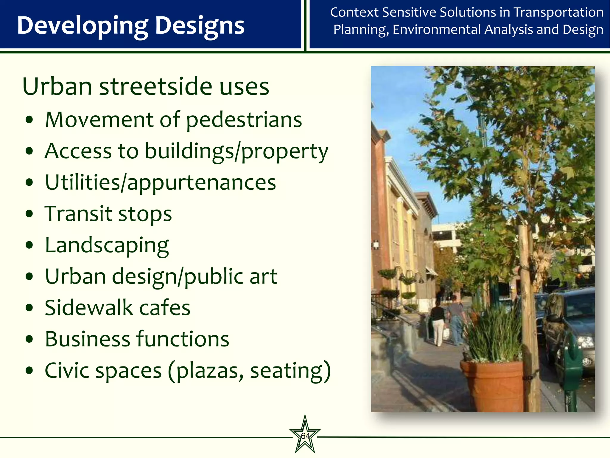
Developing Designs Planning, Environmental Analysis and Design
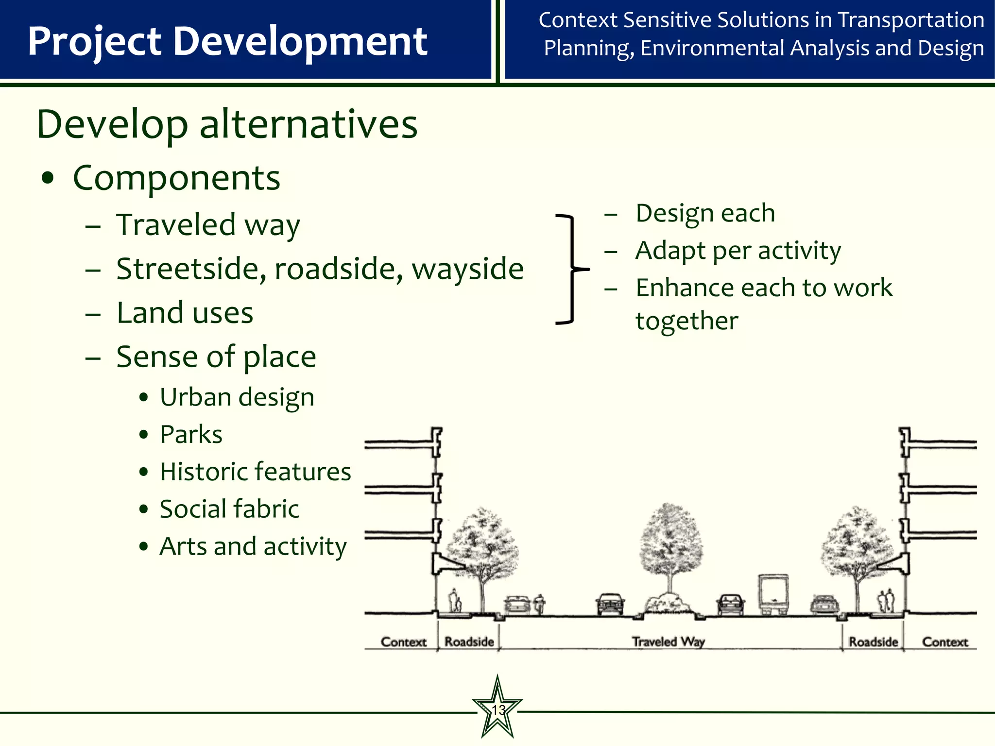
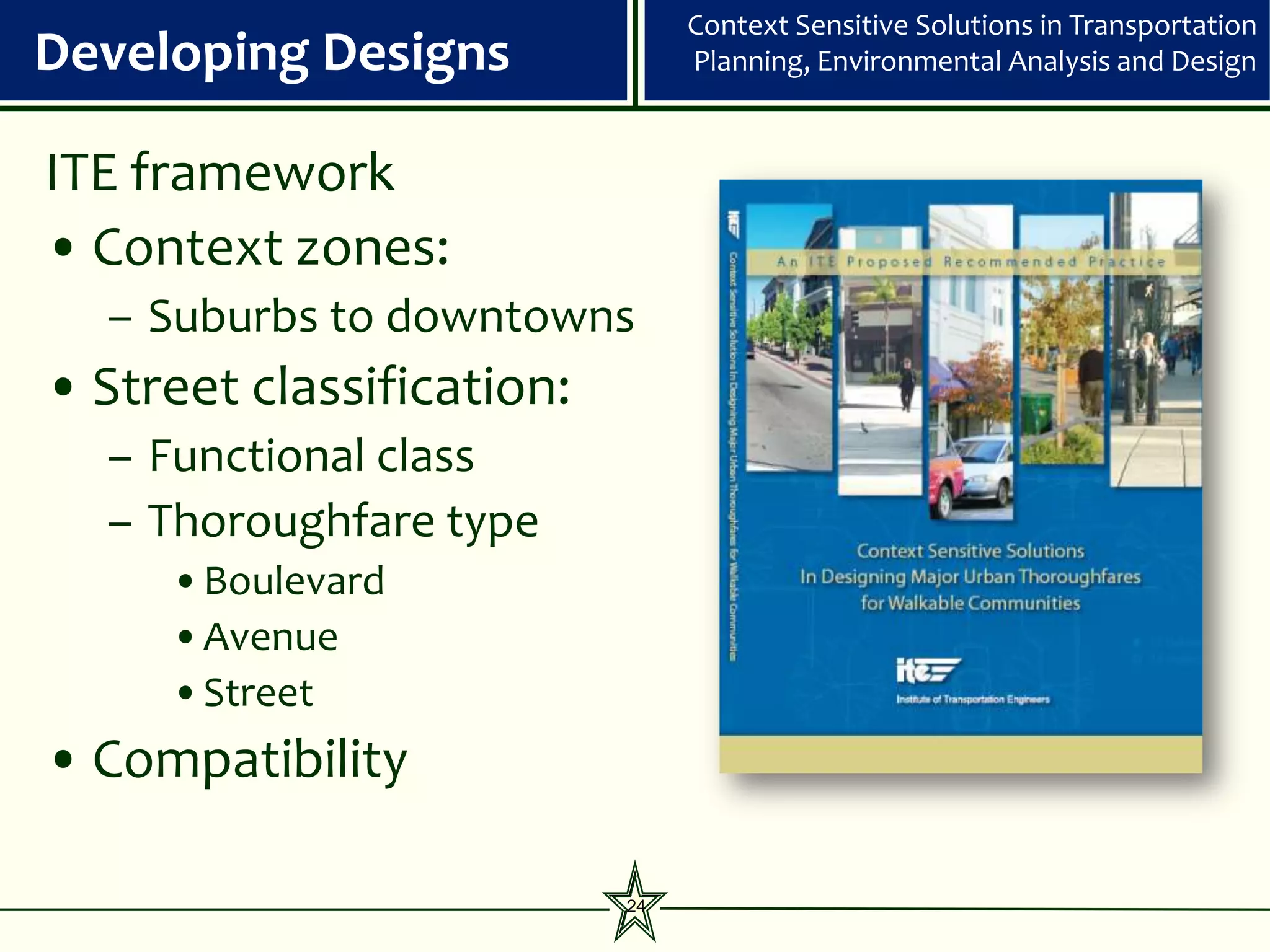
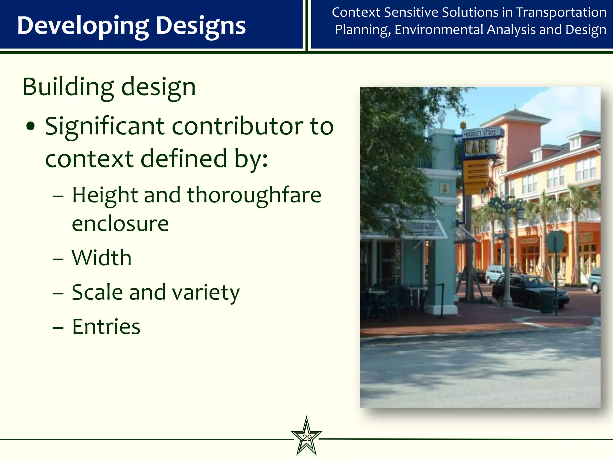
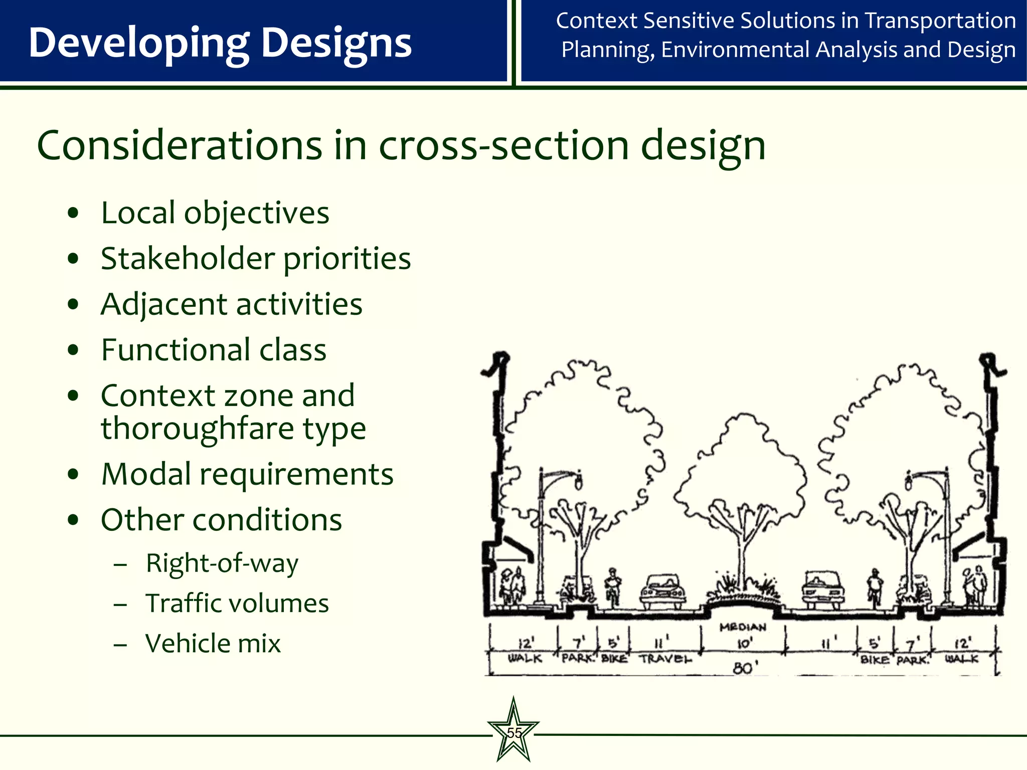
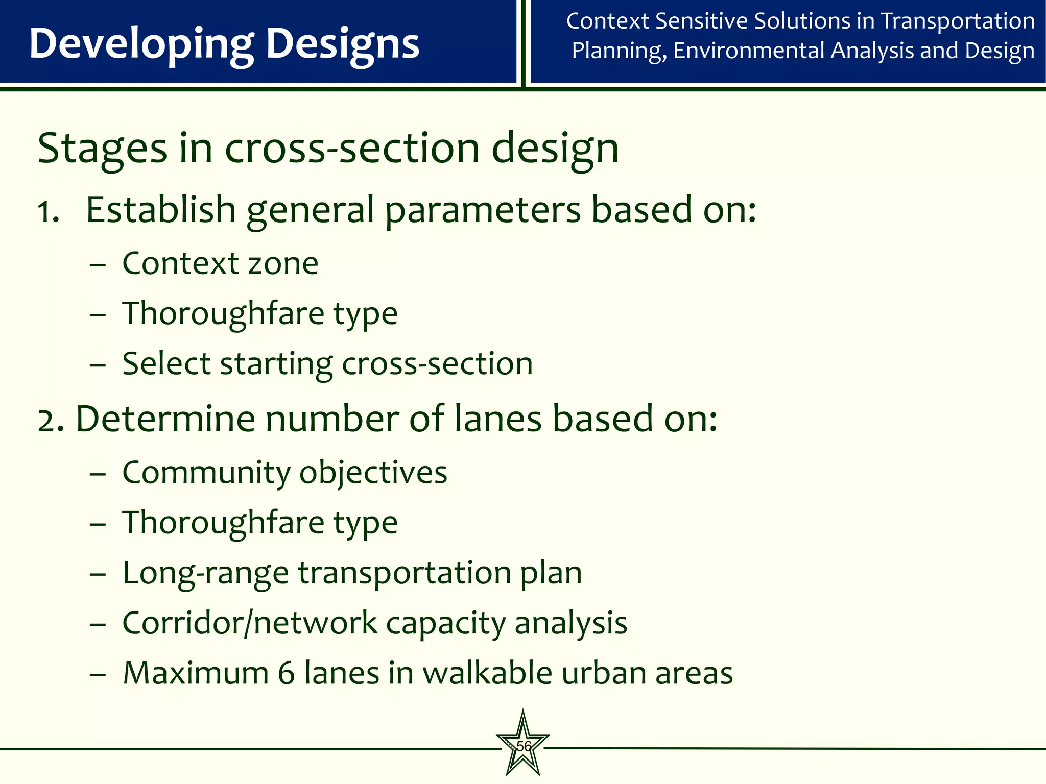
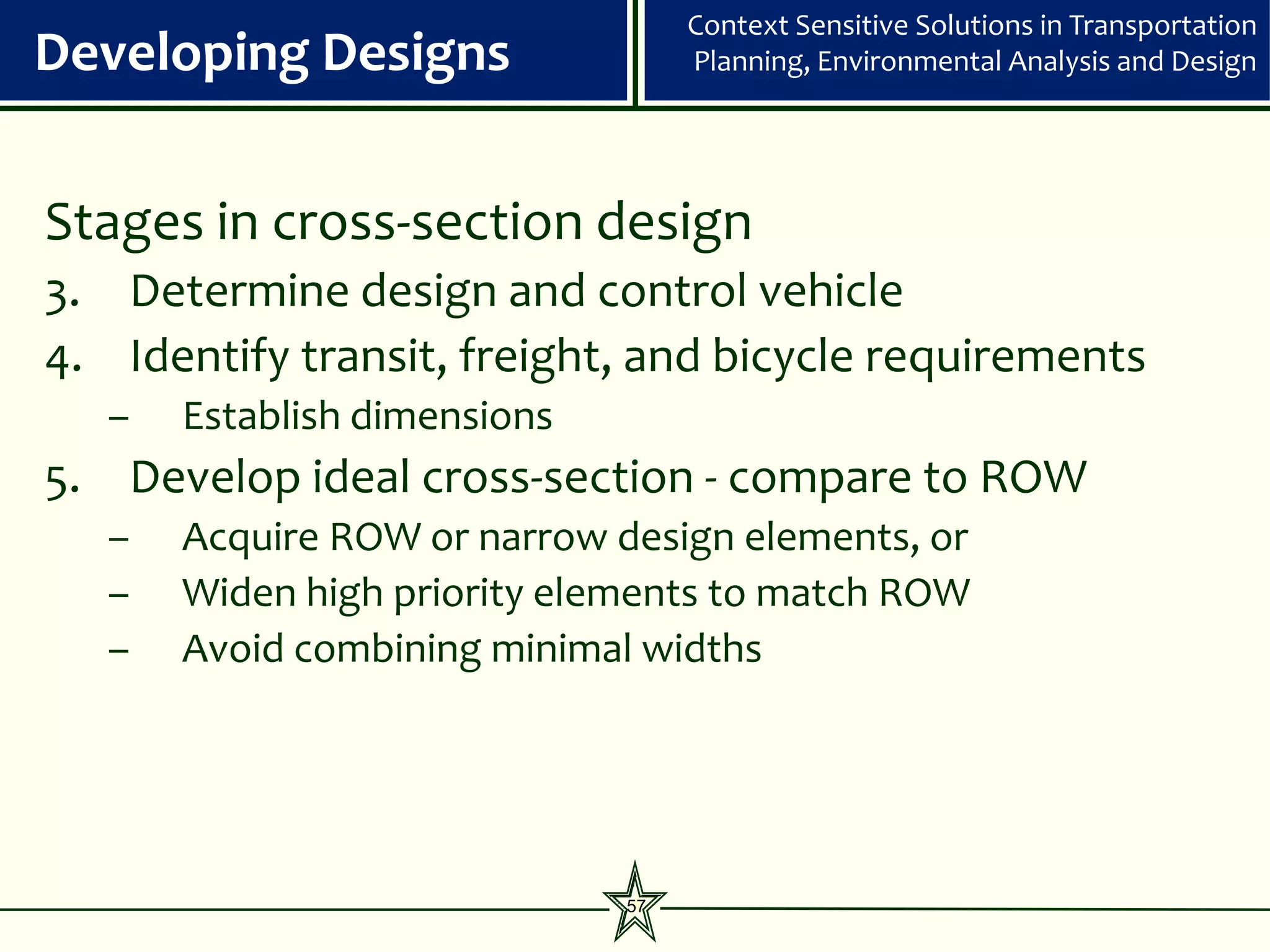
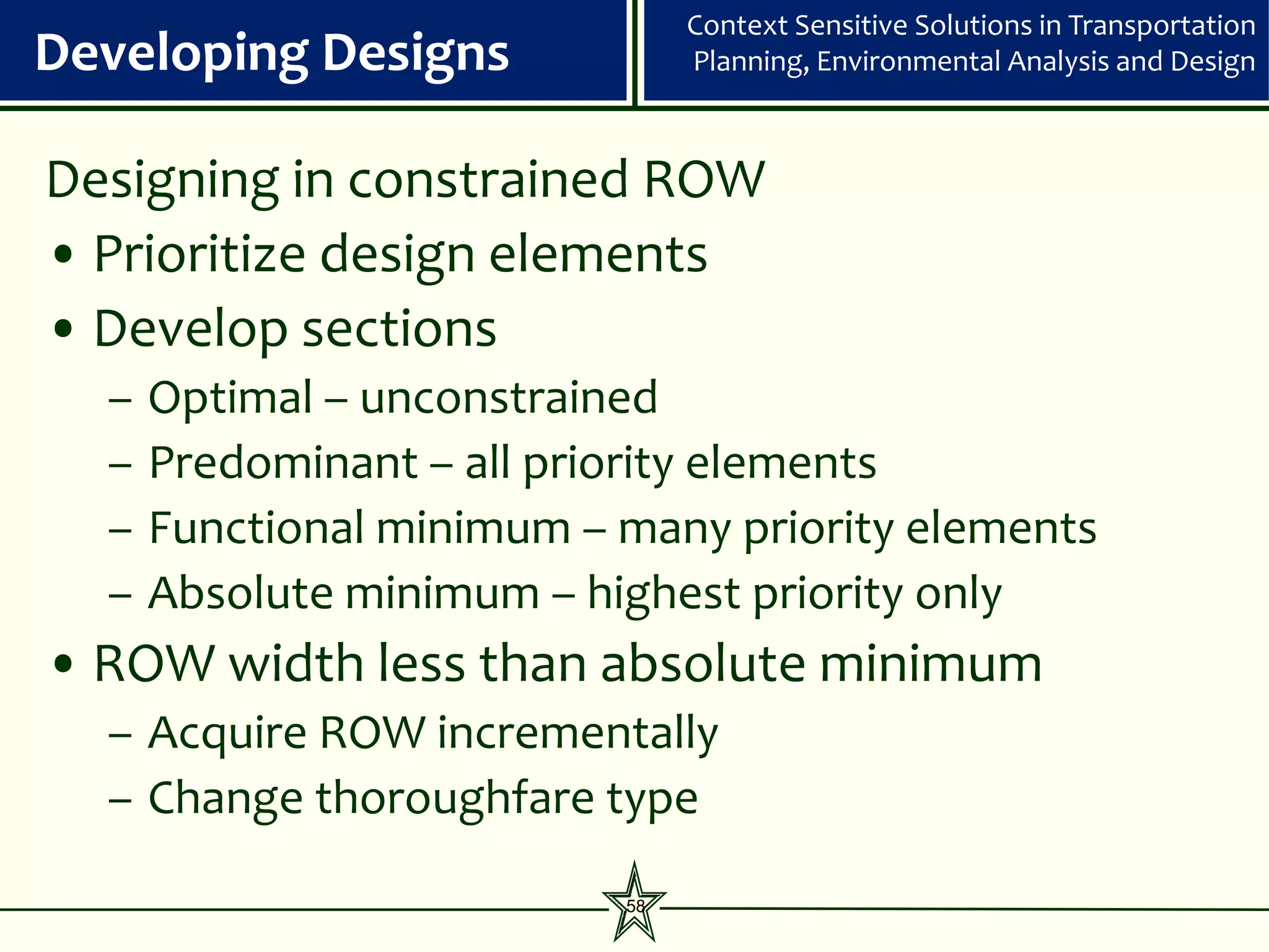
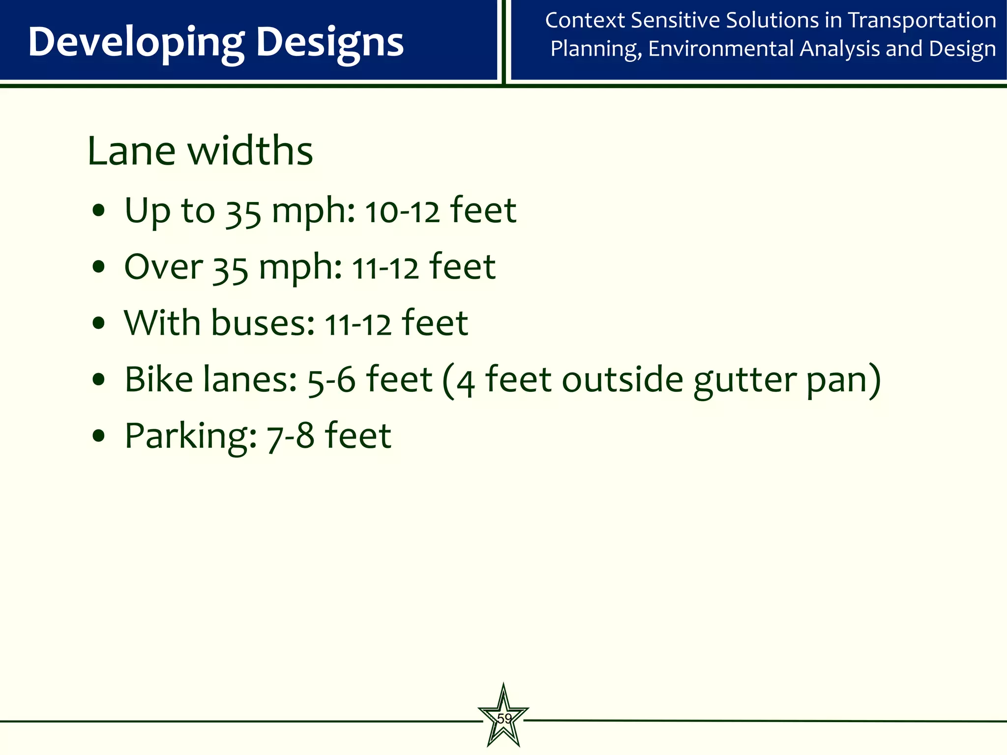
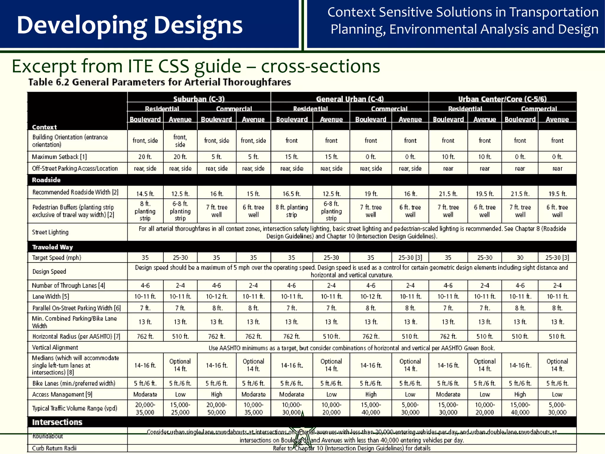
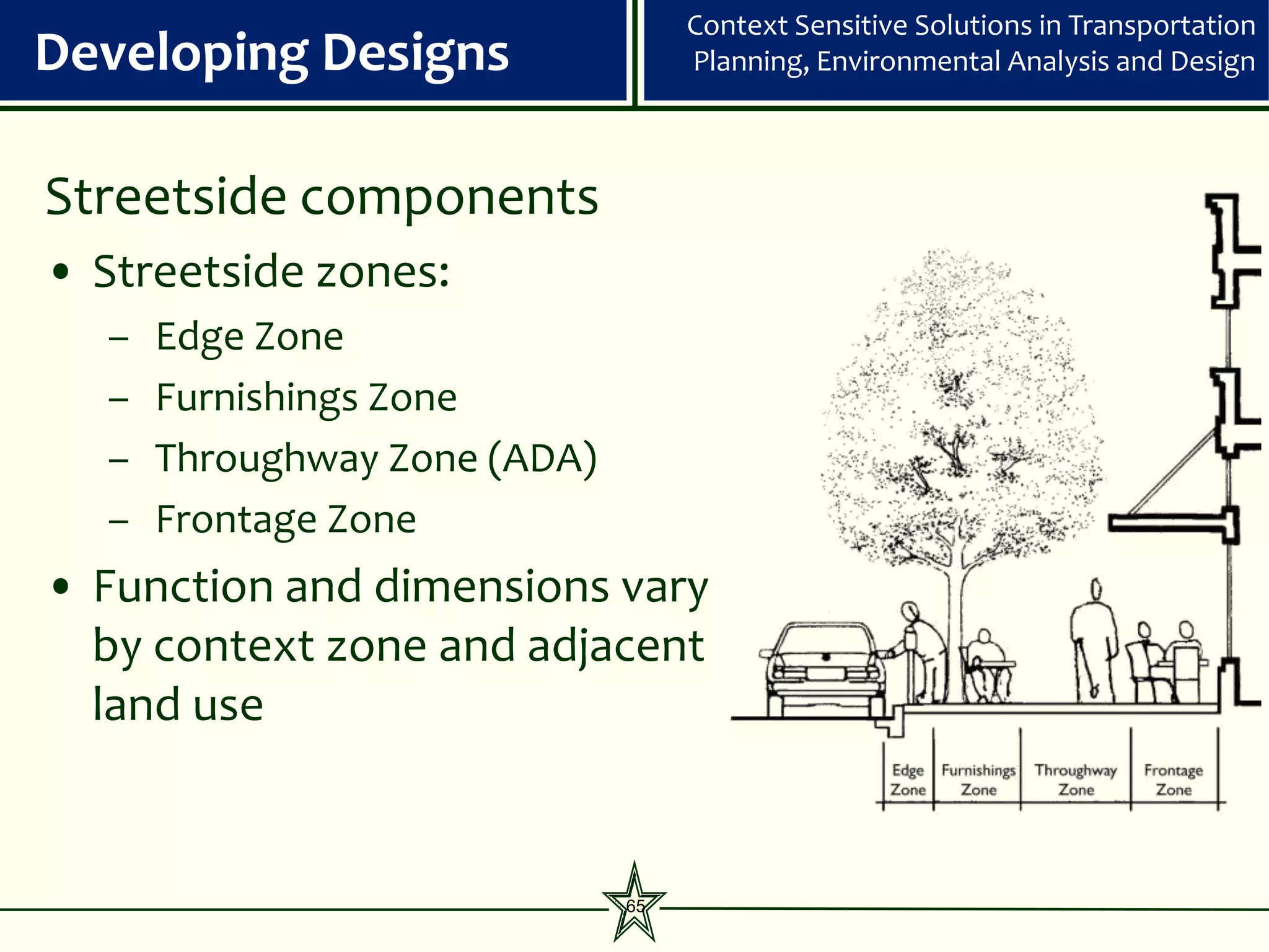
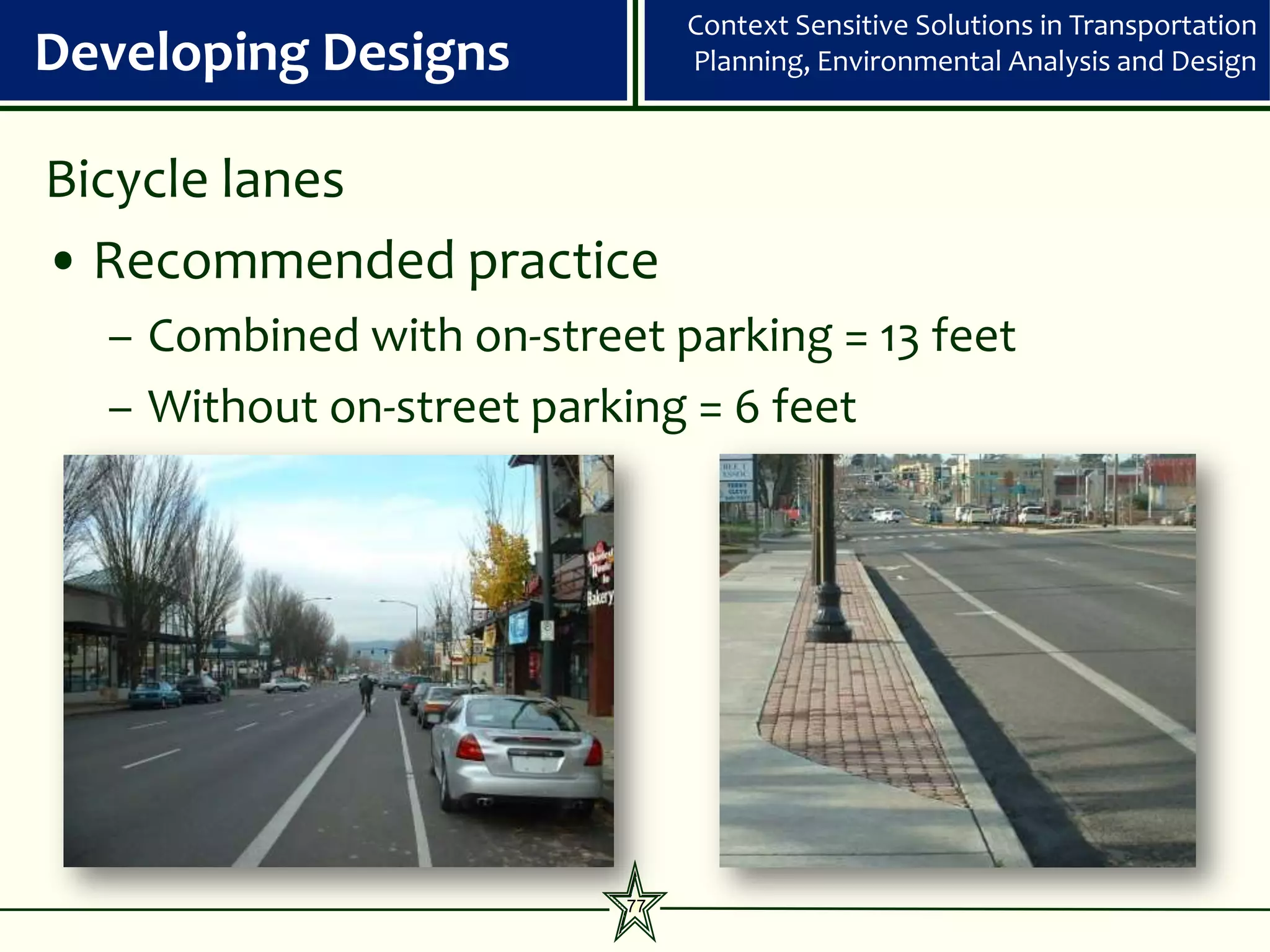
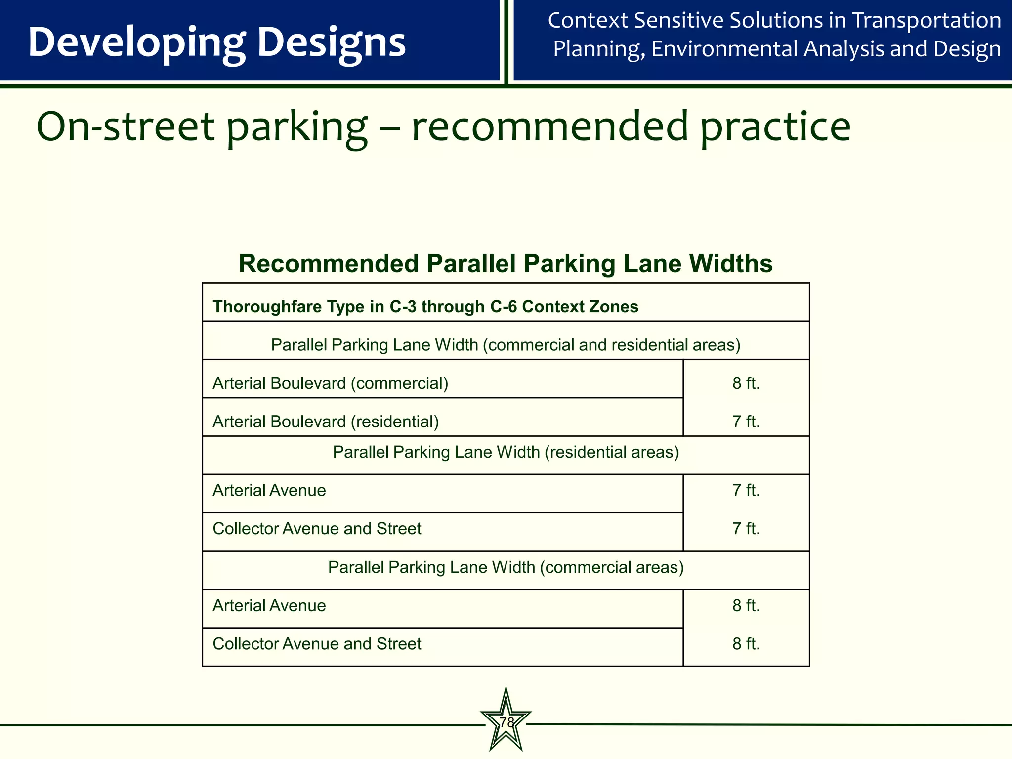
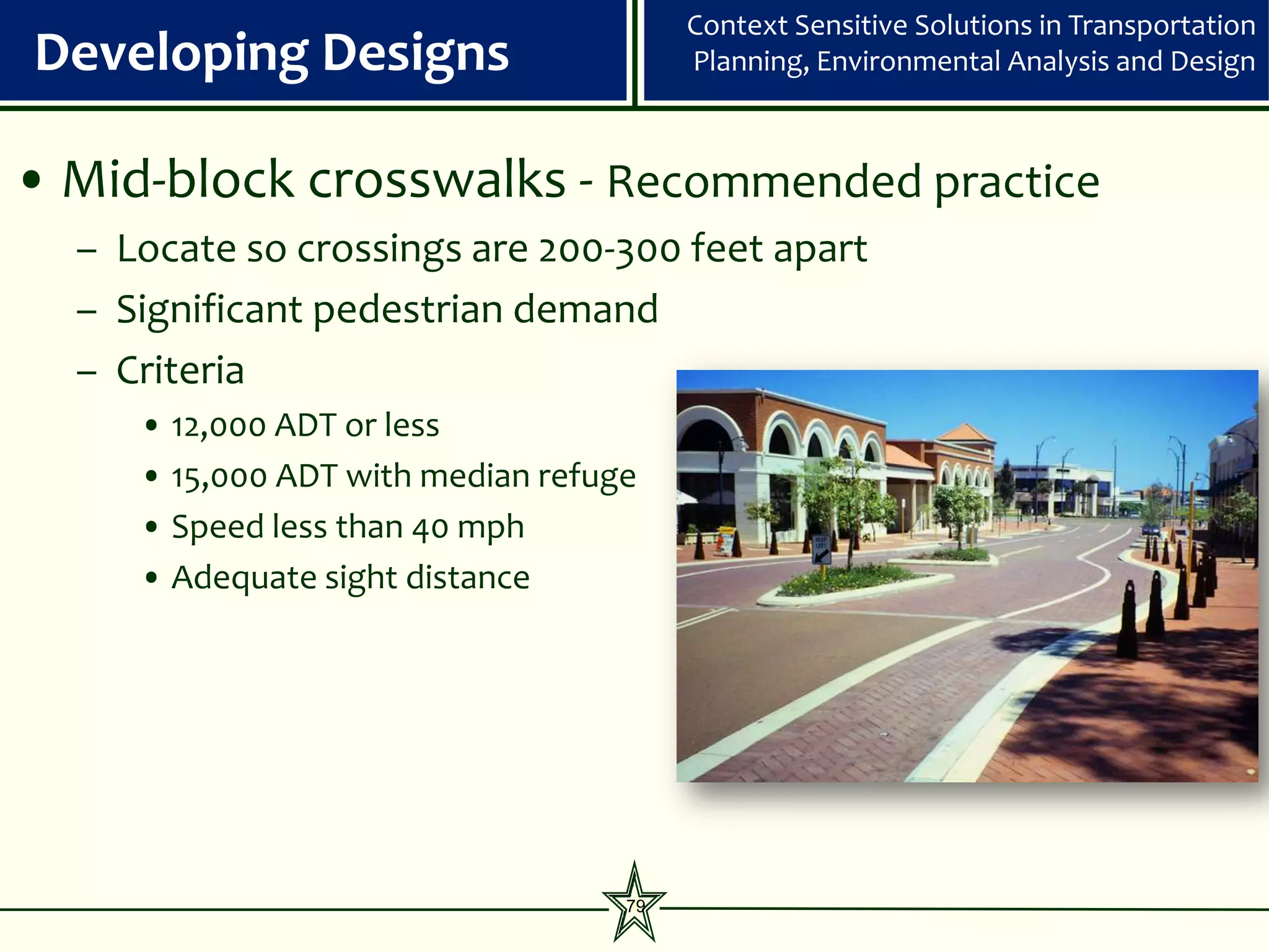
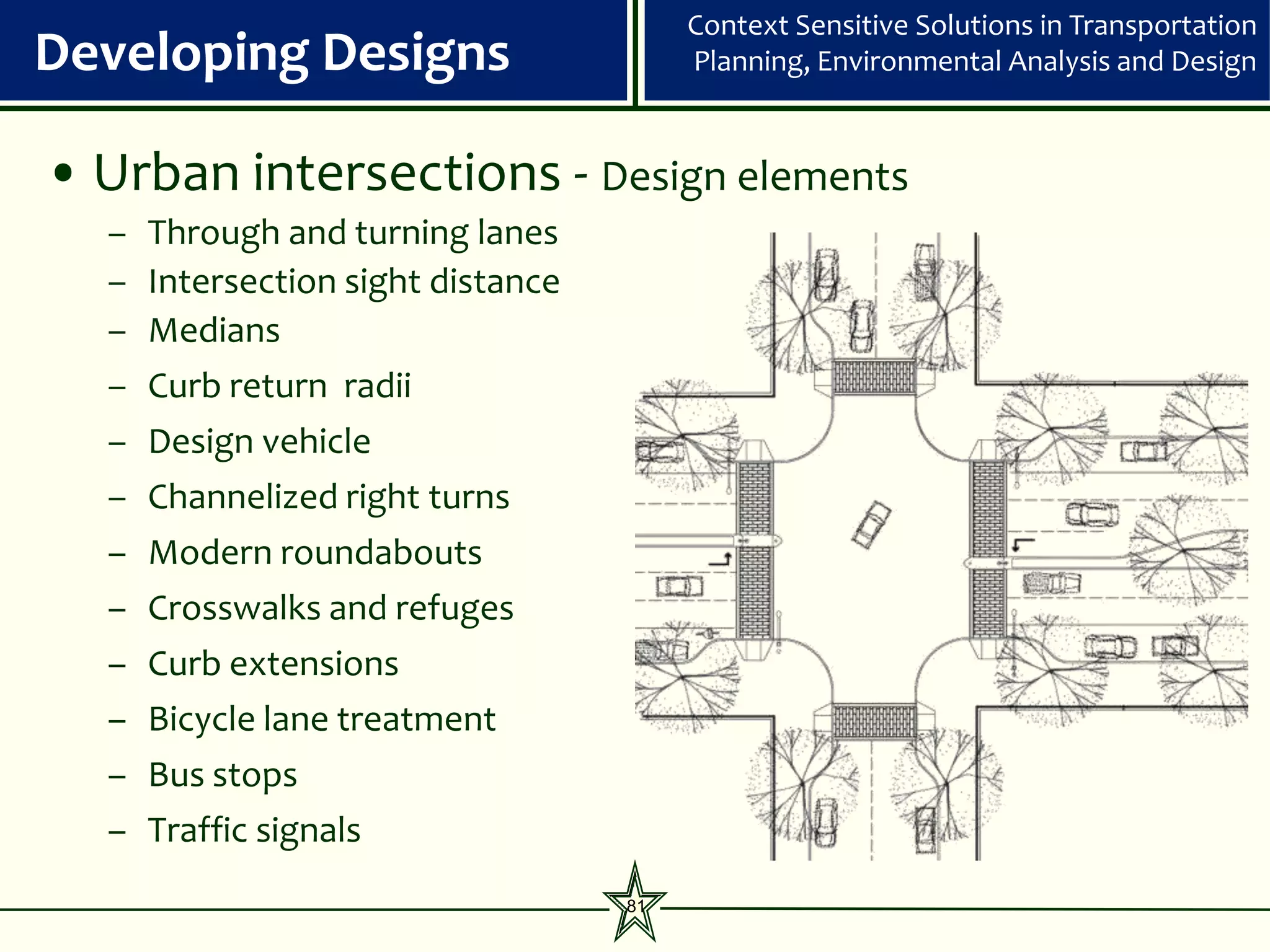
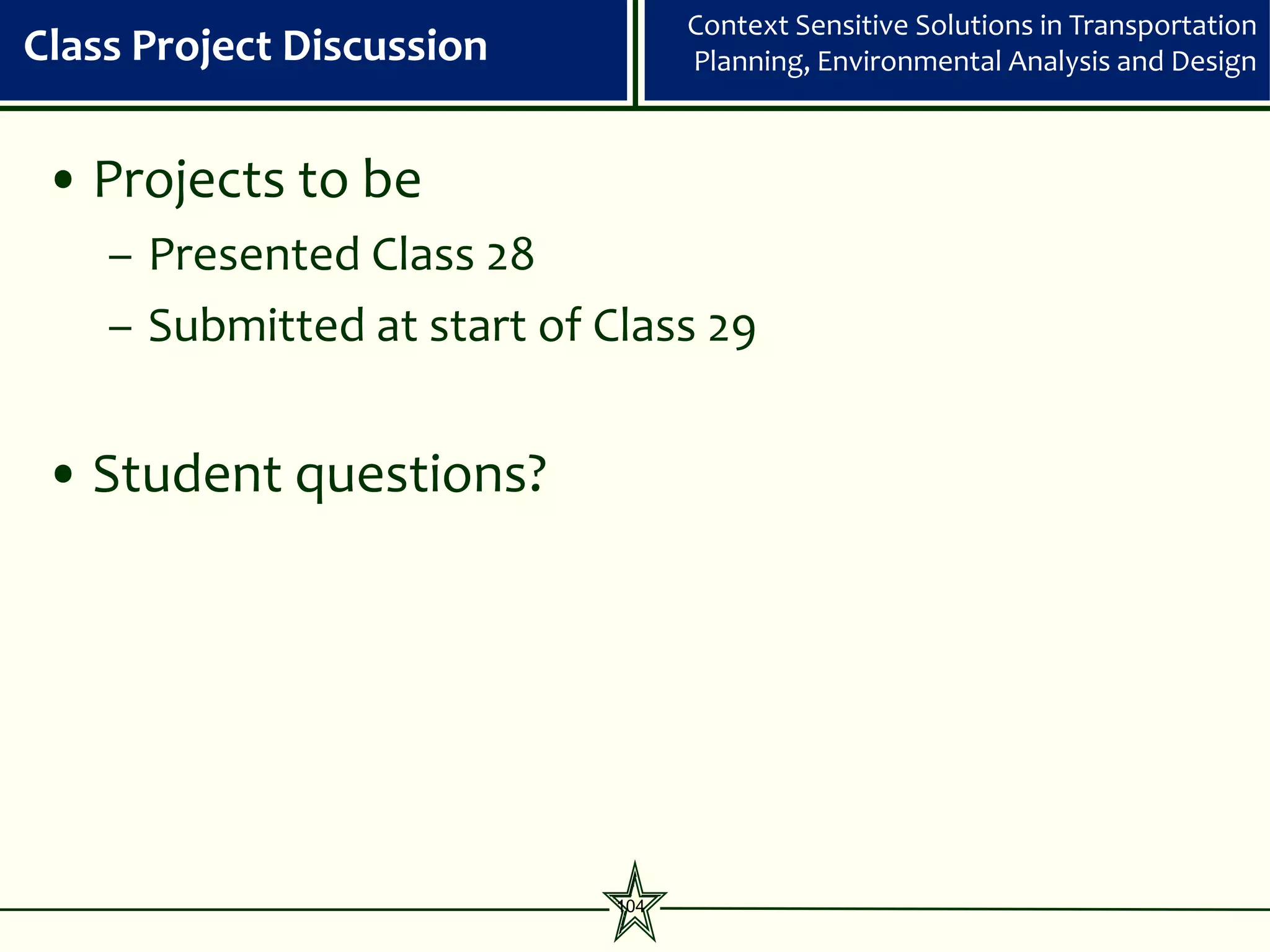
Streetside cross-section guidelines
C-4 w/ Predominantly Commercial Ground
Sidewalk Zone [1] C-6 and C-5 C-4 w/ Predominantly Residential Frontage
Floor Use
1.5 feet 1.5 feet
21.5 foot (recommended)
16.5 foot (recommended)
Edge 0.5 feet
19 foot (recommended)
2.5 feet at diagonal parking 2.5 feet at diagonal parking
12 foot (constrained)
12 foot (constrained)
8 feet
7 feet 7 feet
Boulevard
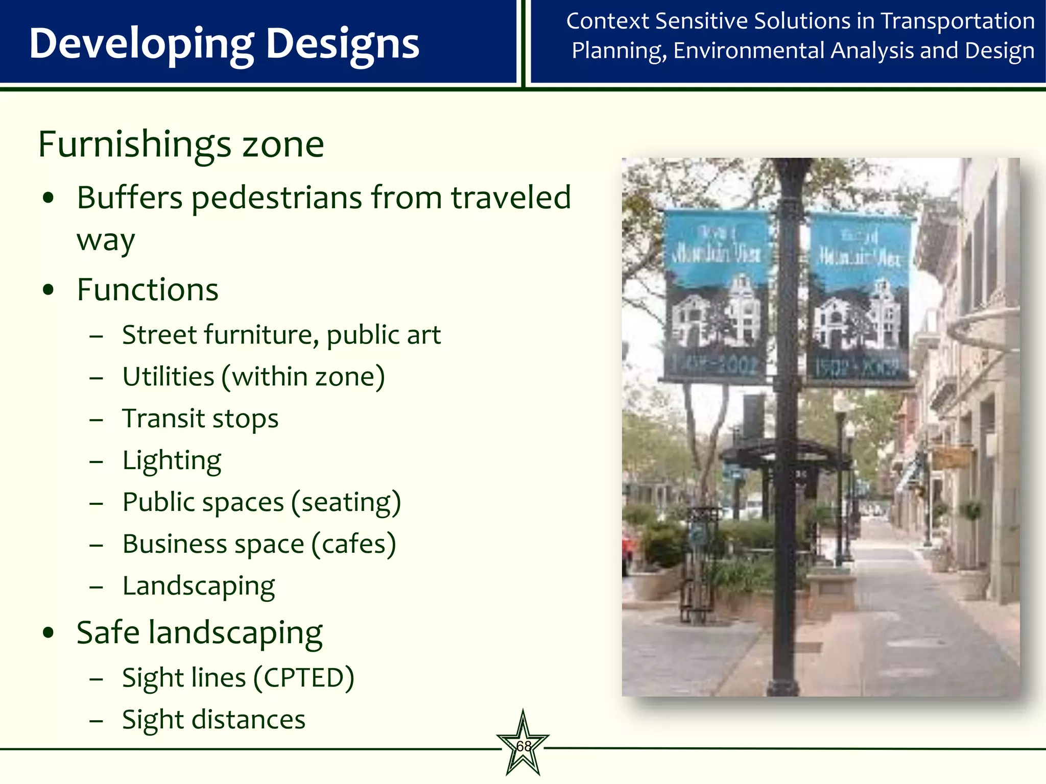
Furnishings (landscape strip w/ trees and grasses or
(trees in tree wells) (trees in tree wells)
groundcovers)
Throughway 10 feet 8 feet 8 feet
0 feet along lawn and groundcover
Frontage 3 feet 2.5 feet 1 foot along low walls, fences, and hedges
1.5 feet along facades, tall walls, and fences
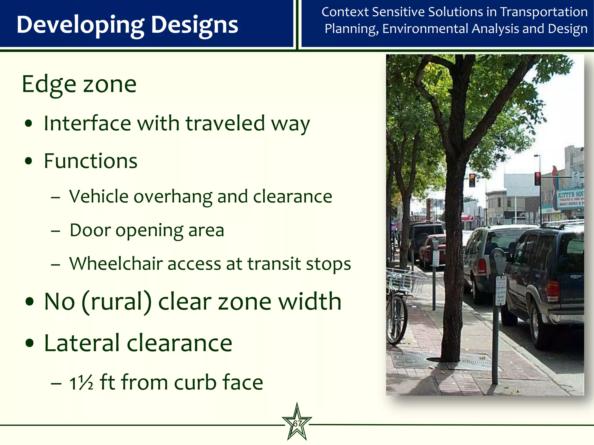
Edge
Boulevard Without Parking
0.5 feet
18.5 foot (Recommended)
10 feet
Furnishings (landscape strip w/ trees and groundcovers or
THIS THOROUGHFARE TYPE NOT APPLICABLE TO THE PREDOMINANTLY low shrubs)
Throughway COMMERCIAL GROUND FLOOR LAND USES FOUND IN C-4 THROUGH C-6 CONTEXT 8 feet
ZONES
0 feet along lawn and groundcover
Frontage 1 foot along low walls, fences, and hedges
1.5 feet along facades, tall walls, and fences
1.5 feet 1.5 feet
Edge 0.5 feet
2.5 feet at diagonal parking 2.5 feet at diagonal parking
19.5 foot (recommended)
14.5 foot (recommended)
16 foot (recommended)
12.0 foot (constrained)
8 feet
12 foot (constrained)
With 6 feet 6 feet
(landscape strip w/ trees and grasses or
Parking trees in tree wells (trees in tree wells)
Furnishings groundcovers)
Avenue
Without 8 feet with 8 feet with 8 feet with
Parking buffer landscaping buffer landscaping buffer landscaping
Throughway 9 feet 6 feet 6 feet
0 feet along lawn and groundcover
Frontage 3 feet 2.5 feet 1 foot along low walls, fences, and hedges
1.5 feet along facades, tall walls, and fences
1.5 feet 1.5 feet
11.5 foot (recommended)
Edge 0.5 feet
16 foot (recommended)
16 foot (recommended)
12.0 foot (constrained)
2.5 feet at diagonal parking 2.5 feet at diagonal parking
12 foot (constrained)
5 feet
6 feet 6 feet
Furnishings (landscape strip w/ trees and grasses or
(trees in tree wells) (trees in tree wells)
Street
groundcovers)
Throughway 6 feet 6 feet 6 feet
0 feet along lawn and groundcover
Frontage 2.5 feet 6 2.5 feet 1 foot along low walls, fences, and hedges
6 1.5 feet along facades, tall walls, and fences](https://image.slidesharecdn.com/cssclasses19-22-developingcompatiblesupportivedesign120309-120228171820-phpapp01/75/Css-classes-19-22-developing-compatible-supportive-design-120309-66-2048.jpg)


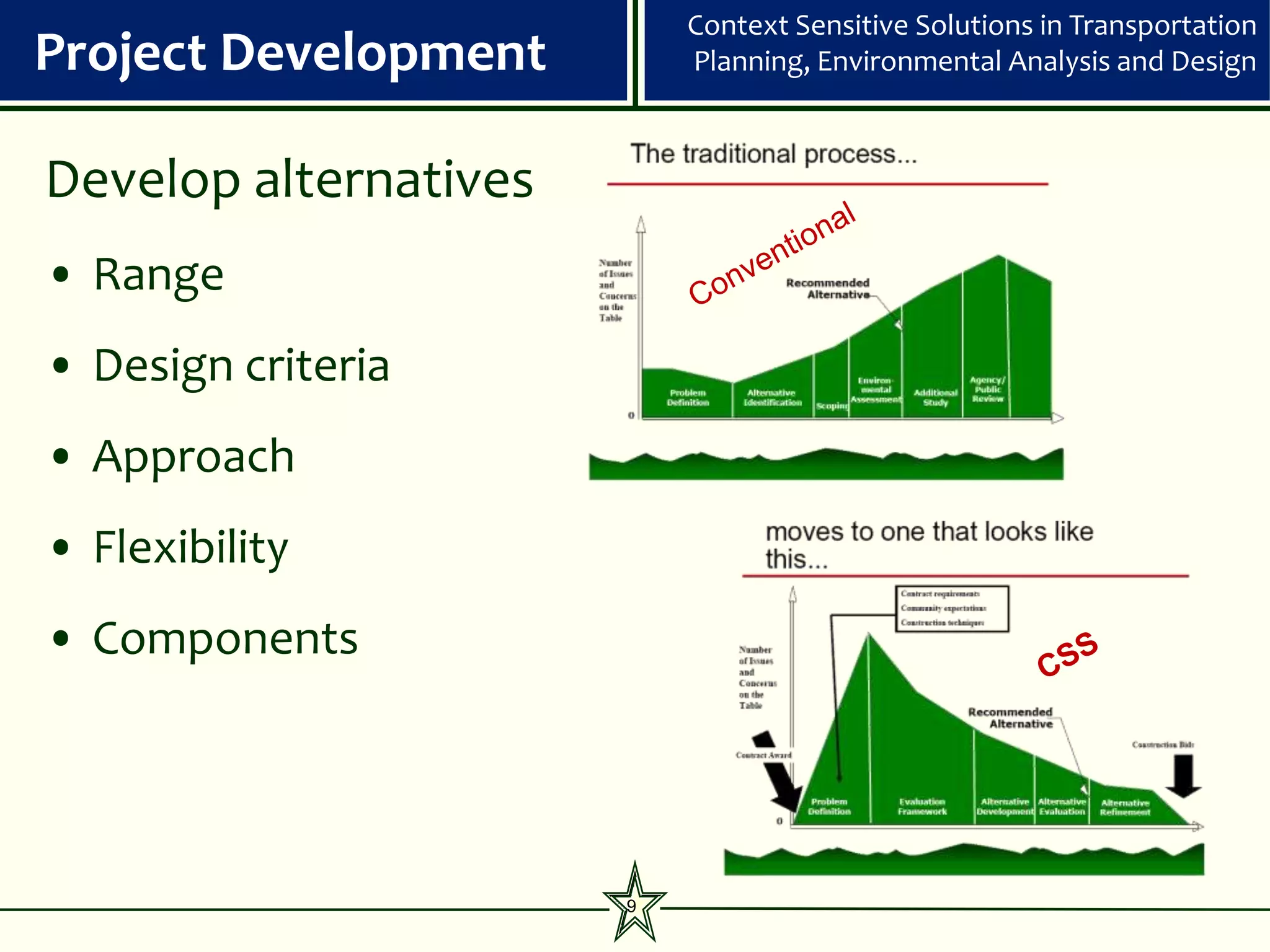
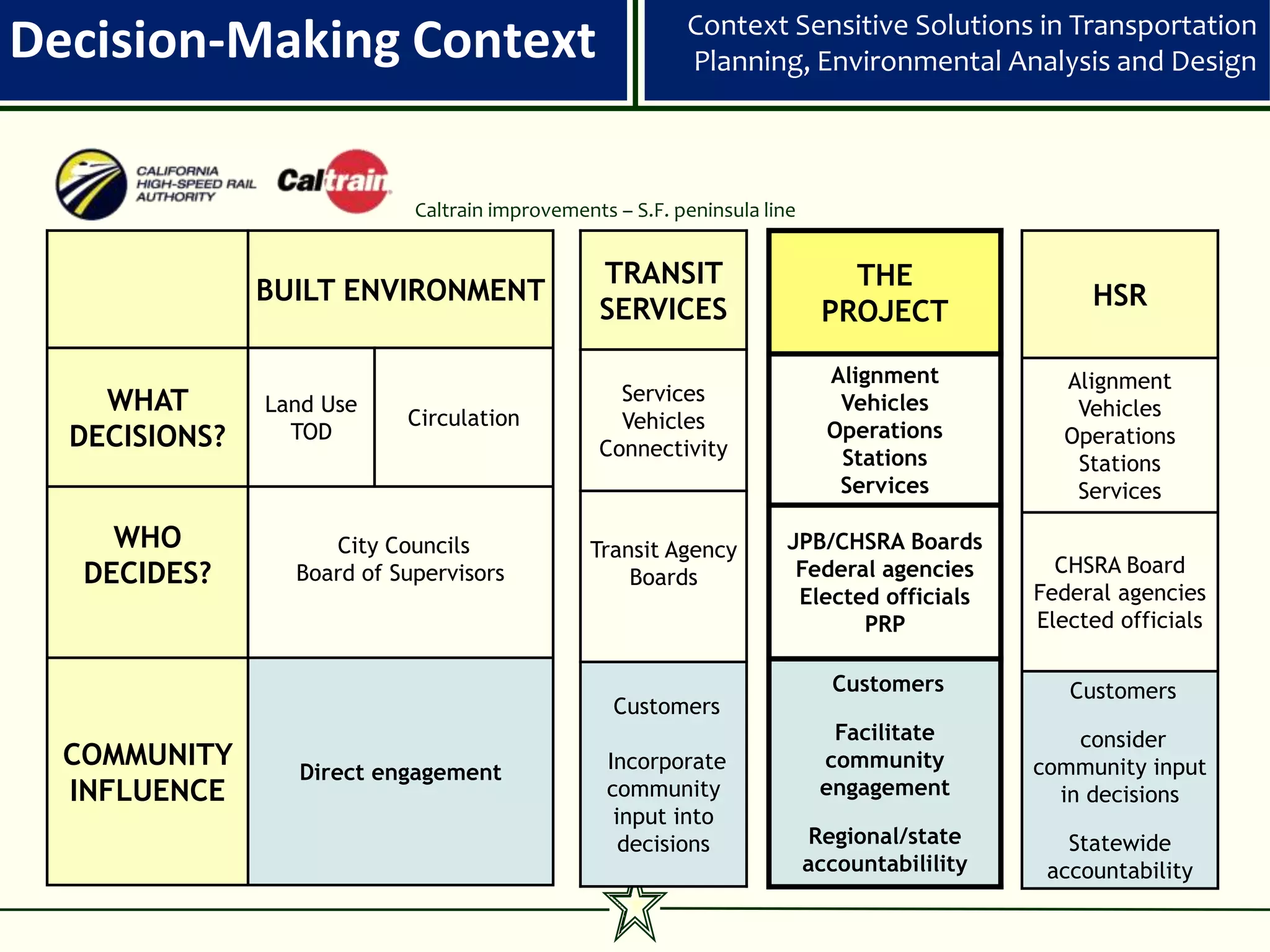
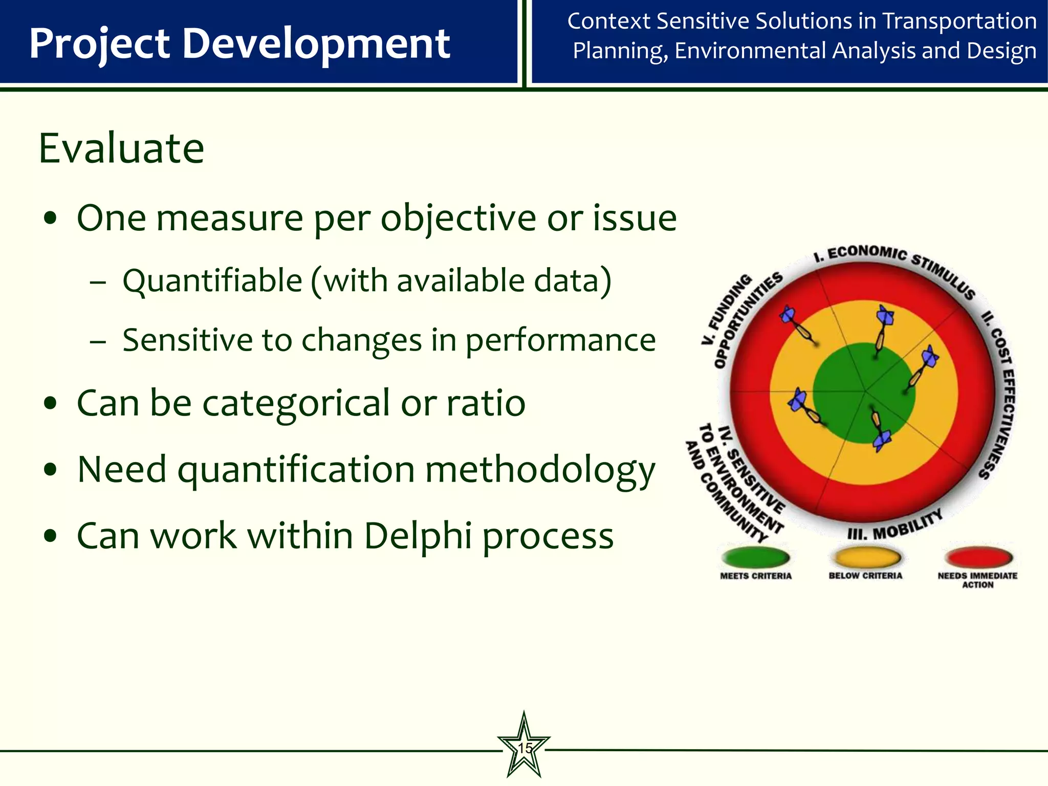
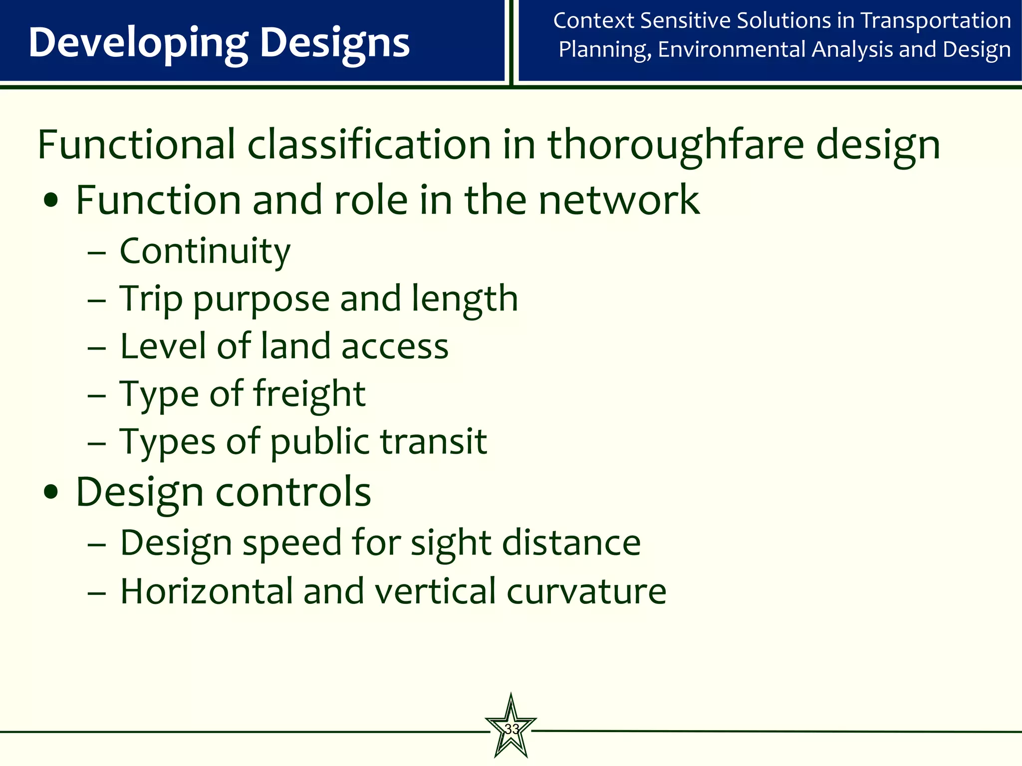
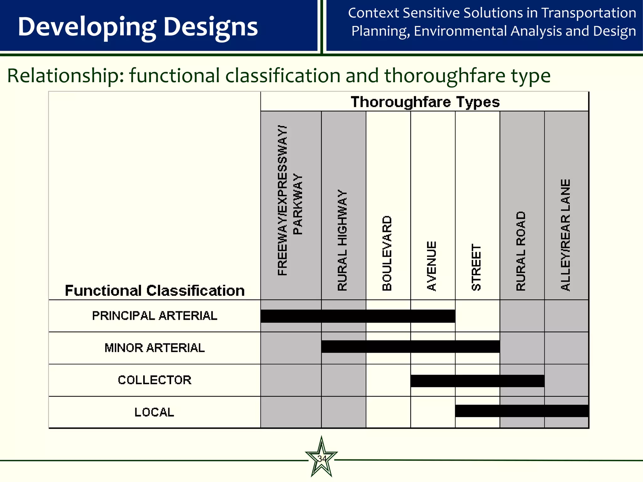
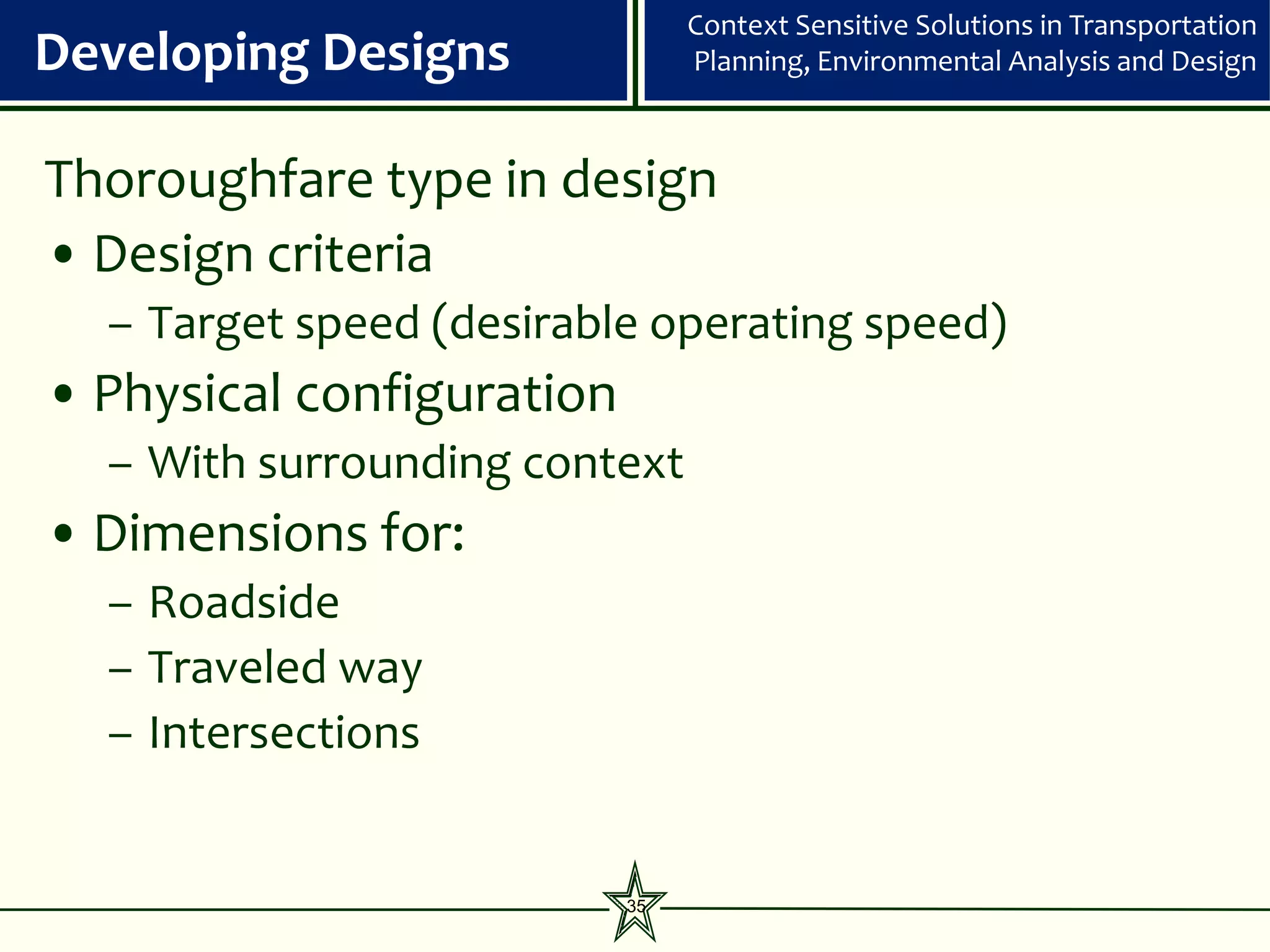
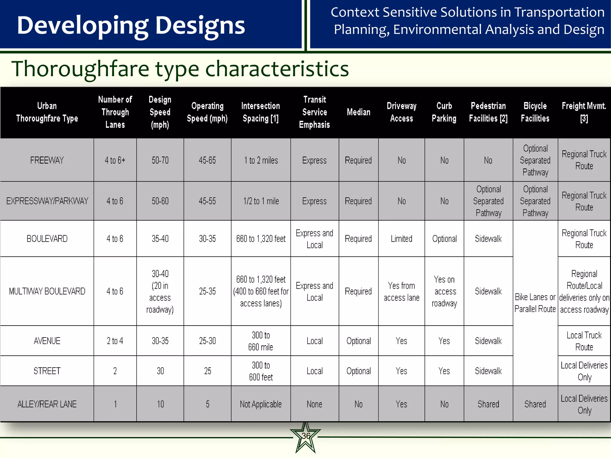
The document discusses context-sensitive solutions (CSS) in transportation, focusing on planning, environmental analysis, and design to create transportation systems that meet community needs, enhance safety, and harmonize with the environment. It outlines a step-by-step project development process including determining context, identifying community issues, developing and evaluating design alternatives, and incorporating stakeholder input. Key tenets of CSS include flexibility in design, multimodal approaches, and creating attractive, functional public spaces that enhance the urban fabric.


![[BDD 2025 - Mobile Development] Mobile Engineer and Software Engineer: Are we...](https://cdn.slidesharecdn.com/ss_thumbnails/md-mobileengineerandsoftwareengineerarewestillrelevantsidiqpermana-251127010650-55224ef1-thumbnail.jpg?width=640&height=640&fit=bounds)
![[BDD 2025 - Full-Stack Development] Agentic AI Architecture: Redefining Syste...](https://cdn.slidesharecdn.com/ss_thumbnails/fs-agenticaiarchitectureredefiningsystemcommunication-251124030838-e6c70cc2-thumbnail.jpg?width=640&height=640&fit=bounds)


![[BDD 2025 - Mobile Development] Exploring Apple’s On-Device FoundationModels](https://cdn.slidesharecdn.com/ss_thumbnails/md-exploringappleson-devicefoundationmodels-251124030840-d690542c-thumbnail.jpg?width=640&height=640&fit=bounds)


![Support, Monitoring, Continuous Improvement & Scaling Agentic Automation [3/3]](https://cdn.slidesharecdn.com/ss_thumbnails/agenticcommunityseries-day3-cfd-251120170304-ddef8112-thumbnail.jpg?width=640&height=640&fit=bounds)


![[BDD 2025 - Artificial Intelligence] AI for the Underdogs: Innovation for Sma...](https://cdn.slidesharecdn.com/ss_thumbnails/ai-aifortheunderdogsinnovationforsmallbusinesses-251124030839-72a599a4-thumbnail.jpg?width=640&height=640&fit=bounds)


