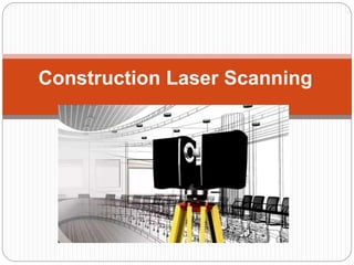
Construction Laser Scanning
Table of contents
 What is construction laser scanning?
 Applications of construction laser scanning
 Types of construction laser scanning
 Laser scanning equipment and software
 Laser scanning workflow
 Challenges and limitations of construction laser
scanning
 Future developments in construction laser scanning
What is construction laser
scanning?
 Construction laser
scanning, also known as
3D laser scanning or
LiDAR (Light Detection
and Ranging), is a
technology that uses
lasers to create precise 3D
models of physical objects
or environments. In the
context of construction,
laser scanning is used to
capture the exact
dimensions, shapes, and
positions of buildings,
infrastructure, and other
construction sites, with
high accuracy and speed.
Applications of construction laser
scanning
 A technology that uses lasers to create a 3D point
cloud of an object or environment. This technology
has several applications in the construction
industry, including:
 Quality control
 BIM modeling
 Site documentation
 Clash detection
 Progress monitoring
 Safety
Types of construction laser
scanning
 Terrestrial Laser
Scanning (TLS)
 Mobile Laser Scanning
(MLS)
 Aerial Laser Scanning
(ALS)
 Handheld Laser
Scanning (HLS)
 Underground Laser
Scanning (ULS)
Laser scanning equipment & software
 Tools used to create detailed 3D models of
physical objects or environments that can be
used for design, analysis, documentation, and
visualization purposes.
 Some popular laser scanning equipment and
software brands include
 Faro
 Leica
 Trimble
 Autodesk
Laser scanning workflow
 Step 1:
 Planning: This involves defining the scope of the
project, determining the necessary accuracy,
identifying the appropriate laser scanning equipment,
and deciding on the scanning locations.
 Step 2:
 Scanning: This involves setting up the equipment and
scanning the target area. The scanner emits laser
beams that bounce off the surface of the object or
environment and create a point cloud, which is a
collection of 3D coordinates.
Laser scanning workflow
 Step 3:
 Registration: This involves combining multiple scans
into a single, unified model. Registration can be done
manually or with the help of software.
 Step 4:
 Processing: This involves cleaning up the point cloud,
removing noise, and creating a surface mesh. The
resulting model can be viewed, manipulated, and
measured.
Laser scanning workflow
 Step 5:
 Analysis: Once the 3D model is created, it can be
analyzed to extract information such as dimensions,
volumes, and distances. This information can be used
for various purposes such as engineering, architecture,
and construction.
 Step 6:
 Output: This can include 2D and 3D drawings, CAD
models, and other deliverables. The output can be
used for documentation, communication, and decision-
making.
Challenges & limitations of construction
laser scanning
 It offers numerous benefits, such as improved project
efficiency and reduced costs, there are also several
challenges and limitations associated with this
technology:
 Cost
 Limited field of view
 Reflections
 Inaccuracies due to movement
 Weather conditions
 Data management
 User expertise
Future developments in construction
laser scanning
 Laser scanning technology is becoming increasingly
popular in the construction industry, as it provides a
fast, accurate, and non-invasive way to capture 3D
data of buildings and construction sites.
 Increased speed and resolution
 Integration with other technologies
 Improved portability
 Automation and artificial intelligence
 Greater accessibility
Thank You…
 For more information regarding Construction
Laser Scanning, Contact Us:
 Phone: +1 240 899 7711
 Email ID: info@topbimcompany.com
 Website: Construction Laser Scanning Services

Construction laser scanning: valuable technology in the construction industry

  • 1.
  • 2.
    Table of contents What is construction laser scanning?  Applications of construction laser scanning  Types of construction laser scanning  Laser scanning equipment and software  Laser scanning workflow  Challenges and limitations of construction laser scanning  Future developments in construction laser scanning
  • 3.
    What is constructionlaser scanning?  Construction laser scanning, also known as 3D laser scanning or LiDAR (Light Detection and Ranging), is a technology that uses lasers to create precise 3D models of physical objects or environments. In the context of construction, laser scanning is used to capture the exact dimensions, shapes, and positions of buildings, infrastructure, and other construction sites, with high accuracy and speed.
  • 4.
    Applications of constructionlaser scanning  A technology that uses lasers to create a 3D point cloud of an object or environment. This technology has several applications in the construction industry, including:  Quality control  BIM modeling  Site documentation  Clash detection  Progress monitoring  Safety
  • 5.
    Types of constructionlaser scanning  Terrestrial Laser Scanning (TLS)  Mobile Laser Scanning (MLS)  Aerial Laser Scanning (ALS)  Handheld Laser Scanning (HLS)  Underground Laser Scanning (ULS)
  • 6.
    Laser scanning equipment& software  Tools used to create detailed 3D models of physical objects or environments that can be used for design, analysis, documentation, and visualization purposes.  Some popular laser scanning equipment and software brands include  Faro  Leica  Trimble  Autodesk
  • 7.
    Laser scanning workflow Step 1:  Planning: This involves defining the scope of the project, determining the necessary accuracy, identifying the appropriate laser scanning equipment, and deciding on the scanning locations.  Step 2:  Scanning: This involves setting up the equipment and scanning the target area. The scanner emits laser beams that bounce off the surface of the object or environment and create a point cloud, which is a collection of 3D coordinates.
  • 8.
    Laser scanning workflow Step 3:  Registration: This involves combining multiple scans into a single, unified model. Registration can be done manually or with the help of software.  Step 4:  Processing: This involves cleaning up the point cloud, removing noise, and creating a surface mesh. The resulting model can be viewed, manipulated, and measured.
  • 9.
    Laser scanning workflow Step 5:  Analysis: Once the 3D model is created, it can be analyzed to extract information such as dimensions, volumes, and distances. This information can be used for various purposes such as engineering, architecture, and construction.  Step 6:  Output: This can include 2D and 3D drawings, CAD models, and other deliverables. The output can be used for documentation, communication, and decision- making.
  • 10.
    Challenges & limitationsof construction laser scanning  It offers numerous benefits, such as improved project efficiency and reduced costs, there are also several challenges and limitations associated with this technology:  Cost  Limited field of view  Reflections  Inaccuracies due to movement  Weather conditions  Data management  User expertise
  • 11.
    Future developments inconstruction laser scanning  Laser scanning technology is becoming increasingly popular in the construction industry, as it provides a fast, accurate, and non-invasive way to capture 3D data of buildings and construction sites.  Increased speed and resolution  Integration with other technologies  Improved portability  Automation and artificial intelligence  Greater accessibility
  • 12.
    Thank You…  Formore information regarding Construction Laser Scanning, Contact Us:  Phone: +1 240 899 7711  Email ID: info@topbimcompany.com  Website: Construction Laser Scanning Services