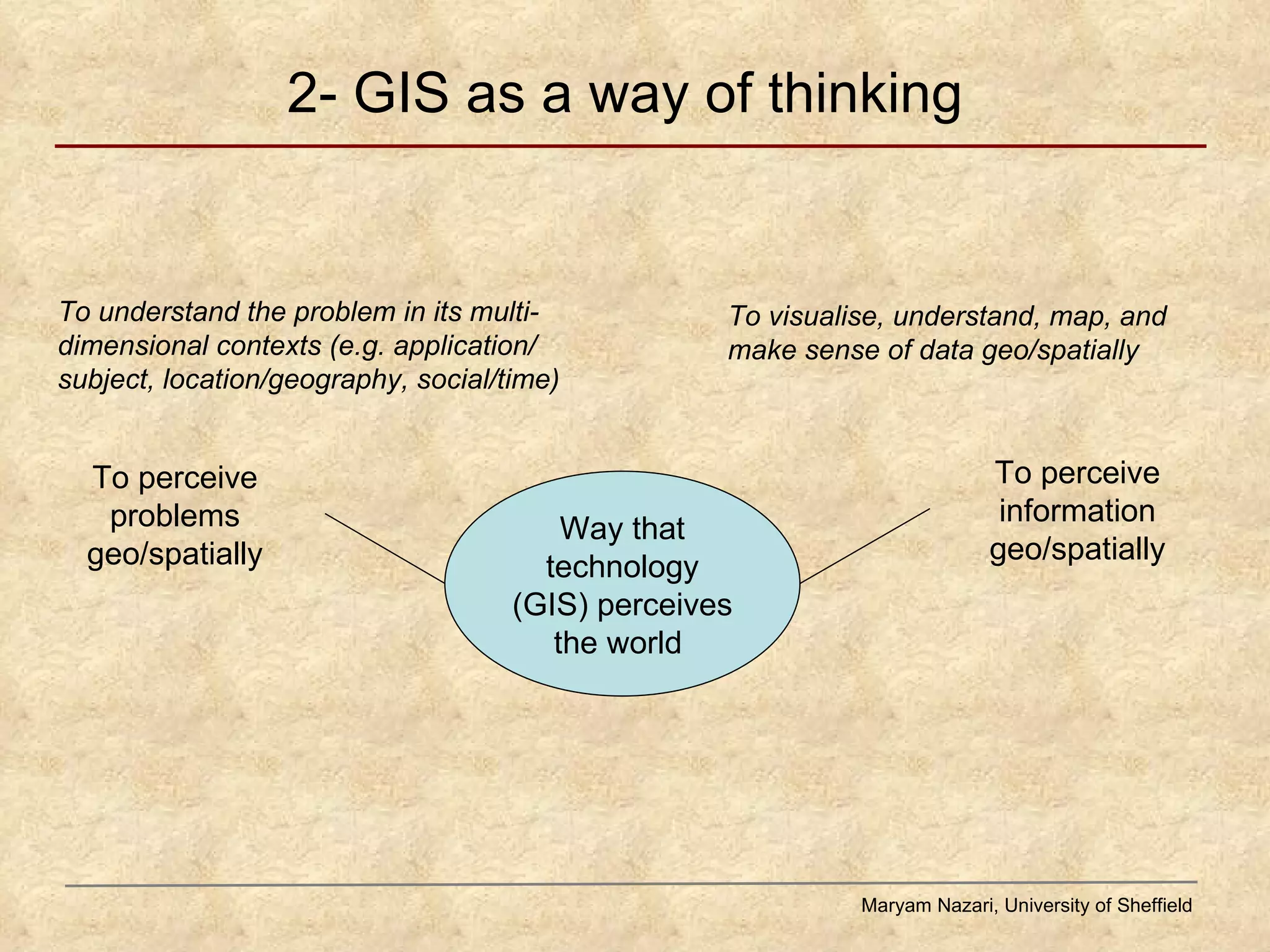
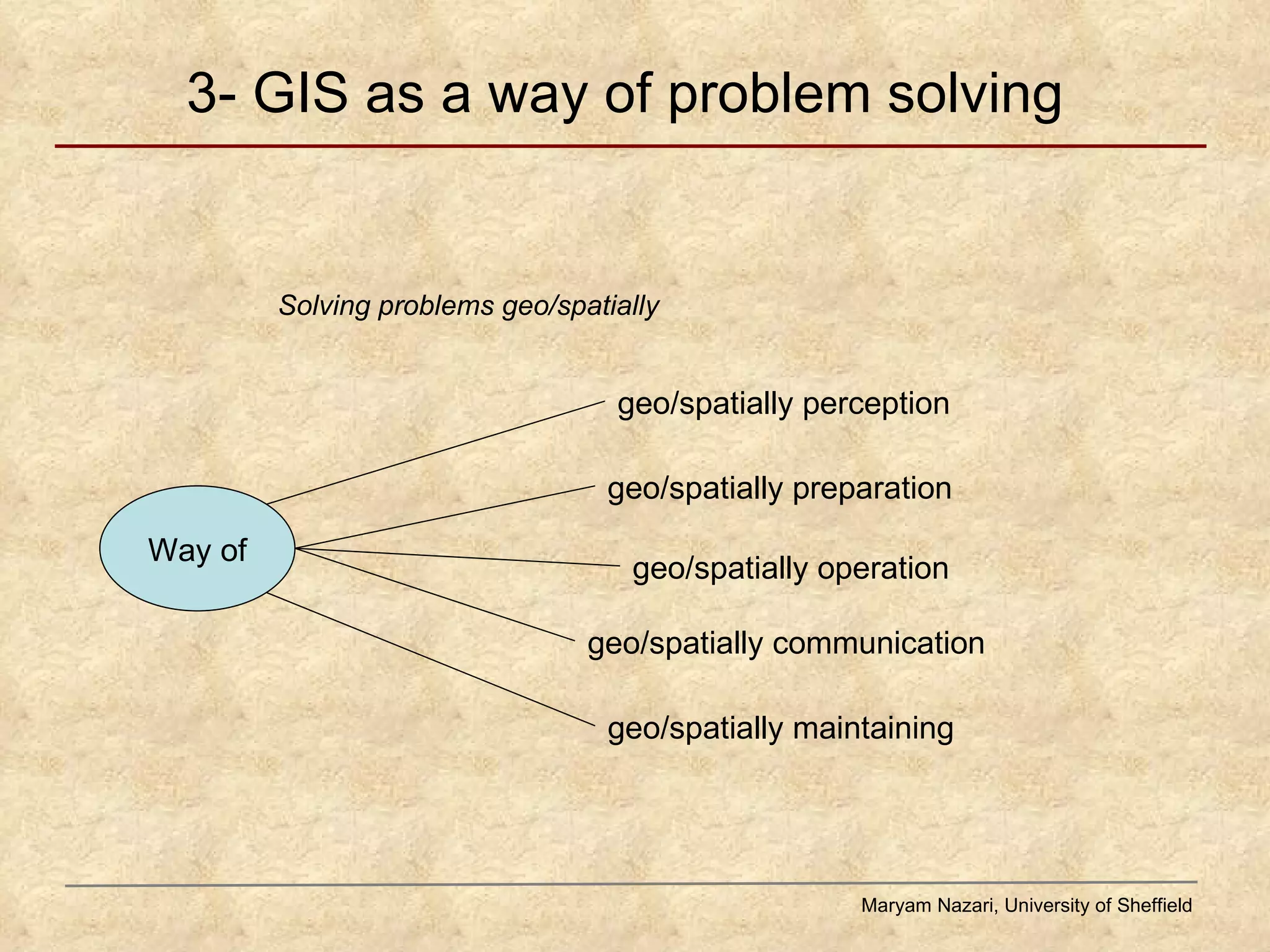
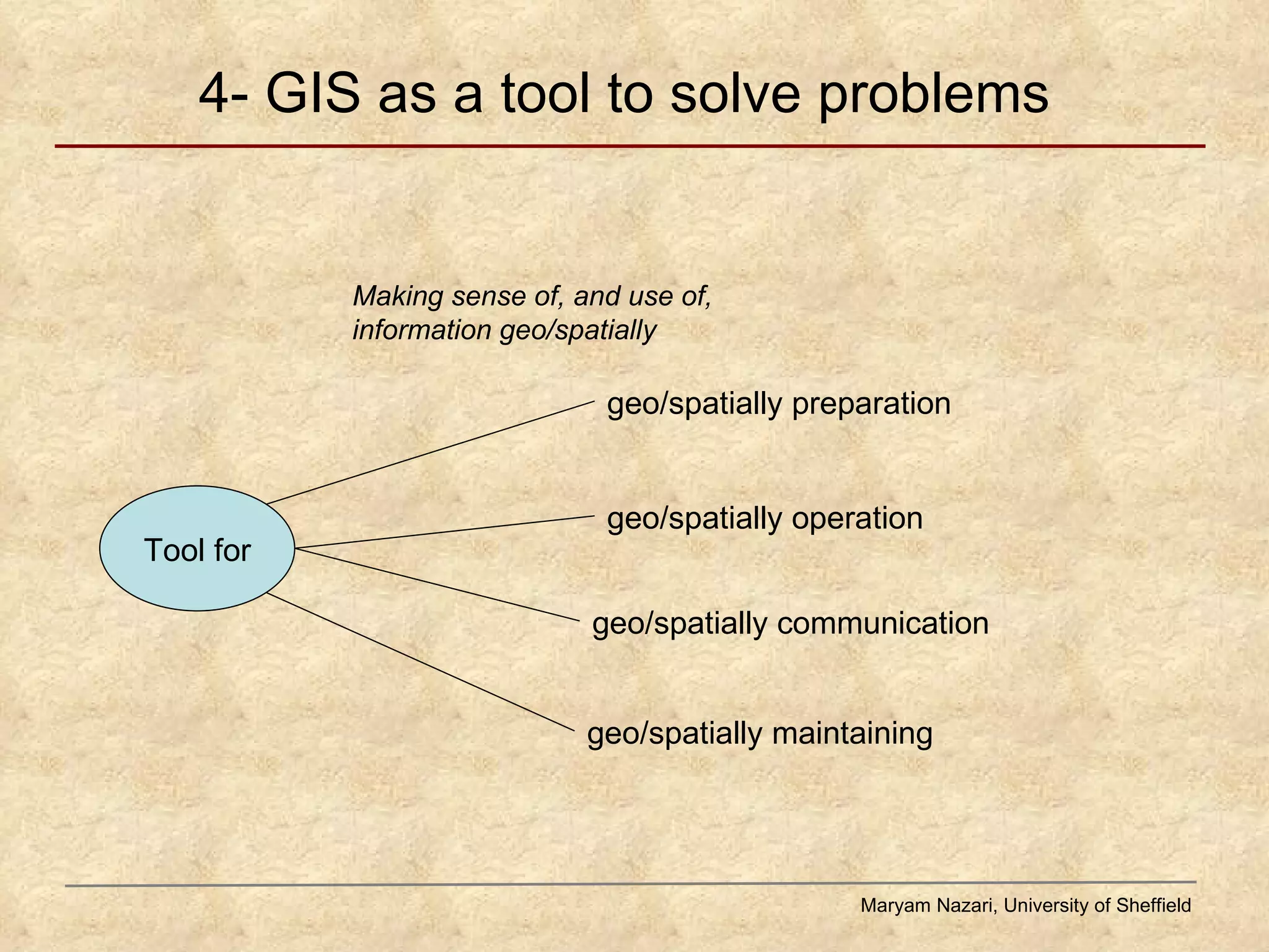
![1- GIS as an evolving, multidimensional discipline Maryam Nazari, University of Sheffield Science Technology Applications Tool/ software Geo/spatial information Geography [and other subjects and disciplines] Geo/spatial information Applications Tool/ software: generic and subject-relevant Evolving techniques and operations Evolving principles, terminologies, methodologies](https://image.slidesharecdn.com/conceptionsofgis-implicationsforil-summerevent-aug2008-100617141738-phpapp02/75/Conceptions-of-GIS-implications-for-information-literacy-9-2048.jpg)
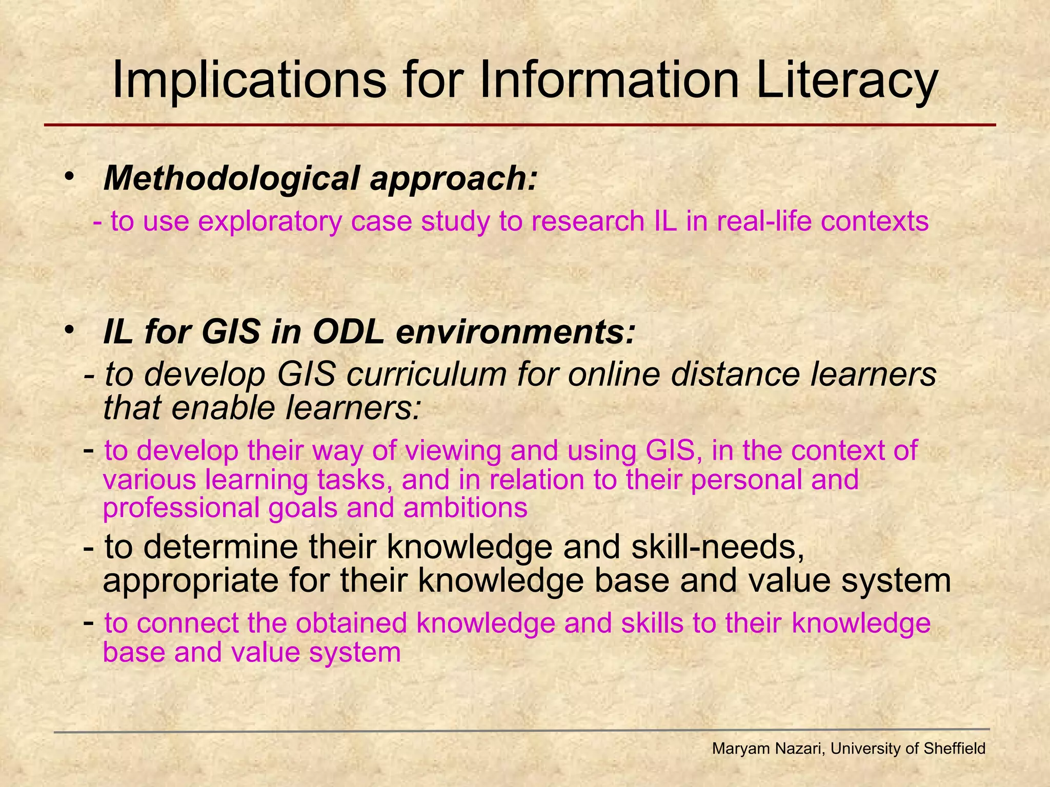

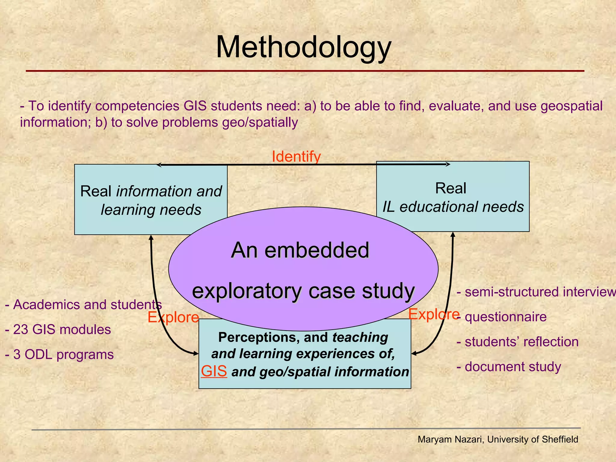
Maryam Nazari's study explores the conceptions of Geographic Information Systems (GIS) and their implications for information literacy, particularly in online distance learning contexts. The research identifies key competencies needed by GIS students to effectively find, evaluate, and use geospatial information, emphasizing the diverse backgrounds and needs of learners. The findings aim to inform the development of GIS curricula and enhance the understanding of geospatial information literacy among educators and librarians.


