Dr. Ram Ben-David presented on two mining projects and two geoengineering projects from his portfolio. For the Sakassou gold exploration project in Cote d'Ivoire, he discussed the regional geology, exploration phases including soil and trench sampling, and initial results. For the Shefa Yamim exploration project in Israel, he outlined the exploration licenses, his role as chief geologist developing programs, and some regional geology. He also presented on coastal cliff stability projects in Israel examining geological problems and engineering solutions, and a large underground parking project in Jerusalem where he provided geological supervision of tunneling.
Why core the Quaternary of the North Sea? An overview/context of the GlaciStore scientific objectives - presentation by Hans-Petter Sejrup (University of Bergen) at the UKCCSRC Glacistore Meeting "Impact of glacial advances and retreats on the strata overlying prospective North Sea CO2 storage sites", 27 February 2015
The glaciation of the North Sea Basin and its implications for Carbon Capture and Storage sites - presentation by Tom Bradwell (BGS/University of Stirling) at the UKCCSRC Glacistore meeting "Impact of glacial advances and retreats on the strata overlying prospective North Sea CO2 storage sites", 27 February 2015
The prolific Niger Delta Basin is a mature petroleum province. Therefore, further prospectivity in
the basin lies within deeper plays which are high pressure and high temperature (HPHT) targets. One of the
main characteristics of the Niger Delta is its unique diachronous tripartite stratigraphy. Its gross onshore and
shallow offshore lithostratigraphy consists of the deep-seated Akata Formation and is virtually exclusively
shale, the petroliferous paralic Agbada Formation in which sand/shale proportion systematically increases
upward, and at the top the Benin Formation composed almost exclusively of sand. This stratigraphic pattern is
not exactly replicated in the deep offshore part of the delta.
After emerging from the resources wilderness thanks to its world-class geology and industry-friendly government policies, South Australia is now a leader in Australian mining and hydrocarbon developments over the last decade.
In little more than a decade the State has gone from four operating mines to more than 20 and is rated Australia’s second most popular exploration destination.
With a comprehensive review of the Mining Act under way, the State’s attractiveness as a place for resources and energy investment is expected to be strengthened.
South Australia is now a leader in the exploration for next generation energy sources with companies such as Santos and BP leading the charge, while initiatives such as the Government’s Copper Strategy – designed to treble annual copper production to 1 mtpa – is set to establish the State as one of the world’s premier producers of the red metal.
In the energy space, uranium and nuclear energy is another area of keen interest, with the South Australian Government initiating a Royal Commission into Participation in the Nuclear Fuel Cycle in 2016.
The State has become synonymous with innovation, cutting-edge development and a remarkable rate of discovery. From uranium prospects, to geothermal energy and the buoyant hydrocarbons sector, South Australia is now a leader in the exploration for next generation energy sources.
With full support from the Department of State Development, the South Australian Resources and Energy Investment Conference will continue to showcase this burgeoning sector in 2017. From copper plays in the Gawler Craton, to iron ore and graphite developments on the Eyre Peninsula and the emergence of the State as a new hydrocarbon frontier, South Australia’s resources potential is at last being fully recognised.
The conference will feature the success stories and emerging players in the State from both minerals and oil and gas and will also tackle thorny industry issues such as infrastructure, corporate social responsibility and the future of the Woomera Prohibited Area.
Crystal Lake Mining: TECHNICAL HIGHLIGHTS OF THE NICOBAT PROJECT: A PIPELINE ...MomentumPR
Crystal Lake Mining is a Canada-based junior exploration company focused on building shareholder value through the discovery of new magmatic nickel sulphide deposits using technical excellence in exploration target development.
A dissertation project in partial completion of Durham Universities Geology F600 Program with funding from Durham Universities Department of Earth Sciences. Fieldwork was carried out over a period of 6 weeks from the Oystercatcher House B&B, Raasay.
After emerging from the resources wilderness thanks to its world-class geology and industry-friendly government policies, South Australia is now a leader in Australian mining and hydrocarbon developments over the last decade.
In little more than a decade the State has gone from four operating mines to more than 20 and is rated Australia’s second most popular exploration destination.
With a comprehensive review of the Mining Act under way, the State’s attractiveness as a place for resources and energy investment is expected to be strengthened.
South Australia is now a leader in the exploration for next generation energy sources with companies such as Santos and BP leading the charge, while initiatives such as the Government’s Copper Strategy – designed to treble annual copper production to 1 mtpa – is set to establish the State as one of the world’s premier producers of the red metal.
In the energy space, uranium and nuclear energy is another area of keen interest, with the South Australian Government initiating a Royal Commission into Participation in the Nuclear Fuel Cycle in 2016.
The State has become synonymous with innovation, cutting-edge development and a remarkable rate of discovery. From uranium prospects, to geothermal energy and the buoyant hydrocarbons sector, South Australia is now a leader in the exploration for next generation energy sources.
With full support from the Department of State Development, the South Australian Resources and Energy Investment Conference will continue to showcase this burgeoning sector in 2017. From copper plays in the Gawler Craton, to iron ore and graphite developments on the Eyre Peninsula and the emergence of the State as a new hydrocarbon frontier, South Australia’s resources potential is at last being fully recognised.
The conference will feature the success stories and emerging players in the State from both minerals and oil and gas and will also tackle thorny industry issues such as infrastructure, corporate social responsibility and the future of the Woomera Prohibited Area.
Geotechnical Properties of Sabkha Soil in the southern part of Al-Khobar city...IJERA Editor
The geotechnical properties of sabkha soil covering most parts of the southern portion of Al-Khobar area –Saudia Arabia were determined. These soil have very low strength, low bearing capacity and high compressibility. The expected settlement is always above the recommended tolerable limits. The chemical analysis of both soil and water from sabkha flat shows a very high concentration of salts. These high concentrations of salts give rise to a very corrosive environment and therefore it is recommended to protect concrete and reinforcement by using sulphate resisting cement, pozzolanic materials, use of corrosion inhibitors and by applying suitable water proofing membranes . The properties determined during this study has a significant impact on both technical and economical values of each project and therefore, the outcome of the study is much important for planners and developers .
TABLE OF CONTENT
>Introduction
>General Morphology of Subduction Zone
>Ocean Trenches
>Back Arc Basins
>Accretionary Prism
>Variation in Zones Characteristics
>Structure of Zones from Earthquakes
>Thermal Structure of Down-going Slab
>Gravity Anomalies
>Volcanic and Plutonic Activity
>Metamorphism at convergent boundaries
Lithofacies Analysis and Petroleum Potentials of Parts of Ikom-Mamfe Embaymen...Premier Publishers
An integrated study involving detailed lithofacies analysis and source rock evaluation were carried out to reconstruct the paleoenvironment and assess the petroleum potentials of the Ikom–Mamfe embayment, southeastern Nigeria. Sedimentological field mapping involving detailed description of lithologic characteristics and facies characterisation was carried out. Geochemical studies were carried out to determine the quantity of organic matter total organic carbon (TOC), soluble organic matter (SOM), the organic matter quality (organic matter type) and level of maturity. Results show that the dominant vertical succession of the various lithofacies indicate a general finning upward succession with basal massive pebbly sandstone, medium to coarse grained sandstones with intercalation of shale and mudstones. Seven lithofacies A to G, were identified. These include: conglomerates, massive pebbly sandstone, trough cross-bedded sandstone, planar cross-bedded sandstone, shale/mudstone facies. These facies were compared with established standard facies association for determining paleoenvironment of deposition. The facies analysis carried out pointed to fluvial (alluvial – braided) depositional system as the environment of deposition. TOC values range from 0.05 – 4.13 wt% indicating poor to excellent and SOM range from 200 – 6000 ppm indicating also poor to excellent. The amount of pyrolizable carbon derived as S1 and S2 peaks suggested that the source rocks possess organic matter capable of generating hydrocarbons. Hydrogen and oxygen indices (HI and OI) ranged from 0.24 to 656 and 0.53 to 61.90 mg/gTOC respectively. Analyses of the evaluated source rock shows that the hydrocarbon potential of the study area is lean and typically of a reworked terrestrial deposit of fluvial depositional system.
Source rock maturation studies using vitrinite reflectance and geothermal dat...Premier Publishers
The source rock maturation levels of six wells in GABO and WABI fields, Niger delta sedimentary basin were evaluated using vitirinite reflectance and geothermal data. The results of the analysis show that the source rocks are mature. Vitrinite reflectance was measured and analyzed in all wells containing greater than 1.0 percent Total organic carbon content (TOC). The thermal alternation index (TAI) values obtained show that temperature was sufficiently good to generate hydrocarbons in the source rock indicating the maturity of the source rock. The GABO and WABI fields have a good range of Vitrinite reflectance values which probably indicate the temperature that were reached in the fields. The average reflectance of Vitrinite in GABO and WABI fields are 0.35 and 0.75, respectively. These values are consistent and suggest that basinal source rocks have begun to generate hydrocarbon.
A sequence of slides detailing a preliminary study for age dating (biostrat) the Enjefa Beach succession in Kuwait. The sedimentology of the cliff section is that of Dr Saifullah Khan Tanoli and acts as the framework. The description of the modern day Beach Rock is by S Crittenden
Independent Review of Hydrological Issues: Deloro Mine SiteLOWaterkeeper
Independent review—prepared by hydrogeologist Wilf Ruland— of hydrological issues pertaining to the MOECC's request for an amended license renewal for various remedial activities at the Deloro Mine Site.
GRANULOMETRIC ANALYSIS AND HEAVY MINERAL STUDIES OF BIMA SANDSTONE
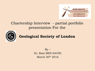
Chartership_Interview. LinkedIn
1. Chartership Interview - partial portfolio
presentation For the
Geological Society of London
By –
Dr. Ram BEN-DAVID
March 30th 2016
2. Presentation Overview
Mining projects
a. The on-going gold exploration project of
Sakassou, Cote d’Ivoire;
b. The Shefa Yamim Ltd. Exploration project,
Northern Israel.
Geo-engineering projects
a. Coastal cliffs stability – the geological
problems and engineering solutions;
b. Tunneling – rock strength and geo-
engineering supervision in Jerusalem.
3. The Sakassou project, Cote d’Ivoire
1. Points on the geology of Cote d’Ivoire geology
• Paleoproterozoic Birimian Supergroup (~2.15-2.2 Ga) – extensive
sediments and volcanics (‘green stone’) ~10,000 m thick section;
• Forming NE-SW structures or belts;
• The metamorphism, deformation and extensive intrusive activity are
part of the Eburnean thermo-tectonic event (orogenic cycle, ~2.1 Ga);
Yamoussoukro
permit
4. 2. Zoom from the Cote d’Ivoire geology to the
Sakassou framework
1st. Phase –
Soil Sampling –
1: 1009
2nd. Phase –
Soil Sampling –
2: ~6000
Local mining
activities
Geological Map of
Cote d’Ivoire
Regional topo-map of
Bouake area
Generalized geological map of the
Sakassou Permit
5. 3. First results and further exploration steps
Structure A1
Structure A2
Structure B
helicopter-borne
geophysical survey for
approximately 1,944 line-
kms of VTEM Plus and
magnetics
The suggested Birimian
structure Coincides with soil
sampling results
Soil sampling results of 1st
sampling stage
Trenching program
6. 4. Some field observations
Altered yel/red
schist, sometimes
greenish
+ qtz. veins.
Mineralizations in
all directions.
9 m
Sample n° TSG-14 From pit base
Sulfidic schist
Iron Oxide schist
Pit N° 17
laterite
7. The Shefa Yamim Ltd. exploration
project, Israel
1. General overview -
• Some evidences indicate kimberlite potential along the Mount
Carmel Ridge;
• Sediments derived from the Carmel, and maybe from the Lower
Galilee may suggest the existence of precious minerals in the
alluvial deposits of the Yizre’el and Zevulun valleys;
• Shefa Yamim Ltd., has received renewable exploration/prospection
licenses since 1999;
• The company had already raised >15M $ in the Israeli Stock
Exchange, promising huge revenues when discovering the main
sources.
2. My role –
• I was appointed as Chief geologist (on a retainer basis) on June
2013;
• My main tasks were: (1) To develop exploration programs, (2)
produce geological reports for the state officials as well as to the Tel
Aviv Stock Exchange.
8. Source: Segev, 2009, Cretaceous Research
~100 Ma Volcanic activities of basic
pyroclastics and few lava flows
represent the 4th tecto-volcanic
event of the Levant.
The Shefa Yamim claim: the close to
kimberlite composition may produce
diamonds.
3. Some geological background
11. Coastal cliff stability along the
Mediterranean Sea – Geological problems
and Engineering Solutions
1. The problem
• The friable geological section retreats in rates of 20-
50 cm/y.
• The sea level rise and the urbanization stress create
the need for comprehensive and durable solutions.
12. 2. The project
10 km The Israeli government has decided to
stabilize several sections along the Israeli
coast
The sections were defined in the National
Master Plan no. 13.
A budget of 0.5 billion NIS (>90,000,000 £)
was defined–
- To plan in detail each of the 6 major
zones shown on the map;
- To concretize the projects in terms of
architecture and engineering;
Our role –
- Geological mapping of many of the
different segments (in red);
- Define the geotechnical problems;
- Advise on optimal solutions.
Tel-Aviv
13. 3. Points on the geology of the East Mediterranean
sea-shore
The geology of the cliff section is composed mainly of Upper
Pleistocene sandstone units (locally called Kurkar) which were
deposited as near-shore dunes and clayey-sand soils (locally
called Hamra);
Their age ranges, by OSL dates, from ~60 KaBP to ~5KaBP;
The extensive weathering of the cliffs occurring along the coast
are due to the ingression of the Mediterranean Sea since the
Late Pleistocene glacial;
The seashore is covered by yellowish quartz sand which
accumulates due to northward and north-eastward flowing sea
currents transporting sand from the Nile cone;
14. 4. The five geological units recognised in the cliff
succession, their geotechnical properties and few
observations
Apolonia park
north
TE
NE
DO
NA
RA
Angle of
internal
friction
Cohesi
on
(Kpa)
Humidity
before/after
rain
)%(
Porosity
)%(
Textur
e
Age
(KA)
OSL
Slope
angle
(degrees
)
Thick
ness
Geol. unit
S---------0-5
Ta’arukha &
Hadera
38-45
170-
600
0.530-50S5-1080-901-5Tel Aviv
35102/8-23-------CL10-2020-902-8Netanya
35-3700-3/84-32S48-5330-503-10Dor
55-901.5--------SL50-5760-850-5Nachsholim
33-43300-2/7.52-23S59-6460-9016-22Ramat Gan
17. The great Jerusalem underground
parking project
1. The project
The Jerusalem new entrance is undergoing a large scale development
processes including –
- New underground railroad station (80 m below surface);
- A new CBD;
- A new underground “Park & Go” parking zone - our project.
The Underground Parking project includes –
- The major part - 2 spaces of 250(L) X 16(W) X 26(H) m;
- Rock cover – 6-10 m;
- Distance between the 2 spaces sides – 6 m;
- Secondary part – entrance/exit accesses tunnels of 90 X 2 m.
Our role –
- Intensive supervision of tunneling processes;
- Rock quality description and designation;
- Providing real-time tools for the engineer for supporting requirements.
22. Time and age enhance my curiosity and
my willing as a geologist to explore the
world in general and earth in particular.
The experience of some 30 years just gives
wider and modest perspective of life.