The document provides information about map sheet 105O03 in the Yukon Territory of Canada. It summarizes that the area contains sedimentary rocks and has undergone folding, faulting, and uplifting. It is classified as part of the Ross River mineral notification area. The document analyzes sample data from the map sheet area and finds evidence of sedimentary exhalative (SEDEX) deposits containing silver, lead, and zinc. Faults in the area are important for the formation of these SEDEX deposits.
Crystal Lake Mining: TECHNICAL HIGHLIGHTS OF THE NICOBAT PROJECT: A PIPELINE ...MomentumPR
Crystal Lake Mining is a Canada-based junior exploration company focused on building shareholder value through the discovery of new magmatic nickel sulphide deposits using technical excellence in exploration target development.
Continental rifts are regions of extensional deformation where the entire thickness of the lithosphere has deformed under the influence of deviatoric tension.
Rifts represent the initial stage of continental break-up where extension may lead to lithospheric rupture and the formation of a new ocean basin.
After emerging from the resources wilderness thanks to its world-class geology and industry-friendly government policies, South Australia is now a leader in Australian mining and hydrocarbon developments over the last decade.
In little more than a decade the State has gone from four operating mines to more than 20 and is rated Australia’s second most popular exploration destination.
With a comprehensive review of the Mining Act under way, the State’s attractiveness as a place for resources and energy investment is expected to be strengthened.
South Australia is now a leader in the exploration for next generation energy sources with companies such as Santos and BP leading the charge, while initiatives such as the Government’s Copper Strategy – designed to treble annual copper production to 1 mtpa – is set to establish the State as one of the world’s premier producers of the red metal.
In the energy space, uranium and nuclear energy is another area of keen interest, with the South Australian Government initiating a Royal Commission into Participation in the Nuclear Fuel Cycle in 2016.
The State has become synonymous with innovation, cutting-edge development and a remarkable rate of discovery. From uranium prospects, to geothermal energy and the buoyant hydrocarbons sector, South Australia is now a leader in the exploration for next generation energy sources.
With full support from the Department of State Development, the South Australian Resources and Energy Investment Conference will continue to showcase this burgeoning sector in 2017. From copper plays in the Gawler Craton, to iron ore and graphite developments on the Eyre Peninsula and the emergence of the State as a new hydrocarbon frontier, South Australia’s resources potential is at last being fully recognised.
The conference will feature the success stories and emerging players in the State from both minerals and oil and gas and will also tackle thorny industry issues such as infrastructure, corporate social responsibility and the future of the Woomera Prohibited Area.
The Llewelyn Fault Zone: A district-scale plumbing system analog to other pro...Stephan Bogner
Core Assets Corp. believes to be onto something big. And there‘s good reason to believe so: The Llewelyn Fault Zone (LFZ) runs through the company‘s recently vastly expanded property (now 148 km2) located in the Atlin Mining District of northwestern British Columbia (BC). The world-class porphyry-related copper-gold deposits in BC‘s prolific Golden Triangle typically share a highly important characteristic: Structure, such as a major fault zone acting as a plumbing system for a metal-enriched feeder zone at depth. With geophysics and subsequent drilling, Core Assets aims to make a major discovery by confirming the LFZ to be the main transport corridor for high-grade metals found on the property at surface.
Silver Spruce Resources Inc. is a Canadian junior exploration company pursuing development of the Pino de Plata project, located in the prolific Sierra Madre Occidental region of western Chihuahua State in Mexico. The Company has signed a binding Letter of Agreement to acquire 100% of the advanced Cocula gold project in Jalisco State, Mexico. Silver Spruce Resources Inc. continues to investigate opportunities that Management has identified or that have been presented to the Company for consideration.
Independent Review of Hydrological Issues: Deloro Mine SiteLOWaterkeeper
Independent review—prepared by hydrogeologist Wilf Ruland— of hydrological issues pertaining to the MOECC's request for an amended license renewal for various remedial activities at the Deloro Mine Site.
In this presentation we discuss cobalt crusts, its classification, Occurrence and Distribution, Formation, Texture, Mineralogy, Scope for future mining and exploration.
THE USE OF AIRBORNE EM CONDUCTIVITY TO LOCATE CONTAMINANT FLOW PATHS AT THE S...Brett Johnson
Richard W. Hammack, Garret A. Veloski, James I. Sams III, and Jennifer S. Shogren
U.S. DOE, National Energy Technology Laboratory, Pittsburgh, PA
Abstract
In 1986, the State of California posted a fish consumption advisory for Clearlake, a large,
freshwater lake located 80 miles north of San Francisco, because of mercury contamination. The
abandoned Sulphur Bank Mercury Mine on the eastern shore of Clearlake is the suspected source of
the mercury. Herman Impoundment, the now flooded open pit of the Sulphur Bank Mercury Mine, is
separated from Clearlake by a dam composed of waste rock removed from the open pit. Hydrological
and geochemical studies indicated that water is flowing from the open pit through the waste rock
dam into Clearlake. However, an accurate map of flow pathways through the waste rock dam was
needed for planning groundwater flow intervention. Results from an airborne EM conductivity survey
flown over the mine site and adjacent areas suggest the probable flow paths taken by the highly
conductive Herman Impoundment water through the waste rock dam. The airborne data were then used
to target areas for ground-based EM conductivity surveys with a Geonics EM34-3XL instrument. The
higher-resolution results of the ground-based survey corroborated the findings of the airborne
survey. This information will allow groundwater-flow intervention efforts to be concentrated within
small areas of the waste rock
dam.
2. Introduction
Yukon(The great River) Territory is one of the three smallest
territories in Canada, Locates in north west of Canada , and it’s
Capital city is White Horse .
Boarders :
• East :Northwest Territories
• West :Alaska
• North: Arctic ocean
• South : British Columbia
The industry is mining and account’s for 30% of the economy
The Yukon contains many undeveloped mines of zinc , lead , silver,
copper and iron.
Sedimentary rocks are the main type of the Yukon territory
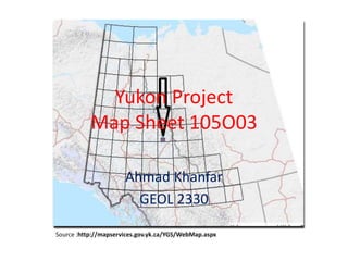
3. Territory map of Yukon
Source : http://geology.com/canada/yukon-territory.shtml
4. Over the last 190 million years , the area was affected by
folding , faulting , metamorphism and uplifting which ended
by stratigraphy of sedimentary units above a stable geological
basement.
The Yukon is classified into five mineral areas :
• Peel (river) class 1 notification area
• Ross river class1 notification area (105O03)
• South western Yukon class 1 notification area
• Watson lake class1 notification area
• Southern Yukon class 1 notification
area(http://mapservices.gov.yk.ca/Mining/WebMap.aspx)
(Class 1 means class 1 exploration program)
In this presentation , I will present different maps layers of map
sheet 105O03 which show the deposits in the area, the geological
events ,rock units and also a brief sample analysing for
Ag(Silver), Pb (Lead) and Zn(Zinc) elements to prove the presence
of SEDEX (Sedimentary Exhalative Deposits) .
6. The Google Erath map shows the young belt of Cordillera province
which formed billion years ago .Map sheet 105O03 location is :
Lat.: 63.1347 Long.: -131.2661 (Earth Google)
Basin : Selwyn Basin : undeveloped districts and contains massive sulphides
7. The mountain belt series is divided into five belts :
• Insular belt : Volcanic and sedimentary rock type
(C . Hart)
• Intermontane belt : Sedimentary rock type.
(C.Hart)
• Omineca belt : Metamorphosed sedimentary rock
and granite. ( C. Hart)
• Foreland belt :Entirely sedimentary. (C. Hart)
• Coast belt : Granitic rock type. (C. Hart)
8. The area of Map sheet 105O03 is : 689,319,057 m²
Source :Yukon Energy ,Mines and Resources Land viewer.
9. Town Map : The closest town to the map sheet 105O03 is Faro
Town .The Faro town has the largest lead and zinc mine in the
world and producer of silver . It’s area is 203’000 squared
meter.
Source:http://mapservices.gov.yk.ca/YGS/WebMap.aspx
10. Access : The nearest road to the area is Canol Road .Macmillan
Pass airport is too close to the area from the east and Dall
Mountain from the north west.
Source : Earth Google
12. The area has two types of Faults :
1) Normal/ reverse faults in the lower part.
2) Thrust/ upright faults in the upper part.
Tectonic activity result in faults is very
important for SEDEX deposits formation.
17. The drainage pattern in the area is dendritic (common
in river ,streams and lakes)Majority of the samples were
collected from the river and the distributary.
In the area , there are deposits of Silver ,Lead and Zinc .
The Selwyn basin main types of deposits are is the
SEDEX deposits.
The tonnage of deposits in Selwyn basin over 9’283’700
tones are as follows:
• Ag 69.4 g/t
• Pb 7.5%
• Zn 6.2%
• Cu 1.81% over 8’510’000 tones
(http://www.geology.gov.yk.ca/pdf/SelwynBasin.pdf)
18. Elements Tonnage
By analyzing the data for the concentrations of
metals in map sheet 105O03 ,Silver , Lead ,Zinc
and Copper, have the highest concentration
and no concentration for Gold was detected .
The deposit type could be VMS or SEDEX.
The tonnage value of Sliver is 69.4 g/t which is
higher than in case if the sediment is VMS
( max 30g/t).
19. Also for Lead , the tonnage is 7.5% which higher than
the tonnage in VMS deposits which maximum 2 %.
The Zinc tonnage is 6.2% which is close to the
maximum values in both VMS and SEDEX.
The absence of the Gold concentration , can lead to a
result of type of deposit which is SEDEX.
20.
21. Pathfinder Indicator :
• The area is rich with Shale and Barite and
sedimentary rocks .
• Zn-Pb are shale hosted in an area with faults .
• The Paleozoic deep water environment contains
SEDEX deposits.(Chverier and Turner,2013-2014)
• The SEDEX formation model is Vent distal
• The fluid move along permeable sedimentary rock or
along the fault .