1) The structural style of the Atlantic margin offshore West Africa shows differences between the passive rifted Northwest African Atlantic Margin (NWAAM) and the West African Transform Margin (WATM).
2) The WATM is characterized by basins between transform faults containing large Upper Cretaceous turbidite systems with proven oil discoveries, while the NWAAM contains multiple petroleum systems trapped against salt structures, in carbonate reefs, and in syn-rift structures.
3) Both regions remain largely untested, particularly the NWAAM in deepwater, and further exploration has potential to make new hydrocarbon discoveries.
3D Inversion & Negative Inversional Fault Systems, Taranaki Basin, Offshore NZ Isaac Kenyon
This is my final MSc Petroleum Geoscience Presentation to academics and professionals at the Royal Holloway University annual MSc Petroleum Geoscience Symposium.
sedimentary basin may be defined as an area of depression in the earth’s crust in which sediments accumulate during a particular time span at a significantly greater rate, and so to a significantly greater thickness.
Timing of oceans on Mars from shoreline deformationSérgio Sacani
Widespread evidence points to the existence of an ancient Martian
ocean1–8. Most compelling are the putative ancient shorelines in
the northern plains2,7
. However, these shorelines fail to follow
an equipotential surface, and this has been used to challenge the
notion that they formed via an early ocean9
and hence to question
the existence of such an ocean. The shorelines’ deviation from a
constant elevation can be explained by true polar wander occurring
after the formation of Tharsis10, a volcanic province that dominates
the gravity and topography of Mars. However, surface loading from
the oceans can drive polar wander only if Tharsis formed far from
the equator10, and most evidence indicates that Tharsis formed near
the equator11–15, meaning that there is no current explanation for
the shorelines’ deviation from an equipotential that is consistent
with our geophysical understanding of Mars. Here we show that
variations in shoreline topography can be explained by deformation
caused by the emplacement of Tharsis. We find that the shorelines
must have formed before and during the emplacement of Tharsis,
instead of afterwards, as previously assumed. Our results imply that
oceans on Mars formed early, concurrent with the valley networks15,
and point to a close relationship between the evolution of oceans
on Mars and the initiation and decline of Tharsis volcanism, with
broad implications for the geology, hydrological cycle and climate
of early Mars.
The San Sai oil field is an important oil field in the Fang Basin. The sedimentary facies and basin
evolution have been interpreted using well data incorporated with 2D seismic profiles. The study indicates that
the Fang Basin was subsided as a half-graben in the Late Eocene by regional plate tectonism. The deposit is
thicker westward toward the major fault. The sedimentary sequence of the Fang Basin can be subdivided into
two formations which comprise five associated depositional environments. The results of total organic carbon
content (TOC), vitrinnite reflectance (%Ro), Rock-Eval pyrolysis and headspace gas analyses and the study of
basin modeling using PetroMod1D software are compiled and interpreted. They indicate that source rocks of
kerogen type II and III with 1.78 – 3.13%wt. TOC were mature and generated mainly oil at 5,600 – 6,700 feet
deep (Middle Mae Sod Formation). Source rocks of kerogen type II and III with 2.07 – 39.07%wt. TOC
locating deeper than 6,700 feet (Lower Mae Sod Formation) were mature to late mature and generated mainly
gas at this level. According to TTI (Time Temperature Index) modeling using PetroMod11.1D software,
hydrocarbon generation took place in the Middle Miocene and the generated oil and gas migrated through
fractures and faults to accumulate in traps at 2,900-4,000 feet deep (Upper Mae Sod Formation).
-Examined features ranging from valley systems in Margaritifer Sinus to inverted topography in Aeolis/Zephyria Plana
-Studied and analyzed MOLA, THEMIS-VIS, OMEGA, MOC, CRISM, HRSC, and CTX imagery
Ravva - Cairn’s first development success story has been the bedrock of innovation, and the foundation of our success story in the country and the region. Ravva, which in Sanskrit and Telegu means “diamond” showcases the journey of growth that Cairn has been able to achieve in its business. Incidentally, Ravva is the only field in India to get such a unique name indicating the belief of the nation in it.
Remote Sensing Technique as Exploration Tool for Ground water in Parts of the...theijes
The study area lies within latitudes 8°00' – 9°00'N and longitudes 11°30' – 12°30'E. Analysis of remote sensing imageries of part of the Upper Benue Trough of Nigeria was carried out on a scale of 1:100,000. The aim of this study includes the structural interpretation of the remote sensing data and the identification of the lineament and drainage patterns associated with the area to infer the influence of such structures on the economic potential of the basin. Results of the structural analysis revealed numerous lineaments. Trend analysis of the lineaments plotted on a rose diagram using the strikes and lengths of the entire lineaments revealed structural trends predominating in the NE-SW direction. The absence of visible lineaments in parts of the area may not indicate absence of geological structures. Some of these lineaments were found on some drainages showing that the drainages in those areas are structurally and tectonically controlled. The areas where the lineaments cross each other are indicative of groundwater availability and there correspond to regions of mean topographic height of about 900m
Ras Muhammad Marine National Park is located on faulted and uplifted Neogene blocks that are
partially covered by Quaternary limestones of predominantly coralgal facies. The physiography of the
reefal limestone cropping out in the area and also the present-day depositional environments are
tectonically controlled. Surface morphology observations show that earthquake pools that cut through the
uplifted Pleistocene reefs indicate continuing recent movements, as indicated by numerous records of
seismic activity in the study area. The morphostructural-generated depositional facies patterns on the
peninsula are a wide tidal belt with tidal shoals and coastal spits, barrier and fringing reefs, three
elongated embayments, Hiddan Bay, mangrove and tidal channels, Ras Muhammad pool and sabkha, and
earthquake pools (two earth fissures). The distribution of marine plants is described for each area. The
abundance of algae in Ras Muhammad appeared to be inversely related to the abundance of living corals.
The study of sequence stratigraphy and sedimentary system in Muglad Basiniosrjce
IOSR Journal of Applied Geology and Geophysics (IOSR-JAGG) is a double blind peer reviewed International Journal that provides rapid publication (within a month) of articles in all areas of Applied Geology and Geophysics. The journal welcomes publications of high quality papers on theoretical developments and practical applications in Applied Geology and Geophysics. Original research papers, state-of-the-art reviews, and high quality technical notes are invited for publications.
The study of sequence stratigraphy and sedimentary system in Muglad Basiniosrjce
Application of sequence stratigraphy theory, by levels of base level cycle sequence feature analysis,
combined with core and log data, establish the sequence stratigraphic framework. The Cretaceous sedimentary
strata are divided into six two sequences and 14 third-order sequences. In sequence stratigraphy based,
combine well logging, seismic and core observation, and comprehensive analysis of each well rock type, color,
bedding and other construction phase marks. Identify the Cretaceous strata have delta, meandering fluvial
facies and braided river with three main facies. Detailed study of Cretaceous sedimentary characteristics,
identify each sedimentary microfacies, sedimentary facies sequence established in the region
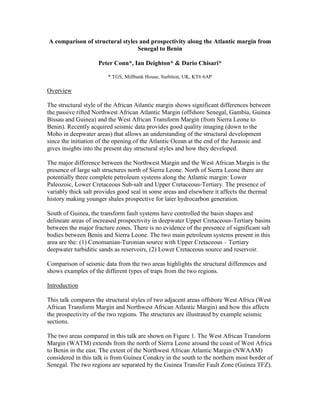
A Comparison of Structural Styles and Prospectivity along the Atlantic Margin from Senegal to Benin
1. A comparison of structural styles and prospectivity along the Atlantic margin from
Senegal to Benin
Peter Conn*, Ian Deighton* & Dario Chisari*
* TGS, Millbank House, Surbiton, UK, KT6 6AP
Overview
The structural style of the African Atlantic margin shows significant differences between
the passive rifted Northwest African Atlantic Margin (offshore Senegal, Gambia, Guinea
Bissau and Guinea) and the West African Transform Margin (from Sierra Leone to
Benin). Recently acquired seismic data provides good quality imaging (down to the
Moho in deepwater areas) that allows an understanding of the structural development
since the initiation of the opening of the Atlantic Ocean at the end of the Jurassic and
gives insights into the present day structural styles and how they developed.
The major difference between the Northwest Margin and the West African Margin is the
presence of large salt structures north of Sierra Leone. North of Sierra Leone there are
potentially three complete petroleum systems along the Atlantic margin: Lower
Paleozoic, Lower Cretaceous Sub-salt and Upper Cretaceous-Tertiary. The presence of
variably thick salt provides good seal in some areas and elsewhere it affects the thermal
history making younger shales prospective for later hydrocarbon generation.
South of Guinea, the transform fault systems have controlled the basin shapes and
delineate areas of increased prospectivity in deepwater Upper Cretaceous-Tertiary basins
between the major fracture zones. There is no evidence of the presence of significant salt
bodies between Benin and Sierra Leone. The two main petroleum systems present in this
area are the: (1) Cenomanian-Turonian source with Upper Cretaceous – Tertiary
deepwater turbiditic sands as reservoirs, (2) Lower Cretaceous source and reservoir.
Comparison of seismic data from the two areas highlights the structural differences and
shows examples of the different types of traps from the two regions.
Introduction
This talk compares the structural styles of two adjacent areas offshore West Africa (West
African Transform Margin and Northwest African Atlantic Margin) and how this affects
the prospectivity of the two regions. The structures are illustrated by example seismic
sections.
The two areas compared in this talk are shown on Figure 1. The West African Transform
Margin (WATM) extends from the north of Sierra Leone around the coast of West Africa
to Benin in the east. The extent of the Northwest African Atlantic Margin (NWAAM)
considered in this talk is from Guinea Conakry in the south to the northern most border of
Senegal. The two regions are separated by the Guinea Transfer Fault Zone (Guinea TFZ).
2. Figure 1: Map of WATM and NWAAM (created from Google Maps)
WATM structure and prospectivity
WATM structure and development has been controlled by transform movements initiated
during a rifting phase in the Lower Cretaceous. The post rift section extends from mid
Albian to Present and includes a period of thermal relaxation and then a passive margin
drift phase. It is noted that no evidence of evaporate deposition has been found in this
region.
WATM is characterised by a series of basins between transform fracture zones oriented
approximately SW-NE terminating against the coast and forming embayments .The
shallow shelf area of each basin tends to be narrow with relatively wide slope and rise
extending out to over 300 km from shore (Figure 1).
This basin geometry has produced large turbidite slope fan and lobe systems throughout
the Upper Cretaceous and Lower Tertiary. These turbidite channels together with source
rocks laid down in periods of deepwater anoxic conditions in the Late Cretaceous
(especially Cenomanian-Turonian) have produced a prolific Upper Cretaceous play along
the present day mid-lower slope in water depths of over 1000 m. This system has been
proven by drilling to extend from Ghana (Jubilee oilfield) to Sierra Leone (Mercury-1
and Jupiter-1 discovery wells). Figure 2 is a schematic of the WATM Upper Cretaceous
slope play system.
3. Figure 2: Schematic diagram of main play types along WATM
A secondary play exists within the Lower Cretaceous synrift section (e.g. Tano North and
South, offshore Ghana) with lacustrine source rocks and shallow water sands or
carbonates forming the reservoirs. However, this play has produced only small oil fields
to date. A possible extension of this play into deep water has not been tested.
A minor play exists in the Saltpond area (offshore Ghana) where transform movements
have created a wider platform area that has preserved a small Paleozoic system
(Devonian source rock and reservoir).
The Keta Basin and Dahomey Embayment (eastern Ghana to Benin) have been affected
by the Niger Prodelta since very Late Cretaceous and the thick Tertiary section in the
deep water areas offers the possibility of reservoirs in the Paleogene.
4. NWAAM structure and prospectivity
NWAAM is identified as a more typical Atlantic Margin syn- and post-rift system. In the
study area the major structures were created during the rifting phase from late Triassic
until late Jurassic and the following thermal sag phase. Since early Cretaceous the region
has been a passive margin.
The NWAAM area is separated from the WATM by the Guinea TFZ which is oriented
NW-SE. Major transform ridges occur along the southern edge of the area and these are
associated with increased subsidence locally and more complicated structure in places,
see Figure 3. Several sub-basins and structural highs (igneous intrusions, ridges along
transform zones, uplifted basement) are found beneath the present day carbonate shelf,
Salt layers of Triassic age have mobilised and provide structures for traps and affect
temperature distribution. Recently acquired seismic data indicates that the salt structures
of the NWAAM region may exist further to the west than generally accepted. Igneous
intrusions of similar age form prominent highs in the north of the area.
Figure 3: Map of major structures and sediment depocentres in NWAAM
Extensive carbonate sedimentation occurred from Jurassic-Albian over much of the
region extending from near coast to deep water with thickness up to over 2000 m. Large
5. platform areas are seen on the shelf with total sediment thickness (syn- and post-rift) up
to 12000 m in places. Examples of different traps associated with structures created by
the tectonic history of the area can be seen in Figure 4.
Figure 4: Interpreted seismic section illustrating NWAAM reservoir and source types
The following comments can be made regarding the hydrocarbon systems present:
Turonian source rock is present, as indicated by DSDP wells, but is only in
expulsion window in places where overburden thickness is sufficient.
Lower Cretaceous source is expected to be mature over most of the region.
Possible Triassic-Jurassic source rocks (syn-rift to early post-rift) are expected in
the area, but would be overmature in the main depocentres.
We cannot totally discount possibility of Paleozoic source near coast as seen
further east onshore Senegal.
Conclusions
The two areas (WATM and NWAAM) have significantly different structural style and
prospectivity. The NWAAM area shows much greater structural variation and trap types
than the WATM. The new regional data set acquired in 2011 is particularly useful in
providing a better understanding of the deep water areas.
The WATM prospectivity is dominated by the Upper Cretaceous slope fan and lobe
systems but other plays (Lower Cretaceous, Paleozoic and Paleogene) exist in the region
and have not been fully explored. Extensive 2D and 3D surveys have been recorded in
this area and have indicated possible extension of the prospectivity zone into the ultra-
deep water areas.
6. The NWAAM area contains several hydrocarbon systems that are found in different parts
of the region depending on local tectonic and thermal history: Upper Cretaceous, Lower
Cretaceous (widespread in the region), Jurassic-Cretaceous and Triassic-Jurassic. These
systems are found in traps of different types including closures against salt bodies, syn-
rift structural traps, carbonate reefs and siliciclastic slope fans. Considerable hydrocarbon
exploration potential exists, with only a few areas tested by drilling and most wells in
relatively shallow water on the platform area.