WHAT IS GEOGRAPHY?
•Fromthe Greek geo, which means “Earth”,
and graphein, which means “to write”.
•The study of places and relatioships between
people and their environments.
19.
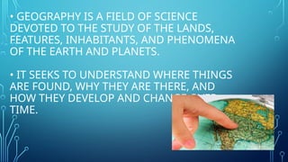
• GEOGRAPHY ISA FIELD OF SCIENCE
DEVOTED TO THE STUDY OF THE LANDS,
FEATURES, INHABITANTS, AND PHENOMENA
OF THE EARTH AND PLANETS.
• IT SEEKS TO UNDERSTAND WHERE THINGS
ARE FOUND, WHY THEY ARE THERE, AND
HOW THEY DEVELOP AND CHANGE OVER
TIME.
20.
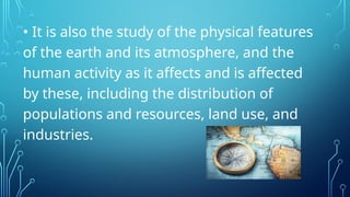
• It isalso the study of the physical features
of the earth and its atmosphere, and the
human activity as it affects and is affected
by these, including the distribution of
populations and resources, land use, and
industries.
21.
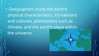
• Geographers studythe earth’s
physical characteristics, it’s habitant
and cultures, phenomena such as
climate, and the earth’s place within
the universe.
22.
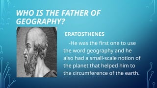
WHO IS THEFATHER OF
GEOGRAPHY?
ERATOSTHENES
-He was the first one to use
the word geography and he
also had a small-scale notion of
the planet that helped him to
the circumference of the earth.
23.
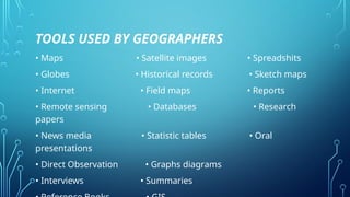
TOOLS USED BYGEOGRAPHERS
• Maps • Satellite images • Spreadshits
• Globes • Historical records • Sketch maps
• Internet • Field maps • Reports
• Remote sensing • Databases • Research
papers
• News media • Statistic tables • Oral
presentations
• Direct Observation • Graphs diagrams
• Interviews • Summaries
24.
HOW IS GEOGRAPHYUSED TODAY?
• Geography can help us to understand the
planet’s movement, changes, and systems. Topics
that are relevant to today such as climate change,
water availability, and natural resources.
25.
FIVE THEMES OFGEOGRAPHY
LOCATION – Pertains to a place or position.
•Absolute location – is defined using it’s
exact address.
•Relative location – describes where a place
is in relation to other location.
26.
PLACE – pertainsto the physical and human attributes
or characteristics of a location.
HUMAN-ENVIRONMENTAL INTERARCTION – This
theme examines all how we have done and continue to
do such things.
MOVEMENT – It deals with the examination of
immigration, emigration, populations, and distribution
in the region, and the countries of the world.
27.
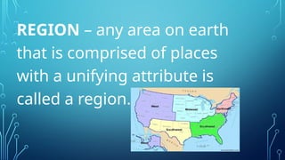
REGION – anyarea on earth
that is comprised of places
with a unifying attribute is
called a region.
28.
SIGNIFICANCE OF GEOGRAPHY
•Geographyhelps us understand basic physical
systems that affect everyday life.
•To learn the location of places and the physical and
cultural characteristics of those places in order to
function more effectively in our increasingly
interdependent world.
29.
• To understandthe spatial organisation of society and
see order in what often appears to be random
scattering of people and places.
• To appreciate Earth as the homeland of humankind
and provide insight for wise management decisions
about how the planet's resources should be used.
• To understand global interdependence and to
become a better global citizen.
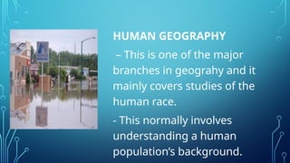
HUMAN GEOGRAPHY
– Thisis one of the major
branches in geograhy and it
mainly covers studies of the
human race.
- This normally involves
understanding a human
population’s background.
32.
EXAMPLES OF HUMAN
GEOGRAPHY
CULTURALGEOGRAPHY
-Studies the relationship between different cultures and
place.
DEVELOPMENT GEOGRAPHY
- Studies the quality of life and standards of living within
different communities around the world.
33.
ECONOMIC GEOGRAPHY
-Geographers underthis branch normally study the
manner in which products are usually produced and
consiquently distributed in their respective niche
markets.
HEALTH GEOGRAPHY
- Healthy geography looks at the distribution and access
to healthcare as well as the overall health of the
populations.
34.
HISTORICAL GEOGRAPHY
- Thisgeography looks at how a place and
people that live there have changed over
time.
POPULATION GEOGRAPHY
- Geographers who are involved in this
discipline normally study the population of
regions in much more detail.
35.
MEDICAL GEOGRAPHY
- Studythe patterns in which particular
diseases spread.
MILITARY GEOGRAPHY
- Geographers who practice this discipline
normally coduct their research and studies
within the military fraternity.
36.
POLITICAL GEOGRAPHY
- Itis involved in the in the investigation of every
aspect of politics.
TRANSPORTATION GEOGRAPHY
- Geographers who are involved in this branch of
geography are usually involved in the research of
the available networks for transportation.
37.
SETTLEMENT GEOGRAPHY
-The studyover time and space of areas where
humans have or currently reside.
URBAN GEOGRAPHY
- With the development of urban cities worldwide,
the branch of urban geography came into play
since it enables researchers to study these trends
much more effectively.
38.
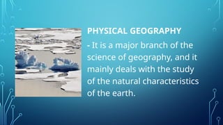
PHYSICAL GEOGRAPHY
- Itis a major branch of the
science of geography, and it
mainly deals with the study
of the natural characteristics
of the earth.
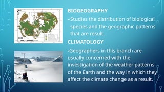
BIOGEOGRAPHY
-Studies the distributionof biological
species and the geographic patterns
that are result.
CLIMATOLOGY
-Geographers in this branch are
usually concerned with the
investigation of the weather patterns
of the Earth and the way in which they
affect the climate change as a result.
41.
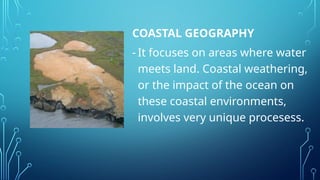
COASTAL GEOGRAPHY
- Itfocuses on areas where water
meets land. Coastal weathering,
or the impact of the ocean on
these coastal environments,
involves very unique procesess.
42.
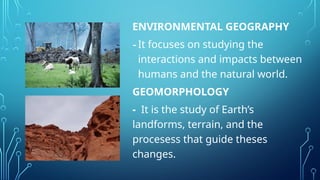
ENVIRONMENTAL GEOGRAPHY
-It focuseson studying the
interactions and impacts between
humans and the natural world.
GEOMORPHOLOGY
- It is the study of Earth’s
landforms, terrain, and the
procesess that guide theses
changes.
43.
GLACIOLOGY
- It isa field of geography
that studies ice sheets
and glacier on Earth’s
surface.
44.
HYDROLOGY
- The studyof hydraulics concerns the
amount of quality of water and its
movement across Earth’s surface.
LANDSCAPE ECOLOGY
- Landscape ecology blends ecology and
geography to show ecological procesess.
45.
LITHOLOGY
-The study ofthe physical composition
of rocks and allows researchers to map
and correlate rock types between
different locations.
METEOROLOGY
- Studies the atmosphere of the Earth as
it relates to weather procesess and
predicting future weather patterns.
46.
OCEANOGRAPHY
- Study ofthe world’s ocean and
seas is known as oceanography.
OROLOGY
- The study of mountains and
their formation.
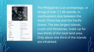
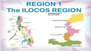
The Philippines isan archipelago, or
string of over 7,1 00 islands, in
southeastern Asia between the
South China Sea and the Pacific
Ocean. The two largest islands,
Luzon and Mindanao, make up for
two-thirds of the total land area.
Only about one third of the islands
are inhabited.
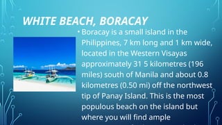
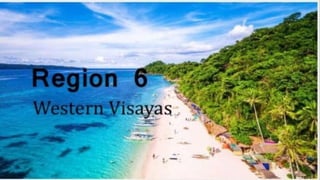
WHITE BEACH, BORACAY
•Boracay is a small island in the
Philippines, 7 km long and 1 km wide,
located in the Western Visayas
approximately 31 5 kilometres (196
miles) south of Manila and about 0.8
kilometres (0.50 mi) off the northwest
tip of Panay Island. This is the most
populous beach on the island but
where you will find ample
53.
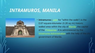
INTRAMUROS, MANILA
• Intramuros(Latin for "within the walls") is the
0.67-square-kilometer (0.26 sq mi) historic
walled area within the city of Manila, the capital
of the Philippines. It is administered by the
Intramuros Administration with the help of the city
government of Manila.
54.
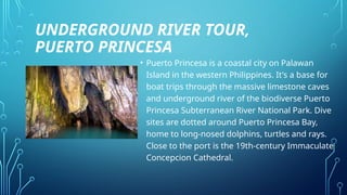
UNDERGROUND RIVER TOUR,
PUERTOPRINCESA
• Puerto Princesa is a coastal city on Palawan
Island in the western Philippines. It's a base for
boat trips through the massive limestone caves
and underground river of the biodiverse Puerto
Princesa Subterranean River National Park. Dive
sites are dotted around Puerto Princesa Bay,
home to long-nosed dolphins, turtles and rays.
Close to the port is the 19th-century Immaculate
Concepcion Cathedral.
55.
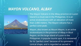
MAYON VOLCANO, ALBAY
•The Mayon Volcano in the Albay province on Luzon
Island is a must-see in the Philippines. It is an
active stratovolcano with an elevation of more
than 2,400 meters. The Mayon volcano has a
perfect cone peak.
• Mayon, also known as Mount Mayon, is an active
stratovolcano in the province of Albay in Bicol
Region, on the large island of Luzon in the
Philippines. A popular tourist spot, it is renowned
for its "perfect cone" because of its symmetric
conical shape, and is regarded as sacred in
56.
CHOCOLATE HILLS, BOHOL
•The geological wonder on the island of Bohol
known as the Chocolate Hills is a unique
natural phenomenon. This UNESCO World
Heritage site is a protected area that features
more than 1,200 small mountains that
emerged above the ground over several
centuries. The area was once under the
ocean, and these unique hills expand in every
direction.
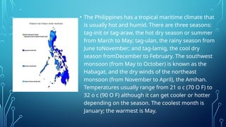
• The Philippineshas a tropical maritime climate that
is usually hot and humid. There are three seasons:
tag-init or tag-araw, the hot dry season or summer
from March to May; tag-ulan, the rainy season from
June toNovember; and tag-lamig, the cool dry
season fromDecember to February. The southwest
monsoon (from May to October) is known as the
Habagat, and the dry winds of the northeast
monsoon (from November to April), the Amihan.
Temperatures usually range from 21 o c (70 O F) to
32 o c (90 O F) although it can get cooler or hotter
depending on the season. The coolest month is
January; the warmest is May.
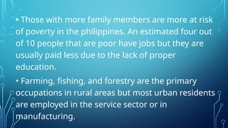
• Those withmore family members are more at risk
of poverty in the philippines. An estimated four out
of 10 people that are poor have jobs but they are
usually paid less due to the lack of proper
education.
• Farming, fishing, and forestry are the primary
occupations in rural areas but most urban residents
are employed in the service sector or in
manufacturing.
61.
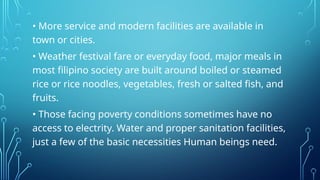
• More serviceand modern facilities are available in
town or cities.
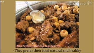
• Weather festival fare or everyday food, major meals in
most filipino society are built around boiled or steamed
rice or rice noodles, vegetables, fresh or salted fish, and
fruits.
• Those facing poverty conditions sometimes have no
access to electrity. Water and proper sanitation facilities,
just a few of the basic necessities Human beings need.
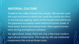
MATERIAL CULTURE
People inthe valley dressed very simply. Old women used
the saya and kimono while men used the camisa de chino
or the barong tagalog. Some of the houses that withstood
the Japanese occupation were historical houses made of
hard wood. Some were bahay-kubo. Most typical homes
were strong and typhoon-resistant.
For agriculture, today, there are only a few have modern
agricultural implements. The majority still use traditional
implements like animal-drawn tools.
69.
NON-MATERIAL CULTURE
Filipinos arecharacterized by its close family ties such that
majority of married couples with children lived with their
parents. The value of bayanihan, sharing, cooperation,
brotherhood, self-responsibility, respect, love, peace, and
dignity, are still very much alive in Cagayan.
ARTS AND CULTUREIN MIMAROPA
Because Mimaropa is ancient, it is home to
indigenous peoples. The Mangyans survive in
Mindoro (they speak seven different languages:
Irava, Alangan, Tambuid, Hanunuo, Tadyawan,
Buhid and Ratagnon).
The Bicol arelargely an agricultural and rural
people, producing rice, coconuts, and hemp.
Nearly all of them are Roman Catholics. Their
language is closely related to others of the
central Philippines, all of which belong to the
Austronesian (Malayo-Polynesian) family of
languages.
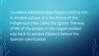
Cordillera Administrative Region(CAR) is rich
in ancient culture. It is the home of the
indigenous tribe called the Igorot. The way
of life of the people in this region existed
way back to ancient Filipinos before the
Spanish colonization.
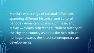
Manila's wide rangeof cultural influences
spanning different historical and cultural
periods - American, Spanish, Chinese, and
Malay — clearly reflect the turbulent history of
the city and country as binds the rich cultural
heritage towards the latest contemporary art
developments.
93.
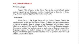
Zamboanga always throbswith the colorful
cultures, traditions, and lifestyles of people
shaped by the confluence of native
Subano, Malay, Islamic (Yakan, Samal,
Tausug and Badjao), Spanish and American
cultures that spanned the course of
centuries.
Northern Mindanao isa region rich in culture,
which can be seen in their numerous festivals. One
of the most popular festivals in the region is the
Higalaay Festival in Cagayan de Oro City. They
celebrate the feast day of St. Augustine every 28th
day of August. Another festival is Kaamulan
festival in Bukidnon. It is an ethnic cultural festival
wherein people allocate a relative amount of their
time to remember the culture and traditions of the
seven ethnic tribes in their area.
Davao City isa melting pot for all cultures;
its geography and surroundings, its colorful
history, the rich diversity of its culture and
tradition, the gathering and festivities like
the Kadayawan Festival, make Davao City an
exciting place to visit.
99.
A pair ofagungs is one of the instruments found
in the kulintang ensemble, and Region XII is home
to a fascinating culture that revolves around
kulintang music, a specific type of gong music
found among both Muslim groups (such as the
Maguindanao) and non-Muslim groups (such as
the Tiruray) of the Southern Philippines
101.
Majority of theinhabitants of the region are of
Visayan lineage. The ethnic residents include the
Manobo, the Mamanwa and other tribes. It is
reported that during the early years of the Caraga
region, its inhabitants came from mainland Asia,
followed by Malayans, Arabs, Chinese, Japanese,
Spanish and Americans.
WHILE Muslims aroundthe world reflect, pray and fast
during the Islamic holy month of Ramadan, the
Autonomous Region in Muslim Mindanao (ARMM)
augments these customs with a celebration of the
Bangsamoro culture. A history and lifestyle exhibition,
called Discover ARMM in 100 Days Journey, runs through
September 22 at the ARMM Compound in Cotabato City.
Cultural villages that represent the architecture and
lifestyle of the ARMM’s tribes—Maguindanaon, Tausug,
Sama, Maranao, Yakan, Iranon and Tedura—highlight the
event.


![GEOGRAPHY-WPS-Office [Autosav.....ed].pptx](https://cdn.slidesharecdn.com/ss_thumbnails/geography-wps-officeautosaved-250309073130-b5d8c98e-thumbnail.jpg?width=640&height=640&fit=bounds)