
Recommended
Recommended
More Related Content
What's hot
What's hot (16)
Viewers also liked
Viewers also liked (17)
Similar to Canadian Intermountain Joint Venture Prospectus
Similar to Canadian Intermountain Joint Venture Prospectus (20)
Canadian Intermountain Joint Venture Prospectus
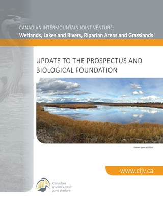
- 1. CANADIAN INTERMOUNTAIN JOINT VENTURE: Wetlands, Lakes and Rivers, Riparian Areas and Grasslands www.cijv.ca Chilcotin Marsh, BC/©DUC UPDATE TO THE PROSPECTUS AND BIOLOGICAL FOUNDATION
- 2. b Update to the Prospectus and Biological Foundation TABLE OF CONTENTS Executive Summary. . . . . . . . . . . . . . . . . . . . . . . . . . . . . . . . . . . . . . . . . . . . . . . . . . . . . . . . . . . . . . . . . . . . . . . . . . . . . . . 1 Preface: Scope and Format . . . . . . . . . . . . . . . . . . . . . . . . . . . . . . . . . . . . . . . . . . . . . . . . . . . . . . . . . . . . . . . . . . . . . . . . . 5 Introduction. . . . . . . . . . . . . . . . . . . . . . . . . . . . . . . . . . . . . . . . . . . . . . . . . . . . . . . . . . . . . . . . . . . . . . . . . . . . . . . . . . . . . 6 Context. . . . . . . . . . . . . . . . . . . . . . . . . . . . . . . . . . . . . . . . . . . . . . . . . . . . . . . . . . . . . . . . . . . . . . . . . . . . . . . . . . . . . . . . . 7 The Landscape . . . . . . . . . . . . . . . . . . . . . . . . . . . . . . . . . . . . . . . . . . . . . . . . . . . . . . . . . . . . . . . . . . . . . . . . . . . . . . . . . . . . . . . 7 A Habitat-based Conservation Approach. . . . . . . . . . . . . . . . . . . . . . . . . . . . . . . . . . . . . . . . . . . . . . . . . . . . . . . . . . . . . . . . . . 8 Building on Regional Achievements and Successes. . . . . . . . . . . . . . . . . . . . . . . . . . . . . . . . . . . . . . . . . . . . . . . . . . . . . . . . . . 9 Planning. . . . . . . . . . . . . . . . . . . . . . . . . . . . . . . . . . . . . . . . . . . . . . . . . . . . . . . . . . . . . . . . . . . . . . . . . . . . . . . . . . . . . . . . 10 Priority Birds. . . . . . . . . . . . . . . . . . . . . . . . . . . . . . . . . . . . . . . . . . . . . . . . . . . . . . . . . . . . . . . . . . . . . . . . . . . . . . . . . . . . . . . . 10 Setting Population Objectives. . . . . . . . . . . . . . . . . . . . . . . . . . . . . . . . . . . . . . . . . . . . . . . . . . . . . . . . . . . . . . . . . . . . . . . . . . 11 Priority Habitats. . . . . . . . . . . . . . . . . . . . . . . . . . . . . . . . . . . . . . . . . . . . . . . . . . . . . . . . . . . . . . . . . . . . . . . . . . . . . . . . . . . . . 12 Wetlands, Lakes and Rivers. . . . . . . . . . . . . . . . . . . . . . . . . . . . . . . . . . . . . . . . . . . . . . . . . . . . . . . . . . . . . . . . . . . . . . . 12 Wetland Habitat Drivers and Trends. . . . . . . . . . . . . . . . . . . . . . . . . . . . . . . . . . . . . . . . . . . . . . . . . . . . . . . . . . . 13 Priority Species and Population Objectives. . . . . . . . . . . . . . . . . . . . . . . . . . . . . . . . . . . . . . . . . . . . . . . . . . . . . 14 Threats and Recommended Actions. . . . . . . . . . . . . . . . . . . . . . . . . . . . . . . . . . . . . . . . . . . . . . . . . . . . . . . . . . . 15 Habitat Objectives. . . . . . . . . . . . . . . . . . . . . . . . . . . . . . . . . . . . . . . . . . . . . . . . . . . . . . . . . . . . . . . . . . . . . . . . . 16 Riparian Habitat. . . . . . . . . . . . . . . . . . . . . . . . . . . . . . . . . . . . . . . . . . . . . . . . . . . . . . . . . . . . . . . . . . . . . . . . . . . . . . . . . 17 Riparian Habitat Drivers and Trends . . . . . . . . . . . . . . . . . . . . . . . . . . . . . . . . . . . . . . . . . . . . . . . . . . . . . . . . . . . 18 Priority Species and Population Objectives. . . . . . . . . . . . . . . . . . . . . . . . . . . . . . . . . . . . . . . . . . . . . . . . . . . . . 19 Threats and Recommended Actions. . . . . . . . . . . . . . . . . . . . . . . . . . . . . . . . . . . . . . . . . . . . . . . . . . . . . . . . . . . 19 Habitat Objectives. . . . . . . . . . . . . . . . . . . . . . . . . . . . . . . . . . . . . . . . . . . . . . . . . . . . . . . . . . . . . . . . . . . . . . . . . 20 Grasslands. . . . . . . . . . . . . . . . . . . . . . . . . . . . . . . . . . . . . . . . . . . . . . . . . . . . . . . . . . . . . . . . . . . . . . . . . . . . . . . . . . . . . 20 Grassland Habitat Drivers and Trends. . . . . . . . . . . . . . . . . . . . . . . . . . . . . . . . . . . . . . . . . . . . . . . . . . . . . . . . . . 21 Priority Species and Population Objectives. . . . . . . . . . . . . . . . . . . . . . . . . . . . . . . . . . . . . . . . . . . . . . . . . . . . . 23 Threats and Recommended Actions. . . . . . . . . . . . . . . . . . . . . . . . . . . . . . . . . . . . . . . . . . . . . . . . . . . . . . . . . . . 24 Habitat Objectives. . . . . . . . . . . . . . . . . . . . . . . . . . . . . . . . . . . . . . . . . . . . . . . . . . . . . . . . . . . . . . . . . . . . . . . . . 24 Initial Focus Areas. . . . . . . . . . . . . . . . . . . . . . . . . . . . . . . . . . . . . . . . . . . . . . . . . . . . . . . . . . . . . . . . . . . . . . . . . . . . . . . . 26 Best Management Practices and Conservation Tools . . . . . . . . . . . . . . . . . . . . . . . . . . . . . . . . . . . . . . . . . . . . . . . . . . 27 Strategic Priorities. . . . . . . . . . . . . . . . . . . . . . . . . . . . . . . . . . . . . . . . . . . . . . . . . . . . . . . . . . . . . . . . . . . . . . . . . . . . . . . . 31 Literature Cited. . . . . . . . . . . . . . . . . . . . . . . . . . . . . . . . . . . . . . . . . . . . . . . . . . . . . . . . . . . . . . . . . . . . . . . . . . . . . . . . . . 33 Appendix 1: Status of Priority Species. . . . . . . . . . . . . . . . . . . . . . . . . . . . . . . . . . . . . . . . . . . . . . . . . . . . . . . . . . . . . . . 36 Appendix 2: Habitat Types Protected within CIJV Conservation Landscapes. . . . . . . . . . . . . . . . . . . . . . . . . . . . . . . 39 Appendix 3: CIJV Partners. . . . . . . . . . . . . . . . . . . . . . . . . . . . . . . . . . . . . . . . . . . . . . . . . . . . . . . . . . . . . . . . . . . . . . . . . 40
- 3. 1Update to the Prospectus and Biological Foundation The Canadian Intermountain Joint Venture (CIJV) is an all-bird habitat Joint Venture formed in 2003 under the North American Waterfowl Management Plan (NAWMP). The CIJV focuses on the habitat needs of breeding, staging and migrating birds in the Interior of British Columbia (BC) and the Rocky Mountain portion of Alberta. In addition to implementing NAWMP in the BC Interior, the CIJV was established to address the challenges of sustaining healthy populations of birds by providing regional implementation of the Canadian Shorebird Conservation Plan (2000), the North American Landbird Conservation Plan (2004) and Canada’s Waterbird Conservation Plan (2003). The CIJV works in partnership with governments, First Nations, environmental non-governmental organizations, academia, industry and landowners. It facilitates and augments existing conservation initiatives and partnerships in the province, and complements the work undertaken by adjacent Joint Ventures such as the Intermountain West Joint Venture to the south in the United States. In 2003, CIJV partners produced a Prospectus document that outlined the Joint Venture’s biological foundation. Following the Prospectus, a detailed implementation plan for wetland habitats was completed in 2010. The current Update to the Prospectus and Biological Foundation and the associated CIJV Conserving Birds in a Working Landscape (2016) build on the previous reports by outlining conservation goals for two additional priority habitat types and providing updated context to guide future activities. This updated document is designed to be a technical supplement to the Canadian Intermountain Joint Venture: Conserving Birds in a Working Landscape (2016). This document details the priorities and objectives of the CIJV over the next 3 to 5 years in greater detail, and is intended to complement the existing Canadian Intermountain Joint Venture Implementation Plan: Wetlands and Associated Species (2010). CIJV priority habitats have been expanded to include three habitat types: 1) wetlands, lakes and rivers; 2) riparian areas; and 3) grasslands. The focus on wetlands and other aquatic habitats reflects the historical foundation of the CIJV and its mandate under NAWMP to maintain healthy waterfowl populations. The addition of riparian areas as a priority habitat is a natural extension given the importance of this habitat type to birds in the CIJV landscape. Grasslands are also included as a priority in the Canadian Intermountain region because they: 1) are relatively rare; 2) support a unique avifauna including several species at risk; and 3) are highly threatened by development. A standardized process was developed to identify the conservation goals and actions needed to conserve CIJV habitat. Firstly, within each of the three priority habitat types, a suite of priority species was identified. Next, population objectives were set for waterbirds, shorebirds and landbirds. EXECUTIVE SUMMARY Barrow’s Goldeneye/Ian Routley
- 4. 2 Update to the Prospectus and Biological Foundation All birds were originally prioritized at the Bird Conservation Region (BCR) level for the CIJV Prospectus in 2003. Priorities have since been revised based on current information. For example, priority waterfowl species were revised based on the 2004 NAWMP Implementation Framework and data collected from aerial waterfowl surveys during 2006-2009. Priority bird species, other than waterfowl, were identified from the BCR 9 and 10 (the two BCRs within the CIJV) Strategies. The resulting CIJV priority species list includes 14 waterfowl, 16 waterbird, 7 shorebird and 43 landbird species. Population objectives for waterbirds, shorebirds and landbirds were taken from the BCR plans and are based on population trend scores developed by Partners in Flight. For waterfowl, the CIJV goal is to maintain an average breeding population of 1.45 million birds, assumed to reflect near-historic levels (1970s), although current waterfowl levels are likely lower especially in urban and agricultural areas where habitat impacts have been greatest. Each of the three priority habitat types face a number of threats and pressures. For wetlands, lakes and rivers the most significant factor is the continued loss of habitat due to development, agriculture and ranching. The loss of wetlands was greatest during the late 1880s and early 1900s, yet impacts continue today due to growing development pressure, livestock grazing and increased demand on water supply. Other factors, including climate change and the mountain pine beetle outbreak, are also causing significant impacts. Riparian habitats face a number of pressures from urban and industrial development, agriculture, reservoir creation and flood control measures. For example, 63 per cent of black cottonwood- red-osier dogwood forest and 92 per cent of water birch-red- osier dogwood riparian forests in the Okanagan Valley have been lost since 1800. Activities, such as ranching and forestry/timber harvest, continue to result in substantial loss and degradation of riparian areas. Almost 90 per cent of British Columbia’s grasslands occur within the Canadian Intermountain region. As a group, grassland birds are undergoing steep population declines across North America – these shrinking grassland habitats are critically important to several species at risk in the CIJV. Historical and current livestock grazing has resulted in severe loss and degradation of grasslands. While range health has generally improved since the mid-1900s, many areas of grassland and shrub-steppe remain impacted. Active fire suppression has also contributed to grassland loss by facilitating the encroachment of shrub and tree species. Similarly, agricultural conversion and urban/industrial development have resulted in substantial loss of grassland habitat. In an effort to raise awareness about environmentally sustainable practices, several organizations and governments have developed freely available guidance documents to address specific issues facing birds. To make this information more easily available, this updated Prospectus contains a summary of relevant Best Management Practices and other conservation tools for the Canadian Intermountain region. This document identifies a number of specific actions that the CIJV partnership can implement to address threats to priority habitats: • Secure high-value and vulnerable priority habitats via purchase, conservation covenant or long-term landowner agreement. • Work with local governments to enact policy tools, such as green bylaws, to protect sensitive ecosystems, including priority habitats. Encourage “smart development” and guide development (housing, industrial, agricultural, roads and highways, etc.) away from priority habitats. Bobolink Pair/Ian Routley
- 5. 3Update to the Prospectus and Biological Foundation • Work with ranchers to manage grazing pressure on and near priority wetland and riparian habitats. Methods include managing the timing, intensity and duration of grazing in rotational systems, placing livestock attractants away from water, using off-site water sources and installing fencing to keep livestock from accessing sensitive areas. • Maintain working ranches on the landscape to prevent their conversion to intensive agriculture or development as residential/industrial areas. Work with ranchers to manage grazing to maintain the full range and diversity of seral stages on the landscape and to ensure ranching activities coexist with grassland birds. • Encourage environmentally friendly farming practices, including best management practices for pesticide and fertilizer application, management of surface water and runoff to prevent contamination and/or eutrophication and establishing buffer zones around riparian areas. • Work with stakeholders to mimic natural hydrological cycles as closely as possible in managed, high-value bird habitats (e.g., around colonies and other major breeding areas, important foraging areas, key staging and wintering sites). • Work with stakeholders (e.g., tourism industry, boating associations, etc.) to limit or avoid disturbances at important waterbird breeding sites. • Engage the forestry industry to increase retention of riparian forest (e.g., adopt third-party certification standards that include additional protection for riparian habitats). Work with forestry industry, firewood cutters, land managers and landowners to increase retention of large, cavity-bearing trees in or near riparian areas for cavity-nesting birds. • Where possible, use prescribed fire and controlled burns to prevent forest encroachment and maintain grassland habitat. One of the CIJV goals is to set robust numerical objectives for each priority habitat type, however this has proved challenging in some cases. For wetlands, deficiencies in Joint Venture-wide data on habitat conditions have made it difficult to set quantitative objectives for the entire CIJV. For example, there is no reliable quantitative estimate of wetland occurrence in the 1970s to use as a reference condition. As an initial step, the CIJV set waterfowl-focused wetland habitat objectives for two of Ducks Unlimited Canada’s Waterfowl Priority Areas (Cariboo-Chilcotin and Okanagan) using the Waterfowl Decision Support System. Based on this method, preliminary wetland objectives were established for the remainder of the Canadian Intermountain region so that a total wetland area could be determined for the Joint Venture. Similarly, it has not been possible to develop objectives for riparian habitats in the CIJV due to the lack of spatial information. As a first step, an estimate of the total area of riparian habitat in the Canadian Intermountain region is needed, but this is not currently available. Grazing studies conducted in the southwestern United States may have relevant information that can apply to the CIJV, in particular to riparian areas in grasslands or shrub-steppe habitats. Unfortunately, there is little information on the impacts of grazing on riparian areas in wetter forest landscapes. Although the CIJV has not been able to set numerical habitat objectives for grassland habitat, new information from the Grassland Conservation Council (GCC) may help advance this work. This project aims to identify and map high-value priority grassland areas for conservation and stewardship. Also, Environment Canada and Simon Fraser University are studying the effects of various intensities of cattle grazing on grassland birds in the Cariboo-Chilcotin area. This information may help to set objectives for grassland habitat in the CIJV in future. Western Screech Owl/Ian Routley
- 6. 4 Update to the Prospectus and Biological Foundation The process of developing the Update on the Prospectus and Biological Foundation and the associated Conserving Birds in a Working Landscape Plan highlighted a number of CIJV program gaps, from deficiencies in spatial and temporal data to a lack of capacity and expertise, within the CIJV for certain types of activities. The CIJV has identified a series of priorities to fill these program gaps over the next 3 to 5 years. In addition to the primary business of securing and restoring habitat, the CIJV recognizes that it must influence land-use practices at a greater scale than individual properties to provide the greatest benefit to birds. This can be accomplished by actively promoting land stewardship and developing new partnerships with industry and local governments. In future, the CIJV will focus on expanding existing partnerships and developing new ones with key communities that include: Industry: The CIJV will continue to work with the ranching industry, and encourage new/expanded involvement with forestry, agricultural, mining and energy sectors. Local Governments and First Nations: Involving local governments and First Nations will enable the CIJV to gather and make use of local knowledge and expertise and help guide the development of local conservation, restoration and management projects. Academia: New and expanded partnerships with universities and/or technical institutes will enable the CIJV to undertake directed research to fill significant knowledge gaps. General Public: Engaging naturalists groups, fish and game clubs and other local associations with an interest in conservation will enable the CIJV to deliver clear, coordinated conservation messaging to the public and raise public awareness and support for conservation activities. Finally, an action plan will be developed to prioritize objectives and link these to specific partners so that the CIJV can advance its conservation efforts as efficiently as possible and avoid duplication of effort ensuring that the most qualified and able partners are undertaking each action. Other priority actions for the CIJV include determining objectives for grassland and riparian habitats and completing the identification of Focus Areas. With these new priority habitats and actions, the CIJV can address major knowledge gaps and provide much of the missing baseline information that is required to help guide conservation efforts for the benefit of all birds in the Canadian Intermountain region.
- 7. 5Update to the Prospectus and Biological Foundation This document is a technical supplement to the Canadian Intermountain Joint Venture: Strategic Plan for Wetlands, Lakes and Rivers, Riparian Areas and Grasslands1. The Strategic Plan’s purpose is twofold: 1. To analyze high priority habitat types in the Canadian Intermountain region 2. To assess the key actions for addressing the conservation needs in the region It provides a framework to facilitate cooperation and coordination among partners to help achieve conservation objectives in an efficient and effective manner. Conserving Birds in a Working Landscape is a stream- lined, non-technical document to inform readers about the purpose of and work undertaken by the CIJV, encourage potential partners to join the CIJV and assist with re-engagement of current and past CIJV partners. A great deal of information was collected and in-depth assessments were undertaken to develop the Conserving Birds in a Working Landscape document. This Update on the Prospectus and Biological Foundation was subsequently produced as a supplement, and contains additional background information and technical details. It outlines the priorities and objectives of the CIJV over the next 3 to 5 years in greater detail, and is intended to complement the existing Canadian Intermountain Joint Venture Implementation Plan: Wetlands and associated species (2010)2. The Conserving Birds in a Working Landscape document and this Update on the Prospectus and Biological Foundation focuses on three major habitat types: 1) wetlands, lakes and rivers; 2) riparian areas; and 3) grasslands. The emphasis on wetlands and other aquatic habitats reflects the history and origins of the CIJV and the mandate under NAWMP to maintain healthy waterfowl populations. It also reflects the significant biological importance of wetlands and water within the greater CIJV landscape. Broadening the focus to encompass associated riparian areas is a natural extension of wetland and waterfowl- associated work. Grasslands are also included as a priority due to 1) their importance to biodiversity in the Canadian Intermountain region and their unique avifauna, including several species at risk; 2) the restricted range and small extent of these habitats; and 3) the high degree of threat they face from encroaching urban and agricultural development. Further expanding the CIJV habitat focus to include forest and alpine habitats is an important priority for the future. PREFACE: SCOPE AND FORMAT Wooded prairie marshes are home to many species of migratory birds./©DUC/Chris Benson 1 CIJV 2014 2 CIJV Technical Committee 2010
- 8. 6 Update to the Prospectus and Biological Foundation The Canadian Intermountain Joint Venture (CIJV) is an “all-bird” habitat Joint Venture under the North American Waterfowl Management Plan (NAWMP) which primarily targets the habitat needs of breeding, staging and migrating birds. Located in the Interior of British Columbia (BC) and the Rocky Mountain portion of Alberta, the CIJV was formally established in 2003 as a partnership of government agencies, First Nations, environmental non-governmentalal organizations, universities, industry and landowners. The CIJV is built on a foundation of many years of cooperative conservation activities among its major partners (see Appendix 3). In addition to implementing NAWMP in the BC Interior, the CIJV was established to address the challenges of sustaining healthy populations of birds by providing regional implementation of the Canadian Shorebird Conservation Plan3, the North American Landbird Conservation Plan4 and Canada’s Waterbird Conservation Plan5. It facilitates and augments existing conservation initiatives and partnerships in the province, and complements adjacent Joint Ventures (e.g., Intermountain West Joint Venture) in conserving shared bird populations. In 2003 the partners produced a CIJV Prospectus to describe the biological foundation of the Joint Venture6. A detailed implementation plan for wetland habitats was completed in 20107. This Update to the Prospectus and Biological Foundation, and the associated Conserving Birds in a Working Landscape8, build on these previous documents to support expansion of CIJV partner activities into additional habitat types and to guide partner activities for years to come. Environment Canada developed all-bird conservation strategies in each of Canada’s Bird Conservation Regions (BCRs) to serve as a framework for implementing bird conservation across Canada. This Update to the Prospectus and Biological Foundation incorporates many of the elements of the plans for BCRs 99 and 1010 (which together encompass the CIJV planning area), particularly as they pertain to non-waterfowl species. INTRODUCTION Migratory waterfowl depend on wetland habitat as breeding and staging habitat./©DUC/Brian Wolitski CIJV VISION The Canadian Intermountain region is a landscape that supports healthy populations of birds, maintains biodiversity and fosters sustainable resource use. CIJV MISSION The partners support an approach to conservation that meets the economic needs of those living and working in this unique area. This is embodied in the mission statement: Working together to maintain, enhance, restore and manage habitat for the benefit of wildlife and people in the Canadian Intermountain region. 3 Donaldson et al 2000 4 Rich et al 2004 5 Milko et al 2003 6 CIJV 2003 7 CIJV Technical Committee 2010 8 CIJV Technical Committee 2014 9 Environment Canada 2013a 10 Environment Canada 2013b
- 9. 7Update to the Prospectus and Biological Foundation THE LANDSCAPE The Canadian Intermountain region is bounded by the Coast and Cascade Mountains to the west, the Rocky Mountains to the east, the international boundary to the south and the boreal forest to the North (Figure 1). The region covers over 489,000 square kilometres (km2), almost 50 per cent of the area of BC, as well as the Rocky Mountains of Alberta. It is one of the most ecologically diverse regions in Canada, with elevation rising from 200 metres to almost 4,000 metres above sea level. This range in elevation and climatic conditions create a tremendous diversity of habitat types including desert, grasslands, shrub-steppe, riparian, wetlands, dry and moist coniferous forests and alpine tundra. The most productive wetlands are found in fertile floodplain valley bottoms and grassland plateaus at mid and low elevations. Overall, 63 per cent of the area is forested, with over 5 per cent covered by lakes and wetlands, 1 per cent is open native grasslands and the remaining area is other non-forested habitat (including urban, agriculture, alpine, rock and ice)11. As a result of the range of habitats found within the Canadian Intermountain region, the area contains some of the most diverse breeding bird fauna in Canada. Three hundred and seventy-three bird species have been recorded in the Canadian Intermountain region12. The region has the highest owl, woodpecker, swift and hummingbird diversity of any ecozone in Canada13, and hosts significant proportions of Pacific flyway duck, goose and swan populations at various stages of their life cycles14. Twenty-four species of waterfowl breed here with an estimated population of 1.45 million birds15. The Canadian Intermountain region is also host to a high number of Canada’s birds that are at risk. Of the 75 bird species, subspecies or populations assessed by the Committee on the Status of Endangered Wildlife in Canada (COSEWIC) as Endangered, Threatened or Special Concern16, 21 (28 per cent) occur in the Canadian Intermountain region. Five of these (Flammulated Owl, Lewis’ Woodpecker, Western Screech-Owl, White-headed Woodpecker, Williamson’s Sapsucker) occur nowhere else in Canada. In addition to its importance to birds, the Canadian Intermountain region hosts a diverse range of other taxa with over 1,500 species of native vascular plants17, 43 species of native freshwater fish18, 29 species of amphibians and reptiles19 and 94 species of native terrestrial mammals20. CONTEXT Figure 1: Map of CIJV area (yellow outline), showing the two Bird Conservation Regions (BCRs) within its boundaries. 11 CIJV Technical Committee 2010 12 Cannings 1998 13 Cannings 1998 14 Canadian Wildlife Service and Ducks Unlimited Canada 2002 15 CIJV Technical Committee 2010 16 Species at Risk Public Registry: www.sararegistry.gc.ca Accessed December 16 2011 17 Olgivie 1998 18 McPhail 1998 19 Gregory and Gregory 1998 20 Dyer 1998
- 10. 8 Update to the Prospectus and Biological Foundation A HABITAT-BASED CONSERVATION APPROACH The CIJV is a habitat-based Joint Venture based on the underlying principle that the best way to conserve and promote healthy bird populations is to ensure they have both sufficient quantity and quality of habitat. This means CIJV actions are focused on conserving, restoring and managing habitats for birds. These actions are supported by science, policy and outreach activities. Securement: Securement programs focus on securing key natural breeding habitats at high risk of loss or degradation. Methods of securement include acquisition through fee simple purchase or donation, permanent conservation covenants and/or long-term landowner or Crown agreements (10+ years). Secured properties are managed for the benefit of wildlife. Compatible commercial and recreational uses (e.g., ecologically sensitive grazing) may be permitted where they do not conflict with wildlife values. Restoration: Partners engage in restoration activities on high-value sites that have been degraded in order to restore lost ecological value. For example, partners may work to re-flood previously drained wetlands, restore natural hydrological cycles, remove invasive species or install fencing to control livestock access to sensitive areas. Stewardship: Stewardship programs are focused on changing broad land use for the benefit of birds and bird habitat, and can affect larger areas than securement programs. For example, the CIJV promotes voluntary adoption of agricultural practices which are better for wetlands, or grazing systems that maintain healthier grasslands and benefit grassland birds, without a long-term (10+ years) agreement. Science: Partners engage in local, regional and national monitoring programs to track bird populations. Examples include continental-scale programs, such as the Breeding Bird Survey, and more focused local programs such as Noctournal Owl Surveys. Joint Venture partners also engage in targeted research to gather key information and answer specific questions around conservation issues in the region. For example, Ducks Unlimited Canada recently partnered with Thompson Rivers University to investigate the effects of cattle grazing on various wetland parameters, including waterfowl. Policy: Policy activities are collaborative and informed by science. Activities focus on encouraging governments to conserve sensitive ecosystems (e.g., wetlands, riparian areas, grasslands) via a variety of strategies, including informing legislation/regulation, supporting incentives such as mitigation, providing awareness/education, developing Integrated Watershed Management Plans and advancing inventory, measurement and tracking mechanisms. CIJV policy activities are coordinated through the Wetland Stewardship Partnership21 (WSP), a collaborative association of three levels of government (federal, provincial, municipal), industry and several key environmental non-governmental organizations. The goal of the WSP is to conserve, restore and manage wetland ecosystems throughout BC. Outreach: CIJV partners engage in public outreach and education though a variety of means, including citizen science programs, publications and educational and interpretive signage at project sites, with the aim of raising awareness of birds and their conservation needs. Educational signs raise public awareness of sensitive habitats./K. Barry 21 Wetland Stewardship Partnership: www.bcwetlands.ca
- 11. 9Update to the Prospectus and Biological Foundation In addition to wetlands, lakes and rivers and riparian areas, grasslands are now a priority habitat in the Canadian Intermountain region. Although limited in extent, grasslands are home to a unique and diverse avifauna (several species of which occur nowhere else in Canada), and are highly threatened by urban, industrial and agricultural development. In addition, the most threatened and some of the most high-value wetland and riparian habitats occur within grassland landscapes. Within each of these habitat types, a suite of priority species have been identified. While no single species can serve as an umbrella for all others, a carefully selected group of species (including those with the narrowest ecological requirements) can represent the requirements of all species in a habitat reasonably well. Identifying the needs of these priority species can help to guide conservation actions to benefit all birds. While this document does not expressly consider other habitat types (e.g., various forest types, alpine areas), efforts will be made to include them in the future. Some initial steps, such as identification of priority species for all habitats and an initial assessment of threats, have been conducted as part of the development of Environment Canada’s BCR Conservation Strategies22. Many CIJV partners already work in a broader landscape context – these diverse partnerships will serve as a solid foundation for expanding the CIJV focus in future. BUILDING ON REGIONAL ACHIEVEMENTS AND SUCCESSES The high biological value and increasing vulnerability of the Canadian Intermountain region has long been recognized. Many organizations, working alone and in partnerships, have invested significant resources and energies in regional conservation efforts. Conservation achievements include a range of habitat acquisitions, promoting protection and stewardship programs, developing and implementing strategies and tools to guide conservation efforts and successful communications and outreach programs. Many of these programs are focused in the South Okanagan and lower Similkameen Valleys, the Columbia River watershed, the East Kootenay and the grasslands of the Cariboo-Chilcotin. The CIJV and many other conservation initiatives and partnerships are interrelated through their funding partners, participants and some activities. The CIJV complements, augments and facilitates the work of existing conservation programs and partners. The value-added aspects of the CIJV provide additional support for current conservation efforts and a context within which local efforts can be prioritized and evaluated. Over $47 million (cash and in-kind contributions) has been invested in CIJV habitat projects between 2003 and 2015 (Table 1). This has translated into the securement or enhancement of over 235,000 hectares of habitat for birds. 22 Environment Canada 2013 a,b Table 1: CIJV partner conservation accomplishments, 2003 to 2015 Initiative Total Total Acres Habitat Retention – Permanent1 $ 35,185,395 293,498 Habitat Retention – Medium (10-99yrs)2 $ 676,394 58,975 Habitat Retention – Short Term (10yrs)3 $ 1,705,059 50,906 Upland Restoration4 $ 1,923,843 149,195 Wetland Restoration5 $ 7,931,202 29,212 $ 47,421,893 581,786 Source: Canadian National Tracking System, October 2016 1 Protection (or preservation) of functional waterfowl habitat and the provision of suitable habitat for other bird species in perpetuity. Includes: Conservation Covenants, Crown Designation and Fee Simple Acquisition. 2 Protection (or preservation) of functional waterfowl habitat and the provision of suitable habitat for other bird species from a period of 10 to 99 years. Includes: Some Conservation Covenants, Leases, Cooperative Land Use Agreements and Crown Agreements. 3 Protection (or preservation) of functional waterfowl habitat and the provision of suitable habitat for other bird species for a period less than 10 years. Includes Leases: Cooperative Land Use Agreements and Crown Agreements. 4 Creation or improvement of upland habitat suitable as waterfowl habitat. 5 Creation or improvement of wetland habitat (and the services provided to waterfowl and other bird species).
- 12. 10 Update to the Prospectus and Biological Foundation PRIORITY BIRDS All birds were originally prioritized at the BCR level for the CIJV Prospectus in 200323. Priorities have since been revised and updated based on new information. For waterfowl, priority species were revised based on the 2004 NAWMP Implementation Framework24 and recent CIJV specific data on population trends from 2006-2009 helicopter surveys. The 2004 NAWMP Implementation Framework25 prioritizes waterfowl species by conservation need within continental and regional contexts. Within the Canadian Intermountain region, these priority species include Cinnamon Teal, Redhead, Gadwall, Ring-necked Duck, Lesser Scaup, American Wigeon, Harlequin Duck, White-winged Scoter and Bufflehead. In addition to continental priorities, several species of waterfowl are of special interest due to the proportion of their continental populations that breed locally. Specifically, the Canadian Intermountain region supports 20 to 25 per cent of the world’s breeding population of Barrow’s Goldeneye, 1 to 2 per cent of the continental population of Mallard, over 15 per cent of the continental breeding population of Hooded Merganser and 5 per cent of the continental breeding population of Ruddy Duck. Although the Canadian Intermountain region supports 5 to 10 per cent of the world’s breeding population of Harlequin Duck, this species is not a CIJV priority due to its dependence on high-elevation streams, which are not considered to be at high risk and are not a conservation priority at this time. Priority bird species other than waterfowl were identified from the conservation strategies developed for BCRs 9 and 1026. Species were considered a priority for each BCR based on the following: • Landbirds: Met the Partners in Flight (PIF) criteria27 for Continental or Regional Concern, or for Continental or Regional Stewardship (those having a high proportion of their global population or range within the BCR) • Waterbirds and Shorebirds: Met the criteria for National Concern under Canada’s Waterbird Conservation Plan28 or Canada’s Shorebird Conservation Plan29, or were considered regional stewardship species based on the threat level and the proportion of their population or range within the BCR • All Species: Are considered at risk according to provincial or federal designations, including: – Red- or Blue-listed species in British Columbia – Endangered, Threatened or Special Concern in Alberta – Species listed under the Federal Species at Risk Act – Species assessed by the Committee on the Status of Endangered Wildlife in Canada (COSEWIC) as Endangered, Threatened or Special Concern • All Species: Were added based on expert screening and review PLANNING 23 Canadian Intermountain Joint Venture 2003 24 North American Waterfowl Management Plan 2004 25 North American Waterfowl Management Plan 2004 26 Environment Canada 2013 a,b 27 Panjabi et al 2005 28 Milko et al 2003 29 Donaldson et al 2000
- 13. 11Update to the Prospectus and Biological Foundation Priority species identified in the BCR conservation strategies as associated with CIJV priority habitats (wetlands, lakes and rivers, riparian areas, grasslands) were identified as priority species for the CIJV. The resulting priority species list for the CIJV contains 14 waterfowl, 16 waterbird, 7 shorebird and 43 landbird species. 30 Environment Canada 2013 a,b 31 Environment Canada 2013 a,b 32 CIJV Technical Committee 2010 SETTING POPULATION OBJECTIVES For waterfowl, the CIJV’s goal is to maintain an average breeding population of 1.45 million. This represents the most current estimate of the breeding population within the Canadian Intermountain region, of which Mallard are the most abundant (14 per cent)32. The goal is assumed to reflect near- historic (1970s) population levels for most species and habitats, except for agricultural and urban landscapes where habitat losses and degradation have been the most severe since the 1970s. Although waterfowl populations are assumed to be at near- 1970s levels in rangelands, they are likely lower due to intensive land-use practices that began in the mid-1800s. a Note that priority species may be associated with more than one habitat type. Species assessed by the Committee on the Status of Endangered Wildlife in Canada (COSEWIC) as Special Concern, Threatened or Endangered are in bold. A number of waterfowl (Canada Goose, Canvasback, Greater Scaup, Greater White-fronted Goose, Harlequin Duck, Lesser Snow Goose, Northern Pintail, Northern Shoveler, Surf Scoter and Tundra Swan) were considered priority in either the Bird Conservation Region (BCR) 9 or BCR 10 conservation plans30, but are not considered priority by the CIJV. Data for these species is omitted from this plan. b Ruddy Duck is a CIJV priority species but was not considered priority by the BCR conservation plans31 and thus is not included in the BCR threat assessment summaries presented later in this plan. Table 2: Priority species in the CIJV Habitat Priority Species (in alphabetical order)a Wetlands, lakes and rivers American Avocet, American Bittern, American Dipper, American White Pelican, American Wigeon, Bank Swallow, Barrow’s Goldeneye, Black Swift, Black Tern, Bufflehead, California Gull, Caspian Tern, Cinnamon Teal, Clark’s Grebe, Common Loon, Common Tern, Double-crested Cormorant, Forster’s Tern, Franklin’s Gull, Gadwall, Great Blue Heron, Green-winged Teal, Gyrfalcon, Hooded Merganser, Horned Grebe, Lesser Scaup, Mallard, Northern Harrier, Peregrine Falcon, Redhead, Red-necked Phalarope, Ring-necked Duck, Rough-legged Hawk, Ruddy Duckb, Rusty Blackbird, Sanderling, Short-eared Owl, Thayer’s Gull, Trumpeter Swan, Virginia Rail, Western Grebe, White-winged Scoter, Wilson’s Phalarope Riparian Barrow’s Goldeneye, Black-billed Magpie, Bufflehead, Calliope Hummingbird, Hooded Merganser, Lazuli Bunting, Lewis’ Woodpecker, Long-eared Owl, MacGillivray’s Warbler, Rufous Hummingbird, Vaux’s Swift, Western Screech- Owl, Willow Flycatcher, Yellow Warbler, Yellow-breasted Chat Grassland, shrubland and agricultural lands American Golden-Plover, American Kestrel, Bank Swallow, Barn Owl, Barn Swallow, Black-billed Magpie, Bobolink, Brewer’s Sparrow (breweri), Burrowing Owl, Canyon Wren, Common Nighthawk, Common Poorwill, Dusky Grouse, Ferruginous Hawk, Golden Eagle, Grasshopper Sparrow, Gyrfalcon, Horned Lark, Lark Sparrow, Long-billed Curlew, Long-eared Owl, Northern Harrier, Prairie Falcon, Rock Wren, Rough-legged Hawk, Sage Thrasher, Sharp-tailed Grouse, Short-eared Owl, Swainson’s Hawk, Upland Sandpiper, Western Meadowlark, White-throated Swift Common Nighthawk/K. Barry
- 14. 12 Update to the Prospectus and Biological Foundation Population objectives for waterbirds, shorebirds and landbirds were taken from the BCR plans33. The BCR plans have established long term (30-year) population targets for priority species according to Partners in Flight (PIF) methodology34. Population objectives were set based on population trend scores (PT) according to the following rules: Population trends were derived by analyzing provincial Breeding Bird Surveys and the Partners in Flight species assessment database35. The highest PT score for each species (either the PT score for all of a BCR or the PT score for the Canadian portion of the BCR only) was used to set population objectives. For species listed under the federal Species at Risk Act, population objectives defer to those contained in the species’ Recovery Plan. Population objectives for priority species and waterfowl population sizes are presented in the following relevant habitat section. PRIORITY HABITATS Wetlands, Lakes and Rivers Wetlands, lakes and other water features cover over 2.6 million hectares, or about 5.3 per cent of the Canadian Intermountain region. The highest densities of wetlands are found at low and middle elevations in the central interior of BC. Wetlands are proportionately rarer in the southern interior, and the lowest densities of wetlands are found in mountainous terrain. Wetlands occur in eight different biogeoclimatic (BGC) zones in a variety of sizes and forms. Wetlands commonly found in the drier Bunchgrass and Interior Douglas-Fir zones and, to a more limited extent, in the Ponderosa Pine zone are represented by cattail or bulrush marshes, willow- dominated fens and saline meadows or ponds dominated by alkali saltgrass. Wetlands within the Bunchgrass zone typically occur within agricultural landscapes or livestock ranges (grazed grassland or grazed open dry forest), with some wetlands adjacent to urban development. Due to commonly steep terrain in the Interior Cedar-Hemlock and Montane Spruce zones, wetlands in these regions are typically restricted to small fens, bogs and skunk cabbage swamps Chilko Lake, Chilcotin Region of BC/K. Barry • For species that have decreased more than 50% in the last 30 years – Double the population (PT=5) • For species that have decreased more than 15% over the last 30 years – Increase the population by 50% (PT=4) • For species with variable or unknown trends – Maintain the population and assess trends (PT=3) • For species with stable or increasing trends – Maintain the population (PT=2 or 1) 33 Environment Canada 2013 a,b 34 Panjabi et al 2005 35 Rocky Mountain Bird Observatory 2005
- 15. 13Update to the Prospectus and Biological Foundation within forested landscapes. The most abundant wetlands are found in the forested landscapes of the Sub-Boreal Pine-Spruce and Sub-Boreal Spruce zones. Wetland communities here are dominated by scrub birch, willow and several sedge species. Many of the wetlands of the Sub-Boreal Pine-Spruce zone are managed for hay production or grazing. For more details on wetlands and the impacts of agriculture, development and climate change, see the CIJV’s Implementation Plan: Wetlands and Associated Species36. Wetland Habitat Drivers and Trends Development, Ranching and Agriculture Wetland ecosystems, lakes and other water features are subject to many stressors associated with human activities wherever they occur in low-lying areas suitable for agriculture and settlement. The Canadian Intermountain region experienced a great deal of wetland habitat loss in the late 1800s and early 1900s, particularly in agricultural areas along valley bottoms. Range and forest management practices have improved since that time, but expanding human populations continue to encroach on remaining wetlands, reducing availability and often significantly decreasing the quality and carrying capacity of wetlands and adjacent upland habitats. Although the likelihood of complete wetland drainage or riparian clearing is lower today than historically, ranching and agriculture continue to be a potential concern. Heavy livestock grazing removes wetland and streamside riparian vegetation (Figure 2), compacts soils, adds nutrients to water and promotes invasive species. The use of fertilizers and other chemicals near wetlands may increase nutrient loading or pollute wetlands. Water extraction to irrigate hay or other crops can dramatically change wetland hydrology and nutrient flow. In addition, damming and flood control measures have already dramatically altered the hydrology of many lakes and rivers in the CIJV. Human populations are expected to continue to increase, particularly in the southern interior. Increases in human water use will only exacerbate the impacts of water regulation and climate change on natural hydrological cycles and the quality of wetland, lake and river habitats. A lack of replicated inventory data means that trends in wetland abundance are not well documented for much of the CIJV. There is some regional information which documents large historic losses in some areas, such as the South Okanagan37,38. Large hydroelectric dams have also resulted in wetland loss in other areas by flooding significant amounts of valley-bottom wetland habitat, such as the Columbia Valley39. The rate of wetland loss has likely remained low in recent years, due to a general slowing of agricultural expansion (other than cattle grazing) and recognition of the value of stable long-term water supplies. Climate Change Climate change is expected to have widespread and severe impacts on wetlands throughout the Canadian Intermountain region. Evidence of climate change in the CIJV over the last century generally points toward warming temperatures, later freeze-up, declining snowpacks and retreating glaciers, earlier peak runoff and lower late summer flows40,41,42. Models predict that for the period up to the 2050s, winter minimum and summer maximum temperatures will continue to rise, snowpacks will continue to decrease despite increased 36 CIJV Technical Committee 2010 37 Lea 2008 38 Sarell 1990 39 BC Commission on Resources and the Environment 1994 40 Zhang et al 2000 41 Murdock et al 2007 42 Rodenhuis et al 2007 The Canadian Intermountain region is a working landscape with areas of significant development./K. Barry
- 16. 14 Update to the Prospectus and Biological Foundation winter precipitation and glaciers will continue to lose volume43,44,45. A predictive model for wetland response in central and southern BC indicates that wetlands will decline in area and number, and small or shallow wetlands at low elevations will dry the most46. Those wetlands which remain will likely experience even greater licensed water use47 (Figure 3). Increased peak flows and decreased late summer flows may also reduce the quality of stream and river habitats, and changes in water levels on ponds and lakes (e.g., increases in spring flooding, more pronounced summer drawdowns) may impact habitat quality and flood, strand or expose the nests of waterbirds. In addition to the drying trend, wetlands and other water features are also expected to change their thermal and chemical characters (e.g., become eutrophic due to an increase in primary productivity) and become ice-free earlier48. Climate change and increased human demand for water means wetlands are increasingly important to maintain biological diversity within semi-arid landscapes. Unfortunately, in the absence of partnership intervention, wetland biodiversity will continue to suffer under most predicted climate change scenarios. The prognosis is not good for waterfowl and other wetland obligate birds that depend on wetlands for breeding and migration. Mountain Pine Beetle In portions of central BC affected by the current Mountain Pine Beetle epidemic, now estimated at 16.3 million hectares49, the interaction of various climate change effects is even more complicated. Evidence is starting to accumulate that death or removal of overstory cover at a large scale is having dramatic hydrologic effects, such as increases in flooding, water yield, peak flows and runoff and earlier runoff timing50,51,52. Widespread logging of beetle-infested stands may also impact watersheds as road construction and riparian salvage operations expand,53 and the hydrologic and habitat effects of logging accelerate. Priority Species and Population Objectives Table 3: Priority species in wetland, lake and river habitats Population Objectivea Priority Species BCR 9 BCR 10 Waterfowl American Wigeon Barrow’s Goldeneye Bufflehead Cinnamon Teal Gadwall Green-winged Teal Hooded Merganser Lesser Scaup Mallard Redhead Ring-necked Duck Ruddy Duckb Trumpeter Swan White-winged Scoter Maintain Current (141,200) Maintain Current (60,000) Maintain Current (186,000) Maintain Current (30,000) Maintain Current (54,000) Maintain Current (108,000) Maintain Current (80,600) Maintain Current (68,000) Maintain Current (200,000) Maintain Current (105,000) Maintain Current (100,000) Maintain Current (54,000) Maintain Current (2,850; wintering) Maintain Current (7,000) Waterbirds American Avocet American Bittern American White Pelican Black Tern California Gull Caspian Tern Clark’s Grebe Common Loon Common Tern Double-crested Cormorant Forster’s Tern Franklin’s Gull Great Blue Heron Horned Grebe Thayer’s Gull Virginia Rail Western Grebe Assess / Maintain Assess / Maintain Assess / Maintain Increase 100% Assess / Maintain Assess / Maintain Increase 50% Assess / Maintain Assess / Maintain Assess / Maintain Assess / Maintain – Assess / Maintain – – Assess / Maintain Migrant – (no population objective) Assess / Maintain Assess / Maintain – Assess / Maintain – Assess / Maintain Maintain Current Assess / Maintain Assess / Maintain Increase 50% Assess / Maintain – Assess / Maintain – Increase 100% Increase 50% Great Blue Heron/©DUC 43 BC Ministry of Water, Land and Air Protection 2002 44 Murdock et al 2007 45 Rodenhuis et al 2007 46 Bunnell et al 2010 47 Wilson and Hebda 2008 48 Compass Resource Management 2007 49 BC Ministry of Forests and Range 2010 50 Redding et al 2008 51 Uunila et al 2006 52Winkler et al 2008 53 Eng 2004
- 17. 15Update to the Prospectus and Biological Foundation Threats and Recommended Actions Threats to Habitat and Birds • Draining or infilling wetlands located near human developments (urban or industrial areas, roadways, etc.), or in areas suitable for agriculture results in permanent loss. Significant areas of wetlands have been lost to these activities in the past and encroachment continues today. • Livestock grazing removes wetland vegetation, compacts soils and adds nutrients to water thereby decreasing water quality. • Creation of large reservoirs for hydroelectric projects has flooded valuable wetland and riparian habitats. Dams, flood control and other water management measures alter natural hydrological cycles, and poorly managed water level changes can degrade habitat. • Increasing water demands can lower water tables and reduce available habitat. a Population objectives for waterbirds, shorebirds and landbirds are from the Bird Conservation Region (BCR) 9 and BCR 10 conservation plans54. Objectives for waterfowl were set for the entire CIJV by the CIJV Technical Committee55. b Note that Ruddy Duck was not considered a priority species in the BCR plans. The threat summary below does not include Ruddy Duck. Riparian fencing in the Cariboo region helps protect important migratory bird habitat./©DUC/Bruce Harrison 54 Environment Canada 2013 a,b 55 CIJV Technical Committee 2010 56 Environment Canada 2013 a,b 0 2 4 6 8 10 12 14 16 18 20 Development Transportation corridors Mining, oil and gas Crop agriculture Ranching Hunting and trapping Timber harvest Mountain pine beetle Invasive and problematic species Dams and water management Disturbance Environmental contaminants Climate change Other L M H Per cent of identified threats Figure 2: Identified threats to priority species in wetland, lake, and river habitats, by category. Data adapted from regional BCR plans56. Population Objectivea Priority Species BCR 9 BCR 10 Shorebirds American Avocet Red-necked Phalarope Sanderling Wilson’s Phalarope Assess / Maintain Assess / Maintain Migrant – (no population objective) Migrant – (no population objective) Assess / Maintain Assess / Maintain Landbirds American Dipper Bank Swallow Black Swift Gyrfalcon Northern Harrier Peregrine Falcon Rough-legged Hawk Rusty Blackbird Short-eared Owl – Assess / Maintain Assess / Maintain – Assess / Maintain Increase 50% Assess / Maintain – Assess / Maintain Increase 50% Assess / Maintain Increase 50% Assess / Maintain – Assess / Maintain Increase 100% Increase 50% Increase 50% Table 3: Priority species in wetland, lake and river habitats – Continued
- 18. 16 Update to the Prospectus and Biological Foundation • Disturbance from recreation, construction and transportation, can impact breeding birds that nest on floating mats or breed in colonies. • Climate change is a significant threat to wetlands and water-associated birds. As a result of the warming climate, wetlands will become less abundant (fewer and smaller) due to water loss, and remaining wetlands will become shallower and less permanent. Also, the chemical, thermal and biological characteristics of wetlands is expected to change (e.g., become eutrophic and lose ice earlier). Changes in precipitation patterns will impact hydrological cycles in all freshwater habitats, and potentially exacerbate water supply problems. Actions • Secure high-value and vulnerable wetland, lake and river habitats via purchase, conservation covenant or long-term landowner agreement. • Work with local governments to enact policy tools such as green bylaws to protect sensitive ecosystems, including wetlands, lakes and rivers. Encourage “smart development” and guide development (housing, industrial, agricultural, roads and highways, etc.) away from sensitive wetlands, lakeshores and river corridors. • Work with ranchers to manage grazing pressure around wetlands and other water features. Methods include managing the timing, intensity and duration of grazing in rotational systems, placing livestock attractants away from water, using off-site water sources and installing fencing around vulnerable wetlands. • Encourage environmentally friendly farming practices, including best management practices for pesticide and fertilizer application and management of surface water and runoff to prevent contamination and/or eutrophication of wetlands, lakes and rivers. • Work with stakeholders to mimic natural hydrological cycles as closely as possible in managed, high-value bird habitats (e.g., around colonies and other major breeding areas, important foraging areas, key staging and wintering sites). • Work with stakeholders (e.g., tourism industry, boating associations, etc.) to limit or avoid disturbance at important waterbird breeding sites, particularly breeding colonies. For more on the threats facing priority species in wetlands, lakes and rivers, and actions that can be taken, see the Implementation Plan: Wetlands and Associated Species57 and the regional BCR plans58. Habitat Objectives The CIJV has set wetland habitat objectives at smaller scales, but deficiencies in Joint Venture-wide data on habitat conditions have made it difficult to set quantitative objectives for the entire area. For example, there is no reliable quantitative estimate of wetland occurrence in the 1970s to use as a “reference condition,” and while habitat losses are ongoing in some areas, it has not been possible to quantify the losses at present. Linking habitat objectives to population trends is also problematic; there is little long-term data (1970s to present) on waterfowl populations, therefore the objective to “maintain current levels” is a default position. Prior to setting Joint Venture-wide objectives, the CIJV set waterfowl-focused wetland habitat objectives for two of Ducks Unlimited Canada’s Waterfowl Priority Areas: Cariboo-Chilcotin and the Okanagan. These two areas are considered to be of critical importance in the Canadian Intermountain region. The process involved focusing on those areas identified as “target habitat” in the Waterfowl Decision Support System (a multi-species breeding habitat model used by the CIJV to plan wetland conservation actions) which had not yet been conserved (see the Wetlands and Associated Species Implementation Plan59 for more details). Once objectives were established for the two waterfowl Priority Areas, preliminary wetland objectives were established for the remainder of the Canadian Intermountain, so that a total could be determined for the Joint Venture (Table 4). The objectives for the remainder of the Canadian Intermountain should be considered as a preliminary and conservative starting point. 57 CIJV Technical Committee 2010 58 Environment Canada 2013 a,b 59 CIJV Technical Committee 2010
- 19. 17Update to the Prospectus and Biological Foundation Riparian Habitat Riparian areas exist throughout the Canadian Intermountain region, from low-elevation floodplains to high mountain streams, grasslands and dry forest landscapes, to moist coniferous and cold subalpine forests. Although they account for a small proportion of the land mass in the CIJV, the density of deciduous trees and proximity to water accounts for their disproportionately high use by birds, particularly in arid regions. In general, lowland riparian areas tend to be associated with low-velocity flows, gentle topography and wide floodplains. These riparian areas are highly productive and tend to have complex vegetative structure. In grasslands, riparian areas may be the only source of trees and snags, providing habitat for many species such as cavity-nesting birds that would otherwise not be present60. In the drier grasslands and ponderosa pine/Douglas-fir woodlands, riparian areas are characterized by tree species such as hybrid spruce, water birch and black cottonwood on floodplains, along with willow swamps and cattail, bulrush and alkaline marshes. With increasing elevation, riparian areas tend to become more similar to upland habitats, but typically retain higher structural diversity61. Interior cedar-hemlock riparian forests are dominated by western hemlock and western red cedar with some spruce, fir and occasional black cottonwood. In the interior low-mid elevation pine-spruce forests, hybrid white spruce is common in riparian areas along with paper birch, black cottonwood and sedge marshes. At high elevations, Engelmann spruce and subalpine fir are often the dominant tree species. In addition to the large number of species that regularly use riparian habitats, several aquatic and landbird species are highly dependent on these areas for nesting, foraging and migratory corridors. Critical attributes of these habitats include aquatic habitat, a dense shrub understory and large diameter trees and snags, especially black cottonwood. 60 Partners in Flight British Columbia and Yukon 2003 61 Partners in Flight British Columbia and Yukon 2003 a Objectives are based on waterfowl habitat needs and represent both wetlands and associated uplands. b For a description of direct, stewardship and policy actions, see p8. c For the Okanagan Priority Area, stewardship objectives were included within the policy program. Table 4: 5-Year wetland habitat objectives for the CIJV 5-Year Habitat Objectives (ha)a Programb Cariboo-Chilcotin Priority Area Okanagan Priority Areac Remainder of CIJV CIJV Total Direct 4,000 1,030 5,030 Stewardship 2,080 2,500 4,580 Policy 3,100 6,700 2,500 12,300 Total 9,180 7,730 5,000 21,910 Small wetlands in agricultural areas provide important bird habitat./K. Barry
- 20. 18 Update to the Prospectus and Biological Foundation Riparian Habitat Drivers and Trends Development, Agriculture and Flood Control Activities such as urban and industrial development, agriculture, reservoir creation and flood control, often have the greatest impact on riparian areas in lowland valleys. In valley bottoms where development has been intense, losses can be dramatic. For example since 1800, 63 per cent of black cottonwood-red-osier dogwood forest and 92 per cent of water birch-red-osier dogwood riparian forests in the Okanagan Valley have been lost62. Channelization and other flood control measures also significantly degrade or destroy riparian habitats by preventing flooding. Altering the natural disturbance regime of floodplains can promote encroachment by upland vegetation and lead to the loss of riparian vegetation which is adapted to periodic flooding. Some important riparian tree species, such as black cottonwood, require periodic flood events for successful reproduction63. Ranching Excessive use of riparian areas by livestock can degrade or completely remove vegetation through grazing, browsing and trampling. In addition to removing vegetation, cattle can trample and flatten banks, widen streams and make them shallower. Grazing can also limit the recruitment of young trees in riparian areas, so old established trees are not replaced when they die64,65. Cattle are typically attracted to and linger in riparian areas due to the presence of water, shade, palatable forage and gentler terrain. Their attraction is more pronounced in arid areas, such as dry ponderosa pine or Douglas-fir forests, grasslands and shrub-steppe66, where intact riparian areas are often of great ecological value. However, careful management of cattle access to riparian areas and controlling the timing, amount and frequency of grazing can maintain the health of riparian areas and allow degraded areas to recover. Forestry Outside of lowland valleys and away from the most intense urban and agricultural development, forestry has great potential to impact riparian habitats. Protection of riparian areas and water quality in forests has improved in recent decades, with the Forest Practices Code of British Columbia Act67 and its successor, the Forest and Range Practices Act68 which set minimum no- harvest setbacks for many watercourses and wetlands in forestry operations. Although the provincial regulations are aimed at preserving water quality and fish habitat, they also benefit riparian-dwelling birds. Certain third-party forest certification standards, such as the Forest Stewardship Council Certification69, also include riparian protection. Areas harvested in the mid-1990s and later have less stream impact and greater retention of riparian vegetation than older harvests70,71. Riparian and wetland habitat in the Columbia River Valley, BC/K. Barry 62 Lea 2008 63 Rood et al 2007 64 Powell et al 2000 65 Partners in Flight British Columbia and Yukon 2003 66 Powell et al 2000 67 Forest Practices Code of British Columbia Act 1995 68 Forest and Range Practices Act 2004 69 Forest Stewardship Council’s BC Guidelines 70 Forest Practices Board 1998 71 BC Ministry of Forests, Lands and Mines 2010
- 21. 19Update to the Prospectus and Biological Foundation However, mandated unharvested buffers are typically only 20 to 30 metres wide on larger or fish bearing streams, 10 metres around lakes, ponds and larger wetlands. Small watercourses and streams that do not support fish may have no protective buffer at all72. Some riparian forest-associated birds require buffers substantially wider than those currently mandated to remain present in a harvested area73. Priority Species and Population Objectives 72 Forest and Range Practices Act 2004 73 Gyug 2000 74 Environment Canada 2013 a,b 75 CIJV Technical Committee 2010 76 Environment Canada 2013 a,b Table 5: Priority species in riparian habitat Population Objectivea Priority Species BCR 9 BCR 10 Waterfowl Barrow’s Goldeneye Bufflehead Hooded Merganser Maintain Current (60,000) Maintain Current (186,000) Maintain Current (80,600) Landbirds Black-billed Magpie Calliope Hummingbird Lazuli Bunting Lewis’ Woodpecker Long-eared Owl MacGillivray’s Warbler Rufous Hummingbird Vaux’s Swift Western Screech-Owl Willow Flycatcher Yellow Warbler Yellow-breasted Chat Assess / Maintain – Assess / Maintain Assess / Maintain Assess / Maintain Maintain Current Increase 100% Increase 50% Assess / Maintain – Increase 50% – Assess / Maintain Assess / Maintain Assess / Maintain – Recovery Objective Recovery Objective Increase 100% Assess / Maintain – Increase 100% Recovery Objective Recovery Objective a Population objectives for waterbirds, shorebirds and landbirds are from Bird Conservation Region (BCR) 9 and BCR 10 Conservation Strategies74. Objectives for waterfowl were set for the entire CIJV by the CIJV Technical Committee75. Threats and Recommended Actions Threats to Habitat and Birds • Their location in accessible valley-bottoms and proximity to water make riparian areas particularly vulnerable to fragmentation and development. In mountainous areas, roads and railways are often restricted to valley bottoms and follow watercourses; these transportation corridors then open up the area to agriculture, housing and industrial development. • Degradation from livestock grazing and trampling; riparian areas in dryer zones such as grasslands and dry woodlands are particularly at risk. • Loss due to timber harvesting (commercial forestry, firewood cutting, etc.) threaten a number of cavity-nesting riparian species. • Climate change, human water management and increasing water demand can alter natural hydrology and lead to loss and/or degradation of riparian habitats. 0 2 4 6 8 10 12 14 16 18 20 Development Transportation corridors Crop agriculture Ranching Hunting and trapping Timber harvest Mountain pine beetle Invasive and problematic species Dams and water management Disturbance Environmental contaminants Climate change Other L M H VH Per cent of identified threats Figure 3: Identified threats to priority species in riparian habitats, by category. Data adapted from regional BCR plans76. Yellow Warbler/Ian Routley
- 22. 20 Update to the Prospectus and Biological Foundation Actions • Secure high-value and vulnerable riparian habitats via purchase, conservation covenant or long-term landowner agreement. • Work with local governments to enact policy tools, including green bylaws to protect riparian areas and other sensitive ecosystems. Encourage “smart development” and encourage development (housing, industrial, agricultural, roads and highways, etc.) away from riparian zones. • Work with ranchers to manage grazing practices in riparian areas. Methods include managing the timing, intensity and duration of grazing in rotational systems, placing livestock attractants away from water, using off-site water sources and installing riparian fencing where needed. • Encourage environmentally friendly farming practices, including broad buffer zones around riparian areas. • Engage the forestry industry to increase retention of riparian forest, including adopting third-party certification standards such as additional protection for riparian habitats. Work with the forestry industry, firewood cutters, land managers and landowners to increase retention of large, cavity-bearing trees in or near riparian areas for cavity-nesting birds. For more information on threats to priority riparian species and actions that can be taken, see the regional BCR plans77. Habitat Objectives The CIJV has not yet set numerical habitat objectives for riparian habitat. Habitat objectives should reflect current and future risk of riparian loss and/or degradation, and would ideally be based on biological relationships such as habitat-species models or historical information on distributions or population sizes. The benefits of conservation practices, such as fencing or grazing management (and the consequences of inaction), should also be quantified. There is little spatial information available for determining habitat objectives for riparian areas. In fact, the total area of this habitat type in the Canadian Intermountain region is currently unknown. There is a considerable body of literature on grazing impacts in riparian areas. While primarily from the southwestern United States, this information may help in quantifying the benefits of riparian grazing management within grasslands or shrub-steppe. However, there is little information on the impacts of grazing on riparian areas in wetter forest landscapes. Montane riparian habitats face a lower level of threat and receive some protection under forestry codes of practice, while lowland riparian habitats face significantly higher threats and have suffered severe losses in some areas. In the interim, the CIJV advocates an objective of no net loss of lowland riparian habitat. Grasslands The Canadian Intermountain region contains almost 90 per cent of British Columbia’s grasslands78. Grasslands have an extremely restricted distribution, covering less than one per cent of the CIJV landscape (about 370,000 hectares). Agricultural areas — a significant portion of which were converted from grasslands – cover an additional 460,000 hectares (0.9 per cent)79. While more than 90 per cent of the Canadian Intermountain region is publicly owned provincial Crown land80, private ownership of grasslands is disproportionately high. Nearly half of the grasslands in 77 Environment Canada 2013 a,b 78 Wikeem and Wikeem 2004 79 CIJV Technical Committee 2010 80 BC Assessment Authority 2010 Sagebrush and common rabbit-brush at White Lake, South Okanagan/K. Barry
- 23. 21Update to the Prospectus and Biological Foundation the Canadian Intermountain region (44 per cent) are privately owned. Private ownership is particularly high in the Okanagan Valley (50 per cent) and the Southern Thompson Upland (70 per cent)81. Within the Canadian Intermountain region, grasslands are found along valley bottoms and associated benches of the Kootenay, Kettle, Okanagan, Similkameen, Thompson, Nicola, Chilcotin and Fraser rivers, and are located almost entirely within the Bunchgrass, Ponderosa Pine and Interior Douglas-Fir biogeoclimatic zones. Small, localized grasslands can occur in other biogeoclimatic zones where factors such as steep slopes, aspect and soil conditions prevent tree establishment82. British Columbia’s grasslands are the northernmost extension of the Palouse Prairie bunchgrass and shrub-steppe which occupies the northern intermountain region of the United States. Most grasslands in the CIJV are hot and dry, and are characterized by widely spaced shrubs, such as big sagebrush and common rabbit-brush, bunchgrasses such as bluebunch wheatgrass, rough fescue and Idaho fescue, and often have a well-developed cryptogram crust83. Grassland birds are one of the fastest and most consistently declining groups in North America84 and are critically important to several species at risk in the Canadian Intermountain region. Of the 44 priority bird species in the CIJV that are either assessed by the Committee on the Status of Endangered Wildlife in Canada as Endangered, Threatened or Special Concern, or Red or Blue-listed by the British Columbia Conservation Data Centre, almost half (21 species, 48 per cent) are found in grassland or shrub-steppe habitats. Many of these, like Brewer’s Sparrow, Sage Thrasher, Burrowing Owl, Long-billed Curlew and Upland Sandpiper, are grassland or shrub-steppe obligates, and occurring nowhere else in the Canadian Intermountain region. Grassland Habitat Drivers and Trends Grazing Historically, grasslands in the Canadian Intermountain region experienced grazing pressure from ungulates such as elk, deer and bighorn sheep. Local First Nations also made extensive use of grasslands and likely grazed livestock locally since the late 1700s. In the mid-1800s, however, European settlers and livestock arrived in the Interior of British Columbia and farms and ranches were established rapidly across most of BC’s grassland habitat. Severe overgrazing had already occurred in some areas by as early as the late 1800s, and was widespread by the mid-1900s when scientific management practices were initiated to maintain range health85. Today’s grasslands still exhibit hallmarks of past and current overgrazing and associated human activity (Figure 6). In many areas, natural grasslands were seeded with exotic grasses in an attempt to improve forage supply for livestock; many of these introduced grasses are now widespread and have replaced native bunchgrasses. Overgrazing has enabled the establishment and spread of many invasive plant species, some of which have become dense, persistent stands over wide areas86. While range health has generally improved since the mid-1900s, many areas of grassland and shrub-steppe remain in an early seral state and in poor range condition due to ongoing grazing pressure87. 81 Grasslands Conservation Council of British Columbia 2004 82 Wikeem and Wikeem 2004 83 Wikeem and Wikeem 2004 84 North American Bird Conservation Initiative, U.S. Committee 2009 85 Wikeem and Wikeem 2004 86 Wikeem and Wikeem 2004 87 Lea 2008 Effects of grazing (left) on vegetative structure of grassland/shrub-steppe/©Tanya Luszcz EC-CWS
- 24. 22 Update to the Prospectus and Biological Foundation Fire Fire is critical to the maintenance of grasslands as recurrent fires sustain grassland-forest ecotones and prevent forest encroachment. Fire also prevents ingrowth of shrubs, such as big sagebrush and common rabbit-brush, and the subsequent conversion of grassland to shrub-steppe. Frequent small fires allow the grassland to develop as a mosaic of successional stages, increasing the diversity of habitats for grassland plants and animals88. The frequency of fire in the grasslands of the Canadian Intermountain region was greatly reduced after European settlement, due to a combination of excessive grazing (which reduced fuel loads) and active fire suppression. Substantial forest ingrowth and grassland habitat loss has been documented, with some areas losing 20 to 40 per cent of their grassland cover in as little as 40 to 50 years. In contrast, large intense fires have cleared forest in other areas opening up new grassland habitat (though the value of such habitats to grassland birds is unknown). While there are no range-wide estimates on the effects of fire suppression on overall grassland habitat availability, there is no doubt that forest encroachment contributes to cause significant local losses89. Development and Agriculture British Columbia’s grasslands have undergone extensive urbanization and agricultural development. European settlers were drawn to the grasslands as they provided a ready forage supply for livestock, had great potential as farmland and often had a steady supply of water from nearby rivers. Developments grew around these earliest-settled areas, and even today, many towns and cities in the Canadian Intermountain region are centered in grasslands. Losses of historic grassland to agricultural conversion and urban/industrial development have been substantial, and vary from a low of 5.2 per cent in the Cariboo- Chilcotin area, to a massive 43 per cent in the Okanagan Valley (Table 6). Even within a region, some ecosystems have been significantly more impacted than others. In the Okanagan Valley, historical mapping indicates that while only 33 per cent of big sagebrush shrub-steppe has been lost to urban, rural and agricultural development since 1800, 68 per cent of antelope brush–needle-and-thread grass, and 77 per cent of Idaho fescue–bluebunch wheatgrass ecosystems have been lost90. These losses continue today and are particularly intense in the Okanagan and Thompson Valleys. Populations in the Southern Interior of BC are projected to increase, and most of this growth will occur in or near grassland habitats. Table 6: Total original grasslands, losses, and % of original grasslands lost by Regional Districta Urbanization Agriculture Total Loss Regional District Ha % Ha % Ha % East Kootenays 950 2.1% 166 0.4% 1,116 2.5% North Okanagan 941 5.2% 230 1.2% 1,171 6.4% Okanagan-Similkameen 2,118 2.6% 1,268 1.6% 3,386 4.2% Thompson Nicola 3,874 1.3% 1,237 0.4% 5,110 1.7% Cariboo-Chilcotin 1,518 1.0% 1,156 0.7% 2,674 1.7% Total 9,400 12.2% 4,057 4.3% 13,458 16.5% a Data is from the Grassland Conservation Council’s Grassland Mapping Project91. 88 Wikeem and Wikeem 2004 89 Grasslands Conservation Council of British Columbia 2003 90 Lea 2008 91 Grassland Ecosystem Mapping and Loss Assessment: Final Report, March 2015. Grasslands Conservation Council and Vancouver Island University
- 25. 23Update to the Prospectus and Biological Foundation Our knowledge of grassland habitat loss due to urbanization and agricultural conversion is a static snapshot; ongoing updates to the Grassland Conservation Council (GCC)’s Grassland Mapping Project are needed to track losses. Finer scale mapping of agriculture is also needed; fallow fields, hayfields and pastures that may provide habitat value to grassland birds may be undergoing losses from more intensive forms of agriculture such as row crops, orchards and vineyards. Priority Species and Population Objectives 92 Environment Canada 2013 a,b Table 7: Priority species in grassland habitat Population Objectivea Priority Species BCR 9 BCR 10 Shorebirds American Golden-Plover Long-billed Curlew Upland Sandpiper Migrant – (no population objective) Assess / Maintain Maintain Current – Assess / Maintain Landbirds American Kestrel Bank Swallow Barn Owl Barn Swallow Black-billed Magpie Bobolink Brewer’s Sparrow (breweri) Burrowing Owl Canyon Wren Common Nighthawk Common Poorwill Dusky Grouse Ferruginous Hawk Golden Eagle Grasshopper Sparrow Gyrfalcon Horned Lark Lark Sparrow Long-eared Owl Northern Harrier Prairie Falcon Rock Wren Rough-legged Hawk Sage Thrasher Sharp-tailed Grouse Short-eared Owl Swainson’s Hawk Western Meadowlark White-throated Swift Increase 50% – Assess / Maintain – Assess / Maintain – Increase 100% Increase 100% Assess / Maintain – Increase 100% Assess / Maintain Increase 100% – Recovery Objective – Assess / Maintain Assess / Maintain Assess / Maintain Increase 100% Assess / Maintain – Increase 100% Assess / Maintain Assess / Maintain Assess / Maintain Increase 50% – Increase 100% – Assess / Maintain – Increase 50% Increase 50% Increase 50% Assess / Maintain Assess / Maintain – Assess / Maintain Increase 50% Assess / Maintain Assess / Maintain Increase 50% – Assess / Maintain – Increase 50% – Increase 100% Increase 50% Increase 50% Increase 50% Assess / Maintain Increase 100% Increase 50% – Assess / Maintain Assess / Maintain a Population objectives for waterbirds, shorebirds and landbirds are from the Bird Conservation Region (BCR) 9 and BCR 10 Conservation Strategies92. Long-billed Curlew/Ian Routley
- 26. 24 Update to the Prospectus and Biological Foundation Threats and Recommended Actions Threats to Habitat and Birds • Agriculture and development are the largest threats to grassland and shrub-steppe birds. BC’s grasslands are limited in extent and have already lost a significant portion of their area to agriculture and urban/suburban development. Losses are ongoing, as more grassland continues to be subdivided and developed or converted to intensive agriculture. • Poorly managed cattle grazing can degrade grassland and shrub-steppe habitat by reducing ground cover, removing litter and altering vegetative structure and species composition. • Fire suppression has led to local grassland losses due to forest encroachment. • Pesticides may impact some grassland birds either through toxic exposure (including consumption of poisoned prey) or by a reduction in food resources (insect prey). Actions • Secure high-value and vulnerable grasslands via purchase, conservation covenant or long-term landowner agreement. • Work with local governments to enact policy tools, such as green bylaws, to protect grasslands and other sensitive ecosystems. Encourage “smart development” and encourage development (housing, industrial, agricultural, roads and highways, etc.) away from sensitive grassland areas. • Maintain working ranches on the landscape to prevent their conversion to intensive agriculture or development as residential/industrial areas. Work with ranchers to manage grazing to maintain the full range and diversity of seral stages on the landscape and to ensure ranching activities coexist with grassland birds. • Encourage environmentally friendly farming practices. • Where possible, use prescribed fire and controlled burns to prevent forest encroachment and maintain grassland habitat. For more information on threats to priority grassland species and actions that can be taken, see the regional BCR plans94. Habitat Objectives The CIJV has not set numerical habitat objectives for grassland habitat; however, objectives are needed to track actions and assess progress in meeting CIJV goals. Habitat objectives should reflect current and future risk of grassland loss and/or degradation, and should be based on biological relationships, such as habitat-species models, or on historical information on distributions or population sizes. The benefits of conservation practices, such as grazing management or prescribed fire (and the consequences of inaction), should also be quantified. 0 5 10 15 20 25 Development Transportation corridors Mining, oil and gas Crop Agriculture Ranching Hunting and trapping Invasive and problematic species Fire and fire suppression Disturbance Environmental contaminants Climate change Other L M H VH Per cent of identified threats Figure 4: Identified threats to priority species in grassland habitats, by category. Data adapted from regional BCR plans93. 93 Environment Canada 2013 a,b 94 Environment Canada 2013 a,b
- 27. 25Update to the Prospectus and Biological Foundation Although grassland objectives have not been set, there is information that provides important first steps towards establishing numerical habitat objectives. The Grassland Conservation Council’s (GCC’s) Grassland Mapping Project95 provides a picture of the location and extent of grassland habitat throughout the Canadian Intermountain region, and it also provides an assessment of historical losses of grasslands resulting from urbanization and agriculture. The GCC has completed the first part of its Priority Grasslands Initiative which aims to identify and map high-value priority grassland areas for conservation and stewardship. A Grasslands Portfolio has been completed for the Thompson Basin, which identifies 87 priority grassland areas (including riparian grasslands), provides descriptive and mapping information for all identified priority areas and offers strategic recommendations both within the priority grasslands and in surrounding grassland landscapes96. There is initial research available to inform the CIJV on the benefits of conservation treatments, such as recent studies by Environment Canada and Simon Fraser University quantifying the effects of various intensities of cattle grazing on grassland birds in the Cariboo-Chilcotin area of the BC Interior97,98. Making the best use of available information, in conjunction with targeted research and assessment of the effectiveness of conservation actions, will help establish numerical habitat objectives for grassland habitats and guide future CIJV activities. 95 Grassland Conservation Council of British Columbia 2004 96 Grassland Conservation Council of British Columbia 2009 97 Harrison et al 2010 98 Harrison et al 2011 The Canadian Intermountain region contains 90% of BC’s grasslands./K. Barry
- 28. 26 Update to the Prospectus and Biological Foundation It is important to ensure that CIJV activities are directed where they are most needed on the landscape. This is particularly true of more costly strategies, such as acquisitions, restoration and enhancement. In the 2003 Prospectus and Biological Foundation99, Initial Focus Areas were identified by combining output from existing biologically based decision tools created by CIJV partners to identify areas of high biological significance for most non-forest birds in the Canadian Intermountain region. These Initial Focus Areas were concentrated primarily along the valley bottoms of the Canadian Intermountain region where, due to similar patterns of human settlement, they included areas at greatest risk of habitat alteration or degradation. Initial Focus Areas could not be developed in a similar manner for forest birds, as they tend to be widely distributed at low densities. For forest birds, conservation must occur by working with existing partner agencies and engaging new partners, in particular the forest industry, to manage habitat by informing policy, public outreach and stewardship activities with industry partners. The CIJV is working to update and refine the Initial Focus Areas. Since the 2003 Prospectus and Biological Foundation100 and formation of the CIJV, many partners have updated and improved decision support tools with new information. For example, Ducks Unlimited Canada is using recent (2006 onwards) helicopter survey data to update their habitat-species models and Decision Support System101, the Nature Conservancy of Canada has completed a suite of ecoregional plans which encompass the Canadian Intermountain region and the Grassland Conservation Council (GCC) has completed mapping of BC’s grasslands102 and has begun assessing priority grassland areas for conservation and stewardship across BC103. The CIJV is also investigating ways in which distribution maps from the BC Breeding Bird Atlas can be used to identify areas of high priority species richness or population density. Together, these tools provide a wealth of information on habitat and biodiversity values. Current CIJV efforts will integrate these sources and combine them with existing bird “hotspot” identification (such as Important Bird Areas104 and Ramsar Wetlands of International Importance sites105) to develop and refine Initial Focus Areas within the Canadian Intermountain region. These activities and those of CIJV partners will not be restricted to Initial Focus Areas, they will also lead to conservation opportunities and inform broad, landscape-scale planning. 99 Canadian Intermountain Joint Venture 2003 100 Canadian Intermountain Joint Venture 2003 101 CIJV Technical Committee 2010 102 Grassland Conservation Council of British Columbia 2004 103 Grassland Conservation Council of British Columbia 2009 104 www.ibacanada.com 105 www.ramsar.org INITIAL FOCUS AREAS
- 29. 27Update to the Prospectus and Biological Foundation The CIJV provides guidance for the on-the-ground conservation activities of partners such as landowners, land managers, all levels of government, non-partner non-governmental organizations and private individuals by providing Best Management Practices and tools to address specific issues facing birds and their habitats. These tools are produced by various agencies (including CIJV partners) and consequently can be difficult to find. In an effort to make existing information more accessible, the CIJV has collated the best available Best Management Practices and conservation tools that are applicable to issues facing birds in the Canadian Intermountain region. BEST MANAGEMENT PRACTICES AND CONSERVATION TOOLS Table 8: Descriptions of Best Management Practices documents and other conservation tools that are applicable in the CIJV Issue Title Source Description Target Audience Scope Bird conservation guidance Bird Conservation Region plans: BCR 9: Great Basin BCR 10: Northern Rockies EC High-level conservation guidance for all bird groups in all habitats. Identifies priority species in each habitat type, identifies and ranks threats to priority species, and provides recommended actions to address identified threats. Actions are higher-level guidance rather than site-specific, but they provide useful direction. Landowners, land managers, industry, NGOs, conservation professionals, general public Birds Sensitive ecosystems Green Bylaws Toolkit WSP Information on bylaws and local ordinances, and how they can be used to protect sensitive ecosystems (such as wetlands and grasslands). Includes examples of legal language and case studies from regions that have implemented green bylaws. Municipal and regional government Biodiversity and ecosystems Wetland and water stewardship Wetland Ways: Interim Guidelines for Wetland Protection and Conservation in British Columbia WSP On-the-ground guidance for activities such as agriculture, grazing, oil gas exploration and development, mining, forestry, road and infrastructure development, urban/ rural land development, and recreation, for the avoidance and mitigation of impacts to wetlands. Includes links to all relevant legislation and additional guidelines/information. Landowners, farmers, ranchers, developers, mining, oil, gas and forestry industries Wetlands and surface water Wetlands in British Columbia: A Primer for Local Government WSP Companion to the Green Bylaws toolkit. Provides background information and rationale on why wetlands should be protected, with an emphasis on ecosystem services provided (e.g., water treatment and storage, monetary values, etc.) Local government, general public Wetlands Standards and Best Practices for Instream Works BC Gov. Guidance for any industry or landowner conducting works in and around surface water (streams, rivers, ponds, wetlands). Provides methods to avoid disruption, degradation, or loss of water quality and fish habitat. Includes links to other technical documents and relevant legislation. Any industry conducting works in or around surface water Water quality; fish and fish habitat
- 30. 28 Update to the Prospectus and Biological Foundation Issue Title Source Description Target Audience Scope Environmental Farm Planning BC Gov. ARDCORP A series of guidebooks covering a range of topics, with guidance on how to maintain or increase biodiversity and wildlife habitat values on farmland. Farmers, ranchers Biodiversity and ecosystems Caring for the Green Zone Cows and Fish Provides information on the importance of riparian areas, tools to assess riparian health, and management options. Developed for Alberta, but is applicable in the foothills region. Farmers, ranchers, livestock owners, rural property owners Riparian Riparian Areas: A User’s Guide to Health Backcountry recreation Wildlife Guidelines for Backcountry Tourism/Commercial Recreation in British Columbia BC Gov. Guidance for backcountry recreationists (individuals, organizations/associations, guides and outfitters) on how to avoid and/or minimize negative impacts to habitat and wildlife. Commercial guides and outfitters; recreation clubs and associations; individual backcountry recreationists Biodiversity and ecosystems; wildlife Urban and rural development Develop With Care: Environmental Guidelines for Urban and Rural Land Development in British Columbia BC Gov. Guidelines for environmentally-sensitive development. Provides information on identifying and avoiding important habitats and features, and methods to reduce a development’s footprint and impact on the surrounding landscape. Regional sections discuss local issues and regionally-important wildlife, including birds. Includes information on relevant provincial and federal regulations, as well as links to many other resources that address specific development issues (e.g., stormwater control, shoreline stabilization, timing windows for instream works, etc.). Developers, local government Biodiversity and ecosystems; wildlife Best Management Practices for Raptor Conservation During Urban and Rural Land Development in British Columbia BC Gov. Companion document to Develop With Care. Provides guidance for developers and landowners on retaining features for raptors on urban and rural lands during and after development. Contains both general and species-specific information (e.g., buffer widths, nesting dates, required habitat features). Developers, land owners, land managers (e.g., NGOs), local government Raptors Best Management Practices for Tree Topping, Limbing and Removal in Riparian Areas BC Gov. Provides guidance on when to retain wildlife trees and other valuable trees in urban/suburban environments, and how to minimize the impact of removing or partially removing danger trees. Contains links to relevant legislation and other sources of information. Developers, land owners, land managers (e.g. NGOs), arborists Wildlife, worker safety Forestry and trees Hanging Wildlife Tree Signs BC Gov. Provides information to the public and firewood cutters on what wildlife trees are, how to identify them, their value, and why they should be retained. Landowners, land managers (e.g. NGOs), firewood cutters, general public Wildlife Firewood or Wildlife Tree? Grassland stewardship, ranching and agriculture Grasslands Monitoring Manual for British Columbia GCC Detailed guidance to ranchers and range tenure holders on how to assess and monitor range health over time to assist in grazing management. Ranchers Grasslands Grasslands in British Columbia: A Primer for Local Government WSP Companion to the Green Bylaws toolkit. Provides background information and rationale on why grasslands should be protected, with an emphasis on ecosystem services provided (e.g., water treatment and storage, pollination, recreation, ranching industry, etc.) Local government, general public Grasslands Best Management Practices for Recreational Activities on Grasslands in the Thompson and Okanagan Basins BC Gov. GCC General guidance to backcountry recreationists (individuals, organizations/associations, guides and outfitters) on how to avoid and/or minimize negative impacts to habitat and wildlife in grasslands. Commercial guides and outfitters; recreation clubs and associations; individual backcountry recreationists Grasslands Table 8: Descriptions of Best Management Practices documents and other conservation tools that are applicable in the CIJV – Continued
- 31. 29Update to the Prospectus and Biological Foundation Issue Title Source Description Target Audience Scope Invasive species TIPS: Targeted Invasive Plant Solutions fact sheets IPC BC Outlines various industries and activities that can spread invasive plant species, and presents prevention and management options. TIPS fact sheets are available for forestry, highway maintenance, commercial and/or private gardening and seeding, boating and water recreation, and aquarium and water feature management. General public; any industry with an interest or responsibility to control invasive species Biodiversity and ecosystems Invasive Plant Pest Management Plan for the Southern Interior of British Columbia BC Gov. Management plan for invasive plant species in southern British Columbia. Identifies common sources of invasive species and common methods for spread and/or establishment of invasive species. Presents available methods to control or eradicate infestations (mechanical, biological, chemical), as well as methods to prevent spread and establishment of new species. Landowners, land managers, any industry with a responsibility to control invasive species Biodiversity and ecosystems Collision mortality Wildlife Guidelines for Alberta Wind Energy Projects SRD Guidance on where to locate wind developments in Alberta and what sensitive habitat/habitat features should be avoided. Describes inventory and survey work to be done pre- and post-construction. Links to other more detailed technical documents for survey methodology. Renewable energy developers Birds, bats Fatal Light Awareness Program Toronto Bird Friendly Development Guidelines Calgary Bird Friendly Urban Design Guidelines New York Audubon Bird-Safe Building Guidelines FLAP City of Toronto City of Calgary NY Audubon Provides background information on bird-building collisions, including causes and scope of the issue. Presents options on how to reduce collision risk in buildings, in both new building design and retrofits (visual barriers, window reflectivity, vegetation placement, light management). Developers, architects, building managers, homeowners, general public Birds A Landowner’s Guide to Wildlife- Friendly Fences: How to Build Fences With Wildlife in Mind Montana Fish, Wildlife and Parks Provides detailed information to ranchers and livestock owners on how to build or modify existing fencing to be wildlife-friendly. Directed primarily at allowing free movement of ungulates and other large mammals and preventing entanglement, but also contains tips on making fences friendlier to birds. Ranchers, farmers, rural homeowners Birds, ungulates, other large mammals Domestic cat predation American Bird Conservancy’s Cats Indoors! materials ABC Provides information on why domestic cats should be kept indoors (including pet health and wildlife impacts) and how owners can convert outdoor cats to indoor cats. Includes downloadable brochures, fact sheets and videos. Cat owners Birds, wildlife, pet cat health Species- specific reports and/ or recovery plans COSEWIC Reports Federal Recovery Plans and Management Plans BC Status Reports BC Recovery Plans Alberta Status Reports Alberta Recovery Plans COSEWIC EC BC Gov. BC Gov. SRD SRD Federal and provincial species-specific reports, management plans, and/or recovery plans. Contains species-specific information on threats and actions to reduce, mitigate, or avoid threats. Anyone with a duty to adhere to SARA, MBCA, or the BC or Alberta Wildlife Acts; any persons or industry conducting activities within the species range and habitat. Birds (individual species) Identified Wildlife Management Strategy: Accounts and Measures for Managing Identified Wildlife BC Gov. Details management activities required for a suite of specific species (considered species at risk under the BC Species at Risk Act or regionally important wildlife under the BC Wildlife Act). Those undertaking activities on provincial crown lands Birds (individual species) Table 8: Descriptions of Best Management Practices documents and other conservation tools that are applicable in the CIJV – Continued