Auditing involves systematically examining an organization's books and records to verify financial information and report on the results. It ensures accuracy and helps detect errors and fraud. Internal auditors check financial, costing, and other information for management, as well as the effectiveness of internal controls. External audits are compulsory and conducted by registered accountants to satisfy legal and other requirements. Auditing provides benefits to management, shareholders, and the public through more accurate financial reporting and improved operations. However, it requires qualified staff, independence, access to records, and adequate resources to be effective.
Audits are performed to evaluate information validity, reliability, and internal controls. The goal is to express an opinion on the subject based on test work. IT audits specifically examine technology infrastructure, applications, development processes, and governance to evaluate security, integrity, effectiveness, and risk management. Key areas include systems, facilities, development lifecycle, management, architecture, and client/server environments. Findings are reported to assess controls and risks with recommendations for improvement.
The document provides an overview of internal auditing basics and best practices. It discusses the purpose and objectives of internal auditing, which includes independently evaluating activities within an organization to examine controls and ensure responsibilities are carried out effectively and efficiently. The document also outlines the audit process, including planning, performing, and reporting phases. It describes establishing objectives and scope, assessing risks, designing tests, documenting work, summarizing results, and following up on corrective actions. The overall goal is to help organizations achieve their objectives and promote continuous improvement.
Nhận viết luận văn đại học, thạc sĩ trọn gói, chất lượng, LH ZALO=>0909232620
Tham khảo dịch vụ, bảng giá tại: https://vietbaitotnghiep.com/dich-vu-viet-thue-luan-van
Luận văn thạc sĩ ngành luật: Pháp luật về thuế thu nhập cá nhân từ thực tiễn thành phố Cần Thơ, cho các bạn tham khảo
Download luận án tiến sĩ ngành luật kinh tế với đề tài: Pháp luật về thuế thu nhập cá nhân từ thực tiễn thành phố Cần Thơ, cho các bạn làm luận án tham khảo
Nhận viết luận văn Đại học , thạc sĩ - Zalo: 0917.193.864
Tham khảo bảng giá dịch vụ viết bài tại: vietbaocaothuctap.net
Download luận văn tóm tắt ngành kĩ thuật điện tử với đề tài: Nghiên cứu tính chất nhiệt của ống nhiệt mao dẫn, cho các bạn làm luận văn tham khảo
Download luận án tiến sĩ ngành luật hiến pháp với đề tài: Pháp luật giám sát hoạt động của ngân hàng thương mại ở Việt Nam hiện nay, cho các bạn làm luận án tham khảo
Nhận viết luận văn Đại học , thạc sĩ - Zalo: 0917.193.864
Tham khảo bảng giá dịch vụ viết bài tại: vietbaocaothuctap.net
Download luận văn thạc sĩ ngành luật kinh tế với đề tài: Pháp luật về bảo vệ quyền lợi người tiêu dùng trong lĩnh vực dược phẩm tại tỉnh Quảng Ngãi, cho các bạn làm luận văn tham khảo
NGHIÊN CỨU CHẤN THƯƠNG XUYÊN NHÃN CẦU CÓ DỊ VẬT NỘI NHÃN TẠI BỆNH VIỆN MẮT TRUNG ƯƠNG TRONG 5 NĂM (2003 – 2007)
Phí Tải.20.000đ Liên hệ quangthuboss@gmail.com
Download luận văn thạc sĩ ngành kĩ thuật điện tử với đề tài: Ứng dụng kỹ thuật kết hợp tần số nhằm nâng cao chất lượng ảnh siêu âm cắt lớp, cho các bạn có thể tham khảo
Nhận viết luận văn Đại học , thạc sĩ - Zalo: 0917.193.864
Tham khảo bảng giá dịch vụ viết bài tại: vietbaocaothuctap.net
Download luận văn thạc sĩ ngành kĩ thuật điện tử với đề tài: Ứng dụng kỹ thuật kết hợp tần số nhằm nâng cao chất lượng ảnh siêu âm cắt lớp, cho các bạn làm luận văn tham khảo
This document discusses a marketing solution involving Facebook message marketing. It will utilize Facebook mobile, desktop, and profile data as well as page, company and group information to target potential customers. The solution aims to engage customers through personalized messages.
This document describes Edition 3.1 of the Association of Geotechnical and Geoenvironmental Specialists' (AGS) format for the electronic transfer of geotechnical and geoenvironmental data. The AGS format was created to standardize the electronic transfer of subsurface investigation data between different software programs and users. This updated edition includes new groups, fields, pick lists, and determinand codes added based on user suggestions. It aims to incorporate commonly used additions to the format while maintaining compatibility with previous versions.
This document contains 17 references related to rock mechanics and rock engineering. The references span from 1931 to 1994 and include journal articles, conference proceedings, books, theses, and reports. The references cover topics such as rock mass classification systems, shear strength of rock joints, rockfall analysis, tunnel support, and case histories of rock engineering projects.
The document discusses blasting damage in rock excavations and methods to control it. It begins with a brief history of blasting and how the understanding of its effects on rock stability has lagged behind other areas of rock mechanics. Blasting can damage rock through dynamic stresses, gas pressure, and fracturing from the release of compressed rock. Precisely controlling blasting techniques from the initial cut through the full blast sequence is necessary to minimize damage extending several meters into the surrounding rock. Methods discussed include pre-splitting, smooth blasting, and the use of delays to allow broken rock to clear before subsequent holes detonate. Proper blasting design is crucial for ensuring the stability of underground excavations and rock slopes.
Shotcrete is a cement-based concrete that is pneumatically projected at high velocity onto underground excavation surfaces for rock support. There are two main types - dry mix, where materials are conveyed dry to the nozzle and water added, and wet mix, where materials are pre-mixed with water. Recent developments include adding steel fibers for reinforcement and microsilica for strength. Shotcrete provides effective support in mining when applied correctly using proper equipment and experienced operators. It is increasingly used for permanent openings and offers advantages over traditional rockbolt and mesh support.
This document discusses design considerations for large underground caverns excavated in weak rock at depths of 100-300m below the surface for hydroelectric projects. It addresses the stability of caverns and surrounding rock mass given in situ stress conditions, effects of nearby slopes, and determining appropriate pillar sizes between excavations. The key design factors are the strength of the rock mass, influence of structural features like joints and bedding planes, sequence of excavation and support, and stress changes induced by nearby slopes and excavations. Pillar size between caverns must consider stresses imposed and stability of the rock mass.
The document discusses rock mass properties and the Hoek-Brown failure criterion for estimating the strength of jointed rock masses. It presents the generalized Hoek-Brown criterion equation and describes how to determine the intact rock properties of uniaxial compressive strength (σci) and the Hoek-Brown constant (mi) from triaxial test data or estimates. It also discusses estimating the Geological Strength Index (GSI) of the rock mass.
This document discusses rockfall hazards and analysis. It begins with an introduction noting that rockfalls are a major hazard for mountainous transportation routes and have resulted in numerous deaths. It then discusses the mechanics of rockfalls, noting that slope geometry and surface materials are most important in determining rockfall trajectories. Various measures to reduce rockfall hazards are discussed, including identification of problems, reducing energy from excavation, installing physical barriers like nets and ditches, and the Rockfall Hazard Rating System used to assess slopes.
The document introduces factor of safety and probability of failure in engineering design. It discusses using sensitivity studies to systematically vary parameters over their credible ranges to determine the influence on factor of safety. This allows a more rational assessment of design risks than relying on a single calculated factor of safety. The document then provides an introduction to probability theory and statistical concepts used in probabilistic analyses, including random variables, probability distributions, sampling techniques, and calculating the probability of failure for a slope design example.
The document describes a slope stability analysis of a steep rock slope in Hong Kong located near apartment buildings. Due to heavy rains causing landslides in the 1970s, the stability of this slope was analyzed. A simple limit equilibrium model was used to calculate the factor of safety under normal conditions and during earthquakes or heavy rains. The analysis found that instability could occur if the slope became fully saturated during an earthquake. However, as earthquakes and heavy rains are unlikely to occur simultaneously, it was concluded there was no serious short-term threat to stability. Evacuation of nearby apartments was deemed unnecessary based on this short-term stability assessment.
The Rio Grande project involves a 1000 MW pumped storage hydroelectric plant located in Argentina. It provides electrical storage for the local power grid. The main underground facilities are located within high quality gneiss rock. Support requirements were assessed during excavation and minimal support was needed due to the excellent rock quality. Rockbolts and shotcrete were used as needed based on geotechnical inspection. The UNWEDGE program was utilized to analyze wedge failures and determine support requirements.
The document discusses the shear strength of discontinuities in rock masses. It defines key terms like basic friction angle (φb), residual friction angle (φr), cohesion (c), and introduces Barton's method for estimating shear strength which accounts for joint roughness coefficient (JRC) and joint compressive strength (JCS). Small scale laboratory tests are used to determine φb, while JRC and JCS are estimated visually in the field. The shear strength of rough surfaces is higher than smooth surfaces due to surface asperities. Shear strength decreases if discontinuities are filled with soft materials like clay.
This document discusses when a rock engineering design can be considered acceptable. It notes that there are no universal rules and that each design is unique based on the site conditions, loads, and intended use. Acceptability is based on engineering judgment guided by analyses and studies. Tables provide examples of typical problems, parameters, analysis methods, and acceptability criteria for different rock structures. Case histories are also discussed to illustrate the factors considered and criteria used to determine acceptability, including ensuring stability and reducing deformation. One case examines slope drainage works to improve stability of landslides in a reservoir area. Another evaluates deformation control for a power tunnel by locating a replacement in a zone of small movements.
1. The development of rock engineering began in the late 18th century, but it was not established as a formal discipline until the 1960s after several catastrophic dam failures that demonstrated limitations in predicting rock mass behavior.
2. Early contributors to rock mechanics came from various fields like soil mechanics, mining, and geology. They made important contributions to understanding rock failure even if they did not consider themselves "rock mechanics engineers".
3. Major events like dam failures and mine collapses in the 1950s and 1960s highlighted the need for rock mechanics as a discipline and led to rapid advances in methods for designing rock structures and underground excavations.
This document provides guidance on ensuring geotechnical slope stability for post-mining landforms. It discusses designing stable slopes for landforms such as low wall spoil, out-of-pit dumps, and final void batters. It emphasizes the importance of geotechnical investigations and slope design to prevent issues like lost production, safety risks, and remediation costs. Data collection should consider factors like foundation strength, slope stability, and drainage for dumped materials.
This document summarizes three articles related to previous topics in Geotechnical Instrumentation News (GIN). The first article discusses distributed optical fiber sensing, which allows continuous strain measurement along an optical fiber cable. This is useful for geotechnical applications where soil loading is non-uniform. The second article compares different technologies for strain monitoring, including distributed optical fiber sensing. The third article provides examples of using distributed optical fiber sensing to monitor strain in pile foundations and detect cracks.
This study aimed to map forest fire risk zones in Quang Ninh province, Vietnam using remote sensing and GIS. Forest fire data from MODIS and field surveys were compared to validate the analysis. Factors like forest type, proximity to roads and settlements, slope, and aspect were used as inputs to a weighted overlay analysis. This generated a risk map classifying the area into very low to very high risk zones. Most fire locations fell within high or very high risk areas, validating the model. Improving input data resolution and incorporating additional social and weather factors could enhance future analyses. The study effectively mapped forest fire risk to aid decision-making for forest management in Quang Ninh province.
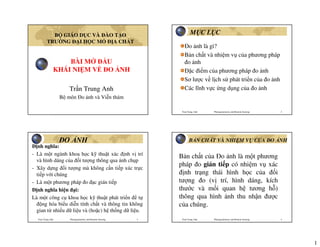
1. B GIÁO D C VÀ ÀO T O M CL C
TRƯ NG IH CM A CH T
o nh là gì?
B n ch t và nhi m v c a phương pháp
BÀI M U o nh
KHÁI NI M V O NH c i m c a phương pháp o nh
Sơ lư c v l ch s phát tri n c a o nh
Tr n Trung Anh Các lĩnh v c ng d ng c a o nh
B môn o nh và Vi n thám
Tran Trung Anh Photogrammetry and Remote Sensing 2
O NH B N CH T VÀ NHI M V C A O NH
nh nghĩa:
- Là m t ngành khoa h c k thu t xác nh v trí
B n ch t c a o nh là m t phương
và hình dáng c a i tư ng thông qua nh ch p
pháp o gián ti p có nhi m v xác
- Xây d ng i tư ng mà không c n ti p xúc tr c
ti p v i chúng nh tr ng thái hình h c c a i
- Là m t phương pháp o c gián ti p tư ng o (v trí, hình dáng, kích
nh nghĩa hi n i: thư c và m i quan h tương h )
Là m t công c khoa h c k thu t phát tri n t thông qua hình nh thu nh n ư c
ng hóa bi u di n tính ch t và thông tin không c a chúng.
gian t nhi u d li u và (ho c) h th ng d li u.
Tran Trung Anh Photogrammetry and Remote Sensing 3 Tran Trung Anh Photogrammetry and Remote Sensing 4
1
2. C I M C A O NH O NH
Có kh năng o c t t c các i tư ng o mà
không ph i ti p xúc tr c ti p. i tư ng o a Thu nh n hình nh và thông tin c a i
d ng.
Nhanh chóng thu ư c tư li u o c, gi m nh
tư ng o (ch p nh)
công tác ngoài tr i, tránh nh hư ng th i ti t và D ng l i, o v i tư ng o t nh
môi trư ng o.
ch p ( o nh)
Có th o cùng m t th i i m nhi u i m o khác
nhau, thu n l i cho phép tính toán, so sánh s bi n
i i tư ng o.
Quy trình công ngh thu n l i cho vi c áp d ng
các thành t u KHCN, t ng hóa, nâng cao hi u
qu kinh t kĩ thu t.
Thi t b chuyên d ng, t ti n
Tran Trung Anh Photogrammetry and Remote Sensing 5 Tran Trung Anh Photogrammetry and Remote Sensing 6
Phân lo i phương pháp o nh o nh m t t
Theo v trí c a thi t b thu nh n nh:
o nh m t t ( o nh kho ng cách g n)
o nh hàng không
o nh v tinh
Theo thi t b o nh, nguyên lý o nh:
gi i nh
o nh tương t
o nh gi i tích
o nh s
o nh ơn/ o nh l p th
Tran Trung Anh Photogrammetry and Remote Sensing 7 Tran Trung Anh Photogrammetry and Remote Sensing 8
2
4. Sù ph¸t triÓn C«ng NghÖ chôp ¶nh h ng kh«ng nh ch p trên khinh khí c u
i l Luis Pháp 1858 và TP Boston 1860
1858, “Nadar”
ch p b c nh
u tiên trên
khinh khí c u
Paris t
cao 80m
Tran Trung Anh Photogrammetry and Remote Sensing 13 Tran Trung Anh Photogrammetry and Remote Sensing 14
¶nh chôp tõ diÒu bay ¶nh chôp tõ diÒu bay
*1906,
*1882, Nhà khí tư ng Lawrence
h c ngư i Anh ch p nh
Archibaid ch p nh TP San
hàng không t m t Francisco
chi c di u. t di u
* Nh ng năm cu i bay trư c
1880 Arthur Batut và sau v
ch p TP ng t
Labruguiere, Pháp t và h a
di u bay. ho n
kh ng
khi p
Tran Trung Anh Photogrammetry and Remote Sensing 15 Tran Trung Anh Photogrammetry and Remote Sensing 16
4
5. CHIM B CÂU MANG MÁY CH P NH nh ch p t máy nh mang b i
chim b câu
*1903,
Julius Lâu ài Châu Âu
Neubonner
khoác trên
c 3 con
chim b
câu chi c
máy ch p
nh n ng
70gm, c
phim
70mm
Tran Trung Anh Photogrammetry and Remote Sensing 17 Tran Trung Anh Photogrammetry and Remote Sensing 18
Chuy n bay u tiên v i máy bay có m t ng
cơ ư c i u khi n b i phi công Wilbur
Wright, 17/11/1903 phía b c California
Anh em nhà Wright
sáng ch ra máy bay,
năm 1902 bay thành
công phía b c
California
Tran Trung Anh Photogrammetry and Remote Sensing 19 Tran Trung Anh Photogrammetry and Remote Sensing 20
5
6. Nh ng b c nh hàng không u tiên ¶nh chôp tõ m¸y bay
1908, m t th
ch p nh bay
cùng v i Wight
ch p m t s
b c nh trên
vùng tr i Le
Mans, Pháp.
Trong su t
chi n tranh th
gi i th nh t,
có hơn 1 tri u
t m nh hàng
không ư c
ch p ph c
v quân i.
TP. NewYork 1908 TP. Reims 1908
Tran Trung Anh Photogrammetry and Remote Sensing 21 Tran Trung Anh Photogrammetry and Remote Sensing 22
Máy bay Curtiss AH 13 Boeing B29 và các máy ch p nh,
ch p v th h t nhân 25/7/1946
Phi công và
th ch p
nh v i máy
ch p
Graflex
hàng không
năm 1915
Tran Trung Anh Photogrammetry and Remote Sensing 23 Tran Trung Anh Photogrammetry and Remote Sensing 24
6
7. nh hàng không ch p v th Máy bay ch p nh hi n i
h t nhân 25/7/1946
Tran Trung Anh Photogrammetry and Remote Sensing 25 Tran Trung Anh Photogrammetry and Remote Sensing 26
Sù ph¸t triÓn C«ng NghÖ chôp ¶nh vÖ tinh ¶nh chôp tõ tªn löa
Bøc ¶nh chôp ®Çu
tiªn tõ mét qu¶ tªn
löa nhá tõ ®é cao
kho¶ng 100m, qu¶
tªn löa n y ®−îc
thiÕt kÕ bëi Alfred
Nobel, phãng trªn
mét miÒn quª Thôy
§iÓn v o n¨m 1897
Chôp ¶nh bÒ mÆt tr¸i ®Êt tõ tªn löa ®−îc thiÕt kÕ bëi
Alfred Maul ë ®é cao 600m.
Tran Trung Anh Photogrammetry and Remote Sensing 27 Tran Trung Anh Photogrammetry and Remote Sensing 28
7
9. C¸c VÖ tinh viÔn th¸m Sù ph¸t triÓn C«ng NghÖ ®o ¶nh
Radarsat
IKONOS Landsat IRS
Regional Operations
Center Regional Operations
§å gi¶i ¶nh (1850-1900) §o ¶nh t−¬ng tù (1900-1960)
Center
Space Imaging
Primary Operations Center
Regional Operations
Center
Remote Operations Transportable Ground
Center Station
Aerial Imagery
§o ¶nh gi¶i tÝch (1950-nay) §o ¶nh sè(1990-nay)
Tran Trung Anh Photogrammetry and Remote Sensing 33 Tran Trung Anh Photogrammetry and Remote Sensing 34
®å gi¶i ¶nh (plan table photogrammetry) ®o ¶nh t−¬ng tù (analog photogrammetry)
1850-1900 1900-1960
A. Lausedat A. Mendenbauer phototheodolite E.Deville Carl Fulfrich R.Hugershoff O.V.Gruber Heinrich Wild
Tran Trung Anh Photogrammetry and Remote Sensing 35 Tran Trung Anh Photogrammetry and Remote Sensing 36
9
10. M¸y to n n¨ng: quang häc, c¬ häc, quang c¬ ®o ¶nh gi¶i tÝch (analytical photogrammetry)
1950-nay
Wild BC1
H.Schmid
H.M.Karara
Tran Trung Anh Photogrammetry and Remote Sensing 37 Tran Trung Anh Photogrammetry and Remote Sensing 38
M¸y to n n¨ng gi¶i tÝch sd 3000 M¸y to n n¨ng gi¶i tÝch planicom p3
Tran Trung Anh Photogrammetry and Remote Sensing 39 Tran Trung Anh Photogrammetry and Remote Sensing 40
10
11. ®o ¶nh sè (digital photogrammetry)
1990-nay PHOTOMOD
U.Helava
Tran Trung Anh Photogrammetry and Remote Sensing 41 Tran Trung Anh Photogrammetry and Remote Sensing 42
VR WorkStation 3DMapper
Tran Trung Anh Photogrammetry and Remote Sensing 43 Tran Trung Anh Photogrammetry and Remote Sensing 44
11
12. Thành l p b n a hình
CÁC LĨNH V C NG D NG
C A O NH
Tran Trung Anh Photogrammetry and Remote Sensing 45 Tran Trung Anh Photogrammetry and Remote Sensing 46
Thành l p b n a chính Thành l p DEM, DTM
DEM:
Digital
Elevation
Model
DTM:
Digital
Terrain
Model
Tran Trung Anh Photogrammetry and Remote Sensing 47 Tran Trung Anh Photogrammetry and Remote Sensing 48
12
14. §o vÏ phi §ÞA H×NH
- Quan tr¾c biÕn d¹ng c«ng tr×nh: cÇu...
- §o vÏ hiÖn tr−êng tai n¹n giao th«ng:
Tran Trung Anh Photogrammetry and Remote Sensing 53 Tran Trung Anh Photogrammetry and Remote Sensing 54
Tran Trung Anh Photogrammetry and Remote Sensing 55 Tran Trung Anh Photogrammetry and Remote Sensing 56
14
16. Tran Trung Anh Photogrammetry and Remote Sensing 61 Tran Trung Anh Photogrammetry and Remote Sensing 62
Các v n c nn m ư c
1. o nh, b n ch t và nhi m v c a
phương pháp o nh
2. Các c i m c a phương pháp o nh
3. Các phương pháp o nh
4. Các lĩnh v c ng d ng c a o nh
Tran Trung Anh Photogrammetry and Remote Sensing 63 Tran Trung Anh Photogrammetry and Remote Sensing 64
16