3. ARNOLD
What is ARNOLD?
FHWA’s internal name for the All Roads Network Of Linear referenced Data.
I did not receive the memo, what are you talking
about?
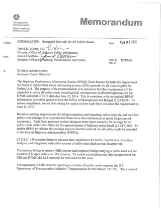
On August 7, 2012, FHWA issued a requirement for States to provide an extensive coverage
of a Geospatial Network of all highways in their State.Memo
What is the background behind the requirement for a
state to provide a geospatial network of all public
roads in their State?
The spirit behind Arnold came from the National States Geographic Information Council
(NSGIC) through the Transportation for the Nation (TFTN) initiative. It has long been
recognized that a complete highway network was lacking in the US. The Strategic Plan that
was created from TFTN identified the Highway Performance Monitoring System (HPMS) as
the current best hope to accomplish a successful development of the initiative.
What are the specific requirements does this network
support?
1. OMB Circular A-16 (http://www.whitehouse.gov/omb/circulars_a016)identifies the
USDOT as the steward of the FGDC Transportation Data Theme
2. USDOT passed this stewardship to the FHWA.
3. FHWA requires a complete inventory of all bridges in the US.NBI
4. FHWA requires data to support Highway Safety for all public roads as part of the of the
Highway Safety improvement Program (HSIP).This includes a Basemap for the
purpose of geolocating all public roads.MAP-21
5. General Accounting Office (GAO) identified inefficienciesGAO Report from maintaining
several networks at the federal and local level.
Who does FHWA recognize has having that authority
for transportation data?
Page 1 of 6ARNOLD
1/21/2014http://production808.com/arnold.html
4. In a federal system, each State has primary authority over all public non-federal highways in
their State so FHWA looks to each State DOT as the authority for information about roads in
their State. For example, there is an annual certification of centerline miles by each governor
or designee. A State DOT may pass this authority to another entity (a private sector vendor,
local government, State GIO etc.) but the FHWA recognizes each States DOT as the final
Authority.
The FHWA Federal Lands Division has identified each Federal Agency owner as the authority
on roads owned by that agency.
What is the Network Specification?
Through the next several months, FHWA will lead an effort to reach a consensus as to the
final specification of Arnold. Most elements are straightforward but the devil is in the details.
Scope All States, US Territories, District of Columbia
Extent
All Public Highways including Ramps and Frontage Roads TODO: Expand on
this definition.
Authority Federal Highways – Federal Agency Owner
Non-Federal Highways - State DOT
Directionality Dual Carriageway Representation
Defined as Positive Barrier Median or Median width of 4’ or greater.
Linear Reference Begin and End Calibration accurate to .001 mile
Geodetic Datum The network will be stored in WGS 84
Geospatial
Accuracy
1:24,000 or better
Topology Rules TBD
Unit of Measure Miles
Attributes
1. Year_Record INT
2. State_Code INT
3. Route_ID varchar(60)
4. Shape Geometry
Geometry: Well Known Binary (X,Y,M)
Open Geospatial Consortium (OGC): Simple Feature Specification
Due Date?
1. Plan of action: June 15, 2013
2. Network due: June 15, 2014
Page 2 of 6ARNOLD
1/21/2014http://production808.com/arnold.html
5. What should be identified in the plan?
1. Indicate the work that has already been accomplished. For instance "My state has a
complete LRS on all State Owned Highways however the off state system is only 20%
LRS. "
2. What do you expect to report on June 15, 2014"We anticipate that by June 15, 2014
we should be able to report all of the State System most of the Locals"
3. What obstacles do you anticipate?"We expect that working with our Local data
providers are going to take time and may delay getting a complete representation of
our highways. We also need to develop a statewide model to assign Route IDs to the
local roads"
4. If your state will require additional funding (through the sources identified below) how
will you use these funds?"We would like to hire a contractor to develop a system for
assigning route IDs to the local roads. We anicipate requesting HSIP funds since SPR
fund are already designated for other projects."
Funding Options
1. SPR with the State Match waived
2. HSIP Funds
1. Funds should be depleted from other sources first before HSIP Fund request
2. Requires a 10% State Match
3. Pooled Fund Study
4. Tell me more about the Pooled Fund Study.TODO: Add Link here
What HPMS section data items are required on the
Non Federal Aid and Non Inventory direction facilities
in ARNOLD?
States should follow the requirements identified in the HPMS Field Manual regarding the
extent for reporting data.
There is no requirement for a State to provide HPMS section data items on facilities
functionally classified as Local or Rural Minor Collector other than highways designated as
National Highway System. Currently there is no requirement for a State to provide additional
HPMS data items for the non inventory direction.
Metadata for ARNOLD?
Metadata should follow the ISO FGDC ISO metadata standard.
Page 3 of 6ARNOLD
1/21/2014http://production808.com/arnold.html
6. Is a State DOT required to provide addresses or
address ranges?
The TFTN calls for the ability to support addressing. FHWA is partnering with the US Census
Bureau to capitolize on the hard work to produce the TIGER Line.
Although there is no requirement for a State to report address or address ranges in HPMS, it
is anticipated that ARNOLD will be capable of supporting address data.
What is the Future of the National Highway Planning
Network(NHPN)?
The NHPN uses HPMS as a source as part of a planning product. It is taylored to the upper
level functional classified roads. The NHPN has some value added elements (i.e routing
across state boundaries) and may include other data that has not been provided by State
DOTs. Since NHPN is mostly a product, it is anticipated that it will continue to fulfill that role
for its many customers.
Questions from February 13, 2013 Webinar
Is the State Match waiver for all of ARNOLD, or just to develop the plan?
The SPR State Match Waiver is for any work in the planning or implementing ARNOLD.
Has the FGDC Metadata Standard already been decided or are there other considerations
like the ISO Metadata Standard?
FHWA recognizes the need for metadata. An evaluation of which standard should adopted is
still pending.
What about states that use proprietary map datasets (e.g. NavTeq)? If the state's network is
based on proprietary data, can it be submitted - can licensing restrictions be respected?
We are engaged in dialogs with both Nokia/NavTeq and TomTom about the use of their
data in the public sector. Both vendors have indicated a desire to make this project
successful.
Can you distinguish trail from road?
23USC101 (21) Public road. - The term "public road" means any road or street under the
jurisdiction of and maintained by a public authority and open to public travel. 23 USC206 (2)
Recreational trail. - The term "recreational trail" means a thoroughfare or track across land
or snow, used for recreational purposes such as -(A) pedestrian activities, including
wheelchair use; (B) skating or skateboarding; (C) equestrian activities, including carriage
driving; (D) nonmotorized snow trail activities, including skiing; (E) bicycling or use of other
Page 4 of 6ARNOLD
1/21/2014http://production808.com/arnold.html
7. human-powered vehicles; (F) aquatic or water activities; and (G) motorized vehicular
activities, including all-terrain vehicle riding, motorcycling, snowmobiling, use of off-road
light trucks, or use of other off-road motorized vehicles.
Will mike neathery use this network? i keep on getting different network issues from his
shop...is he using battelle, ornl or some other obscure network that's not coordinated w/
hpms?
It is anticipated that the NHS will be recorded and maintained on ARNOLD. Arnold will
become a source for the Nation Highway Planning Network of with the official National
Highway System is designated.
Road mileage would be capacity lanes only? Do you expect us to double our milage with
divided roads?
Certified Public Mileage should be based on Capacity Lanes in the inventory direction or
centerline
You mentioned some topology rules, what are you thinking about for topology rules?
These rules are pending.
Will you be addressing the difficulty of collecting median types for dual carriageways. This
data is only collected on sample sections
We will be assembling a list of challenges that need to be addressed.
Will all attributes be required for reporting on the dual carriageways or only on centerline as
is now.
When will BLM be considered public? Does BLM follow 23USC101 (21)?
FHWA has a partnership with BLM through the Federal Lands Division. FHL will be
responsible for these roads.
Since we get fed miles from you (FHWA) will we also get their LRS from you all as well?
We anticipate that FHL would be responsible for these roads.
Then we don't have to ask Fed agencies for their mileage each year anymore?
This part of the vision however the current practice still exists until this is worked out.
How will the dual carriage ways be distinguished from the mainline in the route feature
class?
We distinguish these roads from the mainline using the FACILTY_TYPE data item, this
attribute may be required on all roads. There will need to be a discussion regarding this
issue.
Page 5 of 6ARNOLD
1/21/2014http://production808.com/arnold.html
8. Is there a rough timeline when the pooled fund study will begin and is it a 2 or 3 year
project timeline?
When will you have guidance about samples on federal lands?
Are BIA and Indian Nation roads considered non-federal?
For the purpose of ARNOLD, FHL will be responsible for BIA and Indian Nation Highways.
How are states expected to have the LRS completed if it is going to take several years for
the pooled fund study and research tobe completed?
This will be a major effort in NYS. Our SPR money is fully commited to other projects. We
are hearing total SPR funding is reduced under MAP-21. Can you confirm?
CDOT: What if there is no way that we can meet all requirements by 2014? When will
punative measures start being enacted?
I don't know what punitive measures you are talking about.
Does BLM follow 23USC101 (21) ?
Can we submit all of our public roads this year to see if acceptable?
HPMS Software a set up the handle ingesting the new requirements.
which states are submitting all roads including locals for hpms currently?
Ann Austin - VIrginia DOT: quick question on the revised NHS (Map 21)- when will it be
required to be reported in our submittals? 2012 or 2013 submittal???
Are there going to be Sessions on this at GIS_T?
FHWA will be giving a workshop on Sunday May 5,2013 and other presentations during
GIS-T in Boise,Idaho.
ALDOT: Per FMIS, are DOT's still required to have roads projects are on within the HPMS
Routes? Is there a grace period?
FMIS has made a requirement to submit an LRS and Linework for Federal Aid Projects. The
contingencies are still in work for States that are unable to meet the deadline of October,
2014.
This is Draft and should not be deemed as official
Page 6 of 6ARNOLD
1/21/2014http://production808.com/arnold.html