Topic of presentation: Deep learning for satellite imagery colorization and distance measuring.
The main points of the presentation:
Using modern techniques we compared existing methods for colorization from the perspective of satelite maps. After this we built our own engine for measuring the distances on the maps.
http://dataconf.com.ua/index.php#agenda
#dataconf
#AIBDConference
International Journal of Engineering Research and Development (IJERD)IJERD Editor
journal publishing, how to publish research paper, Call For research paper, international journal, publishing a paper, IJERD, journal of science and technology, how to get a research paper published, publishing a paper, publishing of journal, publishing of research paper, reserach and review articles, IJERD Journal, How to publish your research paper, publish research paper, open access engineering journal, Engineering journal, Mathemetics journal, Physics journal, Chemistry journal, Computer Engineering, Computer Science journal, how to submit your paper, peer reviw journal, indexed journal, reserach and review articles, engineering journal, www.ijerd.com, research journals,
yahoo journals, bing journals, International Journal of Engineering Research and Development, google journals, hard copy of journal
Comparative between global threshold and adaptative threshold concepts in ima...AssiaHAMZA
A digital image can be considered as a discrete representation of data possessing both spatial (layout) and
intensity (colour) information. Pixel intensities form a gateway communication between human perception
of things and digital image processing.
Image thresholding is a simple form of image segmentation. It is a way to create a binary image from a
grayscale or full-color image. This is typically done in order to separate "object" or foreground pixels from
background pixels to aid in image processing.
In this paper we aim to present a small and modest comparative between two kind of image thresholding.
The local and adapatative concepts may not give the same correct results at the end of a process, and we
aim to demonstrate which kind of the two
Intel Intelligent Systems Labs:
Enhancing Photorealism Enhancement
Abstract:
We present an approach to enhancing the realism of synthetic images. The images are enhanced by a convolutional network that leverages intermediate representations produced by conventional rendering pipelines. The network is trained via a novel adversarial objective, which provides strong supervision at multiple perceptual levels. We analyze scene layout distributions in commonly used datasets and find that they differ in important ways. We hypothesize that this is one of the causes of strong artifacts that can be observed in the results of many prior methods. To address this we propose a new strategy for sampling image patches during training. We also introduce multiple architectural improvements in the deep network modules used for photorealism enhancement. We confirm the benefits of our contributions in controlled experiments and report substantial gains in stability and realism in comparison to recent image-to-image translation methods and a variety of other baselines.
Parking detection system using background subtraction and HSV color segmentationjournalBEEI
Manual system vehicle parking makes finding vacant parking lots difficult, so it has to check directly to the vacant space. If many people do parking, then the time needed for it is very much or requires many people to handle it. This research develops a real-time parking system to detect parking. The system is designed using the HSV color segmentation method in determining the background image. In addition, the detection process uses the background subtraction method. Applying these two methods requires image preprocessing using several methods such as grayscaling, blurring (low-pass filter). In addition, it is followed by a thresholding and filtering process to get the best image in the detection process. In the process, there is a determination of the ROI to determine the focus area of the object identified as empty parking. The parking detection process produces the best average accuracy of 95.76%. The minimum threshold value of 255 pixels is 0.4. This value is the best value from 33 test data in several criteria, such as the time of capture, composition and color of the vehicle, the shape of the shadow of the object’s environment, and the intensity of light. This parking detection system can be implemented in real-time to determine the position of an empty place.
At the end of this lesson, you should be able to;
define segmentation.
Describe edge based in segmentation.
describe thresholding and its properties.
apply edge detection and thresholding as segmentation techniques.
3D Reconstruction from Multiple uncalibrated 2D Images of an ObjectAnkur Tyagi
3D reconstruction is the process of capturing the shape and appearance of real objects. In this project we are using passive methods which only use sensors to measure the radiance reflected or emitted by the objects surface to infer its 3D structure.
Image Segmentation from RGBD Images by 3D Point Cloud Attributes and High-Lev...CSCJournals
In this paper, an approach is developed for segmenting an image into major surfaces and potential objects using RGBD images and 3D point cloud data retrieved from a Kinect sensor. In the proposed segmentation algorithm, depth and RGB data are mapped together. Color, texture, XYZ world coordinates, and normal-, surface-, and graph-based segmentation index features are then generated for each pixel point. These attributes are used to cluster similar points together and segment the image. The inclusion of new depth-related features provided improved segmentation performance over RGB-only algorithms by resolving illumination and occlusion problems that cannot be handled using graph-based segmentation algorithms, as well as accurately identifying pixels associated with the main structure components of rooms (walls, ceilings, floors). Since each segment is a potential object or structure, the output of this algorithm is intended to be used for object recognition. The algorithm has been tested on commercial building images and results show the usability of the algorithm in real time applications.
본 논문은 single depth map으로부터의 정확한 3D hand pose estimation을 목표로 한다. 3D hand pose estimation은 HCI, AR등의 기술을 구현함에 있어서 매우 중요한 기술이다. 이를 위해 많은 연구자들이 정확도를 높이기 위해 여러 방법을 제시하였지만, 여전히 손가락들의 비슷한 생김새, 가려짐, 다양한 손가락의 움직임으로 인한 복잡성 때문에 정확도를 올리는데 한계가 있었다. 본 논문은 기존 방법들의 한계를 극복하기 위해 기존 방법들이 사용하는 입력 형태와 출력 형태를 바꾸었다. 2d depth image를 입력으로 받아 hand joint의 3D coordinate를 직접 regress하는 대부분의 기존 방법들과는 달리, 제안하는 모델은 3D voxelized depth map을 입력으로 받아 3D heatmap을 출력한다. 이를 위해 encoder-decoder 형식의 3D CNN을 사용하였고, 달라진 입력과 출력 형태로 인해 제안하는 모델은 널리 사용되는 3개의 3d hand pose estimation dataset, 1개의 3d human pose estimation dataset에서 가장 높은 성능을 내었다. 또한 ICCV 2017에서 주최된 HANDS 2017 challenge에서 우승 하였다.
Seed net automatic seed generation with deep reinforcement learning for robus...NAVER Engineering
본 논문에서는 interactive segmentation 문제를 풀기 위하여 deep reinforcement learning을 활용한 seed gereration 기법을 제안한다. Interactive segmentation 문제의 이슈 중 하나는 사용자의 개입을 최소화하는 것이다. 본 논문에서 제안하는 시스템이 사용자를 대신하여 인공적인 seed를 생성하게 된다. 사용자는 initial seed 정보만을 제공하면 된다. 우리는 optimal seed point 정의의 모호함으로 인해 supervised 기법을 사용하여 학습하기 어려운 점을 reinforcement learning 기법을 사용하여 극복하였다. Seed generation 문제에 맞도록 MDP를 정의하여 deep-q-network를 성공적으로 학습하였다. 우리는 MSRA10K 데이터셋에 대하여 학습을 진행하여 기존 segmentation 알고리즘의 부정확한 initial 결과 대비 우수한 성능을 보였다.
Intel, Intelligent Systems Lab: Syable View Synthesis WhitepaperAlejandro Franceschi
Intel, Intelligent Systems Lab:
Stable View Synthesis Whitepaper
We present Stable View Synthesis (SVS). Given a set
of source images depicting a scene from freely distributed
viewpoints, SVS synthesizes new views of the scene. The
method operates on a geometric scaffold computed via
structure-from-motion and multi-view stereo. Each point
on this 3D scaffold is associated with view rays and corresponding feature vectors that encode the appearance of
this point in the input images.
The core of SVS is view dependent on-surface feature aggregation, in which directional feature vectors at each 3D point are processed to produce a new feature vector for a ray that maps this point into the new target view.
The target view is then rendered by a convolutional network from a tensor of features synthesized in this way for all pixels. The method is composed of differentiable modules and is trained end-to-end. It supports spatially-varying view-dependent importance weighting and feature transformation of source images at each point; spatial and temporal stability due to the smooth dependence of on-surface feature aggregation on the target view; and synthesis of view-dependent effects such as specular reflection.
Experimental results demonstrate that SVS outperforms state-of-the-art view synthesis methods both quantitatively and qualitatively on three diverse realworld datasets, achieving unprecedented levels of realism in free-viewpoint video of challenging large-scale scenes.
An Open Source solution for Three-Dimensional documentation: archaeological a...Giulio Bigliardi
The modern techniques of Structure from Motion (SfM) and Image-Based Modelling
(IBM) open new perspectives in the field of archaeological documentation, providing
a simple and accurate way to record three dimensional data.
The software Python Photogrammetry Toolbox (PPT) is an Open Source solution that
implements a pipeline to perform 3D reconstruction from a set of pictures. It takes
pictures as input and performs automatically the 3D reconstruction for the images for
which 3D registration is possible.
It is composed of python scripts that automate the different steps of the workflow.
The entire process is reduced in two commands, calibration and dense reconstruction.
The user can run it from a graphical interface or from terminal command. Calibration
is performed with Bundler while dense reconstruction is done through CMVS/PMVS.
Despite the automation, the user can control the final result choosing two initial
parameters: the image size and the feature detector. Acting on the first parameter
determines a reduction of the computation time and a decreasing density of the point
cloud. Acting on the feature detector influences the final result: PPT can work both
with SIFT (patent of the University of British Columbia - freely usable only for
research purpose) and with VLFEAT (released under GPL v.2 license). The use of
VLFEAT ensures a more accurate result, though it increases the time of calculation.
Python Photogrammetry Toolbox, released under GPL v.3 license, is a classical
example of FLOSS project in which instruments and knowledge are shared. The community works for the development of the software, sharing code modification,
feed-backs and bug-checking.
This presentation will give a simple overview of image classification technique using difference type software focusing on object-based image classification and segmentation.
High Performance Computing for Satellite Image Processing and Analyzing – A ...Editor IJCATR
High Performance Computing (HPC) is the recently developed technology in the field of computer science, which evolved
due to meet increasing demands for processing speed and analysing/processing huge size of data sets. HPC brings together several
technologies such as computer architecture, algorithm, programs and system software under one canopy to solve/handle advanced
complex problems quickly and effectively. It is a crucial element today to gather and process large amount of satellite (remote sensing)
data which is the need of an hour. In this paper, we review recent development in HPC technology (Parallel, Distributed and Cluster
Computing) for satellite data processing and analysing. We attempt to discuss the fundamentals of High Performance Computing
(HPC) for satellite data processing and analysing, in a way which is easy to understand without much previous background. We sketch
the various HPC approach such as Parallel, Distributed & Cluster Computing and subsequent satellite data processing & analysing
methods like geo-referencing, image mosaicking, image classification, image fusion and Morphological/neural approach for hyperspectral satellite data. Collective, these works deliver a snapshot, tables and algorithms of the recent developments in those sectors and
offer a thoughtful perspective of the potential and promising challenges of satellite data processing and analysing using HPC
paradigms.
CPlaNet: Enhancing Image Geolocalization by Combinatorial Partitioning of MapsNAVER Engineering
Image geolocalization is the task of identifying the location depicted in a photo based only on its visual information. This task is inherently challenging since many photos have only few, possibly ambiguous cues to their geolocation. Recent work has cast this task as a classification problem by partitioning the earth into a set of discrete cells that correspond to geographic regions. The granularity of this partitioning presents a critical trade-off; using fewer but larger cells results in lower location accuracy while using more but smaller cells reduces the number of training examples per class and increases model size, making the model prone to overfitting. To tackle this issue, we propose a simple but effective algorithm, combinatorial partitioning, which generates a large number of fine-grained output classes by intersecting multiple coarse-grained partitionings of the earth. Each classifier votes for the fine-grained classes that overlap with their respective coarse-grained ones. This technique allows us to predict locations at a fine scale while maintaining sufficient training examples per class. Our algorithm achieves the state-of-the-art performance in location recognition on multiple benchmark datasets.
JPM1407 Exposing Digital Image Forgeries by Illumination Color Classificationchennaijp
JP INFOTECH is one of the leading Matlab projects provider in Chennai having experience faculties. We have list of image processing projects as our own and also we can make projects based on your own base paper concept also.
For more details:
http://jpinfotech.org/final-year-ieee-projects/2014-ieee-projects/matlab-projects/
it is highly useful for geography students in the field of remote sensing and it is in very simple and explanatory for the purpose of simplification with relevant images in this ppt.
Ai&bigdataconference oleksandr saienko machine learning use cases in telecomOlga Zinkevych
Topic of presentation: Machine Learning use cases in Telecom
The main points of the presentation: Oleksandr will talk about some interesting examples of using Machine Learning in Telecom: optimizing the cellular network, improving customer experience, models for mobile devices location predicting, customer churn prediction, detecting fraud and others. He will consider the main modern approaches based no machine learning.
http://dataconf.com.ua/oleksandr-saienko.php
Ai big dataconference_taras firman how to build advanced prediction with addi...Olga Zinkevych
Topic of presentation: How to build advanced prediction with adding external data.
The main points of the presentation:
We will discuss different types of time series, main approaches for building forecasting, how to work with missing data, how to add external data using Machine Learning technics. After that, we will consider existing Python's forecasting libraries
http://dataconf.com.ua/index.php#agenda
#dataconf
#AIBDConference
Ai big dataconference_krakovetskyi_microsoft ai a new era of smart solutionsOlga Zinkevych
Topic of presentation: Microsoft AI: a new era of smart solutions
The main points of the presentation: In this presentation we will talk about Microsoft's tools and products that will add some intelligence to your apps and solutions.We will talk about Cognitive Services, chatbots, Cortana and Alexa, Deep Learning and Azure Machine Learning.
http://dataconf.com.ua/index.php#agenda
#dataconf
#AIBDConference
Ai big dataconference_sparkinonehour_vitalii bashunOlga Zinkevych
Topic of presentation: First Spark application in one hour
Are you a beginner in Big Data world? Do not know where to start from? This session is for you. Introduction to distributed computations, Hadoop and the most popular and powerful framework in Big Data world - Apache Spark. This session aims to explain Big Data from scratch in simple words and to show how you can write and run your first Spark application in one hour.
http://dataconf.com.ua/index.php#agenda
#dataconf
#AIBDConference
Ai big dataconference_ml_fastdata_vitalii bondarenkoOlga Zinkevych
Topic of presentation: Machine Learning on Fast Data
The main points of the presentation: We will start from understanding how Machine Learning can be implemented on Enterprise Level Infrastructure and will go to details and discover who trained models could be used in real-time on streaming data. I'll show with live demos how to build Machine Learning Systems in Azure Cloud using open source projects: Apache Kafka, Apache Cassandra, Apache Tensorflow, node.js and Grafana. Also I'll show examples and code from real projects.
http://dataconf.com.ua/index.php#agenda
#dataconf
#AIBDConference
Ai big dataconference_eugene_polonichko_azure data lake Olga Zinkevych
Topic of presentation: Azure Data Lake: what is it? why is it? where is it?
The main points of the presentation:
What is Azure Data Lake? Why does this technology call Microsoft Big Data? Azure Data Lake includes all the capabilities required to make it easy for developers, data scientists, and analysts to store data of any size, shape, and speed, and do all types of processing and analytics across platforms and languages. It removes the complexities of ingesting and storing all of your data while making it faster to get up and running with batch, streaming, and interactive analytics.
http://dataconf.com.ua/index.php#agenda
#dataconf
#AIBDConference
International Journal of Computational Engineering Research(IJCER)ijceronline
International Journal of Computational Engineering Research(IJCER) is an intentional online Journal in English monthly publishing journal. This Journal publish original research work that contributes significantly to further the scientific knowledge in engineering and Technology
Enhanced Optimization of Edge Detection for High Resolution Images Using Veri...ijcisjournal
dge Detection plays a crucial role in Image Processing and Segmentation where a set of algorithms aims
to identify various portions of a digital image at which a sharpened image is observed in the output or
more formally has discontinuities. The contour of Edge Detection also helps in Object Detection and
Recognition. Image edges can be detected by using two attributes such as Gradient and Laplacian. In our
Paper, we proposed a system which utilizes Canny and Sobel Operators for Edge Detection which is a
Gradient First order derivative function for edge detection by using Verilog Hardware Description
Language and in turn compared with the results of the previous paper in Matlab. The process of edge
detection in Verilog significantly reduces the processing time and filters out unneeded information, while
preserving the important structural properties of an image. This edge detection can be used to detect
vehicles in Traffic Jam, Medical imaging system for analysing MRI, x-rays by using Xilinx ISE Design
Suite 14.2.
Comparative Study and Analysis of Image Inpainting TechniquesIOSR Journals
Abstract: Image inpainting is a technique to fill missing region or reconstruct damage area from an image.It
removes an undesirable object from an image in visually plausible way.For filling the part of image, it use
information from the neighboring area. In this dissertation work, we present a Examplar based method for
filling in the missing information in an image, which takes structure synthesis and texture sysnthesis together.
In exemplar based approach it used local information from an image to patch propagation.We have also
implement Nonlocal Mean approach for exemplar based image inpainting.In Nonlocal mean approach it find
multiple samples of best exemplar patches for patch propagation and weight their contribution according to
their similarity to the neighborhood under evaluation. We have further extended this algorithm by considering
collaborative filtering method to synthesize and propagate with multiple samples of best exemplar patches. We
have to preformed experiment on many images and found that our algorithm successfully inpaint the target
region.We have tested the accuracy of our algorithm by finding parameter like PSNR and compared PSNR
value for all three different approaches.
Keywords: Texture Synthesis, Structure Synthesis, Patch Propagation ,imageinpainting ,nonlocal approach,
collabrative filtering.
The model explains how we can Automate System using Artificial Intelligence.
It broadly concerns about:-
1. Lane Detection.
2. Traffic Sign Classification.
3. Behavioural Cloning.
An effective RGB color selection for complex 3D object structure in scene gra...IJECEIAES
Our goal of the project is to develop a complete, fully detailed 3D interactive model of the human body and systems in the human body, and allow the user to interacts in 3D with all the elements of that system, to teach students about human anatomy. Some organs, which contain a lot of details about a particular anatomy, need to be accurately and fully described in minute detail, such as the brain, lungs, liver and heart. These organs are need have all the detailed descriptions of the medical information needed to learn how to do surgery on them, and should allow the user to add careful and precise marking to indicate the operative landmarks on the surgery location. Adding so many different items of information is challenging when the area to which the information needs to be attached is very detailed and overlaps with all kinds of other medical information related to the area. Existing methods to tag areas was not allowing us sufficient locations to attach the information to. Our solution combines a variety of tagging methods, which use the marking method by selecting the RGB color area that is drawn in the texture, on the complex 3D object structure. Then, it relies on those RGB color codes to tag IDs and create relational tables that store the related information about the specific areas of the anatomy. With this method of marking, it is possible to use the entire set of color values (R, G, B) to identify a set of anatomic regions, and this also makes it possible to define multiple overlapping regions.
Our life’s important part is Image. Without disturbing its overall structure of images, we can
remove the unwanted part of image with the help of image inpainting. There is simpler the inpainting of
the low resolution images than that of the high resolution images. In this system low resolution image
contained in different super resolution image inpainting methodologies and there are combined all these
methodologies to form the highly in painted image results. For this reason our system uses the super
resolution algorithm which is responsiblefor inpainting of singleimage.
Extraction of Buildings from Satellite ImagesAkanksha Prasad
Buildings are termed as important components for various applications. Building extraction is defined as a sub-problem of Object Recognition. Though, numerous building extraction techniques have been proposed in the literature. But still they often exhibit limited success in the real scenarios. The main purpose of this research is to develop an algorithm which is able to detect and extract buildings from satellite images. In the proposed approach feature-based extraction process is used to extract buildings from satellite images. The overall system is tested and high performance detection is achieved which shows the effectiveness of proposed approach.
Performance of Efficient Closed-Form Solution to Comprehensive Frontier Exposureiosrjce
IOSR Journal of Electronics and Communication Engineering(IOSR-JECE) is a double blind peer reviewed International Journal that provides rapid publication (within a month) of articles in all areas of electronics and communication engineering and its applications. The journal welcomes publications of high quality papers on theoretical developments and practical applications in electronics and communication engineering. Original research papers, state-of-the-art reviews, and high quality technical notes are invited for publications.
Implementation of Object Tracking for Real Time VideoIDES Editor
Real-time tracking of object boundaries is an
important task in many vision applications. Here we propose
an approach to implement the level set method. This approach
does not need to solve any partial differential equations (PDFs),
thus reducing the computation dramatically compared with
optimized narrow band techniques proposed before. With our
approach, real-time level-set based video tracking can be
achieved.
Similar to Ai big dataconference_volodymyr getmanskyi colorization distance measuring (20)
Overview of text classification approaches algorithms & software v lyubin...Olga Zinkevych
The main points of the presentation:Overview of text classification approaches: algorithms & software
Summary: For the last 2 month I've been building a system for classifying customer support tickets into several categories in terms of product area, importance, etc. Throughout that time I've tried several approaches and benchmarked them against each other. In this talk I would like to showcase some of my findings, including research algorithms that perform well and relevant software. This talk would be useful for someone who needs to build a text categorization system, or someone who just wants to get an overview of one of the most popular NLP research problems (classification).
In this talk you will learn:
* About various approaches used for text classification (e.g. approaches based on TF-IDF, or approaches based on word embeddings and RNNs - recurrent neural nets).
* How these approaches perform against each other on a real-world data.
* Software that is useful for implementing these approaches.
* Research behind some of these approaches.
http://dataconf.com.ua/speaker-page/volodymyr-lyubinets.php
https://www.youtube.com/watch?v=shmc-MI-xbo&index=5&list=PL5_LBM8-5sLjbRFUtXaUpg84gtJtyc4Pu
Evolution of words through time a malenko dataconf 21 04_18Olga Zinkevych
Опис
http://dataconf.com.ua/speaker-page/andrii-malenko.php
Відео
https://www.youtube.com/watch?v=tBgNBeO5-rA&list=PL5_LBM8-5sLjbRFUtXaUpg84gtJtyc4Pu&t=0s&index=13
What it takes to build a model for detecting patients that defaults from medi...Olga Zinkevych
Topic of presentation: What it takes to build a model for detecting patients that defaults from medication
The main points of the presentation:
Why data exploration is important?
Clean data is a half of success
why subject knowledge experts are crucial in healthcare project
feature engineerings as a way to make you model more accurate
We will talk about how using clinical data tyr to predict if patients will or will not defect from their medication.
http://dataconf.com.ua/speaker-page/jaya-plmanabhan.php
https://www.youtube.com/watch?v=vjvwzhyLOX4&list=PL5_LBM8-5sLjbRFUtXaUpg84gtJtyc4Pu&t=0s&index=7
http://dataconf.com.ua/speaker-page/khrystyna-kosenko.php
Topic of presentation: Variational autoencoders for speech processing
The main points of the presentation: Variational autoencoders (or VAE) have become one of the most popular unsupervised learning techniques for modelling complex data distributions, such as images and audio. In this talk I'll begin with a general introduction to VAEs and then review a recent technique called VQ-VAE which is capable of learning rundimentary phoneme-level language model from raw audio without any supervision.
http://dataconf.com.ua/speaker-page/dmytro-bielievtsov.php
https://www.youtube.com/watch?v=euYSAL-aKMI&list=PL5_LBM8-5sLjbRFUtXaUpg84gtJtyc4Pu&t=0s&index=9
Dataservices based on mesos and kafka kostiantyn bokhan dataconf 21 04 18Olga Zinkevych
Topic of presentation: Dataservices based on mesos and kafka
The main points of the presentation: У своїй доповіді Костянтин поділіться досвідом побудови датасервісів на основі таких технологій як: Kafka, Docker, Mesos, Aerospike та Spark. Будуть розглянуті наступні питання: оркестрація, ізоляція, управляння ресурсами, service discovery and load balancing, взаємодія датасервісів. Будуть обговорені проблеми управління ресурсами Java-based та Spark-based сервісів під керування mesos кластера, а також реалізація CI та CD датасервісів.
*CI - continuous integration, CD - continuous delivery
http://dataconf.com.ua/speaker-page/kostiantyn-bokhan.php
https://www.youtube.com/watch?v=4d41DDyKuwU&list=PL5_LBM8-5sLjbRFUtXaUpg84gtJtyc4Pu&t=0s&index=3
Azure data catalog your data your way eugene polonichko dataconf 21 04 18Olga Zinkevych
Topic of presentation: Azure Data Catalog: your data, your way
The main points of the presentation:It’s a fully-managed service that lets you—from analyst to data scientist to data developer—register, enrich, discover, understand, and consume data sources
http://dataconf.com.ua/speaker-page/eugene-polonichko.php
https://www.youtube.com/watch?v=wceGzcQcPOo&list=PL5_LBM8-5sLjbRFUtXaUpg84gtJtyc4Pu&t=0s&index=4
Aibdconference chat bot for every product Maksym VolchenkoOlga Zinkevych
Topic of presentation: Chat Bot for every product
The main points of the presentation: During the presentation you will know about:
• what are conversational interfaces?
• which AI technologies are they based on?
• how we can use conversational interfaces in our products?
• which technologies & tools are needed to build conversational interfaces?
• how to work with statistics about bot?
Ai big dataconference_semantic image segmentatation using word embeddings_ole...Olga Zinkevych
Topic of presentation: Semantic image segmentation using word embeddings
The main points of the presentation:
Semantic image segmentation
Word embeddings
Unsupervised learning
Object detection
Multimodal learning
http://dataconf.com.ua/index.php#agenda
#dataconf
#AIBDConference
Ai big dataconference_jeffrey ricker_kappa_architectureOlga Zinkevych
Topic of presentation: Kappa architecture (and beyond)
The main points of the presentation:
We will discuss the evolution of big data architecture, from batch to Lambda to Kappa. I will walk through how to implement a Kappa architecture with practical examples, focusing on how to reach full potential and avoid the pitfalls. We will finish with reviewing what lies ahead, including the inevitable consolidation between microservices, GPGPU and Hadoop.
http://dataconf.com.ua/index.php#agenda
#dataconf
#AIBDConference
Levelwise PageRank with Loop-Based Dead End Handling Strategy : SHORT REPORT ...Subhajit Sahu
Abstract — Levelwise PageRank is an alternative method of PageRank computation which decomposes the input graph into a directed acyclic block-graph of strongly connected components, and processes them in topological order, one level at a time. This enables calculation for ranks in a distributed fashion without per-iteration communication, unlike the standard method where all vertices are processed in each iteration. It however comes with a precondition of the absence of dead ends in the input graph. Here, the native non-distributed performance of Levelwise PageRank was compared against Monolithic PageRank on a CPU as well as a GPU. To ensure a fair comparison, Monolithic PageRank was also performed on a graph where vertices were split by components. Results indicate that Levelwise PageRank is about as fast as Monolithic PageRank on the CPU, but quite a bit slower on the GPU. Slowdown on the GPU is likely caused by a large submission of small workloads, and expected to be non-issue when the computation is performed on massive graphs.
Adjusting primitives for graph : SHORT REPORT / NOTESSubhajit Sahu
Graph algorithms, like PageRank Compressed Sparse Row (CSR) is an adjacency-list based graph representation that is
Multiply with different modes (map)
1. Performance of sequential execution based vs OpenMP based vector multiply.
2. Comparing various launch configs for CUDA based vector multiply.
Sum with different storage types (reduce)
1. Performance of vector element sum using float vs bfloat16 as the storage type.
Sum with different modes (reduce)
1. Performance of sequential execution based vs OpenMP based vector element sum.
2. Performance of memcpy vs in-place based CUDA based vector element sum.
3. Comparing various launch configs for CUDA based vector element sum (memcpy).
4. Comparing various launch configs for CUDA based vector element sum (in-place).
Sum with in-place strategies of CUDA mode (reduce)
1. Comparing various launch configs for CUDA based vector element sum (in-place).
Explore our comprehensive data analysis project presentation on predicting product ad campaign performance. Learn how data-driven insights can optimize your marketing strategies and enhance campaign effectiveness. Perfect for professionals and students looking to understand the power of data analysis in advertising. for more details visit: https://bostoninstituteofanalytics.org/data-science-and-artificial-intelligence/
As Europe's leading economic powerhouse and the fourth-largest hashtag#economy globally, Germany stands at the forefront of innovation and industrial might. Renowned for its precision engineering and high-tech sectors, Germany's economic structure is heavily supported by a robust service industry, accounting for approximately 68% of its GDP. This economic clout and strategic geopolitical stance position Germany as a focal point in the global cyber threat landscape.
In the face of escalating global tensions, particularly those emanating from geopolitical disputes with nations like hashtag#Russia and hashtag#China, hashtag#Germany has witnessed a significant uptick in targeted cyber operations. Our analysis indicates a marked increase in hashtag#cyberattack sophistication aimed at critical infrastructure and key industrial sectors. These attacks range from ransomware campaigns to hashtag#AdvancedPersistentThreats (hashtag#APTs), threatening national security and business integrity.
🔑 Key findings include:
🔍 Increased frequency and complexity of cyber threats.
🔍 Escalation of state-sponsored and criminally motivated cyber operations.
🔍 Active dark web exchanges of malicious tools and tactics.
Our comprehensive report delves into these challenges, using a blend of open-source and proprietary data collection techniques. By monitoring activity on critical networks and analyzing attack patterns, our team provides a detailed overview of the threats facing German entities.
This report aims to equip stakeholders across public and private sectors with the knowledge to enhance their defensive strategies, reduce exposure to cyber risks, and reinforce Germany's resilience against cyber threats.
Chatty Kathy - UNC Bootcamp Final Project Presentation - Final Version - 5.23...John Andrews
SlideShare Description for "Chatty Kathy - UNC Bootcamp Final Project Presentation"
Title: Chatty Kathy: Enhancing Physical Activity Among Older Adults
Description:
Discover how Chatty Kathy, an innovative project developed at the UNC Bootcamp, aims to tackle the challenge of low physical activity among older adults. Our AI-driven solution uses peer interaction to boost and sustain exercise levels, significantly improving health outcomes. This presentation covers our problem statement, the rationale behind Chatty Kathy, synthetic data and persona creation, model performance metrics, a visual demonstration of the project, and potential future developments. Join us for an insightful Q&A session to explore the potential of this groundbreaking project.
Project Team: Jay Requarth, Jana Avery, John Andrews, Dr. Dick Davis II, Nee Buntoum, Nam Yeongjin & Mat Nicholas
Techniques to optimize the pagerank algorithm usually fall in two categories. One is to try reducing the work per iteration, and the other is to try reducing the number of iterations. These goals are often at odds with one another. Skipping computation on vertices which have already converged has the potential to save iteration time. Skipping in-identical vertices, with the same in-links, helps reduce duplicate computations and thus could help reduce iteration time. Road networks often have chains which can be short-circuited before pagerank computation to improve performance. Final ranks of chain nodes can be easily calculated. This could reduce both the iteration time, and the number of iterations. If a graph has no dangling nodes, pagerank of each strongly connected component can be computed in topological order. This could help reduce the iteration time, no. of iterations, and also enable multi-iteration concurrency in pagerank computation. The combination of all of the above methods is the STICD algorithm. [sticd] For dynamic graphs, unchanged components whose ranks are unaffected can be skipped altogether.
Ai big dataconference_volodymyr getmanskyi colorization distance measuring
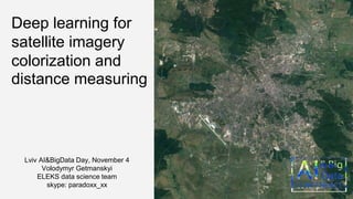
1. Deep learning for
satellite imagery
colorization and
distance measuring
Lviv AI&BigData Day, November 4
Volodymyr Getmanskyi
ELEKS data science team
skype: paradoxx_xx
2. Automatic image colorization is the task of adding colors to a new grayscale image without any
user intervention. This problem is ill-posed in the sense that there is no unique colorization of a
grayscale image without any prior knowledge. Indeed, many objects can have different colors:
artificial objects, such as plastic objects which can have random colors, but also for natural objects
such as tree leaves which can have various nuances of green and brown in different seasons,
without significant change of shape.
3. Most of the modern methods uses pretrained convolutional
neural networks and extracts the information about
features/objects from the image. Then there is a possibility to
upscale them to original size and concatenating them all
together.
Also most of them uses some simplification to train the models to
produce two color channels which can be concatenated with the
grayscale input channel to produce the YUV/CIELUV image.
4. The most obvious loss function is a Euclidean distance function between the network RGB output image
and the true color RGB image (distance in UV space – from previous slide).
We, however, notice that in numerous cases, the images colorized with such approach are mostly sepia-
toned and muted in color.
To understand why, consider a pixel that exists in a flower petal across multiple images that are identical,
save for the color of the flower petals. Depending on the picture, this pixel can take on various tones of
red, yellow, blue, and more. With a regression-based system that uses an loss function, the predicted
pixel value that minimizes the loss for this particular pixel is the mean pixel value. Accordingly, the
predicted pixel ends up being a mixture of the possible colors.
5. Another problem is that pre-trained CNN weights, that was used for feature extraction, are from
estimators that were trained on reсognizing different objects but not the objects from satellite images.
Also all trained models for colorizing (with RGB/UV distance minimizing), were trained to restore
colors for different objects but not for satellite images.
6. We tried to test existing solutions but most of them are facing the problems that we mentioned earlier
and demonstrates low performance:
* http://demos.algorithmia.com/colorize-photos, http://www.colorizephoto.com/converter
http://pinetools.com/colorize-image, https://github.com/richzhang/colorization
7. After the first steps we found more efficient ways (with no or small sepia effects) and also try to train
the estimator based on maps.
Below you can see our basic results with adding color histograms and color mapping as additional map
features:
8. Below you can see our basic results with models training (black&white original, colorized, original):
First iteration of our model (sepia warning): Weak trained model (1K iteration, 20K
samples without augmentation):
9. Measuring distance is a key tool in map reading and is especially useful for hikers and cyclists who want
to measure how far they have travelled or how far they wish to go based on raw maps. BTW, such
distance measuring is helpful for understanding map scale that is the first step for camera height
evaluation (the distance from sea level to eye level) or altitude of the plane/drone above sea / terrain level
(ASL).
So the main task here is to get the scale. If you understand the map scale number that's great and you
can still measure distances accurately.
So based on such thoughts we decided to build the estimator that can measure distances on real
unlabeled maps using some patterns like shadows, trees’ crowns, roofs and roads.
10. For data gathering we used typical browser and google maps with ImageGrab and win32api python
libraries the same as for colorization task (20K samples), but there are few image processing methods
before the DL usage. So here we need to extract/recognize the scale that will be our labels. Scale is
located on the right bottom of the image, so we need to detect the defining point from which we can move
scale detection. Here we can simply slides the template image over the input image (as in cascade
methods) and compares the template and patch of input image with some distance metric.
11. After the successful detection we can extract two elements that we need for labeling:
- Current measurement units (using simple OCR like tesseract and further rule-based engine)
- Scale Line length (simply calculated the location of rows’ mode with continuous range of white
columns)
12. After the validation comparison with VGG architecture we choose AlexNet architecture with all
convolutional layers frozen (transfer learning for efficient feature extraction):
# Real-time data preprocessing
img_prep = ImagePreprocessing()
img_prep.add_featurewise_zero_center()
img_prep.add_featurewise_stdnorm()
# Real-time data augmentation
img_aug = ImageAugmentation()
img_aug.add_random_flip_leftright()
img_aug.add_random_rotation(max_angle=135.)
13. Results (examples from testset, mae≈25%):
Image Side length Predicted length Image Side length Predicted length
168 m 213 m 45 m 69 m
1333 m 954 m 4970 m 4720 m
14. Through our small experiment, we have checked the efficiency of using deep neural networks to colorize
black and white satellite images the same as for measuring maps’ scale. So our conclusions are the
following.
In particular, formulating the maps colorization task as a classification problem can yield colorized maps
that are arguably much more aesthetically-pleasing than those generated by a baseline regression-based
model (with sepia), and thus shows much promise for further development.
Also, redesigning the system around an adversarial network may improve results, since instead of
focusing on minimizing the loss on a per-pixel deviation, the system would learn to generate/colorize
pictures that compare well with real-world maps.
From distance measuring approach we recommend to use similar feature extraction (transfer learning)
that helps to feed the real objects (trees, roofs, roads) into distance result.
Use Ctrl+Shift+V (Cmd+Shift+V) to paste text (Thanks C.O.!) If your presentation is business confidential - keep “business confidential” mark. It other cases you can delete it.