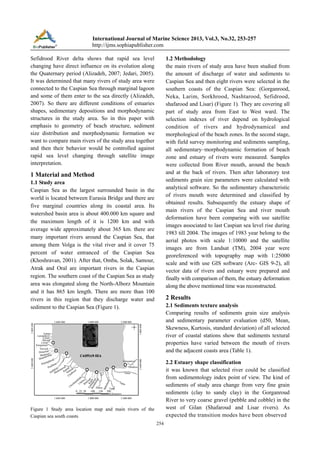
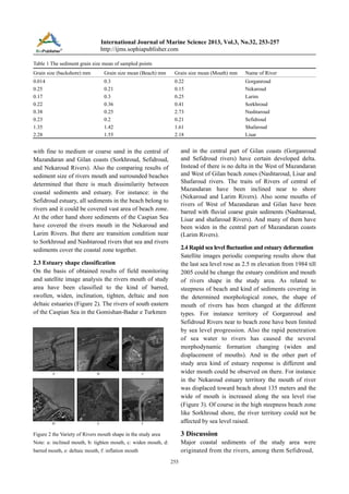
Download to read offline

This document analyzes the impact of rapid sea level changes in the Caspian Sea on the morphodynamic deformation of estuaries along the southern coasts. Sediment samples were collected from 8 main rivers and analyzed to classify the estuary shapes and sediment characteristics. Satellite images from 1983-2004, which correspond to a 2.5m sea level rise, were interpreted to measure estuary deformation. The results showed different estuary types, including barred, swollen, widened, and deltaic. Some estuary territories were limited by the sea level progression, while other estuary mouths widened or were displaced toward the beach. Overall, the rivers responded differently to the sea level rise depending on the beach steepness and sediment size.