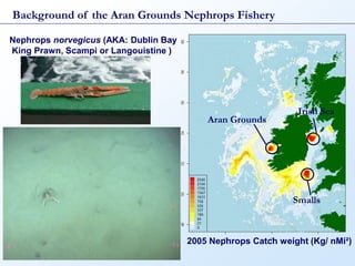
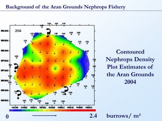
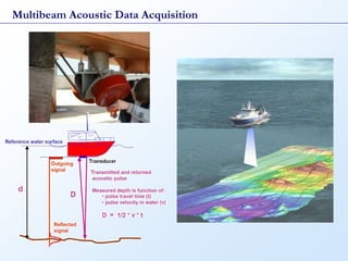
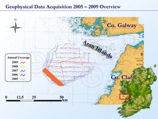
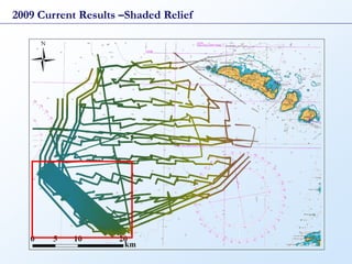
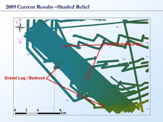
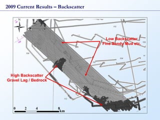
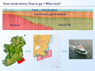
The document summarizes a seabed survey of the Aran Grounds area conducted in 2009. It provides background on the Nephrops fishery in the area. It describes the acquisition of multibeam acoustic and geophysical data from 2005-2009. Results from 2009 include shaded relief and backscatter imagery identifying areas of fine sandy mud, gravel lag, and bedrock. Future work involves sub-bottom profiling to interpret sediment layers and producing a 3D model of the mud layer that is habitat for Nephrops.