
Recommended
More Related Content
Viewers also liked
Viewers also liked (17)
Similar to 1848 gowanus canalv2 hires
Similar to 1848 gowanus canalv2 hires (6)
More from proteusgowanus
Recently uploaded
Recently uploaded (20)
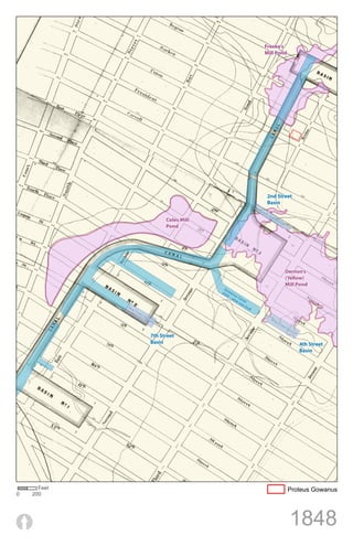
1848 gowanus canalv2 hires
- 1. Freeke’s Mill Pond 2nd Street Basin No w Fil led Coles Mill Se cti on Pond Denton’s (Yellow) Mill Pond Go 20 wan 09 us - w Ca ha na tw l as No bu w ilt Fil led Se cti No on w Fil led Se cti on 7th Street Basin 4th Street Basin Feet Proteus Gowanus 0 200 1848