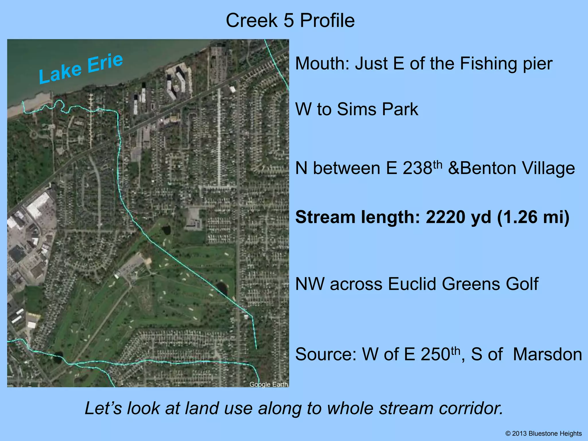
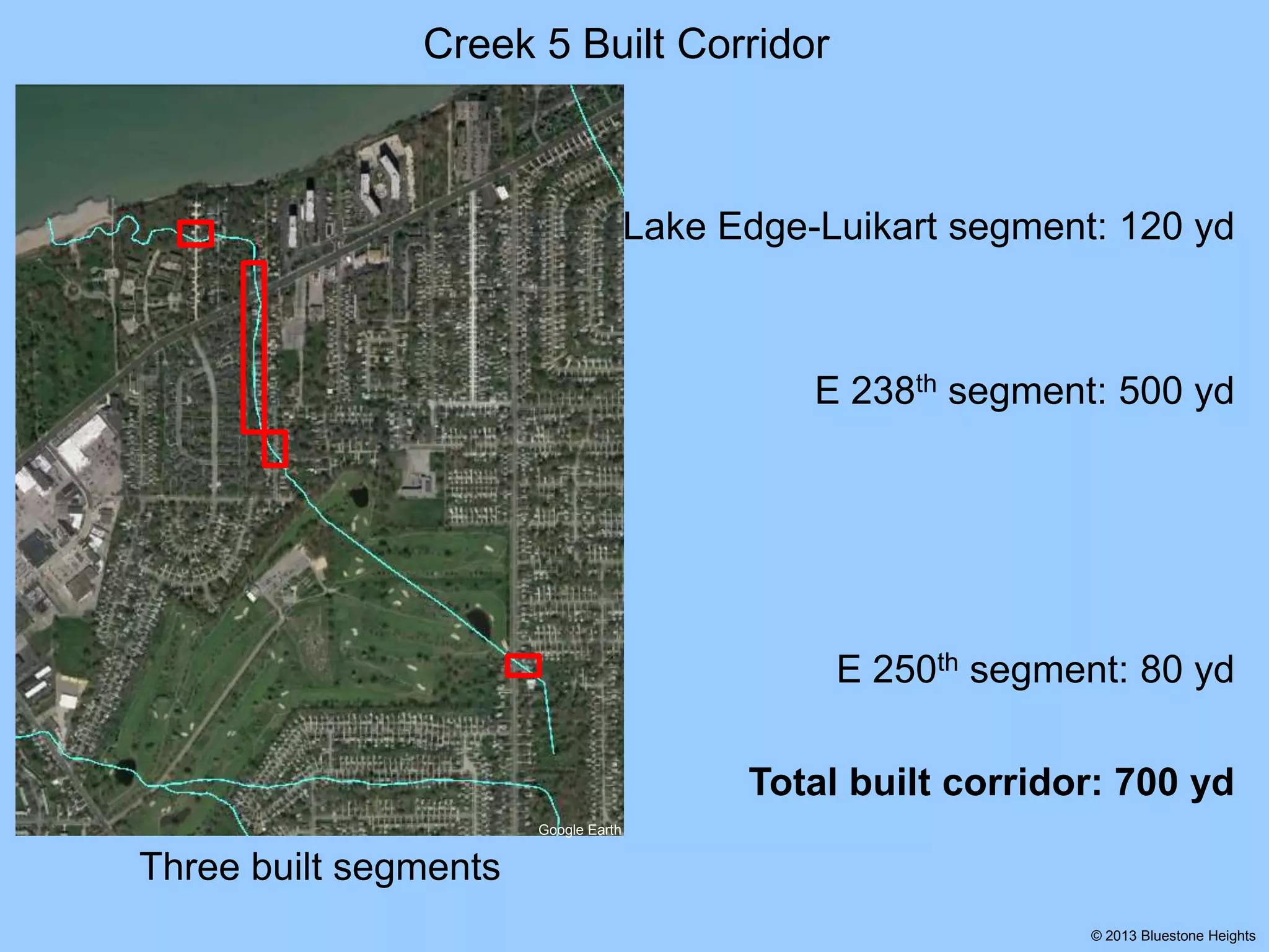
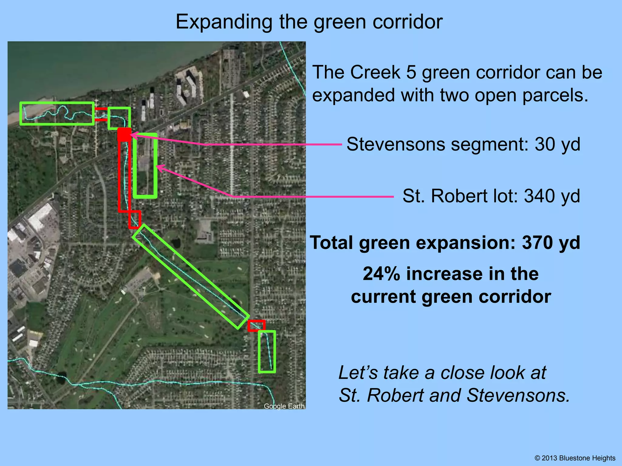
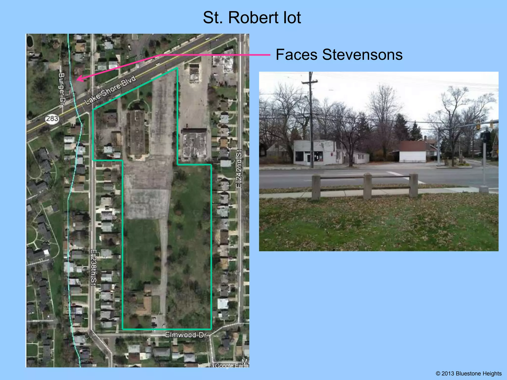
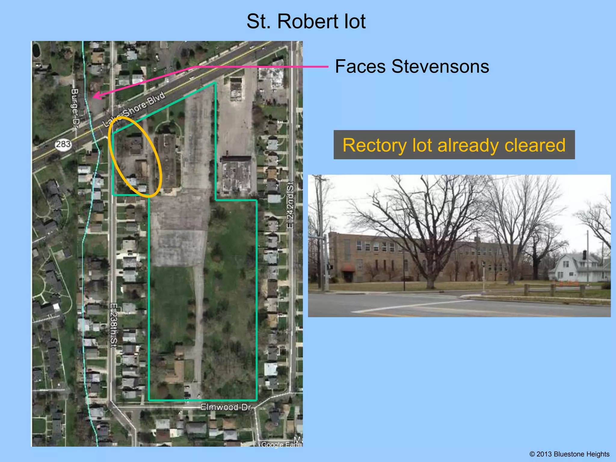
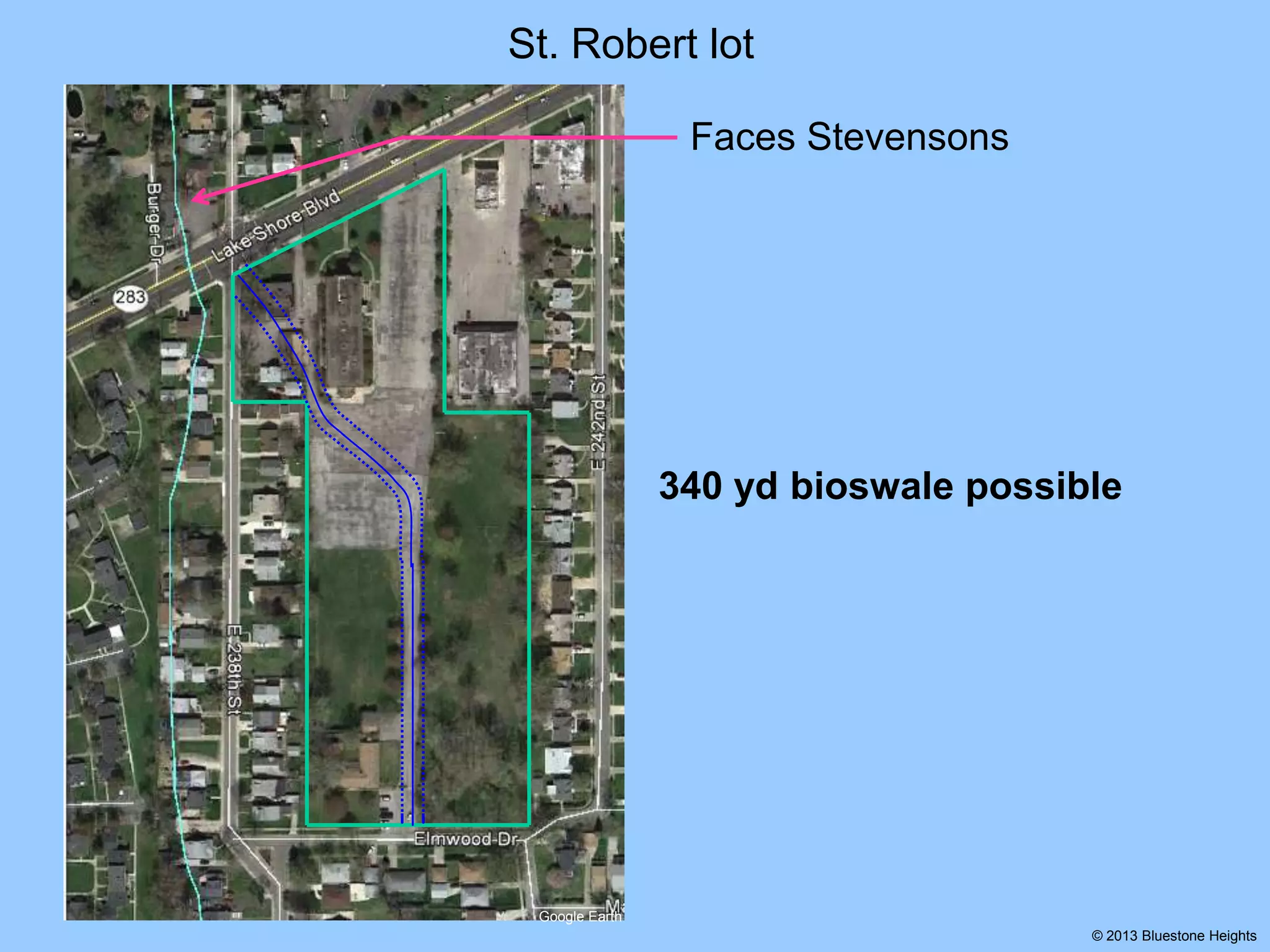
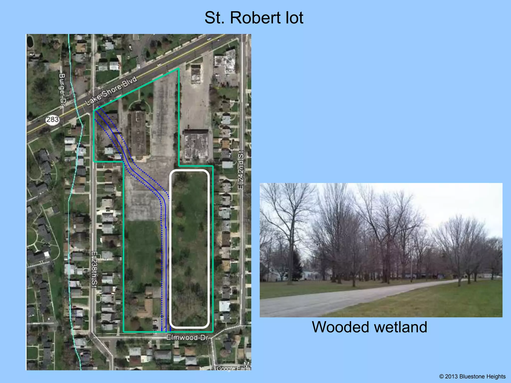
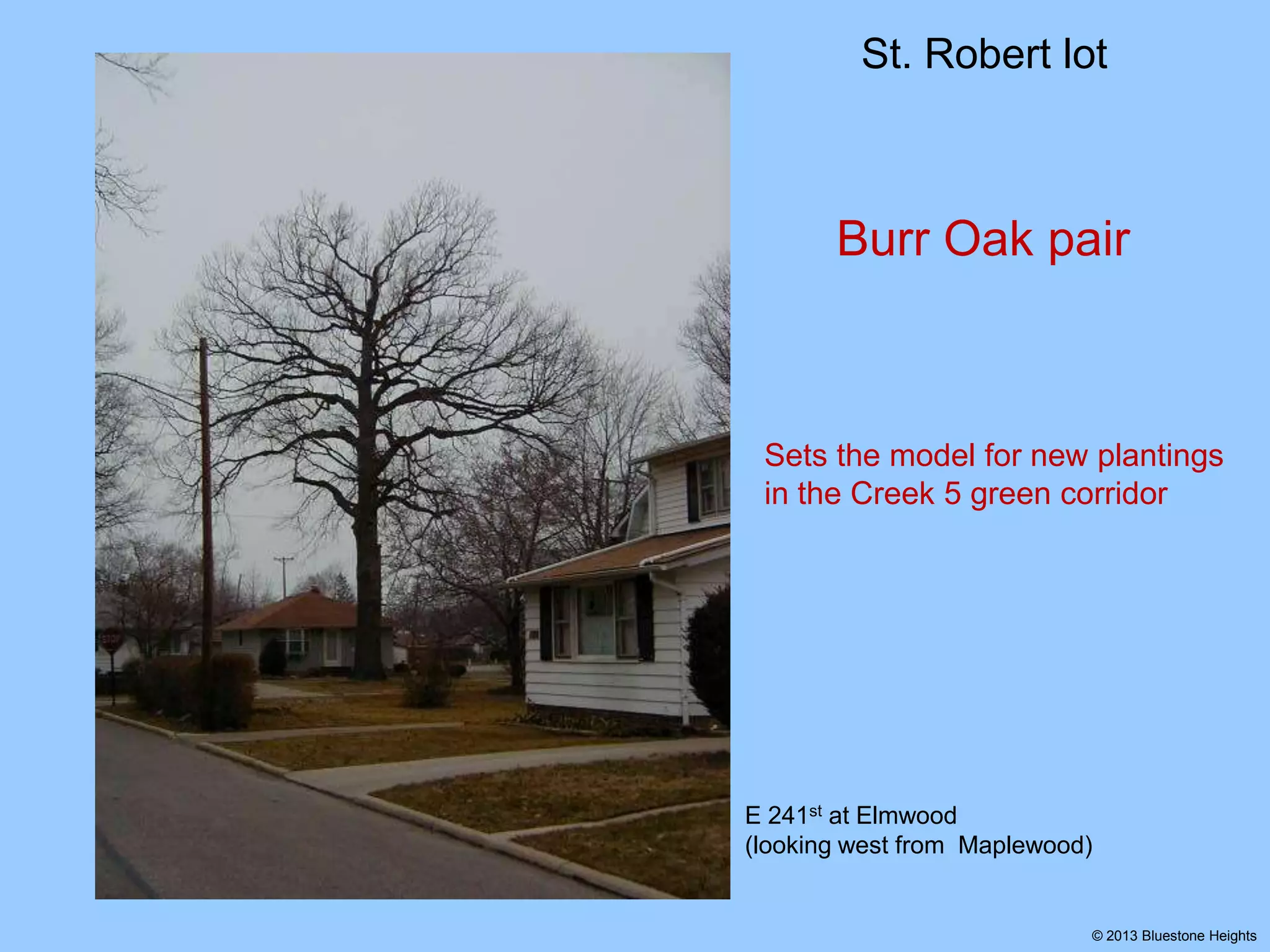
Gilchrist Harbor

With healthy, vibrant streams
Expanding
the

“Creek 5”
Green Corridor

Google Earth
USGS LiDAR
railsandtrails.com

© 2013 Bluestone Heights
Gilchrist Harbor

With healthy, vibrant streams
Expanding
the

“Creek 5”
Green Corridor

Among our buried lake plain stream
channels, Creek 5 is a test case for
expanding a green corridor.
Google Earth
USGS LiDAR
railsandtrails.com

© 2013 Bluestone Heights
Creek 5 Profile
Mouth: Just E of the Fishing pier
W to Sims Park
N between E 238th &Benton Village

Stream length: 2220 yd (1.26 mi)

NW across Euclid Greens Golf

Source: W of E 250th, S of Marsdon
Google Earth

Let’s look at land use along to whole stream corridor.
© 2013 Bluestone Heights
Creek 5 Built Corridor

Lake Edge-Luikart segment: 120 yd

E 238th segment: 500 yd

E 250th segment: 80 yd
Total built corridor: 700 yd
Google Earth

Three built segments
© 2013 Bluestone Heights
Creek 5 Green Corridor

Bend

Meander segment: 360 yd

Meander

Bend segment: 170 yd

Briardale segment: 760 yd

Briardale

Source segment: 230 yd

Source

Total green corridor: 1520 yd
Google Earth

Four green segments
© 2013 Bluestone Heights
Creek 5 Green Corridor Profile
Green corridor
Bend
Meander

Meander

Bend

Briardale

Source

Google Earth

Source

Briardale
Each green segment has unique character.
© 2013 Bluestone Heights
Expanding the green corridor
The Creek 5 green corridor can be
expanded with two open parcels.

Google Earth

© 2013 Bluestone Heights
Expanding the green corridor
The Creek 5 green corridor can be
expanded with two open parcels.

St. Robert lot: 340 yd

Google Earth

© 2013 Bluestone Heights
Expanding the green corridor
The Creek 5 green corridor can be
expanded with two open parcels.
Stevensons segment: 30 yd
St. Robert lot: 340 yd

Google Earth

© 2013 Bluestone Heights
Expanding the green corridor
The Creek 5 green corridor can be
expanded with two open parcels.
Stevensons segment: 30 yd
St. Robert lot: 340 yd
Total green expansion: 370 yd
24% increase in the
current green corridor

Google Earth

© 2013 Bluestone Heights
Expanding the green corridor
The Creek 5 green corridor can be
expanded with two open parcels.
Stevensons segment: 30 yd
St. Robert lot: 340 yd
Total green expansion: 370 yd
24% increase in the
current green corridor

Google Earth

Let’s take a close look at
St. Robert and Stevensons.

© 2013 Bluestone Heights
St. Robert lot

7.6 acres with just one building

Google Earth
© 2013 Bluestone Heights
St. Robert lot
Faces Stevensons

7.6 acres with just one building

Google Earth
© 2013 Bluestone Heights
St. Robert lot
Faces Stevensons

Rectory lot already cleared
7.6 acres with just one building

Google Earth
© 2013 Bluestone Heights
St. Robert lot
Faces Stevensons

340 yd bioswale possible

Google Earth
© 2013 Bluestone Heights
St. Robert lot

Wooded wetland
Google Earth
© 2013 Bluestone Heights
St. Robert lot

Wooded wetland

Magnificent Burr Oak pair
Google Earth
© 2013 Bluestone Heights
St. Robert lot

Burr Oak pair

Sets the model for new plantings
in the Creek 5 green corridor

E 241st at Elmwood
(looking west from Maplewood)

© 2013 Bluestone Heights
Stevensons lot
Stevensons
The Stevensons buildings
lie on the south end of the
Bend open segment.

Google Earth

© 2013 Bluestone Heights
Stevensons lot
Stevensons
The Stevensons buildings
lie on the south end of the
Bend open segment.

Google Earth

Opposite, on Lake Shore, the
1898 interurban RR railing
marks the stream alignment.

© 2013 Bluestone Heights
Stevensons lot

200

If, after demolition, the
Stevensons lot can be kept open
We can lengthen the Bend
green segment by 30 yd, from
170 to 200 yd.

Google Earth

© 2013 Bluestone Heights
Stevensons lot

200

Let’s take a close look

Google Earth

© 2013 Bluestone Heights
Stevensons lot
Plan views
aerial

parcels

Google Earth
© 2013 Bluestone Heights
Stevensons lot
Current inward sloping bioswale
aerial

parcels

Google Earth
© 2013 Bluestone Heights
Stevensons lot
Current inward sloping bioswale
aerial

parcels

Google Earth
© 2013 Bluestone Heights
Stevensons lot
Scale up to parcel view
aerial

parcels

Google Earth
© 2013 Bluestone Heights
15’

0

15’

15’

Google Earth

0

15’

Stevensons lot
© 2013 Bluestone Heights
0

15’

15’

0

15’

Stevensons
buildings

house
Stevensons

15’

Google Earth

garage

Stevensons lot
© 2013 Bluestone Heights
0

15’

15’

0

15’

Current elevation
contours

house
Stevensons

15’

Google Earth

garage

Stevensons lot
© 2013 Bluestone Heights
15’

0

15’

15’

0

15’

Post demolition
configuration

drain

manhole

Plan
View

8.5’
11.5’

Google Earth

culvert (3’ dia)
© 2013 Bluestone Heights
15’

0

15’

15’

0

15’

Upon demolition:
Establish a 30 ft wide
bioswale channel

Google Earth

© 2013 Bluestone Heights
15’

0

15’

15’

0

15’

Solidify bioswale
with inward grading

Plan
View
Google Earth

© 2013 Bluestone Heights
15’

0

15’

Green with plantings
extant
silver maple

ash
silver maple

osage
orange

Google Earth

honey locusts

© 2013 Bluestone Heights
15’

0

15’

Green with plantings
extant
proposed ground cover
silver maple

ash
silver maple

osage
orange

Google Earth

honey locusts

© 2013 Bluestone Heights
15’

0

15’

Green with plantings
burr oak

extant
proposed oak grove
silver maple

burr
oak

burr oak

burr
oak
ash
silver maple
burr
oak

burr
oak

burr
oak

burr
oak

osage
orange

honey locusts

burr
oak

Oak grove goals:
Demarcate/shade the riparian corridor
Provide an attractive corner lot
Connect with the St. Robert lot burr oaks
Compliment/eventually replace extant trees
Google Earth

© 2013 Bluestone Heights
Green with plantings
extant
proposed oak grove

Oak grove goals:
Demarcate/shade the riparian corridor
Provide an attractive corner lot
Connect with the St. Robert lot burr oaks
Compliment/eventually replace extant trees
Google Earth

© 2013 Bluestone Heights
With healthy, vibrant streams
In conclusion:

Escarpment Ravines + Vacant parcels
= Portage Escarpment Ravine Preserves
The Creek 5 segments of St. Robert
and Stevensons are the first
building blocks in our must-have
series of Lake Plain Green Stream
Corridors

With them, we may begin to:

ReImagining Cleveland

Restore places & eco-functions
Enhance cultural richness
Prepare for a better future
© 2013 Bluestone Heights

Euclid Creek 5 Green Corridor