SlideShare a Scribd company logo
1 of 21
This work is supported by the National Science Foundation’s
Directorate for Education and Human Resources TUES-1245025, IUSE-
1612248, IUSE-1725347, and IUSE-1914915. Questions, contact education-AT-unavco.org
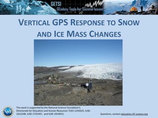
VERTICAL GPS RESPONSE TO SNOW
AND ICE MASS CHANGES
WHAT IS GPS?
• GPS receivers are in
phones, cars, etc.—
basically anything that tells
you where you are
Note: global positioning system (GPS) is
technically just the US component of
the global navigation satellite system
(GNSS) which includes Russia, Europe,
China, and others
HOW DOES GPS WORK?
• A receiver
obtains
signals
from GPS
satellites
Artist’s conception of a GPS Block II-F satellite in Earth orbit
HOW DOES GPS WORK?
• Network of 24–32
satellites
• Precisely known
orbits and time
• A receiver needs
4 satellites to
accurately
determine
position
http://spaceplace.nasa.gov/gps-pizza/en/
HOW DOES GPS WORK?
http://spaceplace.nasa.gov/gps-pizza/en/
• Receiver position is
determined by
calculating the distances
to at least 4 satellites
• Solve for the variables:
• North–South position
• East–West position
• Elevation
• Time
6
GPS antenna inside of dome
Monument solidly attached into
the ground with braces.
If the ground moves, the station
moves.
Solar panel for power
Equipment enclosure
• GPS receiver
• Power/batteries
• Communications/radio/modem
• Data storage/memory
HIGH-PRECISION PERMANENT GPS STATION
ANTENNAS RECEIVE DATA STREAMS
Your location is:
37o
23.323’ N
122o
02.162’ W
The time is:
11:34.9722 (UTC)
Works the same…
ERRORS
Horiz: ± 10 m
Vert: ± 15 m
ERRORS (after 8 hrs)
Horiz: ± 2-4 mm
Vert: ± 10-15 mm
RATES
~1 mm/year
after ~2 years
Greenland GPS Network (GNET) GPS station (station name: NNVN) installed on a nunatak (a
rocky exposure completely surrounded by an ice sheet whose peak is above the ice) north of
Niviarsiat Nunatak, Southern Greenland. Equipment in the foreground is the GPS antenna.
Solar panels and instrument boxes are to the right. Photo courtesy of Mike Bevis (Ohio State
University)
GNET GPS station (name: HJOR) in SE
Greenland. GPS antenna is visible in the
photo. Site was constructed in 2007.
GNET GPS station (name: PLPK) on Pilgupik
Island, southeast Greenland. The glacier
visible across the water is Laube Glacier.
Vertical displacement of GPS receiver located on bedrock adjacent to Helheim Glacier from
2000–2011 (after Bevis et al., 2012).
EXAMPLE GREENLAND GPS BEDROCK STATION DATA
GREENLAND VERTICAL GPS
VELOCITIES (BEDROCK)
• GNET (Greenland GPS Network)
• Limited data 2000-2011.25
• Expanded network starting
2007-2009
• Rates vary from <1 to >20 mm/yr
vertical uplift
• Probably mostly elastic but some
viscoelastic response
WHAT PROCESSES ARE BEHIND ELEVATION CHANGES
WHEN SURFACE LOADS CHANGE?
1. Elastic response
• Near-instantaneous
• Order of magnitude smaller
2. Isostatic response
3. Flexural response
• 103-104 years time
• Viscoelastic
• Much bigger change in
the end
ELASTIC RESPONSE: HOW MUCH VERTICAL MOTION IS
FROM ANNUAL/MULTI-YEAR SNOW AND ICE VARIATIONS?
• Response to loading on a short time frame depends on the elastic
parameter E (Young’s modulus) for the bedrock beneath the station
• Compressional stress (s) = E x strain (e) (shortening or lengthening,
expressed as e (dimensionless) reflecting a greater or lesser force
being applied)
• Units for stress are force/area (N/m2) or (Pa).
F
VISCOELASTIC RESPONSE
Occurs when the
asthenosphere
actually moves in
response to loading
or unloading
HOW MUCH VARIATION IS DUE TO VISCOELASTIC
RESPONSES RELATED TO POST GLACIER REBOUND (PGR)?
Kelvin Viscoelastic Model
ISOSTATIC RESPONSE
Initial state – isostatic equilibrium
Weight of column to compensation
depth = rl g hlith + rasth g hroot
A load is applied (=action)
 Restoring force develops (=reaction)
 It is driven by density contrasts =
buoyancy force
Isostatic equilibrium is reached again
when: Acting force = Restoring force
Column to compensation depth =
rl g (hlith + hload)
Buoyance force = (weight of column after) – (weight of column before)
= rl g (hlith + hload) – (r g hlith + rasth g hroot) = (rl hload – rasth hroot) g
r = density h = height
HOW MUCH VARIATION IS DUE TO VISCOELASTIC
RESPONSES RELATED TO FLEXURAL LOADING?
FLEXURAL LOADING
bulging up
bulge decreases
when load decreases
Vertical GPS Response to Snow and Ice Mass Changes

More Related Content

What's hot

My Pathway in Science and Teaching
My Pathway in Science and TeachingMy Pathway in Science and Teaching
My Pathway in Science and TeachingAli Osman Öncel
 
Soil Dynamics - Local Site Effects - Ground response - Geotechnical Earthquak...
Soil Dynamics - Local Site Effects - Ground response - Geotechnical Earthquak...Soil Dynamics - Local Site Effects - Ground response - Geotechnical Earthquak...
Soil Dynamics - Local Site Effects - Ground response - Geotechnical Earthquak...Cristian Soriano-Camelo
 
Gravity anomaly across reagional structures
Gravity anomaly across reagional structuresGravity anomaly across reagional structures
Gravity anomaly across reagional structuresAmit K. Mishra
 
2015 Broken Hill Resources Investment Symposium - Geological Survey of South ...
2015 Broken Hill Resources Investment Symposium - Geological Survey of South ...2015 Broken Hill Resources Investment Symposium - Geological Survey of South ...
2015 Broken Hill Resources Investment Symposium - Geological Survey of South ...Symposium
 
focal plane solutions and stress pattern of Sumatra Andaman subduction zone
focal plane solutions and stress pattern of Sumatra Andaman subduction zonefocal plane solutions and stress pattern of Sumatra Andaman subduction zone
focal plane solutions and stress pattern of Sumatra Andaman subduction zoneHamid Hussain
 
ÖNCEL AKADEMİ: INTRODUCTION TO GEOPHYSICS
ÖNCEL AKADEMİ: INTRODUCTION TO GEOPHYSICSÖNCEL AKADEMİ: INTRODUCTION TO GEOPHYSICS
ÖNCEL AKADEMİ: INTRODUCTION TO GEOPHYSICSAli Osman Öncel
 
Kulkarni Glacier August27 Revised
Kulkarni   Glacier August27 RevisedKulkarni   Glacier August27 Revised
Kulkarni Glacier August27 Revisedequitywatch
 
ÖNCEL AKADEMİ: SOLID EARTH GEOPHYSICS
ÖNCEL AKADEMİ: SOLID EARTH GEOPHYSICSÖNCEL AKADEMİ: SOLID EARTH GEOPHYSICS
ÖNCEL AKADEMİ: SOLID EARTH GEOPHYSICSAli Osman Öncel
 
3 notti studying and monitoring
3 notti studying and monitoring3 notti studying and monitoring
3 notti studying and monitoringceriuniroma
 
Vincent Henault-Brunet: On the Dynamics of 47 Tuc and its Richer Legacy: Mult...
Vincent Henault-Brunet: On the Dynamics of 47 Tuc and its Richer Legacy: Mult...Vincent Henault-Brunet: On the Dynamics of 47 Tuc and its Richer Legacy: Mult...
Vincent Henault-Brunet: On the Dynamics of 47 Tuc and its Richer Legacy: Mult...JeremyHeyl
 
Ground Penetrating Radar based Analysis of Substructure of Dune du Pilat
Ground Penetrating Radar based Analysis of Substructure of Dune du PilatGround Penetrating Radar based Analysis of Substructure of Dune du Pilat
Ground Penetrating Radar based Analysis of Substructure of Dune du PilatDebopriyo Biswas
 
WORLDWIDE GLACIER MONITORING AS PART OF POLICY-RELATED CLIMATE OBSERVATION
WORLDWIDE GLACIER MONITORING AS PART OF POLICY-RELATED CLIMATE OBSERVATIONWORLDWIDE GLACIER MONITORING AS PART OF POLICY-RELATED CLIMATE OBSERVATION
WORLDWIDE GLACIER MONITORING AS PART OF POLICY-RELATED CLIMATE OBSERVATIONInfoAndina CONDESAN
 

What's hot (17)

CV mona-rev 2
CV mona-rev 2CV mona-rev 2
CV mona-rev 2
 
My Pathway in Science and Teaching
My Pathway in Science and TeachingMy Pathway in Science and Teaching
My Pathway in Science and Teaching
 
GSJ 2004
GSJ  2004GSJ  2004
GSJ 2004
 
Soil Dynamics - Local Site Effects - Ground response - Geotechnical Earthquak...
Soil Dynamics - Local Site Effects - Ground response - Geotechnical Earthquak...Soil Dynamics - Local Site Effects - Ground response - Geotechnical Earthquak...
Soil Dynamics - Local Site Effects - Ground response - Geotechnical Earthquak...
 
Gravity anomaly across reagional structures
Gravity anomaly across reagional structuresGravity anomaly across reagional structures
Gravity anomaly across reagional structures
 
2015 Broken Hill Resources Investment Symposium - Geological Survey of South ...
2015 Broken Hill Resources Investment Symposium - Geological Survey of South ...2015 Broken Hill Resources Investment Symposium - Geological Survey of South ...
2015 Broken Hill Resources Investment Symposium - Geological Survey of South ...
 
focal plane solutions and stress pattern of Sumatra Andaman subduction zone
focal plane solutions and stress pattern of Sumatra Andaman subduction zonefocal plane solutions and stress pattern of Sumatra Andaman subduction zone
focal plane solutions and stress pattern of Sumatra Andaman subduction zone
 
ÖNCEL AKADEMİ: INTRODUCTION TO GEOPHYSICS
ÖNCEL AKADEMİ: INTRODUCTION TO GEOPHYSICSÖNCEL AKADEMİ: INTRODUCTION TO GEOPHYSICS
ÖNCEL AKADEMİ: INTRODUCTION TO GEOPHYSICS
 
Kulkarni Glacier August27 Revised
Kulkarni   Glacier August27 RevisedKulkarni   Glacier August27 Revised
Kulkarni Glacier August27 Revised
 
ÖNCEL AKADEMİ: SOLID EARTH GEOPHYSICS
ÖNCEL AKADEMİ: SOLID EARTH GEOPHYSICSÖNCEL AKADEMİ: SOLID EARTH GEOPHYSICS
ÖNCEL AKADEMİ: SOLID EARTH GEOPHYSICS
 
Hiruni_SRCC_2016 linkedin
Hiruni_SRCC_2016 linkedinHiruni_SRCC_2016 linkedin
Hiruni_SRCC_2016 linkedin
 
3 notti studying and monitoring
3 notti studying and monitoring3 notti studying and monitoring
3 notti studying and monitoring
 
Vincent Henault-Brunet: On the Dynamics of 47 Tuc and its Richer Legacy: Mult...
Vincent Henault-Brunet: On the Dynamics of 47 Tuc and its Richer Legacy: Mult...Vincent Henault-Brunet: On the Dynamics of 47 Tuc and its Richer Legacy: Mult...
Vincent Henault-Brunet: On the Dynamics of 47 Tuc and its Richer Legacy: Mult...
 
Ijsrp p8127
Ijsrp p8127Ijsrp p8127
Ijsrp p8127
 
Geog2750 11
Geog2750 11Geog2750 11
Geog2750 11
 
Ground Penetrating Radar based Analysis of Substructure of Dune du Pilat
Ground Penetrating Radar based Analysis of Substructure of Dune du PilatGround Penetrating Radar based Analysis of Substructure of Dune du Pilat
Ground Penetrating Radar based Analysis of Substructure of Dune du Pilat
 
WORLDWIDE GLACIER MONITORING AS PART OF POLICY-RELATED CLIMATE OBSERVATION
WORLDWIDE GLACIER MONITORING AS PART OF POLICY-RELATED CLIMATE OBSERVATIONWORLDWIDE GLACIER MONITORING AS PART OF POLICY-RELATED CLIMATE OBSERVATION
WORLDWIDE GLACIER MONITORING AS PART OF POLICY-RELATED CLIMATE OBSERVATION
 

Similar to Vertical GPS Response to Snow and Ice Mass Changes

Grace satellite technology
Grace satellite technologyGrace satellite technology
Grace satellite technologydzbsjk
 
Geodetic and seismological analysis of the January 26th, 2014 Cephalonia Isla...
Geodetic and seismological analysis of the January 26th, 2014 Cephalonia Isla...Geodetic and seismological analysis of the January 26th, 2014 Cephalonia Isla...
Geodetic and seismological analysis of the January 26th, 2014 Cephalonia Isla...Demitris Anastasiou
 
“The strong attraction of gravity at Geoscience Australia” (Richard Lane, Geo...
“The strong attraction of gravity at Geoscience Australia” (Richard Lane, Geo...“The strong attraction of gravity at Geoscience Australia” (Richard Lane, Geo...
“The strong attraction of gravity at Geoscience Australia” (Richard Lane, Geo...Richard Lane
 
Delineation and Comparison of Urban Heat Islands in Tamilnadu
Delineation and Comparison of Urban Heat Islands in TamilnaduDelineation and Comparison of Urban Heat Islands in Tamilnadu
Delineation and Comparison of Urban Heat Islands in TamilnaduVignesh Sekar
 
Monitoring surface deformation combining optical and radar sentinel data gsg ...
Monitoring surface deformation combining optical and radar sentinel data gsg ...Monitoring surface deformation combining optical and radar sentinel data gsg ...
Monitoring surface deformation combining optical and radar sentinel data gsg ...Pavlos Krassakis
 
Eidws 115 navy space
Eidws 115 navy spaceEidws 115 navy space
Eidws 115 navy spaceIT2Alcorn
 
IGARSS11_DESDynI_V2.pptx
IGARSS11_DESDynI_V2.pptxIGARSS11_DESDynI_V2.pptx
IGARSS11_DESDynI_V2.pptxgrssieee
 
FR4.TO5.2.ppt
FR4.TO5.2.pptFR4.TO5.2.ppt
FR4.TO5.2.pptgrssieee
 
Rupture processes of the 2012 September 5 Mw 7.6 Nicoya CONSTRAINED
Rupture processes of the 2012 September 5 Mw 7.6 Nicoya CONSTRAINEDRupture processes of the 2012 September 5 Mw 7.6 Nicoya CONSTRAINED
Rupture processes of the 2012 September 5 Mw 7.6 Nicoya CONSTRAINEDAllan Lopez
 
Rupture processes of the 2012 September 5 Mw 7.6 Nicoya CONSTRAINED
Rupture processes of the 2012 September 5 Mw 7.6 Nicoya CONSTRAINEDRupture processes of the 2012 September 5 Mw 7.6 Nicoya CONSTRAINED
Rupture processes of the 2012 September 5 Mw 7.6 Nicoya CONSTRAINEDAllan Lopez
 
170123Seattle_AMS_OLYMPEXposter_Rowe
170123Seattle_AMS_OLYMPEXposter_Rowe170123Seattle_AMS_OLYMPEXposter_Rowe
170123Seattle_AMS_OLYMPEXposter_RoweMegan Chaplin
 
GPS_Environmental
GPS_EnvironmentalGPS_Environmental
GPS_EnvironmentalDwayne Free
 

Similar to Vertical GPS Response to Snow and Ice Mass Changes (20)

Grace satellite technology
Grace satellite technologyGrace satellite technology
Grace satellite technology
 
2013.10.17 ice sheet-symposium_ditmar
2013.10.17 ice sheet-symposium_ditmar2013.10.17 ice sheet-symposium_ditmar
2013.10.17 ice sheet-symposium_ditmar
 
Unit 1 Introductory slides
Unit 1 Introductory slidesUnit 1 Introductory slides
Unit 1 Introductory slides
 
Unit 4: GPS introduction
Unit 4: GPS introductionUnit 4: GPS introduction
Unit 4: GPS introduction
 
Unit 4: Figures
Unit 4: FiguresUnit 4: Figures
Unit 4: Figures
 
Unit 4: figures
Unit 4: figuresUnit 4: figures
Unit 4: figures
 
Geodetic and seismological analysis of the January 26th, 2014 Cephalonia Isla...
Geodetic and seismological analysis of the January 26th, 2014 Cephalonia Isla...Geodetic and seismological analysis of the January 26th, 2014 Cephalonia Isla...
Geodetic and seismological analysis of the January 26th, 2014 Cephalonia Isla...
 
“The strong attraction of gravity at Geoscience Australia” (Richard Lane, Geo...
“The strong attraction of gravity at Geoscience Australia” (Richard Lane, Geo...“The strong attraction of gravity at Geoscience Australia” (Richard Lane, Geo...
“The strong attraction of gravity at Geoscience Australia” (Richard Lane, Geo...
 
Overview of Satellite Radar Altimetry
Overview of Satellite Radar AltimetryOverview of Satellite Radar Altimetry
Overview of Satellite Radar Altimetry
 
Delineation and Comparison of Urban Heat Islands in Tamilnadu
Delineation and Comparison of Urban Heat Islands in TamilnaduDelineation and Comparison of Urban Heat Islands in Tamilnadu
Delineation and Comparison of Urban Heat Islands in Tamilnadu
 
Monitoring surface deformation combining optical and radar sentinel data gsg ...
Monitoring surface deformation combining optical and radar sentinel data gsg ...Monitoring surface deformation combining optical and radar sentinel data gsg ...
Monitoring surface deformation combining optical and radar sentinel data gsg ...
 
Eidws 115 navy space
Eidws 115 navy spaceEidws 115 navy space
Eidws 115 navy space
 
IGARSS11_DESDynI_V2.pptx
IGARSS11_DESDynI_V2.pptxIGARSS11_DESDynI_V2.pptx
IGARSS11_DESDynI_V2.pptx
 
FR4.TO5.2.ppt
FR4.TO5.2.pptFR4.TO5.2.ppt
FR4.TO5.2.ppt
 
Rupture processes of the 2012 September 5 Mw 7.6 Nicoya CONSTRAINED
Rupture processes of the 2012 September 5 Mw 7.6 Nicoya CONSTRAINEDRupture processes of the 2012 September 5 Mw 7.6 Nicoya CONSTRAINED
Rupture processes of the 2012 September 5 Mw 7.6 Nicoya CONSTRAINED
 
Rupture processes of the 2012 September 5 Mw 7.6 Nicoya CONSTRAINED
Rupture processes of the 2012 September 5 Mw 7.6 Nicoya CONSTRAINEDRupture processes of the 2012 September 5 Mw 7.6 Nicoya CONSTRAINED
Rupture processes of the 2012 September 5 Mw 7.6 Nicoya CONSTRAINED
 
170123Seattle_AMS_OLYMPEXposter_Rowe
170123Seattle_AMS_OLYMPEXposter_Rowe170123Seattle_AMS_OLYMPEXposter_Rowe
170123Seattle_AMS_OLYMPEXposter_Rowe
 
Unit 1 Introductory slides BethPS
Unit 1 Introductory slides BethPSUnit 1 Introductory slides BethPS
Unit 1 Introductory slides BethPS
 
GPS_Environmental
GPS_EnvironmentalGPS_Environmental
GPS_Environmental
 
Formation flyingoct01
Formation flyingoct01Formation flyingoct01
Formation flyingoct01
 

More from SERC at Carleton College

StatVignette03_Sig.Figs_v04_07_15_2020.pptx
StatVignette03_Sig.Figs_v04_07_15_2020.pptxStatVignette03_Sig.Figs_v04_07_15_2020.pptx
StatVignette03_Sig.Figs_v04_07_15_2020.pptxSERC at Carleton College
 
Cretaceous Coatlines and Modern Voting Patterns Presentation
Cretaceous Coatlines and Modern Voting Patterns PresentationCretaceous Coatlines and Modern Voting Patterns Presentation
Cretaceous Coatlines and Modern Voting Patterns PresentationSERC at Carleton College
 
Presentation: Unit 1 Introduction to the hydrological cycle
Presentation: Unit 1 Introduction to the hydrological cyclePresentation: Unit 1 Introduction to the hydrological cycle
Presentation: Unit 1 Introduction to the hydrological cycleSERC at Carleton College
 
KSKL_Chapter 4_ Chem Properties of Soils.pptx
KSKL_Chapter 4_ Chem Properties of Soils.pptxKSKL_Chapter 4_ Chem Properties of Soils.pptx
KSKL_Chapter 4_ Chem Properties of Soils.pptxSERC at Carleton College
 
Presentation: Unit 3 background information
Presentation: Unit 3 background informationPresentation: Unit 3 background information
Presentation: Unit 3 background informationSERC at Carleton College
 
Presentation: Unit 2 Measuring Groundwater Background Information
Presentation: Unit 2 Measuring Groundwater Background InformationPresentation: Unit 2 Measuring Groundwater Background Information
Presentation: Unit 2 Measuring Groundwater Background InformationSERC at Carleton College
 

More from SERC at Carleton College (20)

StatVignette03_Sig.Figs_v04_07_15_2020.pptx
StatVignette03_Sig.Figs_v04_07_15_2020.pptxStatVignette03_Sig.Figs_v04_07_15_2020.pptx
StatVignette03_Sig.Figs_v04_07_15_2020.pptx
 
StatVignette06_HypTesting.pptx
StatVignette06_HypTesting.pptxStatVignette06_HypTesting.pptx
StatVignette06_HypTesting.pptx
 
Unit 1 (optional slides)
Unit 1 (optional slides)Unit 1 (optional slides)
Unit 1 (optional slides)
 
Cretaceous Coatlines and Modern Voting Patterns Presentation
Cretaceous Coatlines and Modern Voting Patterns PresentationCretaceous Coatlines and Modern Voting Patterns Presentation
Cretaceous Coatlines and Modern Voting Patterns Presentation
 
Climate and Biomes PPT 2
Climate and Biomes PPT 2Climate and Biomes PPT 2
Climate and Biomes PPT 2
 
weather tracking ppt
weather tracking pptweather tracking ppt
weather tracking ppt
 
Presentation: Unit 1 Introduction to the hydrological cycle
Presentation: Unit 1 Introduction to the hydrological cyclePresentation: Unit 1 Introduction to the hydrological cycle
Presentation: Unit 1 Introduction to the hydrological cycle
 
StatVignette05_M3_v02_10_21_2020.pptx
StatVignette05_M3_v02_10_21_2020.pptxStatVignette05_M3_v02_10_21_2020.pptx
StatVignette05_M3_v02_10_21_2020.pptx
 
KSKL chapter 8 PPT
KSKL chapter 8 PPTKSKL chapter 8 PPT
KSKL chapter 8 PPT
 
KSKL chap 5 PPT
KSKL chap 5 PPTKSKL chap 5 PPT
KSKL chap 5 PPT
 
KSKL_Chapter 4_ Chem Properties of Soils.pptx
KSKL_Chapter 4_ Chem Properties of Soils.pptxKSKL_Chapter 4_ Chem Properties of Soils.pptx
KSKL_Chapter 4_ Chem Properties of Soils.pptx
 
Degraded Soil Images.pptx
Degraded Soil Images.pptxDegraded Soil Images.pptx
Degraded Soil Images.pptx
 
Educators PPT file chapter 7
Educators PPT file chapter 7Educators PPT file chapter 7
Educators PPT file chapter 7
 
Educators PPT file chapter 2
Educators PPT file chapter 2Educators PPT file chapter 2
Educators PPT file chapter 2
 
Educators PPT file chapter 6
Educators PPT file chapter 6Educators PPT file chapter 6
Educators PPT file chapter 6
 
Educators PPT chapter 3
Educators PPT chapter 3Educators PPT chapter 3
Educators PPT chapter 3
 
Unit 4 background presentation
Unit 4 background presentationUnit 4 background presentation
Unit 4 background presentation
 
Presentation: Unit 3 background information
Presentation: Unit 3 background informationPresentation: Unit 3 background information
Presentation: Unit 3 background information
 
Presentation: Unit 2 Measuring Groundwater Background Information
Presentation: Unit 2 Measuring Groundwater Background InformationPresentation: Unit 2 Measuring Groundwater Background Information
Presentation: Unit 2 Measuring Groundwater Background Information
 
Introduction to GPS presentation
Introduction to GPS presentationIntroduction to GPS presentation
Introduction to GPS presentation
 

Vertical GPS Response to Snow and Ice Mass Changes

  • 1. This work is supported by the National Science Foundation’s Directorate for Education and Human Resources TUES-1245025, IUSE- 1612248, IUSE-1725347, and IUSE-1914915. Questions, contact education-AT-unavco.org VERTICAL GPS RESPONSE TO SNOW AND ICE MASS CHANGES
  • 2. WHAT IS GPS? • GPS receivers are in phones, cars, etc.— basically anything that tells you where you are Note: global positioning system (GPS) is technically just the US component of the global navigation satellite system (GNSS) which includes Russia, Europe, China, and others
  • 3. HOW DOES GPS WORK? • A receiver obtains signals from GPS satellites Artist’s conception of a GPS Block II-F satellite in Earth orbit
  • 4. HOW DOES GPS WORK? • Network of 24–32 satellites • Precisely known orbits and time • A receiver needs 4 satellites to accurately determine position http://spaceplace.nasa.gov/gps-pizza/en/
  • 5. HOW DOES GPS WORK? http://spaceplace.nasa.gov/gps-pizza/en/ • Receiver position is determined by calculating the distances to at least 4 satellites • Solve for the variables: • North–South position • East–West position • Elevation • Time
  • 6. 6 GPS antenna inside of dome Monument solidly attached into the ground with braces. If the ground moves, the station moves. Solar panel for power Equipment enclosure • GPS receiver • Power/batteries • Communications/radio/modem • Data storage/memory HIGH-PRECISION PERMANENT GPS STATION
  • 7. ANTENNAS RECEIVE DATA STREAMS Your location is: 37o 23.323’ N 122o 02.162’ W The time is: 11:34.9722 (UTC) Works the same… ERRORS Horiz: ± 10 m Vert: ± 15 m ERRORS (after 8 hrs) Horiz: ± 2-4 mm Vert: ± 10-15 mm RATES ~1 mm/year after ~2 years
  • 8. Greenland GPS Network (GNET) GPS station (station name: NNVN) installed on a nunatak (a rocky exposure completely surrounded by an ice sheet whose peak is above the ice) north of Niviarsiat Nunatak, Southern Greenland. Equipment in the foreground is the GPS antenna. Solar panels and instrument boxes are to the right. Photo courtesy of Mike Bevis (Ohio State University)
  • 9.
  • 10. GNET GPS station (name: HJOR) in SE Greenland. GPS antenna is visible in the photo. Site was constructed in 2007.
  • 11. GNET GPS station (name: PLPK) on Pilgupik Island, southeast Greenland. The glacier visible across the water is Laube Glacier.
  • 12. Vertical displacement of GPS receiver located on bedrock adjacent to Helheim Glacier from 2000–2011 (after Bevis et al., 2012). EXAMPLE GREENLAND GPS BEDROCK STATION DATA
  • 13. GREENLAND VERTICAL GPS VELOCITIES (BEDROCK) • GNET (Greenland GPS Network) • Limited data 2000-2011.25 • Expanded network starting 2007-2009 • Rates vary from <1 to >20 mm/yr vertical uplift • Probably mostly elastic but some viscoelastic response
  • 14. WHAT PROCESSES ARE BEHIND ELEVATION CHANGES WHEN SURFACE LOADS CHANGE? 1. Elastic response • Near-instantaneous • Order of magnitude smaller 2. Isostatic response 3. Flexural response • 103-104 years time • Viscoelastic • Much bigger change in the end
  • 15. ELASTIC RESPONSE: HOW MUCH VERTICAL MOTION IS FROM ANNUAL/MULTI-YEAR SNOW AND ICE VARIATIONS? • Response to loading on a short time frame depends on the elastic parameter E (Young’s modulus) for the bedrock beneath the station • Compressional stress (s) = E x strain (e) (shortening or lengthening, expressed as e (dimensionless) reflecting a greater or lesser force being applied) • Units for stress are force/area (N/m2) or (Pa). F
  • 16. VISCOELASTIC RESPONSE Occurs when the asthenosphere actually moves in response to loading or unloading
  • 17. HOW MUCH VARIATION IS DUE TO VISCOELASTIC RESPONSES RELATED TO POST GLACIER REBOUND (PGR)? Kelvin Viscoelastic Model
  • 18. ISOSTATIC RESPONSE Initial state – isostatic equilibrium Weight of column to compensation depth = rl g hlith + rasth g hroot A load is applied (=action)  Restoring force develops (=reaction)  It is driven by density contrasts = buoyancy force Isostatic equilibrium is reached again when: Acting force = Restoring force Column to compensation depth = rl g (hlith + hload) Buoyance force = (weight of column after) – (weight of column before) = rl g (hlith + hload) – (r g hlith + rasth g hroot) = (rl hload – rasth hroot) g r = density h = height
  • 19. HOW MUCH VARIATION IS DUE TO VISCOELASTIC RESPONSES RELATED TO FLEXURAL LOADING?
  • 20. FLEXURAL LOADING bulging up bulge decreases when load decreases