Africa 3º ESO bil
•Download as PPT, PDF•
1 like•4,070 views

ppt CREATED TO WORK IN CLASS WITH THE aFRICAN MAPS

Recommended
More Related Content
Viewers also liked
Viewers also liked (20)
More from Rocío G.
More from Rocío G. (20)
Africa 3º ESO bil
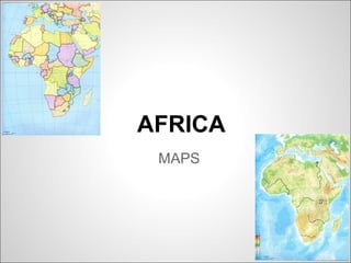
- 1. AFRICA MAPS
- 2. Take an African political blank map and place every country in it.
- 4. AFRICAN COUNTRIES-CAPITALS 1 Algeria - Algiers [æl d ər ə] [æl d əz]ˈ ʒɪ ɪ ˈ ʒɪ 2 Angola - Luanda [æŋ gə lə] /l ændə/ˈ ʊ ʊˈ 3 Benin - Porto-Novo /b ni n/ / p tə nə və /ɛˈ ː ˈ ɔː ʊ ˈ ʊ ʊ 4 Botswana - Gaborone [b tsw nə] / hæbə rə n /ɒˈ ɑː ˌ ˈ ʊ ɪ 5 Burkina Faso - Ouagadougou /b ki nə fæsə / / w ə du u /ɜːˈ ː ˈ ʊ ˌ ɑːɡ ˈ ːɡ ː 6 Burundi - Bujumbura /bə r nd / / bu d əm b ərə/ˈ ʊ ɪ ˌ ː ʒ ˈ ʊ 7 Cameroon - Yaoundé [ kæmə ru n] /french: jaunde/ˌ ˈ ː 8 Cape Verde - Praia [ke p v d/ /'praia/ɪ ɜː 9 Central African Republic - Bangui /french: b ̃ i/ɑɡ 10 Chad - N'Djamena /t æd/ /ənd me nə/ʃ ʒɑːˈ ɪ 11 Comoros - Moroni / k mə rə z/ /mə rə n ; french: m r ni/ˈ ɒ ˌ ʊ ˈ ʊ ɪ ɔ ɔ 12 Democratic Republic of the Congo - Kinshasa / k ŋ ə / /k n zə - sə/ˈ ɒ ɡ ʊ ɪ ˈʃɑː ˈʃɑː 13 Republic of the Congo - Brazzaville /french: brazavil/ 14 Côte d’Ivoire - Yamoussoukro /french: kot divwar/ / jæm su krə /ˌ ʊˈ ː ʊ 15 Djibouti - Djibouti /d bu t /ʒɪˈ ː ɪ 16 Egypt - Cairo / i d pt/ / ka rə /ˈ ː ʒɪ ˈ ɪ ʊ
- 5. 17 Equatorial Guinea - Malabo [ ekwə t r əl g n / /mə l bə /ˌ ˈ ɔː ɪ ˈ ɪ ɪ ˈ ɑː ʊ 18 Eritrea - Asmara / r tre ə/ /æs m rə/ˌɛ ɪˈ ɪ ˈ ɑː 19 Ethiopia - Addis Ababa / i θ ə p ə/ / æd s æbəbə/ˌ ː ɪˈ ʊ ɪ ˈ ɪ ˈ 20 Gabon - Libreville / ə b n; french: ab ̃/ /french: librəvil/ɡ ˈ ɒ ɡ ɔ 21 The Gambia - Banjul / æmb ə/ /bæn d u l/ˈɡ ɪ ˈ ʒ ː 22 Ghana - Accra / nə/ /ə kr /ˈɡɑː ˈ ɑː 23 Guinea - Conakry / g n / /french: k nakri/ˈ ɪ ɪ ɔ 24 Guinea-Bissau - Bissau / g n b sa /ˈ ɪ ɪ ɪˈ ʊ 25 Kenya -Nairobi / k njə/ /na rə b /ˈ ɛ ɪˈ ʊ ɪ 26 Lesotho - Maseru /l su t ; lə sə tə / /mə s əru /ɪˈ ː ʊ ˈ ʊ ʊ ˈ ɛ ː 27 Liberia - Monrovia /la b ər ə/ /m n rə v ə/ɪˈ ɪ ɪ ɒ ˈ ʊ ɪ 28 Libya - Tripoli / l b ə/ / tr pəl /ˈ ɪ ɪ ˈ ɪ ɪ 29 Madagascar - Antananarivo / mædə æskə/ / æntə nænə ri və /ˌ ˈɡ ˌ ˌ ˈ ː ʊ 30 Malawi - Lilongwe /mə l w / /l l ŋw /ˈ ɑː ɪ ɪˈ ɒ ɪ 31 Mali - Bamako / m l / / bæmə kə /ˈ ɑː ɪ ˌ ˈ ʊ 32 Mauritania - Nouakchott / m r te n ə/ /french: nwak t/ˌ ɒ ɪˈ ɪ ɪ ʃɔ 33 Mauritius - Port Louis /mə r əs/ / p t lu s; lu /ˈ ɪʃ ˈ ɔː ːɪ ˈ ːɪ 34 Mayotte - Mamoudzou /french: maj t/ /ma'mu:tzu/ɔ
- 6. 35 Morocco - Rabat /mə r kə / /rə b t/ˈ ɒ ʊ ˈ ɑː 36 Mozambique - Maputo / mə zəm bi k/ /mə pu tə /ˌ ʊ ˈ ː ˈ ː ʊ 37 Namibia - Windhoek /n m b ə nə-/ / w nt h k v nt-/ɑːˈ ɪ ɪ ˈ ɪ ˌ ʊ ˈ ɪ 38 Niger - Niamey / na d ə/ /nj me /ˈ ɪ ʒ ɑːˈ ɪ 39 Nigeria - Abuja /na d ər ə/ /ə bu d ə/ɪˈ ʒɪ ɪ ˈ ː ʒ 40 Réunion Island - Saint-Denis /ri ju njən; french: reynj ̃/ /french: s ̃dni/ːˈ ː ɔ ɛ 41 Rwanda - Kigali /r ændə/ /k l /ʊˈ ɪˈɡɑː ɪ 42 Saint Helena - Jamestown / s nt li nə/ / d e mz ta n/ˌ ɛ ɪˈ ː ˈ ʒ ɪ ˌ ʊ 43 São Tomé and Príncipe - São Tomé /portuguese: sə̃un tu m pr ̃ sipə/ˈ ɛ ˈɛː ˈ ɪː 44 Senegal - Dakar / s n l/ / dækə/ˌ ɛ ɪˈɡɔː ˈ 45 Seychelles - Victoria /se l - lz/ /v k t r ə/ɪˈʃɛ ˈʃɛ ɪ ˈ ɔː ɪ 46 Sierra Leone - Freetown /s ərə l ə n ; l ə n/ / fri ta n/ɪˈɛ ɪˈ ʊ ɪ ɪˈ ʊ ˈ ːˌ ʊ 47 Somalia - Mogadishu /sə m l ə/ / m ə d u /ʊˈ ɑː ɪ ˌ ɒɡ ˈ ɪʃ ː 48 South Africa - Pretoria (executive) /pr t r ə/ɪˈ ɔː ɪ , Bloemfontein (judicial) / blu mf nˈ ː ɒ te n/ˌ ɪ , Cape Town (legislative) 49 Sudan - Khartoum /su d n - dæn/ /k tu m/ːˈ ɑː ˈ ɑːˈ ː 50 Swaziland / sw z lænd/ˈ ɑː ɪ - Lobamba /lo'ba:mba/ (royal / legislative), Mbabane (administrative) /əmb b n /ɑːˈ ɑː ɪ 51 Tanzania - Dodoma / tænzə ni ə/ / də dəmə/ˌ ˈ ː ˈ ʊ
- 7. 52 Togo - Lomé / tə ə / /lə 'me/ˈ ʊɡ ʊ ʊ 53 Tunisia - Tunis /tju n z ə - n s ə/ / tju n s/ːˈ ɪ ɪ ˈ ɪ ɪ ˈ ː ɪ 54 Uganda - Kampala /ju ændə/ /kæm p lə/ːˈɡ ˈ ɑː 55 Western Sahara - El Aaiún /sə h rə/ / l a ju n/ˈ ɑː ɛ ɪˈ ː 56 Zambia - Lusaka / zæmb ə/ /lu z kə - s kə/ˈ ɪ ːˈ ɑː ˈ ɑː 57 Zimbabwe - Harare /z m b bw -we / /hə r r /ɪ ˈ ɑː ɪ ɪ ˈ ɑː ɪ 58 Somaliland - Hargeisa /sə m l lænd/ /h e sə/ʊˈ ɑː ɪˌ ɑːˈɡ ɪ unrecognised self-declared de facto sovereign state that is internationally recognised as an autonomous region of Somalia. 59 South Sudan - Juba / d u bə/ South Sudan became an independent state on 9ˈ ʒ ː July 2011.
- 8. Physical features - Africa
- 9. Relief -Atlas Mountains / ætləs/ˈ -Rift Valley /r ft væl /ɪ ˈ ɪ -Ethiopian Highlands / i θ ə p ənˌ ː ɪˈ ʊ ɪ ha ləndz/ˈ ɪ -Hoggar Mountains or the Ahaggar /'ho gæ:/ -Tibesti Mountains or Massif /tɪ b st /ˈ ɛ ɪ -Drakensberg / dr kənz b /ˈ ɑː ˌ ɜːɡ -Mount Kilimanjaro / k l mənˌ ɪ ɪ d rə /ˈ ʒɑː ʊ -Saharan Desert -Namib Desert -Kalahari Desert -Congo basin Saharan Desert Namib Desert Atlas Mountains Rift Valley Ethiopian Highlands Ahaggar Tibesti Mountains Drakensberg Kilimanjaro Kalahari Congo basin
- 12. Rivers and Lakes -Nile /na l/ɪ -Niger / na d ə/ˈ ɪ ʒ -Senegal / s n l/ˌ ɛ ɪˈɡɔː -Congo / k ŋ ə /ˈ ɒ ɡ ʊ -Zambezi /zæm bi z /ˈ ː ɪ -Orange / r nd /ˈɒ ɪ ʒ -Lake Chad /t æd/ʃ -Lake Victoria /v k t r ə/ɪ ˈ ɔː ɪ -Lake Malawi /mə l w /ˈ ɑː ɪ -Lake Volta / v ltə/ˈ ɒ -Lake Tanganyika / tæŋ ə nji kə/ˌ ɡ ˈ ː Nile Niger Senegal Congo Zambezi Orange Lake Chad Lake Victoria Lake Tanganyika Lake Malawi Lake Volta
- 13. Coastal features -Atlantic Ocean -Indian Ocean -Red Sea -Mediterranean Sea -Mozambique Channel -Cape of Good Hope -Gulf of Aden / e dən/ˈ ɪ -Gulf of Guinea Atlantic Ocean Indian Ocean Red Sea Mediterranean Sea Mozambique ChannelCape of Good Hope Gulf of Aden Gulf of Guinea