
Recommended
Recommended
More Related Content
What's hot
What's hot (20)
Similar to Moscow 2009, 3P Arctic
Similar to Moscow 2009, 3P Arctic (20)
Recently uploaded
Recently uploaded (20)
Moscow 2009, 3P Arctic
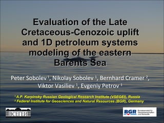
- 1. Evaluation of the Late Cretaceous-Cenozoic uplift and 1D petroleum systems modeling of the eastern Barents Sea Peter Sobolev 1 , Nikolay Sobolev 1 , Bernhard Cramer 2 , Viktor Vasiliev 1 , Evgeniy Petrov 1 1 A.P. Karpinsky Russian Geological Research Institute (VSEGEI), Russia 2 Federal Institute for Geosciences and Natural Resources (BGR), Germany
- 2. The Russia Barents Sea – achievements and problems + One of the most promising shelf area in Russia – there are 11 large oil and gas deposits; + Plans to start an industrial development for several fields in the nearest future; + The area is studied beginning from 1970-s; - The area covered with surveys and wells very irregularly; - All gas and oil fields related with Jurassic and Triassic complexes, whereas for the Timan almost whole section is productive (from Ordovician up to Triassic). - Large volume of data (especially on well logs) is not processed with modern methods.
- 5. Large volume of various data 1
- 6. Geodynamic reconstructions Structural maps ( Late Jurassic) 1 Paleogeographic maps (Early Cretaceuos)
- 8. Previous studies on modeling 2 D modeling along 7 profiles ( Barents and Pechora Sea ) Suprunenko, Oreshkin, Lopatin, Viskunova, Merkulov 2007 2
- 11. Boreholes on the Barents Sea shelf Total number of drilled boreholes is more than 100 Petrophysical analysis + 1D modeling 3 Parametric 11 Prospecting 71 Exploration > 40
- 14. Petrophysical analysis for 10 wells Travel time ( s/ft ) – depth ( m ) Porosity – depth ( m )
- 15. Porosity trends ( e - c·z ) 3
- 16. Erosion evaluation Porosity curves calculated relatively Ledovay-1 well curves 3
- 17. Rough evaluation of regional uplift 400 - 700 м 700 - 100 0 м > 1000 м Isolines - seismic horizon “ Г ” – lower Cretaceous upper boundary 3
- 18. Examples from the literature. (Jankowsky,1962; Magara,1976). Magara(1976,1986) showed, that the acoustic interval transit time ( Δ t) of shales decreases exponentially with depth ( normal compaction trend ). Magara’s sonic log extrapolation technique 3
- 20. Conclusion: Upper limit of Cenozoic erosion is about of 500 m Uncompacted shale value of approximately 200 s/ft (656 s/m) 3
- 21. Vitrinite reflectance measurements Conclusion: Uplift evaluation is about of 500 m near-surface reflectance value is of 0.25% 3
- 22. Timing of regional uplift Cavanagh et al., 2006 Southwestern Barents Sea 33.9 – 2 Ma Pg3-N1 3
- 23. D 2-3 P-T J 2 K 1 P-T Thermal history - subsidence curve analysis K 1 K 1 4
- 24. Main rift events in the Barents Sea Basin (from the analysis of subsidence rate) Heat flow changing during rifting – McKenzie model 4 Time, Ma Epoch β Abun-dance Occurences in neighbouring areas 115-125 K1 < 1.2 local Normal faulting and subsidence in the Western Barents Sea 160-170 J2 < 1.2 regional Rifting over major parts of the North Atlantic 240-260 P-T ~ 2 global Global boundary. Mass extinction, rifting, basaltic magmatism, beginning of Pangaea break-up 360-380 D2-3 < 1.2 regional Rifting and magmatism throughout the Russian Platform
- 26. S-Kildinskaya-82: maturity history 5 Kinetic models – Burnham(1989)_T2 for sapropelic, Burnham(1989)_T3 – for humus. gas show-ings gas pool
- 27. Stokmanovskaya-1: maturity history 5 gas cond. pool
- 28. Prirazlomanaya-1: maturity history 5 gas mainly gas/oil showings oil pool
- 30. „ Exploration strategy“ for the Barents Sea oil window surface Central parts of the Barents Sea Deep depressions of the Barents Sea The Pechora Sea and highs in the Barents Sea 5 Upper Jurassic Lower Triassic Devonian-Carboniferous Upper Jurassic Lower Triassic Devonian-Carboniferous Upper Jurassic Lower Triassic Devonian-Carboniferous
- 35. Thank you for your attention !
Editor's Notes
- Good afternoon! Dear chairmen! Dear colleagues! My presentation is devoted to some regional geological problems of the Russian part of Barents Sea Basin which are important for petroleum investigations.
- I will not repeat well known facts how important the Barents Sea shelf for Russia. I would like only to draw your attention to some actual problems. First, the area is studied very irregularly and insufficiently. Second, the efficiency of prospecting is not so high accordingly modern criteria, a large body of raw data (especially well logging data) is not processed completely until now.
- Thus, main goal of my presentation is to show an example of new ways for integrating data analysis. The general structure of my presentation is following: First I will talk very briefly about recent works of VSEGEI and previous works on modeling. Central part of my talk will be devoted to the regional uplift evaluation. Then I will say very briefly about thermal history and modeling. Finally – about our plans and ambitions.
- Let’s start. During the last decade VSEGEI ( Russian Geological Research Institute) carried out some large projects on the Russian Arctic Shelves, you can see one of them.
- The large body of the different data was compiled, including well log data, regional geophysical data, seismic sections and so on.
- The data were processed and reinterpretated. Some results, for example: structural maps, p alaeogeographic maps, geodynamic reconstructions.
- So, decision to start basin modeling was quite reasonable as a continuation of the data generalization on new level. Other reasons are the lack of such an approach in Russia and cooperation with our colleagues from with Geological Survey of Germany. I would like to emphasize that 1D modeling I am talking about is only a beginning of our planned works.
- Previous works on modeling are very few for the Russian Barents Sea. The only published work was carried out by Okeangeologiya (Suprunenko with co-authors) two years ago. They made a lot of new geochemical investigations along the whole section, and then studied burial and thermal history on seven regional profiles. The main shortcoming is the absence of the reliable uplift assessment.
- The Late Cretaceous-Cenozoic exhumation of the northeastern European margin is an important event impacting crucially on the timing of petroleum generation and entrapment. We used three independent methods – two of them related with well log analysis and the third one is based on v itrinite reflectance. The second problem is thermal history evaluation. It is of fundamental importance for modeling as well.
- For the western Barents Sea the scale of the uplift and its effect on the petroleum systems was investigated with several methods and the results are published in many articles (e.g. Cavanagh et al., 2006). For the Russian Barents Sea the uplift was not considered in detail so far. The only published works devoted this subject that I know is the abstract of geologists from Murmansk.
- There are more than a hundred drilled wells in the Russian part of the Barents Sea. However, usually only parametric ones (red dots) are well studied. Data on exploration wells are absent. Our knowledge on shelf is based upon prospecting wells (yellow dots) which were drilled during 1970-80s. We carried out petrophysical analysis for 11 wells and 1D modeling for 3 wells. But processing of raw data on the wells has many troubles.
- First problem is the very irregular representability – both in plan and in cross-section. Next trouble is very rare sampling – several tens meters for well with length about of 3000-4000 m. There are some problems with well logging data as well.
- Let’s start with statistical analysis of porosity. Here it is the principal scheme of interpretation. We used several methods – sonic, polarization, resistivity, gamma to calculate porosity trends for different rock types. Unfortunately, the interpretation of the porosity trend is ambiguous – it depends on many factors including erosion level, pore pressure, rock type, sedimentary rate and so on. So, it is only the first rough evaluation.
- You can see here data for transit time and calculated porosity for the 10 wells. Depth is along the vertical axis.
- After filtration and generalization we could plot porosity trends. We assume exponential dependence porosity on depth. You see three pictures for mudstones, sandstones, and siltstones. Colors mean different wells.
- We can use these curves for the erosion evaluation. These are the same curves with reduction of corresponding curve for Ledovaya-1 well. Shift between curves with more or less the same form shows relative difference in the level of erosion.
- The first map of uplift for the Russian Barents Sea was created using such ideas. It is very rough and will be improved. Anyway, you see general tendency for increasing of the uplift magnitude northward (size of circle marks the level of erosion). The isolines show reflective horizon G – upper Cretaceous.
- Another approach is based on Magara technique - acoustic interval transit time of shales decreases exponentially with depth. It’s possible to evaluate erosion level using comparison of the trend with occurred measurements for shales.
- The main problem is to choose very accurately shales only, because an interlayering of clastic rocks is typical for the whole section. We used several criteria – gamma filter and lowest values for shale intervals.
- We make trendline for the points (semi-logarithmic plot travel time vs. depth) and then we found its intersection with mean value near surface. It gave the erosion evaluation of about 500 m.
- Other absolutely independent method for the estimation of the uplift is related with vitrinite reflectance. Here you can see available data of the parameter for different wells. Intersection of most trend lines shows approximately 500 m again.
- About beginning and duration of the uplift. We used results of Cavanagh with co-authors for South-Western Barents Sea (Oligocene-Miocene).
- Next serious problem is thermal history reconstruction. The simplest way is to suggest that main increasing of heat flow was related with rifting, and therefore with extension. Times of quick subsidence were outlined with using curves of burial history. The four periods of activization were revealed.
- Therefore, we assumed that there were four principal stages of rifting. All of them confirmed in the neighboring areas. The Permian-Triassic boundary is a well-known global activity phase. If we know the timing of rifting and extension factor beta we can calculate easily heat flow curve using the simple McKenzie model.
- Well, after uplift and thermal history evaluation everything is ready to start modeling. Geochemical data on organic matter were added as well. We use Petromod software for modeling. You can see some basic challenges for the petroleum system modeling of the Russian Barents Sea.
- This is an burial history and evolution of maturity of organic matter for the Severo-Kildinskoe field. The green colour means “oil windows” and the red one means “gas windows”. You can see real location of gas pool on the right column. The conditions were favorable for the gas generation during Mesozoic times and the present gas condensate pools in Early Triassic are very likely indigenous.
- The similar picture we have at the Shtokmanovskoe field. Organic-rich upper Jurassic shales are thermally immature. Gas condensate pools trapped in Jurassic reservoirs migrated probably from the deeper buried Triassic source rocks.
- In the Pechora Sea (the Prirazlomanoe field) favorable conditions for petroleum generation during Mesozoic times were realized in Paleozoic oil-prone source rocks.
- The principal conclusions from the modeling are following. For the central parts of the Russian Barents Sea Basin Lower Triassic petroleum system were favourable during Mesozoic time. Gas pools are very likely indigenous there; Organic matter in the Jurassic sequence is immature; For the marginal parts of the Barents Sea with reduced thickness of Mesozoic rocks a petroleum generation is possible during Paleozoic time.
- This rather trivial picture shows an „Exploration strategy“ for the Barents Sea. Three columns show different vertical shift and therefore different conditions for oil and gas generation. The Jurassic shales may reach the necessary thermal maturity only in the most deeply buried parts of the basin.
- So, at last final part. We made reinterpretation of some well log data and started 1D modeling. Its results are following: Qualitative evaluation of the Cenozoic uplift; Several rifting events recognition in PZ-MZ; Petroleum systems evaluations for different tectonic settings; Modeling is a useful tool for many reasons: Integration of data; Detection of errors; Formulation of new tasks; and Evaluation of hypotheses.
- You see our ambitions. We are going to continue checking up of the results and improve them. Also we hope to start a new project on 2D and 3D-modeling of the Barents Sea basin soon. And there some ideas to spread such an approach for new areas.
- Some specific features of the future project. First of all it will be an open approach. Then we hope to carry out new joint interpretation of geophysical, lithostratigraphic, petrophysical data; new petrochemical, petrographic, petrophysical measurements. Several models of tectonic evolution will be analyzed. And we plan to do full set of studies - from 1D to 3D models, maybe in different scales.
- Now about most actual problems. First of all, these are lack of the data and low quality of many raw data. Then, uncertainties with interpretation of tectonic history and timing of Late Cretaceous – Cenozoic uplift. We have to choose software for modeling. And finally - last but not least - searching for an additional financial support.
- Thank you!