Bhu 19 pet_solved_1
•
0 likes•158 views

BHU PET 2019 M.Sc Geology Solved question paper part 1

Recommended
More Related Content
What's hot
What's hot (20)
Similar to Bhu 19 pet_solved_1
Similar to Bhu 19 pet_solved_1 (20)
More from Nikhil Sherekar
More from Nikhil Sherekar (13)
Recently uploaded
Recently uploaded (20)
Bhu 19 pet_solved_1
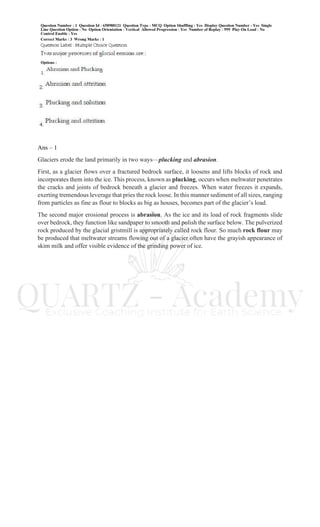
- 1. Ans – 1 Glaciers erode the land primarily in two ways—plucking and abrasion. First, as a glacier flows over a fractured bedrock surface, it loosens and lifts blocks of rock and incorporates them into the ice. This process, known as plucking, occurs when meltwater penetrates the cracks and joints of bedrock beneath a glacier and freezes. When water freezes it expands, exerting tremendous leverage that pries the rock loose. In this manner sediment of all sizes, ranging from particles as fine as flour to blocks as big as houses, becomes part of the glacier’s load. The second major erosional process is abrasion. As the ice and its load of rock fragments slide over bedrock, they function like sandpaper to smooth and polish the surface below. The pulverized rock produced by the glacial gristmill is appropriately called rock flour. So much rock flour may be produced that meltwater streams flowing out of a glacier often have the grayish appearance of skim milk and offer visible evidence of the grinding power of ice.
- 2. Ans – 4 BARCHAN DUNES. Solitary sand dunes shaped like crescents with tips pointing downwind are called barchan dunes. • These dunes form where supplies of sand are limited and the surface is relatively flat, hard, and lacking vegetation. • They migrate slowly with the wind at a rate of up to 15 meters per year. • Their size is usually modest, with the largest barchans reaching heights of about 30 meters while the maximum spread between their horns approaches 300 meters. • When the wind direction is nearly constant, the crescent form of these dunes is nearly symmetrical. • However, when the wind direction is not perfectly fixed, one tip becomes larger than the other
- 3. Ans – 2
- 4. Terraces • Tectonic uplift can change the equilibrium of a stream valley, resulting in flat, steplike surfaces that line the stream above the floodplain. • These terraces mark former floodplains that existed at a higher level before regional uplift or an increase in discharge caused the stream to erode into the former floodplain. • Terraces are made of floodplain deposits and are often paired, one on each side of the stream, at the same level (Figure 18.26). • Terrace formation starts when a stream creates a floodplain. Rapid uplift then changes the stream's equilibrium, causing it to cut down into the floodplain. • In time, the stream reestablishes a new equilibrium at a lower level. • It may then build another floodplain, which will also undergo uplift and be sculpted into another, lower pair of terraces.
- 6. Ans – 3 END AND GROUND MORAINES. An end moraine is a ridge of till that forms at the terminus of a glacier and is characteristic of ice sheets and valley glaciers alike. These relatively common landforms are deposited when a state of equilibrium is attained between ablation and ice accumulation. That is, the end moraine forms when the ice is melting and evaporating near the end of the glacier at a rate equal to the forward advance of the glacier from its region of nourishment. Although the terminus of the glacier is now stationary, the ice continues to flow forward, delivering a continuous supply of sediment in the same manner a conveyor belt delivers goods to the end of a production line. As the ice melts, Ice-Laid Deposits A moraine is an accumulation of rocky, sandy, and clayey material carried by the ice or deposited as till. There are many types of moraines, each named for its position with respect to the glacier that formed it (see Table 21.1). One of the most prominent in size and appearance is an end moraine, formed at the ice front. As the ice flows steadily downhill, it brings more and more sediment to its melting edge. The unsorted material accumulates there as a hilly ridge of till. Regardless of the shape or location, moraines of all kinds consist of till.
- 7. Ans – 1 Ans – 1 Cross-Stratification Structures Cross-Bedding Layers and laminae that make up the internal structure of some beds are deposited at an angle to the bounding surfaces of the bed and are, therefore, called cross-strata or cross-lamina. Beds composed of cross-stratified or cross-laminated units are called cross-beds. The bounding surfaces of cross-beds may be either parallel or nonparallel. Cross-bedding forms primarily by migration of ripples and dunes in water or air. Ripple or dune migration leads to formation of dipping foreset laminae owing to avalanching or suspension settling in the zone of separation on the lee sides of these bedforms. The inclined strata, called foresets, have dips that range from 20 to 35°. Set boundaries are deposited sub-horizontally, especially as seen on vertical sections parallel to flow. Cross bedding is classified on the basis of (1) the shape and attitude of foresets, (2) the shape of set boundaries, and (3) the thickness of sets. Foresets are described as planar or tangential, on the basis of their shape as viewed in vertical sections parallel to the dip direction (Fig. 1.16). Planar foresets are nearly flat and intersect the lower set boundary at a relatively high angle. Some authors
- 8. use "angular" instead of "planar." Tangential foresets are curved concave-up and intersect the lower set boundary at a low angle. Aeolian ripples generally do not form well defined internal structures because migration is "less by repeated lee side avalanches than by saltation bombardment" (Leeder 1982: 97). Swash cross stratification Swash cross stratification, formed in the beach swash zone, is characterized by seaward-dipping low-angle (2-10°) strata (Fig. 1.25). Sets tend to be wedge-shaped because of variations in the slope of the beachface, which changes with varying wave conditions. Laminae are subparallel to lower set boundaries and commonly show reverse textural grading.
- 10. Ans – 1 Ans – 3
- 11. LONGITUDINAL DUNES. Longitudinal dunes are long ridges of sand that form more or less parallel to the prevailing wind where sand supplies are moderate. Apparently the prevailing wind direction varies somewhat but remains in the same quadrant of the compass. Although the smaller types are only 3 or 4 meters high and several dozens of meters long, in some large deserts longitudinal dunes can reach great size. For example, in portions of North Africa, Arabia, and central Australia, these dunes can approach a height of 100 meters and extend for distances of more than 100 kilometers (62 miles).
- 12. Ans – 4
- 13. Ans – 1 Join us - Telegram – https://t.me/joinchat/F0YSxRk74GYHjhjMJVL6Nw WhatsApp Group 1 – https://chat.whatsapp.com/IP8aQw3hsTvEdWQvvwwzSt WhatsApp Group 2 - https://chat.whatsapp.com/LQmvgO8WXWX45kRh0cU3me Instagram – https://www.instagram.com/geologistical/ Facebook – https://www.facebook.com/Quartz-Exclusive-Coaching-Institute-for-earth-Sciences- 507962722965703 Slideshare – https://www.slideshare.net/nikhilsherekar LinkedIn - https://www.linkedin.com/in/nikhil-sherekar-8b179a9b/