
Recommended
More Related Content
Similar to Coordinate Powerpoint.ppt
Similar to Coordinate Powerpoint.ppt (20)
Recently uploaded
Recently uploaded (20)
Coordinate Powerpoint.ppt
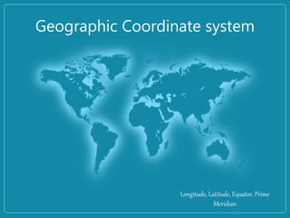
- 1. Geographic Coordinate system Longitude, Latitude, Equator, Prime Meridian
- 2. OBJECTIVES: At the end of the lesson, the students should be able to: • differentiate latitude from longitude; • describe the location of the Philippines using latitude and longitude; and • determine the location of different places using coordinates.
- 3. Competencies: • The Philippine Archipelago (location) • Location of different places using a coordinate system
- 5. Coordinate System - is a reference system used to represent the locations of geographic features, imagery, and locations within a common geographic framework. Coordinate System
- 6. Geographic Coordinate System (GCS) - is the most common coordinate system that uses degrees of latitude and longitude to describe a location on the earth’s surface. - is a three-dimensional reference system that locates points on the Earth's surface. Geographic Coordinate System (GCS) - is the most common coordinate system that uses degrees of latitude and longitude to describe a location on the earth’s surface. - is a three-dimensional reference system that locates points on the Earth's surface.
- 17. Reference Line • Equator - is the imaginary line running east and west where the diameter of the globe is greatest.
- 18. Reference Line • Prime Meridian - is the imaginary line running from pole to pole and passing through Greenwich, a section of London, England.
- 19. Prime Meridian
- 20. - The unit of measure is usually decimal degrees. - A point has two coordinate values: latitude and longitude. Latitude and longitude measure angles. Geographic Coordinate System (GCS)
- 21. • Maps – instruments based on a coordinate system, a method much like the Cartesian method of plotting X and Y Points.
- 24. Latitude • Lines of Latitude run horizontally • Latitude is measured in degrees. • The Equator is 0 degree Latitude. • Lines of Latitude locate places North or South of the Equator. • The North Pole is 90 degrees N Latitude, and the South Pole is 90 degrees S Latitude. Latitude
- 25. Latitude Latitude lines are also called parallels because on a globe, latitude lines never touch each other — they are parallel to each other. Distance bet. the lines of latitude is constant to 111.12km (60 nautical miles) Latitude
- 26. Five Divisions
- 27. Five Divisions
- 28. Longitude • Lines of Longitude run vertically. • They are also called Meridians. • The Prime Meridian is found in Greenwich, England. • The Prime Meridian is 0 degrees Longitude.
- 29. Longitude The measurement that tells you how far you are east or west of the Prime Meridian (the thick line that passes through Greenwich, England and part of Africa).
- 30. Lines of Longitude • The Prime Meridian (0°) and the 180° IDL split the earth into the Western Hemisphere and Eastern Hemisphere. • They are not parallels (like latitude lines), since they actually all touch each other on the north and south ends of the earth. • Lines from pole to pole are called meridians
- 31. Graticule - is the network of lines of latitude and longitude upon which map is drawn. - graticule on the are divided into 180 equal sections from north to south. - each hemisphere is divided into 90 equal sections.
- 33. By combining latitude and longitude, any location can be pinpointed.
- 34. • In order to accomplish level of accuracy of describing certain location on the globe, degrees are divided into minutes(')and seconds ("). 60’ = 1° 60’’ = 1’ 3600’’ = 1° Example: 12° 52' 46.9956'' N 121° 46' 26.4612'' E DMS
- 35. Putting Latitude and Longitude Together West East North South
- 36. Combine the latitude and longitude to determine the coordinate.
- 37. Combine the latitude and longitude to determine the coordinate. 12.879721 ° N, 121.774017 °E
- 41. Application: • Philippines is in the Northern Hemisphere because it is north of the Equator. It is in the Eastern Hemisphere because it is east of the Prime Meridian.
- 42. Evaluation: I. Identification: 1.What do lines of Latitude and Longitude combine to make? 2.Compare and Contrast Latitude and Longitude. 3.What is 0 degrees Latitude? 4.What is 0 degrees Longitude?
- 44. III. Use world map or globe. A. Identify the city nearest to the ff. coordinates. 1.280 N, 770 E 2.60 S, 1060 E 3.230 N, 820 W B. Determine the coordinates of the ff. city. 1.Abu Dhabi 2. Bangkok 3. Buenos Aires
Editor's Notes
- 25, 42, 78, 85, 93
- Map grid must be divided into sections to describe with an acceptable level of accuracy a specific location on the map.