SlideShare a Scribd company logo
1 of 77
Download to read offline
Oro
First guide: Fluvial gold prospecting
08/03/2018 1
Gold & Rivers
Secondary gold deposits and fluvial dynamics
• A short useful guide for gold prospecting along river banks
with or without the presence of bedrock.
08/03/2018 2
The author
08/03/2018 3
Matteo Oberto is an Italian
amateur gold prospector with
knowledge in geological
sciences as part of his
geology degree.
He is active on the web as a
promoter of many products
and he has written guides on
prospecting gold and gems.
1 ) Main locations of gold deposits along
rivers
08/03/2018 4
Contents:
- Imbrications & natural traps;
- Superficial enrichment;
- Presence and influence of bedrock;
- Fluvial traps & boulder enrichments;
- How to find a pay streak;
- How to work a pay streak;
- Prospecting the river banks;
- Conclusive notes and contacts
1 a – Imbrications & natural traps;
08/03/2018 5
Blue arrow: main water current flow during the flood;
Red rectangles: Major dimensional axes of clasts , showing the imbrication structure;
Purple triangles: Main gold enrichment, the main one is behind the final cobble (the large violet triangle).
1 b – Superficial enrichment (Surface flood enrichment)- an example
08/03/2018
6
The best place to look for gold is usually close to the surface, due to its accessibility and readiness to recover. The first
30 – 40 cm are the best for finding good gold, which comes from the last flood. It is wrong to automatically assume
that gold is greater in quantity with depth - however, sometimes this case holds true, for example if there is overburden on
that gold deposit or if there have been many prospectors in that area.
Is it possible to pick gold out from other sediments by hand?
08/03/2018
7
The technique known as “gold picking” is rarely possible, in fact gold will usually be collected with
equipment (pan, sluice, etc) and traces of gold can be found inside the concentrate of heavy
minerals or by panning. Instead of pick ing gold by hand, it would be better if the prospector learns how to observe the
environment. Other factors to keep in mind are:
the presence of big boulders, imbraction structures, green or dark grey – black cobbles, etc.
1 c – The concentration of big boulders
08/03/2018 8
On the left, you can see that the boulder
can have a 2 metre long major axis.
In respect to the adjacent clasts and their average
dimensions , the boulders are really
concentrated there. These are often good spots
for attaining large amounts of gold.
08/03/2018 9
The alluvional material concentrated among the boulders
will not be easier to prospect or dig out but it is often good quality, in
terms of the quantity of gold content and heavy minerals.
The prospector should remember that if there isn’t any kind of
gold in the river, it won’t be trapped by any fluvial traps.
Examples of heavy minerals: Magnetite, garnet, hematite, gold, corindum, etc.
Example of heavy antrophic materials found with gold: Tin shots, metallic rubbish, etc.
The prospect should be concentrated closer to bigger boulders
Pay attention to the superficial wash of light sediments (clay, silt, sand)
08/03/2018 10
As the reader can see, in the left picture there is a real case where the
blue portion is made of washed clasts and there isn’t any sandy or silty material.
Below that level, it is concentrated by the wash itself and the heaviest portion
of the sediment collected among the clasts.
In this case, the prospector should move the upper clasts away in order to dig the
best portion of sediment.
Clast cover
Enrichment due to the wash
1 d – The presence and influence of bedrock
08/03/2018 11
Water on clay
bedrock
The alluvional auriferous deposit could be positioned above a bedrock, which
could contain gold usually in the cracks on the top or along local depressions.
The bedrock could be:
- Bedrock made by rock (this will be discussed in depth in another guide);
- Bedrock made by clay and silt (we will focus on this aspect in this guide);
Both cases are good for gold enrichment in fluvial deposits above the
bedrock. Usually, the sediments above the bedrock are richer than more distant ones.
It’s also true that the river doesn’t carry any gold and you won’t find any gold on the
bedrock.
In the left picture, the water on the clay bedrock is visible.
This works as an impermeable limit, and water has to accumulate on it.
Detail of an alluvial deposit
08/03/2018 12
Quaternary deposits may get altered during time and they could become
a sort of bedrock themselves, useful for gold deposition.
In the left picture, the reader can see a very altered alluvial deposit set above
the real regional clay bedrock, called “Villafranchiano»”
The reader should also be aware of the clasts inside the altered fluvial deposit.
They appear white or white grey and are quarzites, which are usually
very difficult to be altered. The light brown coloration of the deposit is due to
the high content of clay, a product of alteration.
Rivarolo (near Turin), a real case of clay bedrock
- Where are the best auriferous levels set?
08/03/2018 13
Clay bedrock (Villafranchiano)
Alluvial altered
deposit
Quaternary alluvial deposit
The quaternary alluvial deposit is the sum of several erosion episodes during past floods. The gold
present in the sediments would be mobilized if the erosion takes place in the floods- the successive
deposition and sedimentation could generate a local enrichment.
C
b
B
a
A
C – Gold has been found along the most depressed path along the river bed or located along pay streaks;
b – Best auriferous gravel level sets above B. It’s just 30 cm thick;
B – Gold has been found fine and dispersed;
a – Nice auriferous gravel level sets above A. It contains also chunky gold and flakes;
A – Gold has been found only in the superficial cracks or local erosion depressions.
Simplified profile
transversal ( respect the
flow direction)
d
08/03/2018 14
Simplified model of chronological events
Auriferous level a genesis -> deposition of deposit B -> Auriferous level b genesis
Partial erosion of B-> auriferous level d genesis -> deposition of deposit C
The reader should note that gold is present in both deposits B and C but the best layers of heavy minerals are set above
the deposits themselves.
NB: B is only locally conserved.
Simplified transverse profile
(respect the main flow direction)
Deposit A genesis
Clay bedrock (Villafranchiano)
Alluvial altered
deposit
Quaternary alluvial depositC
b
B
a
A
d
Evidence of clay bedrock outcrop
08/03/2018 15
Deposit C
Clay bedrock “Villafranchiano»”
Auriferous level c
The outcrop is steep and so the sandy material is washed away and the bigger clasts are concentrated in the lowest part
of the picture.
08/03/2018 16
C deposit
B deposit
A deposit (partially buried)
Auriferous level a
Auriferous level b
Example of an outcrop where you can see the differences among the deposits
Lateral b pass to d.
Evidence of the outcrops of deposit A
08/03/2018 17
Other evidence of the outcrops of the deposits A (red) and B (yellow)
08/03/2018 18
08/03/2018 19
C deposit
B deposit
Auriferous level b
Detail of the alluvial origin of deposit B. There is also the presence
of poligenic cobbles, some of these are totally altered and only the shapes are
visible.
Quarzite, cobble with a good grade of
roundness, index of river transport.
08/03/2018 20
Above picture: detail of the oxide patterns on the
cobbles, index of fluid migration, in this case, above the
impermeable units (clay bedrock);
Right picture: detail of completely altered gneiss cobble
08/03/2018 21
Auriferous level b
The red area is the exploited portion of the auriferous level b,
the reader should be aware that the correct exploitation of that level
has involved also the upper part of deposit B and the lower part of C.
Cracks in B and depressions have been exploited preferentially.
08/03/2018 22
A deposit
B deposit
C deposit
Frontal view of the exploited outcrop
A few conclusions from real cases
08/03/2018 23
- The auriferous levels a and b are usually richer than other deposits, they also contain flakes;
- Richness of level a > level b;
- Richness of the deposits: C >> B > A;
- Exclusive alluvial origin of the enrichment (erosion & deposition);
- Presence of big boulders or cobbles at the base of B and C due to the normal river sedimentation and presence of
evident imbricated structures;
- At the bottom of local paleo river erosion depressions, there are the presence of oxides of Mn and Fe due to the
circulation of mineralized fluids;
- Digging in the right locations, the average quantity of gold found per day is usually around 0.1 – 0.8 gram.
1 e - Fluvial traps & boulder enrichments
08/03/2018 24
Blue arrow: main water direction during the
flood;
Red triangle: gold enriched area;
The two cases are different-
In A, the reader can see a good spot for gold
while in B someone has worked on that spot
in the past.
In A, all the dimensions of clasts are present,
such as gravel, sand, silt, and some cobbles.
In B there is a local depression with the
majority of components made of cobbles or
washed gravel.
NB: Exceptional floods are able to change the river pattern and enrich these types of traps.
A B
Simplified model of gold enrichment behind and in front of boulders (flow obstacles)
08/03/2018
Materiale didattico gratuito e condivisibile a seguito di
citazione autore: Matteo Oberto 2017.
25
Obstacle
Main direction of
the river flow
Obstacle major axis:
It’s set up orthogonal with respect to the obstacle.
The obstacle makes a pertubation in the river flow and in front and behind
itself there will be low velocity zones, where gold may be collected.
Vision from above
Gold enrichment positions
08/03/2018
Materiale didattico gratuito e condivisibile a seguito di
citazione autore: Matteo Oberto 2017.
26
Obstacle
Frontal enrichment
Posterior main enrichment
Flow direction
Erosion wingsErosion wings
Along erosion wings the alluvial material, during floods, is eroded. Part of it will be collected in the posterior enrichment.
Vision from above
Model for gold enrichment
08/03/2018
Materiale didattico gratuito e condivisibile a seguito di
citazione autore: Matteo Oberto 2017.
27
Obstacle
Fluvial bed
Frontal enrichment
Posterior enrichment
Due to the velocity pertubation there will be two main portion of low velocity thanks to the vortices. Heavy minerals
will be collected in the frontal and posterior enrichment areas, while the lighter particles will be washed away.
Those vorteces work as concentrators, so heavy material just has to be concentrated during time and floods while lighter
stuff will be transported away thank the water flow. The richest portion are usually ubicated close to the boulder itself.
Lateral view
Where can I find gold?
08/03/2018
Materiale didattico gratuito e condivisibile a seguito di
citazione autore: Matteo Oberto 2017.
28
Obstacle
Fluvial bed
Frontal enrichment
Posterior enrichment
Richer portion and
larger gold particles
(Red portion)
Finer and lower gold quantityFiner and lower gold quantity
Lateral view
Frontal and posterior enrichment
08/03/2018
Materiale didattico gratuito e condivisibile a seguito di
citazione autore: Matteo Oberto 2017.
29
B
A
B – Frontal gold enrichment;
A – Posterior gold enrichment;
In this case, someone has already
obtained the best material.
Imbrications as local obstacles
08/03/2018 30
The river bed works as a sluice in some parts, in fact every clast, cobble and boulder may act as a local gold trap. In this case
the reader can see how few cobbles have been set up imbricated. The purple portion is the main region for gold.
08/03/2018 31
Big obstacles
These tend to generate a posterior enrichment bigger
than the frontal one during floods.
In the picture, the posterior enrichment has been
buried by lighter sediments, which became sediments during the
final phases of the flood. Generally these don’t contain gold.
The elongation of the posterior enrichment shows the
direction and the verse of the water during the formation.
08/03/2018 32
Another difference is how the posterior enrichment shows us
the direction and the verse of the water current.
In this case the last phases didn’t cover the good spots, in fact there
isn’t a sandy layer on the enrichment as we saw before.
08/03/2018 33
Example of a posterior enrichment exploited by a prospector. There is
a general anbsence of the gravel portion, removed for washing.
It’s useful to note that the posterior enrichment should be greater than the
frontal one, and richer also.
Just sometimes, in the frontal enrichment there is more gold, compared to
the posterior enrichment.
08/03/2018 34
Example of posterior enrichment exploitation.
In this case, the reader should note that under the boulder
there was a clay bedrock, in a concentrated layer.
An accurate cleaning of the above portion (5-10cm) can
show nice surprises.
1 f – How to find a pay streak
08/03/2018 35
Alluvial simple pay streak
Floods may create good spotted enrichment just after
concave portions of the river pattern. Along concave curves
the river force can erode big amounts of sediments and the
sedimentation just after, makes a pay streak.
This is known as simple pay streak, when just one
big flood permanently alters the river pattern.
Pay streak body
Cappello
limoso
Depressione interna
«core», porzione più ricca,
semplificata con un ellisse.
An alluvial simple pay streak is generated by one exceptional
flood event.
Vision from above
08/03/2018 36
General gold distribution along a single simple pay streak (top view image)
The reader should be aware that this image is a simplification of reality due to the several processes that could have been
important for the pay streak or its past.
Blue portion: Simple pay streak
Light green: presence of fine gold;
Green: presence of medium gold;
Dark green: presence of coarse gold;
08/03/2018 37
Identification of the pay streak
core by satellite images.
Modern tools like satellite images
are beneficial to prospectors in
finding good locations to search for gold.
The concave fluvial margin
provides gold during floods due to
its erosion by the force of the river flow.
08/03/2018 38
Alluvial pay streaks are used to be found
just after a concave fluvial margin.
They are ephemeral entities.
Some pay streaks may be eroded or buried or
became enriched.
Among important floods, the pay streak may be locally
eroded and some portion will get enriched. This is the
origin of complex pay streaks.
08/03/2018 39
Complex alluvial pay streaks
In a complex alluvial pay streak there are many cores,
so the prospector can find many good locations for finding
gold. Usually, the different cores are ubicated along the
closer margin of the pay streak with respect to the river.
The reader should be aware about what we said before:
local enrichments by obstacles are active in this context, so
boulders may locally enrich a portion of gold.
08/03/2018 40
Morphology of a complex alluvial pay streak.
As we noted before, a simple alluvial pay streak may be created by an important flood event. Among many smaller floods
the same pay streak could be partially mobilized and some portions get richer. In this way along the same actual
pay streak, the prospector can work several cores (usually closer the river course).
It’s useful to note that the bigger gold should be present majorly in the first and the ancient core. An exception should
be noted for flat gold, which can move away and be found in the last cores (the youngest ones).
A real case of complex pay streak
Green cores:
Dark: older
Light: young
08/03/2018 41
Complex alluvial pay straeks, a detailed look
Here is an example of the alluvial pattern of several
complex pay streaks along the same
river. The reader should note that after
an erosion curve, there is usually a
sedimentation area.
Complex alluvial pay streaks
Grey arrow: sedimentation
Blue arrow: erosion
The main concept is that among several notable floods there were several patterns of simple pay streaks. Among two
important flood events there is the time to create few complex pay streakspatterns by the partial erosion and
concentration of past simple pay streaks.
08/03/2018 42
Other types of gold enrichment
When the river section gets larger, gold may be concentrated
When the river path gets larger, the water
speed suffers a decrease and so it would
boost the sedimentation process.
08/03/2018 43
Hidden pay streaks
They are ubicated along old river paths, usually called abandoned meandres or similar ones.
They could be very profitable if no one prospected them over the past few decades.
The blue ellipses are considered hidden
pay streaks and it’s a pattern inactive at the
moment (maybe it could be active during floods).
The purple ellispes are recent simple and
complex pay streaks, part of the recent
alluvial pattern.
08/03/2018
Materiale didattico gratuito e condivisibile a seguito di
citazione autore: Matteo Oberto 2017.
44
Central pay streaks
In this type of pay streak the greater quantity of gold should be higher than the lower core zones, due to
the main important floods that created them. The blue ellipses are the core zone of central pay streaks.
08/03/2018 45
Erosion curve
An example: the core is the richest portion of a pay streak, in this case the blue ellipse. You could find great quantities of
heavy minerals, like magnetite, garnet and tin.
08/03/2018 46
During a flood there were a few metres of water against this erosion curve. Imagine the force of that flow! How many
m3 of sediments have been eroded?
1 g - How to work a pay streak;
08/03/2018 47
Once the prospectors have exploited a paystreak, he must restore the place in the best way possible.
Spotted prospecting
08/03/2018 48
A B C
Field activities order:
- A pay streak has been found by satellite pictures
or by field activity (A);
- The area should be panned by the prospector in
the best places (the volume should be the same for
every sample (B);
- In this phase the prospector could spot the richest
portion of the pay streak, it starts the cultivation phase (C).
This order is notable for exploiting the pay streak in
the right way and the easier way possible.
Blue dots: good gold content by panning;
Yellow dots: low gold quantity;
Blue ellipse: core of the pay streak.
08/03/2018 49
The spot prospecting is a speditive way to prospect
an area, based mainly on panning. In this way
the prospector understands the best places to dig.
The circular excavation
08/03/2018 50
A
After a very good prospecting spot, the prospector could increase
the dimension of the test in a circular way.
This type of excavation is used mainly for getting more precise data
from a promising exploitation.
Example of circular excavation: central aperture and circular enlargement
08/03/2018 51
Blue ellipse: approximate limit of the excavation,
over that there is still the intact alluvial deposit.
Green ellipse: approximate limit of the tailing from
the sieving phase. The reader should note that there
isn’t any imbrication structuresor auriferous sand
and gravel component. The main structure is chaotic.
The excavation proceeds from a central fulcrum, ubicated where the prospector had the best dot sample, to the external
margin, materializing an ellipse like shape.
08/03/2018 52
A practical example:
It’s evident that the prospectors started from the centre and
they proceded to the external margins in all directions,
drawing a circle – ellipse.
Only the most shallow deposits have been exploited by the
prospectors (30 – 40 cm from the surface).
The refuse should be leveled as restoration and not crowded
at the centre.
The hole theory
08/03/2018 53
The lighter ellipses show several moments of the exploitation of the same
alluvial deposit by different prospectors. All of them had a unique plan for
the right exploitation, so they only made holes around the best places.
After months of this activity, the prospector would see a situation similar to
the picture: a very big and messy system of excavations. It is possible that
there is still some good portion that has been buried.
A huge hole doesn’t mean that they found a lot of gold!
Initial
situation
Final
situation
An example of rectangular excavation
08/03/2018 54
A
A – spot samplings (a) by panning or other system designs the
core portion of the pay streak;
B - Conservative physiognomy of the excavation. All the core is
included in the excavation limits;
C- Towers of cobbles mark the limit of the rectangular excavation.
a
a
a
a
a
a
C
C
C
C
C
C
08/03/2018 55
This method tends to be conservative, in fact the whole core must be included
in the rectangular limits. Obviously some border portions will contain less gold
but the prospector will be sure that he has exploited all of the core first.
A
a
a
a
a
a
a
C
C
C
C
C
C
08/03/2018 56
Example of a rectangular exploitation
The darker green spots show the best direction for the correct
exploitation, usually determinated by panning.
Linear exploitation is a method, in which the prospector can collect
the best gold from less material. Basically, he or she works out the material
among the green dots.
This is a non-conservative way to exploit due to the material that won’t be
worked by the prospector in the first time. It could be useful when there is
less time to work, or the locality is far.
Orange dots: limits of the rectangular exploitation;
White dots: preliminary dots exploitation and the gold content (shades of green);
Green dots:
- Dark green – Greater gold quantity;
- Green – Medium gold quantity;
- Lighter green – Less gold quantity.
08/03/2018 57
c
c
The greater rectangular side is the most comfortable one
for imposing a limit at the exploitation.
The yellow arrow shows the progression direction of the
exploitation.
During the restoration phase, the prospectors put bigger
cobbles one close to the other and above them a cover
made of smaller clasts, like gravel (waste of the washed
material).
After this adjustment, the spot will be levelled.
An example of rectangular exploitation
Bigger cobbles
Wasted washed gravel
08/03/2018 58
The first part of the exploitation is to extract the cobble cover and
collect the auriferous gravel ubicated among the bigger cobbles.
It is good to wash out the cobbles and all the gravel
in place, and just after bring that material to the sluicing phase.
Sometimes gold could stay attached to rocks!
Then the prospector will put the bigger cobbles behind himself and above
that level, the washed material (made of washed gravel).
The extraction phase
08/03/2018 59
Bed of the exploitation
Main direction of the exploitation Correct way:
Uncorrect way:
Bed of the exploitation
It makes no sense to pile boulders and cobbles in the frontal part of the exploitation or along the borders.
Yes
Profile view:
How to collect auriferous material and restore the site
08/03/2018 60
View from above:
Correct Incorrect
Portion to work
Tailings
Excavation front
During the restoration phase, the prospector should also level the wasted material and not
accumulate a tower.
Green spots: limits of the excavation;
Black spots: boulders or big cobbles.
08/03/2018 61
The sieving phase is one of the initial processes which is important for reducing the volume of the
processed material. It’s important to be aware of the gold that we will expect due to
our efforts to not waste it. In fact, the net dimension of the sieve retrains a percentage of material (tailings) that
could still contain a lot of gold if it’s present.
The sieving phase
08/03/2018 62
Generally, a wet sieving is more convenient in terms of
recovery, in fact all auriferous particles could be washed away
during an energetic wet sieving phase.
Instead, the dry sieving is preferred during a dry climate or prolonged
dry seasons, when water is less than normal and the auriferous
material is very dry. In that case the grade of suddivision of the
material could be greater and more convenient.
Usually, finer gold particles tend to stay attached at cobbles or gravel;
the wet sieving helps to collect this percentage.
Dry sieving
Wet sieving
08/03/2018 63
Sluicing
The sluice is an helpful tool for the prospector, in fact it helps during
the concentration phase or the processing one.
The main goal is to notably reduce the volume of the output
auriferous material and by the sluicing, it is possible.
It works as a concentration tool, where several traps help the
heavier material to be caught. After many hours, the sluice cleaning
can give good results.
We will discuss these tools in greater depth in the next guide.
08/03/2018 64
The panning
Panning is preferred during the initial steps, when the prospector has to prospect the paydirt, in order to find
a good spot. It’s also used for the final washing phase, when the last portion of material, collected by a sluice, for example,
has to be worked due to extract all gold particles.
Every pan has its own limits and finalities. It is useful to know these aspects, and use the right tool in the correct
situation.
Example of wasted sand (sluicing and panning tailings)
08/03/2018 65
The blue ellipses show localized sluicing and panning tailings, the products of the processing phase.
08/03/2018 66
A SUMMARY:
The three golden rules:
1- Gold doesn’t become greater with depth;
2- If I’m digging well, I’m already restoring the site;
3- It’s not correct leaving the site with holes, trenches or any kind of rubbish; Clean your path!.
Always remember that your pits could be mortal traps for animals, people or children.
Plan and dig responsibly!
1 h – Prospecting the river banks;
08/03/2018 67
08/03/2018 68
What are the main components that I should look for?
Each flood is composed by an erosion phase and a deposition phase. The first one may make
an erosion semi-ellipse profile seen in the picture below. The next phase will fill the concave
shape with coarser sediments at the bottom and lighter sediments at the top.
Gold will be concentrated at the bottom of the semi-ellipse.
Orthogonal view with respect to the main
water direction.
Semi-ellipse shape
08/03/2018 69
The cross concave stratification will be made by several flood episodes that can work together in order to
build the below situation.
This view is available if you can observe an orthogonal cut
with respect to the main water direction in that moment.
08/03/2018 70
Every flood episode may free new gold from old deposits and so it will be concentrated during the
deposition phase in this way and spatial direction.
Gold will be deposited along the most depressed paths!
Obviously there isn’t just gold but also other heavy minerals, like
magnetite, garnet, tin, etc.
08/03/2018 71
An example:
Clay
bedrock
Localities with the above blue arrows are the most depressed local channel
bed positions, where gold could be found easier.
08/03/2018 72
An old channel bed, could it be gold rich?
08/03/2018 73
As the reader can observe, in this picture there is the outcrop of a clay bedrock and locally it has been
eroded. Along the most depressed area good quality gold can be found.
08/03/2018 74
General conclusions from this guide:
- It’s important to know that nature is more complicated than this guide could highlight, in fact
many old floods can’t be investigated easly and so the easiest way to prospect is to test and panning
different locations.
- This guide has underlined the importance that the gold seekers should fall in love with nature,
and the best gold he can have is the fresh air and the beauty of passing all day in the nature.
It’s also a job for the prospectors to keep the localities clean where they prospect.
- It’s obviously important to be aware of legislation, each state or region
has its own rules and the prospector has to follow them.
The legal aspects are a priority!
40X
08/03/2018 75
See you in the next guide!
The author hopes that this guide can be helpful to other prospectors around the world, who do not
have much geological background but would like to learn more about gold prospecting.
In the next guide, the main topic will be: “Techniques and gold prospecting”
40X
08/03/2018 76
Author’s notes:
This guide was written in November 2017.
It was written by the author specifically for prospectors or amateurs, who want
to look for gold and who would like to improve their gold recovery. The guide will be
maintained for up to date information which is easy to access.
See you in the next guide!
Matteo
Oberto
08/03/2018 77
Contact details:
If you want to contact me for cultural and scientific events such as radio calls, skype interviews etc, you can find me at:
Oberto.matteo@libero.it
If you want to participate in my web discussions or give me feedback on this and other guides,
you can find me on Facebook, look for: Matteo Oberto.
If you liked this guide and you want to join my Facebook page, where you can find more free
material in the file section, join:
@Trainingforgoldprospectors

More Related Content

Similar to 1- Gold and rivers 2017 - (eng version) - [Oberto, 2018]

Athabasca Basin Uranium by Darren Smith
Athabasca Basin Uranium by Darren SmithAthabasca Basin Uranium by Darren Smith
Athabasca Basin Uranium by Darren Smith
Uranium Exploration
 
Investor Ideas Soltera Mining Interview
Investor Ideas Soltera Mining InterviewInvestor Ideas Soltera Mining Interview
Investor Ideas Soltera Mining Interview
Carlton Parfitt
 
Investor ideas Soltera Mining Interview 2
Investor ideas Soltera Mining Interview 2Investor ideas Soltera Mining Interview 2
Investor ideas Soltera Mining Interview 2
Carlton Parfitt
 
1992 Lisle_Golconda Goldfield
1992 Lisle_Golconda Goldfield1992 Lisle_Golconda Goldfield
1992 Lisle_Golconda Goldfield
Julius Marinelli
 
Royalle fact sheet 20150617 d
Royalle fact sheet 20150617 dRoyalle fact sheet 20150617 d
Royalle fact sheet 20150617 d
John Chapman
 

Similar to 1- Gold and rivers 2017 - (eng version) - [Oberto, 2018] (20)

Athabasca Basin Uranium by Darren Smith
Athabasca Basin Uranium by Darren SmithAthabasca Basin Uranium by Darren Smith
Athabasca Basin Uranium by Darren Smith
 
Aem trivedy
Aem trivedyAem trivedy
Aem trivedy
 
Field report of malakand field trip
Field report of malakand field trip   Field report of malakand field trip
Field report of malakand field trip
 
THE ORE-BEARING FLUIDS
THE ORE-BEARING FLUIDSTHE ORE-BEARING FLUIDS
THE ORE-BEARING FLUIDS
 
Investor Ideas Soltera Mining Interview
Investor Ideas Soltera Mining InterviewInvestor Ideas Soltera Mining Interview
Investor Ideas Soltera Mining Interview
 
Major Hart Project Salient Points
Major Hart Project Salient PointsMajor Hart Project Salient Points
Major Hart Project Salient Points
 
Investor ideas Soltera Mining Interview 2
Investor ideas Soltera Mining Interview 2Investor ideas Soltera Mining Interview 2
Investor ideas Soltera Mining Interview 2
 
C 75 Report
C 75 ReportC 75 Report
C 75 Report
 
Olympic damm thomas hahn
Olympic damm thomas hahnOlympic damm thomas hahn
Olympic damm thomas hahn
 
Kristineberg VMS deposit, northern Sweden
Kristineberg VMS deposit, northern SwedenKristineberg VMS deposit, northern Sweden
Kristineberg VMS deposit, northern Sweden
 
Gold Project In Mashonaland West, Zimbabwe seeks investors
Gold Project In Mashonaland West, Zimbabwe seeks investorsGold Project In Mashonaland West, Zimbabwe seeks investors
Gold Project In Mashonaland West, Zimbabwe seeks investors
 
Evaporites and coal
Evaporites and coalEvaporites and coal
Evaporites and coal
 
Ch21
Ch21Ch21
Ch21
 
1992 Lisle_Golconda Goldfield
1992 Lisle_Golconda Goldfield1992 Lisle_Golconda Goldfield
1992 Lisle_Golconda Goldfield
 
Anomolies in drainage sediments
Anomolies in drainage  sedimentsAnomolies in drainage  sediments
Anomolies in drainage sediments
 
Uranium deposits
Uranium depositsUranium deposits
Uranium deposits
 
Geokniga Diamond Geology
Geokniga Diamond GeologyGeokniga Diamond Geology
Geokniga Diamond Geology
 
Royalle fact sheet 20150617 d
Royalle fact sheet 20150617 dRoyalle fact sheet 20150617 d
Royalle fact sheet 20150617 d
 
Economic geology - Sedimentary ore deposits
Economic geology - Sedimentary ore depositsEconomic geology - Sedimentary ore deposits
Economic geology - Sedimentary ore deposits
 
Cobalt crust
Cobalt crustCobalt crust
Cobalt crust
 

Recently uploaded

Heat Units in plant physiology and the importance of Growing Degree days
Heat Units in plant physiology and the importance of Growing Degree daysHeat Units in plant physiology and the importance of Growing Degree days
Heat Units in plant physiology and the importance of Growing Degree days
Brahmesh Reddy B R
 
Chemistry Data Delivery from the US-EPA Center for Computational Toxicology a...
Chemistry Data Delivery from the US-EPA Center for Computational Toxicology a...Chemistry Data Delivery from the US-EPA Center for Computational Toxicology a...
Chemistry Data Delivery from the US-EPA Center for Computational Toxicology a...
US Environmental Protection Agency (EPA), Center for Computational Toxicology and Exposure
 
Nanoparticles for the Treatment of Alzheimer’s Disease_102718.pptx
Nanoparticles for the Treatment of Alzheimer’s Disease_102718.pptxNanoparticles for the Treatment of Alzheimer’s Disease_102718.pptx
Nanoparticles for the Treatment of Alzheimer’s Disease_102718.pptx
ssusera4ec7b
 
Electricity and Circuits for Grade 9 students
Electricity and Circuits for Grade 9 studentsElectricity and Circuits for Grade 9 students
Electricity and Circuits for Grade 9 students
levieagacer
 

Recently uploaded (20)

Heat Units in plant physiology and the importance of Growing Degree days
Heat Units in plant physiology and the importance of Growing Degree daysHeat Units in plant physiology and the importance of Growing Degree days
Heat Units in plant physiology and the importance of Growing Degree days
 
Vital Signs of Animals Presentation By Aftab Ahmed Rahimoon
Vital Signs of Animals Presentation By Aftab Ahmed RahimoonVital Signs of Animals Presentation By Aftab Ahmed Rahimoon
Vital Signs of Animals Presentation By Aftab Ahmed Rahimoon
 
Chemistry Data Delivery from the US-EPA Center for Computational Toxicology a...
Chemistry Data Delivery from the US-EPA Center for Computational Toxicology a...Chemistry Data Delivery from the US-EPA Center for Computational Toxicology a...
Chemistry Data Delivery from the US-EPA Center for Computational Toxicology a...
 
ANATOMY OF DICOT AND MONOCOT LEAVES.pptx
ANATOMY OF DICOT AND MONOCOT LEAVES.pptxANATOMY OF DICOT AND MONOCOT LEAVES.pptx
ANATOMY OF DICOT AND MONOCOT LEAVES.pptx
 
Nanoparticles for the Treatment of Alzheimer’s Disease_102718.pptx
Nanoparticles for the Treatment of Alzheimer’s Disease_102718.pptxNanoparticles for the Treatment of Alzheimer’s Disease_102718.pptx
Nanoparticles for the Treatment of Alzheimer’s Disease_102718.pptx
 
dkNET Webinar: The 4DN Data Portal - Data, Resources and Tools to Help Elucid...
dkNET Webinar: The 4DN Data Portal - Data, Resources and Tools to Help Elucid...dkNET Webinar: The 4DN Data Portal - Data, Resources and Tools to Help Elucid...
dkNET Webinar: The 4DN Data Portal - Data, Resources and Tools to Help Elucid...
 
Harry Coumnas Thinks That Human Teleportation is Possible in Quantum Mechanic...
Harry Coumnas Thinks That Human Teleportation is Possible in Quantum Mechanic...Harry Coumnas Thinks That Human Teleportation is Possible in Quantum Mechanic...
Harry Coumnas Thinks That Human Teleportation is Possible in Quantum Mechanic...
 
VILLAGE ATTACHMENT For rural agriculture PPT.pptx
VILLAGE ATTACHMENT For rural agriculture  PPT.pptxVILLAGE ATTACHMENT For rural agriculture  PPT.pptx
VILLAGE ATTACHMENT For rural agriculture PPT.pptx
 
Technical english Technical english.pptx
Technical english Technical english.pptxTechnical english Technical english.pptx
Technical english Technical english.pptx
 
Molecular and Cellular Mechanism of Action of Hormones such as Growth Hormone...
Molecular and Cellular Mechanism of Action of Hormones such as Growth Hormone...Molecular and Cellular Mechanism of Action of Hormones such as Growth Hormone...
Molecular and Cellular Mechanism of Action of Hormones such as Growth Hormone...
 
PARENTAL CARE IN FISHES.pptx for 5th sem
PARENTAL CARE IN FISHES.pptx for 5th semPARENTAL CARE IN FISHES.pptx for 5th sem
PARENTAL CARE IN FISHES.pptx for 5th sem
 
Electricity and Circuits for Grade 9 students
Electricity and Circuits for Grade 9 studentsElectricity and Circuits for Grade 9 students
Electricity and Circuits for Grade 9 students
 
Film Coated Tablet and Film Coating raw materials.pdf
Film Coated Tablet and Film Coating raw materials.pdfFilm Coated Tablet and Film Coating raw materials.pdf
Film Coated Tablet and Film Coating raw materials.pdf
 
Costs to heap leach gold ore tailings in Karamoja region of Uganda
Costs to heap leach gold ore tailings in Karamoja region of UgandaCosts to heap leach gold ore tailings in Karamoja region of Uganda
Costs to heap leach gold ore tailings in Karamoja region of Uganda
 
A Scientific PowerPoint on Albert Einstein
A Scientific PowerPoint on Albert EinsteinA Scientific PowerPoint on Albert Einstein
A Scientific PowerPoint on Albert Einstein
 
Introduction and significance of Symbiotic algae
Introduction and significance of  Symbiotic algaeIntroduction and significance of  Symbiotic algae
Introduction and significance of Symbiotic algae
 
MSC IV_Forensic medicine - Mechanical injuries.pdf
MSC IV_Forensic medicine - Mechanical injuries.pdfMSC IV_Forensic medicine - Mechanical injuries.pdf
MSC IV_Forensic medicine - Mechanical injuries.pdf
 
MSCII_ FCT UNIT 5 TOXICOLOGY.pdf
MSCII_              FCT UNIT 5 TOXICOLOGY.pdfMSCII_              FCT UNIT 5 TOXICOLOGY.pdf
MSCII_ FCT UNIT 5 TOXICOLOGY.pdf
 
Information science research with large language models: between science and ...
Information science research with large language models: between science and ...Information science research with large language models: between science and ...
Information science research with large language models: between science and ...
 
EU START PROJECT. START-Newsletter_Issue_4.pdf
EU START PROJECT. START-Newsletter_Issue_4.pdfEU START PROJECT. START-Newsletter_Issue_4.pdf
EU START PROJECT. START-Newsletter_Issue_4.pdf
 

1- Gold and rivers 2017 - (eng version) - [Oberto, 2018]

  • 1. Oro First guide: Fluvial gold prospecting 08/03/2018 1 Gold & Rivers
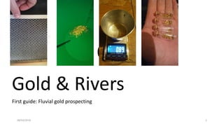
  • 2. Secondary gold deposits and fluvial dynamics • A short useful guide for gold prospecting along river banks with or without the presence of bedrock. 08/03/2018 2
  • 3. The author 08/03/2018 3 Matteo Oberto is an Italian amateur gold prospector with knowledge in geological sciences as part of his geology degree. He is active on the web as a promoter of many products and he has written guides on prospecting gold and gems.
  • 4. 1 ) Main locations of gold deposits along rivers 08/03/2018 4 Contents: - Imbrications & natural traps; - Superficial enrichment; - Presence and influence of bedrock; - Fluvial traps & boulder enrichments; - How to find a pay streak; - How to work a pay streak; - Prospecting the river banks; - Conclusive notes and contacts
  • 5. 1 a – Imbrications & natural traps; 08/03/2018 5 Blue arrow: main water current flow during the flood; Red rectangles: Major dimensional axes of clasts , showing the imbrication structure; Purple triangles: Main gold enrichment, the main one is behind the final cobble (the large violet triangle).
  • 6. 1 b – Superficial enrichment (Surface flood enrichment)- an example 08/03/2018 6 The best place to look for gold is usually close to the surface, due to its accessibility and readiness to recover. The first 30 – 40 cm are the best for finding good gold, which comes from the last flood. It is wrong to automatically assume that gold is greater in quantity with depth - however, sometimes this case holds true, for example if there is overburden on that gold deposit or if there have been many prospectors in that area.
  • 7. Is it possible to pick gold out from other sediments by hand? 08/03/2018 7 The technique known as “gold picking” is rarely possible, in fact gold will usually be collected with equipment (pan, sluice, etc) and traces of gold can be found inside the concentrate of heavy minerals or by panning. Instead of pick ing gold by hand, it would be better if the prospector learns how to observe the environment. Other factors to keep in mind are: the presence of big boulders, imbraction structures, green or dark grey – black cobbles, etc.
  • 8. 1 c – The concentration of big boulders 08/03/2018 8 On the left, you can see that the boulder can have a 2 metre long major axis. In respect to the adjacent clasts and their average dimensions , the boulders are really concentrated there. These are often good spots for attaining large amounts of gold.
  • 9. 08/03/2018 9 The alluvional material concentrated among the boulders will not be easier to prospect or dig out but it is often good quality, in terms of the quantity of gold content and heavy minerals. The prospector should remember that if there isn’t any kind of gold in the river, it won’t be trapped by any fluvial traps. Examples of heavy minerals: Magnetite, garnet, hematite, gold, corindum, etc. Example of heavy antrophic materials found with gold: Tin shots, metallic rubbish, etc. The prospect should be concentrated closer to bigger boulders
  • 10. Pay attention to the superficial wash of light sediments (clay, silt, sand) 08/03/2018 10 As the reader can see, in the left picture there is a real case where the blue portion is made of washed clasts and there isn’t any sandy or silty material. Below that level, it is concentrated by the wash itself and the heaviest portion of the sediment collected among the clasts. In this case, the prospector should move the upper clasts away in order to dig the best portion of sediment. Clast cover Enrichment due to the wash
  • 11. 1 d – The presence and influence of bedrock 08/03/2018 11 Water on clay bedrock The alluvional auriferous deposit could be positioned above a bedrock, which could contain gold usually in the cracks on the top or along local depressions. The bedrock could be: - Bedrock made by rock (this will be discussed in depth in another guide); - Bedrock made by clay and silt (we will focus on this aspect in this guide); Both cases are good for gold enrichment in fluvial deposits above the bedrock. Usually, the sediments above the bedrock are richer than more distant ones. It’s also true that the river doesn’t carry any gold and you won’t find any gold on the bedrock. In the left picture, the water on the clay bedrock is visible. This works as an impermeable limit, and water has to accumulate on it.
  • 12. Detail of an alluvial deposit 08/03/2018 12 Quaternary deposits may get altered during time and they could become a sort of bedrock themselves, useful for gold deposition. In the left picture, the reader can see a very altered alluvial deposit set above the real regional clay bedrock, called “Villafranchiano»” The reader should also be aware of the clasts inside the altered fluvial deposit. They appear white or white grey and are quarzites, which are usually very difficult to be altered. The light brown coloration of the deposit is due to the high content of clay, a product of alteration.
  • 13. Rivarolo (near Turin), a real case of clay bedrock - Where are the best auriferous levels set? 08/03/2018 13 Clay bedrock (Villafranchiano) Alluvial altered deposit Quaternary alluvial deposit The quaternary alluvial deposit is the sum of several erosion episodes during past floods. The gold present in the sediments would be mobilized if the erosion takes place in the floods- the successive deposition and sedimentation could generate a local enrichment. C b B a A C – Gold has been found along the most depressed path along the river bed or located along pay streaks; b – Best auriferous gravel level sets above B. It’s just 30 cm thick; B – Gold has been found fine and dispersed; a – Nice auriferous gravel level sets above A. It contains also chunky gold and flakes; A – Gold has been found only in the superficial cracks or local erosion depressions. Simplified profile transversal ( respect the flow direction) d
  • 14. 08/03/2018 14 Simplified model of chronological events Auriferous level a genesis -> deposition of deposit B -> Auriferous level b genesis Partial erosion of B-> auriferous level d genesis -> deposition of deposit C The reader should note that gold is present in both deposits B and C but the best layers of heavy minerals are set above the deposits themselves. NB: B is only locally conserved. Simplified transverse profile (respect the main flow direction) Deposit A genesis Clay bedrock (Villafranchiano) Alluvial altered deposit Quaternary alluvial depositC b B a A d
  • 15. Evidence of clay bedrock outcrop 08/03/2018 15 Deposit C Clay bedrock “Villafranchiano»” Auriferous level c The outcrop is steep and so the sandy material is washed away and the bigger clasts are concentrated in the lowest part of the picture.
  • 16. 08/03/2018 16 C deposit B deposit A deposit (partially buried) Auriferous level a Auriferous level b Example of an outcrop where you can see the differences among the deposits Lateral b pass to d.
  • 17. Evidence of the outcrops of deposit A 08/03/2018 17
  • 18. Other evidence of the outcrops of the deposits A (red) and B (yellow) 08/03/2018 18
  • 19. 08/03/2018 19 C deposit B deposit Auriferous level b Detail of the alluvial origin of deposit B. There is also the presence of poligenic cobbles, some of these are totally altered and only the shapes are visible. Quarzite, cobble with a good grade of roundness, index of river transport.
  • 20. 08/03/2018 20 Above picture: detail of the oxide patterns on the cobbles, index of fluid migration, in this case, above the impermeable units (clay bedrock); Right picture: detail of completely altered gneiss cobble
  • 21. 08/03/2018 21 Auriferous level b The red area is the exploited portion of the auriferous level b, the reader should be aware that the correct exploitation of that level has involved also the upper part of deposit B and the lower part of C. Cracks in B and depressions have been exploited preferentially.
  • 22. 08/03/2018 22 A deposit B deposit C deposit Frontal view of the exploited outcrop
  • 23. A few conclusions from real cases 08/03/2018 23 - The auriferous levels a and b are usually richer than other deposits, they also contain flakes; - Richness of level a > level b; - Richness of the deposits: C >> B > A; - Exclusive alluvial origin of the enrichment (erosion & deposition); - Presence of big boulders or cobbles at the base of B and C due to the normal river sedimentation and presence of evident imbricated structures; - At the bottom of local paleo river erosion depressions, there are the presence of oxides of Mn and Fe due to the circulation of mineralized fluids; - Digging in the right locations, the average quantity of gold found per day is usually around 0.1 – 0.8 gram.
  • 24. 1 e - Fluvial traps & boulder enrichments 08/03/2018 24 Blue arrow: main water direction during the flood; Red triangle: gold enriched area; The two cases are different- In A, the reader can see a good spot for gold while in B someone has worked on that spot in the past. In A, all the dimensions of clasts are present, such as gravel, sand, silt, and some cobbles. In B there is a local depression with the majority of components made of cobbles or washed gravel. NB: Exceptional floods are able to change the river pattern and enrich these types of traps. A B
  • 25. Simplified model of gold enrichment behind and in front of boulders (flow obstacles) 08/03/2018 Materiale didattico gratuito e condivisibile a seguito di citazione autore: Matteo Oberto 2017. 25 Obstacle Main direction of the river flow Obstacle major axis: It’s set up orthogonal with respect to the obstacle. The obstacle makes a pertubation in the river flow and in front and behind itself there will be low velocity zones, where gold may be collected. Vision from above
  • 26. Gold enrichment positions 08/03/2018 Materiale didattico gratuito e condivisibile a seguito di citazione autore: Matteo Oberto 2017. 26 Obstacle Frontal enrichment Posterior main enrichment Flow direction Erosion wingsErosion wings Along erosion wings the alluvial material, during floods, is eroded. Part of it will be collected in the posterior enrichment. Vision from above
  • 27. Model for gold enrichment 08/03/2018 Materiale didattico gratuito e condivisibile a seguito di citazione autore: Matteo Oberto 2017. 27 Obstacle Fluvial bed Frontal enrichment Posterior enrichment Due to the velocity pertubation there will be two main portion of low velocity thanks to the vortices. Heavy minerals will be collected in the frontal and posterior enrichment areas, while the lighter particles will be washed away. Those vorteces work as concentrators, so heavy material just has to be concentrated during time and floods while lighter stuff will be transported away thank the water flow. The richest portion are usually ubicated close to the boulder itself. Lateral view
  • 28. Where can I find gold? 08/03/2018 Materiale didattico gratuito e condivisibile a seguito di citazione autore: Matteo Oberto 2017. 28 Obstacle Fluvial bed Frontal enrichment Posterior enrichment Richer portion and larger gold particles (Red portion) Finer and lower gold quantityFiner and lower gold quantity Lateral view
  • 29. Frontal and posterior enrichment 08/03/2018 Materiale didattico gratuito e condivisibile a seguito di citazione autore: Matteo Oberto 2017. 29 B A B – Frontal gold enrichment; A – Posterior gold enrichment; In this case, someone has already obtained the best material.
  • 30. Imbrications as local obstacles 08/03/2018 30 The river bed works as a sluice in some parts, in fact every clast, cobble and boulder may act as a local gold trap. In this case the reader can see how few cobbles have been set up imbricated. The purple portion is the main region for gold.
  • 31. 08/03/2018 31 Big obstacles These tend to generate a posterior enrichment bigger than the frontal one during floods. In the picture, the posterior enrichment has been buried by lighter sediments, which became sediments during the final phases of the flood. Generally these don’t contain gold. The elongation of the posterior enrichment shows the direction and the verse of the water during the formation.
  • 32. 08/03/2018 32 Another difference is how the posterior enrichment shows us the direction and the verse of the water current. In this case the last phases didn’t cover the good spots, in fact there isn’t a sandy layer on the enrichment as we saw before.
  • 33. 08/03/2018 33 Example of a posterior enrichment exploited by a prospector. There is a general anbsence of the gravel portion, removed for washing. It’s useful to note that the posterior enrichment should be greater than the frontal one, and richer also. Just sometimes, in the frontal enrichment there is more gold, compared to the posterior enrichment.
  • 34. 08/03/2018 34 Example of posterior enrichment exploitation. In this case, the reader should note that under the boulder there was a clay bedrock, in a concentrated layer. An accurate cleaning of the above portion (5-10cm) can show nice surprises.
  • 35. 1 f – How to find a pay streak 08/03/2018 35 Alluvial simple pay streak Floods may create good spotted enrichment just after concave portions of the river pattern. Along concave curves the river force can erode big amounts of sediments and the sedimentation just after, makes a pay streak. This is known as simple pay streak, when just one big flood permanently alters the river pattern. Pay streak body Cappello limoso Depressione interna «core», porzione più ricca, semplificata con un ellisse. An alluvial simple pay streak is generated by one exceptional flood event. Vision from above
  • 36. 08/03/2018 36 General gold distribution along a single simple pay streak (top view image) The reader should be aware that this image is a simplification of reality due to the several processes that could have been important for the pay streak or its past. Blue portion: Simple pay streak Light green: presence of fine gold; Green: presence of medium gold; Dark green: presence of coarse gold;
  • 37. 08/03/2018 37 Identification of the pay streak core by satellite images. Modern tools like satellite images are beneficial to prospectors in finding good locations to search for gold. The concave fluvial margin provides gold during floods due to its erosion by the force of the river flow.
  • 38. 08/03/2018 38 Alluvial pay streaks are used to be found just after a concave fluvial margin. They are ephemeral entities. Some pay streaks may be eroded or buried or became enriched. Among important floods, the pay streak may be locally eroded and some portion will get enriched. This is the origin of complex pay streaks.
  • 39. 08/03/2018 39 Complex alluvial pay streaks In a complex alluvial pay streak there are many cores, so the prospector can find many good locations for finding gold. Usually, the different cores are ubicated along the closer margin of the pay streak with respect to the river. The reader should be aware about what we said before: local enrichments by obstacles are active in this context, so boulders may locally enrich a portion of gold.
  • 40. 08/03/2018 40 Morphology of a complex alluvial pay streak. As we noted before, a simple alluvial pay streak may be created by an important flood event. Among many smaller floods the same pay streak could be partially mobilized and some portions get richer. In this way along the same actual pay streak, the prospector can work several cores (usually closer the river course). It’s useful to note that the bigger gold should be present majorly in the first and the ancient core. An exception should be noted for flat gold, which can move away and be found in the last cores (the youngest ones). A real case of complex pay streak Green cores: Dark: older Light: young
  • 41. 08/03/2018 41 Complex alluvial pay straeks, a detailed look Here is an example of the alluvial pattern of several complex pay streaks along the same river. The reader should note that after an erosion curve, there is usually a sedimentation area. Complex alluvial pay streaks Grey arrow: sedimentation Blue arrow: erosion The main concept is that among several notable floods there were several patterns of simple pay streaks. Among two important flood events there is the time to create few complex pay streakspatterns by the partial erosion and concentration of past simple pay streaks.
  • 42. 08/03/2018 42 Other types of gold enrichment When the river section gets larger, gold may be concentrated When the river path gets larger, the water speed suffers a decrease and so it would boost the sedimentation process.
  • 43. 08/03/2018 43 Hidden pay streaks They are ubicated along old river paths, usually called abandoned meandres or similar ones. They could be very profitable if no one prospected them over the past few decades. The blue ellipses are considered hidden pay streaks and it’s a pattern inactive at the moment (maybe it could be active during floods). The purple ellispes are recent simple and complex pay streaks, part of the recent alluvial pattern.
  • 44. 08/03/2018 Materiale didattico gratuito e condivisibile a seguito di citazione autore: Matteo Oberto 2017. 44 Central pay streaks In this type of pay streak the greater quantity of gold should be higher than the lower core zones, due to the main important floods that created them. The blue ellipses are the core zone of central pay streaks.
  • 45. 08/03/2018 45 Erosion curve An example: the core is the richest portion of a pay streak, in this case the blue ellipse. You could find great quantities of heavy minerals, like magnetite, garnet and tin.
  • 46. 08/03/2018 46 During a flood there were a few metres of water against this erosion curve. Imagine the force of that flow! How many m3 of sediments have been eroded?
  • 47. 1 g - How to work a pay streak; 08/03/2018 47 Once the prospectors have exploited a paystreak, he must restore the place in the best way possible.
  • 48. Spotted prospecting 08/03/2018 48 A B C Field activities order: - A pay streak has been found by satellite pictures or by field activity (A); - The area should be panned by the prospector in the best places (the volume should be the same for every sample (B); - In this phase the prospector could spot the richest portion of the pay streak, it starts the cultivation phase (C). This order is notable for exploiting the pay streak in the right way and the easier way possible. Blue dots: good gold content by panning; Yellow dots: low gold quantity; Blue ellipse: core of the pay streak.
  • 49. 08/03/2018 49 The spot prospecting is a speditive way to prospect an area, based mainly on panning. In this way the prospector understands the best places to dig.
  • 50. The circular excavation 08/03/2018 50 A After a very good prospecting spot, the prospector could increase the dimension of the test in a circular way. This type of excavation is used mainly for getting more precise data from a promising exploitation.
  • 51. Example of circular excavation: central aperture and circular enlargement 08/03/2018 51 Blue ellipse: approximate limit of the excavation, over that there is still the intact alluvial deposit. Green ellipse: approximate limit of the tailing from the sieving phase. The reader should note that there isn’t any imbrication structuresor auriferous sand and gravel component. The main structure is chaotic. The excavation proceeds from a central fulcrum, ubicated where the prospector had the best dot sample, to the external margin, materializing an ellipse like shape.
  • 52. 08/03/2018 52 A practical example: It’s evident that the prospectors started from the centre and they proceded to the external margins in all directions, drawing a circle – ellipse. Only the most shallow deposits have been exploited by the prospectors (30 – 40 cm from the surface). The refuse should be leveled as restoration and not crowded at the centre.
  • 53. The hole theory 08/03/2018 53 The lighter ellipses show several moments of the exploitation of the same alluvial deposit by different prospectors. All of them had a unique plan for the right exploitation, so they only made holes around the best places. After months of this activity, the prospector would see a situation similar to the picture: a very big and messy system of excavations. It is possible that there is still some good portion that has been buried. A huge hole doesn’t mean that they found a lot of gold! Initial situation Final situation
  • 54. An example of rectangular excavation 08/03/2018 54 A A – spot samplings (a) by panning or other system designs the core portion of the pay streak; B - Conservative physiognomy of the excavation. All the core is included in the excavation limits; C- Towers of cobbles mark the limit of the rectangular excavation. a a a a a a C C C C C C
  • 55. 08/03/2018 55 This method tends to be conservative, in fact the whole core must be included in the rectangular limits. Obviously some border portions will contain less gold but the prospector will be sure that he has exploited all of the core first. A a a a a a a C C C C C C
  • 56. 08/03/2018 56 Example of a rectangular exploitation The darker green spots show the best direction for the correct exploitation, usually determinated by panning. Linear exploitation is a method, in which the prospector can collect the best gold from less material. Basically, he or she works out the material among the green dots. This is a non-conservative way to exploit due to the material that won’t be worked by the prospector in the first time. It could be useful when there is less time to work, or the locality is far. Orange dots: limits of the rectangular exploitation; White dots: preliminary dots exploitation and the gold content (shades of green); Green dots: - Dark green – Greater gold quantity; - Green – Medium gold quantity; - Lighter green – Less gold quantity.
  • 57. 08/03/2018 57 c c The greater rectangular side is the most comfortable one for imposing a limit at the exploitation. The yellow arrow shows the progression direction of the exploitation. During the restoration phase, the prospectors put bigger cobbles one close to the other and above them a cover made of smaller clasts, like gravel (waste of the washed material). After this adjustment, the spot will be levelled. An example of rectangular exploitation Bigger cobbles Wasted washed gravel
  • 58. 08/03/2018 58 The first part of the exploitation is to extract the cobble cover and collect the auriferous gravel ubicated among the bigger cobbles. It is good to wash out the cobbles and all the gravel in place, and just after bring that material to the sluicing phase. Sometimes gold could stay attached to rocks! Then the prospector will put the bigger cobbles behind himself and above that level, the washed material (made of washed gravel). The extraction phase
  • 59. 08/03/2018 59 Bed of the exploitation Main direction of the exploitation Correct way: Uncorrect way: Bed of the exploitation It makes no sense to pile boulders and cobbles in the frontal part of the exploitation or along the borders. Yes Profile view: How to collect auriferous material and restore the site
  • 60. 08/03/2018 60 View from above: Correct Incorrect Portion to work Tailings Excavation front During the restoration phase, the prospector should also level the wasted material and not accumulate a tower. Green spots: limits of the excavation; Black spots: boulders or big cobbles.
  • 61. 08/03/2018 61 The sieving phase is one of the initial processes which is important for reducing the volume of the processed material. It’s important to be aware of the gold that we will expect due to our efforts to not waste it. In fact, the net dimension of the sieve retrains a percentage of material (tailings) that could still contain a lot of gold if it’s present. The sieving phase
  • 62. 08/03/2018 62 Generally, a wet sieving is more convenient in terms of recovery, in fact all auriferous particles could be washed away during an energetic wet sieving phase. Instead, the dry sieving is preferred during a dry climate or prolonged dry seasons, when water is less than normal and the auriferous material is very dry. In that case the grade of suddivision of the material could be greater and more convenient. Usually, finer gold particles tend to stay attached at cobbles or gravel; the wet sieving helps to collect this percentage. Dry sieving Wet sieving
  • 63. 08/03/2018 63 Sluicing The sluice is an helpful tool for the prospector, in fact it helps during the concentration phase or the processing one. The main goal is to notably reduce the volume of the output auriferous material and by the sluicing, it is possible. It works as a concentration tool, where several traps help the heavier material to be caught. After many hours, the sluice cleaning can give good results. We will discuss these tools in greater depth in the next guide.
  • 64. 08/03/2018 64 The panning Panning is preferred during the initial steps, when the prospector has to prospect the paydirt, in order to find a good spot. It’s also used for the final washing phase, when the last portion of material, collected by a sluice, for example, has to be worked due to extract all gold particles. Every pan has its own limits and finalities. It is useful to know these aspects, and use the right tool in the correct situation.
  • 65. Example of wasted sand (sluicing and panning tailings) 08/03/2018 65 The blue ellipses show localized sluicing and panning tailings, the products of the processing phase.
  • 66. 08/03/2018 66 A SUMMARY: The three golden rules: 1- Gold doesn’t become greater with depth; 2- If I’m digging well, I’m already restoring the site; 3- It’s not correct leaving the site with holes, trenches or any kind of rubbish; Clean your path!. Always remember that your pits could be mortal traps for animals, people or children. Plan and dig responsibly!
  • 67. 1 h – Prospecting the river banks; 08/03/2018 67
  • 68. 08/03/2018 68 What are the main components that I should look for? Each flood is composed by an erosion phase and a deposition phase. The first one may make an erosion semi-ellipse profile seen in the picture below. The next phase will fill the concave shape with coarser sediments at the bottom and lighter sediments at the top. Gold will be concentrated at the bottom of the semi-ellipse. Orthogonal view with respect to the main water direction. Semi-ellipse shape
  • 69. 08/03/2018 69 The cross concave stratification will be made by several flood episodes that can work together in order to build the below situation. This view is available if you can observe an orthogonal cut with respect to the main water direction in that moment.
  • 70. 08/03/2018 70 Every flood episode may free new gold from old deposits and so it will be concentrated during the deposition phase in this way and spatial direction. Gold will be deposited along the most depressed paths! Obviously there isn’t just gold but also other heavy minerals, like magnetite, garnet, tin, etc.
  • 71. 08/03/2018 71 An example: Clay bedrock Localities with the above blue arrows are the most depressed local channel bed positions, where gold could be found easier.
  • 72. 08/03/2018 72 An old channel bed, could it be gold rich?
  • 73. 08/03/2018 73 As the reader can observe, in this picture there is the outcrop of a clay bedrock and locally it has been eroded. Along the most depressed area good quality gold can be found.
  • 74. 08/03/2018 74 General conclusions from this guide: - It’s important to know that nature is more complicated than this guide could highlight, in fact many old floods can’t be investigated easly and so the easiest way to prospect is to test and panning different locations. - This guide has underlined the importance that the gold seekers should fall in love with nature, and the best gold he can have is the fresh air and the beauty of passing all day in the nature. It’s also a job for the prospectors to keep the localities clean where they prospect. - It’s obviously important to be aware of legislation, each state or region has its own rules and the prospector has to follow them. The legal aspects are a priority! 40X
  • 75. 08/03/2018 75 See you in the next guide! The author hopes that this guide can be helpful to other prospectors around the world, who do not have much geological background but would like to learn more about gold prospecting. In the next guide, the main topic will be: “Techniques and gold prospecting” 40X
  • 76. 08/03/2018 76 Author’s notes: This guide was written in November 2017. It was written by the author specifically for prospectors or amateurs, who want to look for gold and who would like to improve their gold recovery. The guide will be maintained for up to date information which is easy to access. See you in the next guide! Matteo Oberto
  • 77. 08/03/2018 77 Contact details: If you want to contact me for cultural and scientific events such as radio calls, skype interviews etc, you can find me at: Oberto.matteo@libero.it If you want to participate in my web discussions or give me feedback on this and other guides, you can find me on Facebook, look for: Matteo Oberto. If you liked this guide and you want to join my Facebook page, where you can find more free material in the file section, join: @Trainingforgoldprospectors