Download as ODP, PPTX

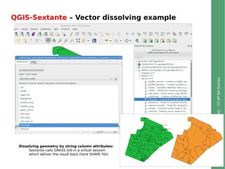
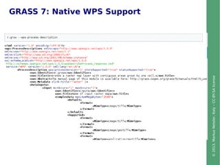
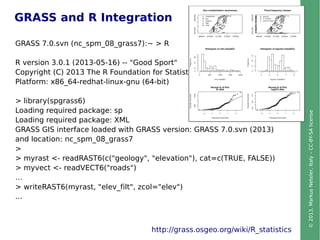
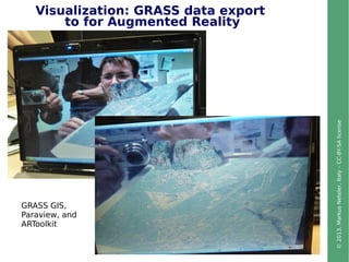
![©2013,MarkusNeteler,Italy–CC-BY-SAlicense
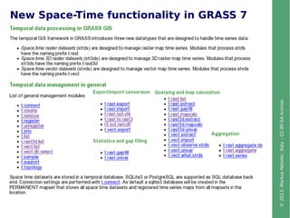
Vector geometry types
Point
Centroid
Line
Boundary
Area (boundary + centroid)
face (3D area)
[kernel (3D centroid)]
[volumes (faces + kernel)]
Geometry is true 3D when: x, y, z
notinallGIS!
Faces
GRASS Topological 2D/3D Vector model](https://image.slidesharecdn.com/plenarynewsingrassgis7neteler-130618061405-phpapp02/85/News-in-GRASS-GIS7-Plenary-talk-at-FOSS4G-CEE-2013-Romania-9-320.jpg)


The document provides an overview of the features and enhancements in GRASS GIS 7, including new tools for vector geometry, network analysis, animation for time series, and improved image processing capabilities. It highlights the software's support for large spatial datasets, integration with Python and R, and user-contributed addons, enhancing its functionality and usability. Additionally, it outlines the software's capabilities for advanced cartographic visualization and geospatial modeling.


