SlideShare a Scribd company logo
1 of 5
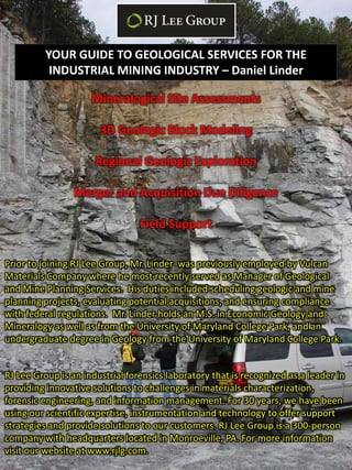
YOUR GUIDE TO GEOLOGICAL SERVICES FOR THE
           INDUSTRIAL MINING INDUSTRY – Daniel Linder

                     Mineralogical Site Assessments

                       3D Geologic Block Modeling

                      Regional Geologic Exploration

                 Merger and Acquisition Due Diligence

                                 Field Support

Prior to joining RJ Lee Group, Mr. Linder was previously employed by Vulcan
Materials Company where he most recently served as Manager of Geological
and Mine Planning Services. His duties included scheduling geologic and mine
planning projects, evaluating potential acquisitions, and ensuring compliance
with federal regulations. Mr. Linder holds an M.S. in Economic Geology and
Mineralogy as well as from the University of Maryland College Park, and an
undergraduate degree in Geology from the University of Maryland College Park.


RJ Lee Group is an industrial forensics laboratory that is recognized as a leader in
providing innovative solutions to challenges in materials characterization,
forensic engineering, and information management. For 30 years, we have been
using our scientific expertise, instrumentation and technology to offer support
strategies and provide solutions to our customers. RJ Lee Group is a 300-person
company with headquarters located in Monroeville, PA. For more information
visit our website at www.rjlg.com.
MAJOR ISSUES


Overburden & Weathered Rock Distribution and Thickness

      Ensuring Material Meets State Specifications

   Discovery and Avoidance of Asbestos, Heavy Metals

             Water Inflow to Pit or Quarry

     Growth and Exploration for New Opportunities
Basic Steps and Purpose of Modeling/Exploration


  1) Information & Data Gathering - Search for all sources of
        information related to the site to be modeled or area to be
        explored for new opportunities.

  2) Forensic Geology – Assemble all collected data regardless of
        condition into a complete, comprehensive, and internally
        consistent digital database.

  3) Critical Thinking - Evaluation of data and preparation of
        graphical displays of data for mapping purposes.


                                                            Old Core Hole Location Maps
      Old Literature               Hand Sketches


Core Evaluation and Sampling
                                                            Old & New Aerial Photography
                               Old & New Geologic Mapping
Basic Steps and Purpose of Modeling/Exploration


1) Hand Mapping – Initial basic geologic mapping of any sort,
   e.g. structural, thickness, quality, etc. is done by hand using all
   available collected information and data and by using
   advanced knowledge of geologic principles.

2) Creation of a Digital Database– Digitization of one’s
   mapping enables transformation into a digital format. By
   deriving this digital mapping from hand made maps and critical
   geologic thinking, there now exists a much more thorough and
   refined understanding of the issue at hand than using
   scattered and inconsistent pieces of data.

1) Computer Modeling – Once mapping exists as digital data,
   maps and/or cross-sections can be generated and customized
   depending on need. This data can also be used to generate 3D
   digital geologic block models.
Basic Steps and Purpose of Modeling/Exploration

1) Support for Mining Engineers- With a geologic block
    model complete, multiple scenarios can be generated to most
    closely estimate the total reserve which can be extracted.
    Additionally, the most cost effective progression of mining can
    be determined.

2) Support for Geologists – These models and the graphical
    products that can be generated aid geologists in further
    mapping, prediction and adjustment or quality checking of the
    subsurface model.

3) Support for Marketing and Sales – With detailed exploration
   maps in hand, the search for new growth opportunities is
   made easier. The compilation of multiple data types enhances
   the ability to strategically seek out greenfields, acquisition
   targets, or company mergers.

4) Support for RJ Lee Group Understanding of the sub-surface
    geology will greatly enhance the ability for proper sampling of
    ledge rock, stockpiles, dust, etc. for materials determined to
    be deleterious to one’s health. This includes, but is not limited
    to asbestos, silica, heavy metals.

More Related Content

What's hot

Soil mapping approach in gis
Soil mapping approach in gisSoil mapping approach in gis
Soil mapping approach in gisSakthivel R
 
Land use land cover mapping for smart village using gis
Land use land cover mapping for smart village using gisLand use land cover mapping for smart village using gis
Land use land cover mapping for smart village using gisSumit Yeole
 
Remote Sensing and GIS in Land Use / Land Cover Mapping
Remote Sensing and GIS in Land Use / Land Cover MappingRemote Sensing and GIS in Land Use / Land Cover Mapping
Remote Sensing and GIS in Land Use / Land Cover MappingVenkatKamal1
 
Role of geo-informatics in land use/land cover
Role of geo-informatics in land use/land coverRole of geo-informatics in land use/land cover
Role of geo-informatics in land use/land coverRohit Kumar
 
Use of remote sensing for land cover monitoring servir science applications
Use of remote sensing for land cover monitoring servir science applicationsUse of remote sensing for land cover monitoring servir science applications
Use of remote sensing for land cover monitoring servir science applicationsKabir Uddin
 

What's hot (6)

Soil mapping approach in gis
Soil mapping approach in gisSoil mapping approach in gis
Soil mapping approach in gis
 
Application of rs and gis
Application of rs and gisApplication of rs and gis
Application of rs and gis
 
Land use land cover mapping for smart village using gis
Land use land cover mapping for smart village using gisLand use land cover mapping for smart village using gis
Land use land cover mapping for smart village using gis
 
Remote Sensing and GIS in Land Use / Land Cover Mapping
Remote Sensing and GIS in Land Use / Land Cover MappingRemote Sensing and GIS in Land Use / Land Cover Mapping
Remote Sensing and GIS in Land Use / Land Cover Mapping
 
Role of geo-informatics in land use/land cover
Role of geo-informatics in land use/land coverRole of geo-informatics in land use/land cover
Role of geo-informatics in land use/land cover
 
Use of remote sensing for land cover monitoring servir science applications
Use of remote sensing for land cover monitoring servir science applicationsUse of remote sensing for land cover monitoring servir science applications
Use of remote sensing for land cover monitoring servir science applications
 

Viewers also liked

Modeling and inversion related activities at Geoscience Australia - September...
Modeling and inversion related activities at Geoscience Australia - September...Modeling and inversion related activities at Geoscience Australia - September...
Modeling and inversion related activities at Geoscience Australia - September...Richard Lane
 
Mathematical modeling
Mathematical modelingMathematical modeling
Mathematical modelingMansour Nasr
 
Types of modeling
Types of modelingTypes of modeling
Types of modelingoskrjulia
 
Hazard modeling
Hazard modelingHazard modeling
Hazard modelingAtiqa khan
 
Introducing Mass Balance Modeling Using a Controversial Environmental Problem
Introducing Mass Balance Modeling Using a Controversial Environmental ProblemIntroducing Mass Balance Modeling Using a Controversial Environmental Problem
Introducing Mass Balance Modeling Using a Controversial Environmental ProblemSERC at Carleton College
 
Inverse Theory in Geophysics, Lecture 1
Inverse Theory in Geophysics, Lecture 1Inverse Theory in Geophysics, Lecture 1
Inverse Theory in Geophysics, Lecture 1Amin khalil
 
Ghrelin mathematical modeling and beyond (The big glucose model: the quest fo...
Ghrelin mathematical modeling and beyond (The big glucose model: the quest fo...Ghrelin mathematical modeling and beyond (The big glucose model: the quest fo...
Ghrelin mathematical modeling and beyond (The big glucose model: the quest fo...Jorge Pires
 
PetroSync - Fractured Reservoir Modeling with Application to Fractured Basement
PetroSync - Fractured Reservoir Modeling with Application to Fractured BasementPetroSync - Fractured Reservoir Modeling with Application to Fractured Basement
PetroSync - Fractured Reservoir Modeling with Application to Fractured BasementPetroSync
 
Graphical 3D Modeling of Molecules and Nanostructures in Sub-nanometer Scale ...
Graphical 3D Modeling of Molecules and Nanostructures in Sub-nanometer Scale ...Graphical 3D Modeling of Molecules and Nanostructures in Sub-nanometer Scale ...
Graphical 3D Modeling of Molecules and Nanostructures in Sub-nanometer Scale ...Stoyan Sarg Sargoytchev
 
Numerical Modelling of Masonry Infill Walls Participation in the Seismic Beha...
Numerical Modelling of Masonry Infill Walls Participation in the Seismic Beha...Numerical Modelling of Masonry Infill Walls Participation in the Seismic Beha...
Numerical Modelling of Masonry Infill Walls Participation in the Seismic Beha...openseesdays
 
Mathematical Modeling for Practical Problems
Mathematical Modeling for Practical ProblemsMathematical Modeling for Practical Problems
Mathematical Modeling for Practical ProblemsLiwei Ren任力偉
 
Types of Financial Model - Financial Modeling by EduCBA
Types of Financial Model - Financial Modeling by EduCBATypes of Financial Model - Financial Modeling by EduCBA
Types of Financial Model - Financial Modeling by EduCBAeduCBA
 
DepthInsight Geoscience Geomodeling Software Technology Introduction
DepthInsight Geoscience Geomodeling Software Technology IntroductionDepthInsight Geoscience Geomodeling Software Technology Introduction
DepthInsight Geoscience Geomodeling Software Technology IntroductionBo Sun
 
Basics mathematical modeling
Basics mathematical modelingBasics mathematical modeling
Basics mathematical modelingcyndy
 
mongoDB 3 type modeling in production
mongoDB 3 type modeling in productionmongoDB 3 type modeling in production
mongoDB 3 type modeling in productionDongHan Kim
 
Lecture 3 ME 176 2 Mathematical Modeling
Lecture 3 ME 176 2 Mathematical ModelingLecture 3 ME 176 2 Mathematical Modeling
Lecture 3 ME 176 2 Mathematical ModelingLeonides De Ocampo
 
Geometric modeling111431635 geometric-modeling-glad (1)
Geometric modeling111431635 geometric-modeling-glad (1)Geometric modeling111431635 geometric-modeling-glad (1)
Geometric modeling111431635 geometric-modeling-glad (1)manojg1990
 
Introduction to mathematical modelling
Introduction to mathematical modellingIntroduction to mathematical modelling
Introduction to mathematical modellingArup Kumar Paria
 
Chapter 3 mathematical modeling
Chapter 3 mathematical modelingChapter 3 mathematical modeling
Chapter 3 mathematical modelingBin Biny Bino
 

Viewers also liked (20)

Modeling and inversion related activities at Geoscience Australia - September...
Modeling and inversion related activities at Geoscience Australia - September...Modeling and inversion related activities at Geoscience Australia - September...
Modeling and inversion related activities at Geoscience Australia - September...
 
Mathematical modeling
Mathematical modelingMathematical modeling
Mathematical modeling
 
Types of modeling
Types of modelingTypes of modeling
Types of modeling
 
Hazard modeling
Hazard modelingHazard modeling
Hazard modeling
 
Introducing Mass Balance Modeling Using a Controversial Environmental Problem
Introducing Mass Balance Modeling Using a Controversial Environmental ProblemIntroducing Mass Balance Modeling Using a Controversial Environmental Problem
Introducing Mass Balance Modeling Using a Controversial Environmental Problem
 
Inverse Theory in Geophysics, Lecture 1
Inverse Theory in Geophysics, Lecture 1Inverse Theory in Geophysics, Lecture 1
Inverse Theory in Geophysics, Lecture 1
 
Ghrelin mathematical modeling and beyond (The big glucose model: the quest fo...
Ghrelin mathematical modeling and beyond (The big glucose model: the quest fo...Ghrelin mathematical modeling and beyond (The big glucose model: the quest fo...
Ghrelin mathematical modeling and beyond (The big glucose model: the quest fo...
 
PetroSync - Fractured Reservoir Modeling with Application to Fractured Basement
PetroSync - Fractured Reservoir Modeling with Application to Fractured BasementPetroSync - Fractured Reservoir Modeling with Application to Fractured Basement
PetroSync - Fractured Reservoir Modeling with Application to Fractured Basement
 
Graphical 3D Modeling of Molecules and Nanostructures in Sub-nanometer Scale ...
Graphical 3D Modeling of Molecules and Nanostructures in Sub-nanometer Scale ...Graphical 3D Modeling of Molecules and Nanostructures in Sub-nanometer Scale ...
Graphical 3D Modeling of Molecules and Nanostructures in Sub-nanometer Scale ...
 
Numerical Modelling of Masonry Infill Walls Participation in the Seismic Beha...
Numerical Modelling of Masonry Infill Walls Participation in the Seismic Beha...Numerical Modelling of Masonry Infill Walls Participation in the Seismic Beha...
Numerical Modelling of Masonry Infill Walls Participation in the Seismic Beha...
 
Mathematical Modeling for Practical Problems
Mathematical Modeling for Practical ProblemsMathematical Modeling for Practical Problems
Mathematical Modeling for Practical Problems
 
Types of Financial Model - Financial Modeling by EduCBA
Types of Financial Model - Financial Modeling by EduCBATypes of Financial Model - Financial Modeling by EduCBA
Types of Financial Model - Financial Modeling by EduCBA
 
DepthInsight Geoscience Geomodeling Software Technology Introduction
DepthInsight Geoscience Geomodeling Software Technology IntroductionDepthInsight Geoscience Geomodeling Software Technology Introduction
DepthInsight Geoscience Geomodeling Software Technology Introduction
 
Basics mathematical modeling
Basics mathematical modelingBasics mathematical modeling
Basics mathematical modeling
 
Reservoir Modeling
Reservoir ModelingReservoir Modeling
Reservoir Modeling
 
mongoDB 3 type modeling in production
mongoDB 3 type modeling in productionmongoDB 3 type modeling in production
mongoDB 3 type modeling in production
 
Lecture 3 ME 176 2 Mathematical Modeling
Lecture 3 ME 176 2 Mathematical ModelingLecture 3 ME 176 2 Mathematical Modeling
Lecture 3 ME 176 2 Mathematical Modeling
 
Geometric modeling111431635 geometric-modeling-glad (1)
Geometric modeling111431635 geometric-modeling-glad (1)Geometric modeling111431635 geometric-modeling-glad (1)
Geometric modeling111431635 geometric-modeling-glad (1)
 
Introduction to mathematical modelling
Introduction to mathematical modellingIntroduction to mathematical modelling
Introduction to mathematical modelling
 
Chapter 3 mathematical modeling
Chapter 3 mathematical modelingChapter 3 mathematical modeling
Chapter 3 mathematical modeling
 

Similar to Purpose Of Modeling

Next generation data delivery for NSW geoscientific data
Next generation data delivery for NSW geoscientific data Next generation data delivery for NSW geoscientific data
Next generation data delivery for NSW geoscientific data Trisha Moriarty
 
CMIC's Exploration Innovation Consortium, presented by François Robert and Al...
CMIC's Exploration Innovation Consortium, presented by François Robert and Al...CMIC's Exploration Innovation Consortium, presented by François Robert and Al...
CMIC's Exploration Innovation Consortium, presented by François Robert and Al...Canada Mining Innovation Council
 
Landmap CETIS 2012
Landmap CETIS 2012Landmap CETIS 2012
Landmap CETIS 2012Bharti Gupta
 
Resume Stephen Kuhlman 05 17 2012 EP
Resume Stephen Kuhlman 05 17 2012 EPResume Stephen Kuhlman 05 17 2012 EP
Resume Stephen Kuhlman 05 17 2012 EPskuhlman
 
Modern mining
Modern miningModern mining
Modern miningarabnubia
 
Application of Modern Geographical Tools & Techniques in Planning and Develo...
Application  of Modern Geographical Tools & Techniques in Planning and Develo...Application  of Modern Geographical Tools & Techniques in Planning and Develo...
Application of Modern Geographical Tools & Techniques in Planning and Develo...Prof Ashis Sarkar
 
RS_GIS_Crop_monitoring-converted.pptx
RS_GIS_Crop_monitoring-converted.pptxRS_GIS_Crop_monitoring-converted.pptx
RS_GIS_Crop_monitoring-converted.pptxSouvikPal60
 
GIS in Mining and Exploration 2011 Brochure
GIS in Mining and Exploration 2011 BrochureGIS in Mining and Exploration 2011 Brochure
GIS in Mining and Exploration 2011 BrochureIQPC Australia
 
Methods and stages of Mineral Exploration: Adaptive Resource Management Plan
Methods and stages of Mineral Exploration: Adaptive Resource Management PlanMethods and stages of Mineral Exploration: Adaptive Resource Management Plan
Methods and stages of Mineral Exploration: Adaptive Resource Management PlanNgatcha Bryan
 
Applications of gis
Applications of gisApplications of gis
Applications of gisPramoda Raj
 
Applications of gis
Applications of gisApplications of gis
Applications of gisPramoda Raj
 
University of Nottingham - NGI Geospatial Science Example Activities
University of Nottingham - NGI Geospatial Science Example ActivitiesUniversity of Nottingham - NGI Geospatial Science Example Activities
University of Nottingham - NGI Geospatial Science Example ActivitiesJeremy Morley
 
ExtremeEarth Data Science Pipeline for Linked Earth Observation Data
ExtremeEarth Data Science Pipeline for Linked Earth Observation DataExtremeEarth Data Science Pipeline for Linked Earth Observation Data
ExtremeEarth Data Science Pipeline for Linked Earth Observation DataExtremeEarth
 
Mineral potential mapping
Mineral potential mappingMineral potential mapping
Mineral potential mappingKenex Ltd
 

Similar to Purpose Of Modeling (20)

Next generation data delivery for NSW geoscientific data
Next generation data delivery for NSW geoscientific data Next generation data delivery for NSW geoscientific data
Next generation data delivery for NSW geoscientific data
 
CMIC's Exploration Innovation Consortium, presented by François Robert and Al...
CMIC's Exploration Innovation Consortium, presented by François Robert and Al...CMIC's Exploration Innovation Consortium, presented by François Robert and Al...
CMIC's Exploration Innovation Consortium, presented by François Robert and Al...
 
Landmap CETIS 2012
Landmap CETIS 2012Landmap CETIS 2012
Landmap CETIS 2012
 
Resume Stephen Kuhlman 05 17 2012 EP
Resume Stephen Kuhlman 05 17 2012 EPResume Stephen Kuhlman 05 17 2012 EP
Resume Stephen Kuhlman 05 17 2012 EP
 
L1 GIS.pptx
L1 GIS.pptxL1 GIS.pptx
L1 GIS.pptx
 
John McGaughey - Towards integrated interpretation
John McGaughey - Towards integrated interpretationJohn McGaughey - Towards integrated interpretation
John McGaughey - Towards integrated interpretation
 
Modern mining
Modern miningModern mining
Modern mining
 
TT_Introduction6
TT_Introduction6TT_Introduction6
TT_Introduction6
 
Application of Modern Geographical Tools & Techniques in Planning and Develo...
Application  of Modern Geographical Tools & Techniques in Planning and Develo...Application  of Modern Geographical Tools & Techniques in Planning and Develo...
Application of Modern Geographical Tools & Techniques in Planning and Develo...
 
RS_GIS_Crop_monitoring-converted.pptx
RS_GIS_Crop_monitoring-converted.pptxRS_GIS_Crop_monitoring-converted.pptx
RS_GIS_Crop_monitoring-converted.pptx
 
Hedrick_Poster
Hedrick_PosterHedrick_Poster
Hedrick_Poster
 
FUTURE TRENDS OF SEISMIC ANALYSIS
FUTURE TRENDS OF SEISMIC ANALYSISFUTURE TRENDS OF SEISMIC ANALYSIS
FUTURE TRENDS OF SEISMIC ANALYSIS
 
GIS in Mining and Exploration 2011 Brochure
GIS in Mining and Exploration 2011 BrochureGIS in Mining and Exploration 2011 Brochure
GIS in Mining and Exploration 2011 Brochure
 
Methods and stages of Mineral Exploration: Adaptive Resource Management Plan
Methods and stages of Mineral Exploration: Adaptive Resource Management PlanMethods and stages of Mineral Exploration: Adaptive Resource Management Plan
Methods and stages of Mineral Exploration: Adaptive Resource Management Plan
 
Applications of gis
Applications of gisApplications of gis
Applications of gis
 
Applications of gis
Applications of gisApplications of gis
Applications of gis
 
University of Nottingham - NGI Geospatial Science Example Activities
University of Nottingham - NGI Geospatial Science Example ActivitiesUniversity of Nottingham - NGI Geospatial Science Example Activities
University of Nottingham - NGI Geospatial Science Example Activities
 
ExtremeEarth Data Science Pipeline for Linked Earth Observation Data
ExtremeEarth Data Science Pipeline for Linked Earth Observation DataExtremeEarth Data Science Pipeline for Linked Earth Observation Data
ExtremeEarth Data Science Pipeline for Linked Earth Observation Data
 
Mineral potential mapping
Mineral potential mappingMineral potential mapping
Mineral potential mapping
 
fund.ppt
fund.pptfund.ppt
fund.ppt
 

Purpose Of Modeling

  • 1. YOUR GUIDE TO GEOLOGICAL SERVICES FOR THE INDUSTRIAL MINING INDUSTRY – Daniel Linder Mineralogical Site Assessments 3D Geologic Block Modeling Regional Geologic Exploration Merger and Acquisition Due Diligence Field Support Prior to joining RJ Lee Group, Mr. Linder was previously employed by Vulcan Materials Company where he most recently served as Manager of Geological and Mine Planning Services. His duties included scheduling geologic and mine planning projects, evaluating potential acquisitions, and ensuring compliance with federal regulations. Mr. Linder holds an M.S. in Economic Geology and Mineralogy as well as from the University of Maryland College Park, and an undergraduate degree in Geology from the University of Maryland College Park. RJ Lee Group is an industrial forensics laboratory that is recognized as a leader in providing innovative solutions to challenges in materials characterization, forensic engineering, and information management. For 30 years, we have been using our scientific expertise, instrumentation and technology to offer support strategies and provide solutions to our customers. RJ Lee Group is a 300-person company with headquarters located in Monroeville, PA. For more information visit our website at www.rjlg.com.
  • 2. MAJOR ISSUES Overburden & Weathered Rock Distribution and Thickness Ensuring Material Meets State Specifications Discovery and Avoidance of Asbestos, Heavy Metals Water Inflow to Pit or Quarry Growth and Exploration for New Opportunities
  • 3. Basic Steps and Purpose of Modeling/Exploration 1) Information & Data Gathering - Search for all sources of information related to the site to be modeled or area to be explored for new opportunities. 2) Forensic Geology – Assemble all collected data regardless of condition into a complete, comprehensive, and internally consistent digital database. 3) Critical Thinking - Evaluation of data and preparation of graphical displays of data for mapping purposes. Old Core Hole Location Maps Old Literature Hand Sketches Core Evaluation and Sampling Old & New Aerial Photography Old & New Geologic Mapping
  • 4. Basic Steps and Purpose of Modeling/Exploration 1) Hand Mapping – Initial basic geologic mapping of any sort, e.g. structural, thickness, quality, etc. is done by hand using all available collected information and data and by using advanced knowledge of geologic principles. 2) Creation of a Digital Database– Digitization of one’s mapping enables transformation into a digital format. By deriving this digital mapping from hand made maps and critical geologic thinking, there now exists a much more thorough and refined understanding of the issue at hand than using scattered and inconsistent pieces of data. 1) Computer Modeling – Once mapping exists as digital data, maps and/or cross-sections can be generated and customized depending on need. This data can also be used to generate 3D digital geologic block models.
  • 5. Basic Steps and Purpose of Modeling/Exploration 1) Support for Mining Engineers- With a geologic block model complete, multiple scenarios can be generated to most closely estimate the total reserve which can be extracted. Additionally, the most cost effective progression of mining can be determined. 2) Support for Geologists – These models and the graphical products that can be generated aid geologists in further mapping, prediction and adjustment or quality checking of the subsurface model. 3) Support for Marketing and Sales – With detailed exploration maps in hand, the search for new growth opportunities is made easier. The compilation of multiple data types enhances the ability to strategically seek out greenfields, acquisition targets, or company mergers. 4) Support for RJ Lee Group Understanding of the sub-surface geology will greatly enhance the ability for proper sampling of ledge rock, stockpiles, dust, etc. for materials determined to be deleterious to one’s health. This includes, but is not limited to asbestos, silica, heavy metals.