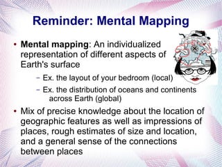
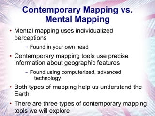
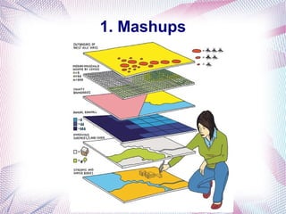
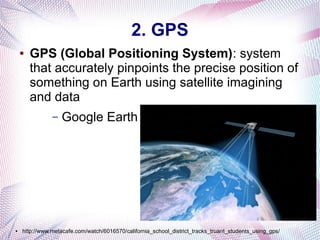
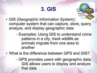
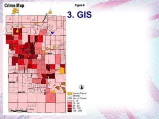
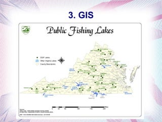
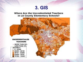
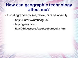
Contemporary Mapping Tools
Essential Questions:
What does it mean to think geographically and
spatially?
How can geographic technology affect me?
Big understanding:
GIS and other contemporary mapping technology
and tools are changing and continue to change our
world and how we look at it
Reminder: Mental Mapping
●

Mental mapping: An individualized
representation of different aspects of
Earth's surface
–
–

●

Ex. the layout of your bedroom (local)
Ex. the distribution of oceans and continents
across Earth (global)

Mix of precise knowledge about the location of
geographic features as well as impressions of
places, rough estimates of size and location,
and a general sense of the connections
between places
Contemporary Mapping vs.
Mental Mapping
●

Mental mapping uses individualized
perceptions
–

●

Contemporary mapping tools use precise
information about geographic features
–

●

●

Found in your own head

Found using computerized, advanced
technology

Both types of mapping help us understand the
Earth
There are three types of contemporary mapping
tools we will explore
1. Mashups
●

Mashups: Maps with overlaying data layers
–

Examples of layers: streets, McDonald's
locations, population density, hotels, sea level,
bike lanes
●

Imagine being able to search for McDonald's
locations near bike lanes or hotels near the
street you are standing on...

–

Google Maps

–

http://goo.gl/maps/sFcFt

–

http://www.zefrank.com/sandwich/tool.html
1. Mashups
2. GPS
●

GPS (Global Positioning System): system
that accurately pinpoints the precise position of
something on Earth using satellite imagining
and data
–

●

Google Earth

http://www.metacafe.com/watch/6016570/california_school_district_tracks_truant_students_using_gps/
3. GIS
●

GIS (Geographic Information System):
computer system that can capture, store, query,
analyze, and display geographic data
Examples: Using GIS to understand crime
patterns in a city, track wildlife as
animals migrate from one area to
another
What is the difference between GPS and GIS?
–

●

–

GPS provides users with geographic data;
GIS allows users to display and analyze
that data
3. GIS
3. GIS
3. GIS
How can geographic technology
affect me?
●

Deciding where to live, move, or raise a family
–
–
–

http://Familywatchdog.us/
http://gruvr.com/
http://drivescore.fizber.com/results.html
Now You!
●

Project write-up/rubric

●

Blog post

Contemporary Mapping Tools

  • 1.
    Contemporary Mapping Tools EssentialQuestions: What does it mean to think geographically and spatially? How can geographic technology affect me? Big understanding: GIS and other contemporary mapping technology and tools are changing and continue to change our world and how we look at it
  • 2.
    Reminder: Mental Mapping ● Mentalmapping: An individualized representation of different aspects of Earth's surface – – ● Ex. the layout of your bedroom (local) Ex. the distribution of oceans and continents across Earth (global) Mix of precise knowledge about the location of geographic features as well as impressions of places, rough estimates of size and location, and a general sense of the connections between places
  • 3.
    Contemporary Mapping vs. MentalMapping ● Mental mapping uses individualized perceptions – ● Contemporary mapping tools use precise information about geographic features – ● ● Found in your own head Found using computerized, advanced technology Both types of mapping help us understand the Earth There are three types of contemporary mapping tools we will explore
  • 4.
    1. Mashups ● Mashups: Mapswith overlaying data layers – Examples of layers: streets, McDonald's locations, population density, hotels, sea level, bike lanes ● Imagine being able to search for McDonald's locations near bike lanes or hotels near the street you are standing on... – Google Maps – http://goo.gl/maps/sFcFt – http://www.zefrank.com/sandwich/tool.html
  • 5.
  • 6.
    2. GPS ● GPS (GlobalPositioning System): system that accurately pinpoints the precise position of something on Earth using satellite imagining and data – ● Google Earth http://www.metacafe.com/watch/6016570/california_school_district_tracks_truant_students_using_gps/
  • 7.
    3. GIS ● GIS (GeographicInformation System): computer system that can capture, store, query, analyze, and display geographic data Examples: Using GIS to understand crime patterns in a city, track wildlife as animals migrate from one area to another What is the difference between GPS and GIS? – ● – GPS provides users with geographic data; GIS allows users to display and analyze that data
  • 8.
  • 9.
  • 10.
  • 11.
    How can geographictechnology affect me? ● Deciding where to live, move, or raise a family – – – http://Familywatchdog.us/ http://gruvr.com/ http://drivescore.fizber.com/results.html
  • 12.

Editor's Notes